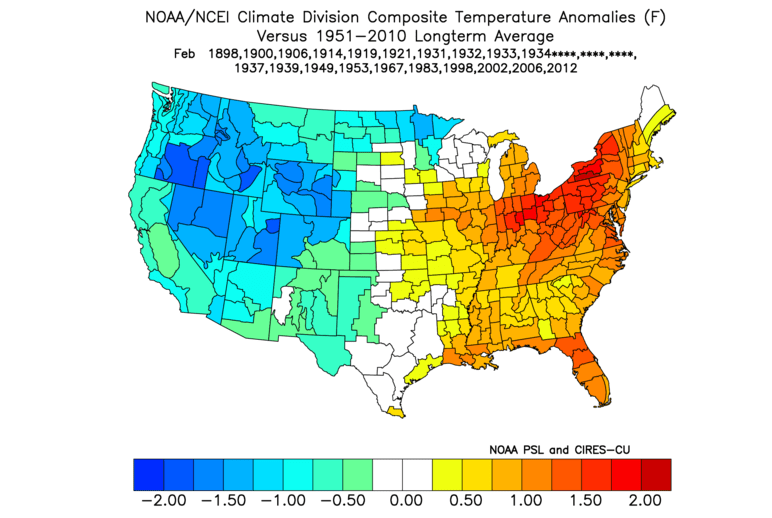
This map above is what typically happens in February when January at Grand Rapids had a very high frequency of above normal temperature days. This suggest we will be near the storm track and that warmer than normal temperatures appear more likely than below normal temperatures for Southwest Michigan.
What I did to figure this out was to look at all the daily departures from normal in the January’s in the Grand Rapids climate data base. For each January I counted the number of days with the daily departure from normal being positive. This used the NCEI normal for that decade. As it turns out, of those January’s with the frequency of being warm than normal was in the top 1/3 highest, 24 years, only 3 years 1900, 1914, and 1934 had a February with the departure from normal frequency in the top 1/3 coldest.
Based on just this idea, it would seem February in Grand Rapids will more likely end up with a higher frequency of above normal temperature days than below normal temperature days. More more point, there is a strong correlation for high frequencies of above normal temperature days in a calendar month and warmer than normal month.
Now let us look at the latest CPC forecast data to see if there is any chance this could really turn out this way.
The CFSv2 forecast for February (the last one CPC issued) surely looks like my forecast map above. Note how the warmer than normal is over the eastern and central CONUS and colder than normal is over the western states. I do admit there is a larger area of warmer than normal on this forecast map than on my forecast map.
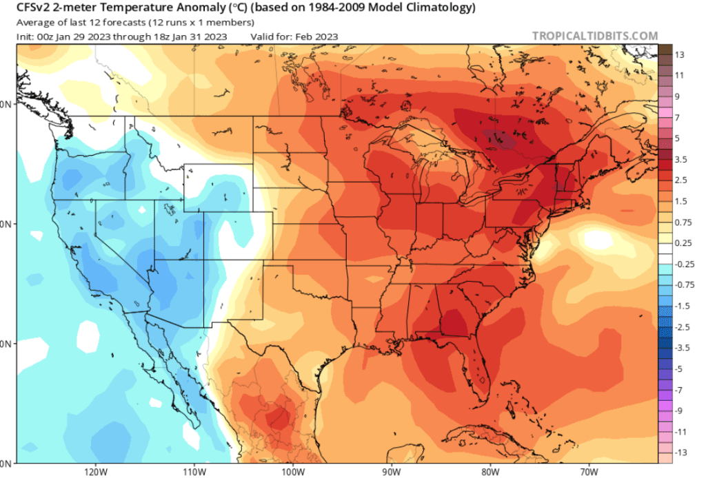
The above map is CFSv2 temperature anomaly forecast for February 2023 from the 18z run on the 31st of January.
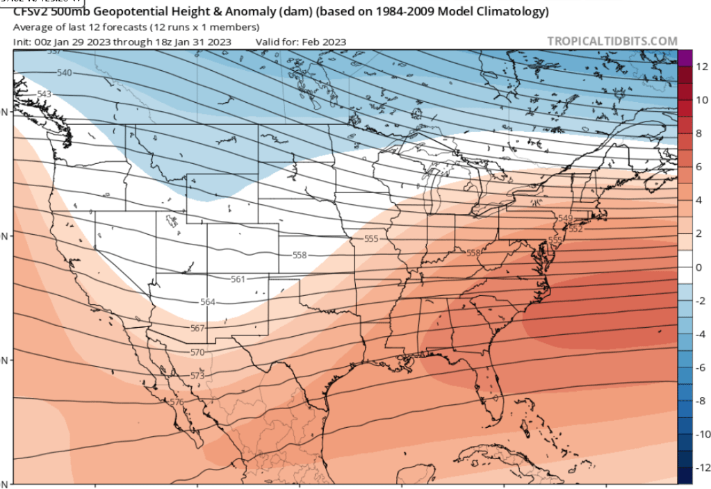
This is the 500 Mb forecast height anomalies for February
Now lets look at the very latest (Feb. 4th) CFSv2 latest weekly forecast. First we will look at the upper level height forecast. This suggests we have an upper level ridge this coming week, which will keep us warm. However for the rest of the month it would seem and upper trough develops and persists into March. This would mean cold will win by the end of the month.
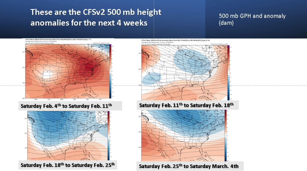
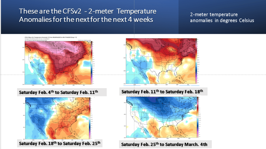
This developing upper trough does not really bring us cold weather until the end of the month. Looking at the next four weeks, it would seem my forecast, based on the frequency of above normal temperature days at Grand Rapids may have predictive value across the CONUS!
Does the MJO support this idea?, I do believe it does. The forecast below is from the ECMWF (which tends to do better than the GFS version of MJO), in this case through they are similar.

Phase 3 is cold for SW Michigan but phases 4 through 7 are warm for Michigan in February. We do not see the MJO going into phase 8 , which is cold for SW Michigan until the end of the month. This will be fun to watch and see how this plays out!
