
One of the nice things about this format is, unlike when I use to write forecast discussions from the National Weather Service, I can add images now!
I am expecting any mixed precipitation that develops this morning over our area to change to snow by afternoon. It will become windy this afternoon and temperatures are expected to fall into the 20s to mid to late afternoon. This will lead to slippy travel over most of our area during the afternoon and evening. The snow should end shortly after midnight.
The heaviest snowfall amounts of 5 to 8 inches will be north of I-96 but south of route 10. The I-96 areas is expected to get between 2 and 4 inches by this evening.

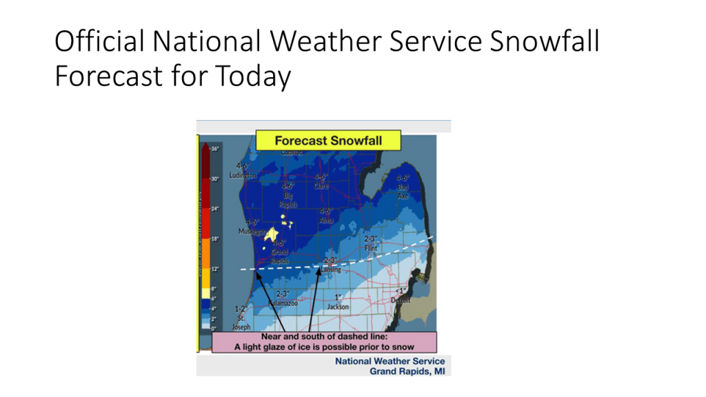
This image is thanks to the Grand Rapids National Weather Service
