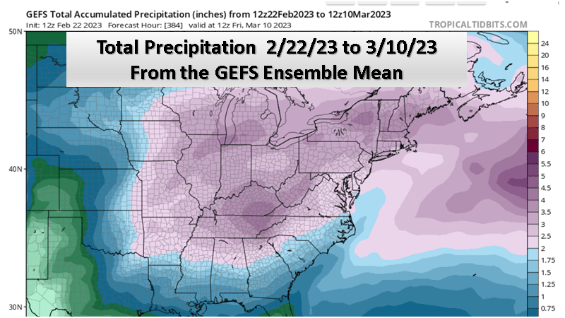
The map below (from Tropical Tidbits) shows the total ensemble mean precipitation expected over the next 2 weeks. Note the expected precipitation is in the 3 to 4 inch range over all of Michigan with the heaviest amounts over Southwest Michigan. It should be noted that while I am showing the GEFS forecast the ECMWF looks very similar for this time period.
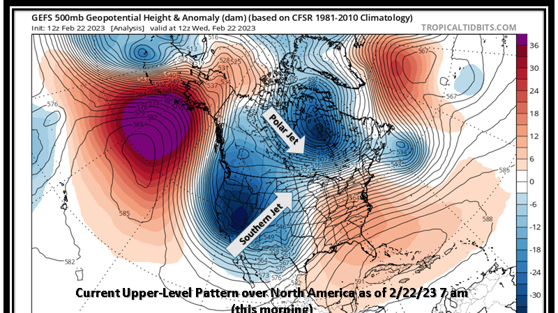
We currently have an upper air pattern that features a western United States upper trough and eastern United States upper ridge. The map below shows this very nicely. This shows a large storm system at upper levels over the western United States and large upper high over the Gulf and eastern Atlantic south of Florida. You may note too the polar jet, which is where the cold air is locked, is over central Canada. It is the southern stream jet that is bringing the moisture for our storm today.
The problem for us is that that deep western trough does not get kicked out with today’s storm. That means we will see more systems come out of this through. As you can see on the side below, the system that comes out today does not really flatten the upper ridge to our east. However the deep system over the western United States does finally start to move east, but in parts. The first part comes out early next week, with a negative tilt upper wave. That storm could be as wet or even wetter than what we have today. Then if that is not enough, yet a third system seems likely when the western upper trough finally moves out late next week.
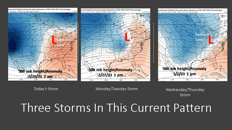
The bottom line is expect a stormy end to February and a storm beginning to March.
