Heavy Rain and Risk for Severe Storms Today

The Storm Prediction Center has put most of the southern 1/3 of Lower Michigan an enhanced risk for severe storms today (mostly late morning into mid afternoon). Locally heavy rainfall is expected too.

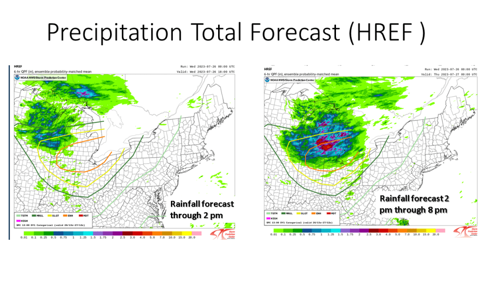
Most of the rainfall today will be from late morning into mid afternoon.

My experience in forecasting over the past 46 years tell me that for Southwest Michigan convection during the spring and summer months, warm fronts, stationary fronts and surface waves bring this area the most rainfall. Cold fronts bring us the least (typically). This event is warm front with a surface wave that develops into a surface low. This tells me most area should see meaningful rainfall today.

Unknown's avatar

Author: The Marinocast

I have just retired from forecasting for the National Weather Service (Dec 31 2022) after working there for 38 years. Prior to that I forecast for the United States Air Force from 1976 to 1984. I am very much into forecasting weather and climate and especially love snow storms.

Leave a comment