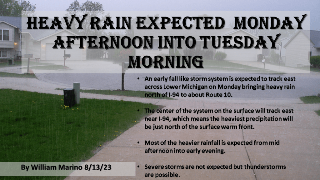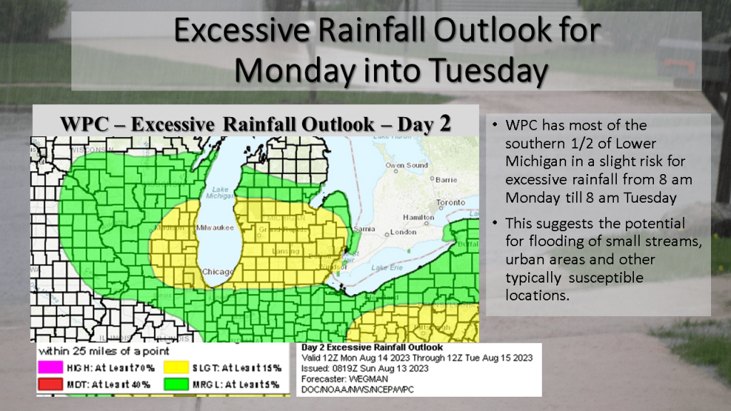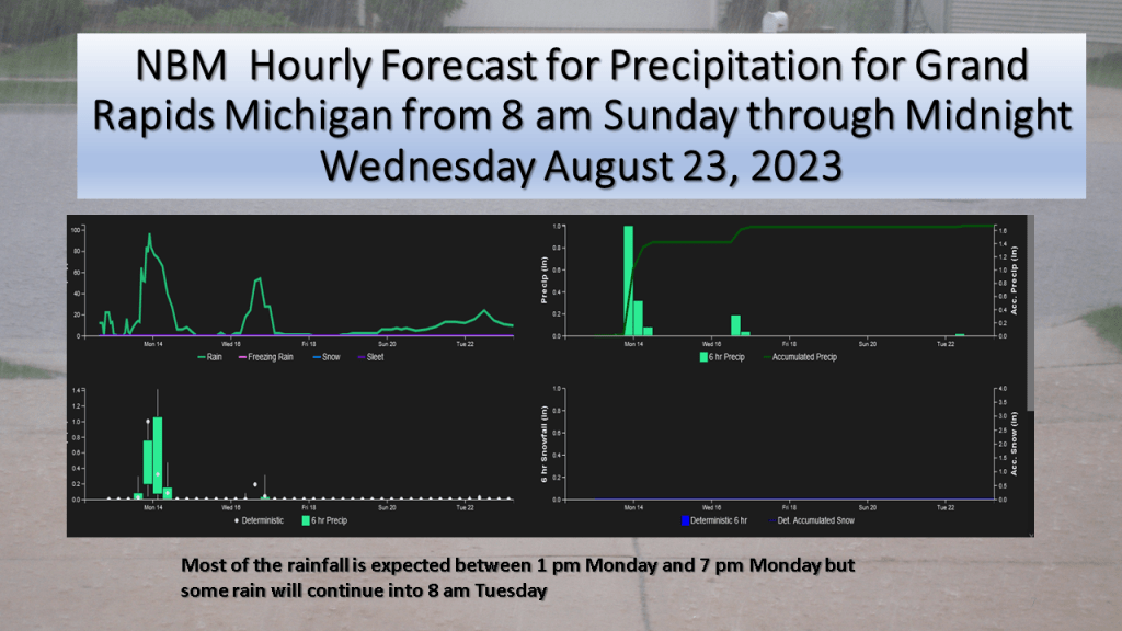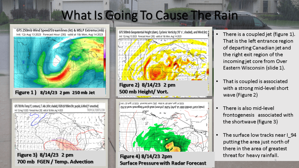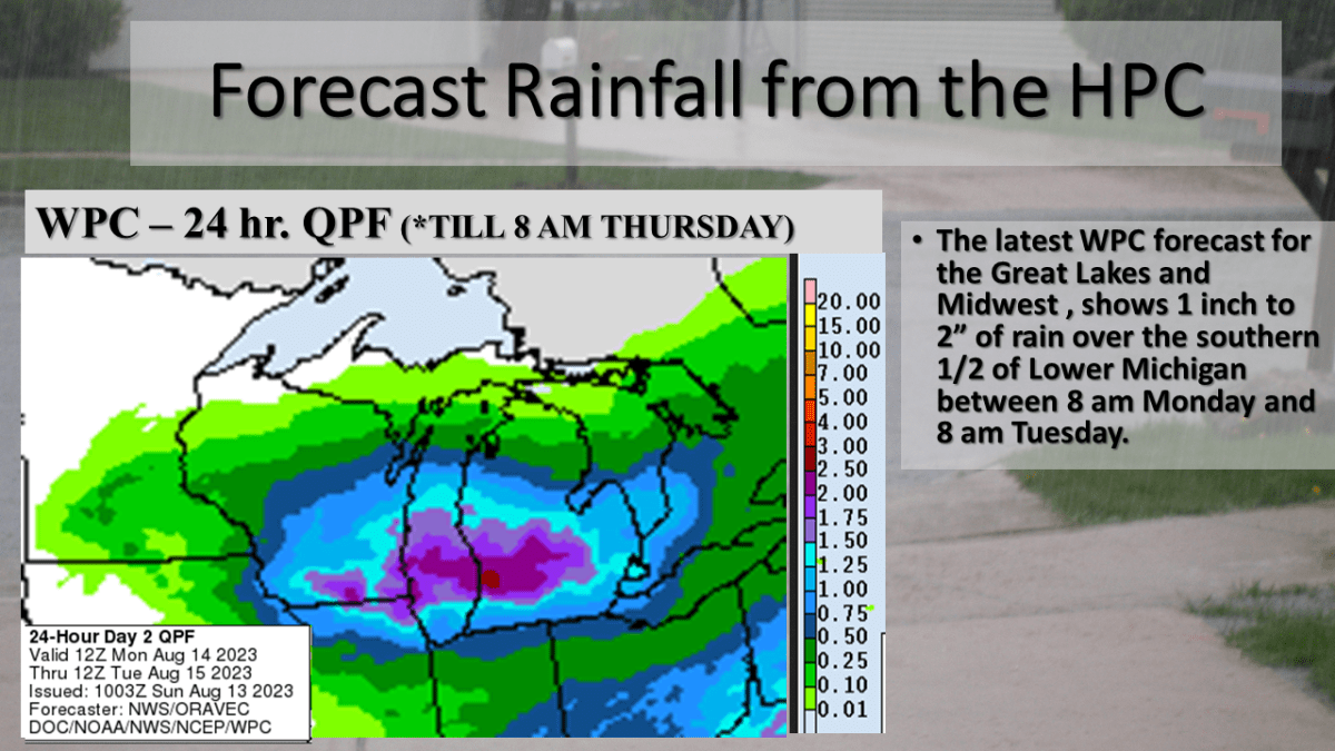
An unusually strong storm system for this time of year is expected to track east across Lower Michigan from Monday into Tuesday morning. This will be an occluded system, with the track of the surface low near I-94. It is typical for the heaviest precipitation to be within 100 miles of track of the surface low, but on the north it’s track. This system as a closed upper low with it and a coupled jet with it. The precipitable water reaches above 1.5 inches Monday afternoon over the southern 1/3 of Lower Michigan as this system tracks through the area. There is also good model continuity with this system so it gives me confidence that the heavy rainfall will happen. Just exactly were is questionable but I would have to believe between I-94 and Route 10, between Monday afternoon and Tuesday morning a large part of that area should see more than an inch of rainfall.