Enjoy the warm weather this week because it will get much colder next week and parts of Michigan may even see their first snowfalls by Tuesday. Happy Halloween!

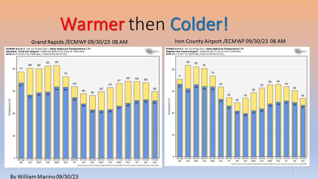
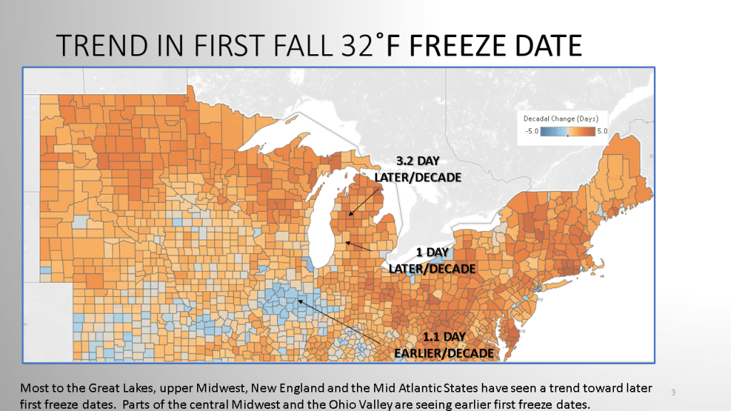
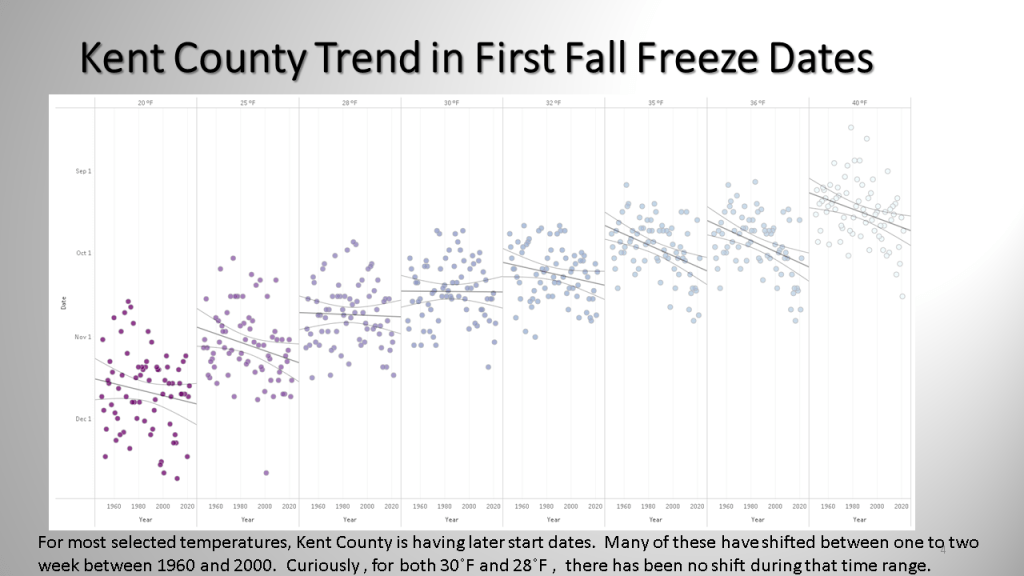
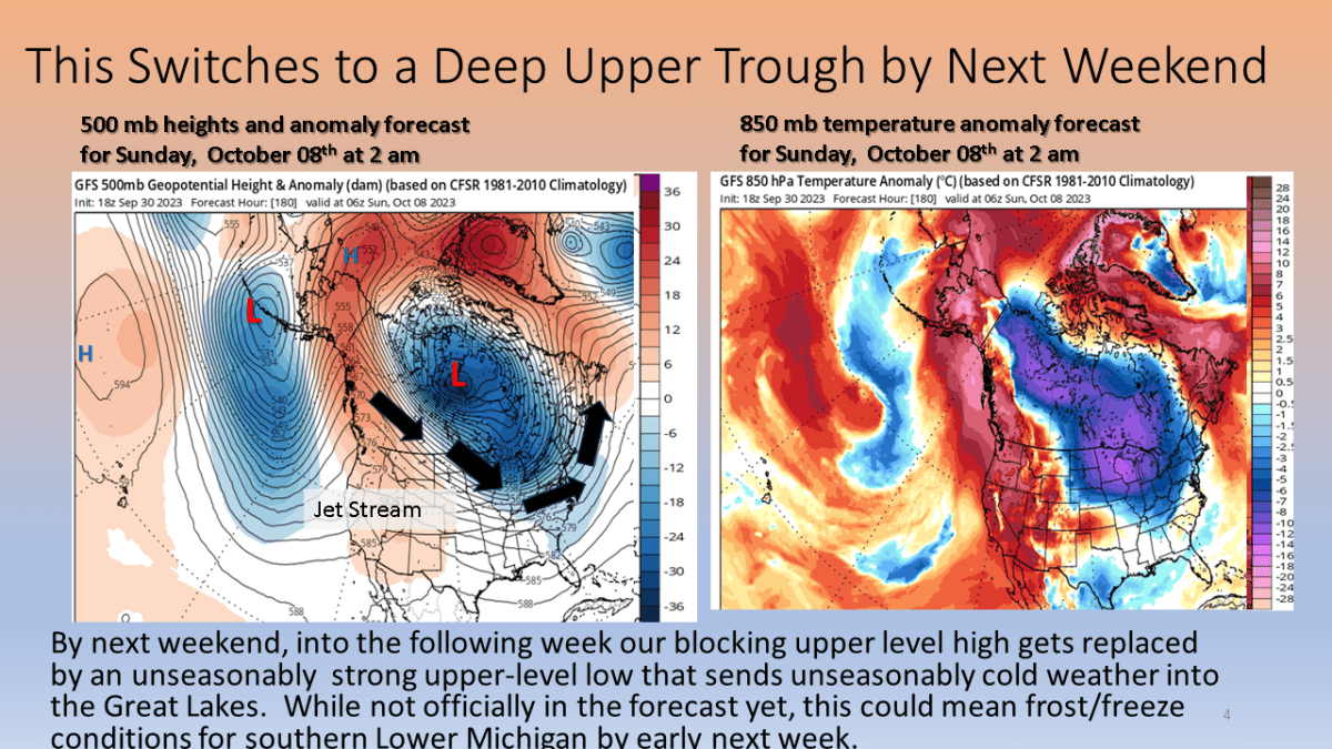
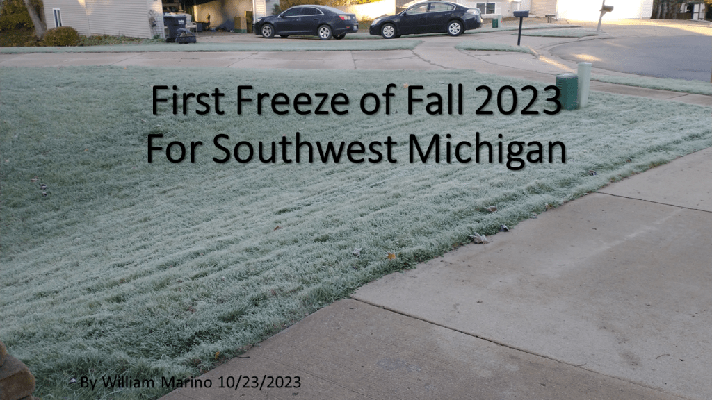
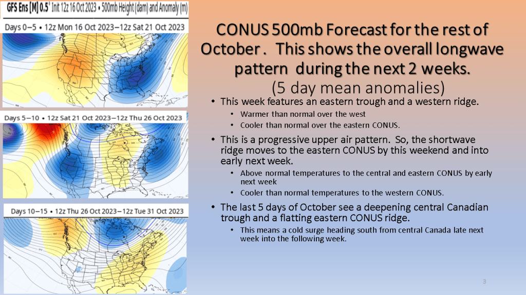
This shows our transition point from warmer to cooler weather.

Southwest Michigan had it’s first widespread freeze of the fall today.

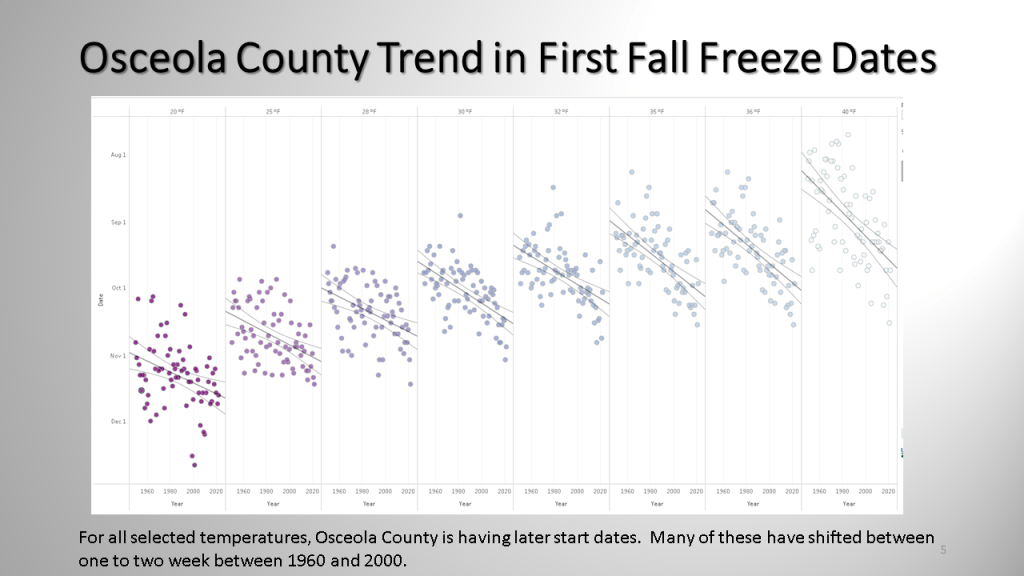
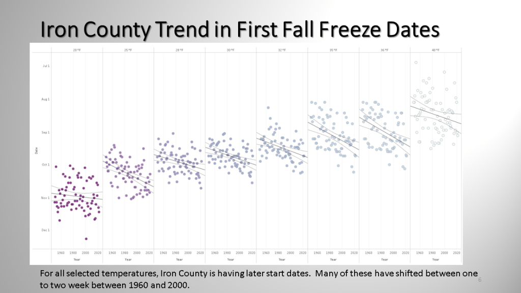
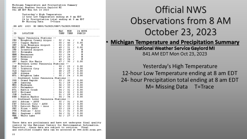
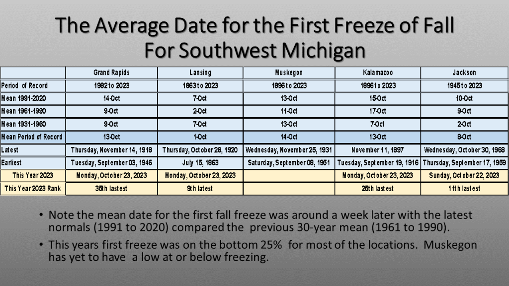
Here is a quick look at what the low temperatures were this morning over all of Lower Michigan, and a summary of what is normal for a few selected stations in Southwest Michigan. This year, at most stations the first freeze was later than what would be the mean first freeze date.

The weather over the next two weeks will feature some warm and dry weather as well as cold and wet weather. Mostly it will be warm dry over the western CONUS into next week. Over the eastern CONUS it will mostly be cooler and wet. A significant warm up may follow over the eastern CONUS by the middle of next week.

Typical of fall we will see a warm up, then it will rain and get cooler, only to warm up by early next week.  Then it will get wet and cooler once again.

Expect the wet and cool weather over Northern Midwest into New England, including the Great Lakes, to persist into early next week. An impressively large blocking upper-level high, over central Canada will keep the storm track over the northern CONUS into early next week. It will also allow a subtropical system to track along the Gulf Coast over the next few days.

After having 4 days with highs in the 80s over Southwest Michigan, to start October, a series of cold fronts will lower our high temperatures by Saturday into the lower 50s. The cooler temperatures are expected to last into the middle of next week before another slow warm up begins. Widespread rainfall, mostly between a quarter and half an inch will occur Thursday as the front moves through. Lake effect rain showers are expected into early next week.

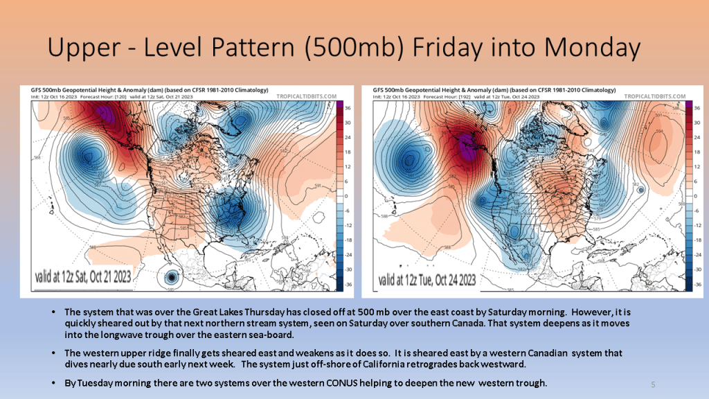
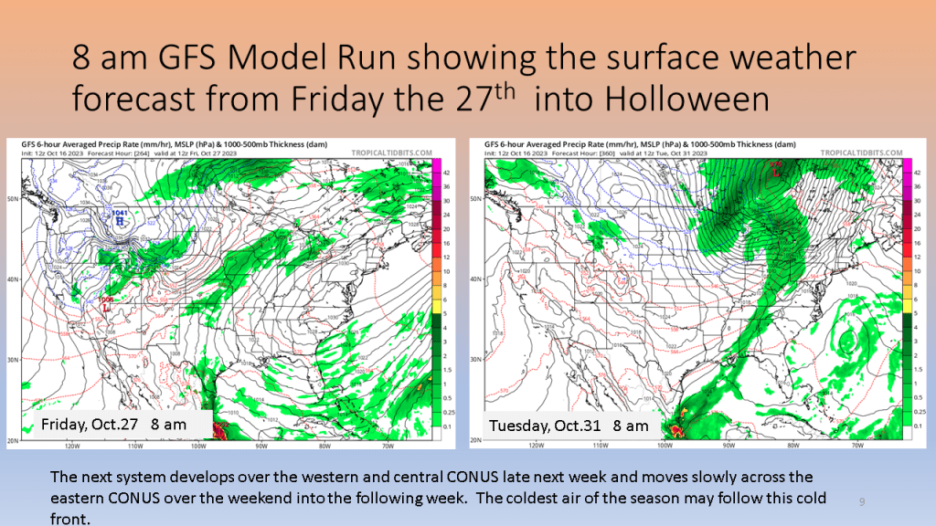
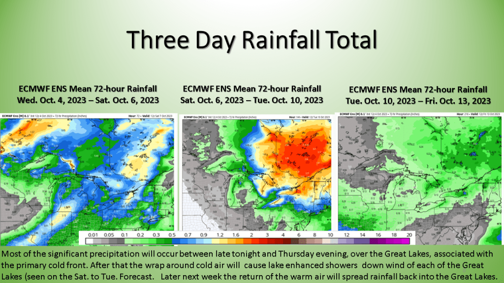
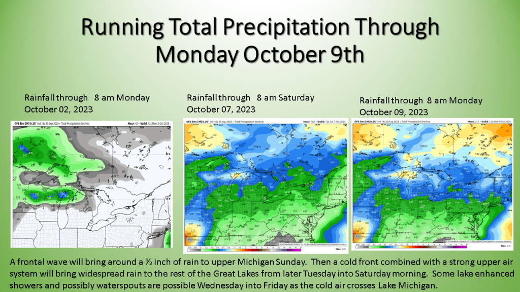
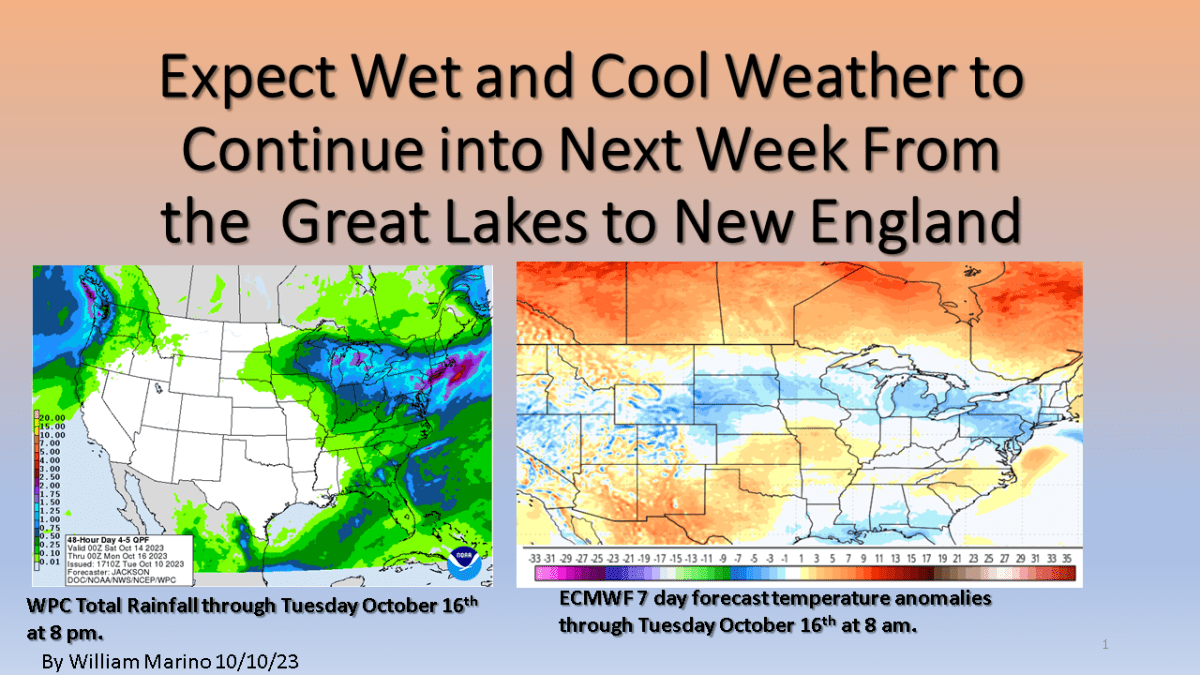
It will fell like fall by Friday morning and that chilly and showery weather my last into Tuesday morning before the system is far enough to east to allow for some clearing. It will remain chilly Tuesday into Wednesday before a warm up starts by Thursday of next week.

Some rather dramatic changes are likely in our weather over the western Great Lakes this week into early next week. Highs in the 80s are expected Sunday into Tuesday, then highs are expected to fall into lower to mid 50s by next weekend. Expect widespread rainfall during the midweek period too.