


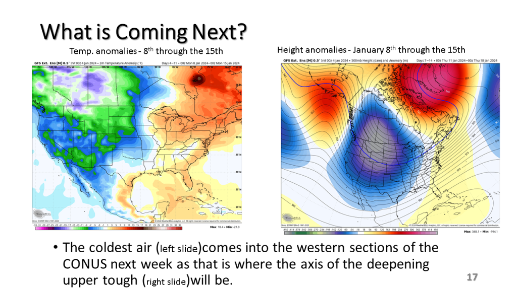


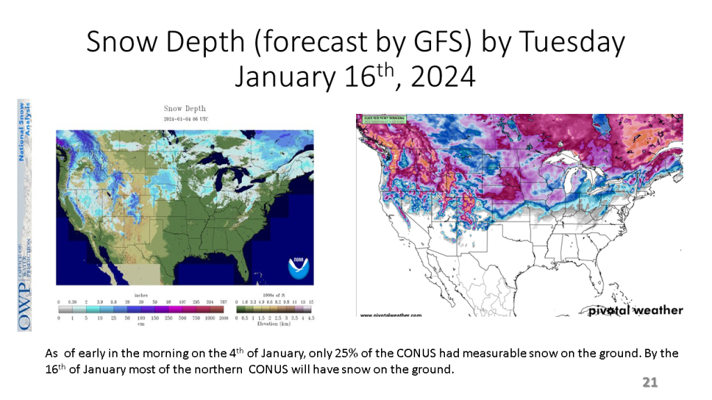
In Conclusion, the storms we will see over the central and eastern Untied States between now and Wednesday are the forerunners of a major change in the weather pattern over the CONUS. That past month or so was mostly warmer than normal over nearly all of the CONUS, with just the southeast sections near to below normal. From the second week through the third week in January we will see much colder weather from the west coast to the east coast and the wet pattern will expand into the central United States. Snow will likely be on the ground over most locations north of Indianapolis by the end of next week.
