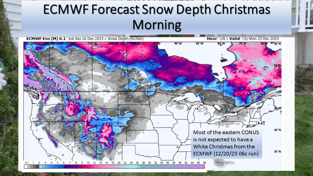
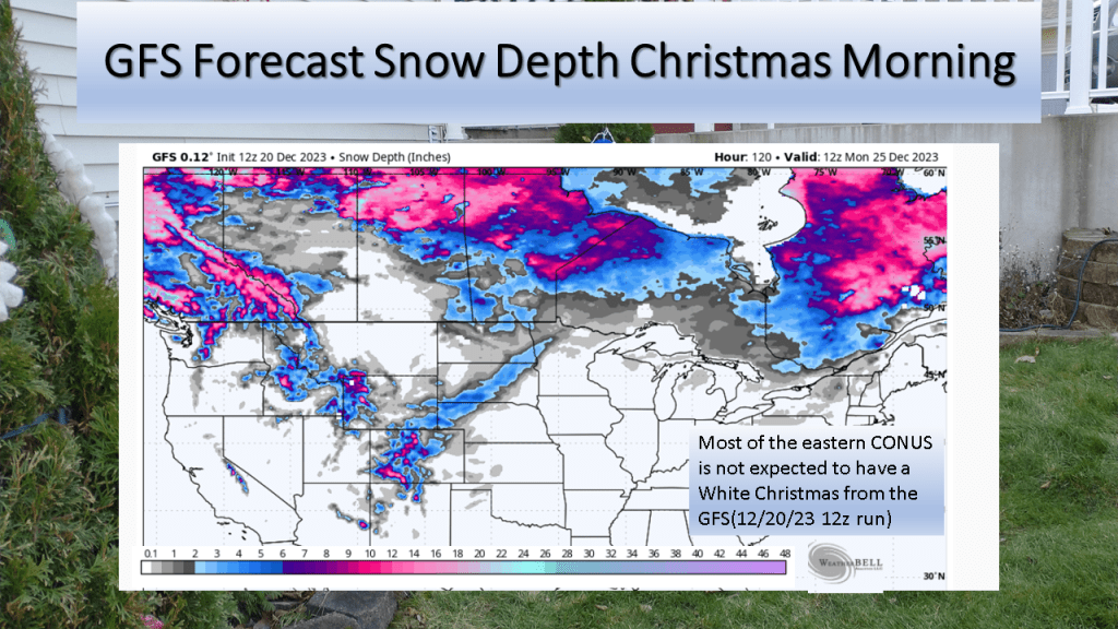
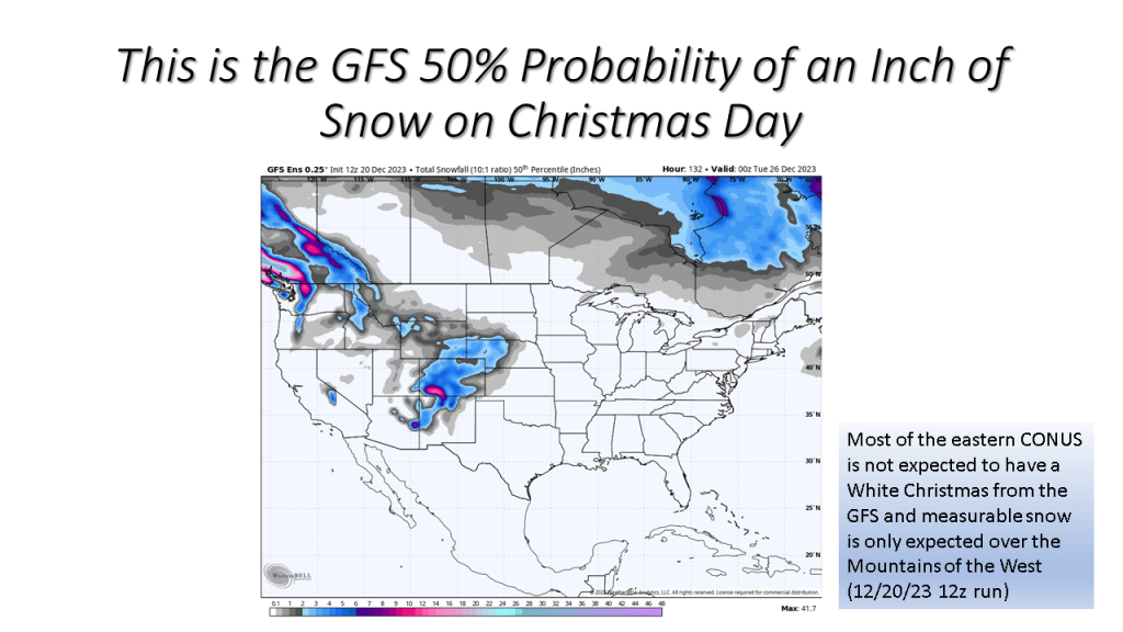
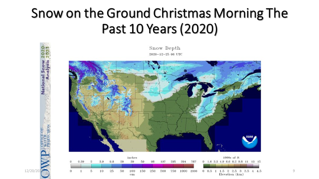
The short story is if you live in the central or eastern CONUS it is very unlikely you’ll have snow on the ground Christmas morning.
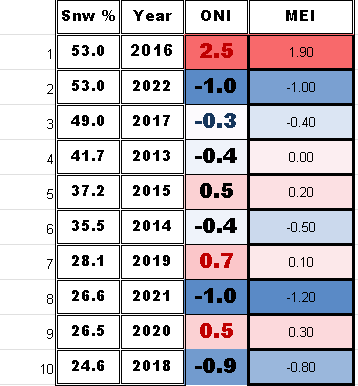
I have updated this to show the percent snow cover and ENSO state for each of the 10 years. At the end I have 2 tables that show the years with the ENSO index numbers and the snow cover for that Christmas. The bottom table sorts the percent snow cover from highest to lowest to see if there is a correlation between the ENSO state and the percent snow cover on Christmas day.


| Area Covered By Snow: | 53% |

| Area Covered By Snow: | 26.6% |
| Area Covered By Snow: | 26.5% |

| Area Covered By Snow: | 28.1% |
2019 was ENSO neutral with the ONI index at +0.7 while the MEI index was 0.1.

| Area Covered By Snow: | 24.6% |

| Area Covered By Snow: | 49.0% |

| Area Covered By Snow: | 44.1% |
24.6%
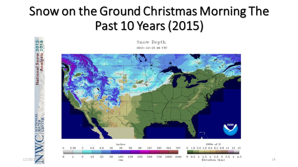
2016 was a strong El Niño, the ONI index was +2.5 while the MEI index was +1.9. The ONI at 2.5 was an all time record for the ONI index.
| Area Covered By Snow: | 37.2% |
| Area Covered By Snow: | 35.5% |
| Area Covered By Snow: | 41.7% |
Below is a table showing the percent snow cover on Christmas
Below is a table showing the percent snow cover on Christmas Day in chronological order.
Below is a table showing ENSO numbers and the percent snow cover on Christmas day for that year sorted from the highest percent snow cover to the lowest. There does not seem to be a significant correlation to the ENSO state and the percent snow cover on Christmas Day.