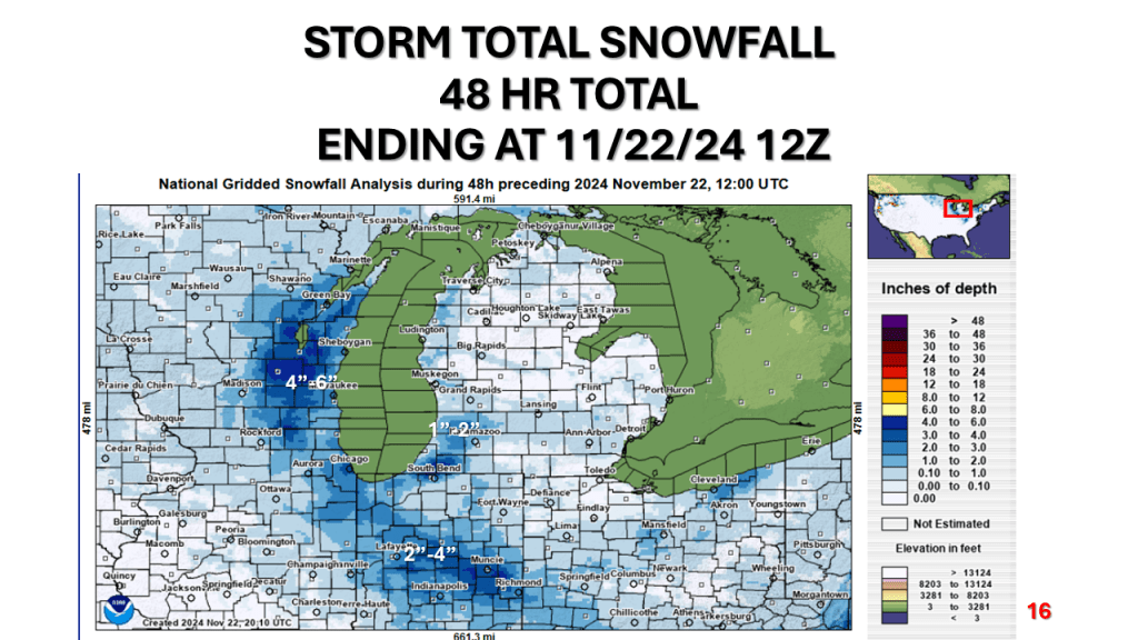
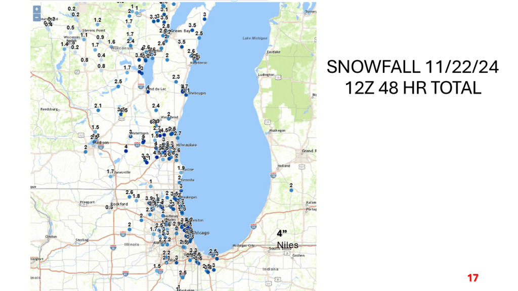
Heavy lake effect snow impacted all of the Great Lakes between Wednesday evening and this morning. Many areas had over 2 feet of snow.


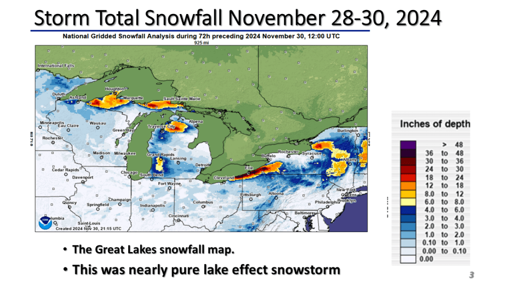


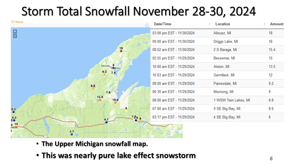


Heavy lake effect snow impacted all of the Great Lakes between Wednesday evening and this morning. Many areas had over 2 feet of snow.
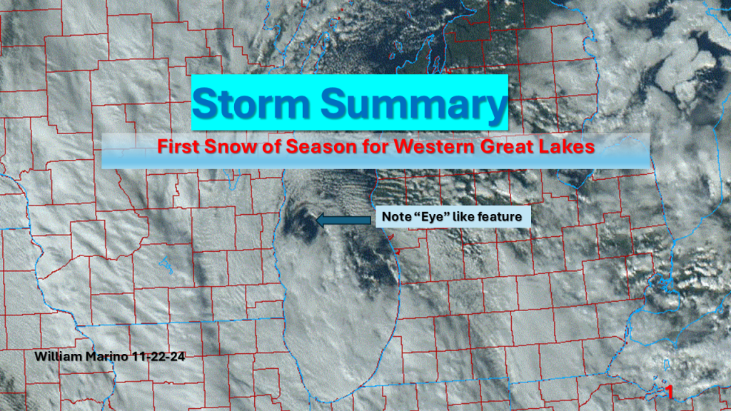
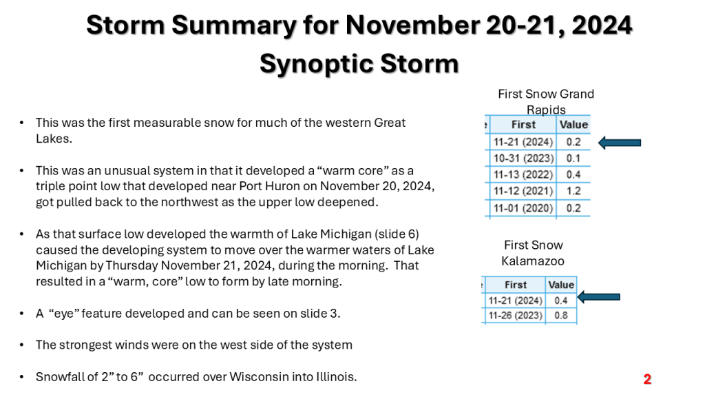
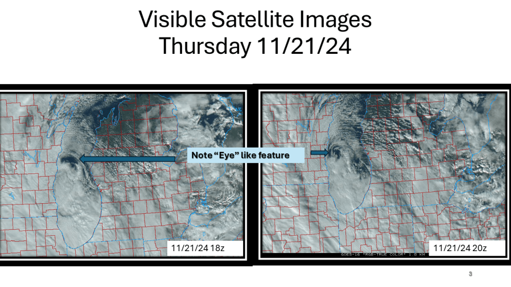
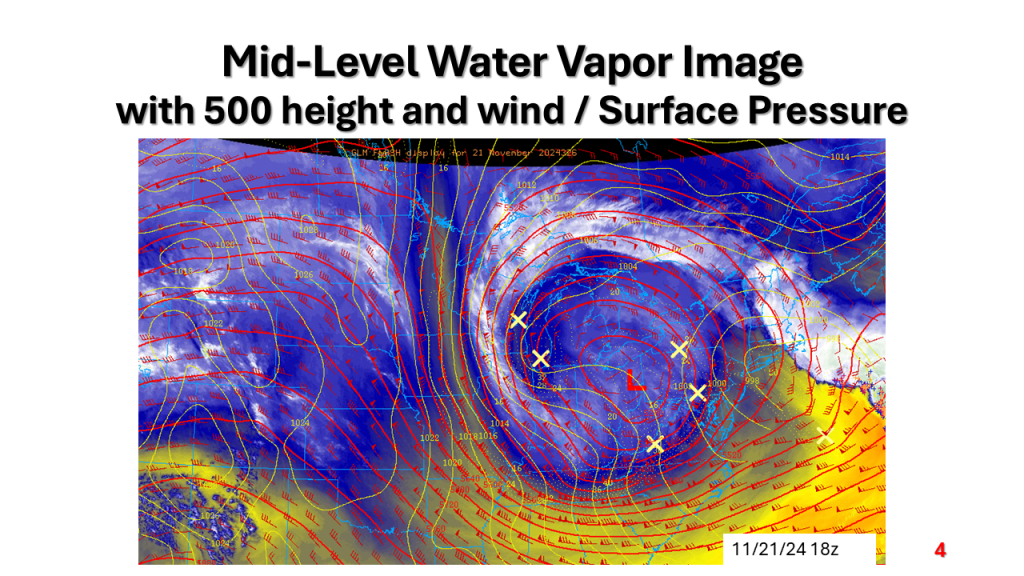
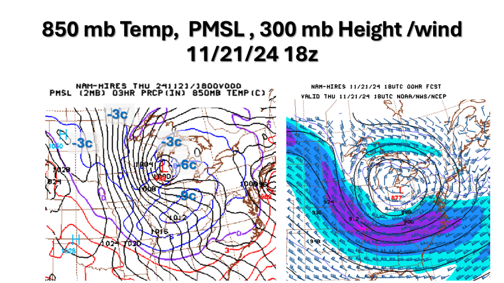
A strong November storm system brought the first snow of the season to parts of the western Great Lakes. Due to the warmth of Lake Michigan and that the surface low moved over Lake Michigan it developed an “Eye” like feature during the afternoon of Thursday, November 21, 2024.


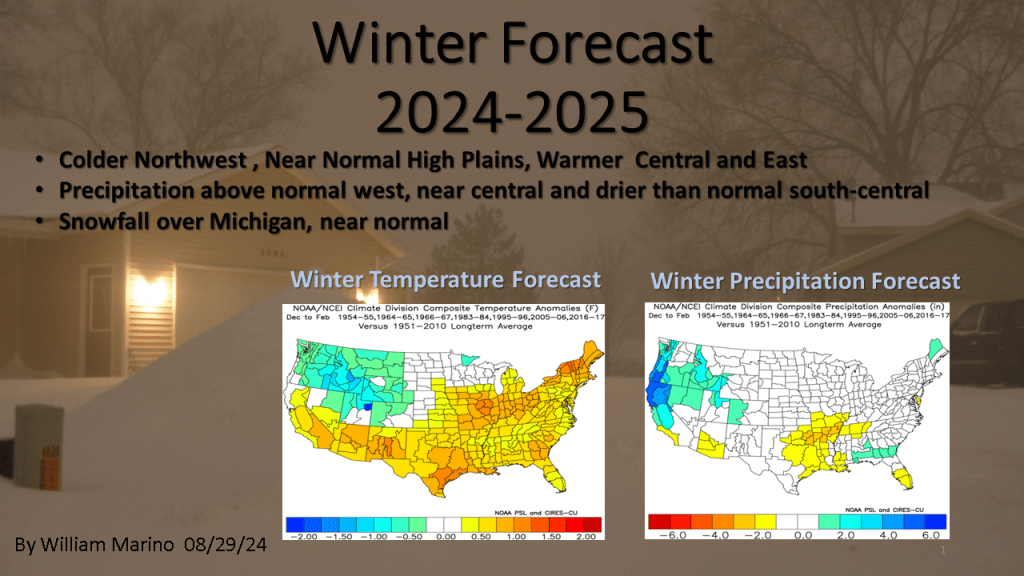
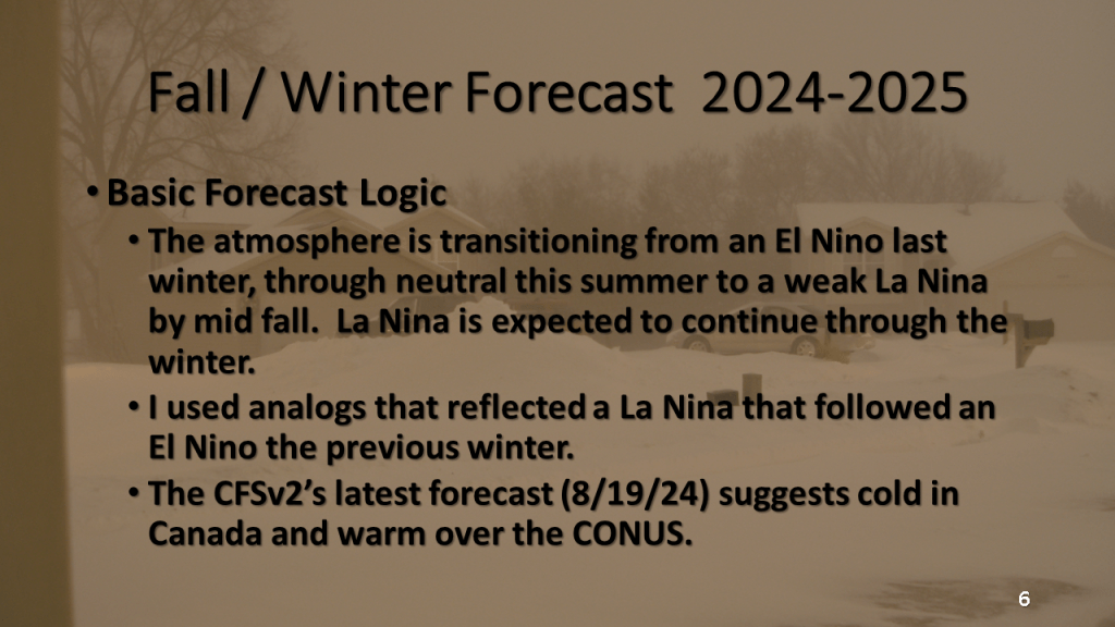
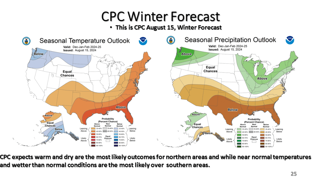
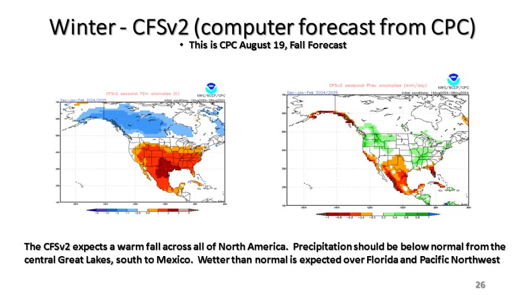
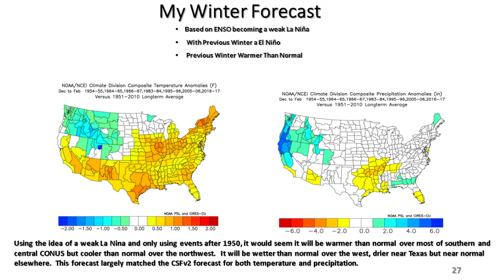
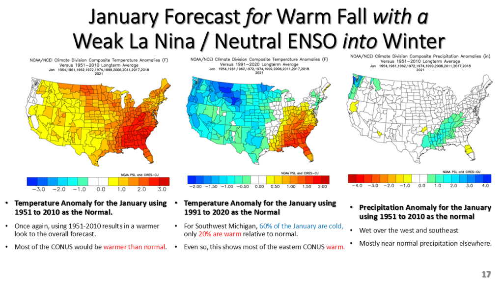
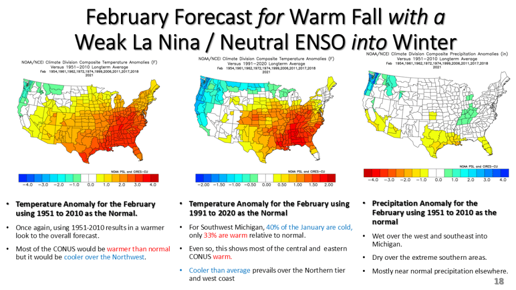
This version of the winter forecast has the seasonal forecast as well as monthly forecasts from December through February.


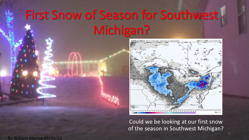
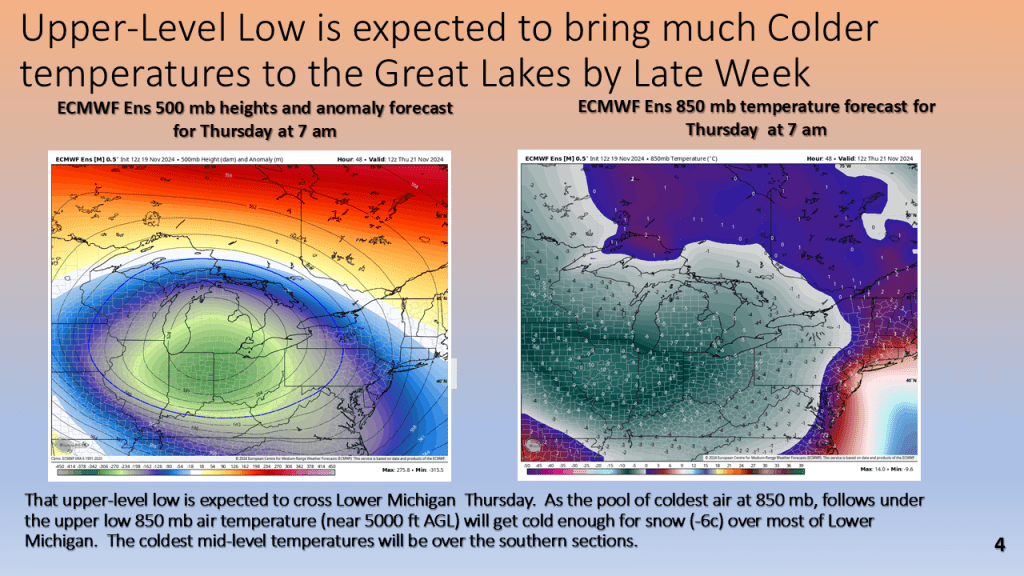
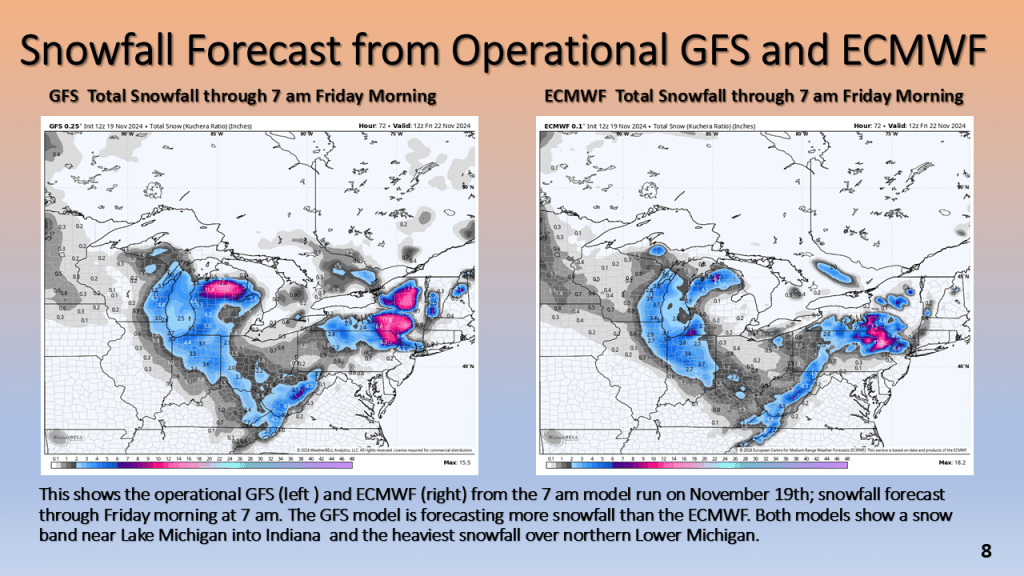
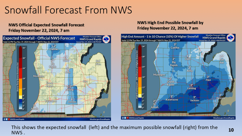
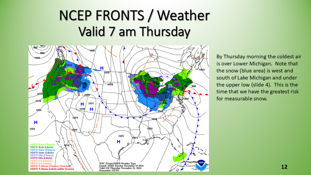
The first snowfall of the 2024/2025 season is likely for Most of Lower Michigan between Wednesday night and Thursday morning.


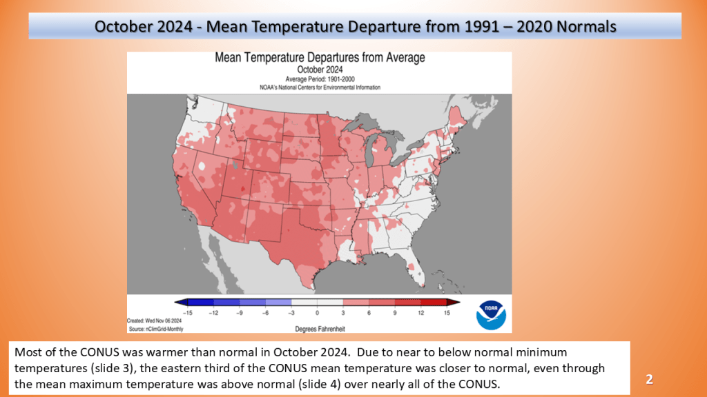
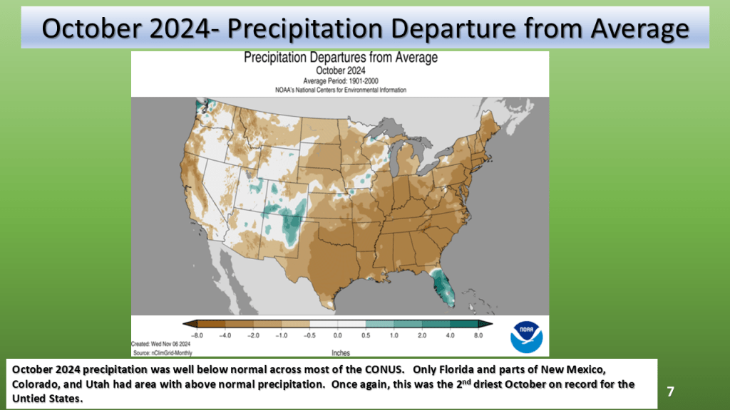
October 2024 was both the second warmest and second driest October on Record, going back to 1895.


That 87% is the highest percent of the CONUS in drought, going back to January 2000 (or maybe even farther).
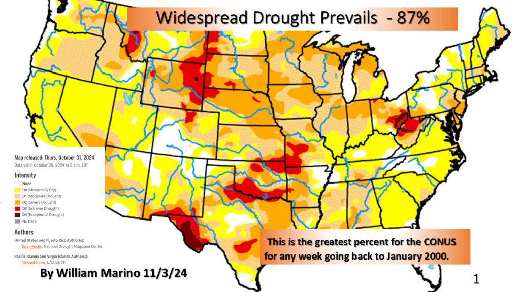
US Drought Monitorhttps://droughtmonitor.unl.edu/CurrentMap.aspx


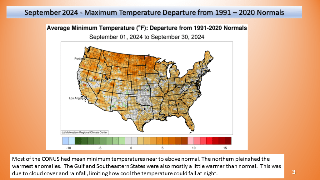
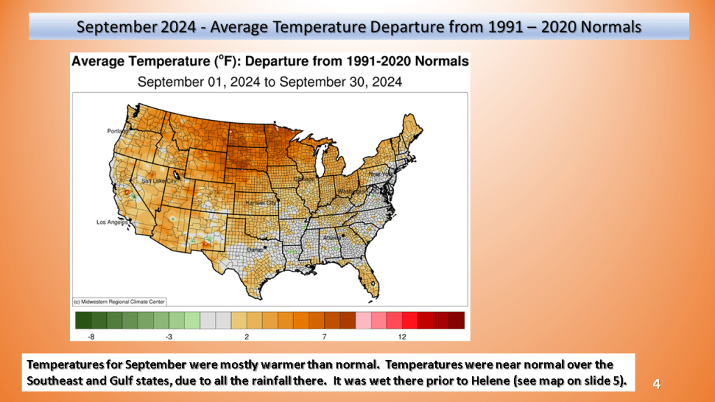
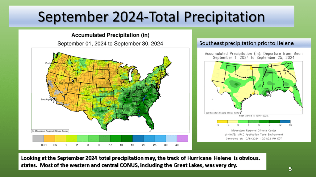
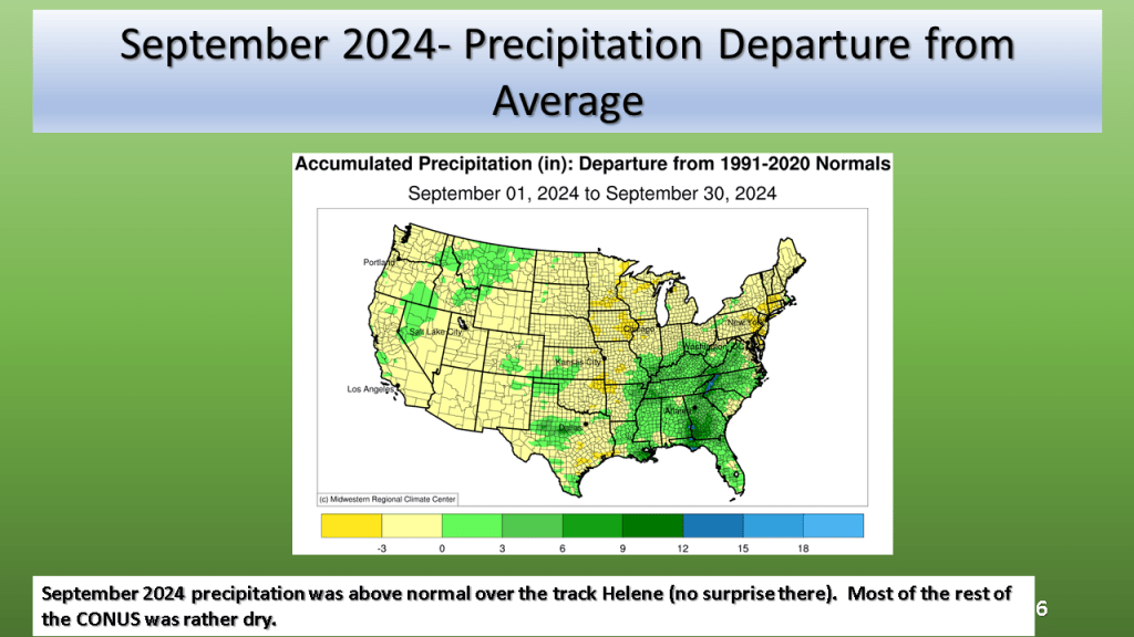
Most of the CONUS was warmer than normal and dry in September. The notable exception was over the Southeast CONUS where Hurricane Helene and it’s remnants caused devastating flooding in some areas.


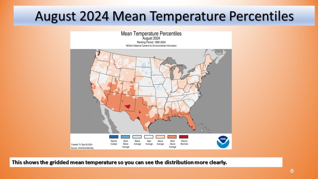
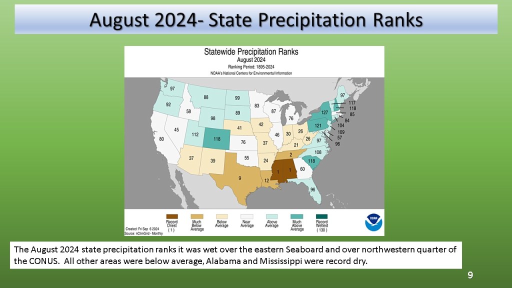
Record dry Alabama and Mississippi, most of the CONUS was warmer than average.


Nationally and Locally over Southwest Michigan
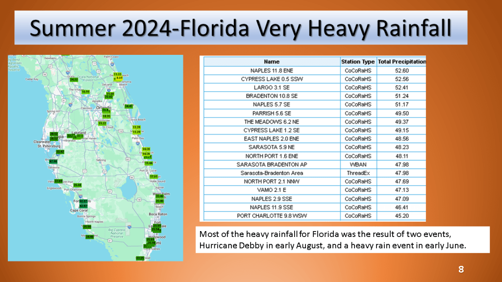
Updated with State Maximum and Minimum Temperature Ranks and details on Florida and Michigan heavy rainfall amounts