


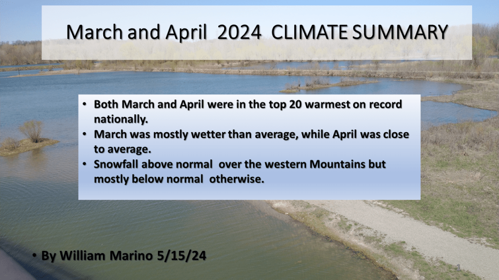
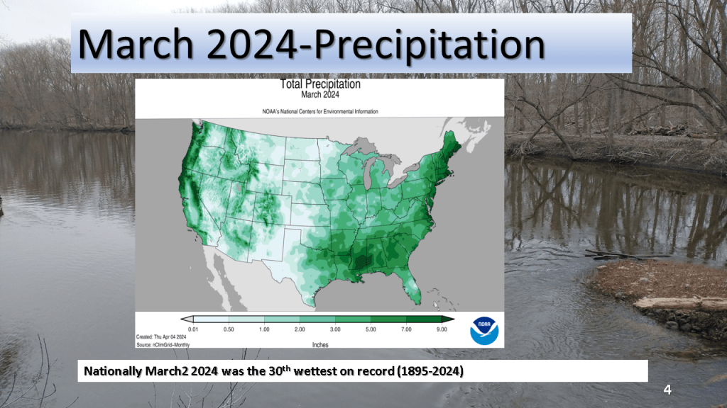
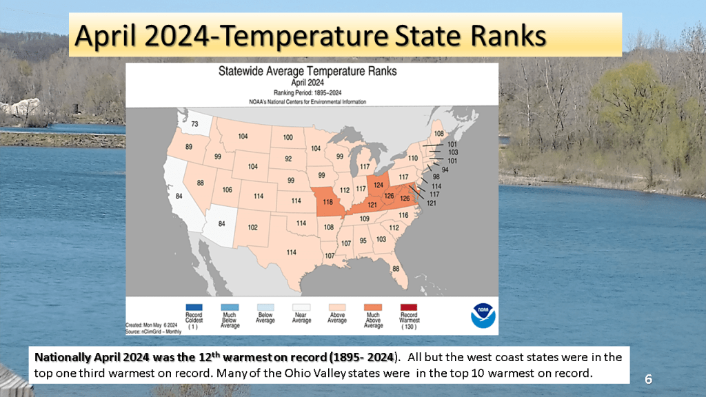
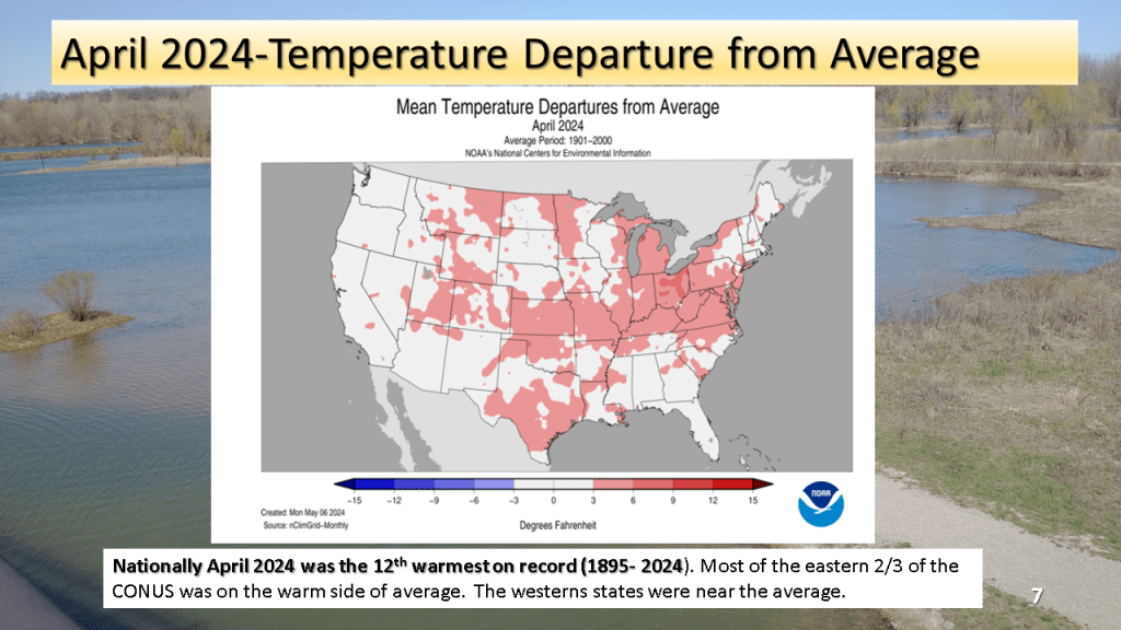
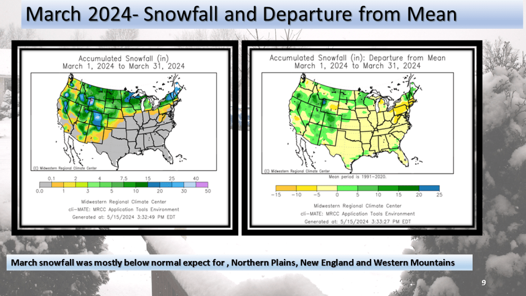
The national trend of top 20 warmest months on record continued for both March and April. March was overall wet compared to average while March was closer to normal. Snowfall was above normal over the western Mountains but below normal (mostly ) elsewhere.


This is a short version compared to my previous seasonal forecasts but I believe the shorter version will be easier to read. I may add details as the season progresses.


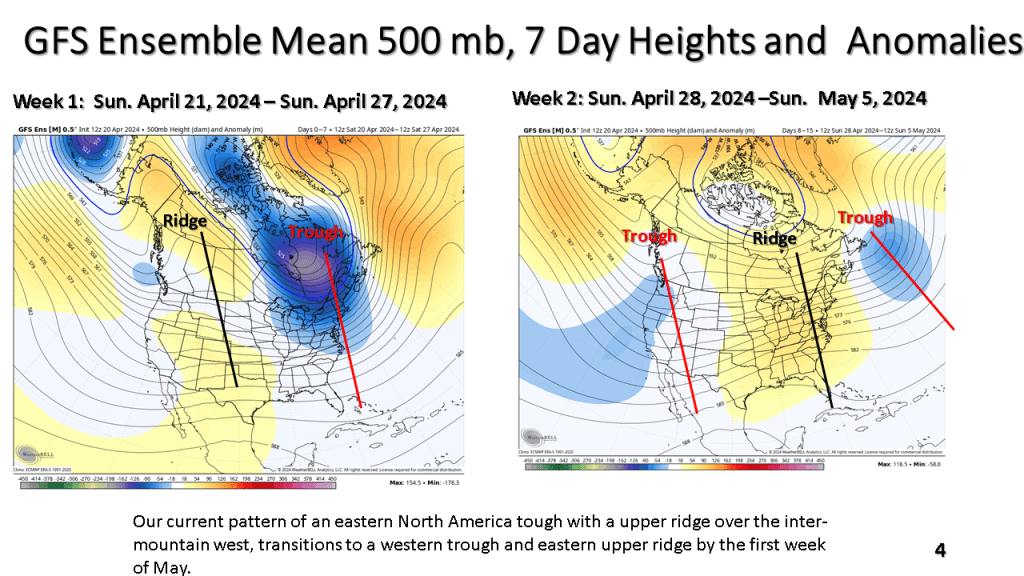
The current cool weather pattern has recently developed over the central and norther Plains. That cold air is expected to spread east over the next week. Frost and freezing temperatures are possible in northern and central sections over the next 7 days. Than, a warmer and wetter weather pattern is expected over most of the eastern and central CONUS.


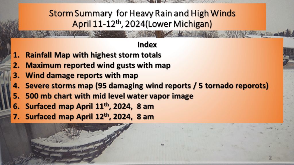
One to two inches of rain fell over a good part of Lower Michigan during this time. A rapidly deepening surface low tracked north across Lake Huron Friday, April 12, 2024 deepening below 980MB by late in the morning. This resulted in winds gusting to 40 to 60 mph across most of the area.


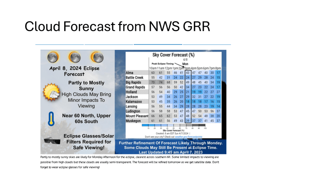
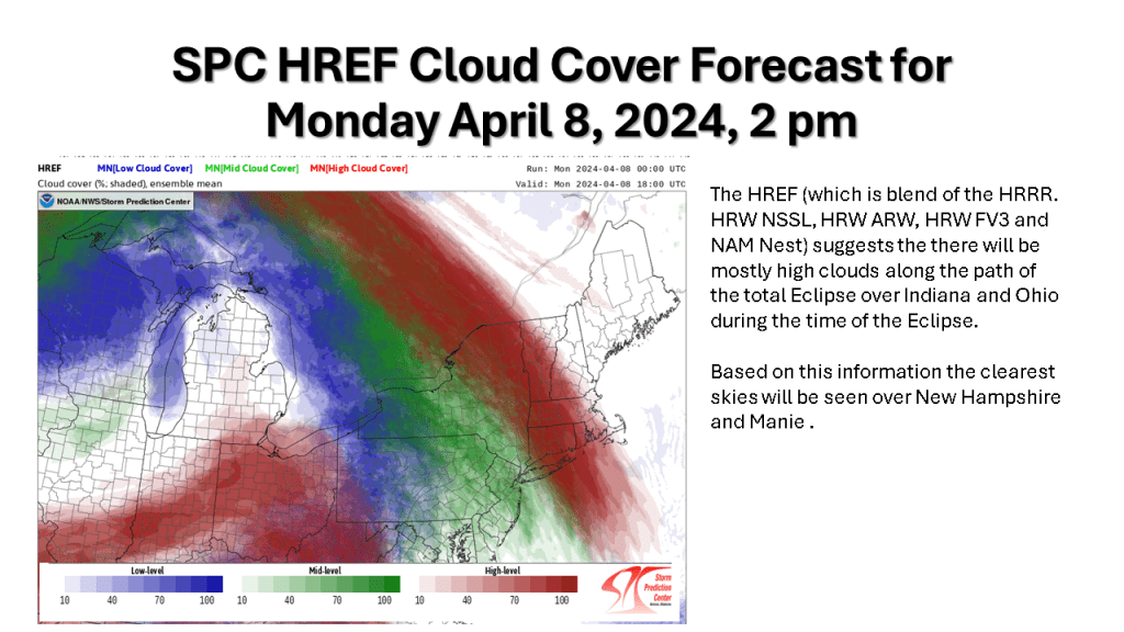
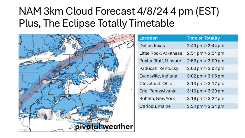
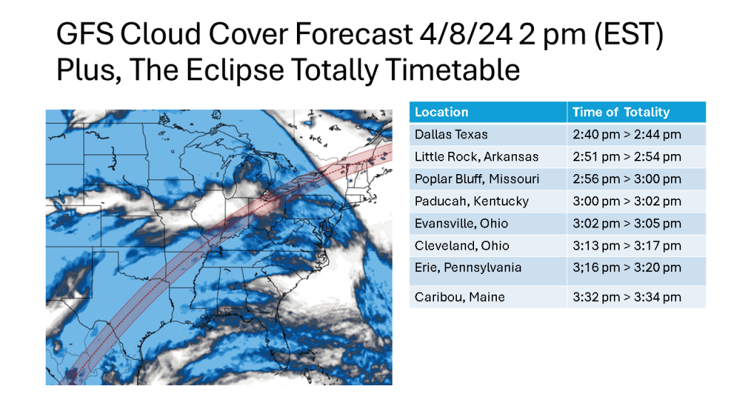
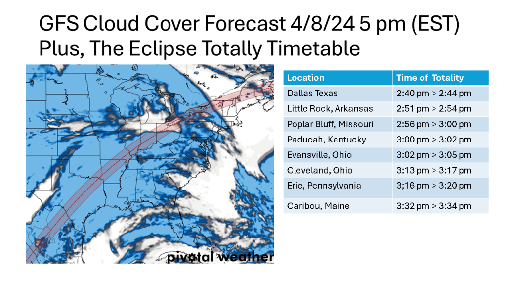
I waited for the evening HREF to come in so I could use the very latest model data for this forecast. Based on the HREF , NAM 12k m, NAM 3Km and the HRRR, it seems likely there will be high clouds over the Eclipse track from Indiana into Ohio. Being high clouds, more than likely you’d see some of the Eclipse. The best viewing still seems to be in over New Hampshire and Maine.


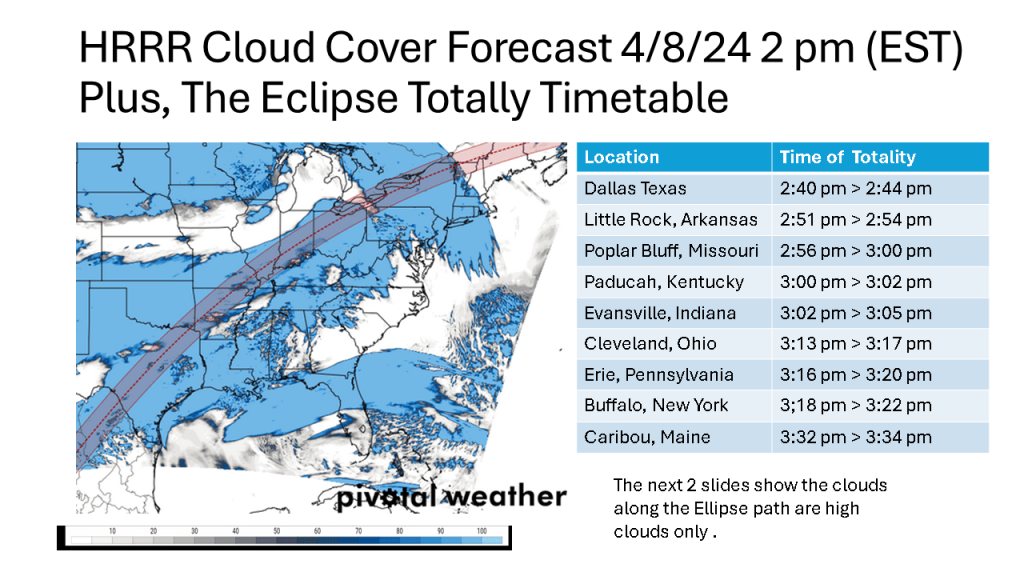

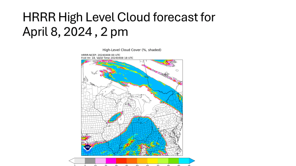

I will update this forecast once the high resolution models get within 48 hours of the time of the Eclipse (2-3 pm Monday).
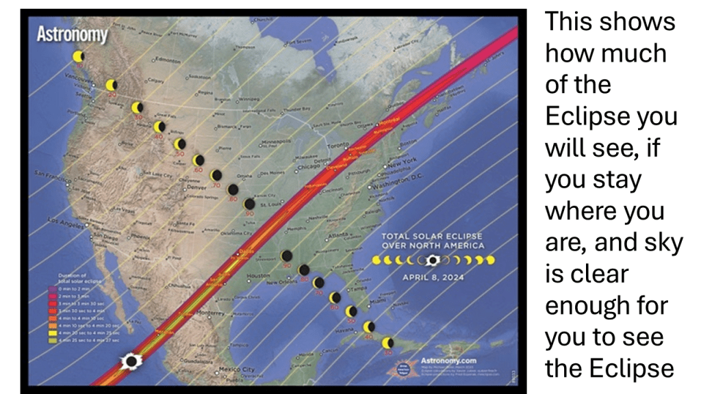
Note the times of Totality at various locations came from Astronomy as did slide #2.


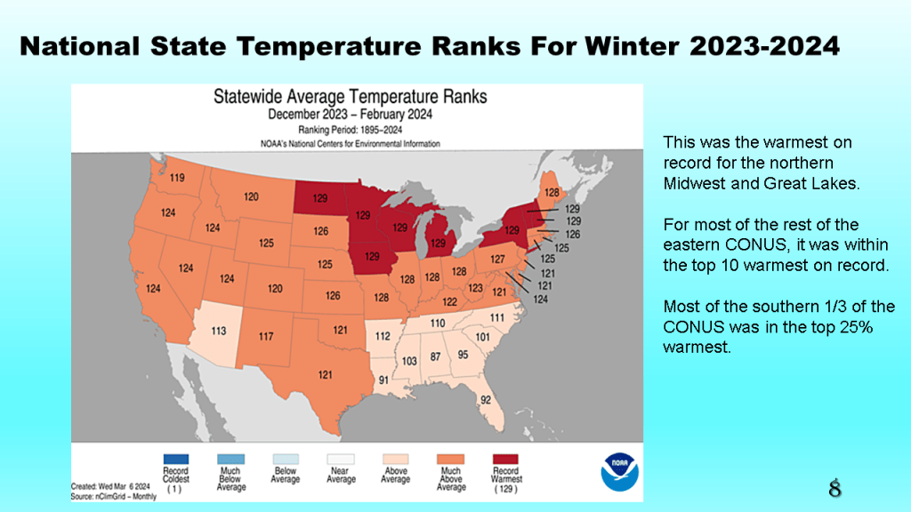
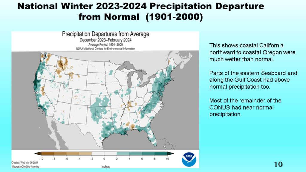
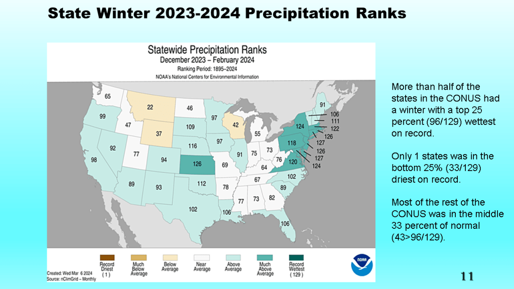
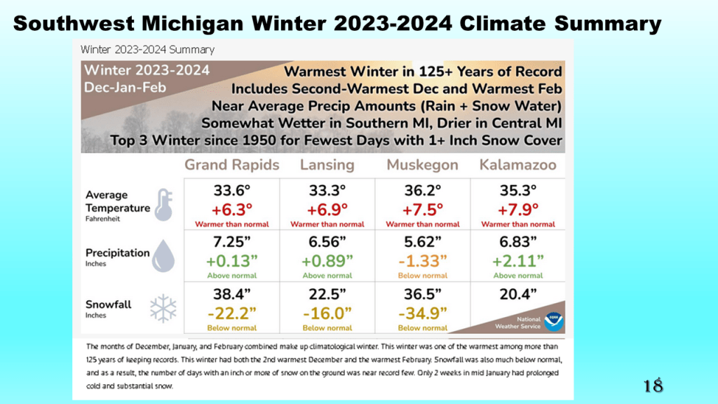
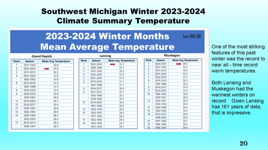
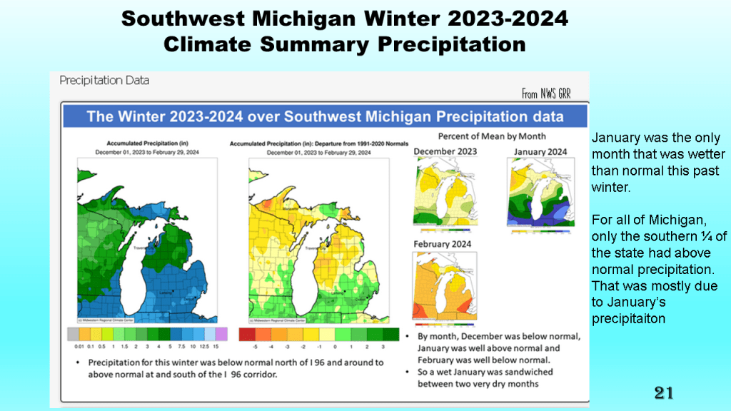
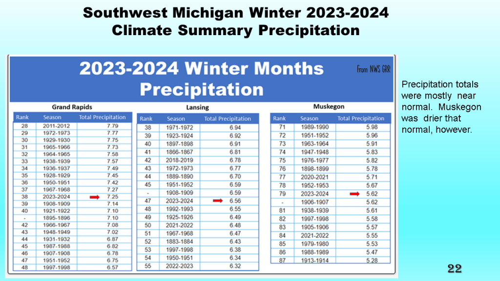
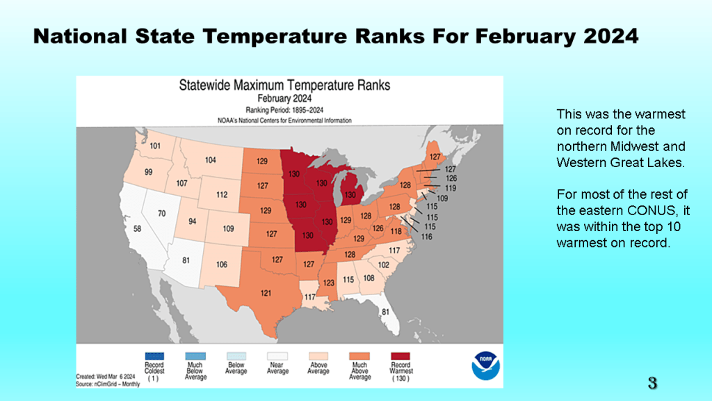
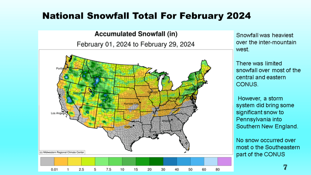
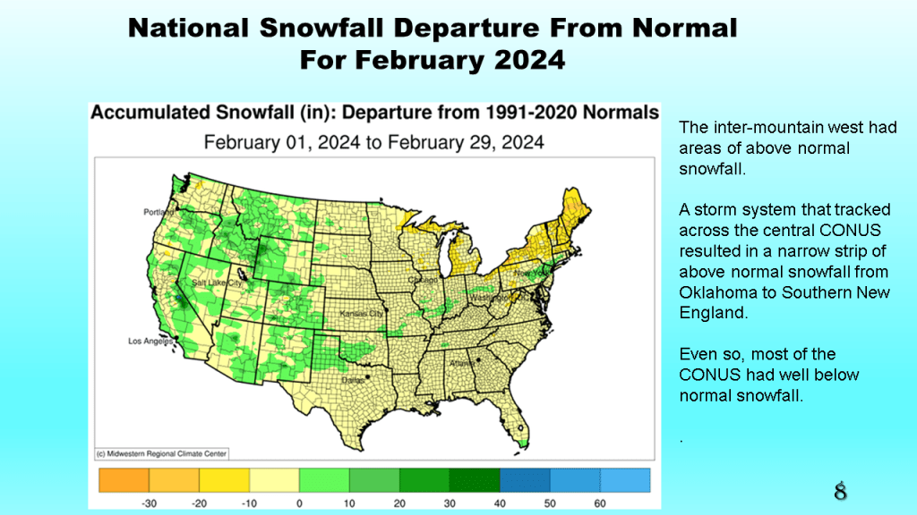
This was both nationally and locally one of the warmest winters on record, with records going back to 1895. Nationally and locally snowfall was below to well below normal. Precipitation was mostly near normal.


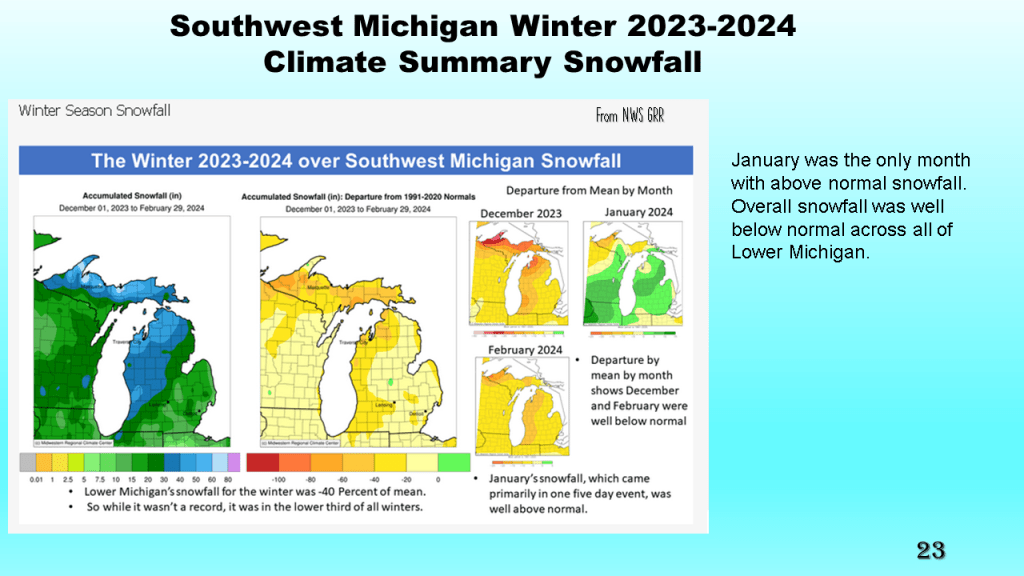
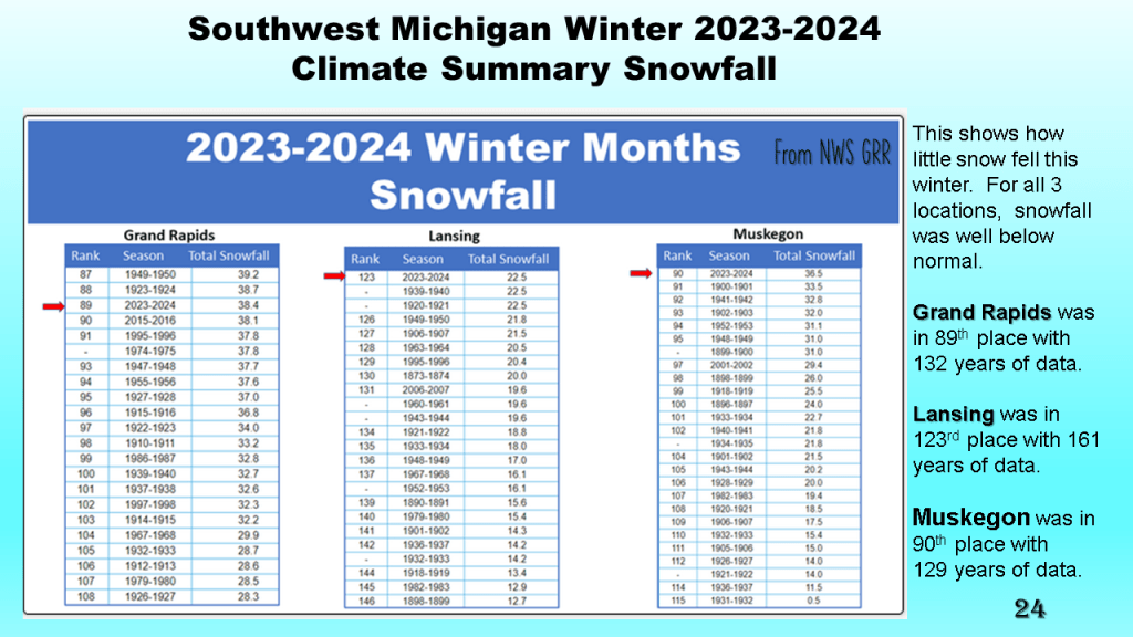


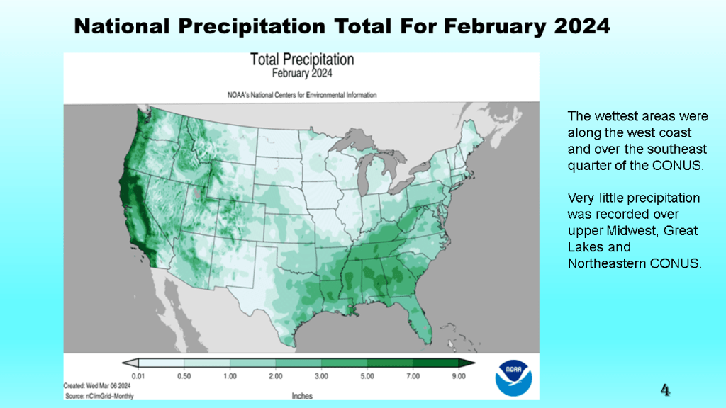
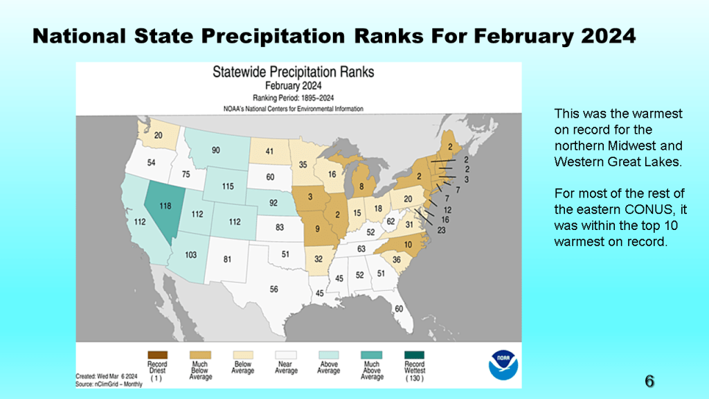
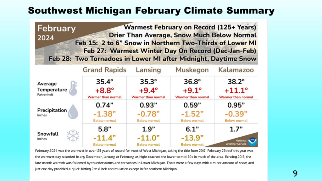
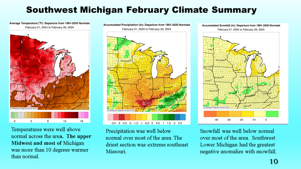
For Southwest Michigan, this was the warmest February on record. Both the total precipitation and snowfall were well below normal. Nationally this was the 3rd warmest and 40th driest on record.

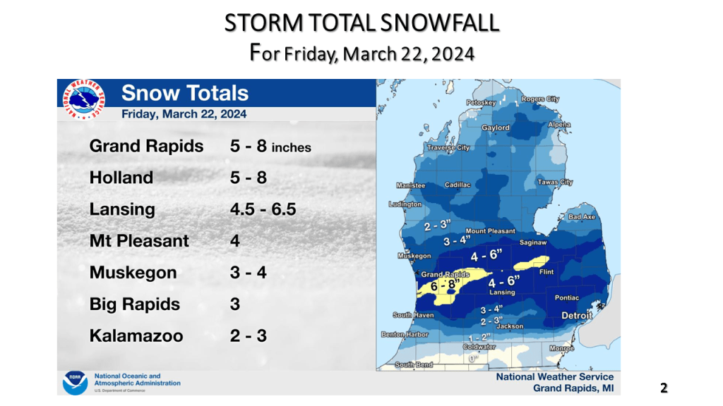
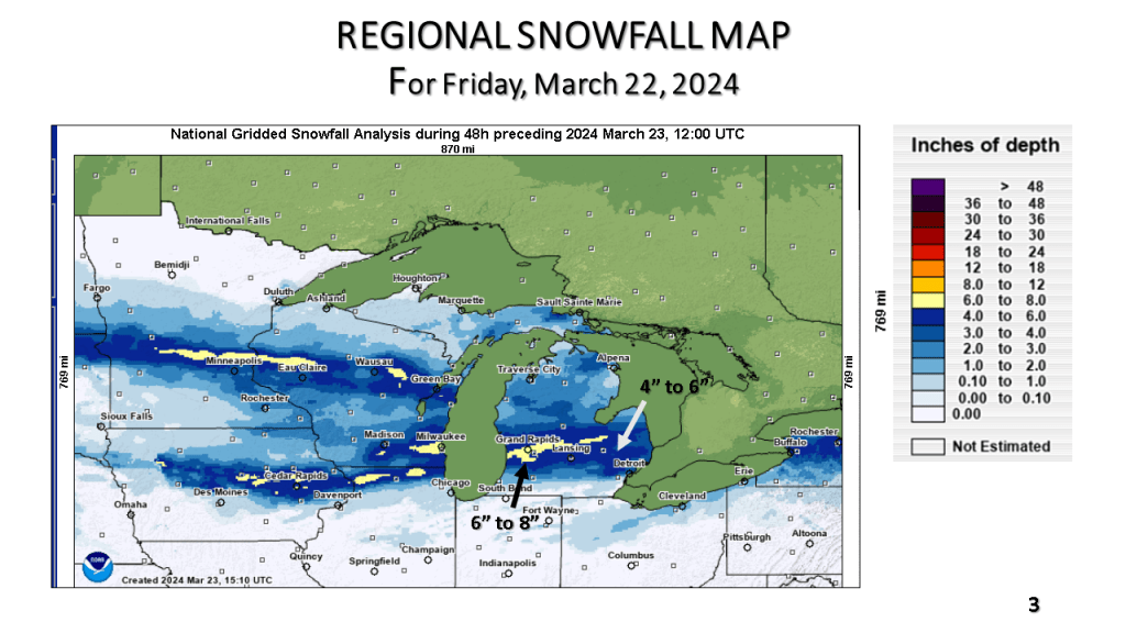
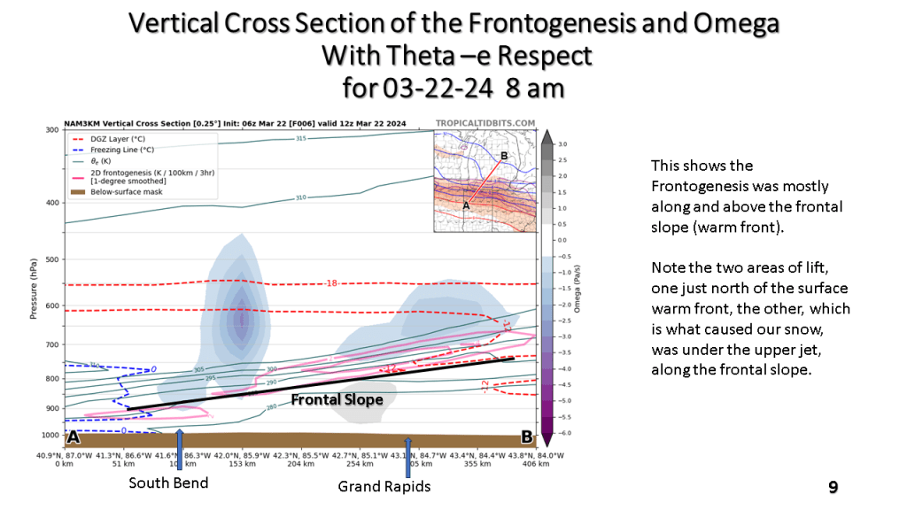
There was a narrow band of 5″ to 8″ of snow From Near Holland Michigan, across the Grand Rapids area, to just north of Flint. Most of the snow fell in about 12 hours.