


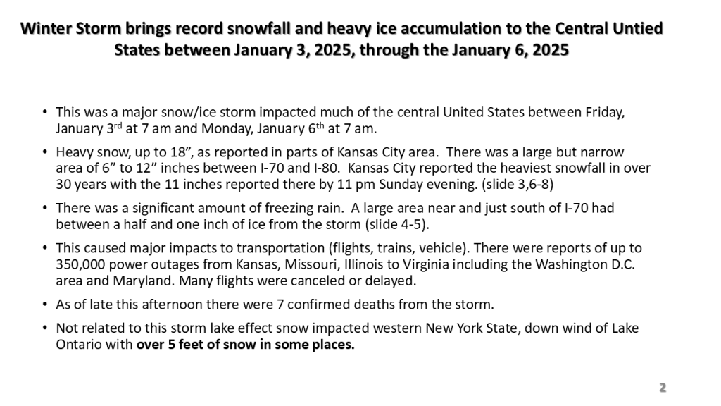
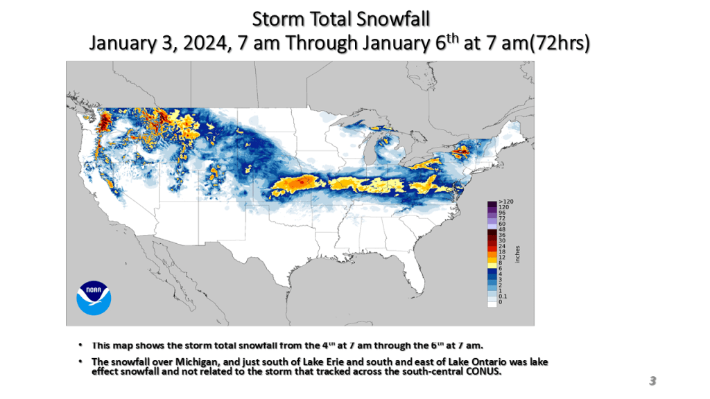
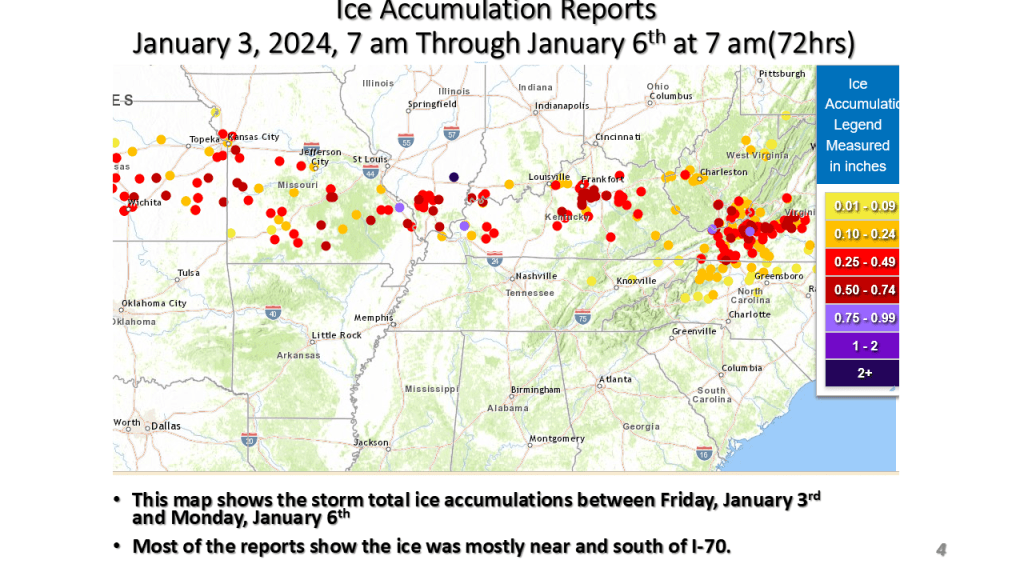
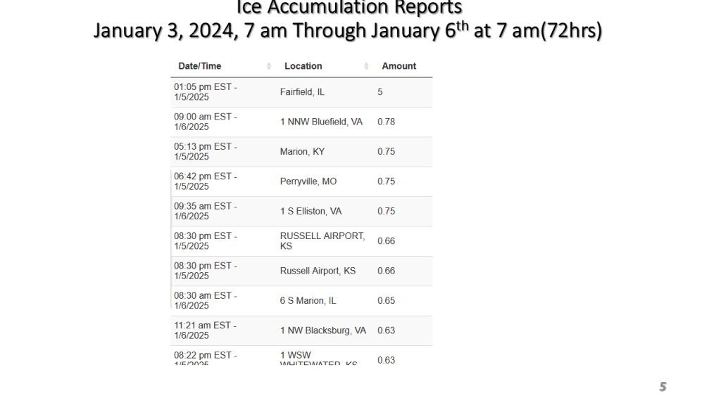
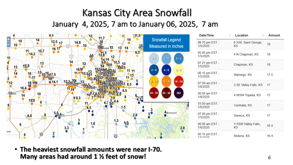
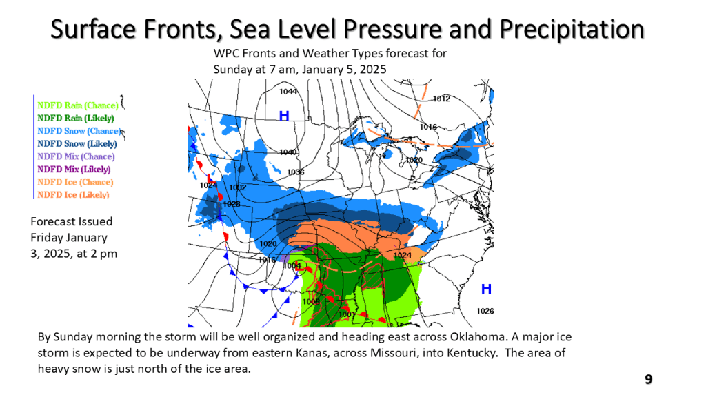
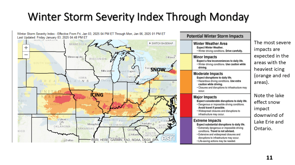
Between Friday, January 3, 2025 and Monday January 6,2025


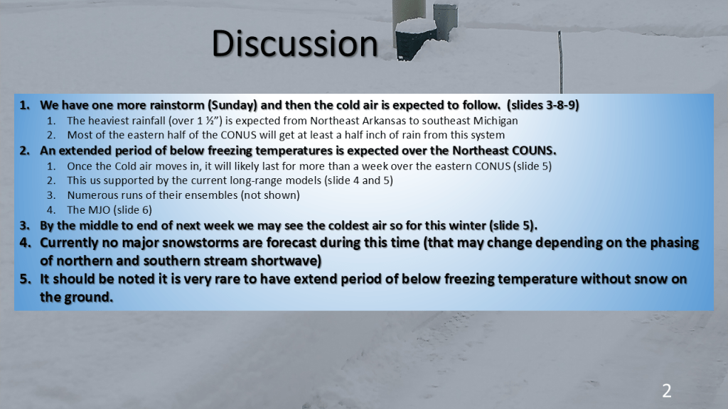
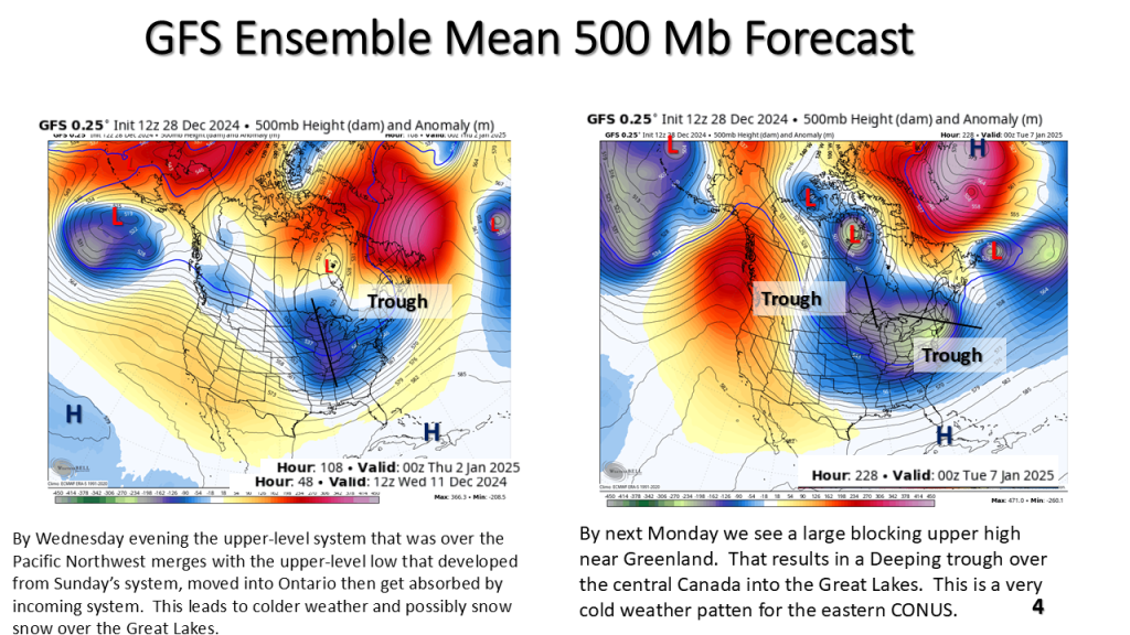
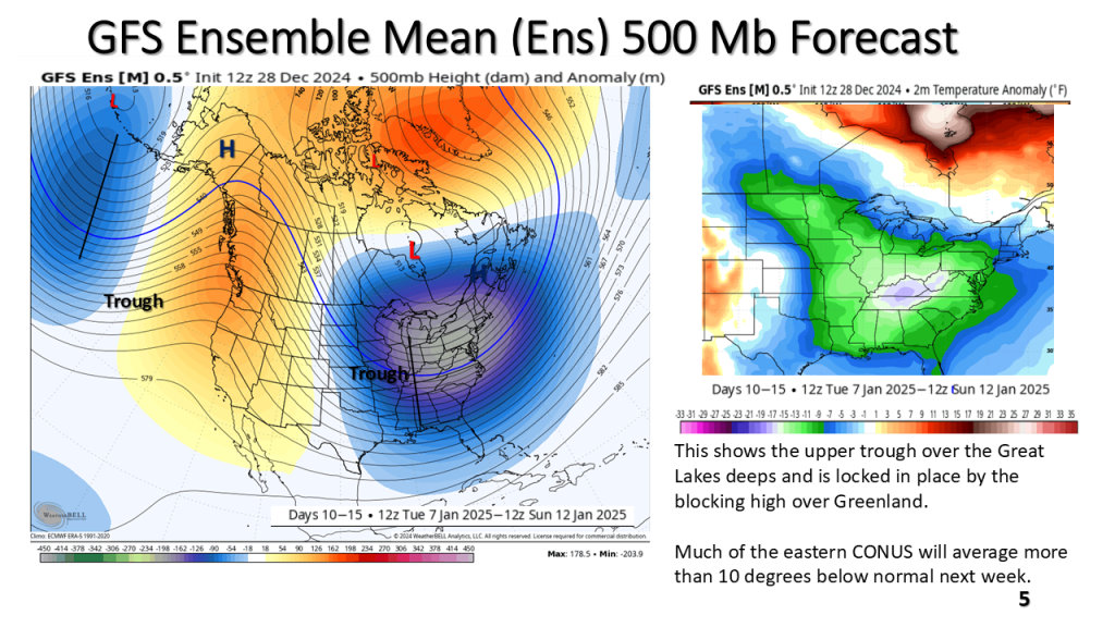
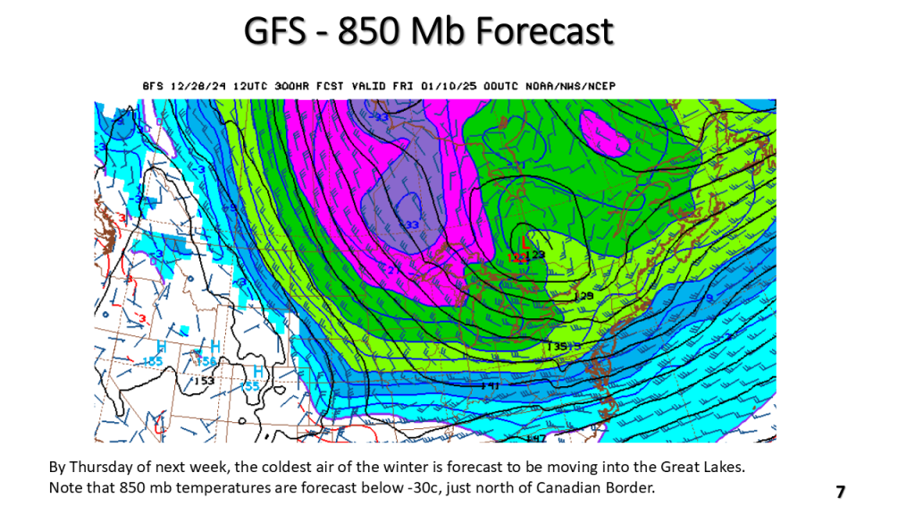
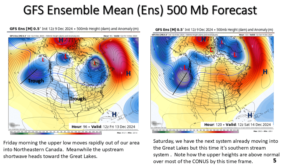
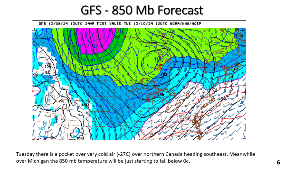
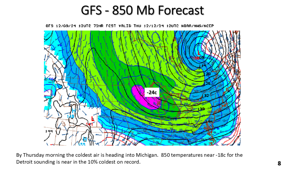
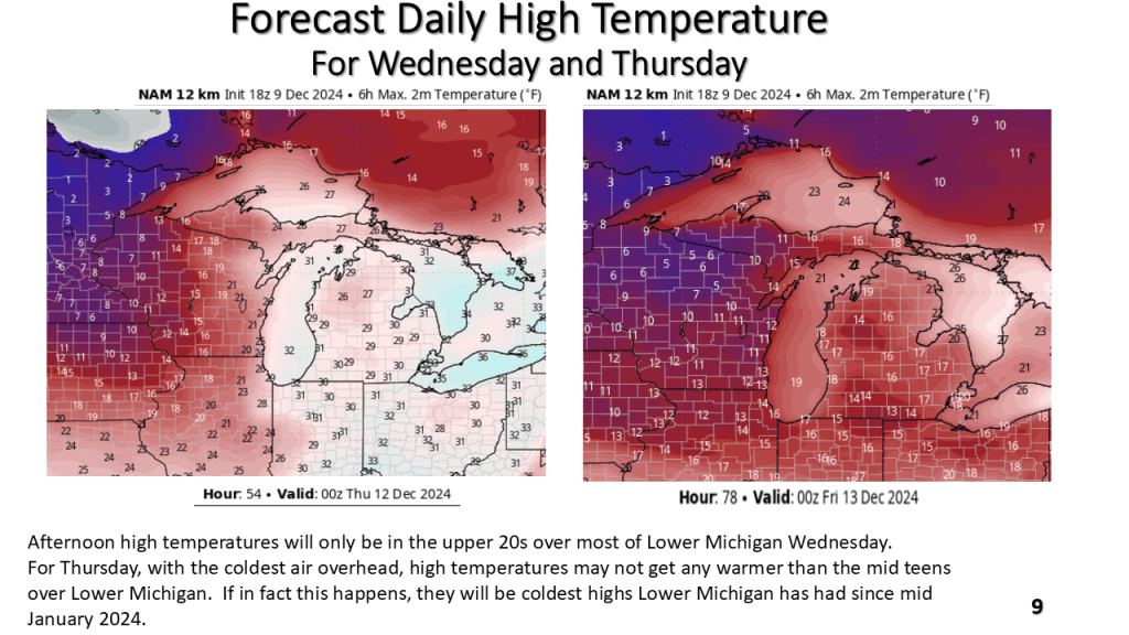
The current warmer than normal temperature pattern over the eastern CONUS will be replaced by below to well below normal temperatures by the middle of this coming week. That new pattern may last into the weekend of the 12th of January.


This is the final version and contains information on recent warming trends


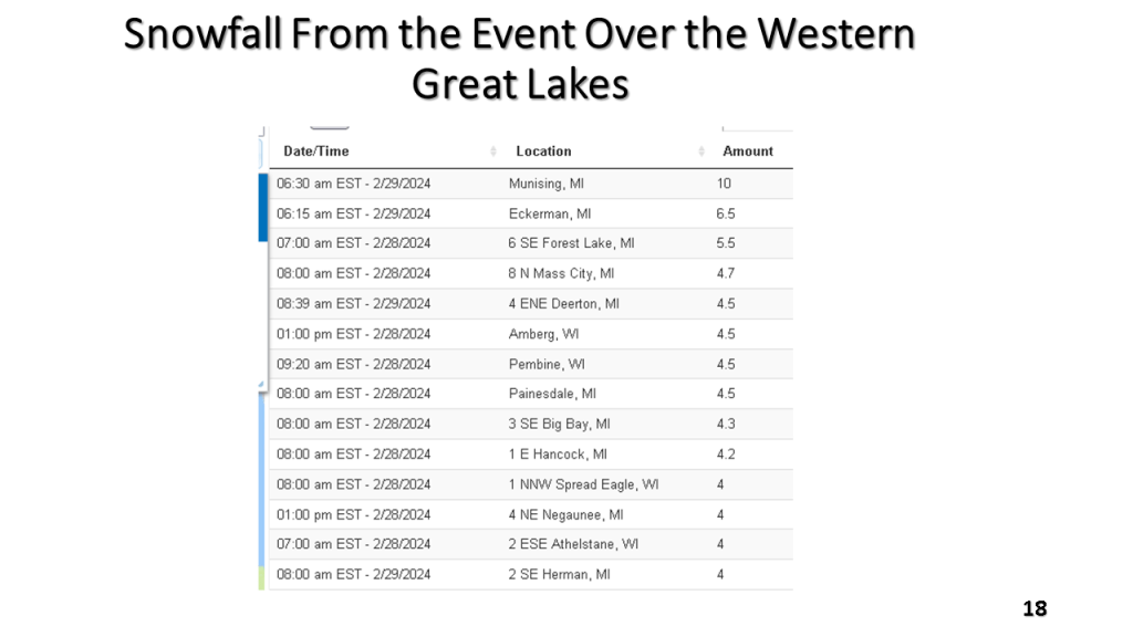
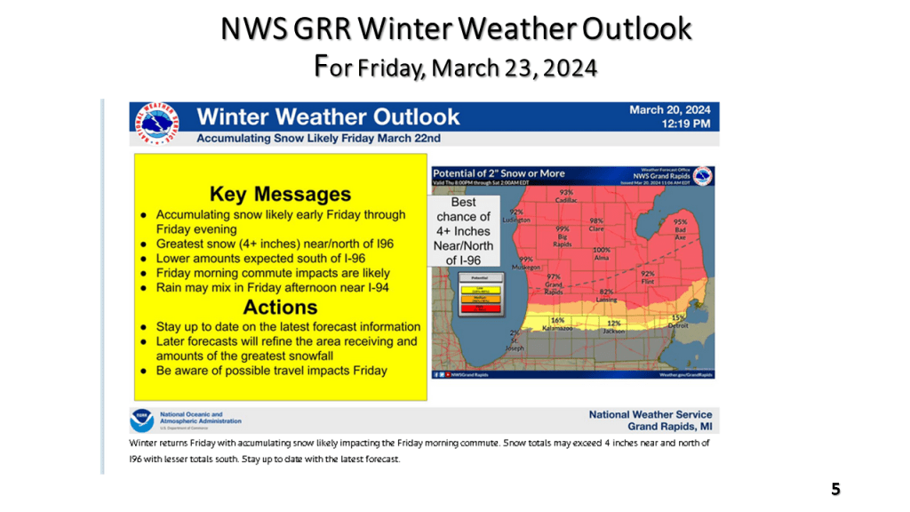
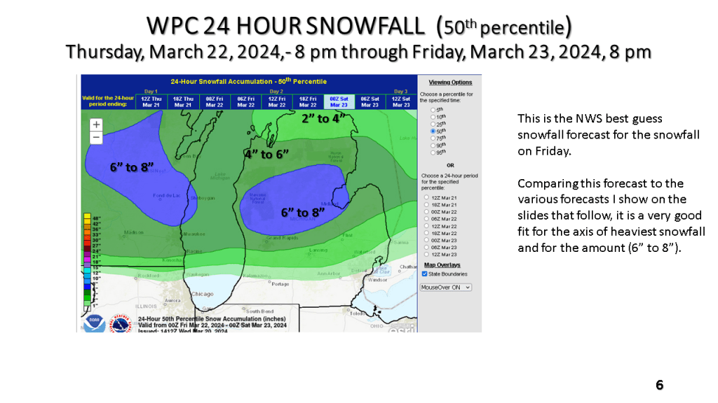
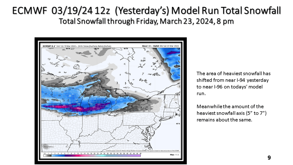
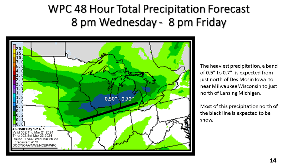
The National Weather Service offices across the western Great Lakes have all issued Winter Weather Advisories for this snowfall event that is expected to continue, even over Iowa into northern Illinois and Wisconsin into early Friday afternoon and over Lower Michigan into the early evening of Friday.
The following slides will show you the details of this event that is expected to bring up to 10″ of snow in about 12 hours to some locations in western Great Lakes. It will likely be the heaviest snowfall over most of the area since mid February.


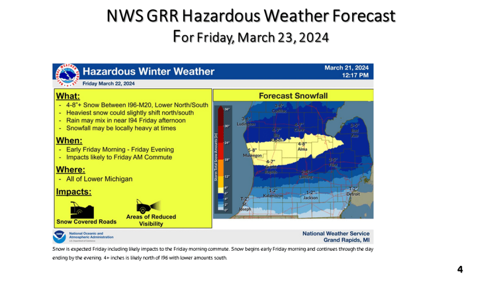
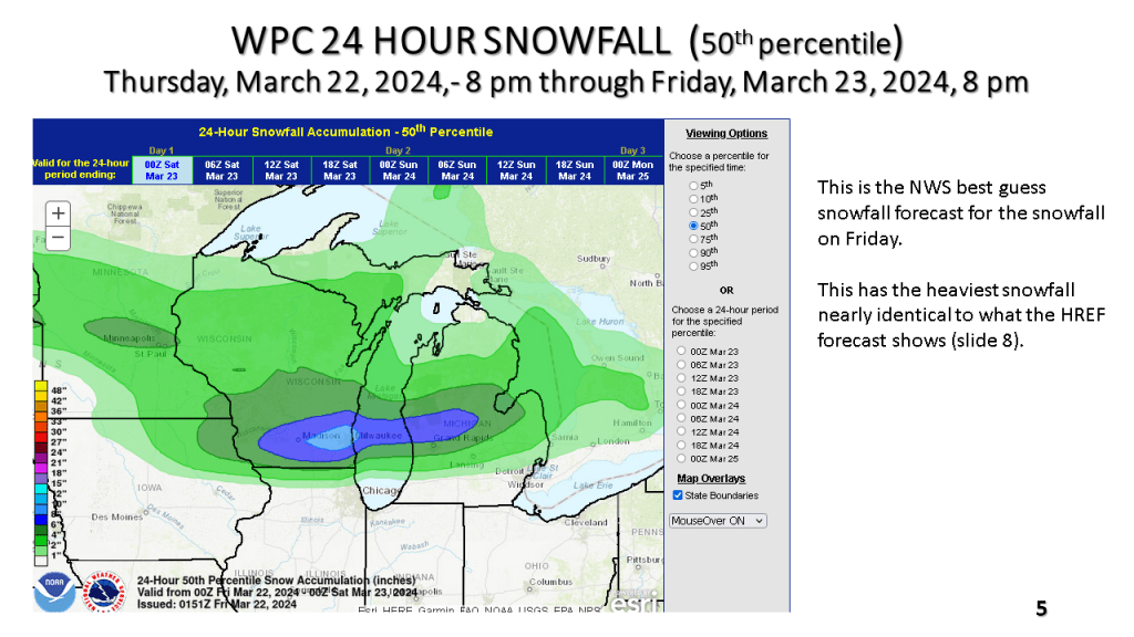


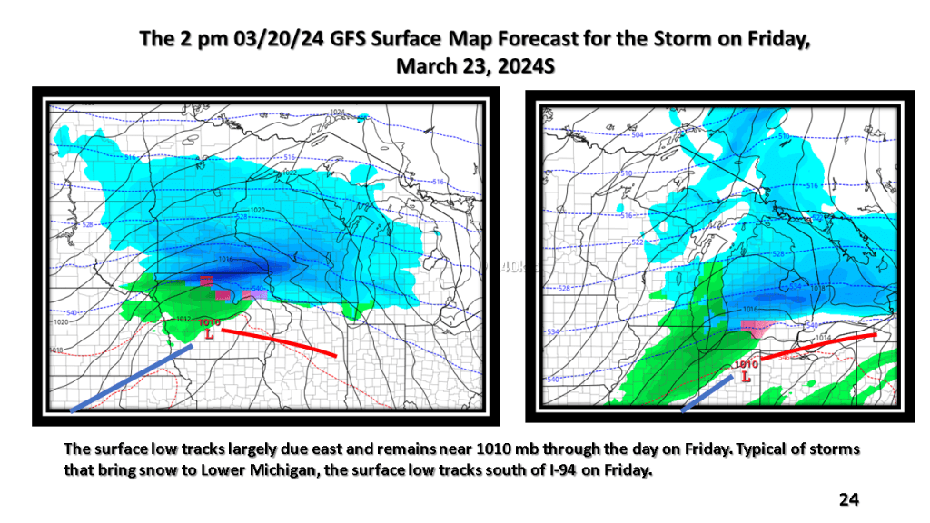
A narrow band of snowfall greater than 6″ in 12 hours is expected about 100 miles north of the track of the surface low. That would be near or just north of I-96 in Michigan. Snowfall rates in the heaviest snow area will be high enough to accumulate during the daytime, even in late March.


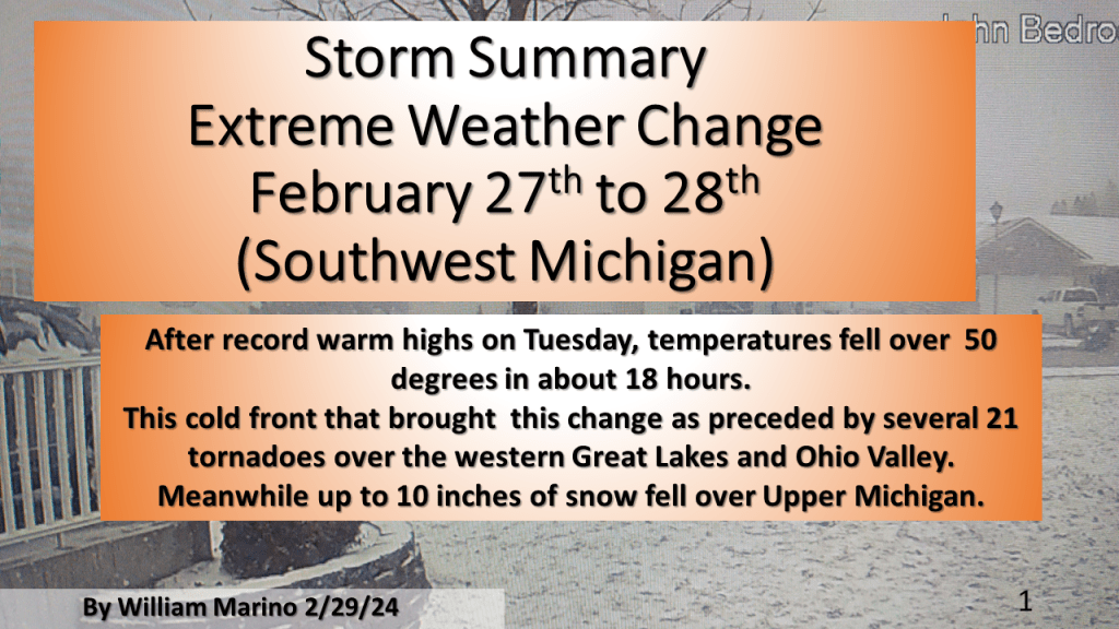
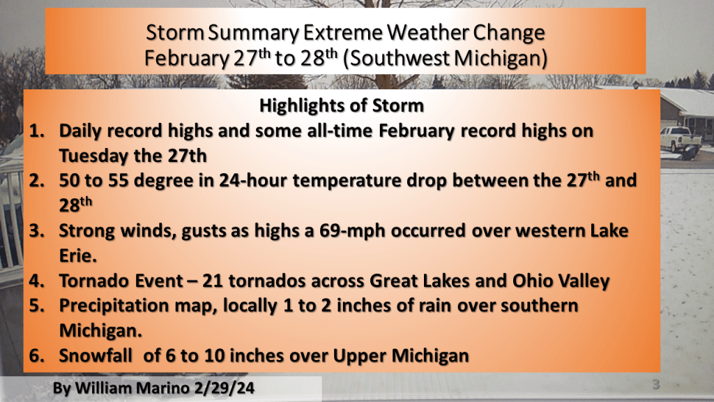
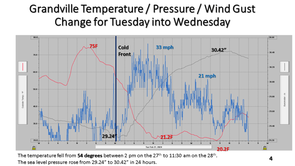
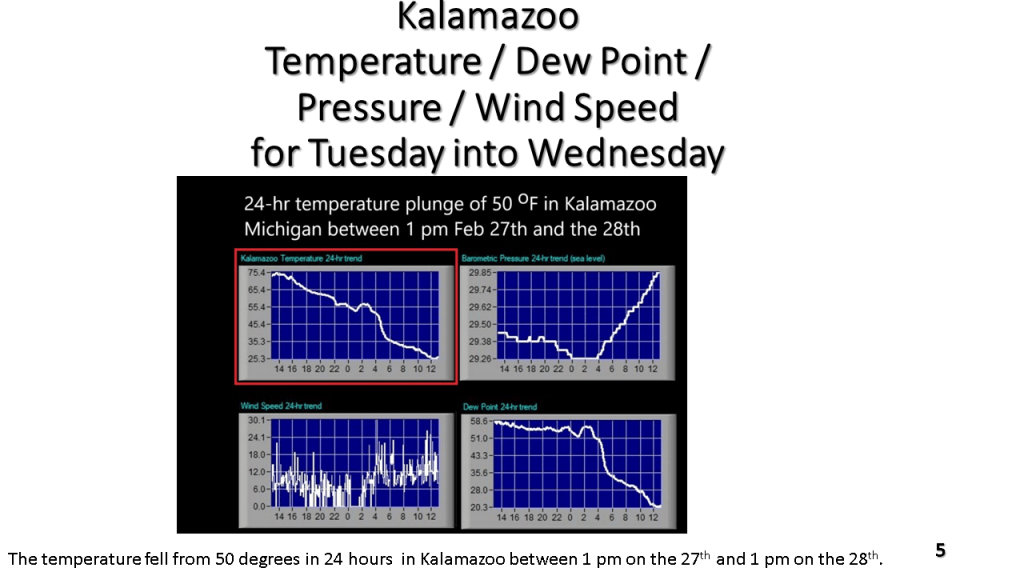
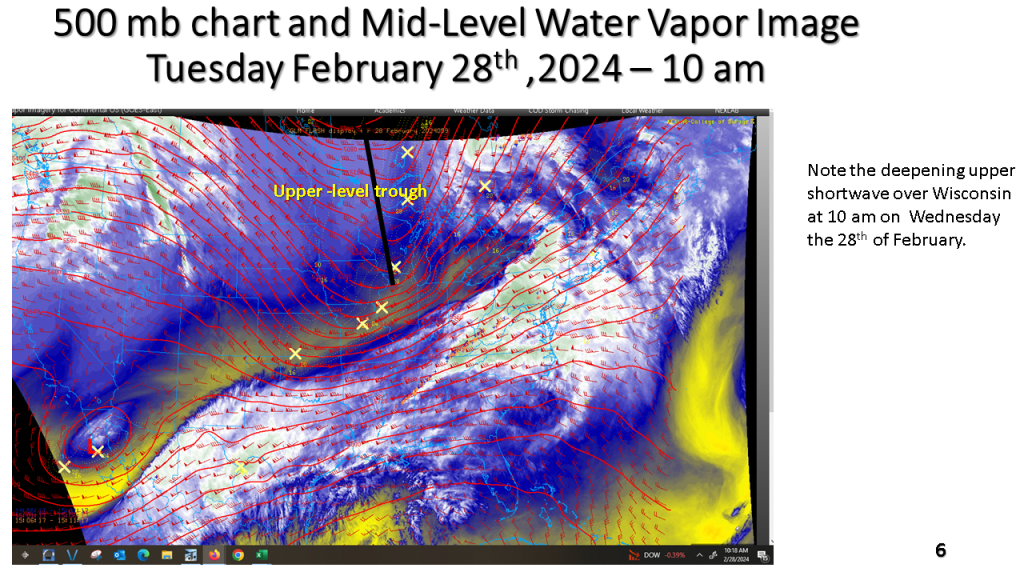
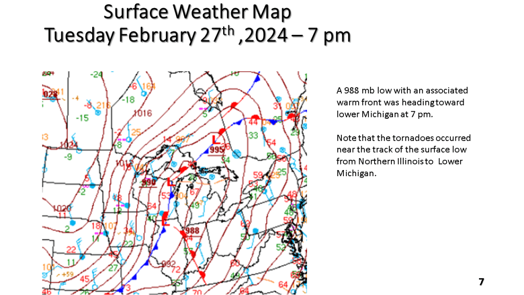
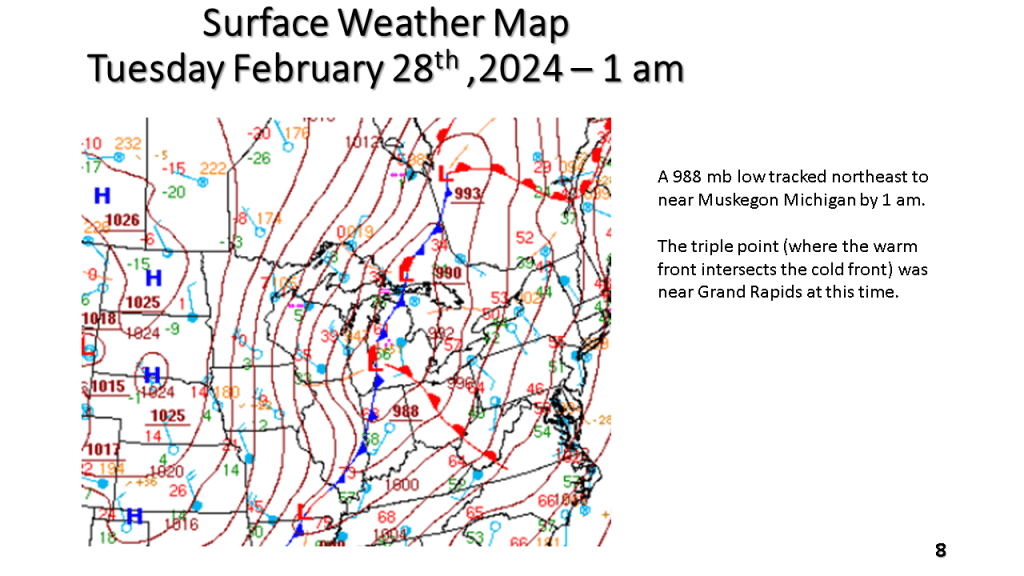
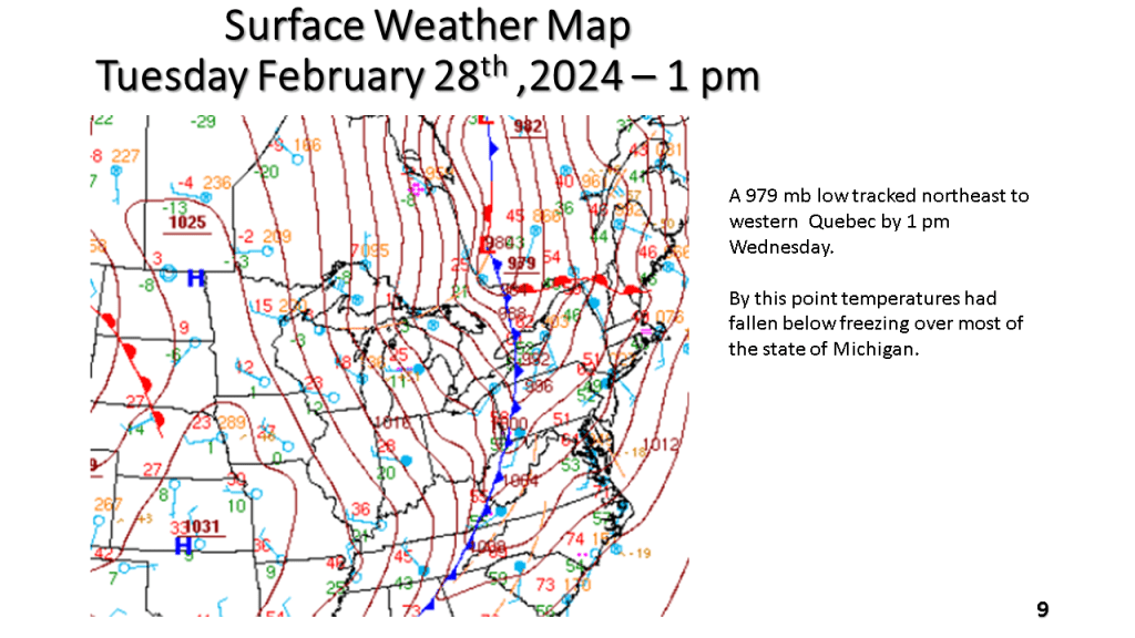
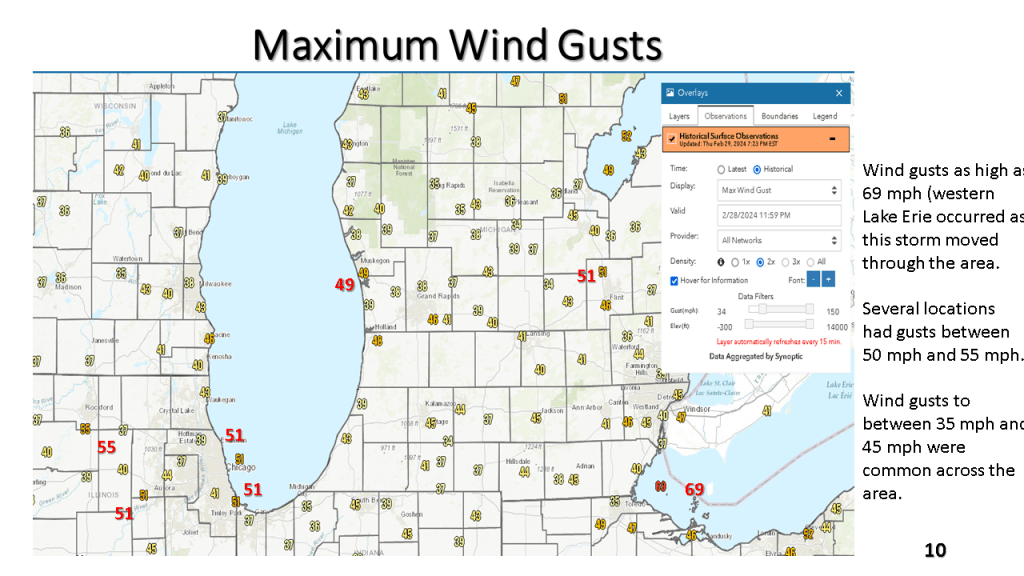
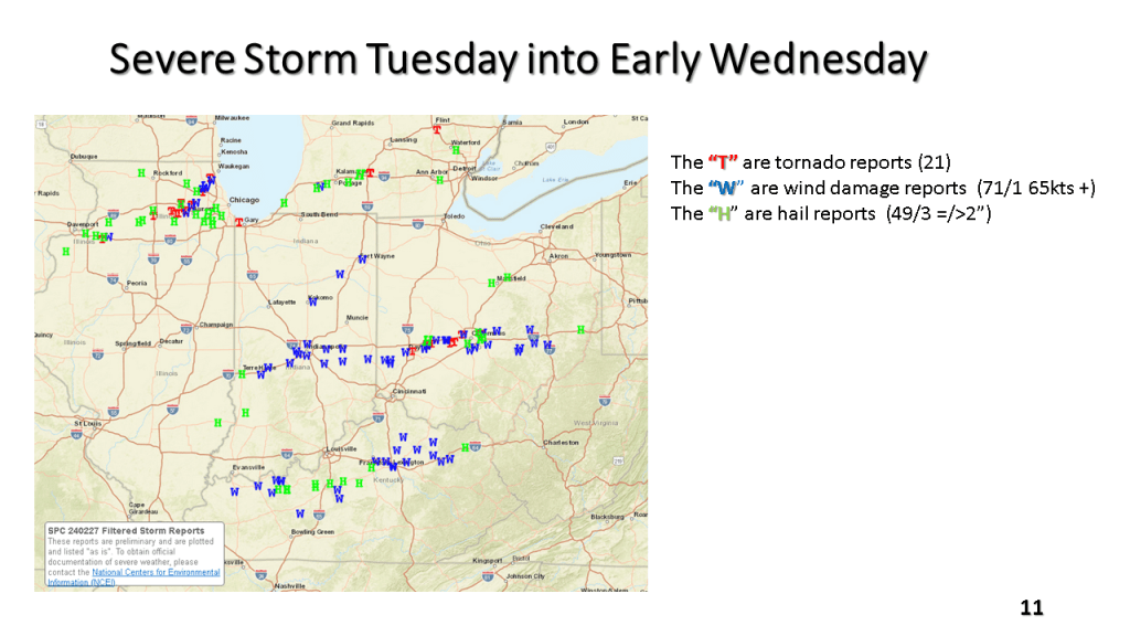
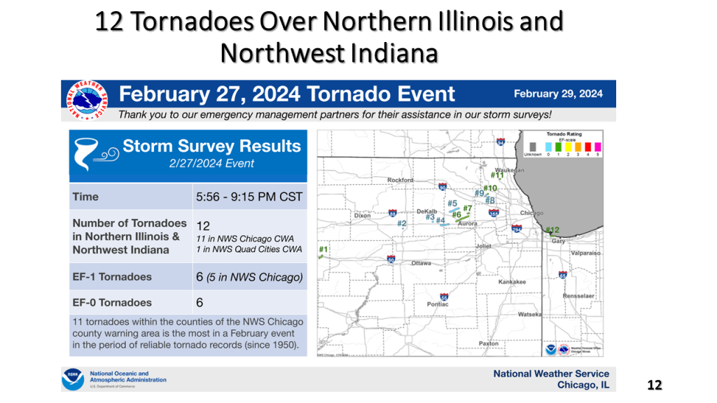
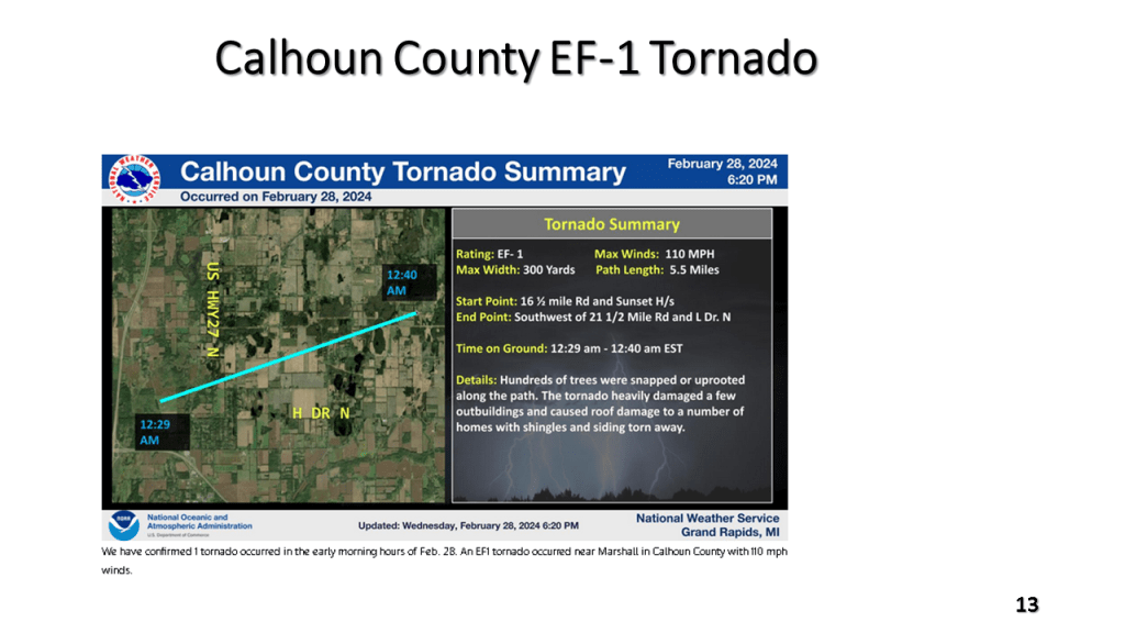
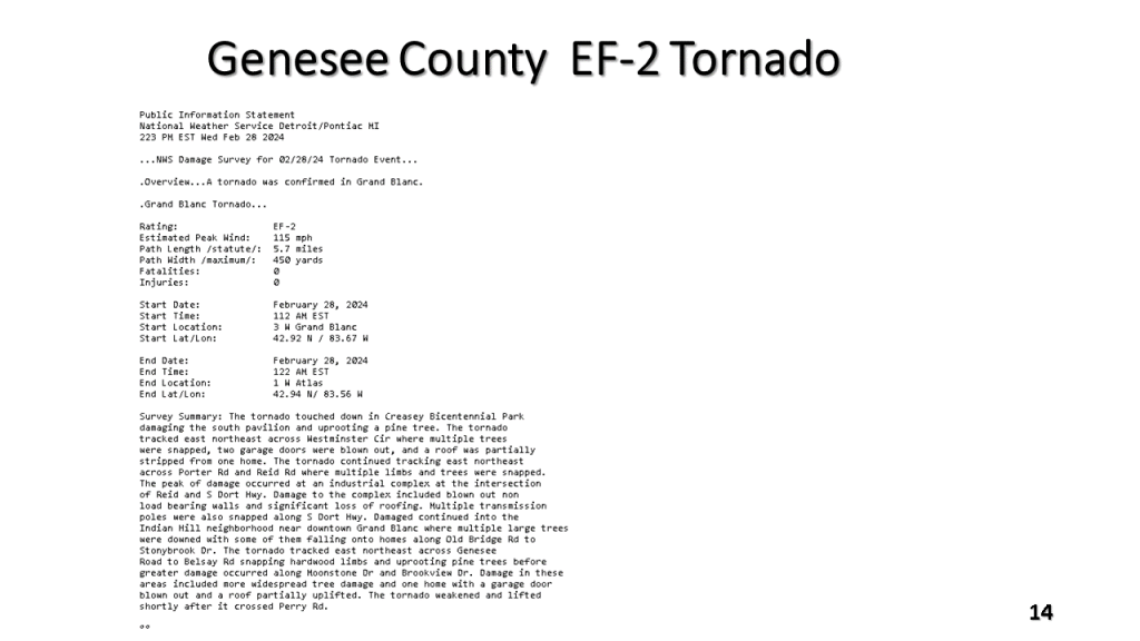
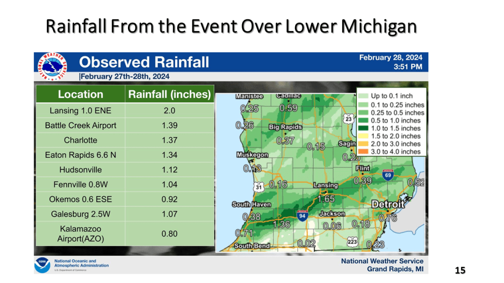
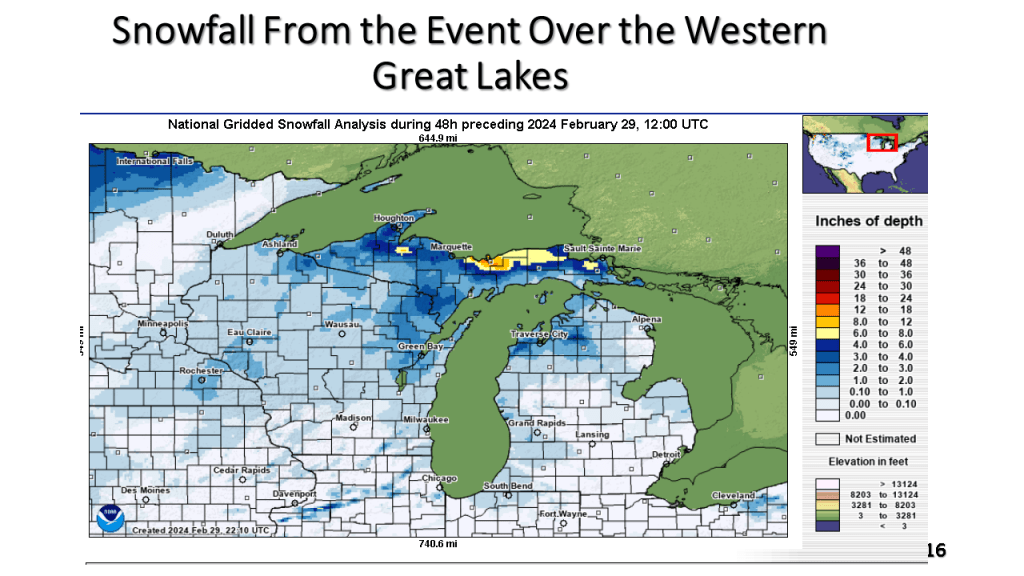
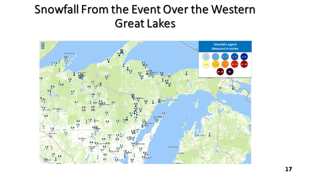
Record high temperatures ( many cases all time record highs for February) were quickly brought to an end by a strong late February cold front. There were 21 reported tornadoes, mostly EF-0 and EF-1 but there was an EF-2 near Grand Blanc in Geneses County just ahead of the cold front. Temperatures fell around 50 degrees between Tuesday afternoon and Wednesday afternoon over Lower Michigan. There was 6 to 10 inches of snow in upper Michigan and locally 1 to 2 inches of rain in parts of southern Lower Michigan. Winds gusted to 69 mph over western Lake Erie.