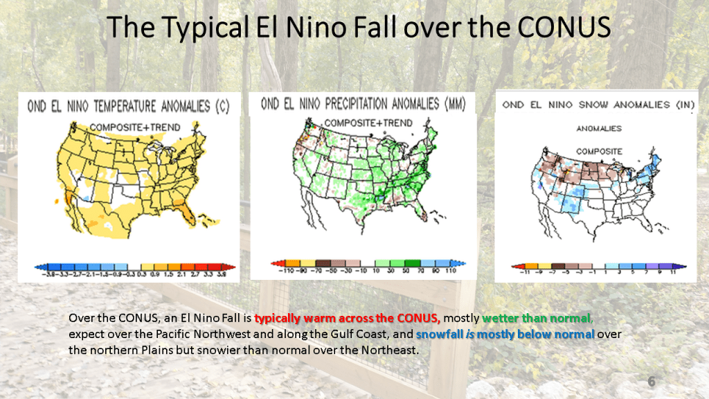
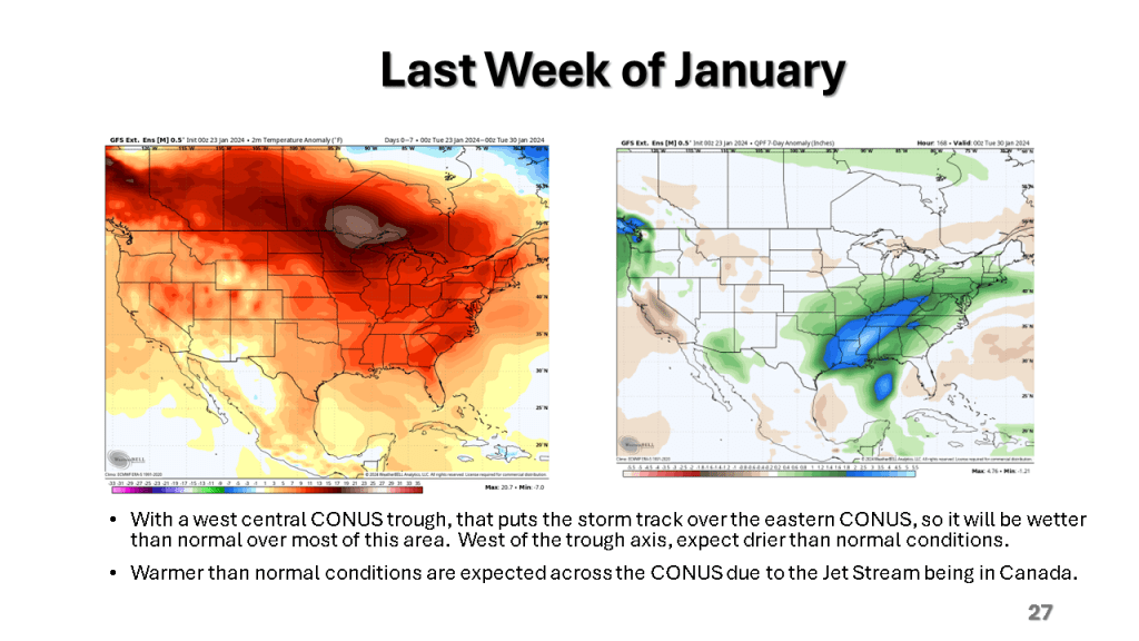
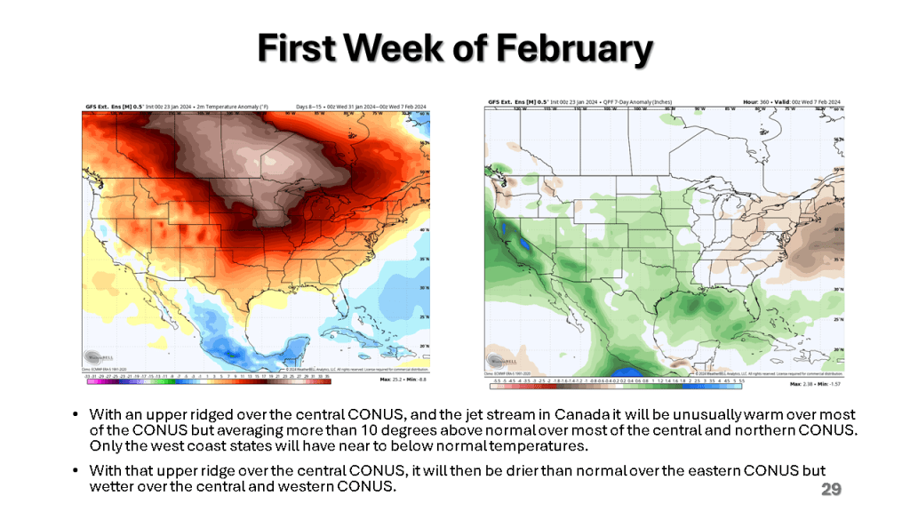
Largely this means warmer and wetter over the CONUS but cold and snowy over southern Canada.


Largely this means warmer and wetter over the CONUS but cold and snowy over southern Canada.
This past 15 days ( Jan. 23- Feb. 7) in Grand Rapids, Michigan were the warmest on record (34.8F) that exceeded the 34.7F for the 15 days ending on January 6th 2012.


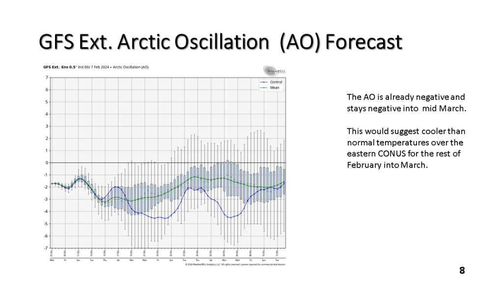


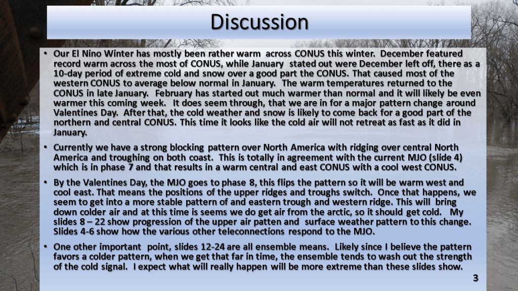


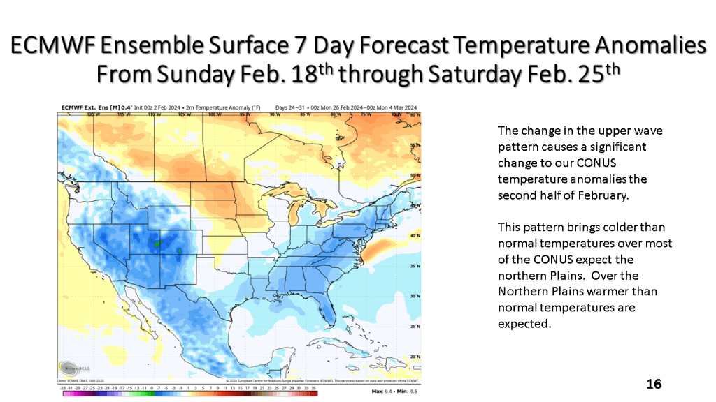


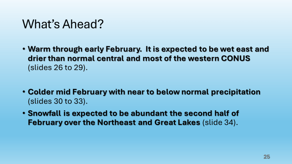
The bottom line is it will be very warm, relative to normal until around Valentine’s Day, the it will get cold across most of the central and eastern CONUS with a significant amount of snow over the Great Lakes and New England.
Does the cold and snowy weather come back?


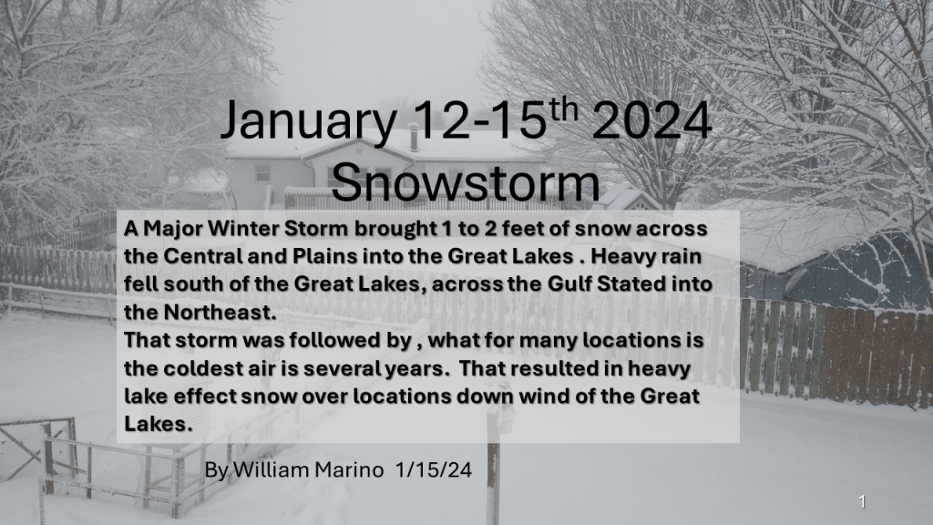
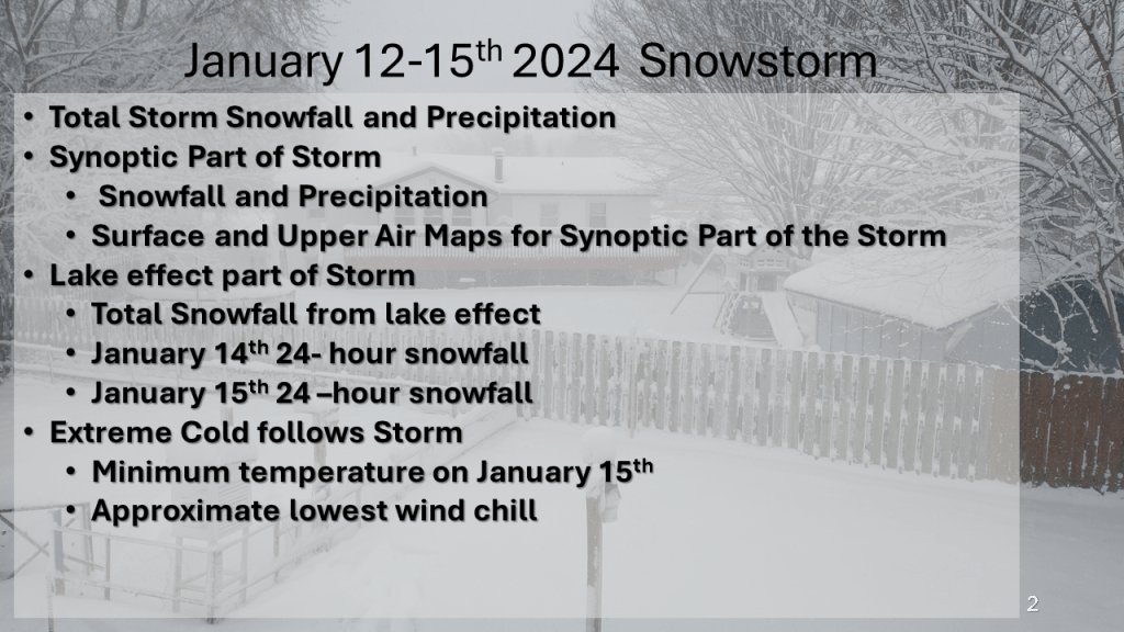
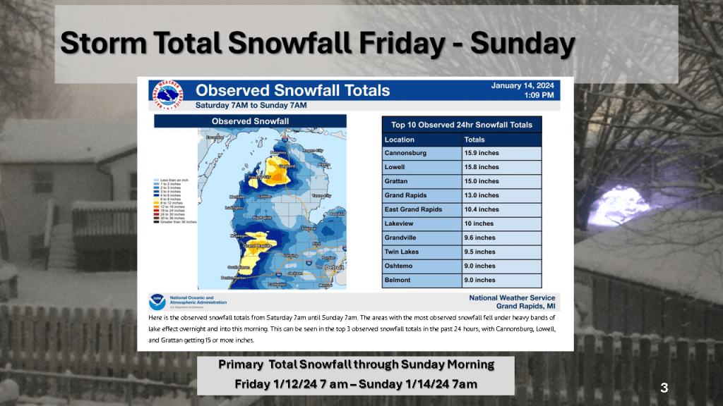
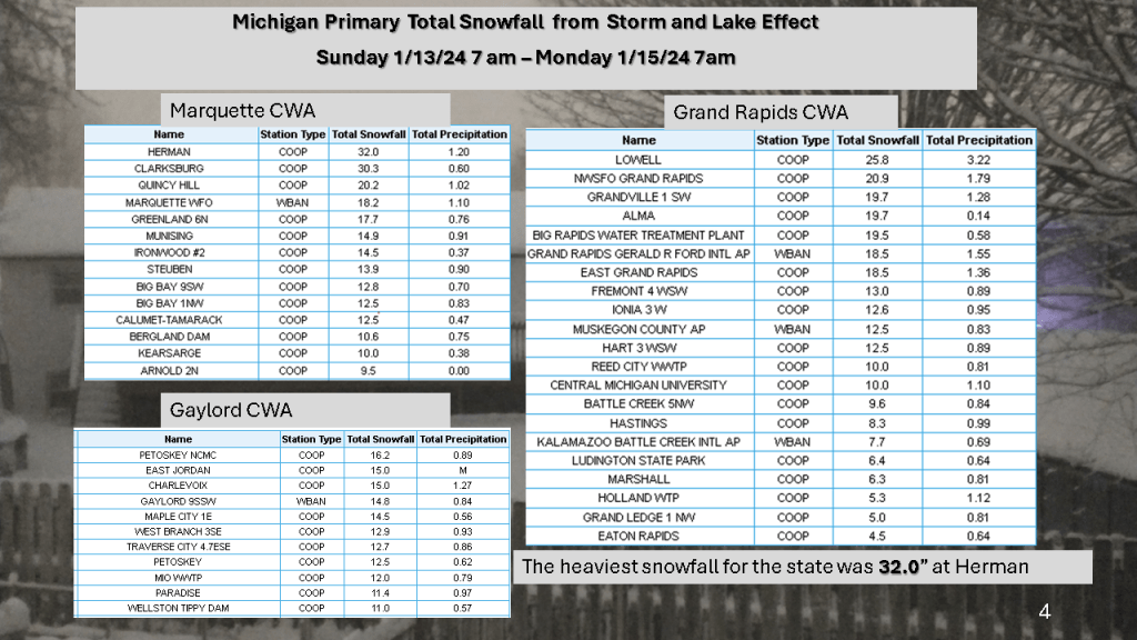
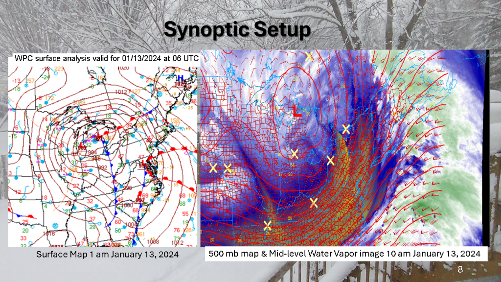
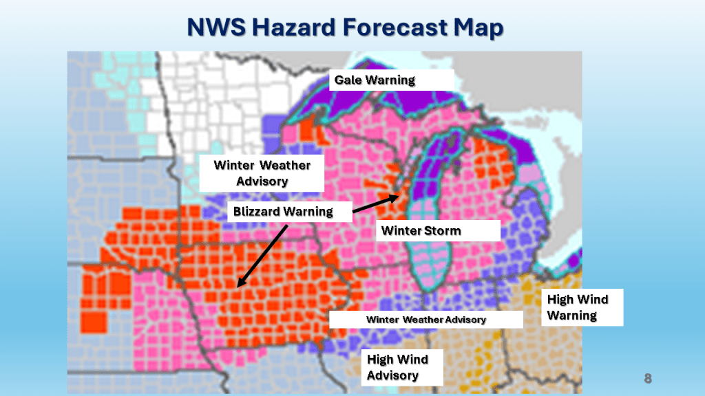
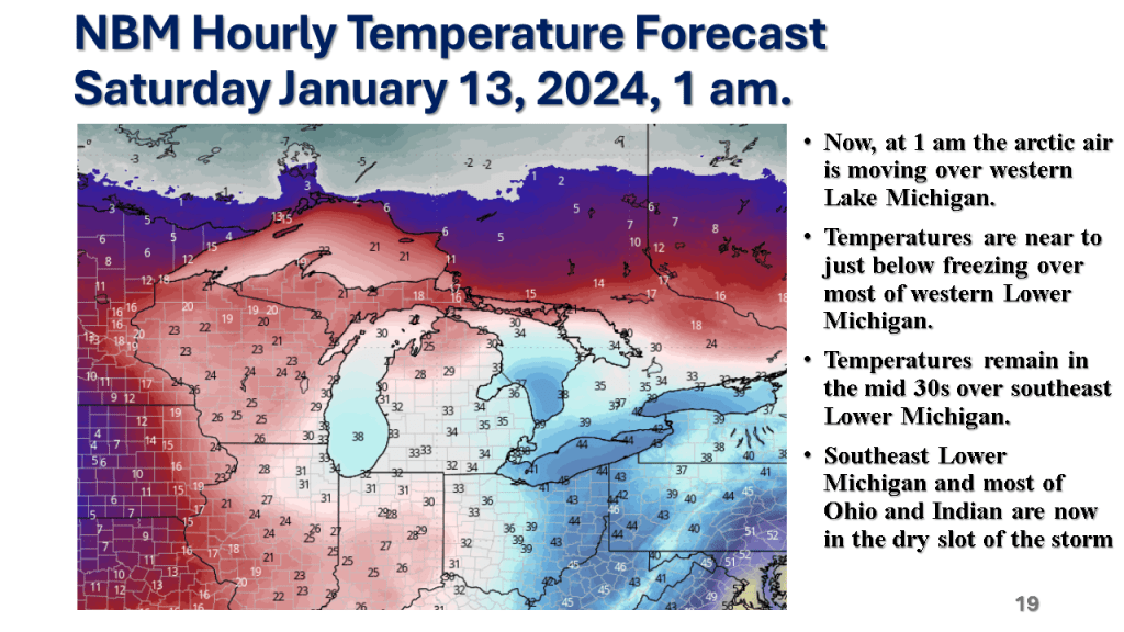
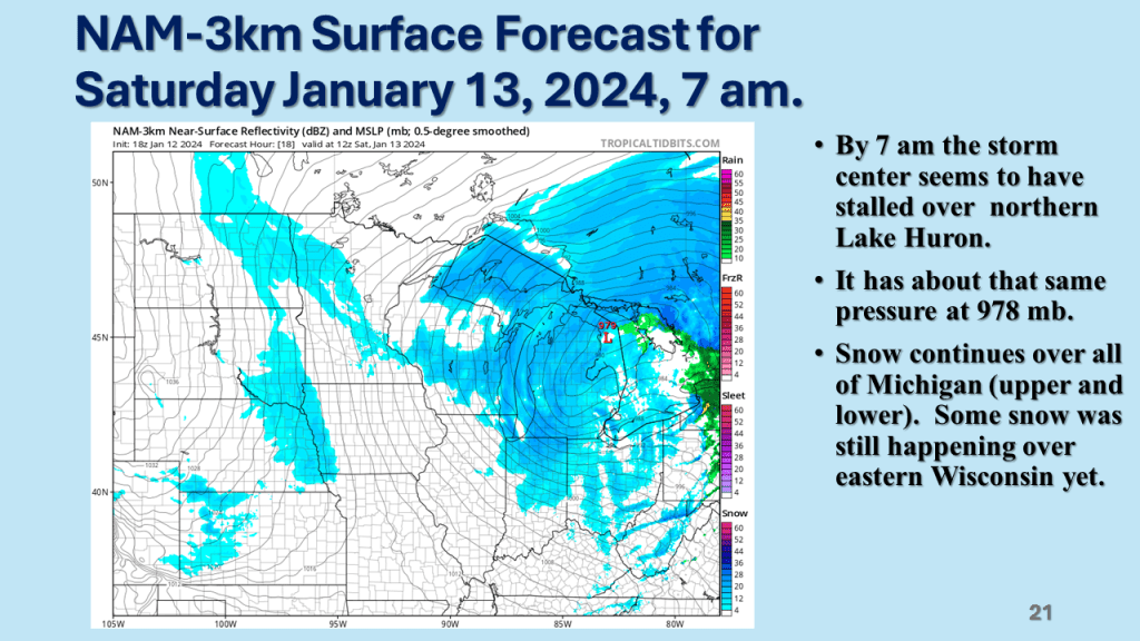
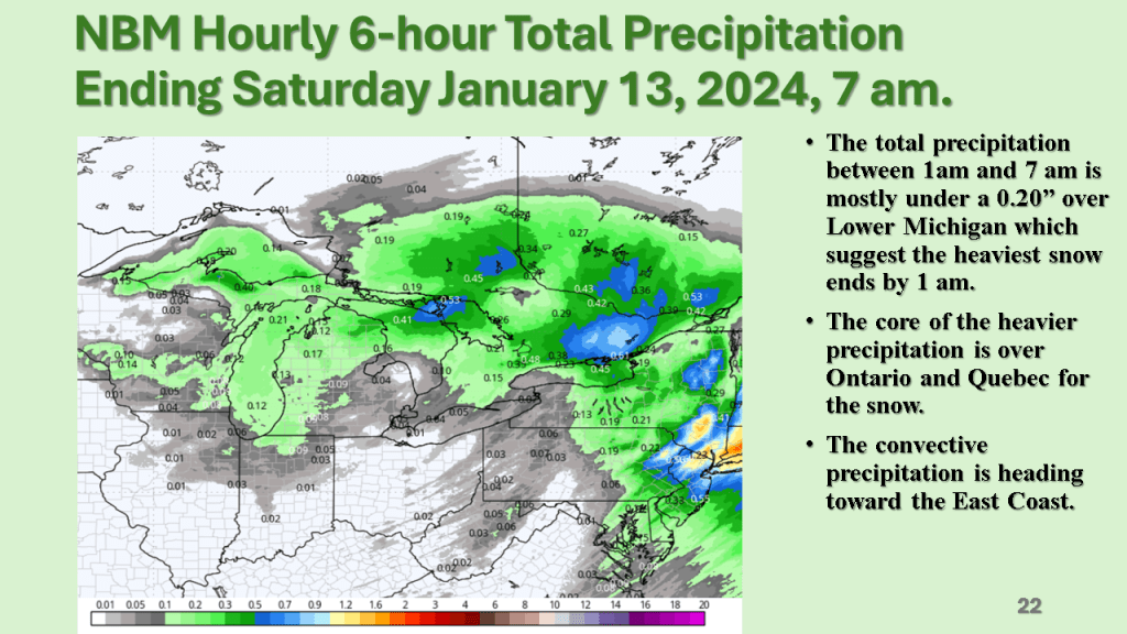
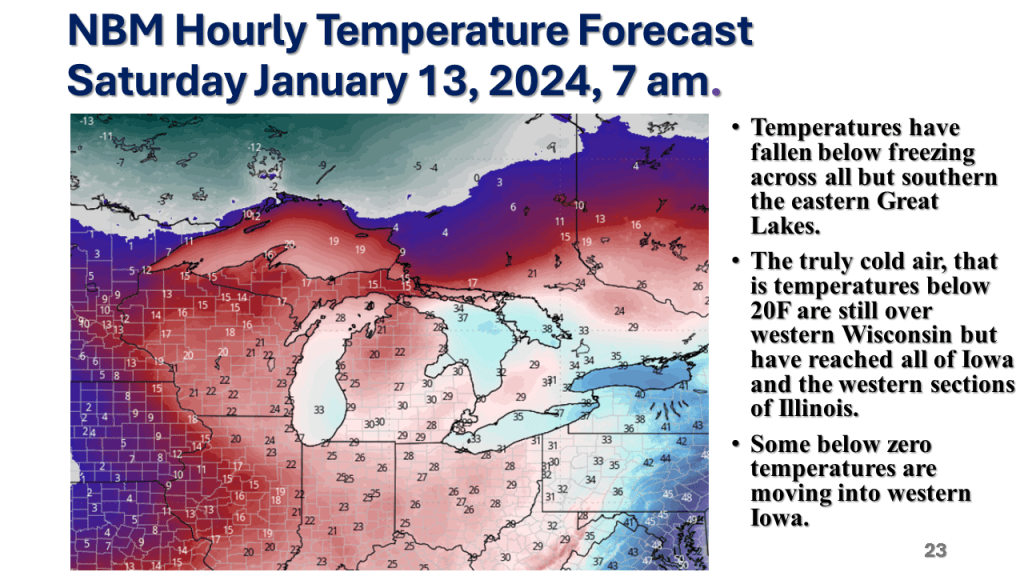
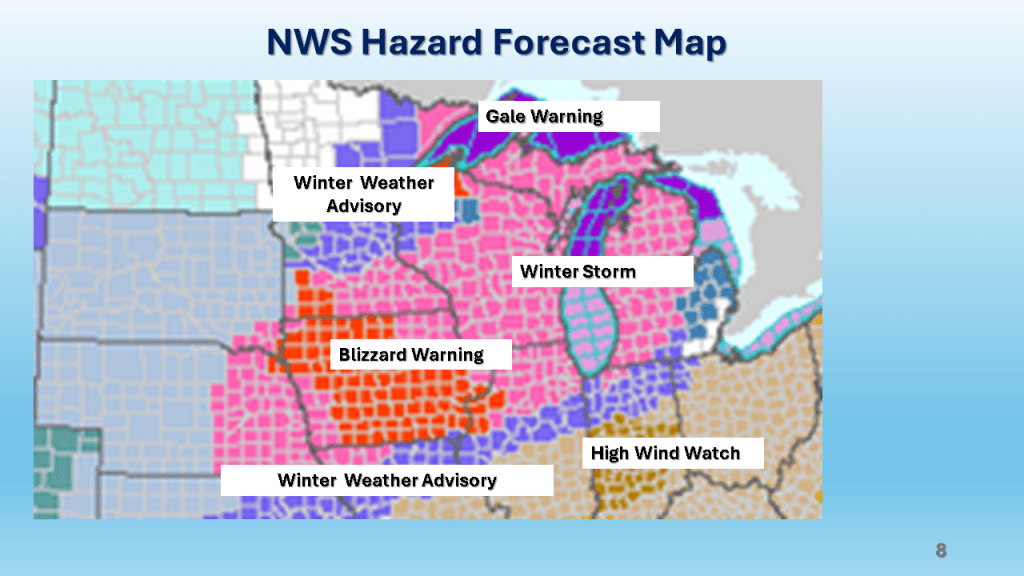
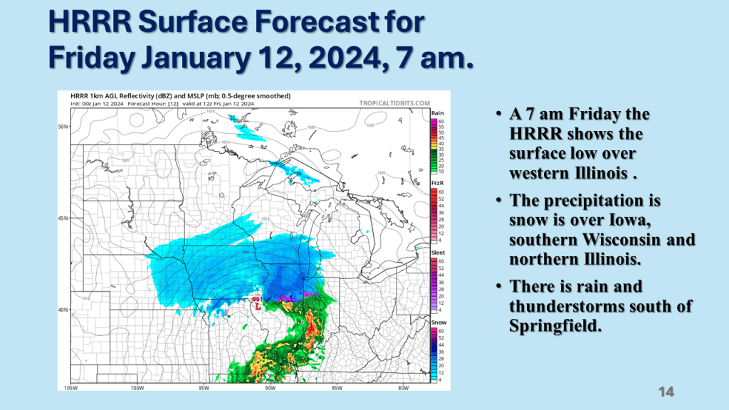
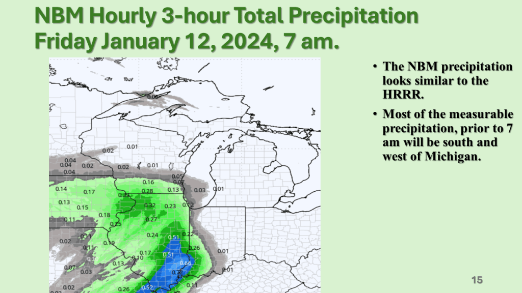
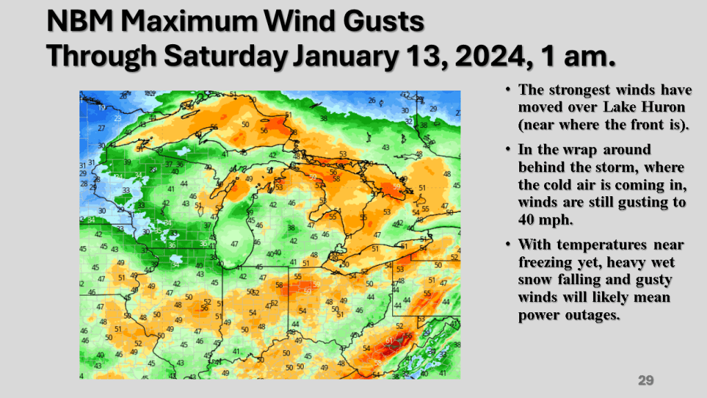
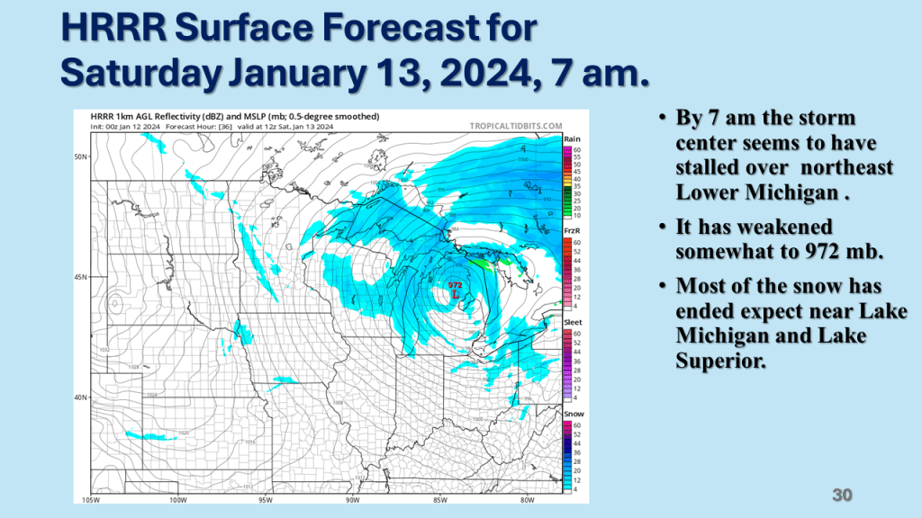
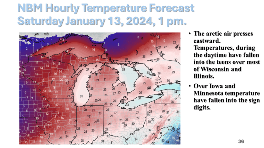
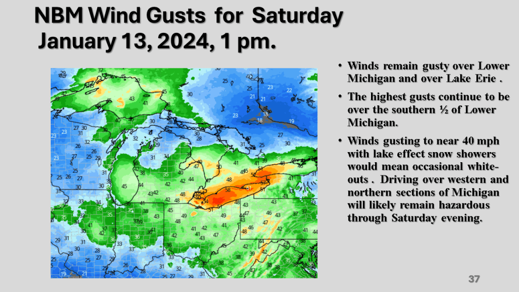
A rapidly deepening storm tracked Texas on Thursday afternoon to the northern Great Lakes by Saturday morning. The storm brought 1 to 2 feet of snow from Nebraska, across Iowa, Wisconsin then into Michigan. Strong winds accompanied the storm then the coldest air in several years followed the storm with dangerously cold wind chills over most of the Northern and Central Midwest. That cold air caused heavy lake effect snow in Michigan, near Buffalo New York and over the Tug Hill Plateau in the Adirondack Mountains, down wind of Lake Ontario.


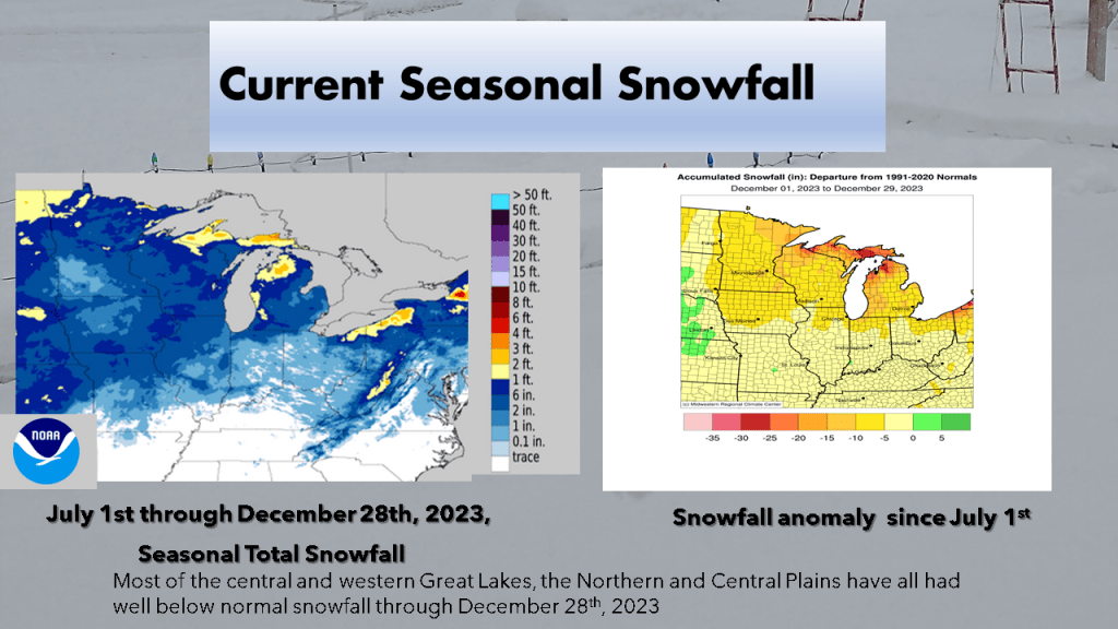


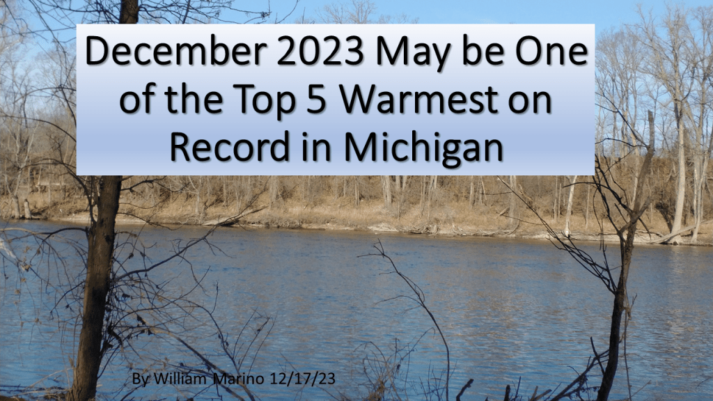
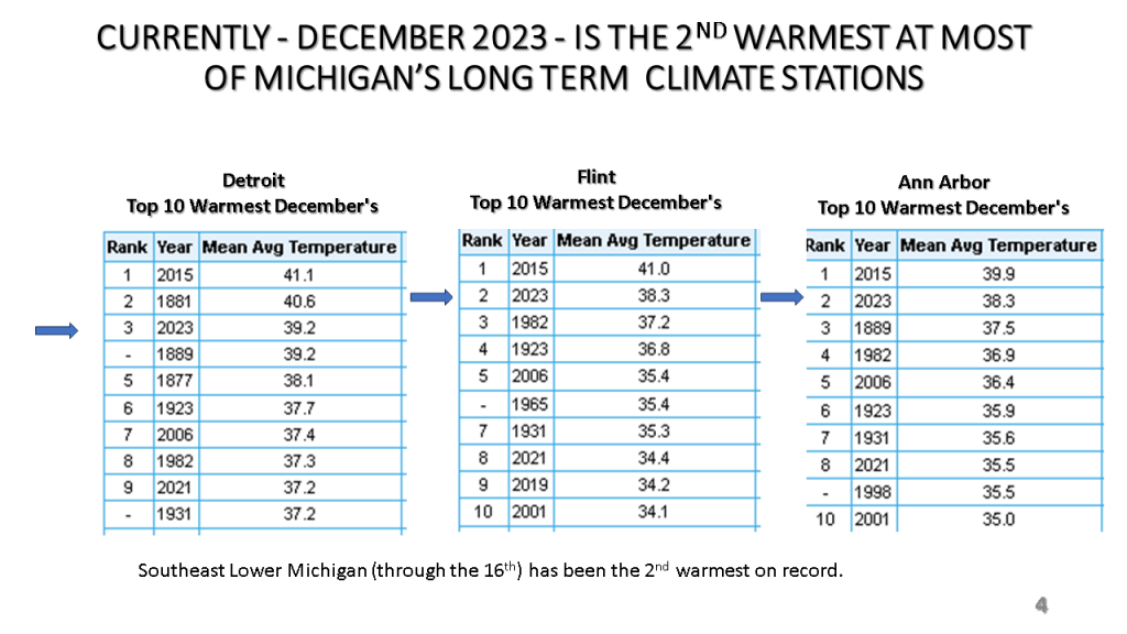
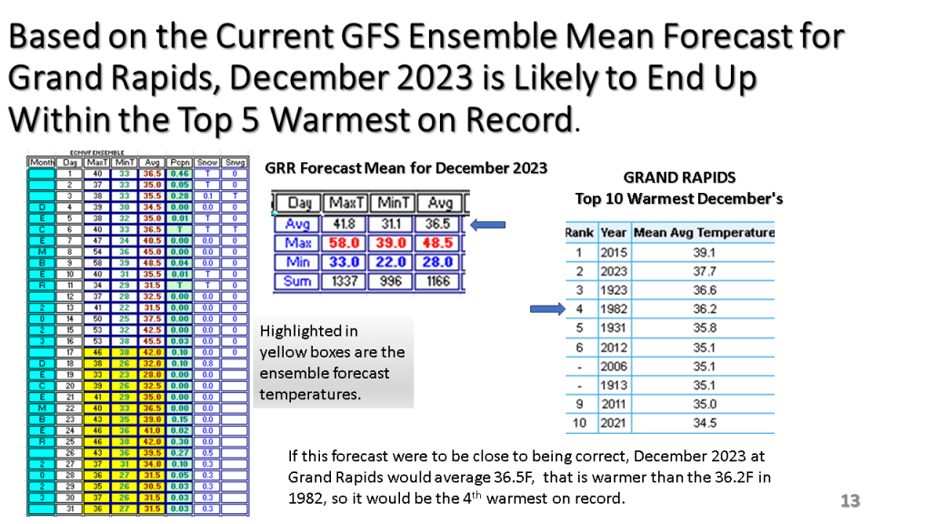
So far, as of the 16th, December is averaging 6 to 8 degrees above normal across Southern Lower Michigan. Flint is warmest with +7.8, while while Grand Rapids is the least with +5.5. Most other climate sites are between 6 and 7 degrees warmer than normal through the 16th in Michigan. Over northern Michigan Alpena has the least positive departure with +4.1 while Gaylord is +5.9 and Traverse City is +5.1. We are expecting two cold days (Monday and Tuesday) but the rest of December is expected to well above normal. Thus, December 2023 is likely to be in the top 5 warmest on record over most of Lower Michigan.


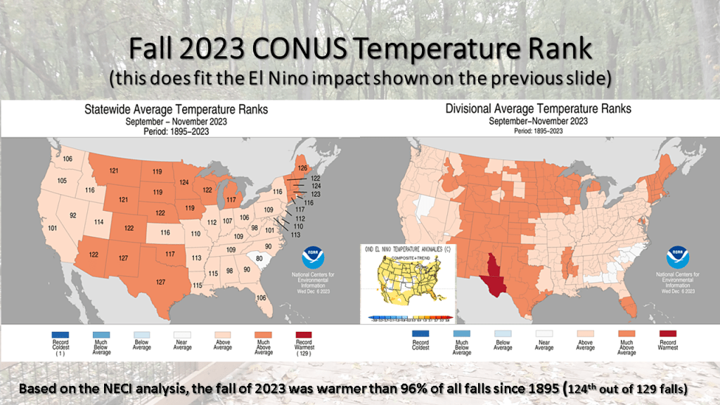
In our string of nationally much warmer than normal seasons, the fall of 2023 was 124th out of 129 falls for warmer than normal. This puts this fall warmer than 96% of all falls since 1895! No area of the CONUS had a below normal temperatures (bottom 1/3 coldest) this fall.