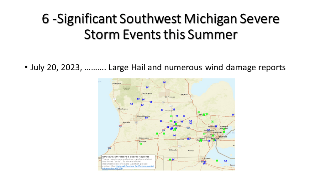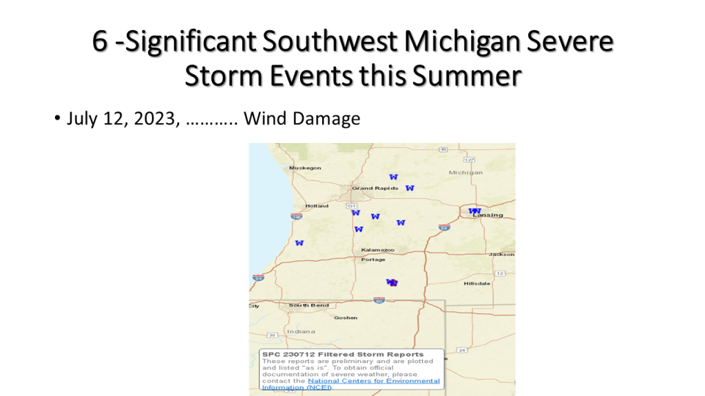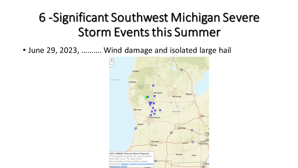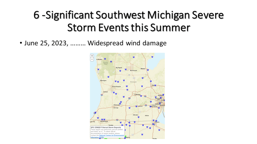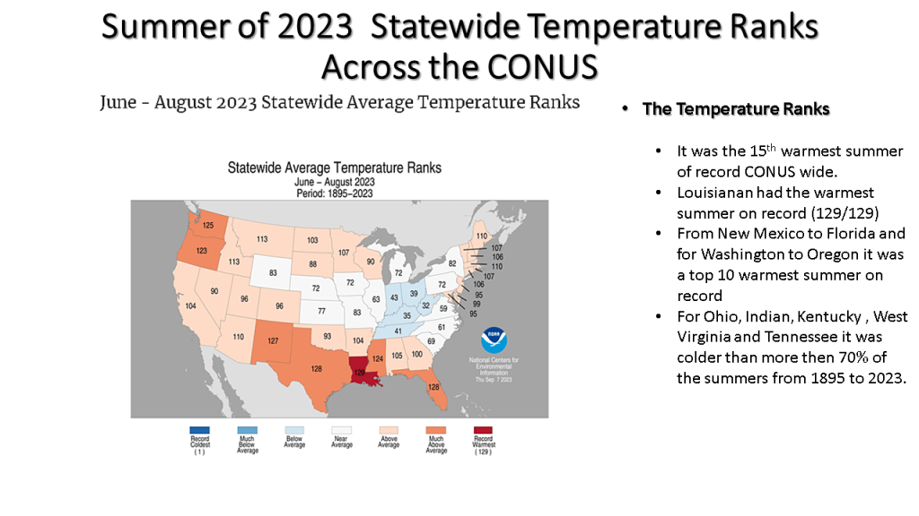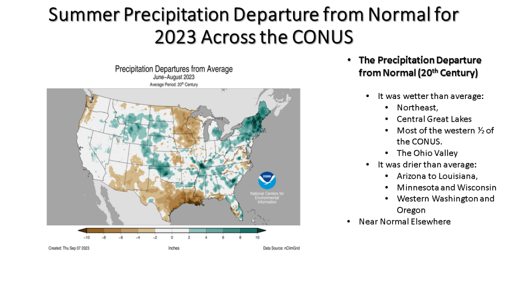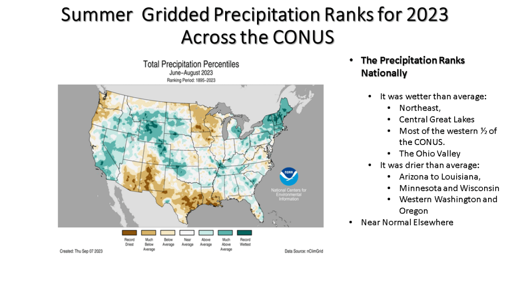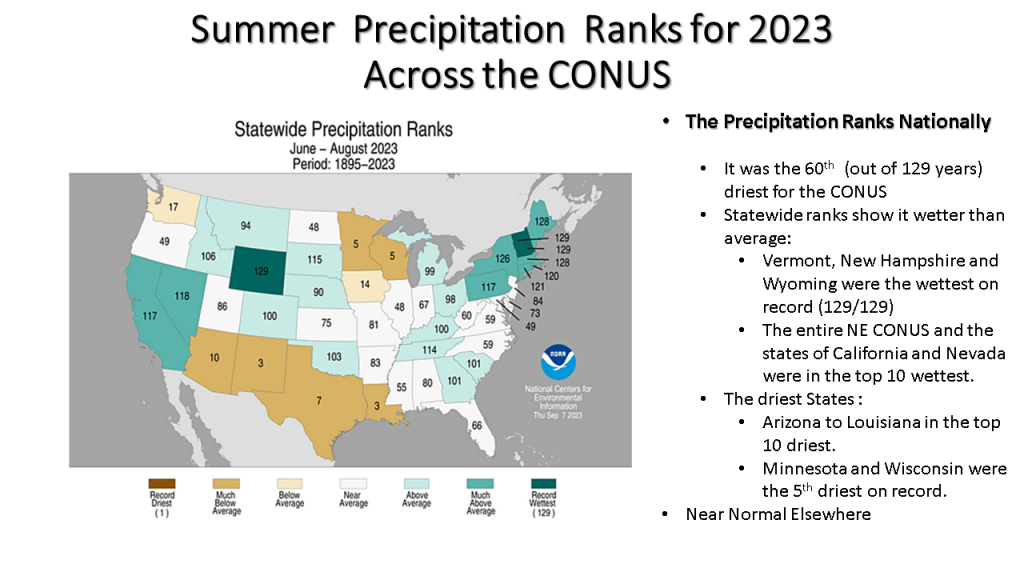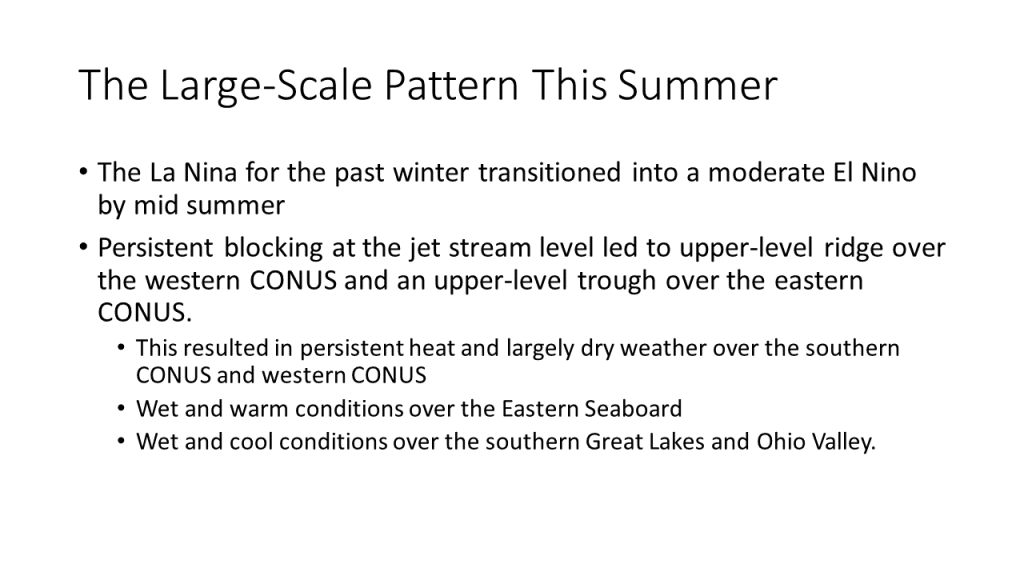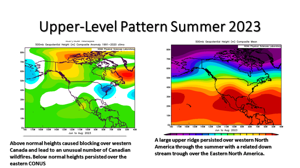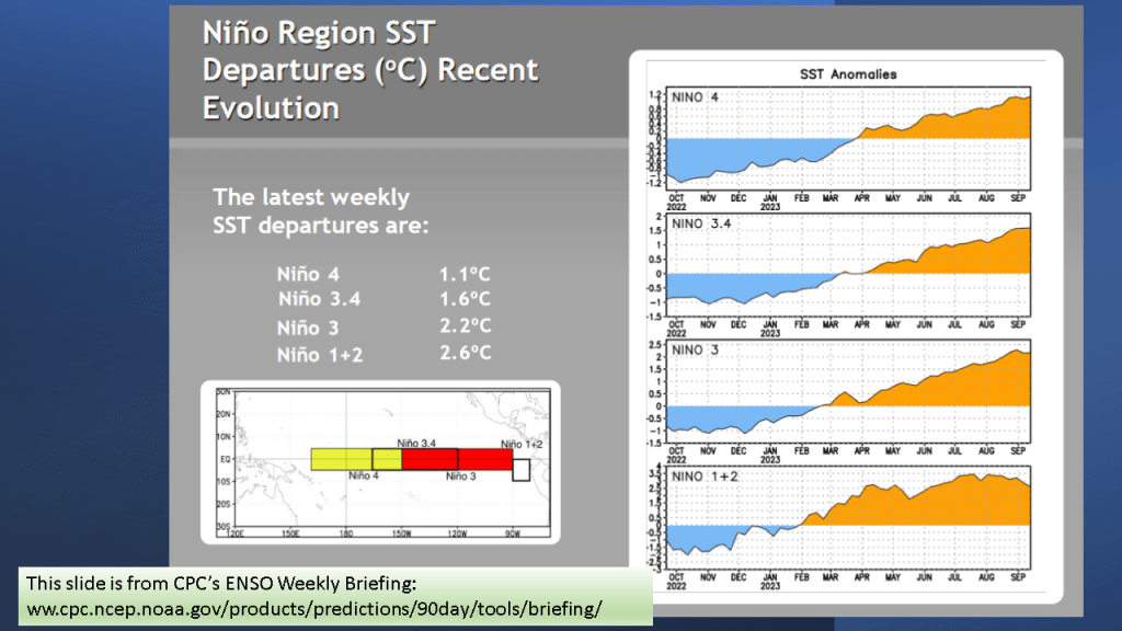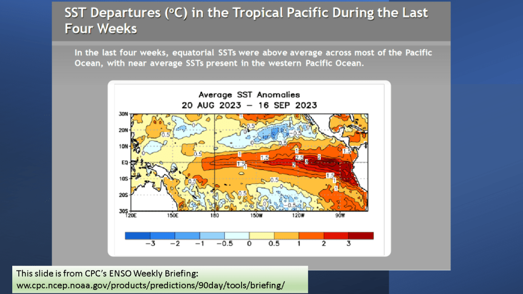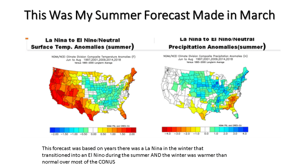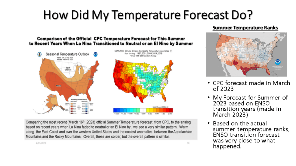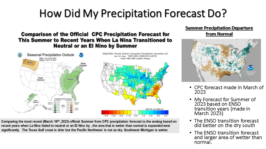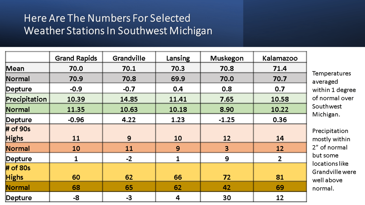
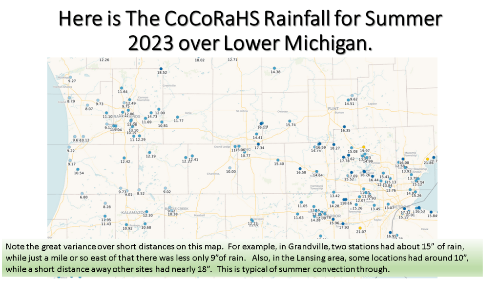
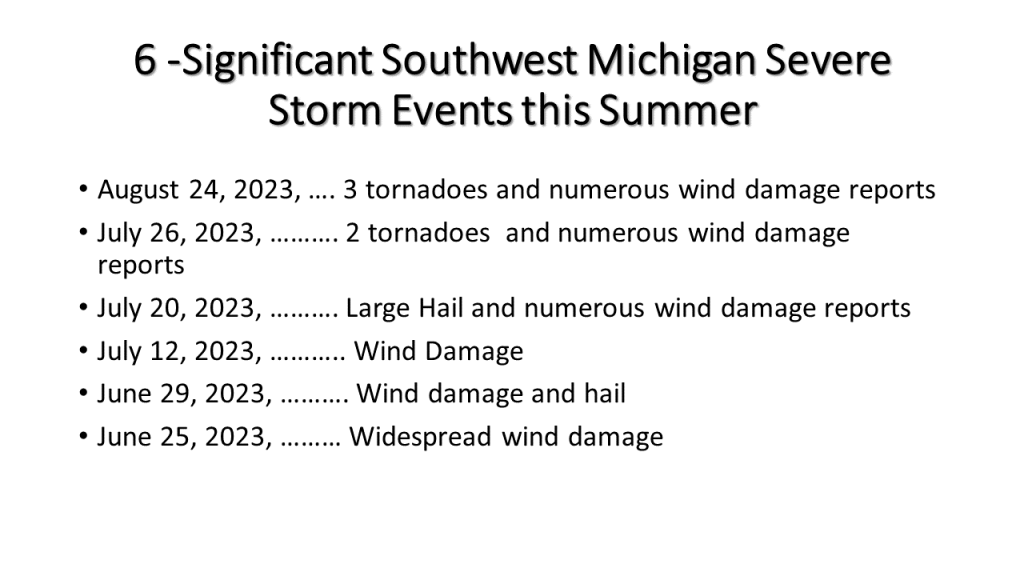
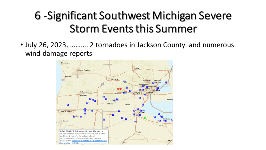
Here is my updated version of the summer of 2023 climate. I have added some details on Southwest Michigan including the severe weather events this summer. I have also added slides on the large scale pattern, that is our transition from La Nina this past winter to El Nino this summer. This lead to persistent blocking over North America, which is why there were persistent heat over the south and wet weather over the eastern 1/3 of the CONUS.

This was a summer that featured persistent weather patterns over most of North America and lead to one of the most active Canadian wildfire seasons on record. It also lead the the 15th warmest summer on record (back to 1895) over the CONUS.

GRR August 24th Event Link

DTX August 24th Event Link

DTX August 24th Event Flooding Link
DTX EVENT SUMMARYhttps://www.weather.gov/dtx/severeweather07202023
DTX EVENT SUMMARY

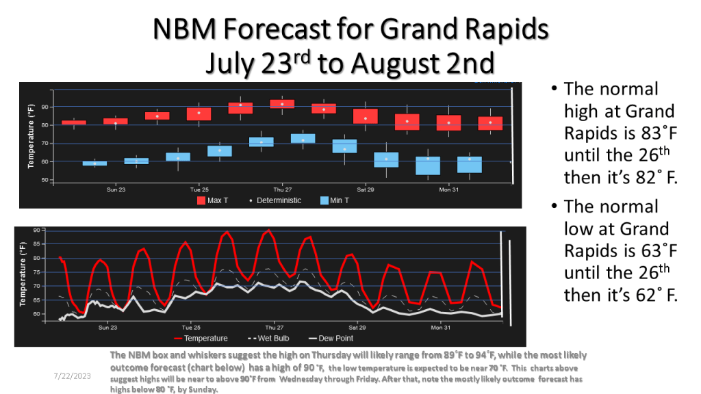
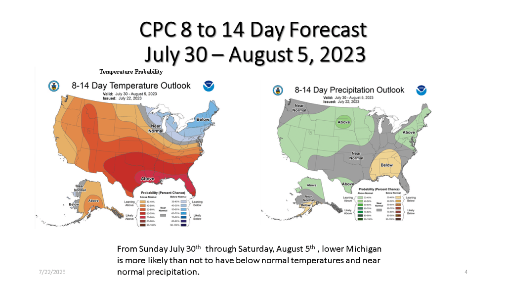
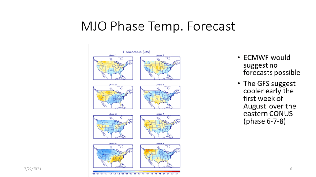
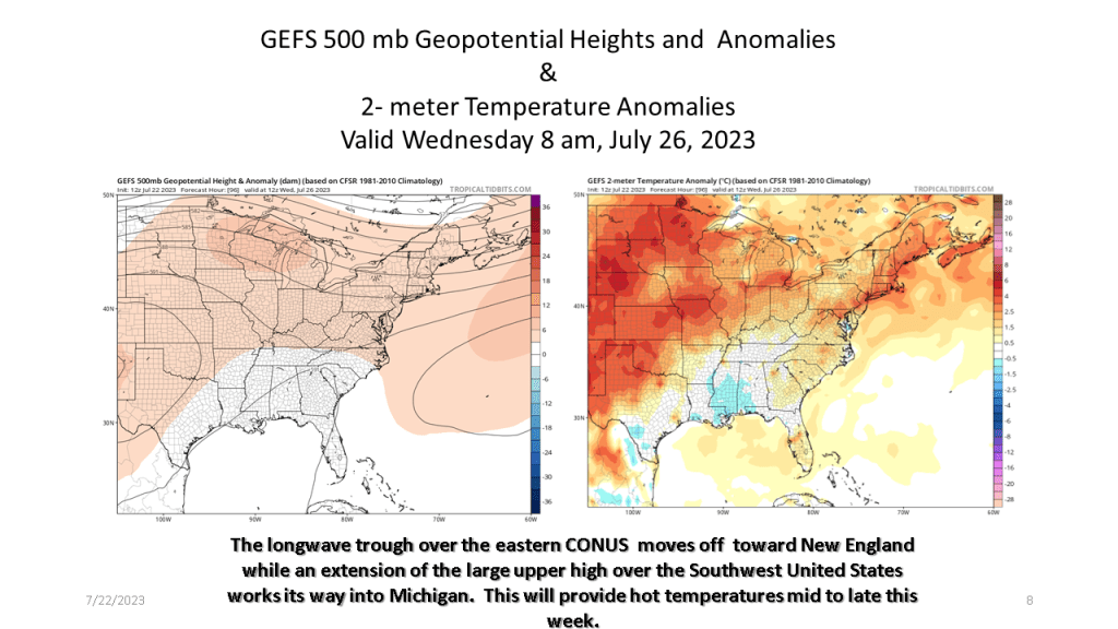
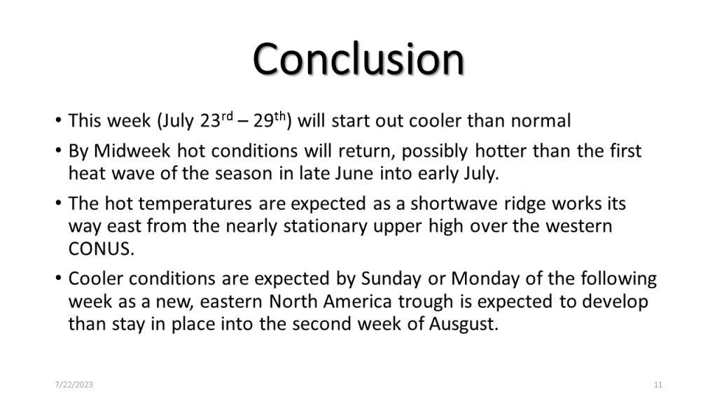
The second and third week of July have been cooler than normal, however, during the fourth week of July a heat wave (3 days or more in a row with highs of 90 or more) is expected for Southwest Lower Michigan. Don’t get to use to that through, cooler temperatures return by the 1st of August.

It’s been cool for the 2nd and 3rd week of July, however a dramatic change to hot weather is expected from Wednesday through Saturday.