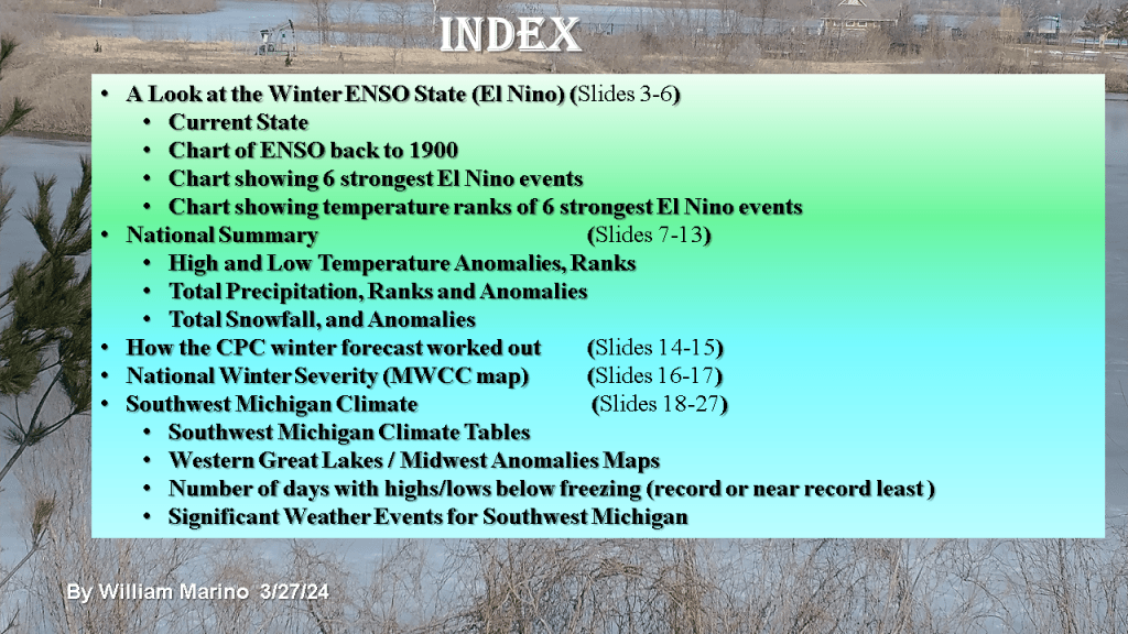
This is for Southwest Lower Michigan

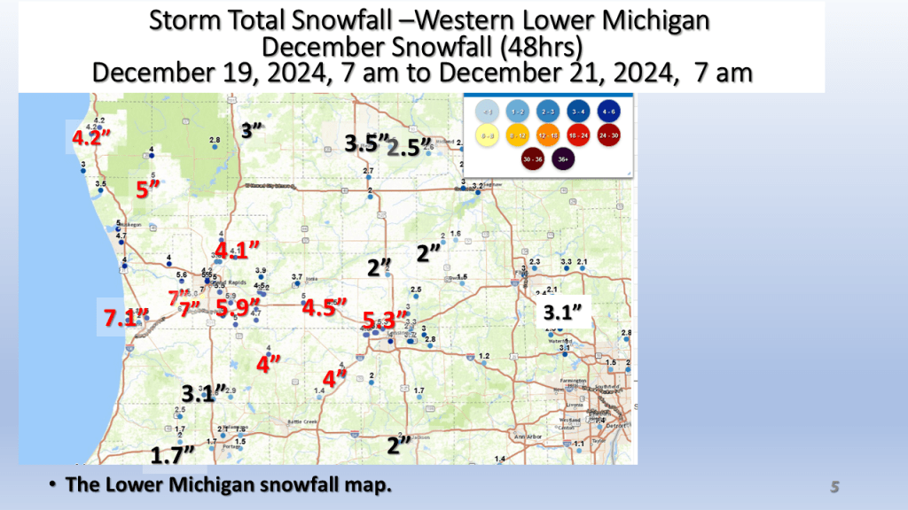


This is for Southwest Lower Michigan
This version of the winter forecast has the seasonal forecast as well as monthly forecasts from December through February.


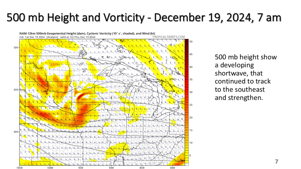
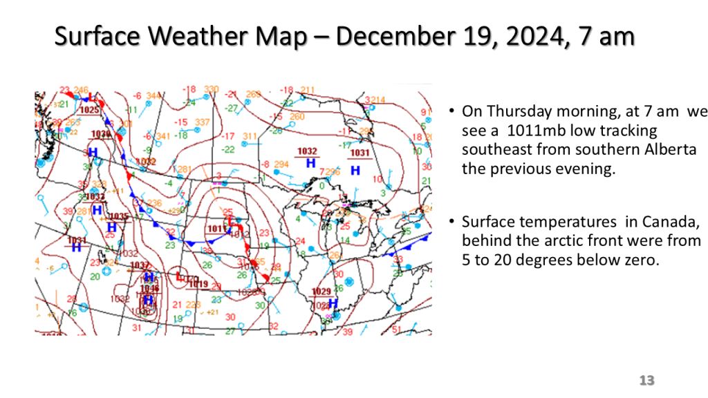
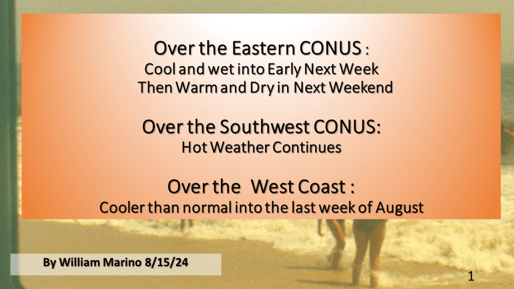
(over the Midwest and Great Lakes)


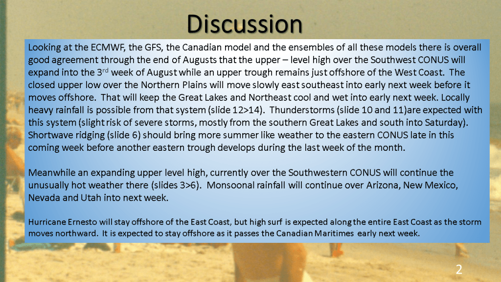


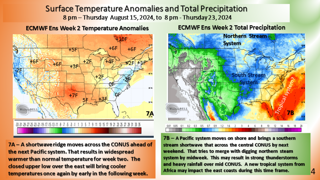
Seems another developing closed upper low my cool the eastern CONUS off by 19th of August (or the 3rd full week of August). This would likely be a wet period over the east.


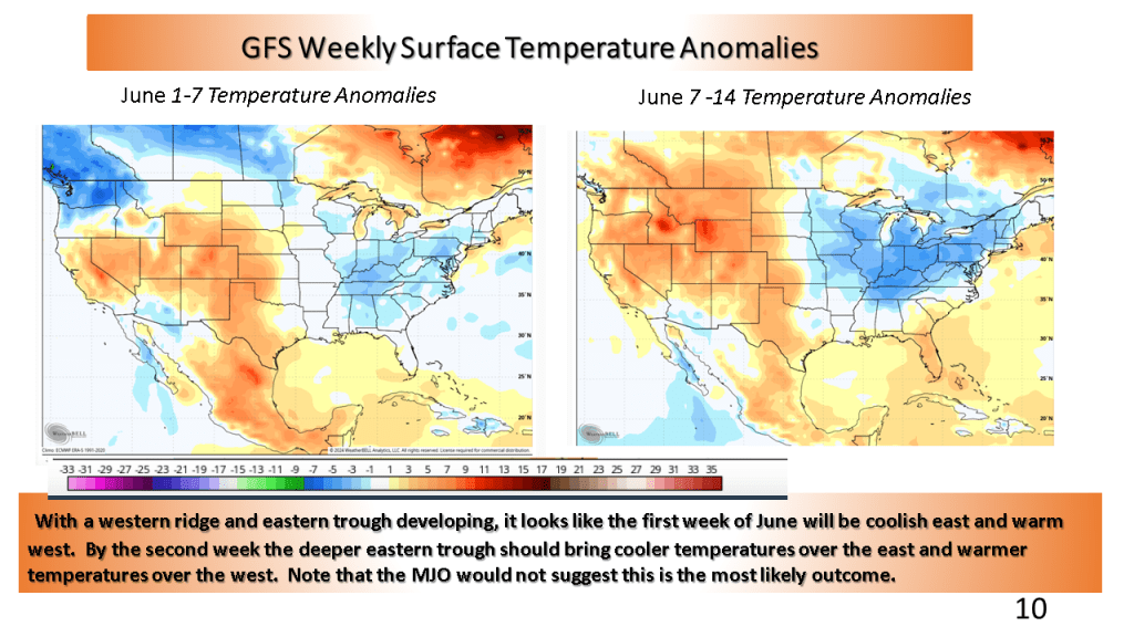
This would suggest cooler than normal over the eastern CONUS and warmer than normal over the western CONUS. The wet weather over the central CONUS may last into the first week of June but most of the rest of June is expected to feature near to below normal precipitation.


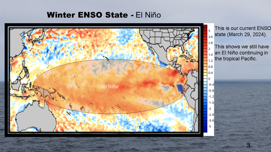
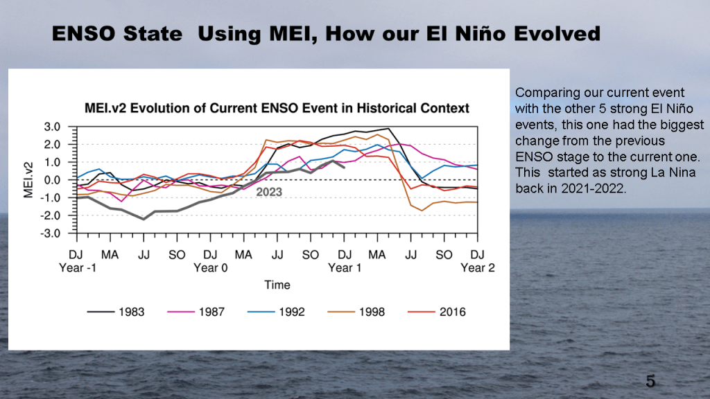
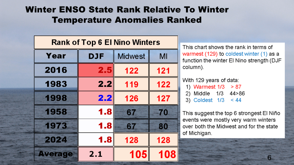
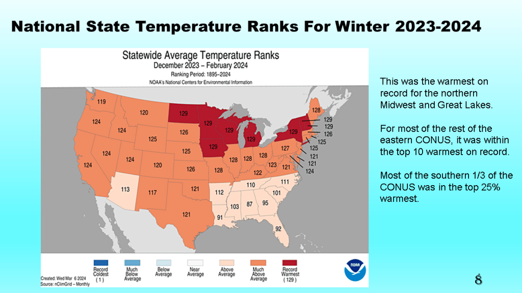
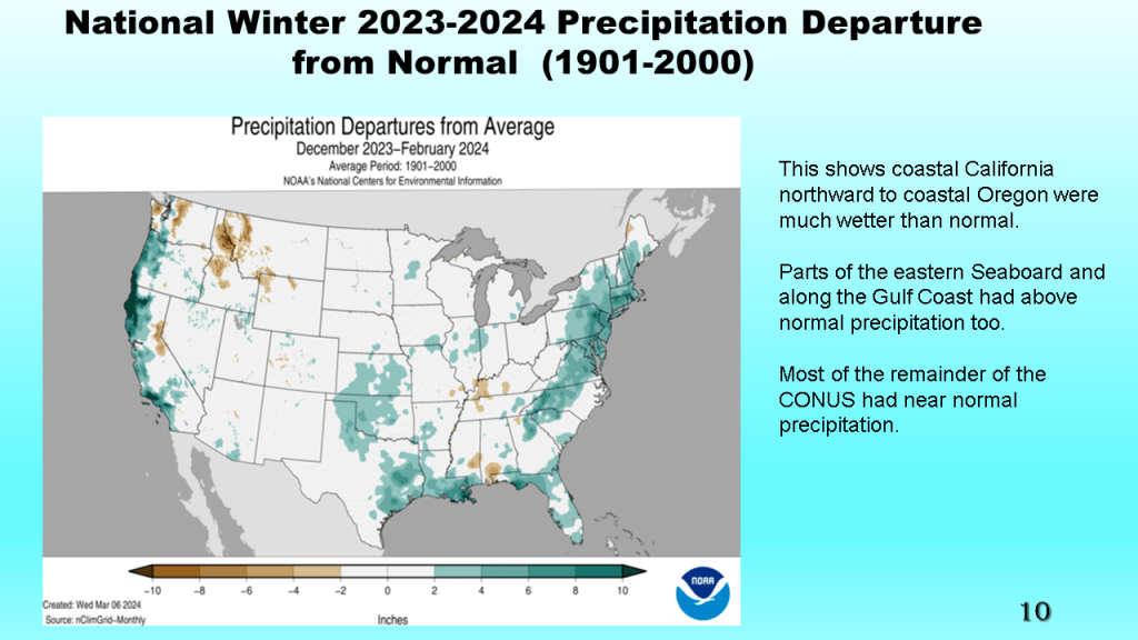
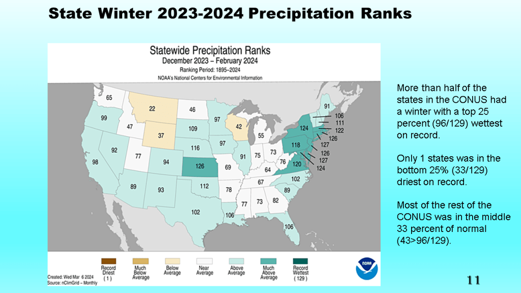
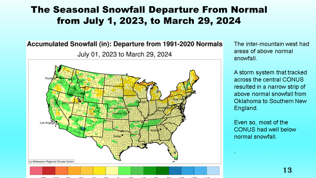
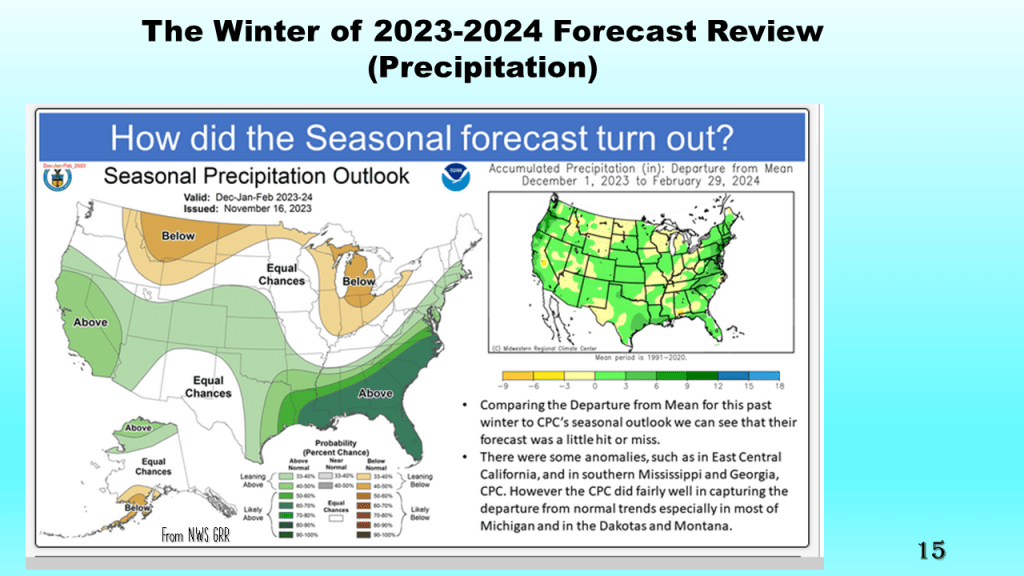
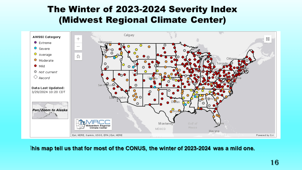
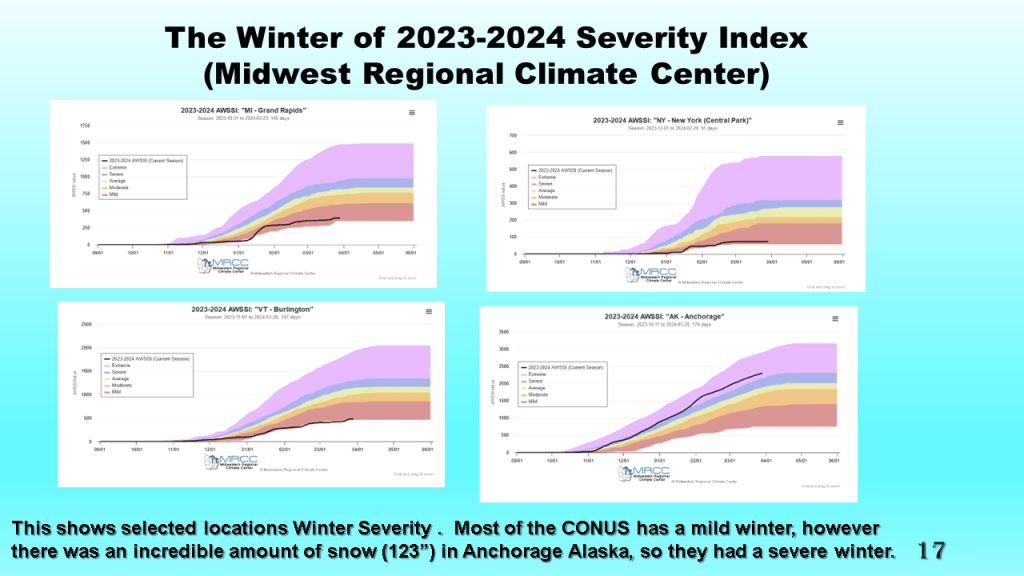
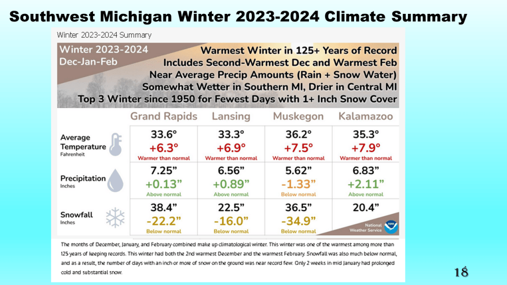
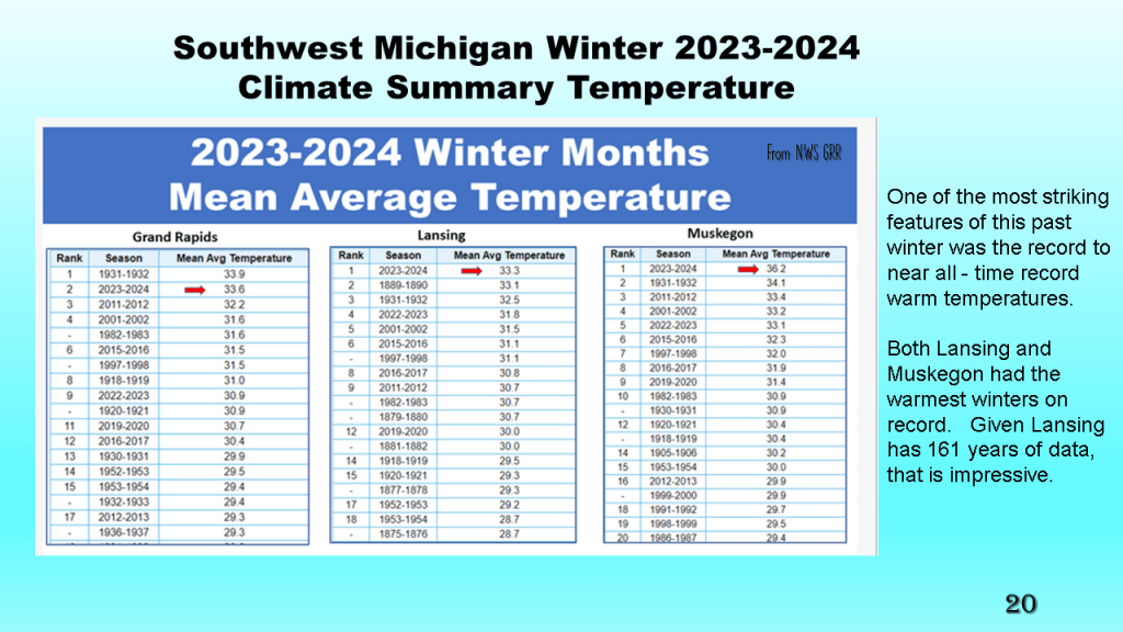
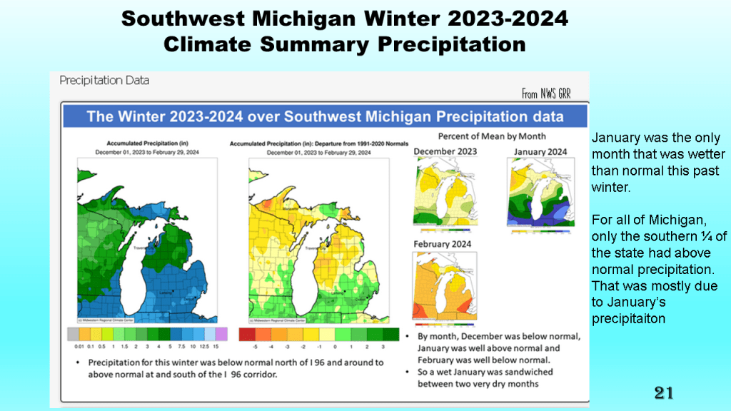
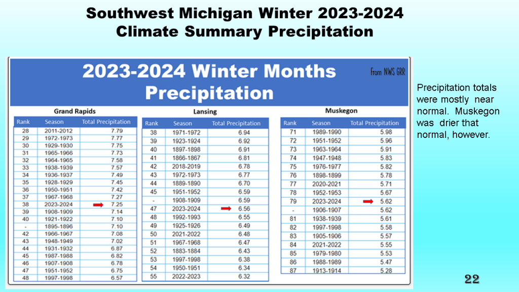
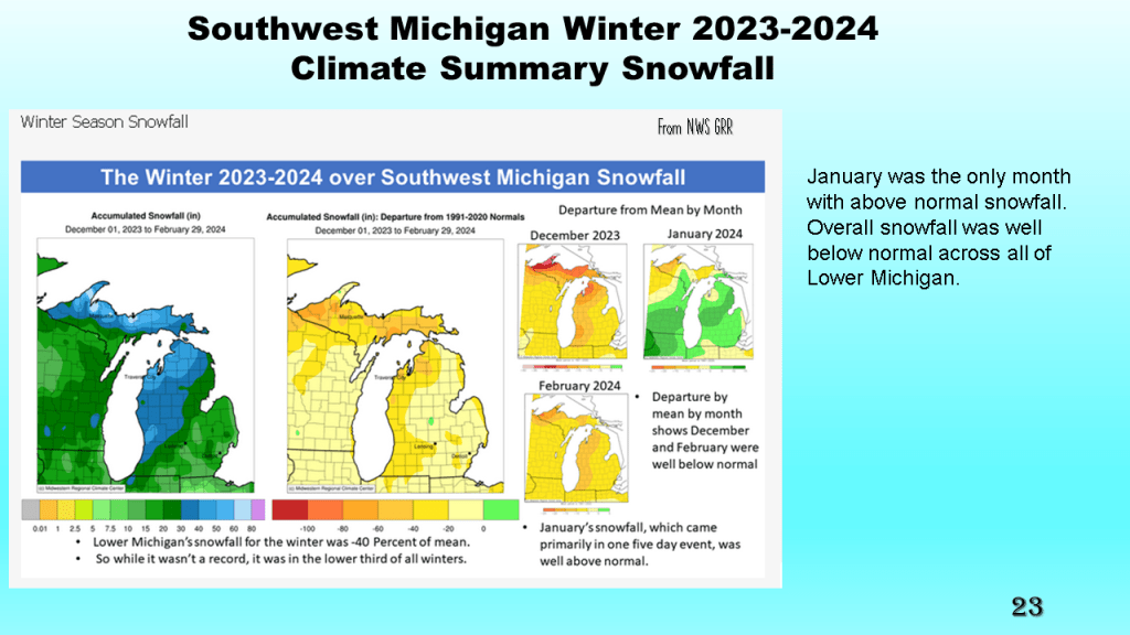
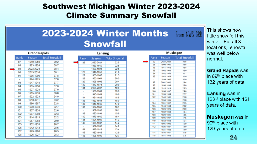
This was both nationally and locally one of the warmest winters on record, with records going back to 1895. Nationally and locally snowfall was below to well below normal. Precipitation was mostly near normal.