


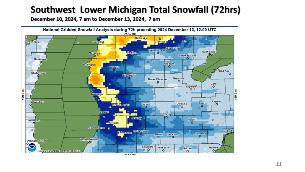
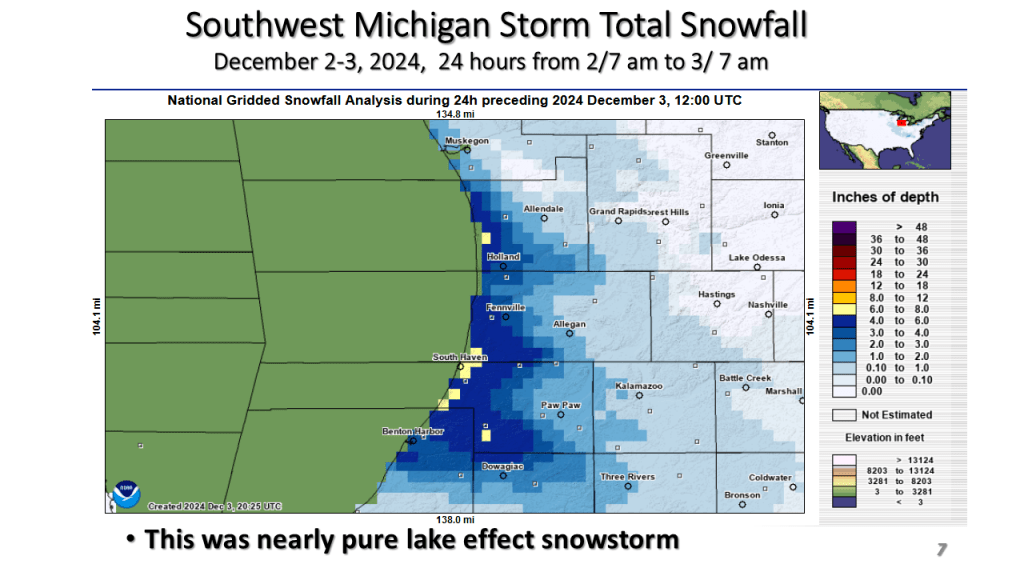
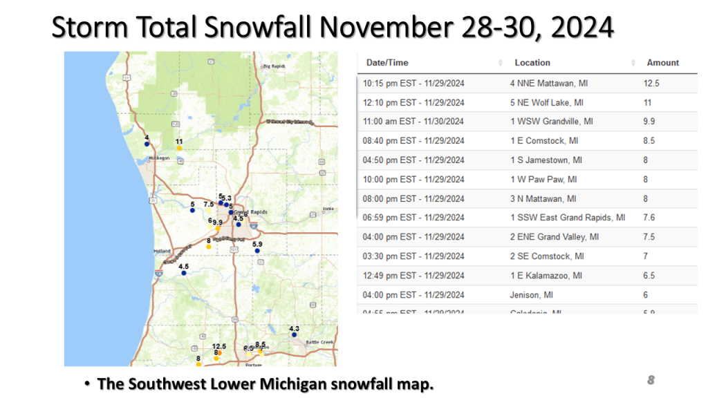
This is for Southwest Lower Michigan


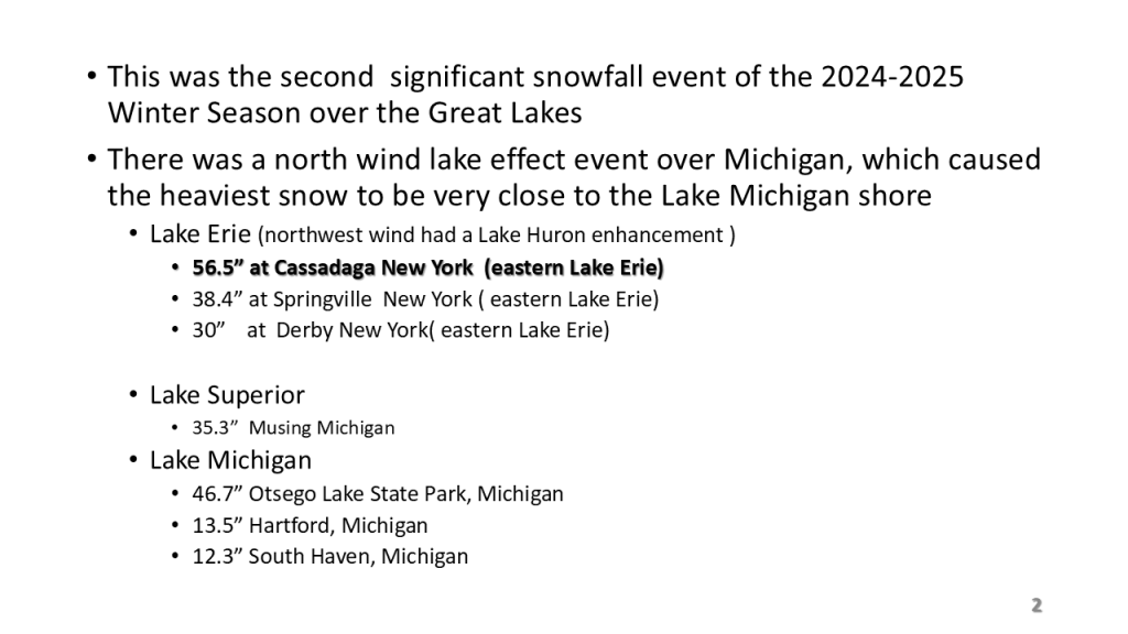


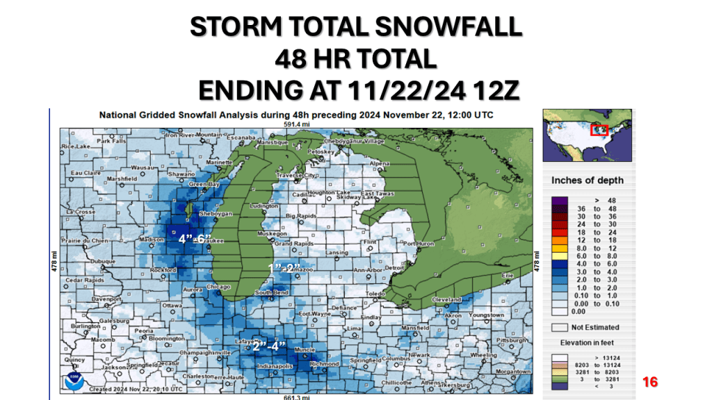
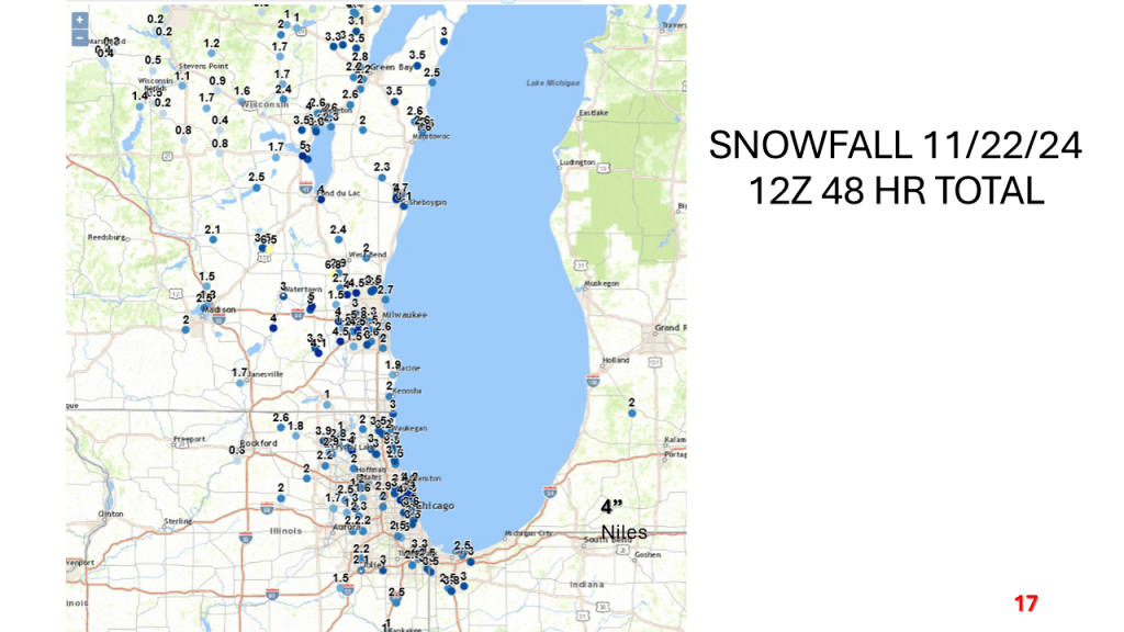
Heavy lake effect snow impacted all of the Great Lakes between Wednesday evening and this morning. Many areas had over 2 feet of snow.


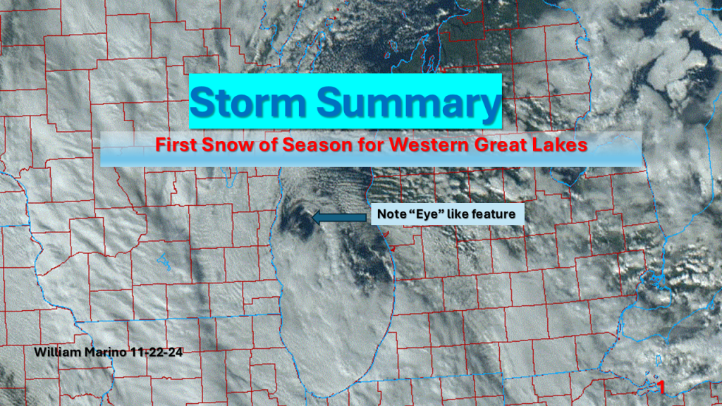
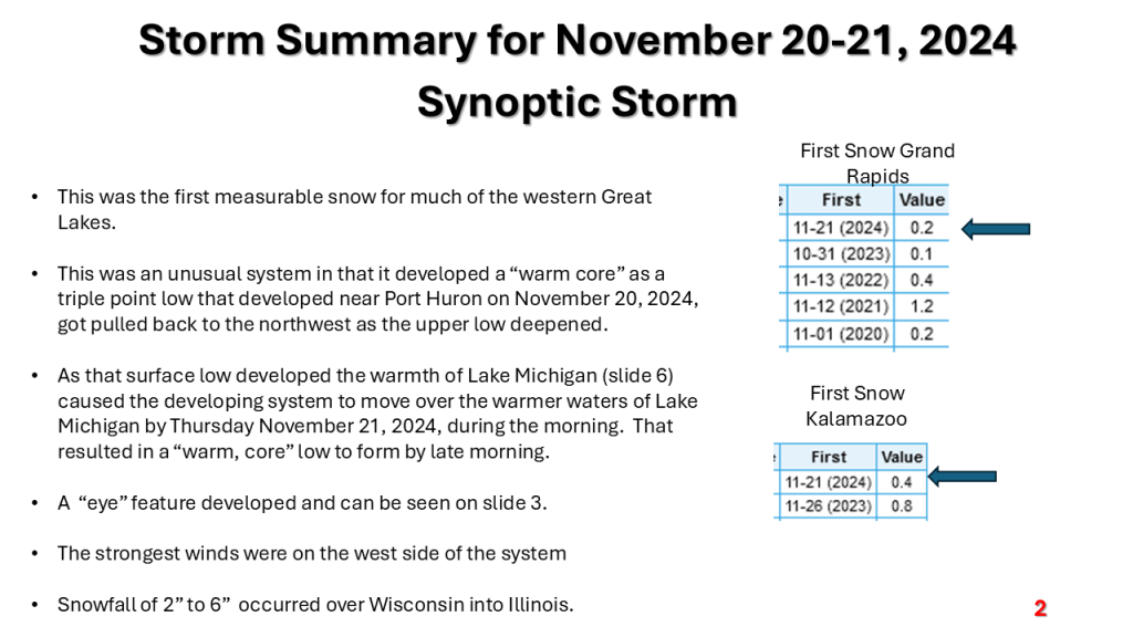
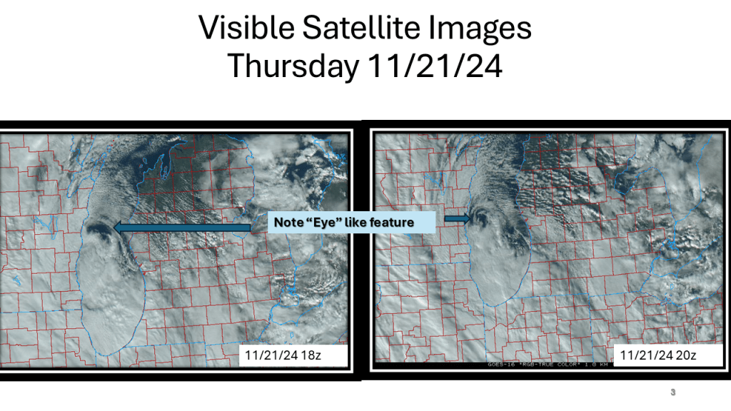
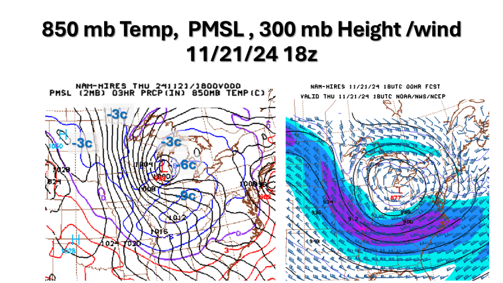
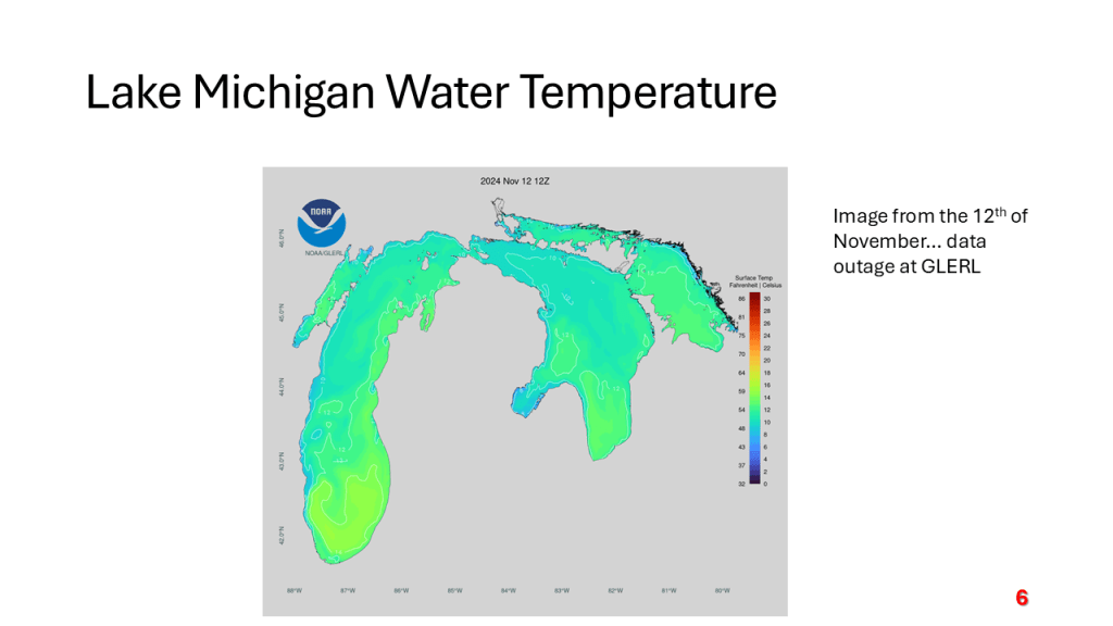
A strong November storm system brought the first snow of the season to parts of the western Great Lakes. Due to the warmth of Lake Michigan and that the surface low moved over Lake Michigan it developed an “Eye” like feature during the afternoon of Thursday, November 21, 2024.


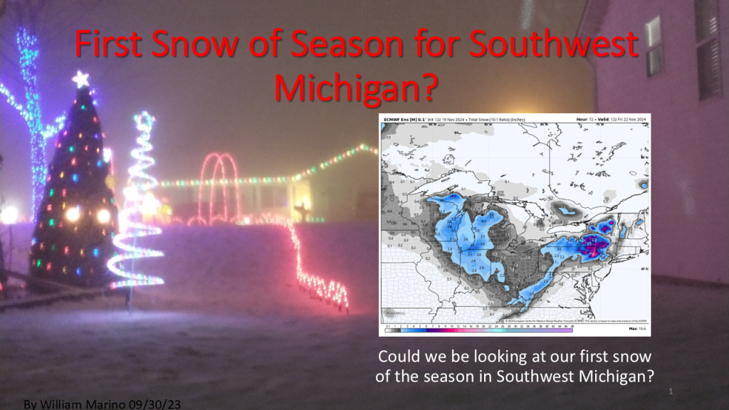
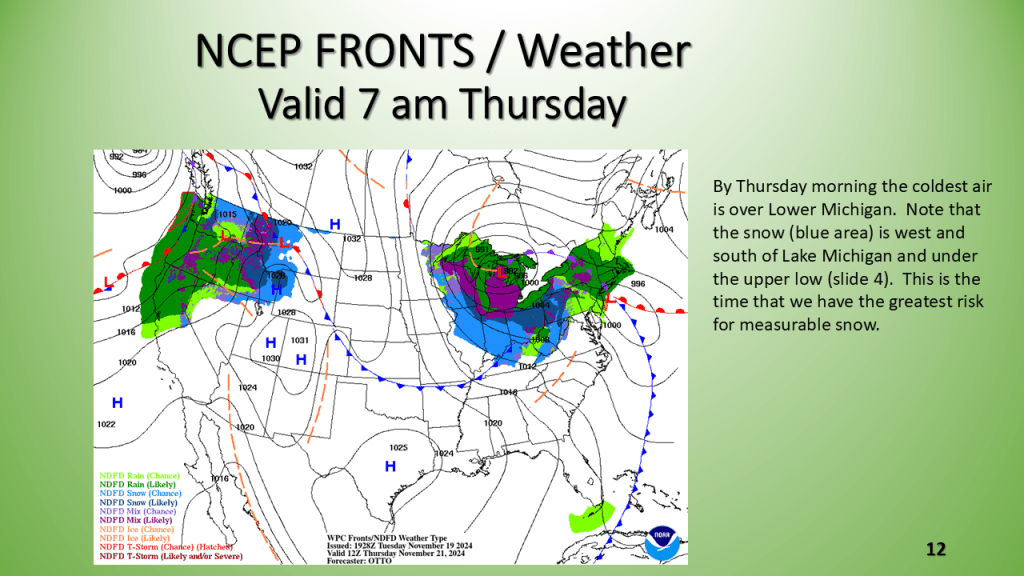
The first snowfall of the 2024/2025 season is likely for Most of Lower Michigan between Wednesday night and Thursday morning.


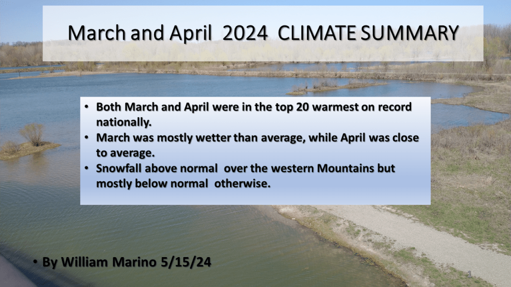
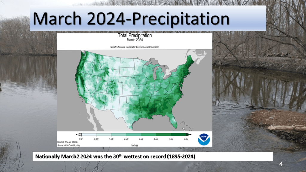
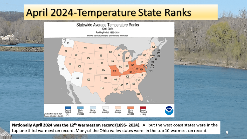
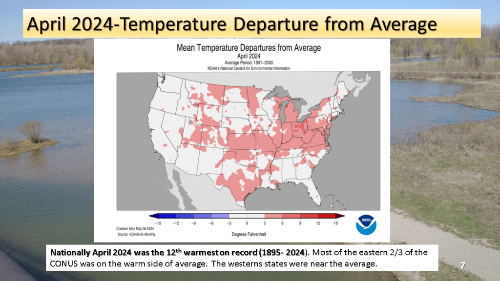
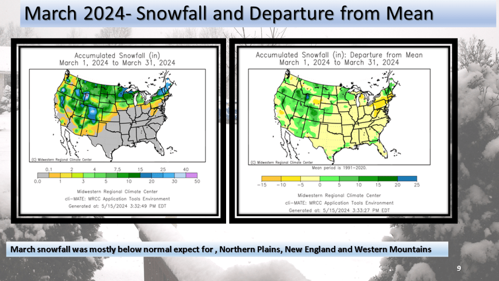
The national trend of top 20 warmest months on record continued for both March and April. March was overall wet compared to average while March was closer to normal. Snowfall was above normal over the western Mountains but below normal (mostly ) elsewhere.