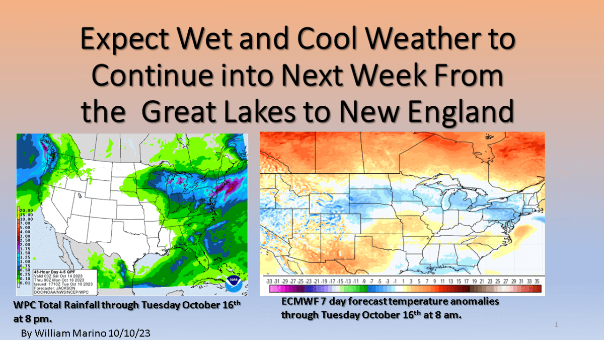
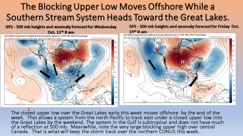
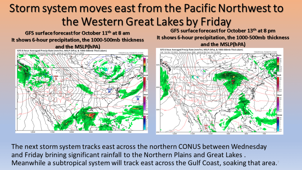
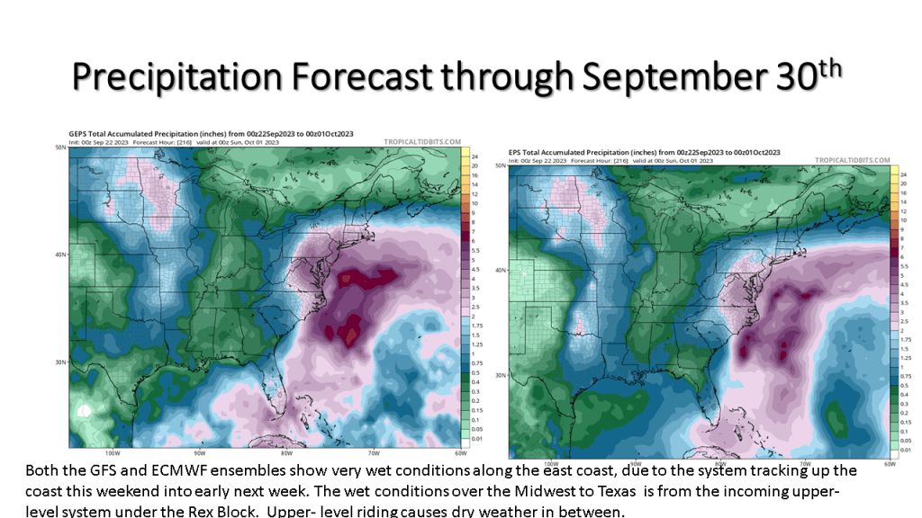
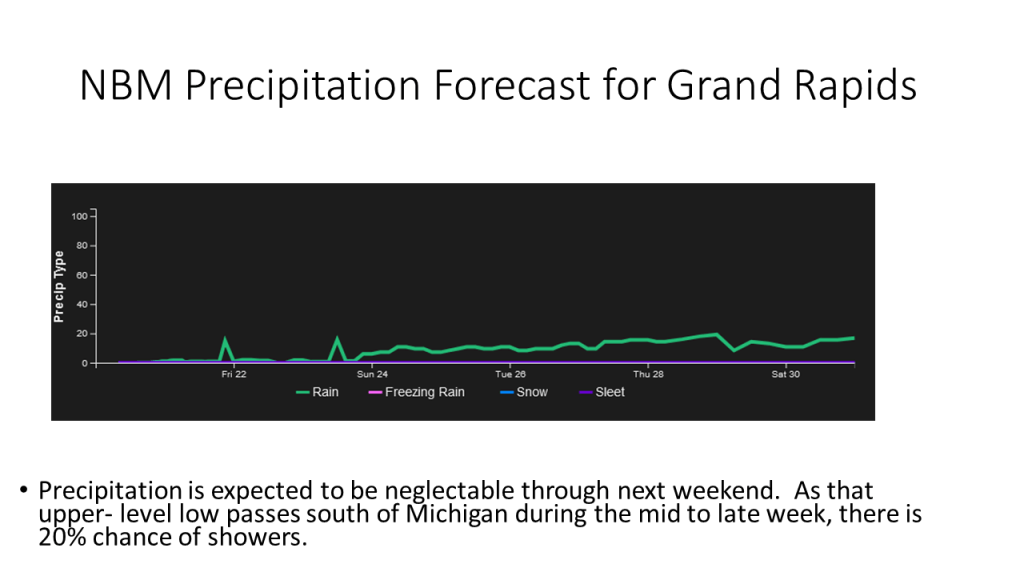
Expect the wet and cool weather over Northern Midwest into New England, including the Great Lakes, to persist into early next week. An impressively large blocking upper-level high, over central Canada will keep the storm track over the northern CONUS into early next week. It will also allow a subtropical system to track along the Gulf Coast over the next few days.
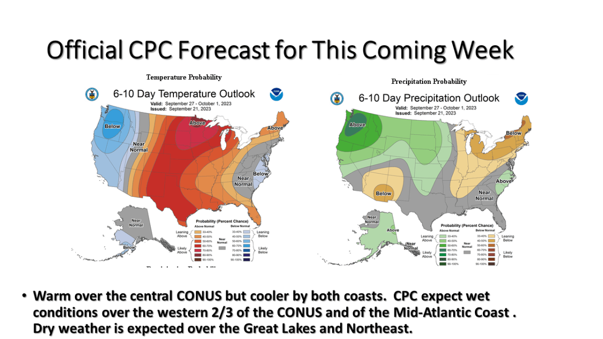
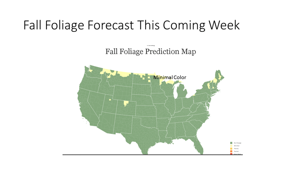
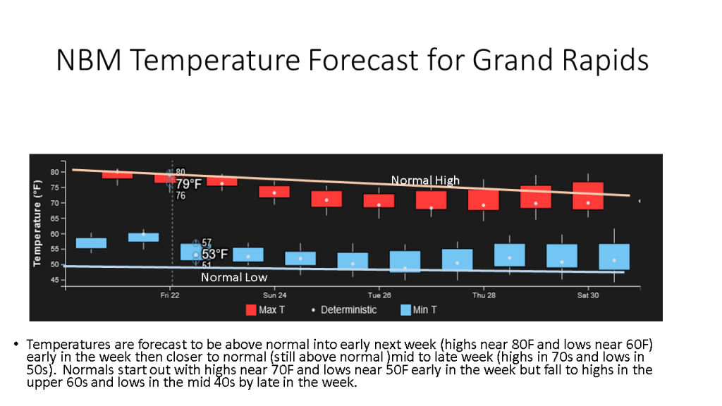
Here is my forecast for this coming week, plus a look at the current fall foliage report. The short story is warm and dry this week of the Great Lakes and northern New England. Wet along most of the East Coast and over the western CONUS. It will be cool and wet over the western CONUS. I am expecting warm and dry weather this week over Michigan but warm and wet over the east coat, and cool and wet over the west coast. Fall Foliage Map