(Severe reports were mostly large hail near Lansing)


(Severe reports were mostly large hail near Lansing)


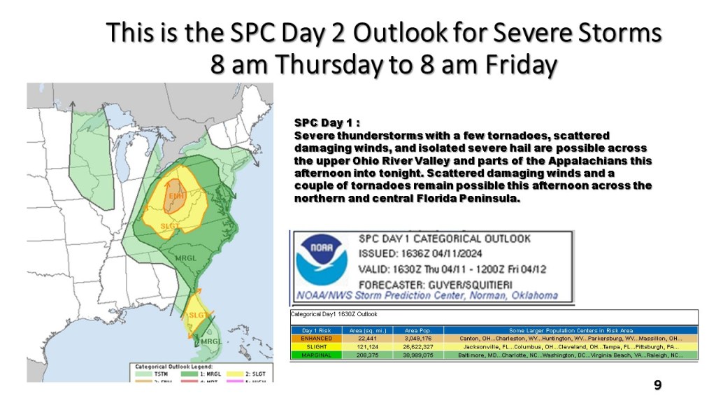


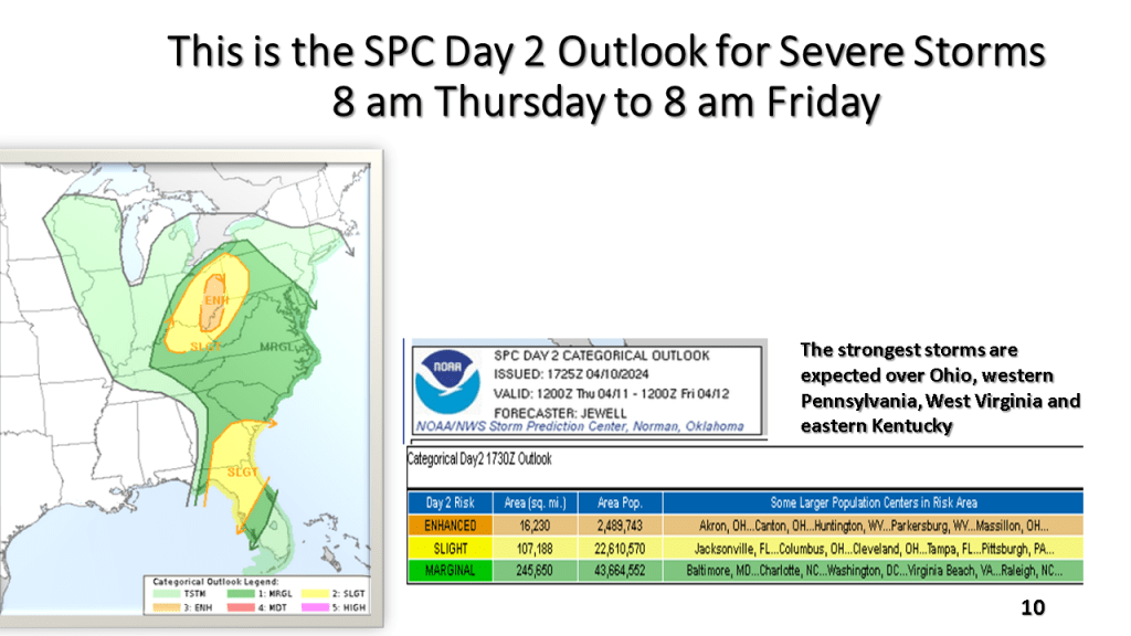
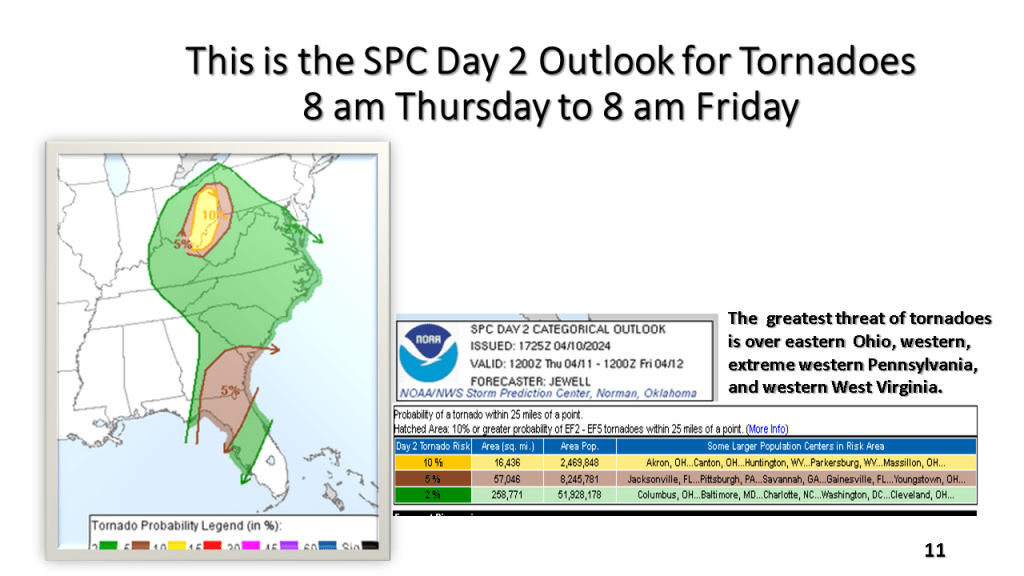
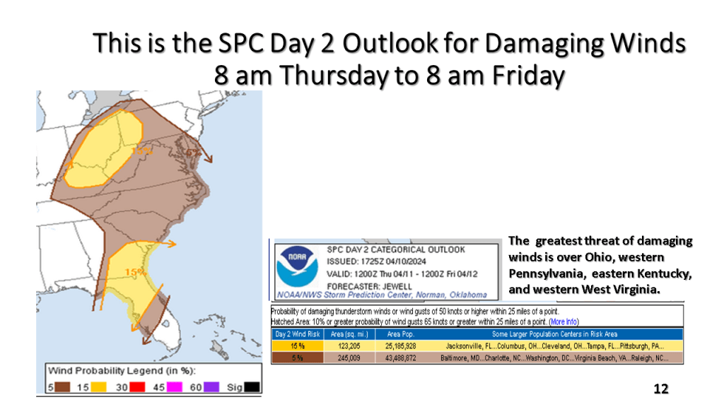
South of Michigan there is an enhanced risk for severe thunderstorms, including tornadoes over Ohio, western Pennsylvanian, West Virginia, and Kentucky.


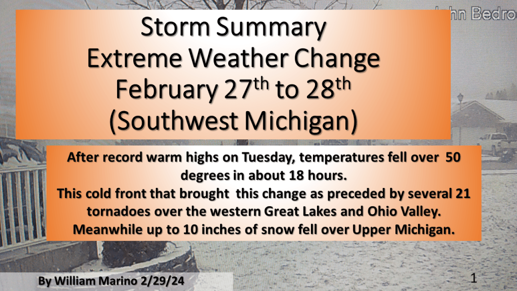
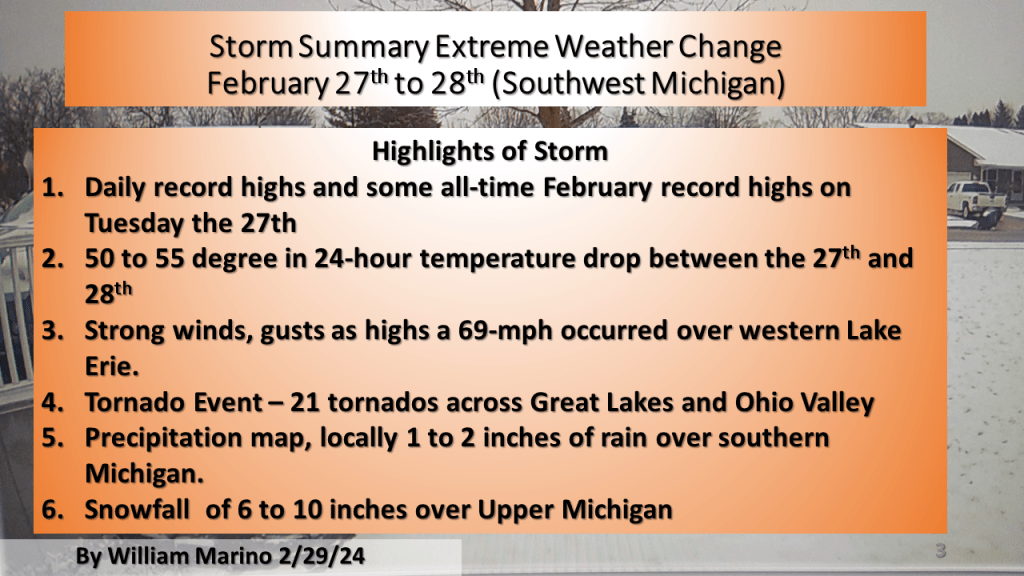
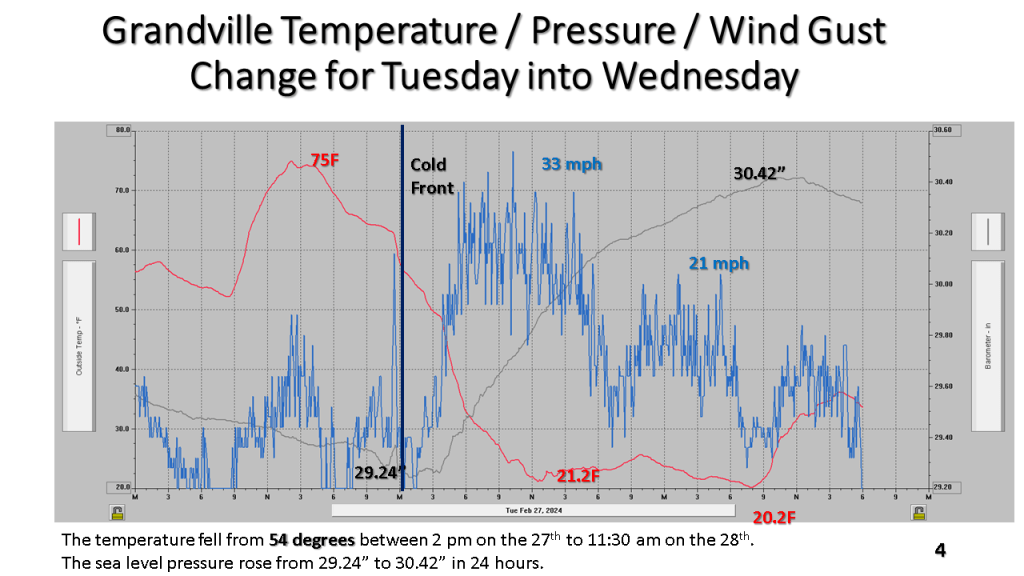
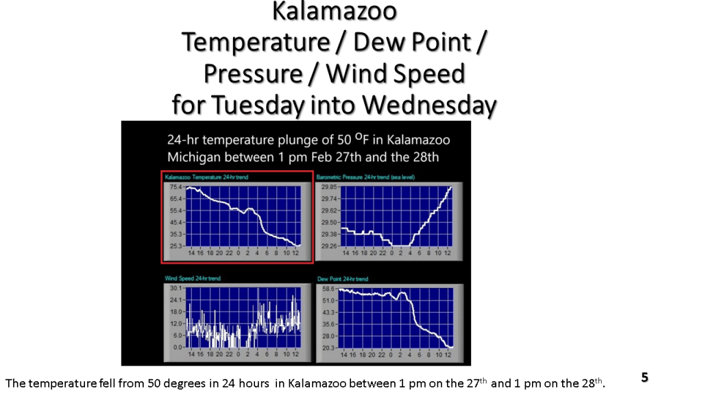
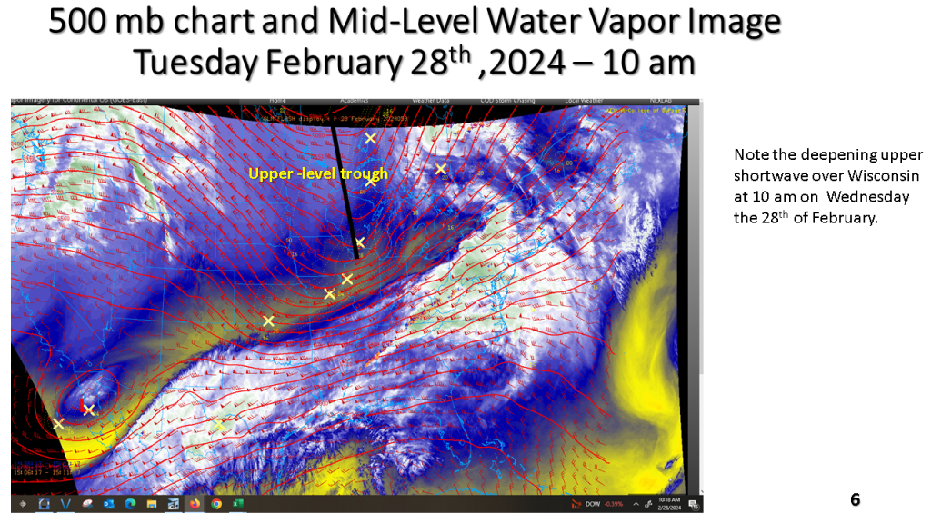
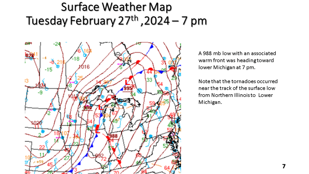
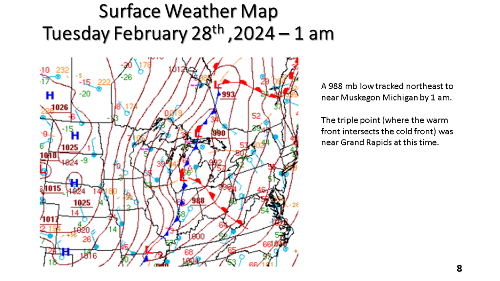
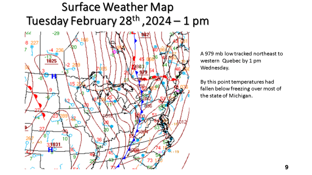
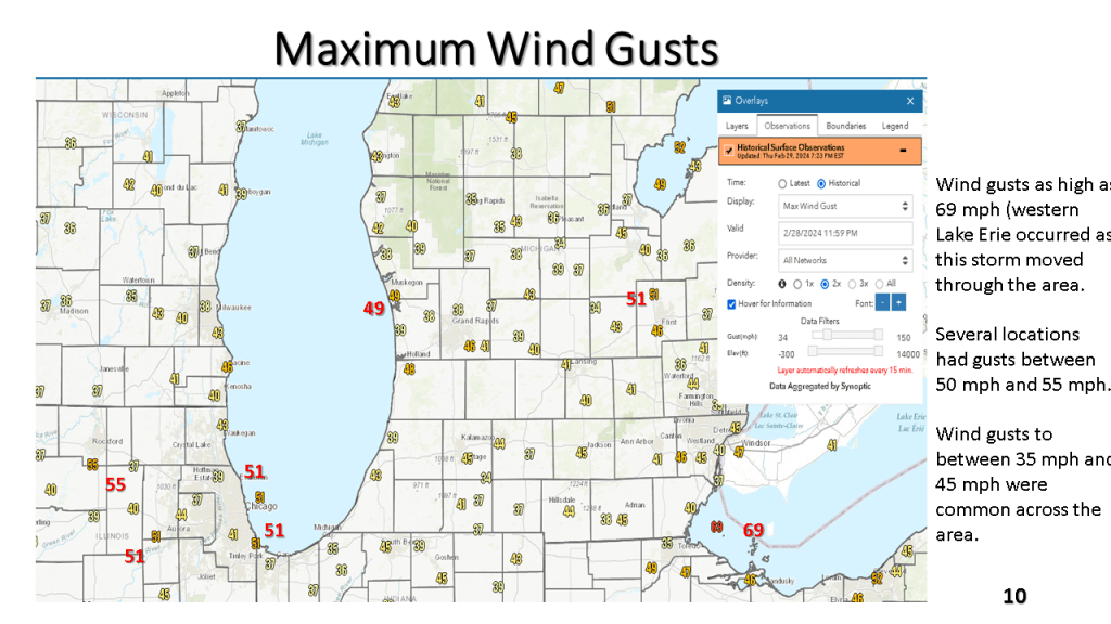
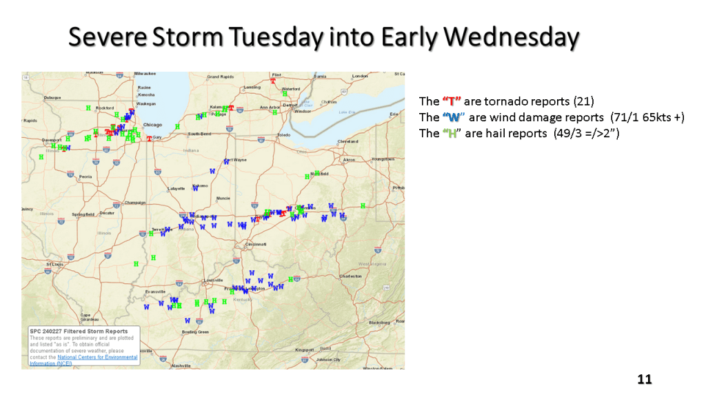
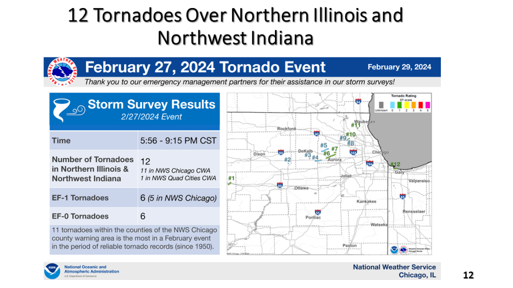
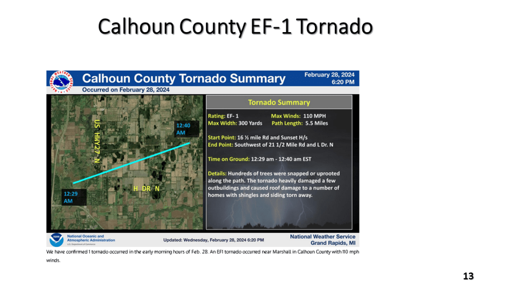
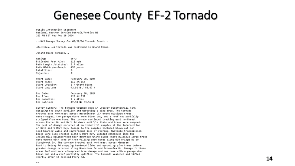
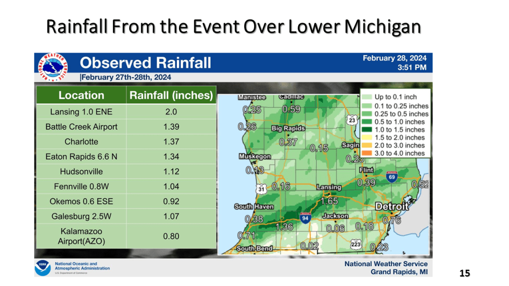
Record high temperatures ( many cases all time record highs for February) were quickly brought to an end by a strong late February cold front. There were 21 reported tornadoes, mostly EF-0 and EF-1 but there was an EF-2 near Grand Blanc in Geneses County just ahead of the cold front. Temperatures fell around 50 degrees between Tuesday afternoon and Wednesday afternoon over Lower Michigan. There was 6 to 10 inches of snow in upper Michigan and locally 1 to 2 inches of rain in parts of southern Lower Michigan. Winds gusted to 69 mph over western Lake Erie.

Largely this means warmer and wetter over the CONUS but cold and snowy over southern Canada.


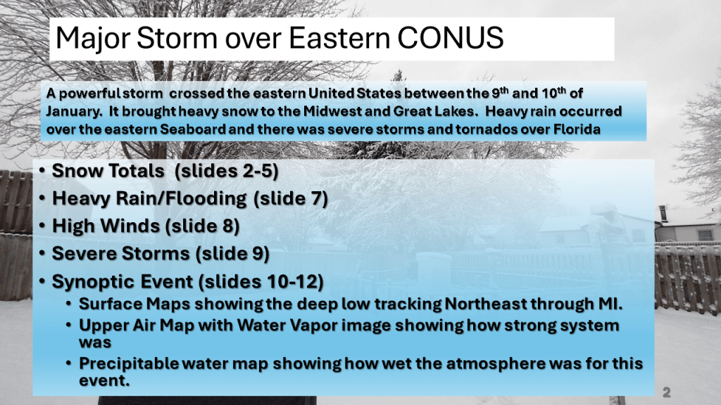
This storm brought heavy snow to the Midwest and parts of the Great Lakes, then there were damaging winds over the eastern Seaboard, as well as flooding. Severe storms and over a dozen tornadoes occurred over the Southeast sections.


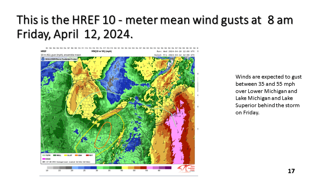
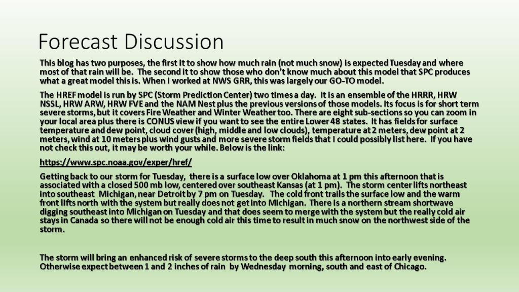
This blog is really more about showing those who do not know about the SPC HREF model. I have some of the key charts from today’s HREF that show where the severe storms are expected, the strongest winds, and heaviest rainfall.
Here is a link to the SPC HREF model.


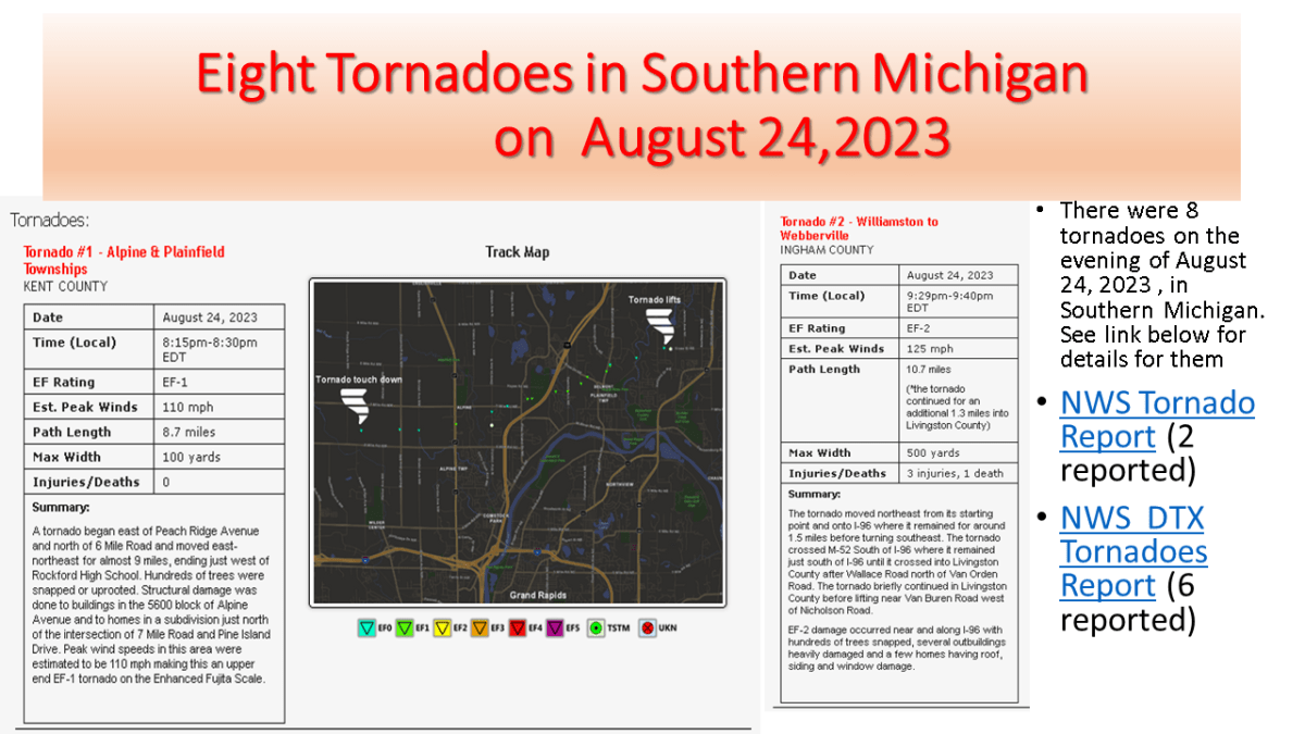
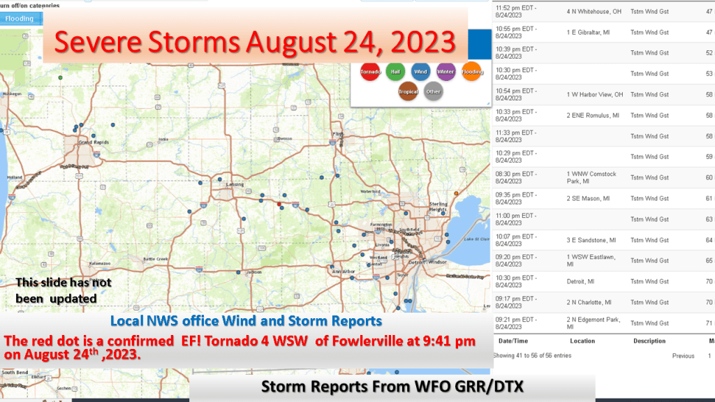
I updated my story about the severe storms since the NWS has now reported 8 tornadoes in Michigan on the 24th of August. The strongest was an EF-2 near Webbrvillle


The Storm Prediction Center has put most of the southern 1/3 of Lower Michigan an enhanced risk for severe storms today (mostly late morning into mid afternoon). Locally heavy rainfall is expected too.

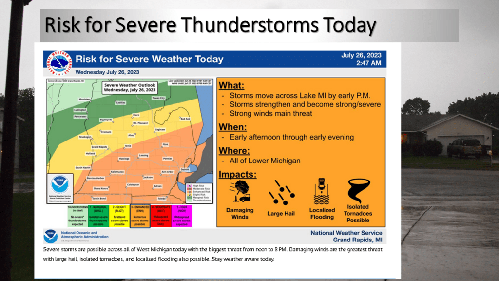
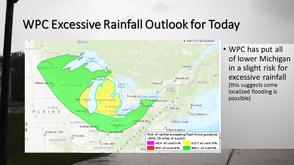
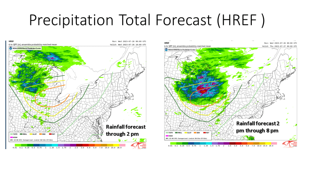
Most of the rainfall today will be from late morning into mid afternoon.
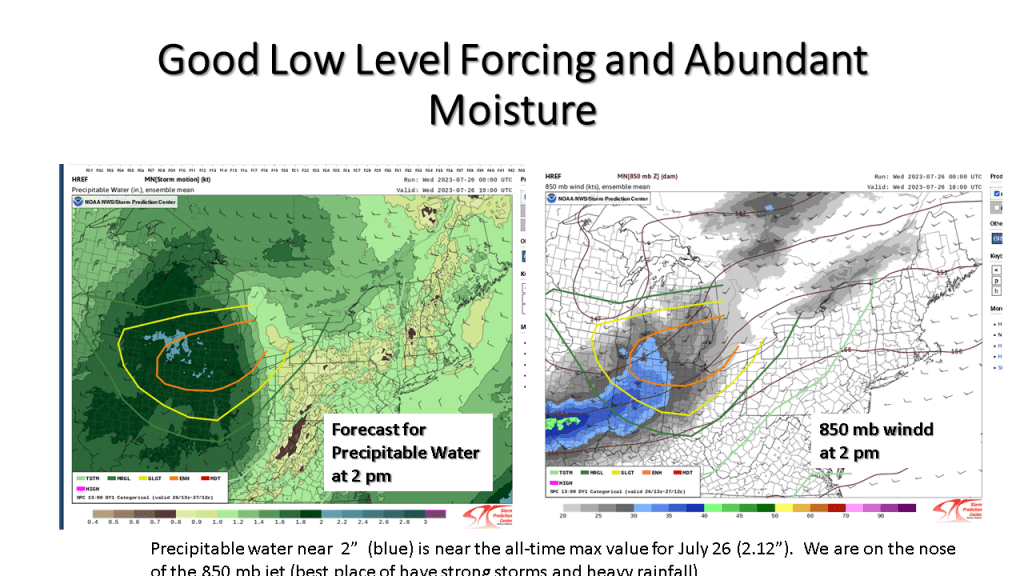
My experience in forecasting over the past 46 years tell me that for Southwest Michigan convection during the spring and summer months, warm fronts, stationary fronts and surface waves bring this area the most rainfall. Cold fronts bring us the least (typically). This event is warm front with a surface wave that develops into a surface low. This tells me most area should see meaningful rainfall today.


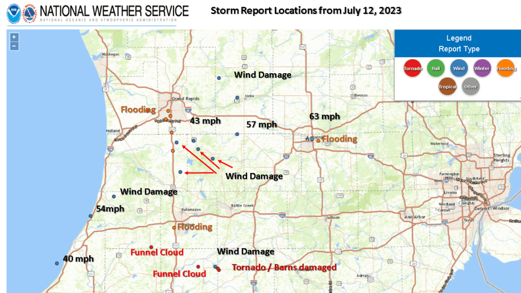
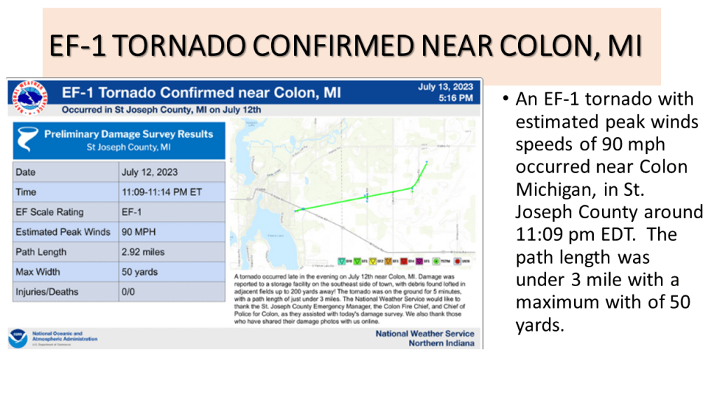
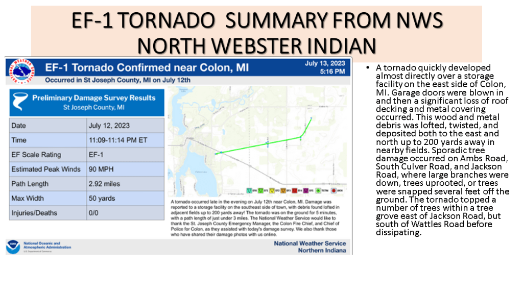
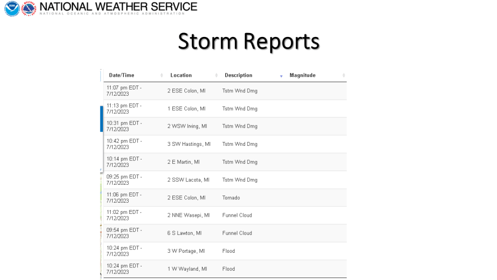
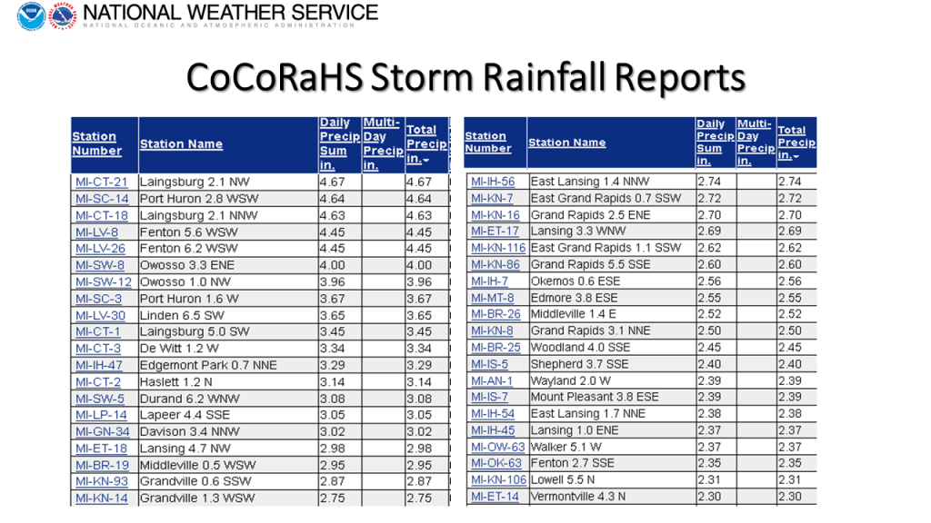
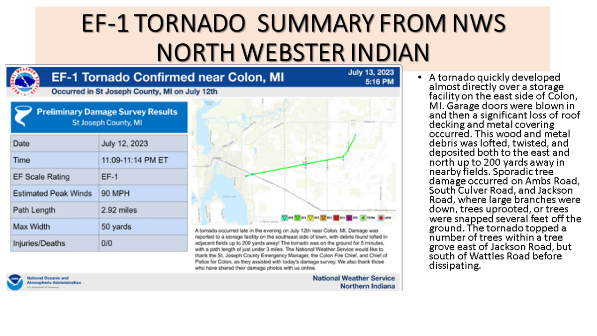
I added the Colon EF-1 Tornado to the storm summary plus the CoCoRaHS rainfall reports for the storm.