Winds to 76 mph, 1″ hail and rainfall to near 5″ within 12 hours

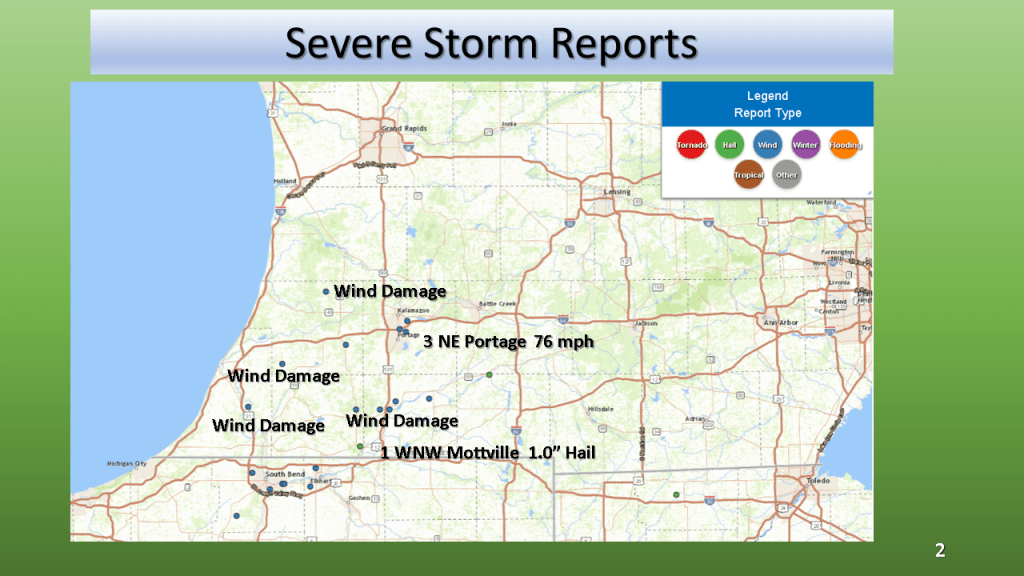


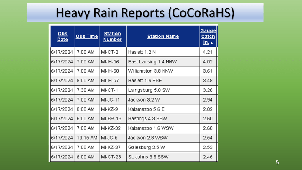
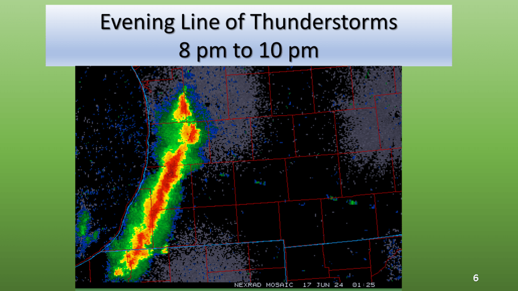
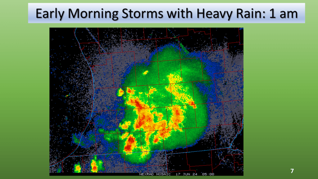


Winds to 76 mph, 1″ hail and rainfall to near 5″ within 12 hours


(with a brief look at Southwest Michigan on the last slide)


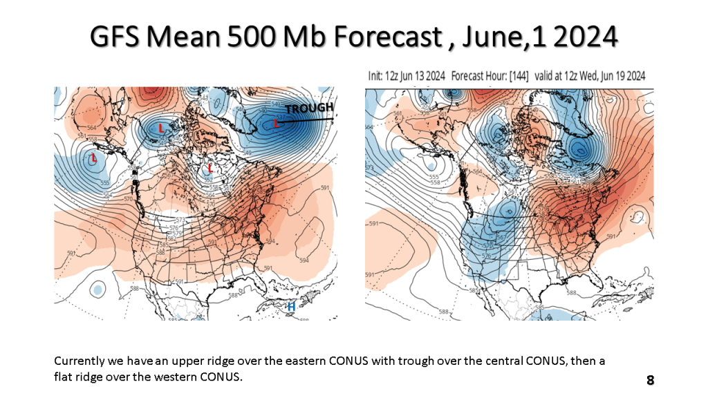
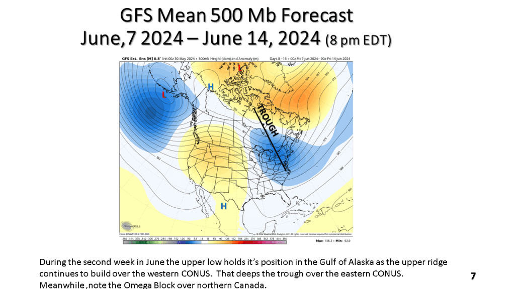
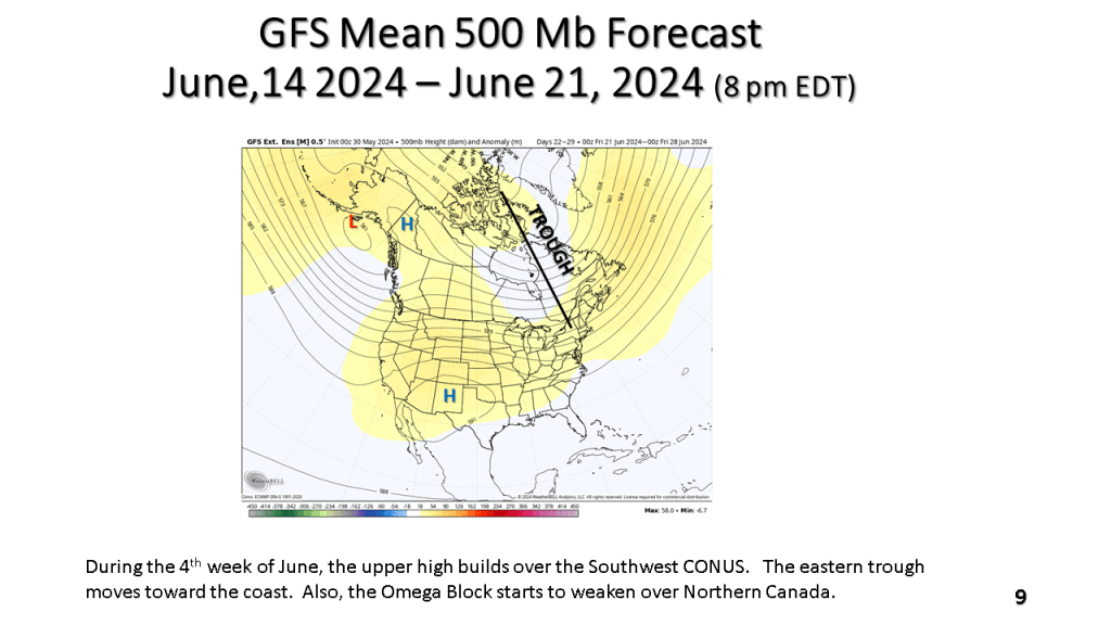
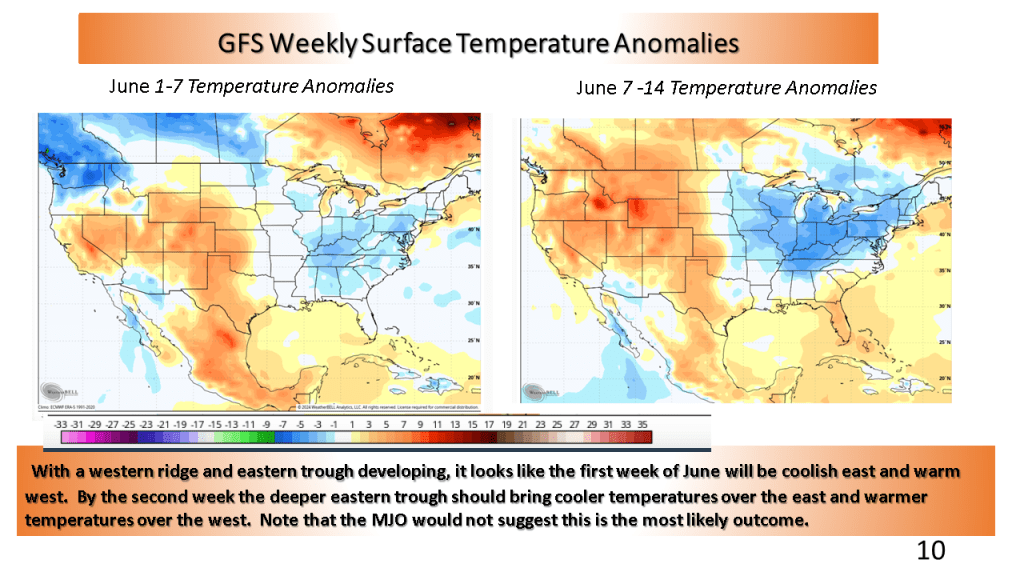
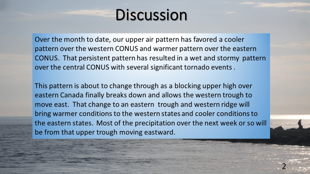
This would suggest cooler than normal over the eastern CONUS and warmer than normal over the western CONUS. The wet weather over the central CONUS may last into the first week of June but most of the rest of June is expected to feature near to below normal precipitation.

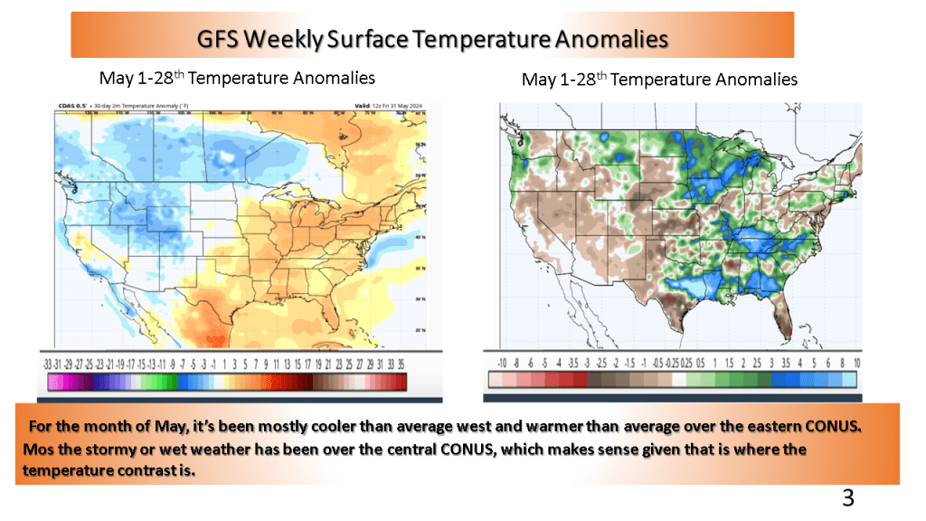


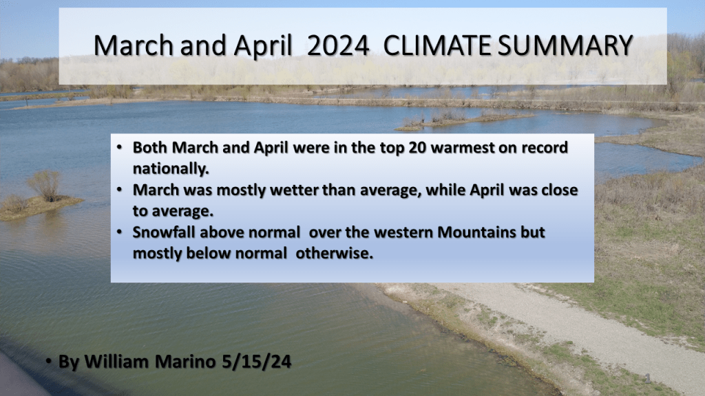
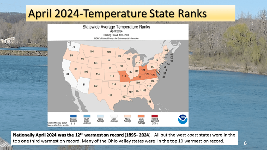
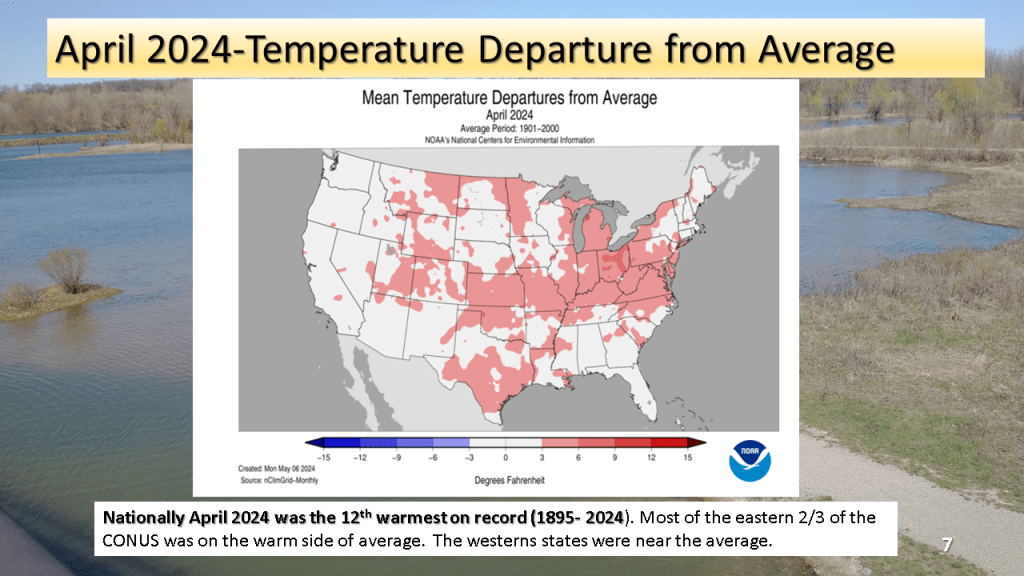
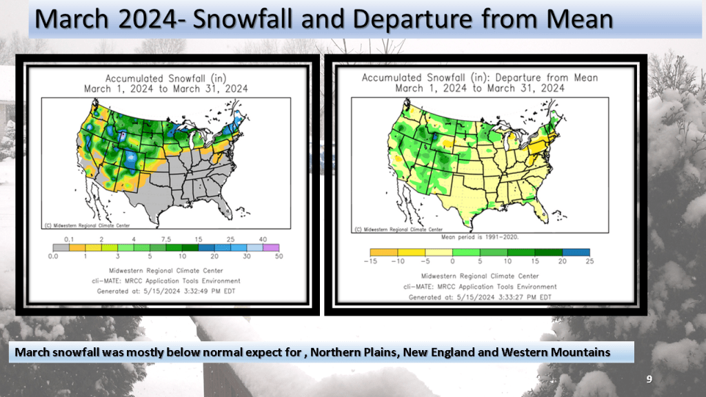
The national trend of top 20 warmest months on record continued for both March and April. March was overall wet compared to average while March was closer to normal. Snowfall was above normal over the western Mountains but below normal (mostly ) elsewhere.


This is a short version compared to my previous seasonal forecasts but I believe the shorter version will be easier to read. I may add details as the season progresses.


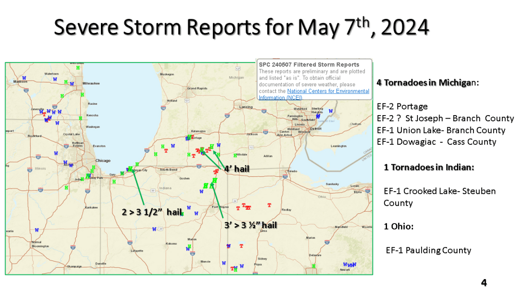
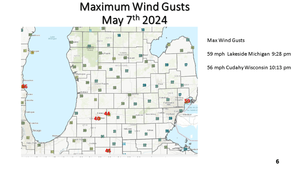
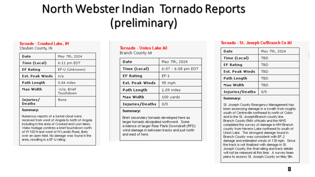
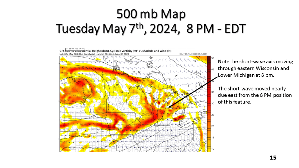
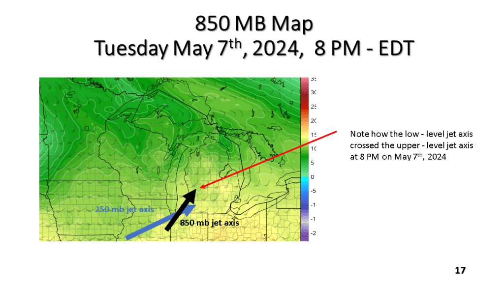
The Southern Great Lakes several tornadoes (2 EF-2), more than a dozen reports of hail larger than 2″, damaging winds, and locally heavy rainfall during the evening of Tuesday May 7th, 2024.