This is the final version and contains information on recent warming trends


This is the final version and contains information on recent warming trends


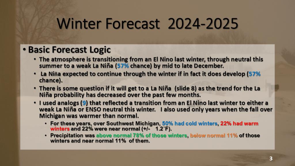
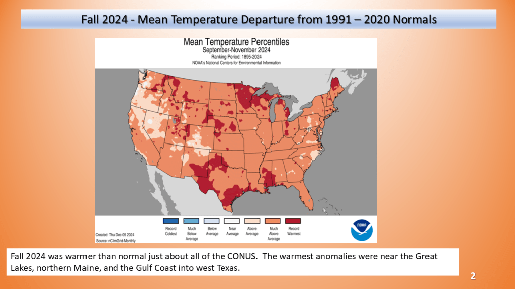
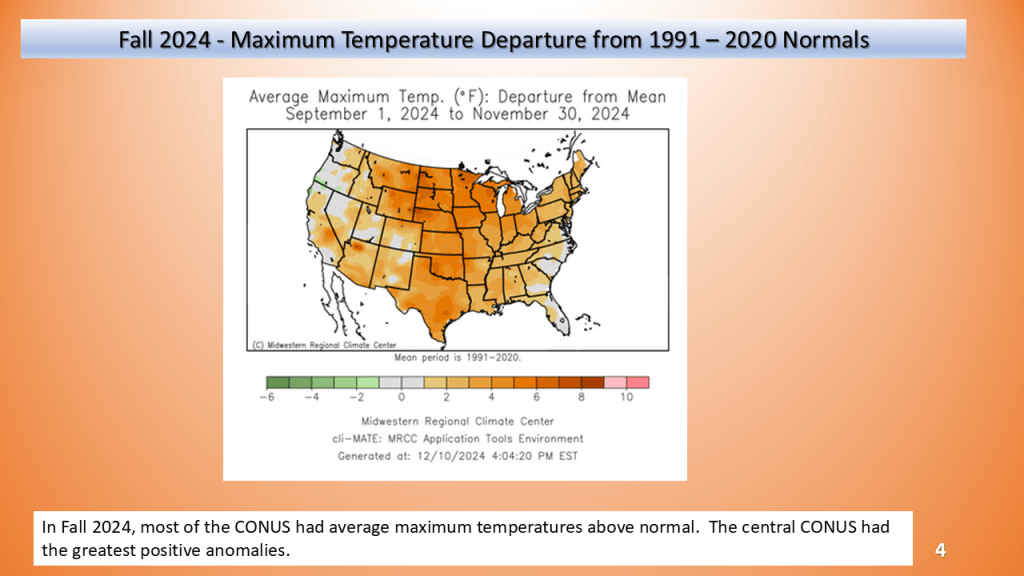
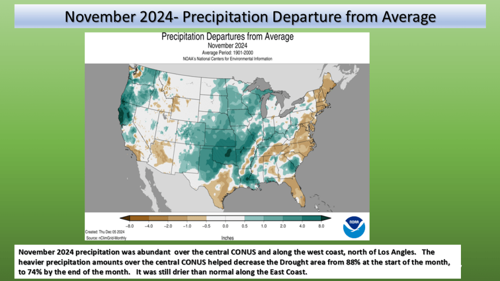
Nationally, fall of 2024 was the warmest on record. It was also the 36th driest fall on record.


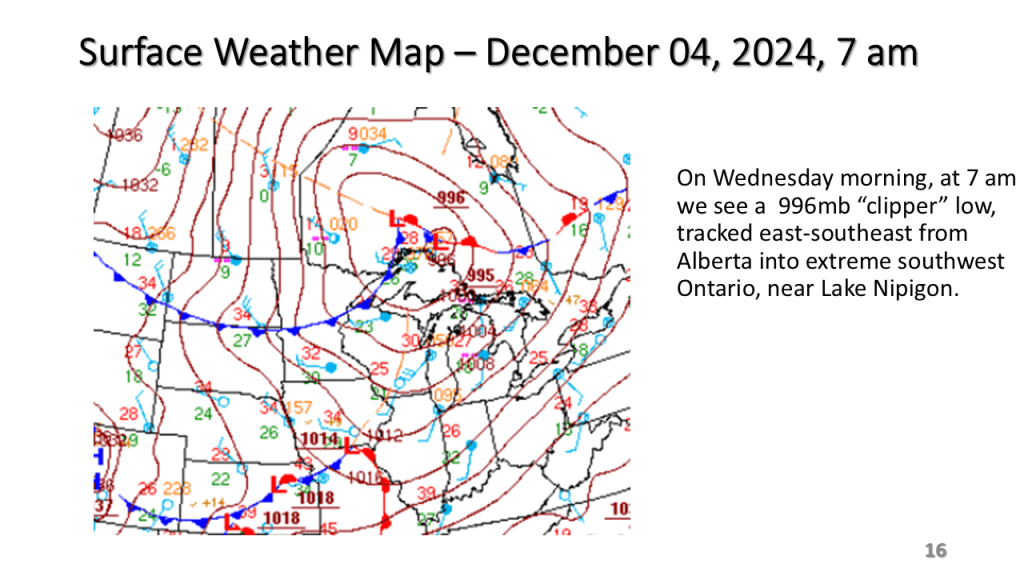
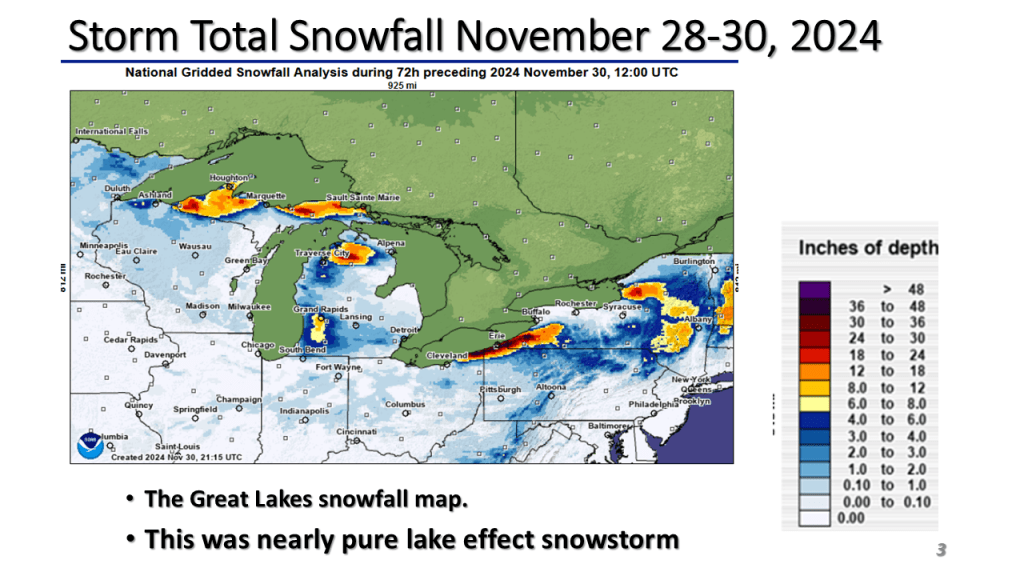
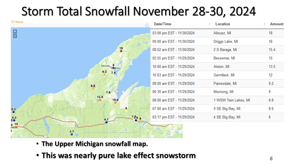
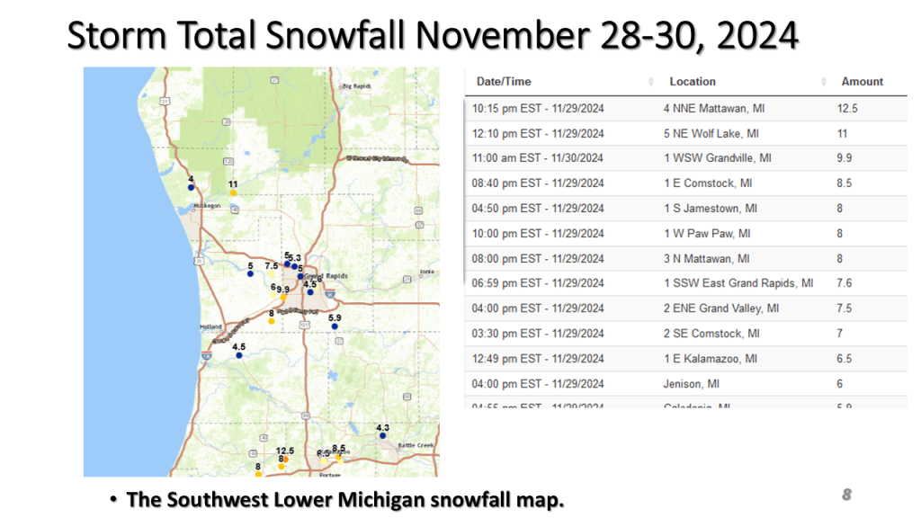
This was the 3rd Winter storm to impact Michigan since Thanksgiving.

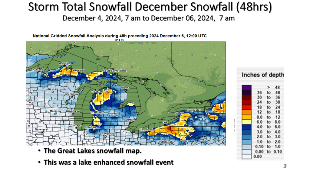
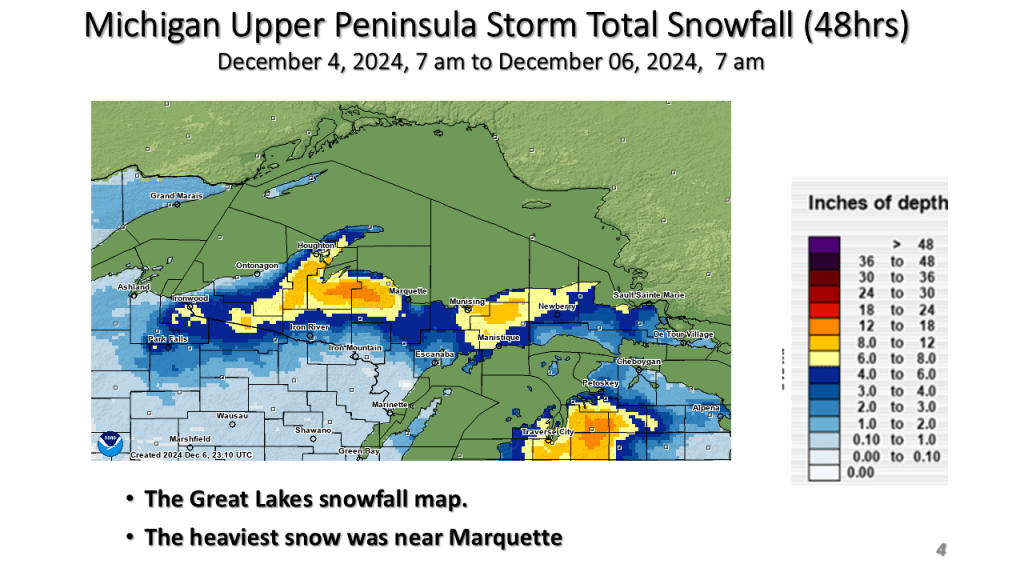
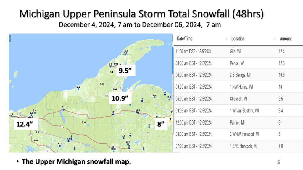


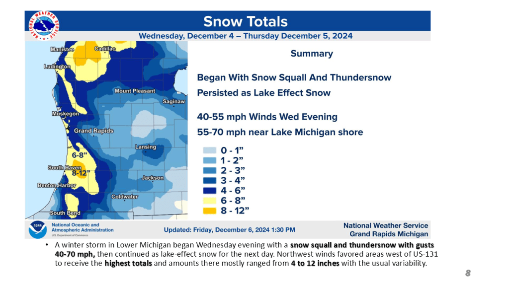
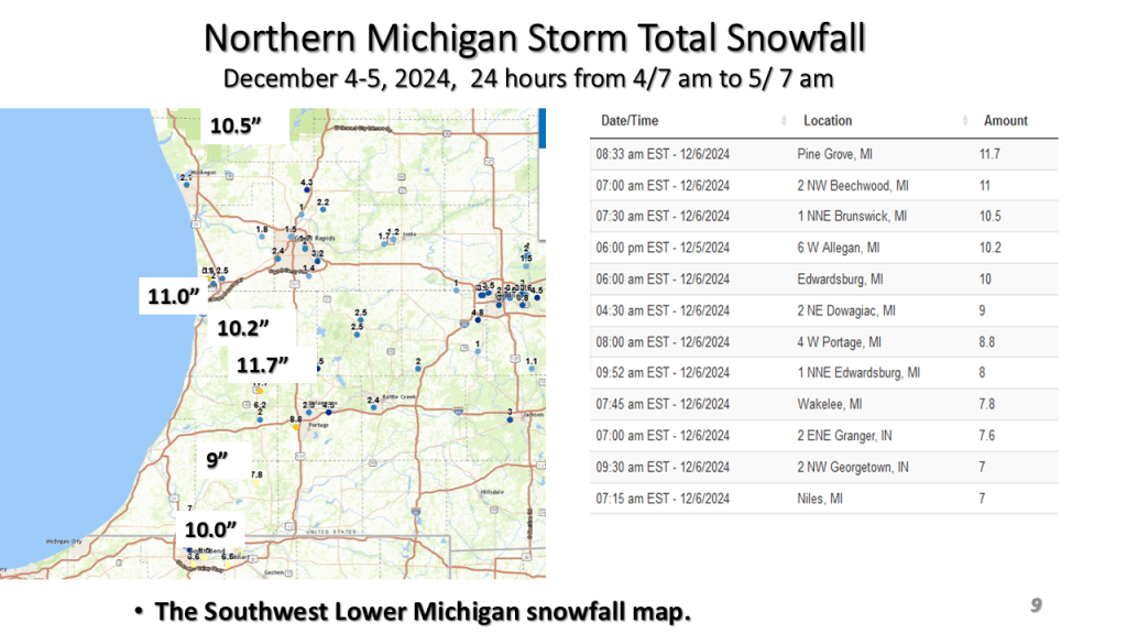
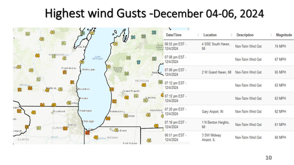


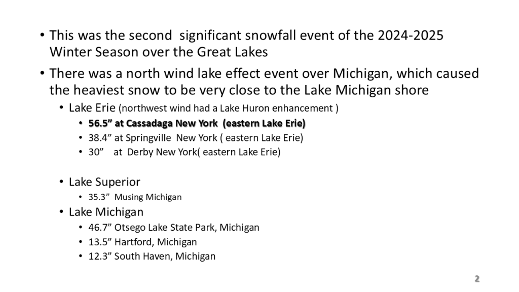


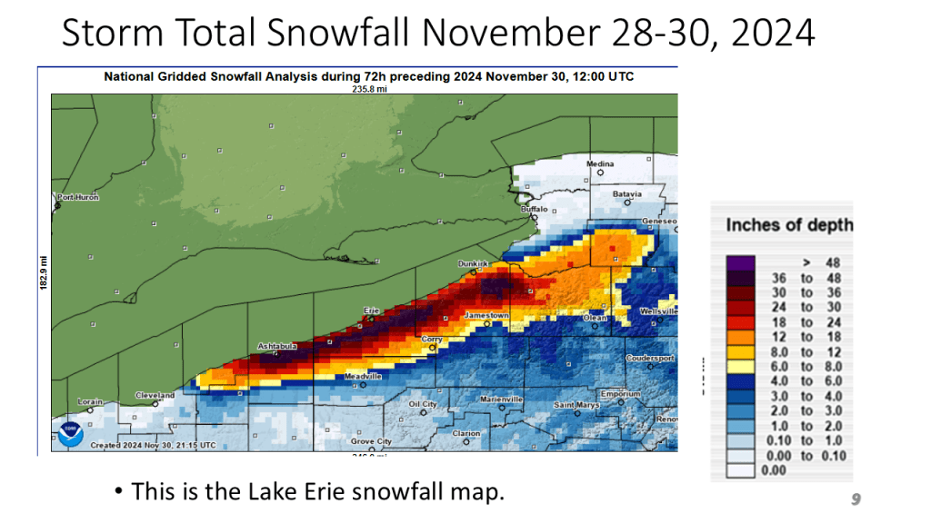
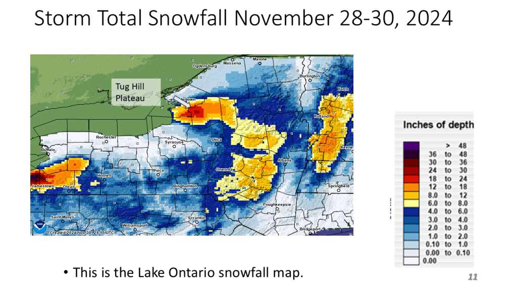
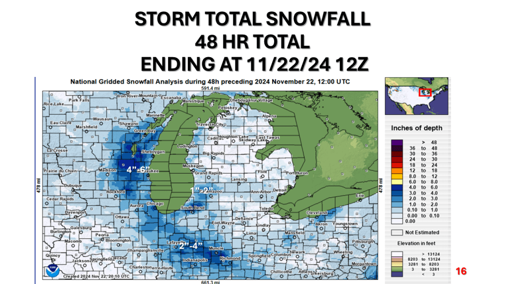
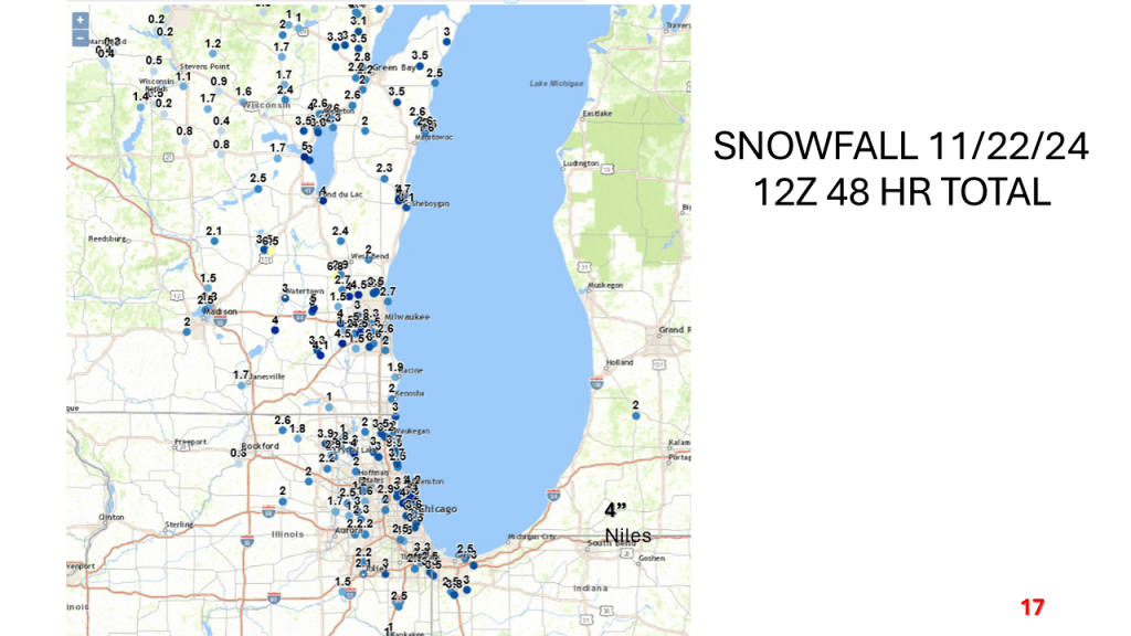
Heavy lake effect snow impacted all of the Great Lakes between Wednesday evening and this morning. Many areas had over 2 feet of snow.


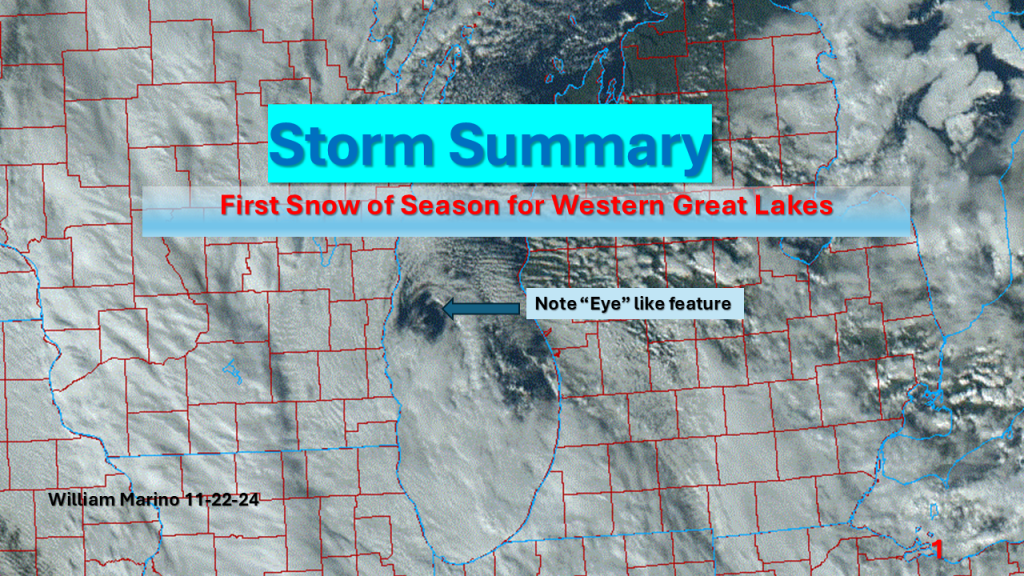
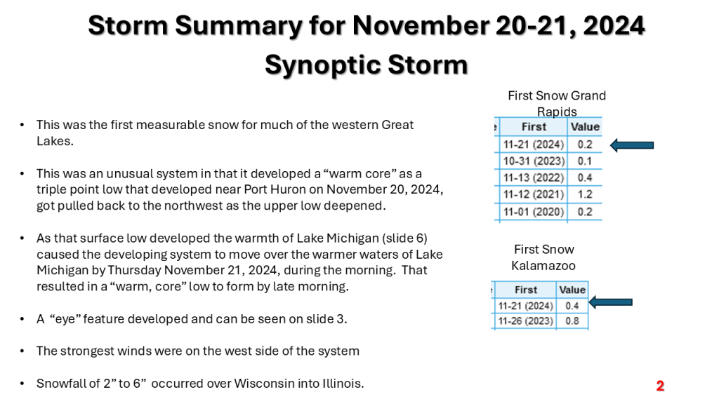
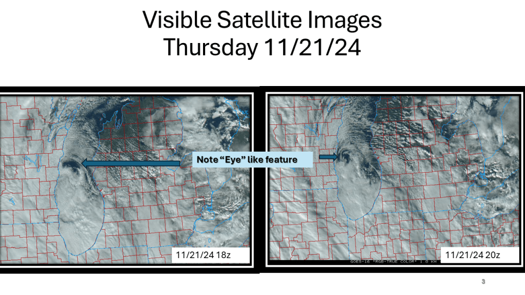
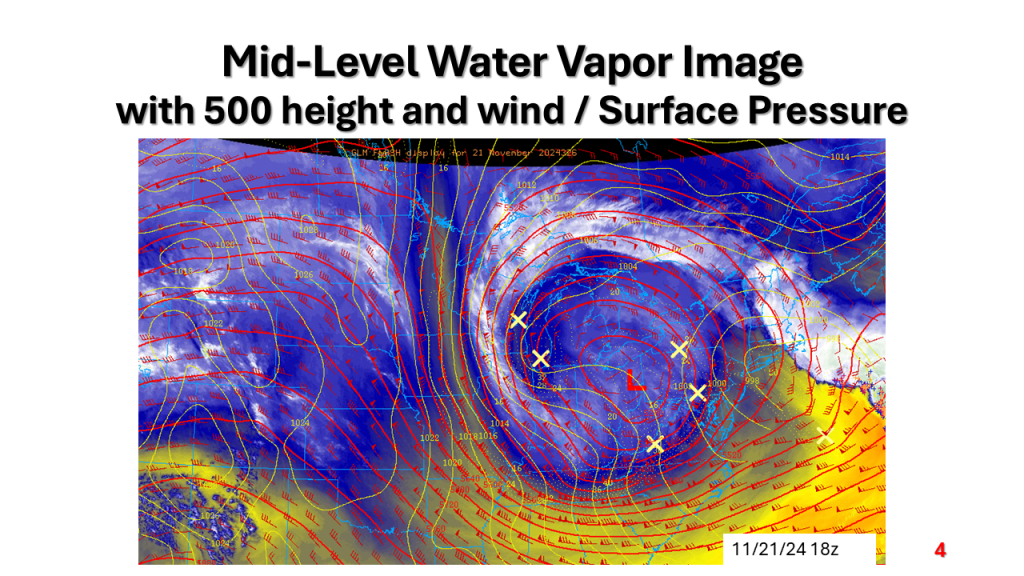
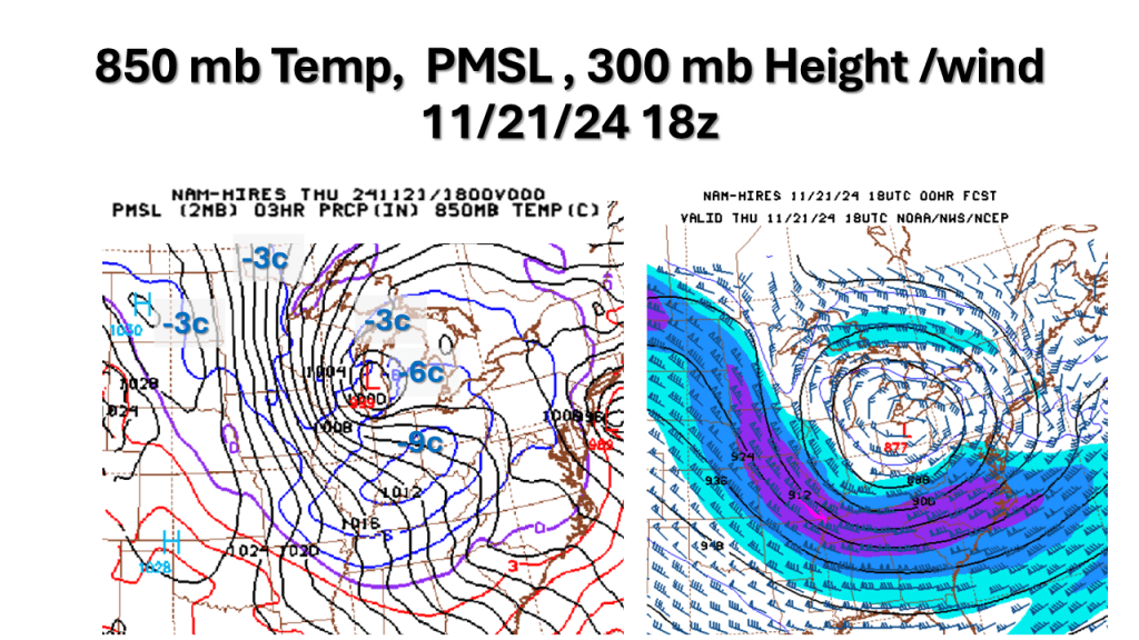
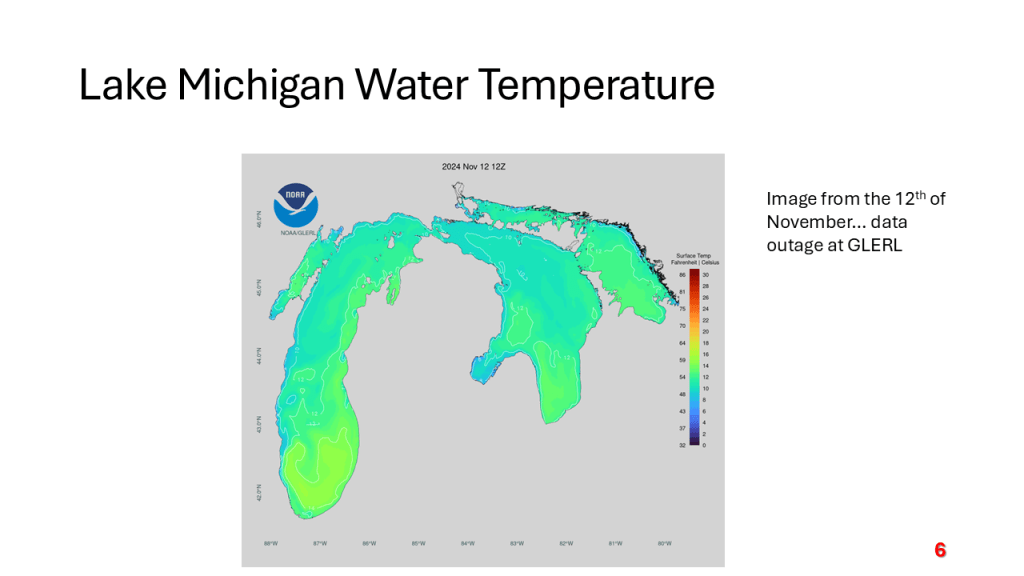
A strong November storm system brought the first snow of the season to parts of the western Great Lakes. Due to the warmth of Lake Michigan and that the surface low moved over Lake Michigan it developed an “Eye” like feature during the afternoon of Thursday, November 21, 2024.


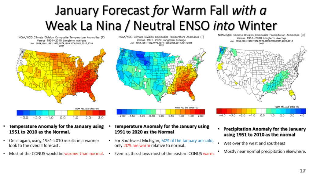
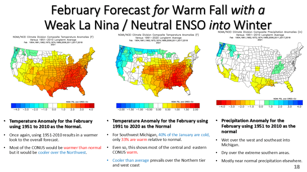
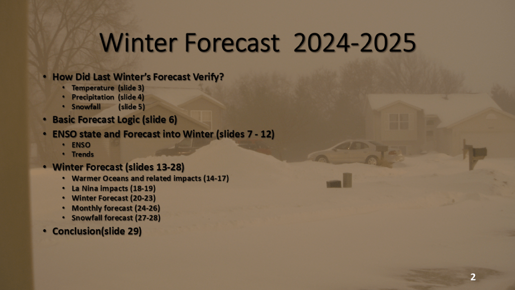
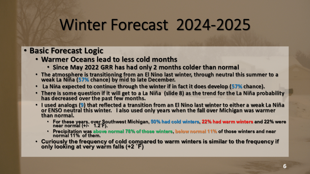
This version of the winter forecast has the seasonal forecast as well as monthly forecasts from December through February.