
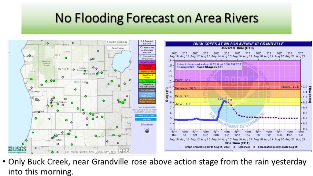
DTX August 24th Event Flooding Link


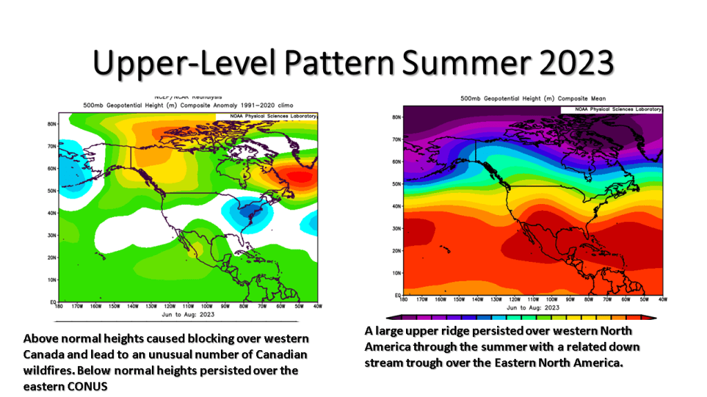


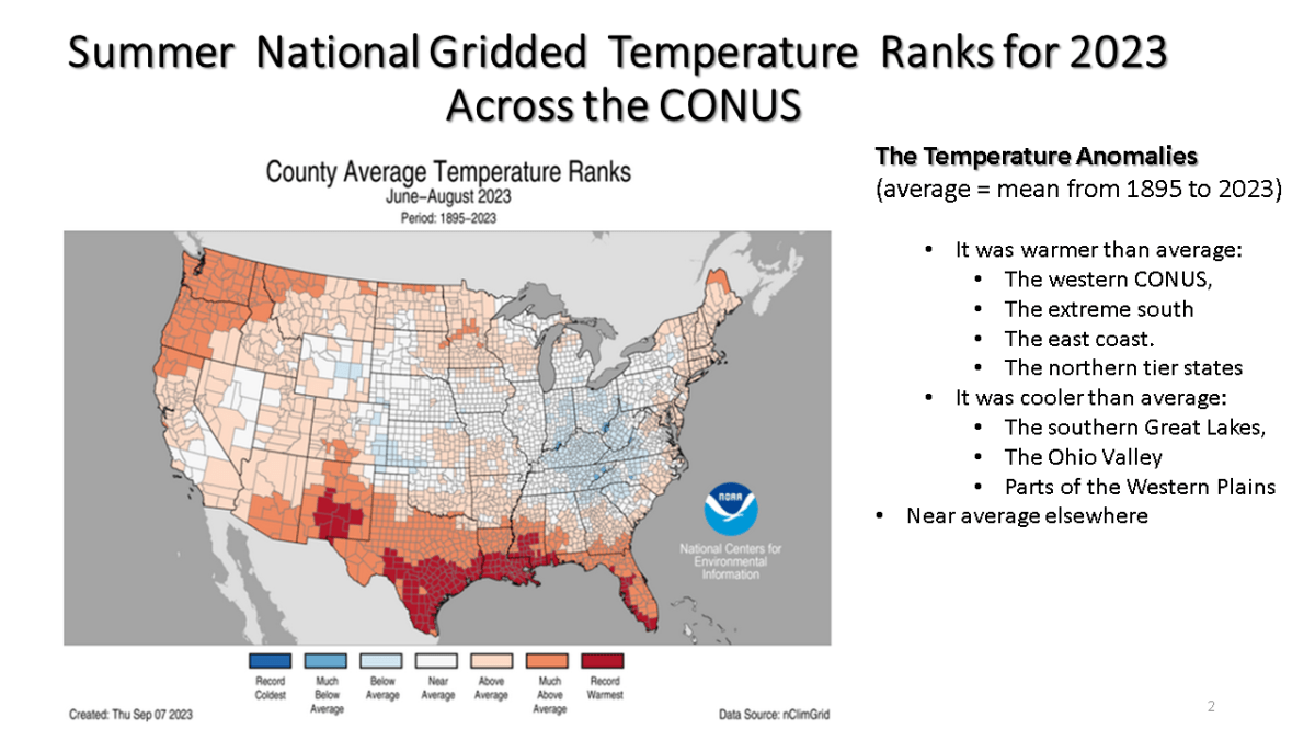
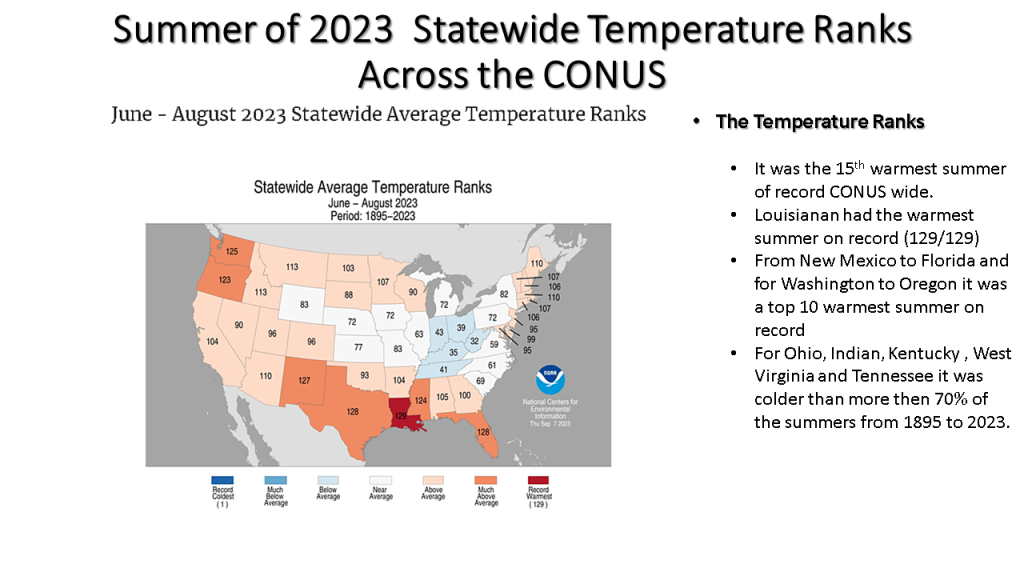
This was a summer that featured persistent weather patterns over most of North America and lead to one of the most active Canadian wildfire seasons on record. It also lead the the 15th warmest summer on record (back to 1895) over the CONUS.
While it was the 15th warmest summer on record nationally, not all of the CONUS had a warm summer. You may want to find out how your area did relative to normal for this summer.


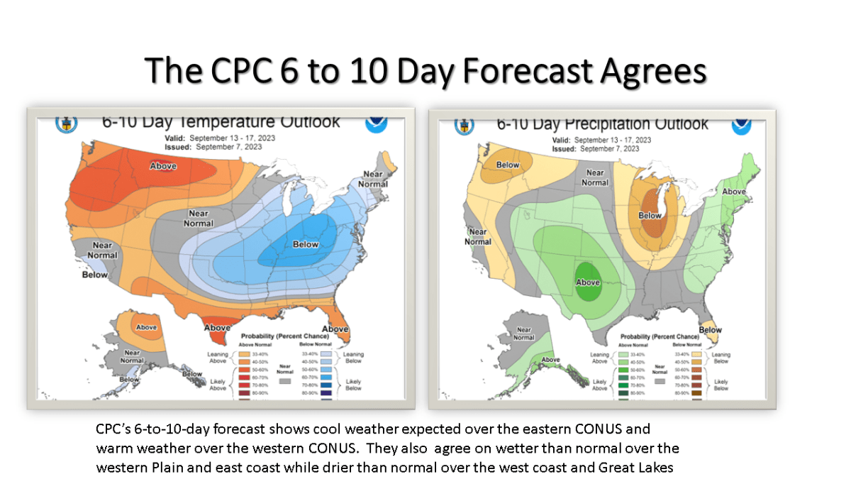
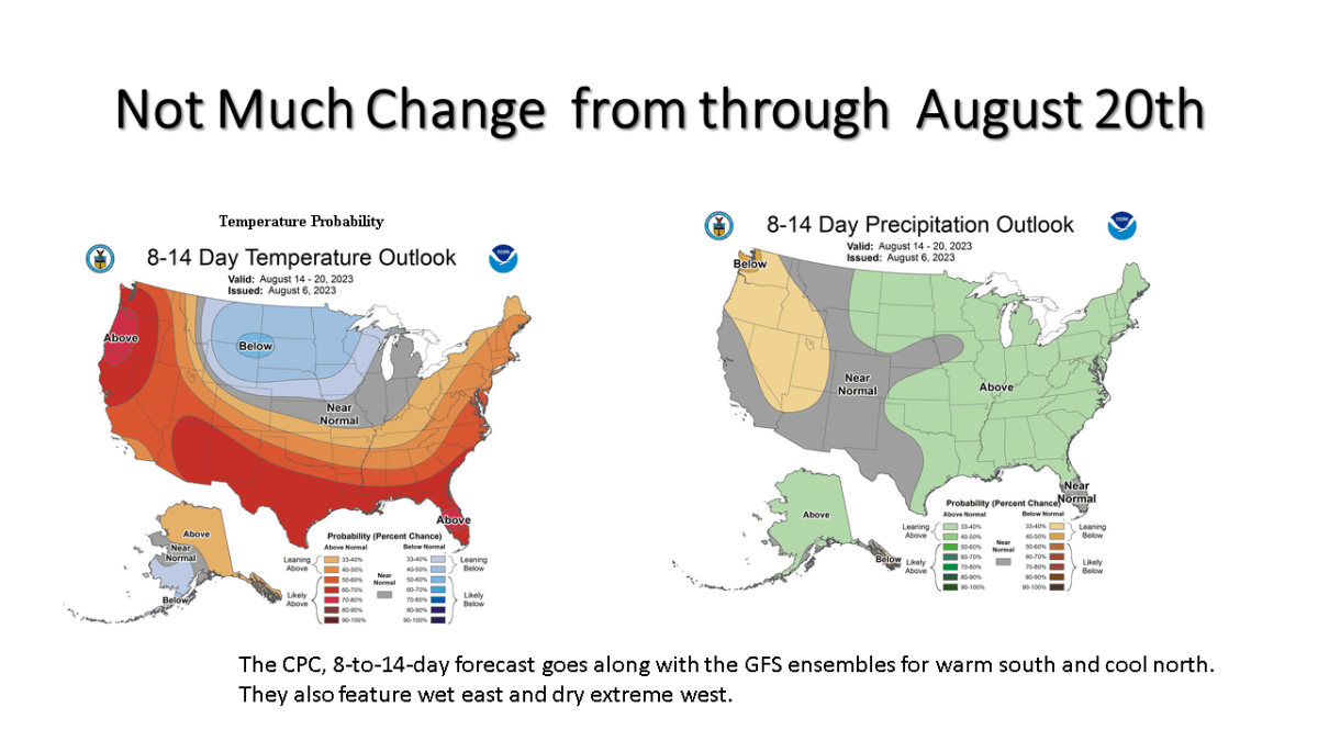
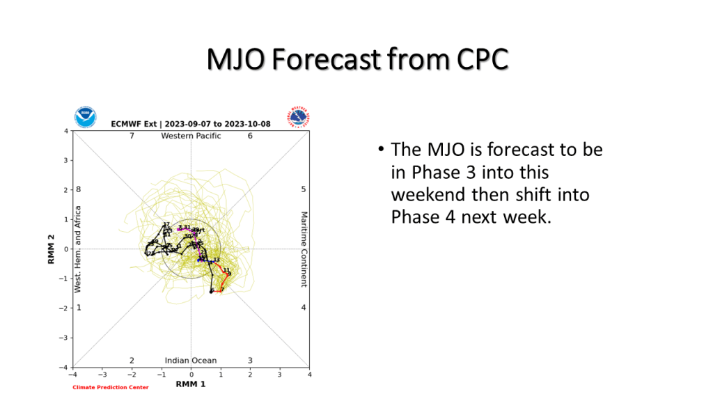
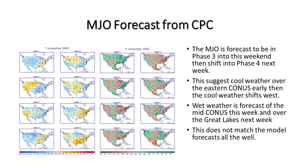
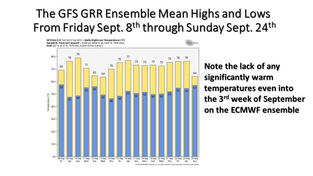
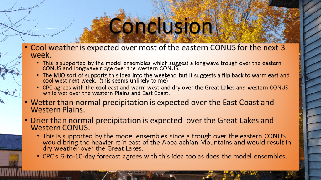
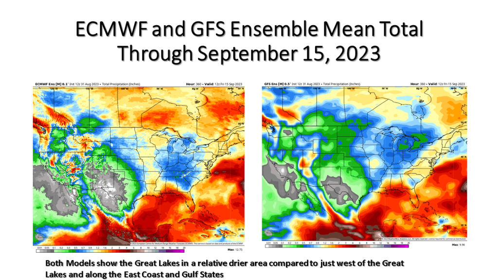
Expect the next 3 weeks to be cooler than normal over most of the eastern United States. It will be dry over the Great Lakes but very wet over the eastern seaboard.


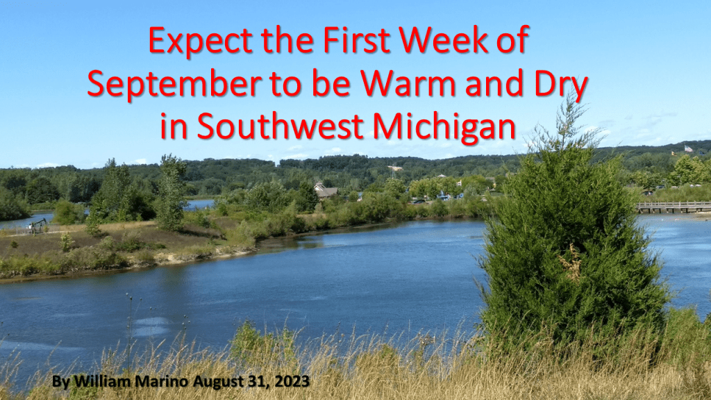
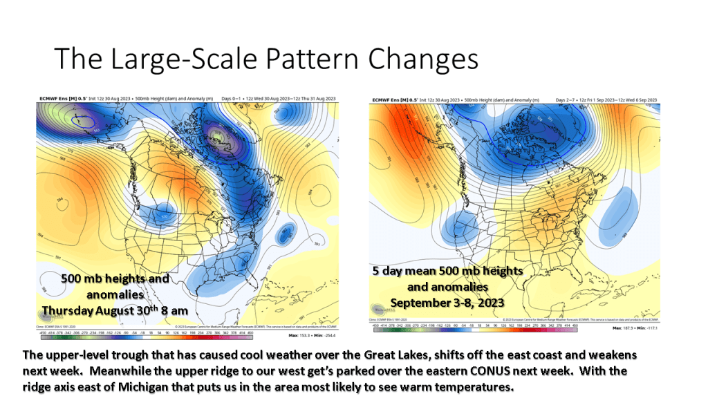
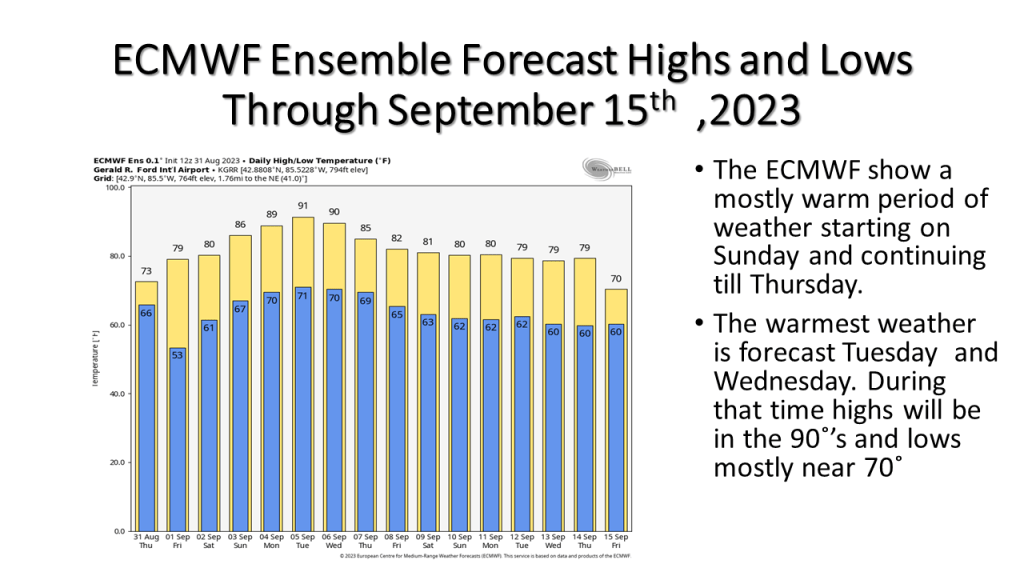
Warmer temperatures are expected from Labor Day into the middle of the week. A cold front coming through the area in late Wednesday/Thursday time frame may bring showers and slightly cooler weather .


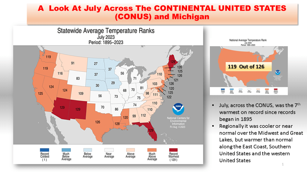
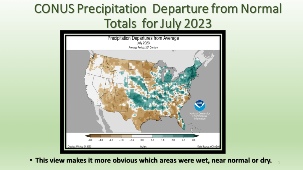
As promised I have posted the national images of July 2023. The short story is it was the 7th warmest and 45th wettest for the CONUS. In Michigan it was the 58th warmest and 5th wettest on record.


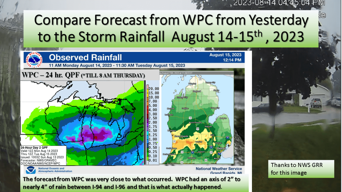
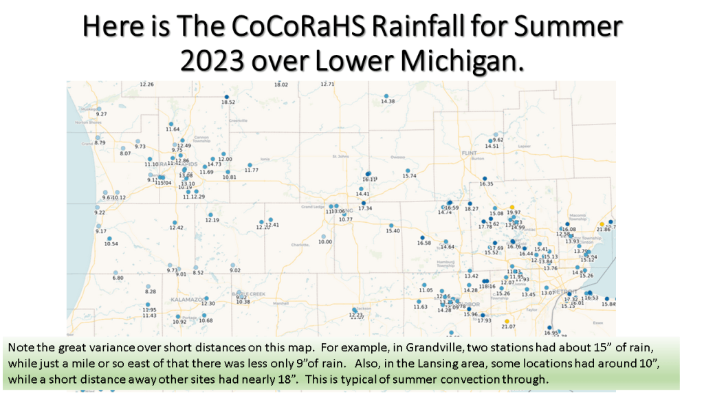
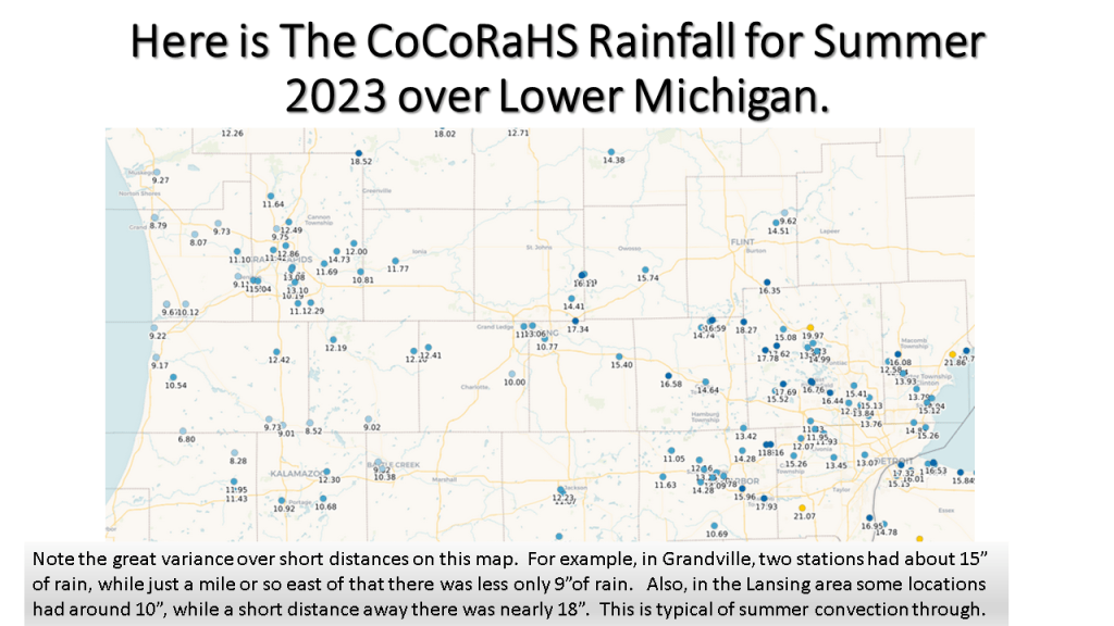
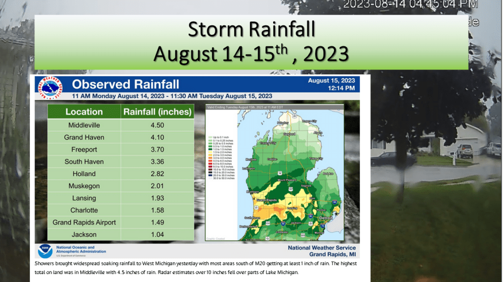
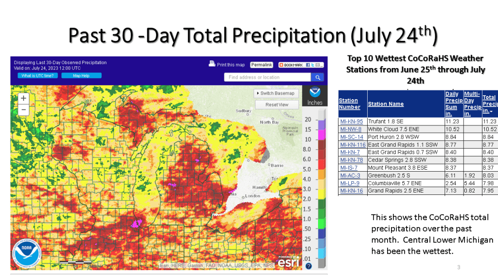
We forecast heavy rain between I-94 and I-96 and that is exactly what did happen. The heaviest rainfall report showed 4.50 inches in Middleville, most of that area had between 1″ and 3″ of rain from the event.


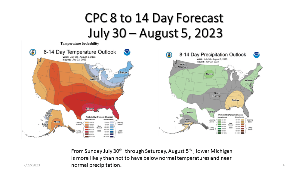
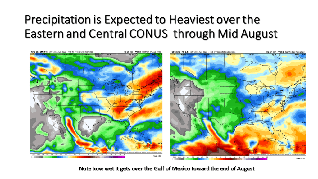
Cooler than normal temperatures are expected to prevail over a large part of the northern CONUS into mid August.
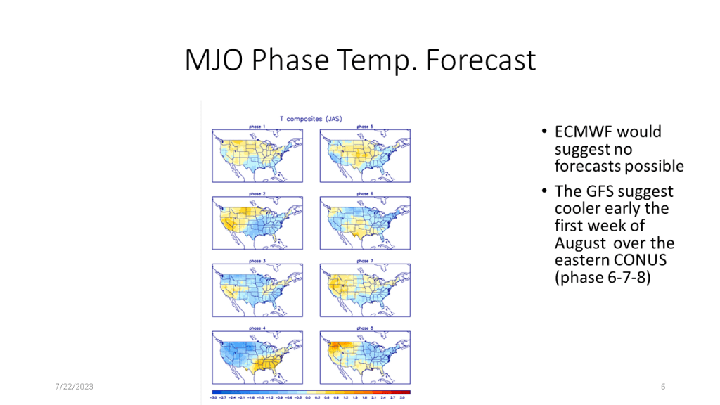
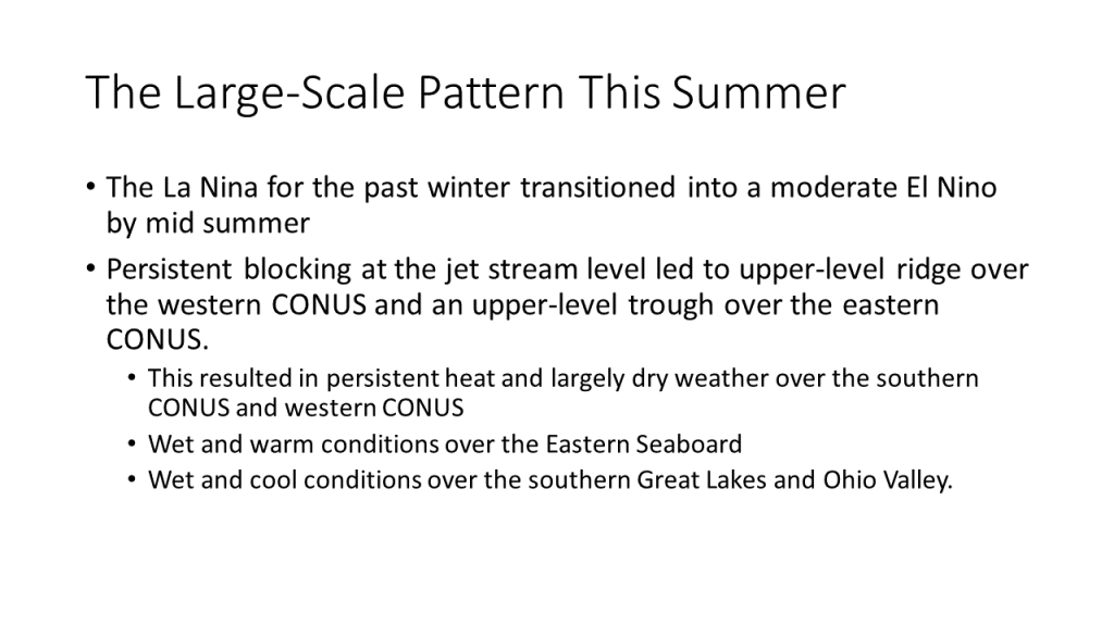
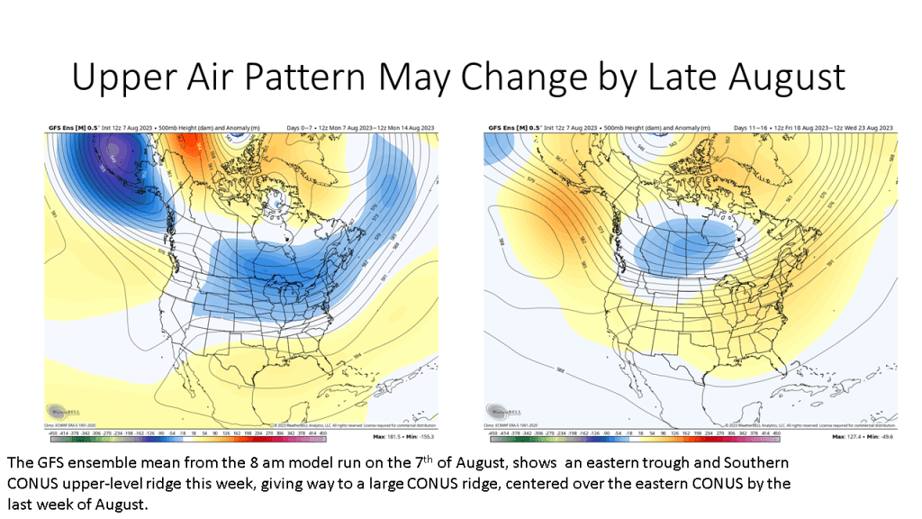
We continue to see an overall eastern North American trough and western upper level ridge prevailing through the 3rd week of August. It does however look like a case of discontinuous retrogression by the later part of August as the models show a large upper ridge developing late in the month over most of the Continental United States (CONUS).


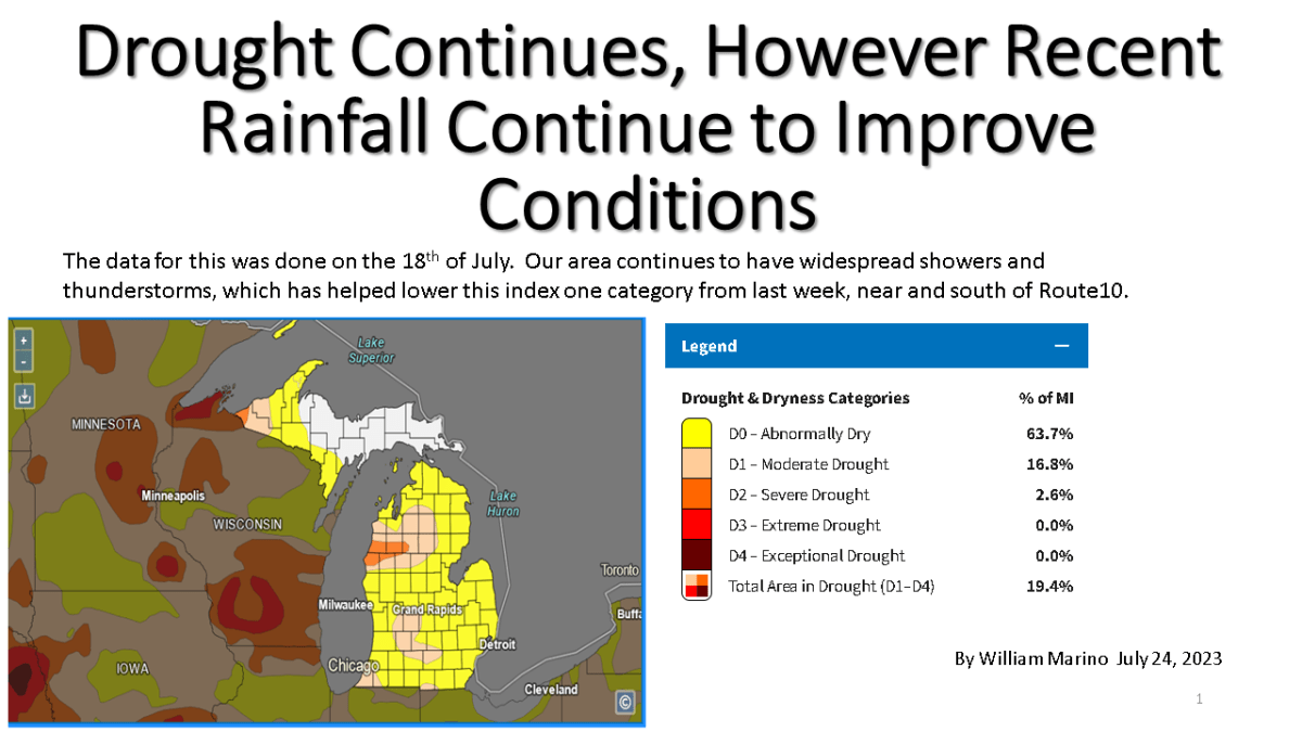
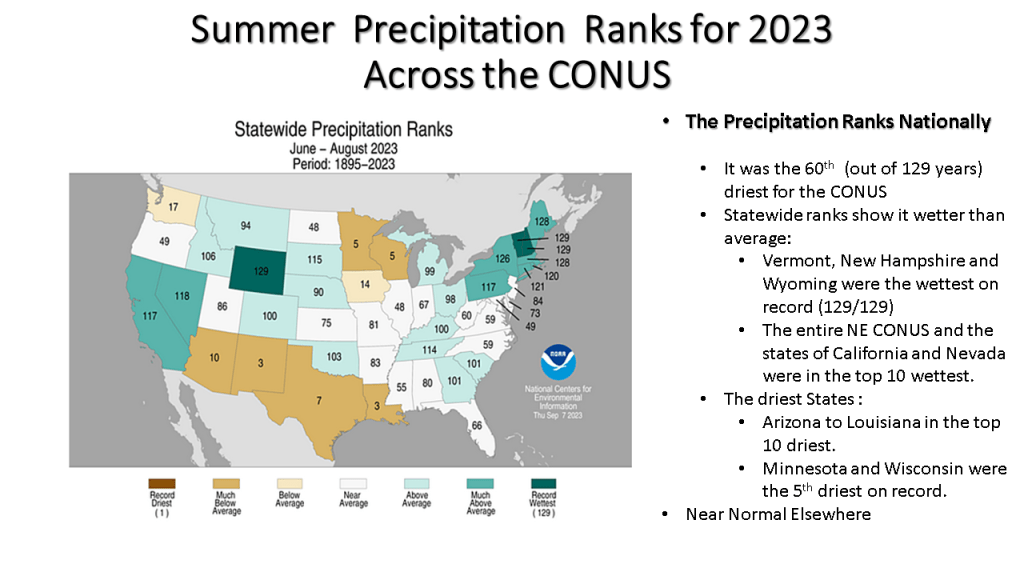
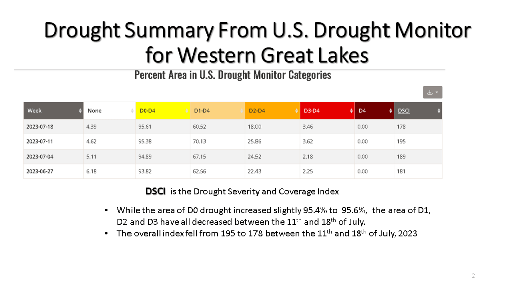
Area wide rainfall of 3 to 8 inches in July has helped reduce drought impacts but even so, the 90 day precipitation anomalies are still near 5 inches.


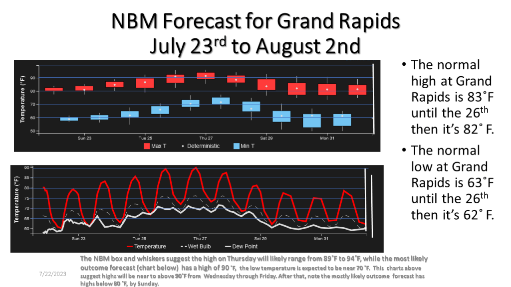
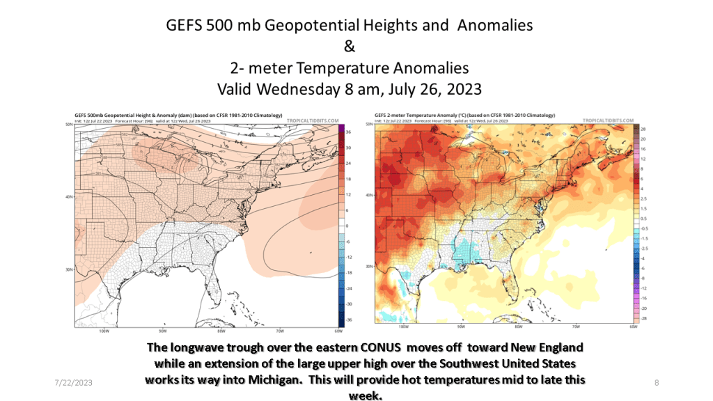
It’s been cool for the 2nd and 3rd week of July, however a dramatic change to hot weather is expected from Wednesday through Saturday.