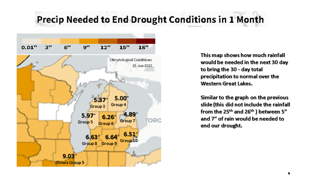
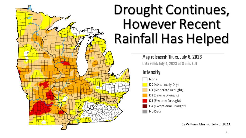


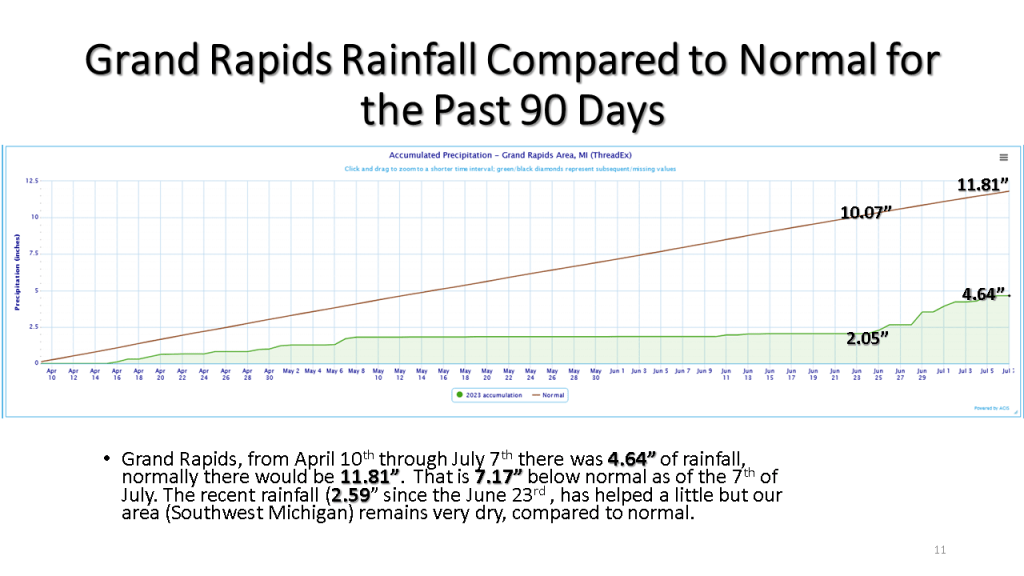

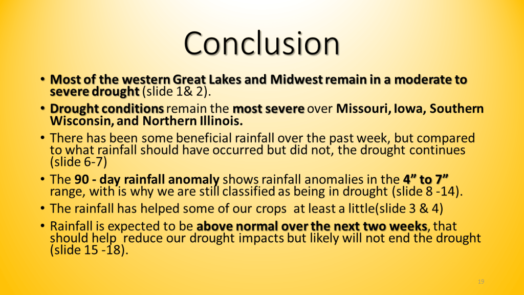
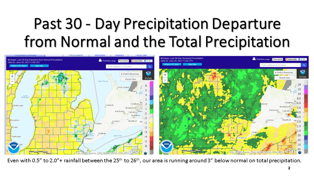
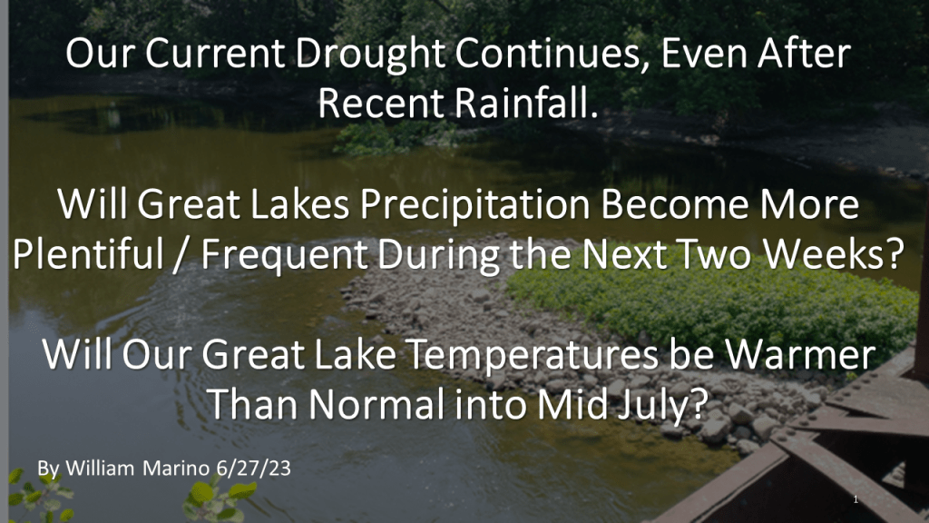
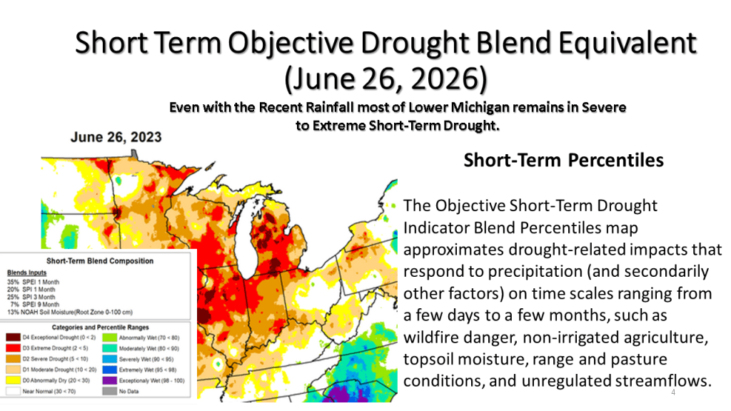
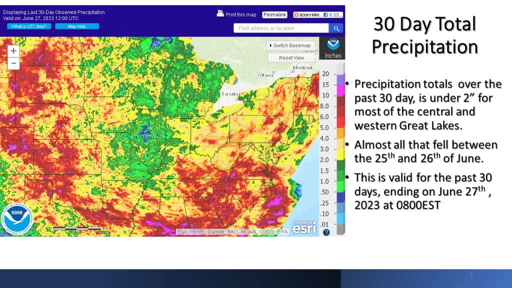
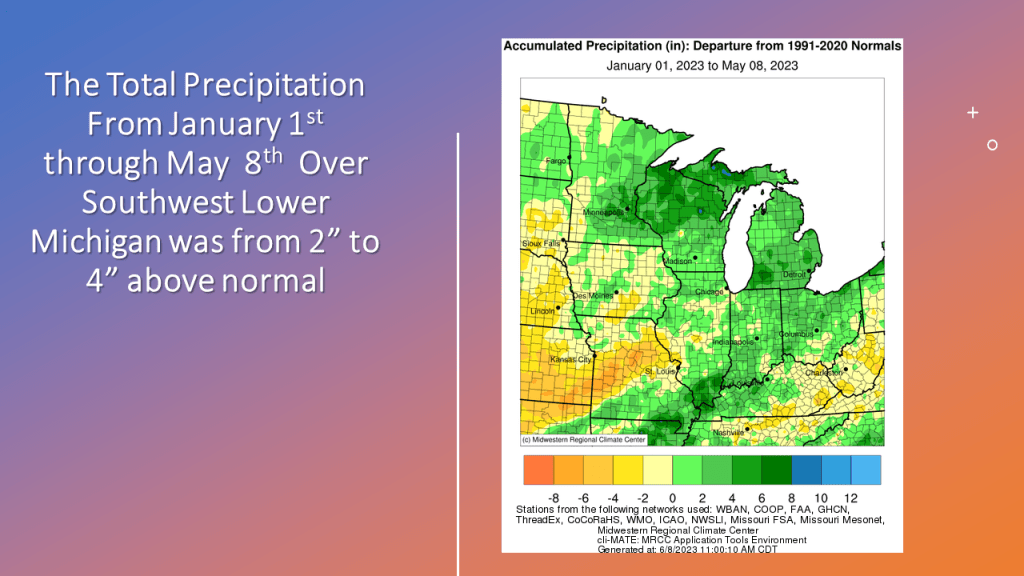
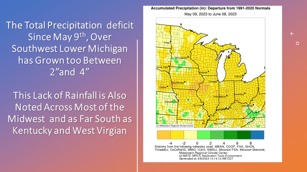
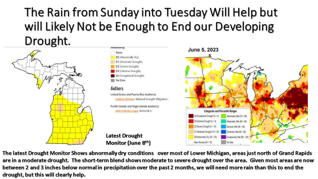
Recent rainfall has helped our drought improve some, but with rainfall anomalies being between 4 and 7 inches over the past 3 months, that has not come close to ending our current drought.
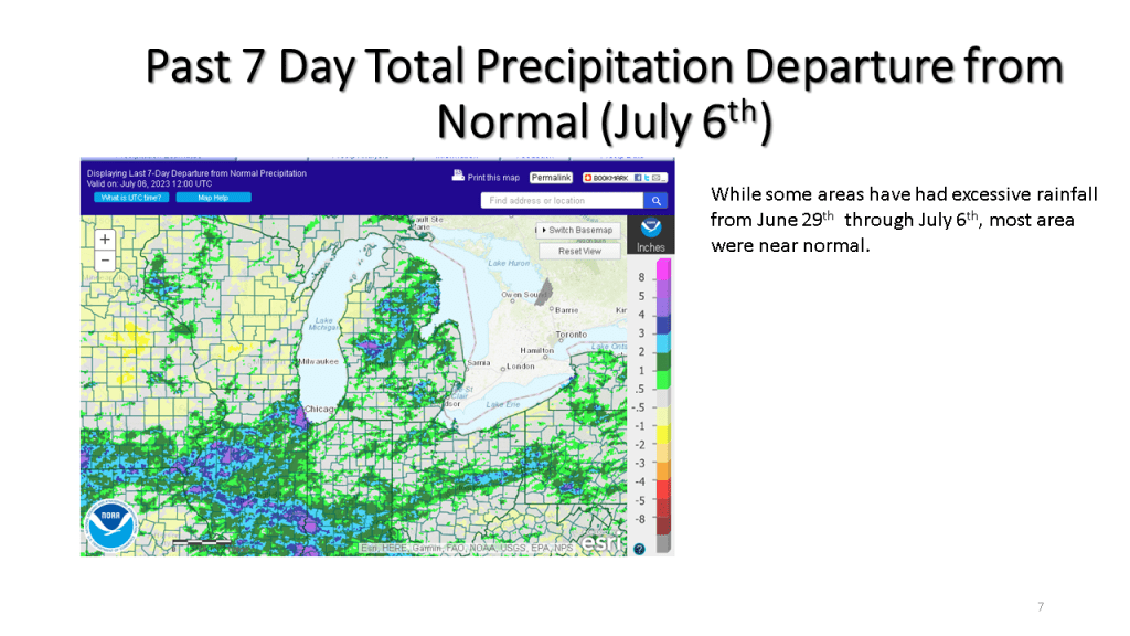
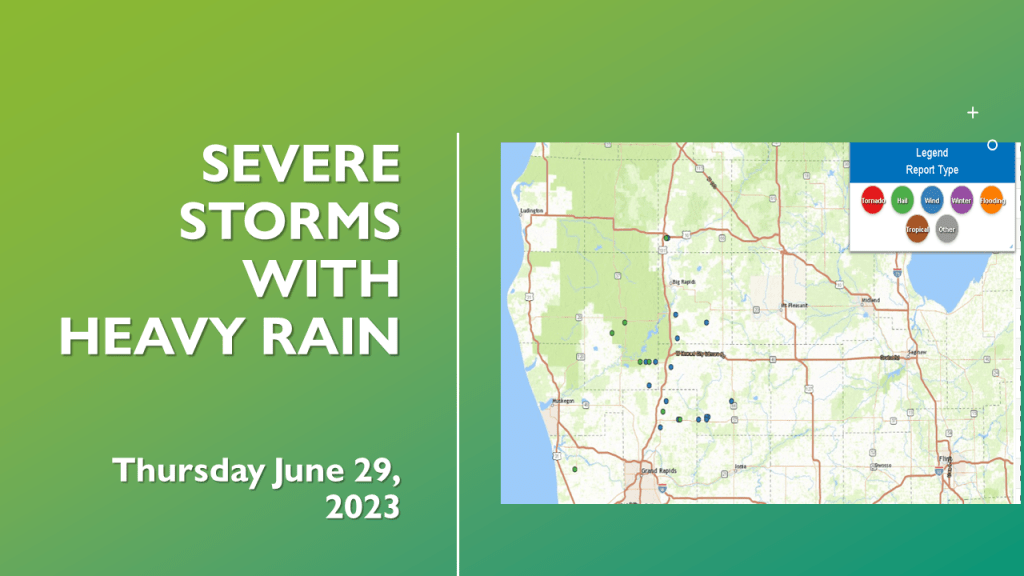
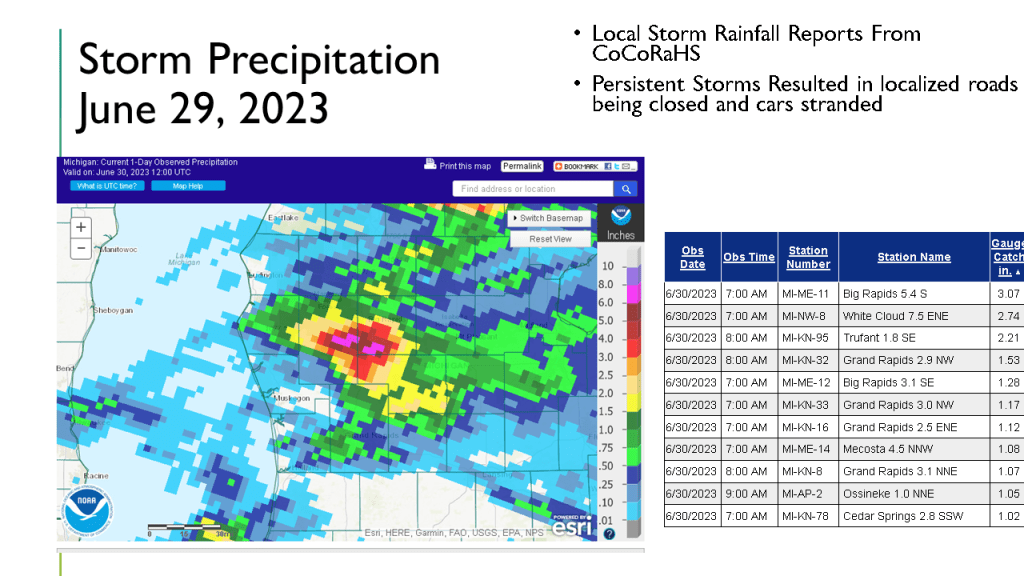
Severe storms during the evening of June 29th 2023 brought down trees and wires. Locally heavy rain causes some roads to be closed for a while.


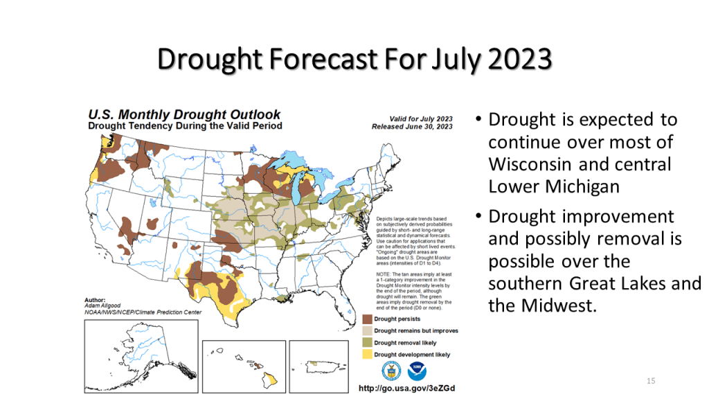
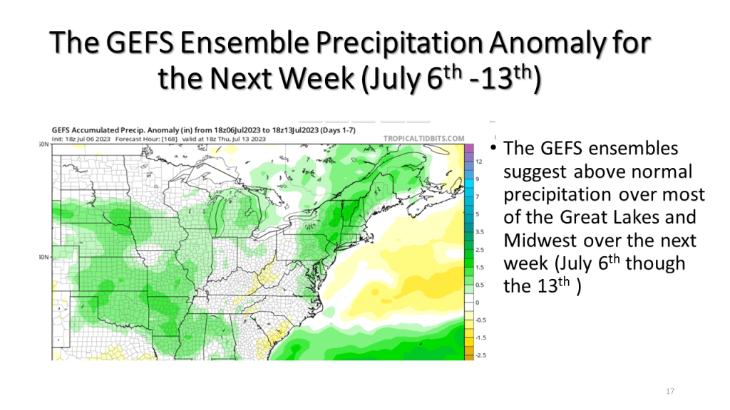
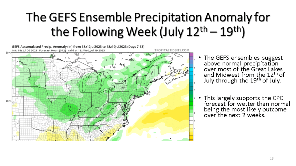
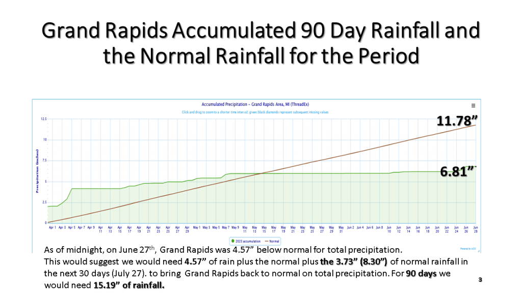
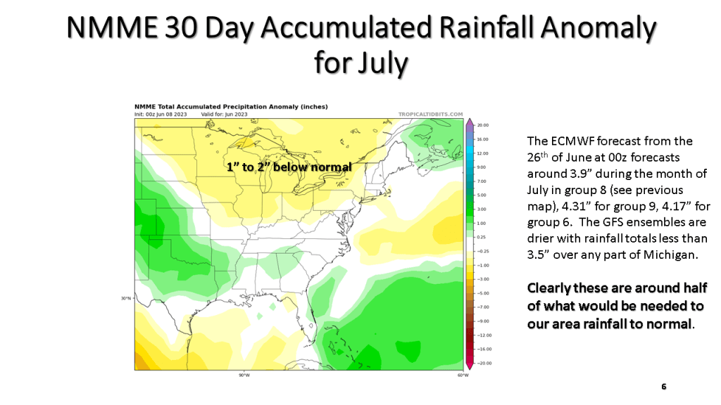
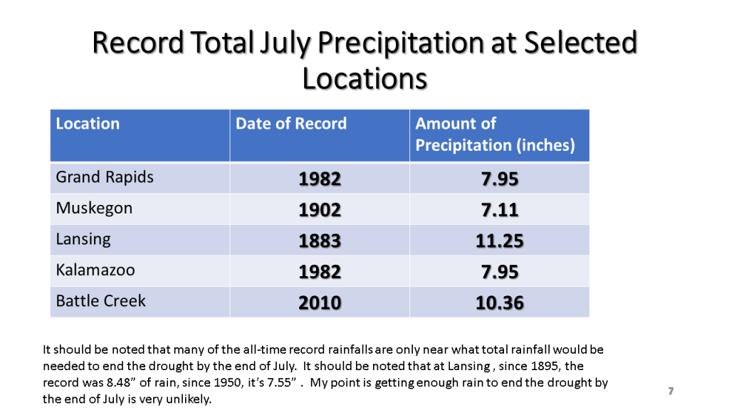
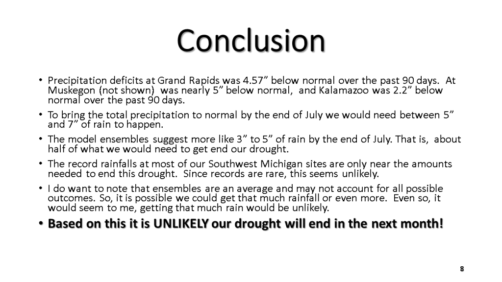
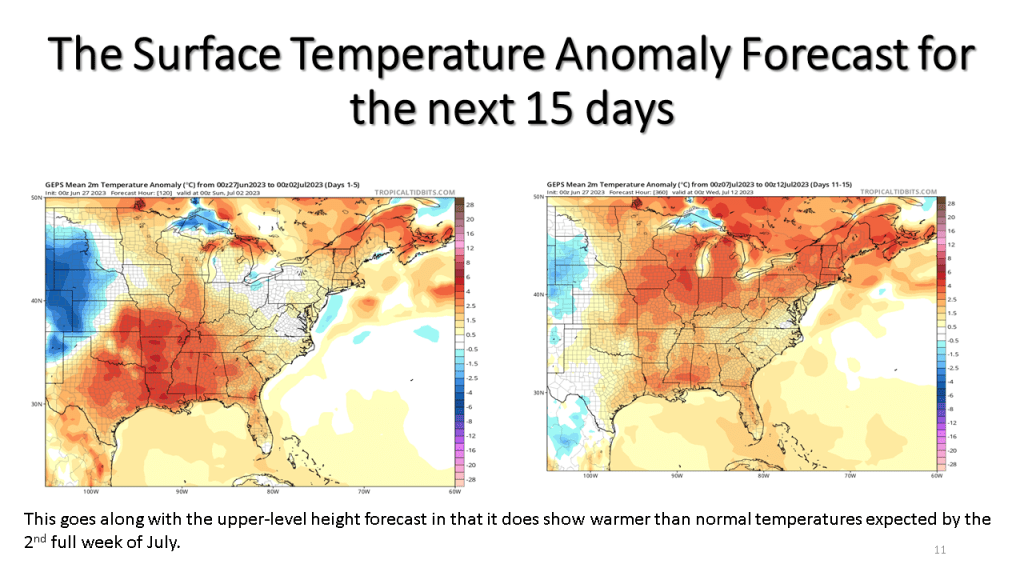
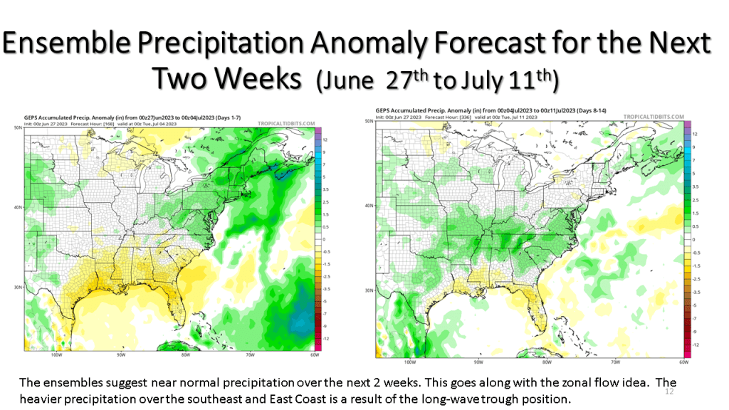
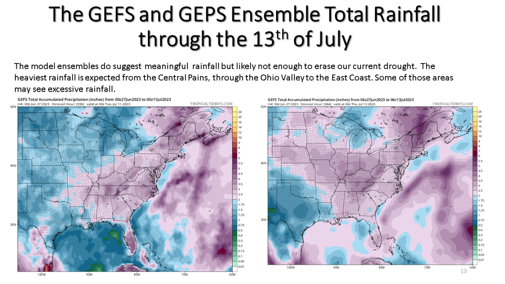
To end our current drought over southern Michigan we would need around 6 inches of rain by the end of July. This is near record totals for July at most of our climate sites. It would seem unlikely given our current weather pattern we would get that much widespread rainfall. So while we do expect more rain in the next month than the previous month, the expected rainfall will likely fall short of ending this drought.


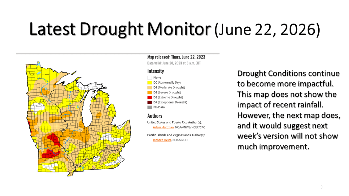
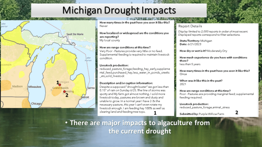
Our current drought and it’s impacts continue across Michigan, this blog looks at what is happening now and then what we should expect going forward into mid July.


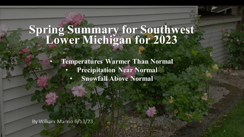
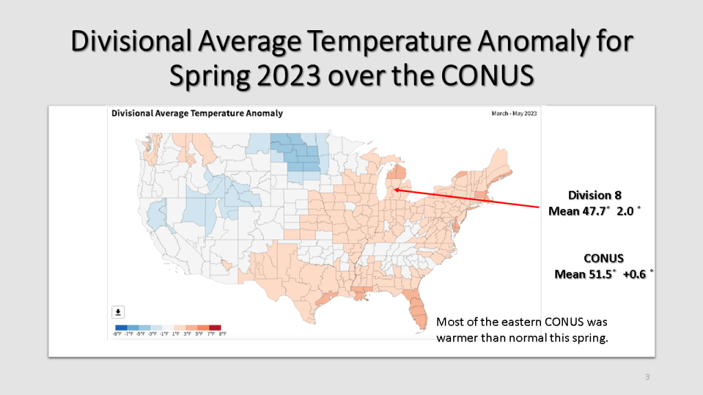
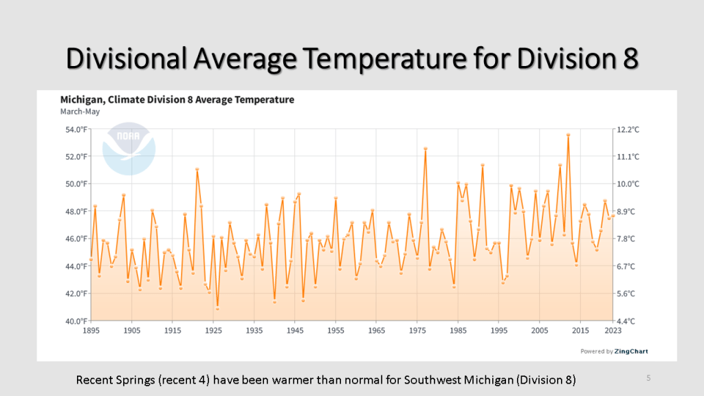
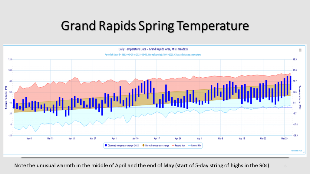
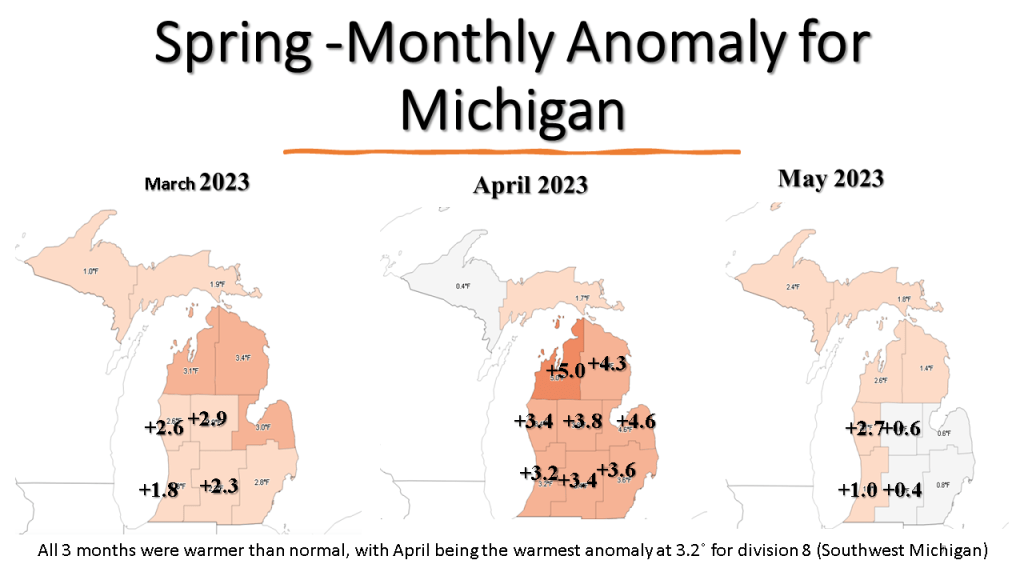
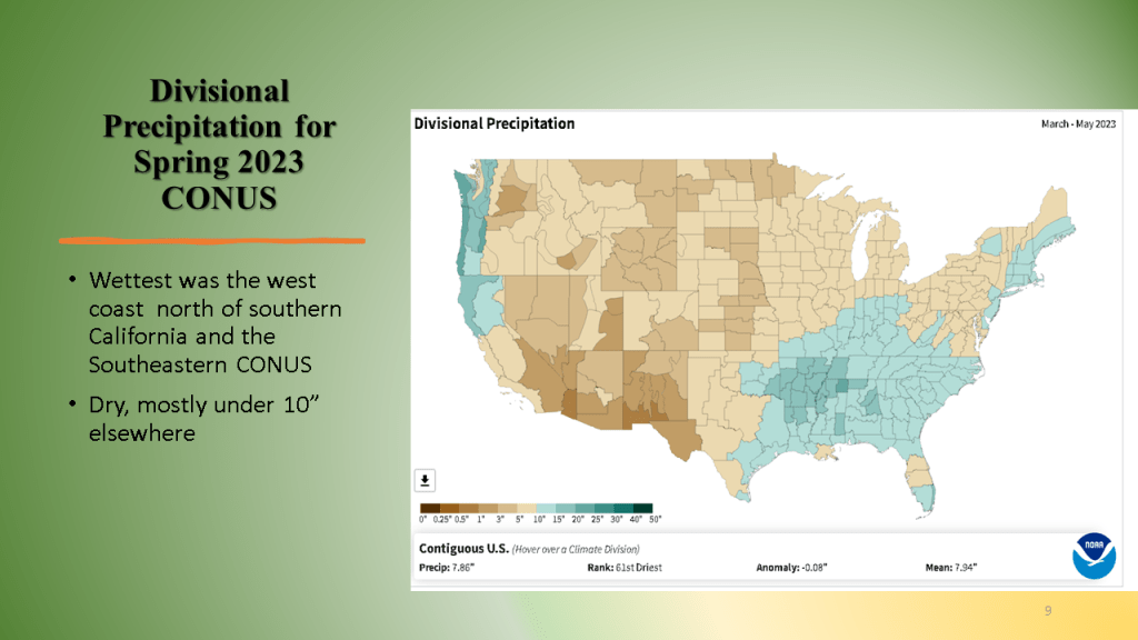
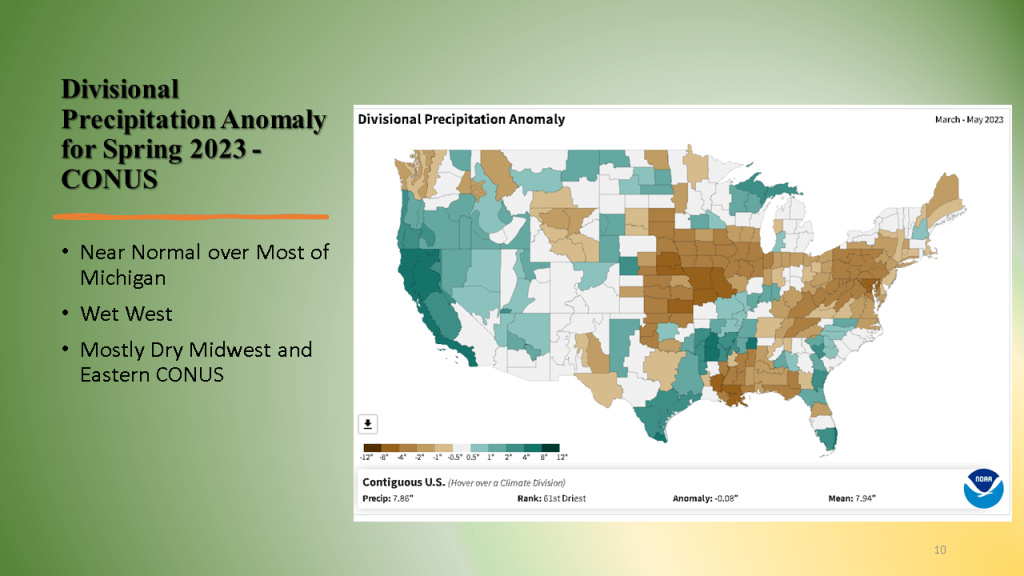
Spring started out in March, warmer than normal, snowy and wet but ended in May still warmer than normal but very dry over Lower Michigan.


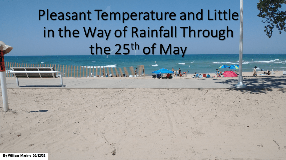
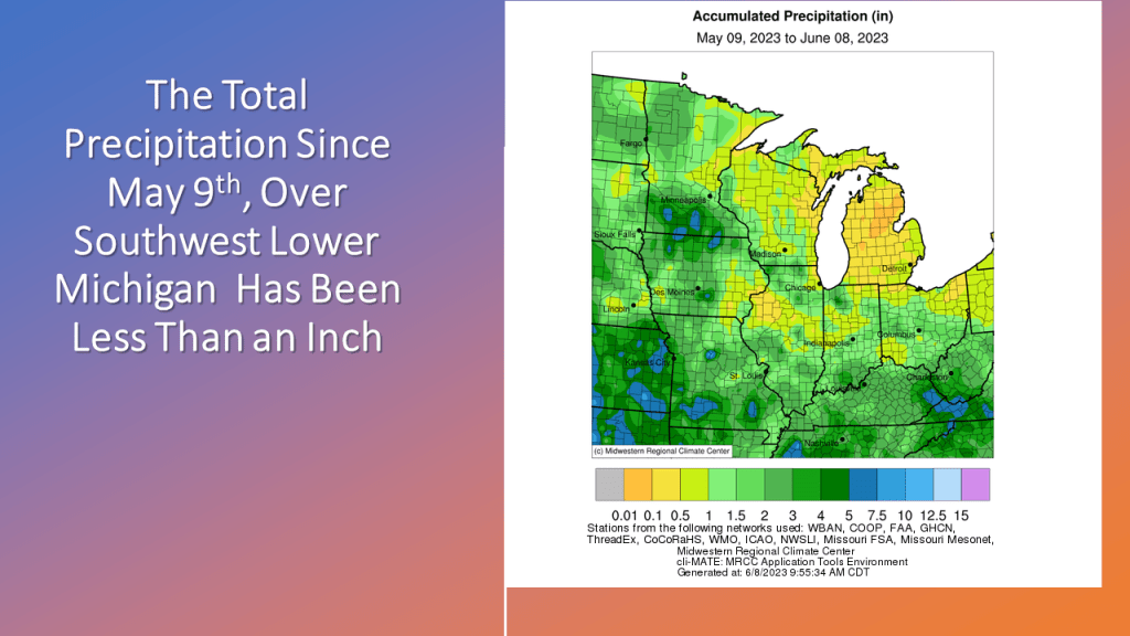
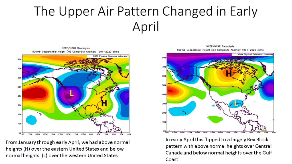
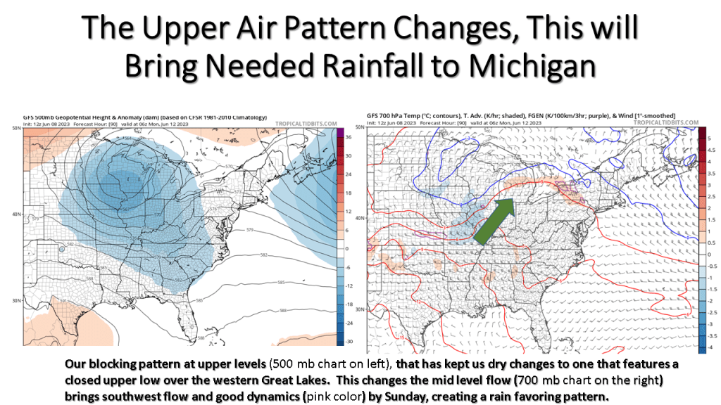
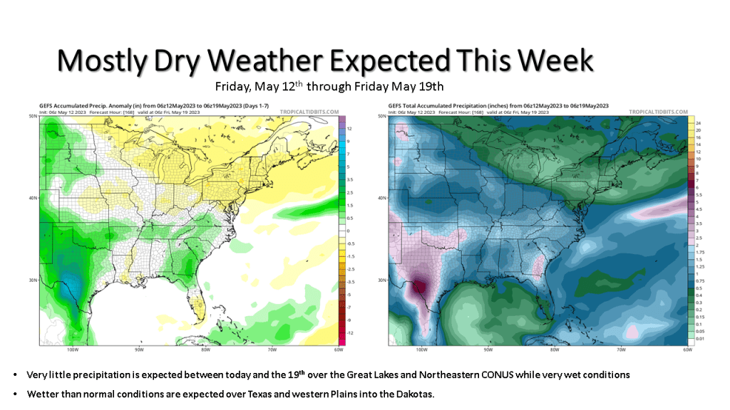
It’s been unusually dry is Lower Michigan since early May, this is expected to change by Sunday.


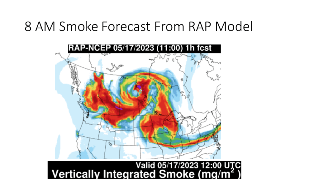
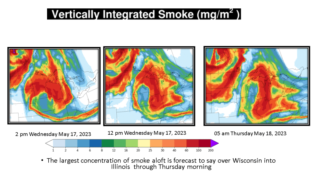
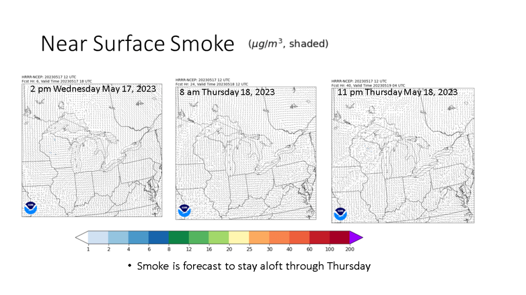
The smoke in the sky the past few days is coming from western and central Canada due to wildfires there.


Over Southwest Michigan, May has largely been drier than normal and cooler than normal Overall the next two weeks will mostly be that way.

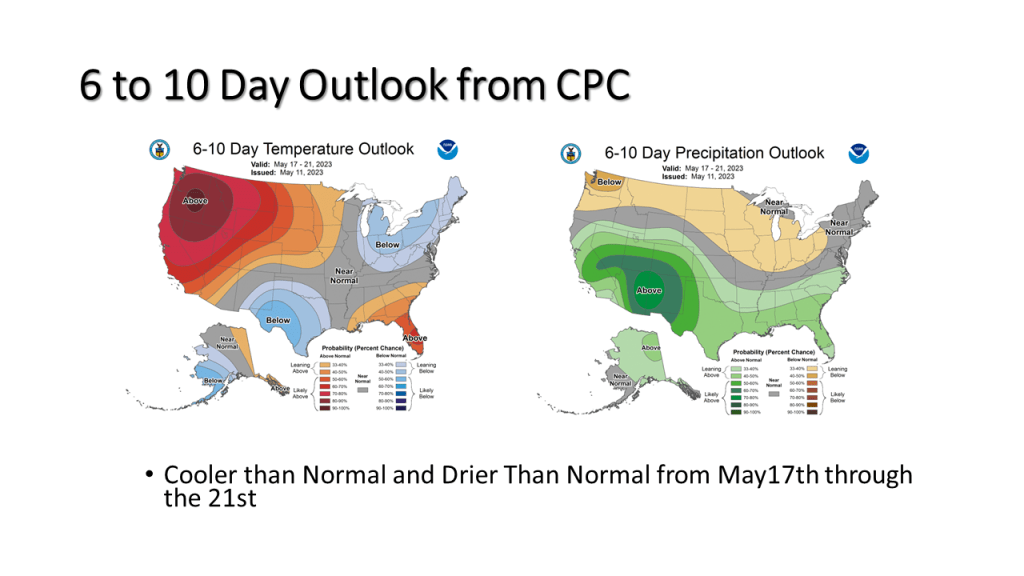


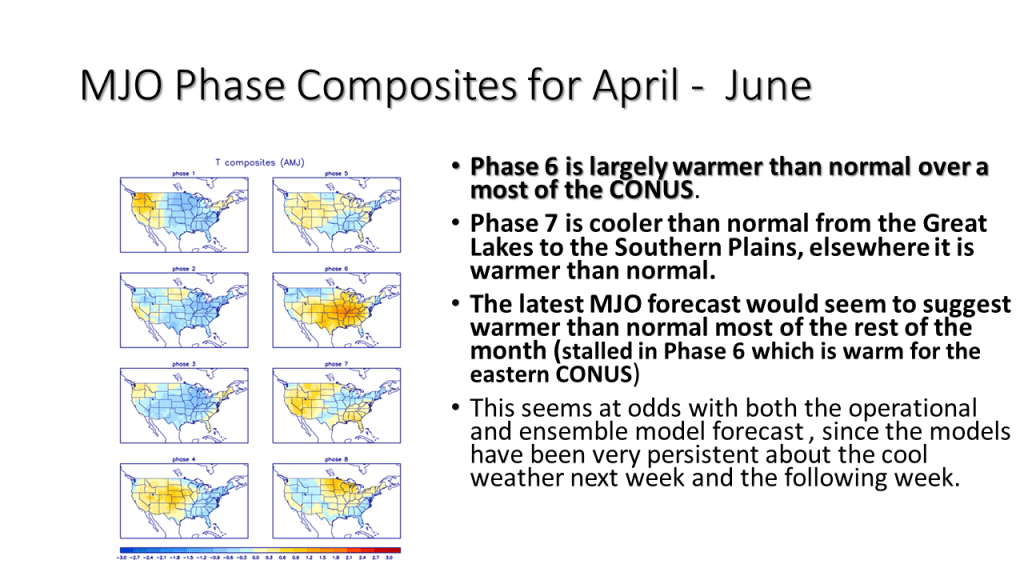
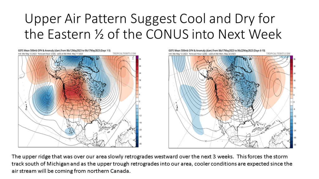
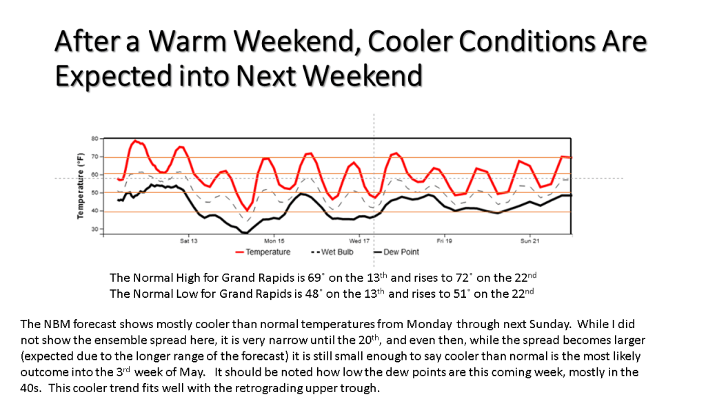
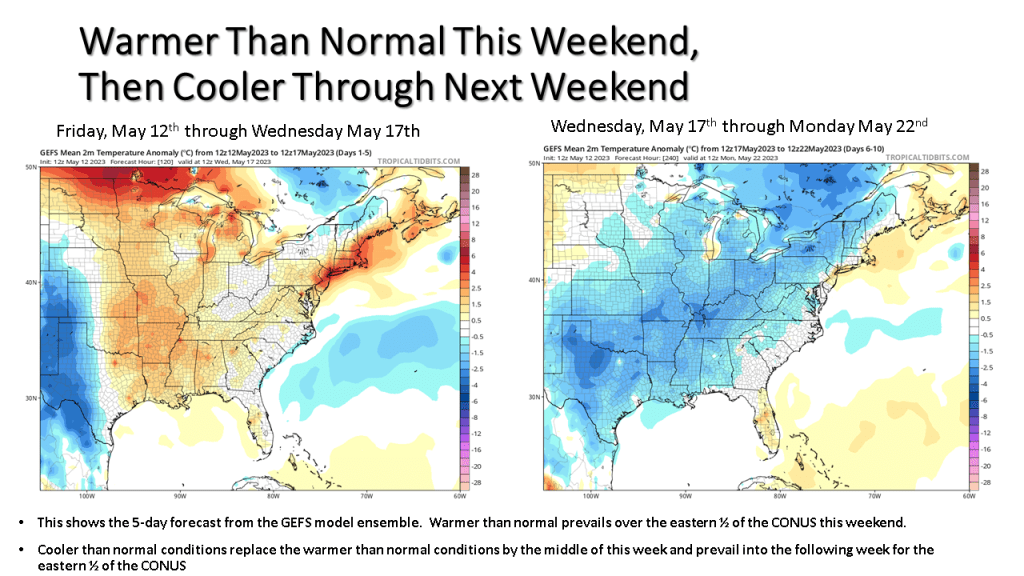


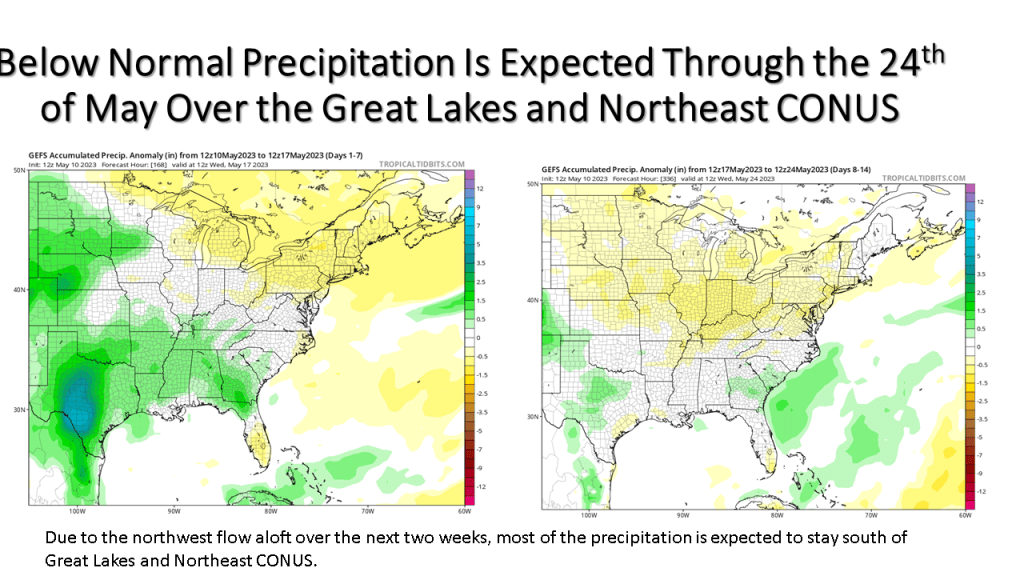
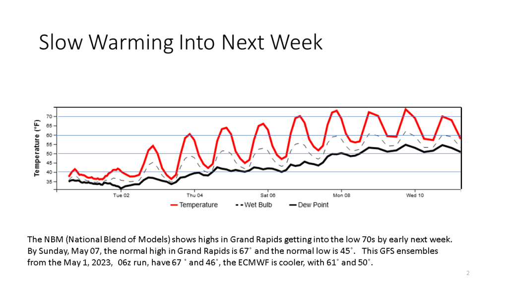
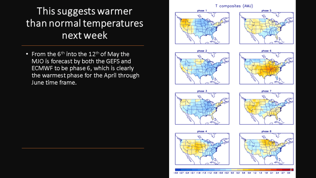
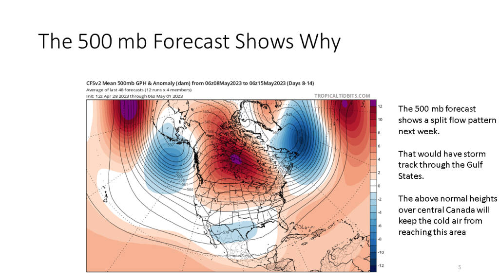
It may be cool today and tomorrow but warmer than normal temperatures are expected from this coming weekend through the 3rd week in May.