After having 4 days with highs in the 80s over Southwest Michigan, to start October, a series of cold fronts will lower our high temperatures by Saturday into the lower 50s. The cooler temperatures are expected to last into the middle of next week before another slow warm up begins. Widespread rainfall, mostly between a quarter and half an inch will occur Thursday as the front moves through. Lake effect rain showers are expected into early next week.

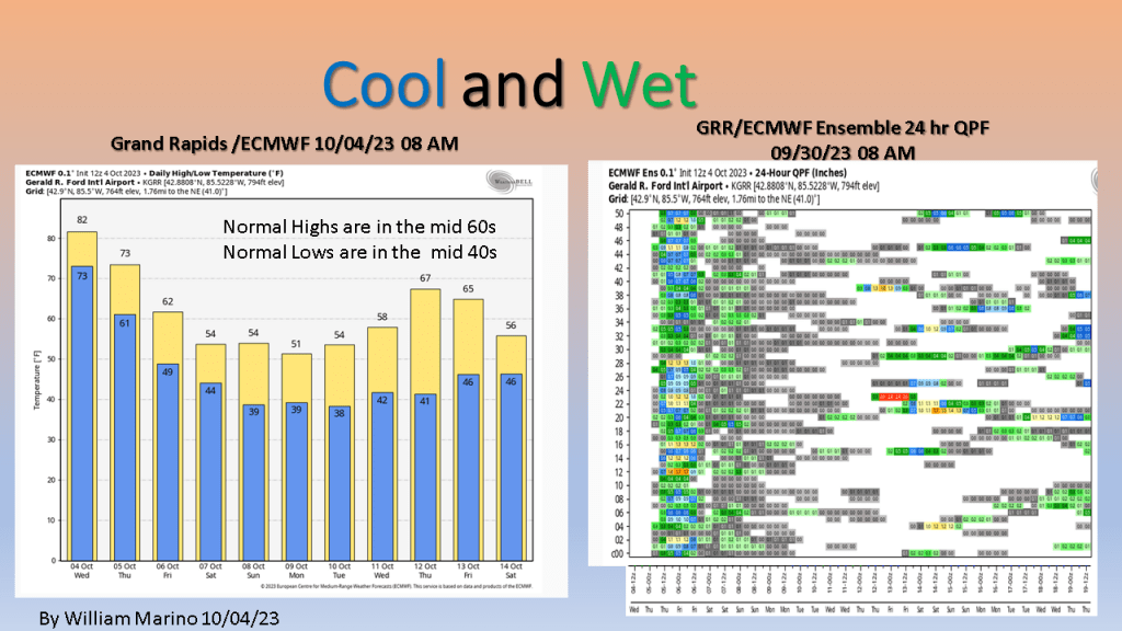
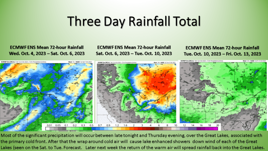
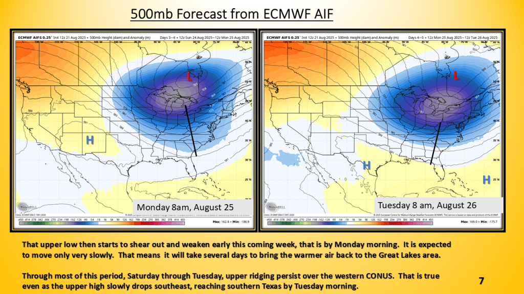
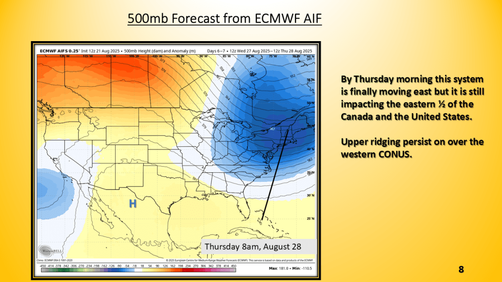
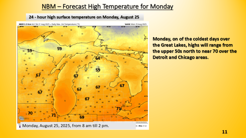
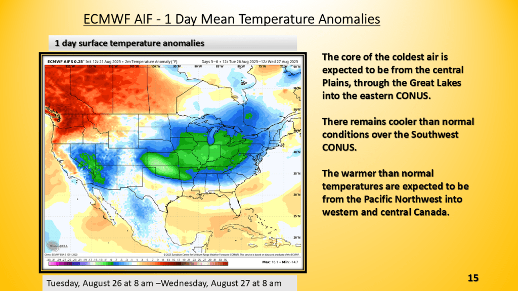
It will fell like fall by Friday morning and that chilly and showery weather my last into Tuesday morning before the system is far enough to east to allow for some clearing. It will remain chilly Tuesday into Wednesday before a warm up starts by Thursday of next week.