


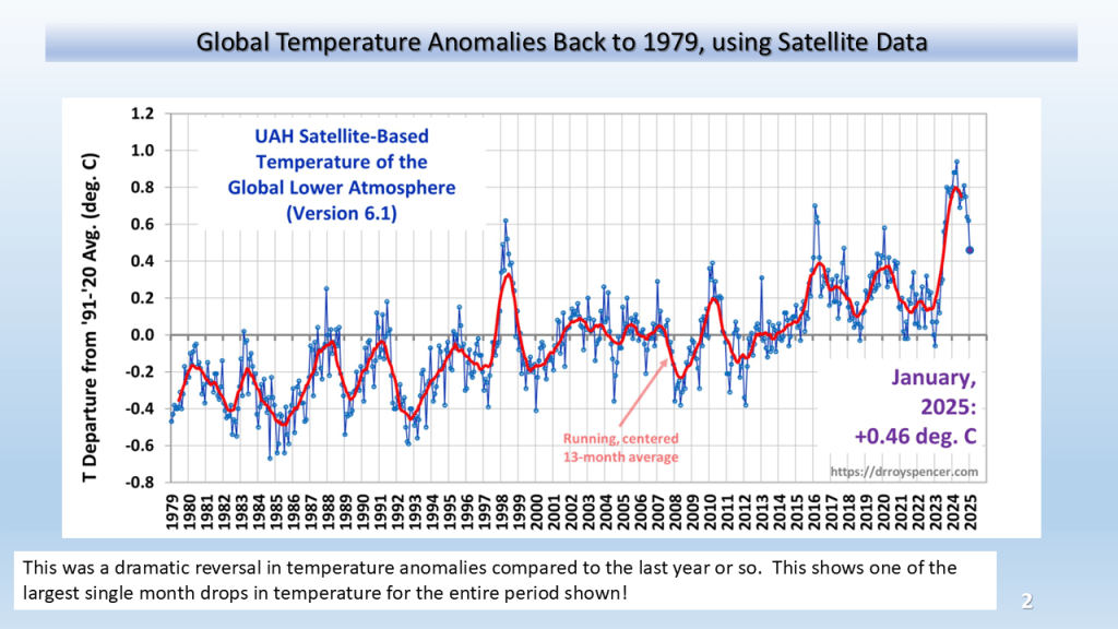
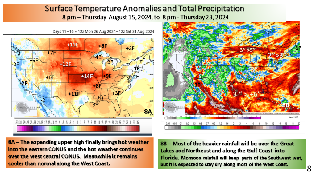
A significant cool down across the CONUS


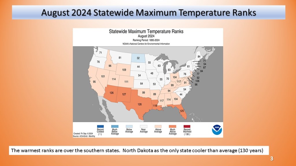
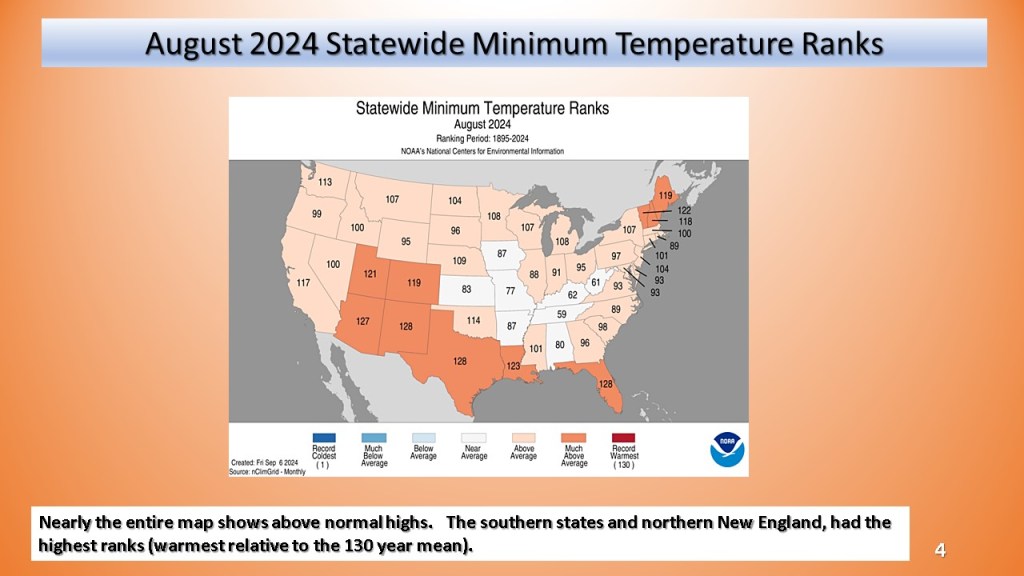
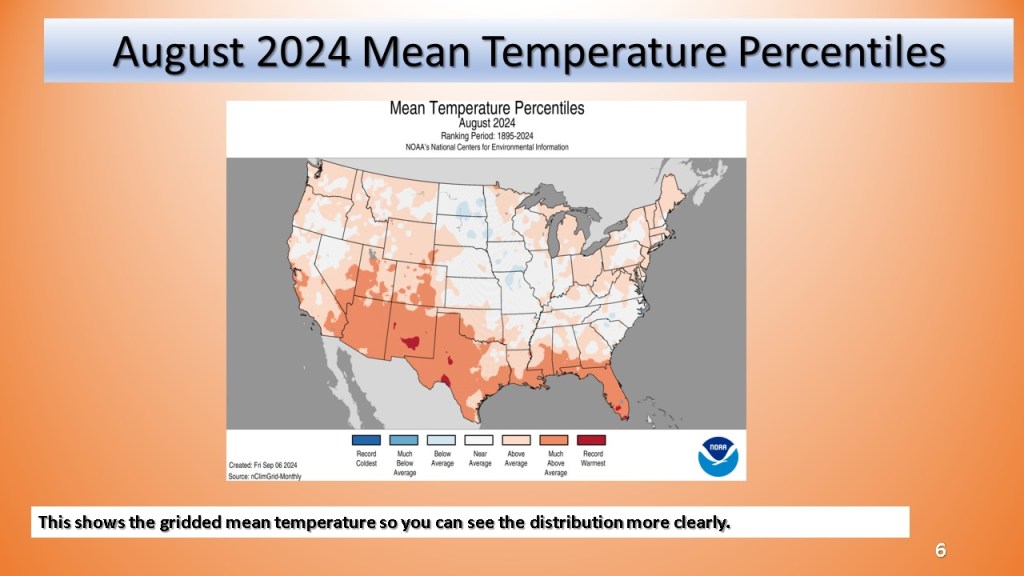
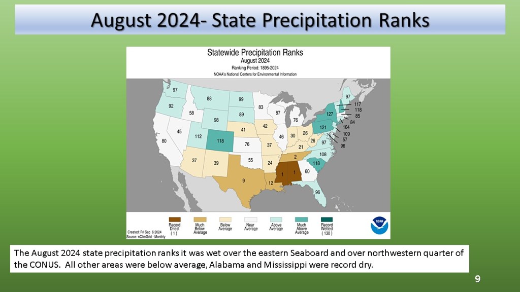
Record dry Alabama and Mississippi, most of the CONUS was warmer than average.


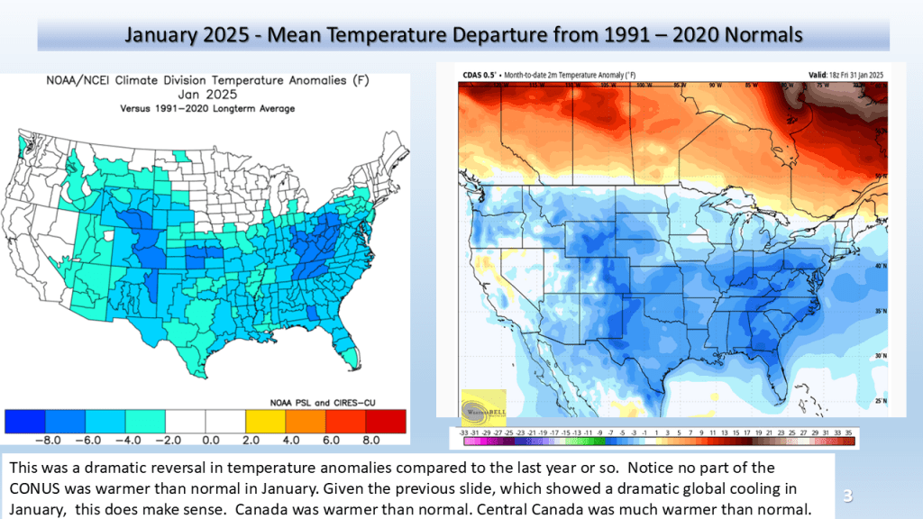
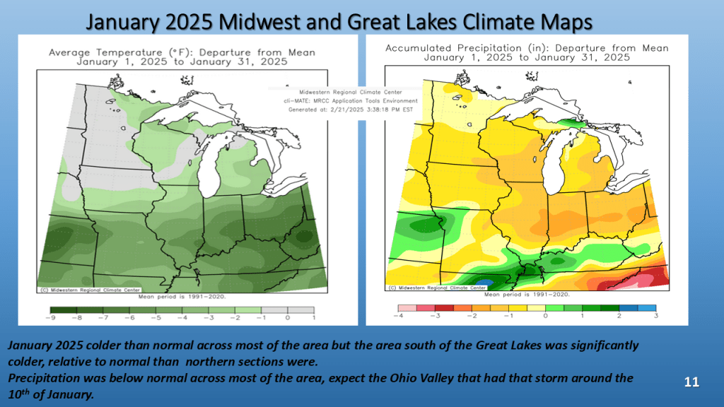
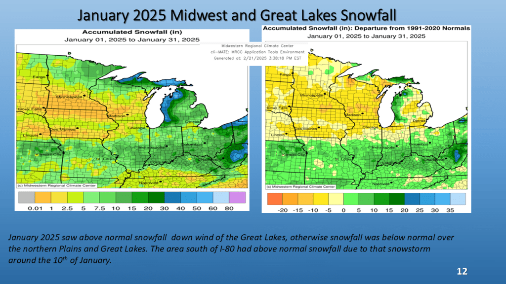
(over the Midwest and Great Lakes)


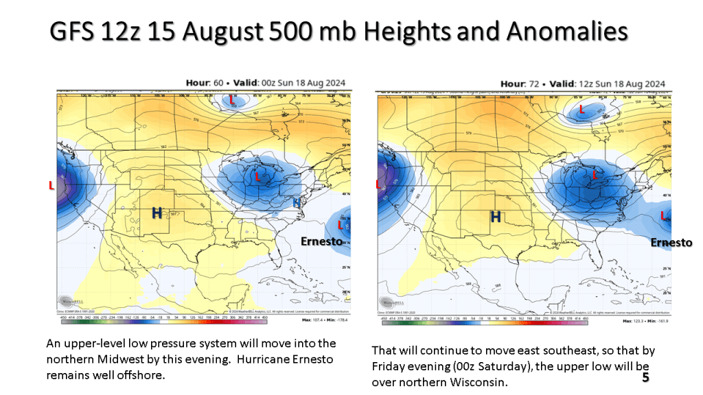


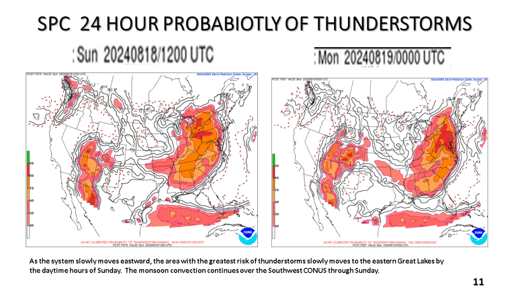
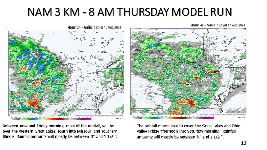

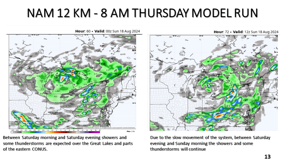
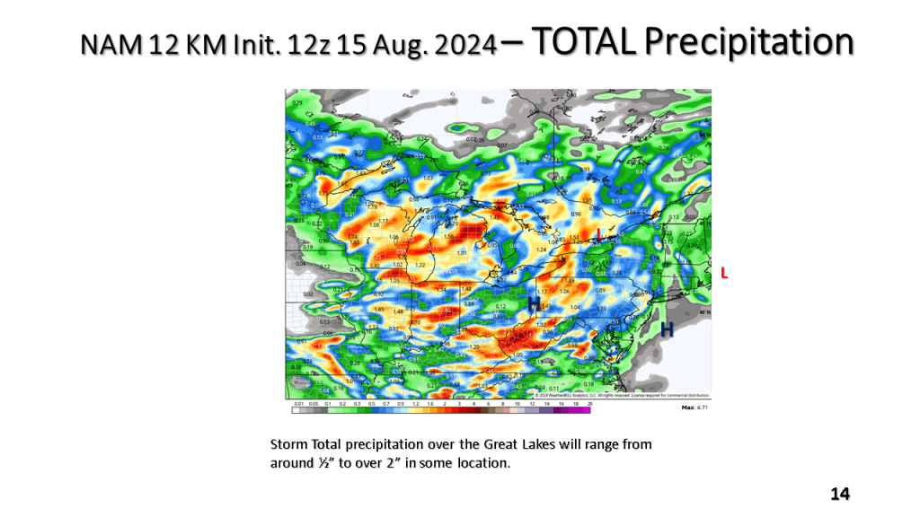
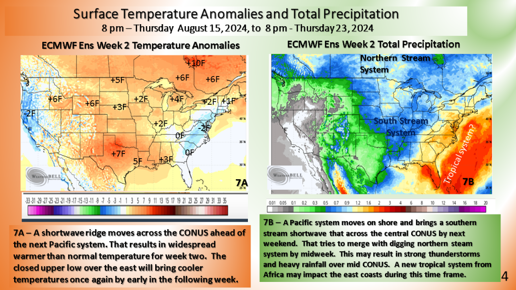
Seems another developing closed upper low my cool the eastern CONUS off by 19th of August (or the 3rd full week of August). This would likely be a wet period over the east.