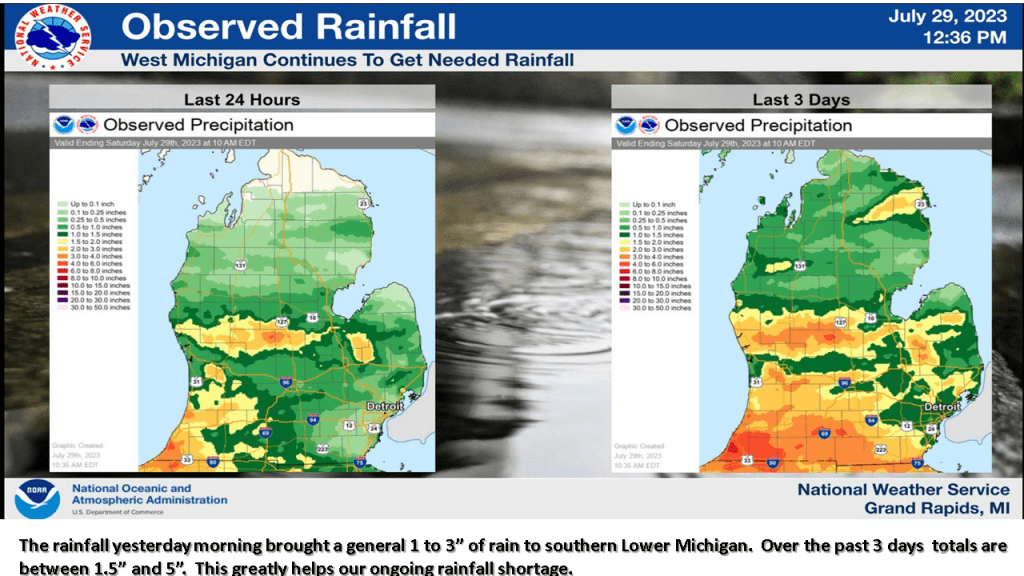
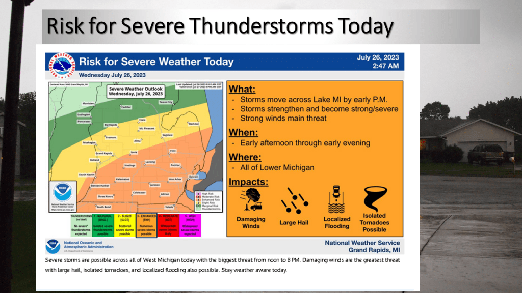
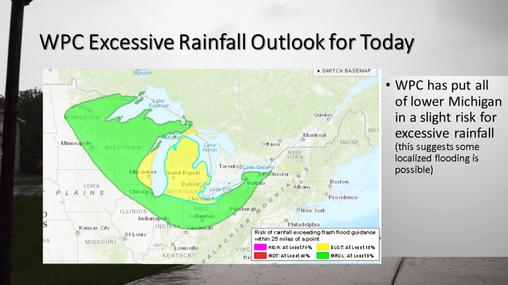
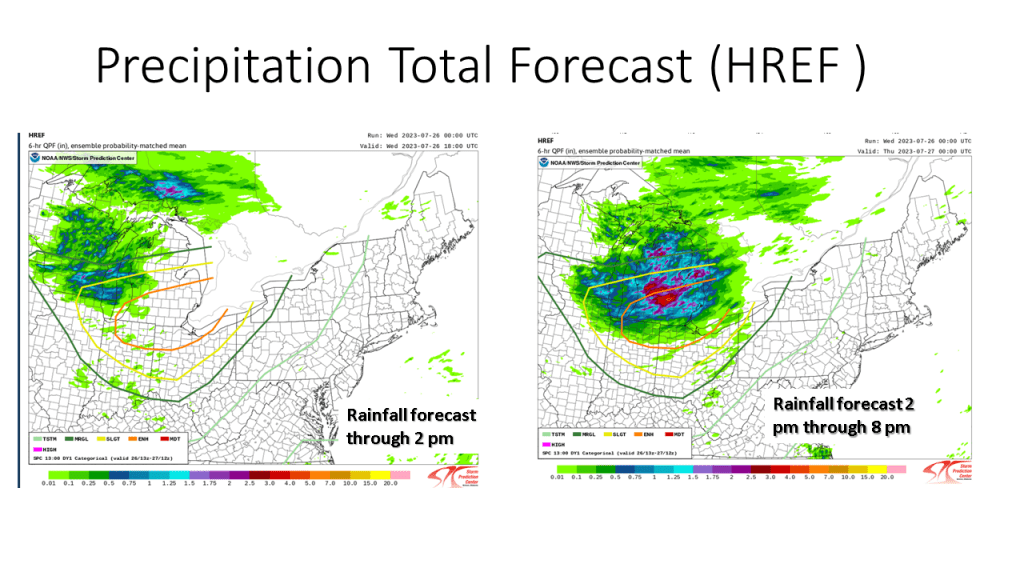
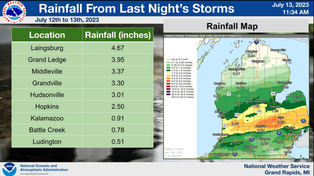
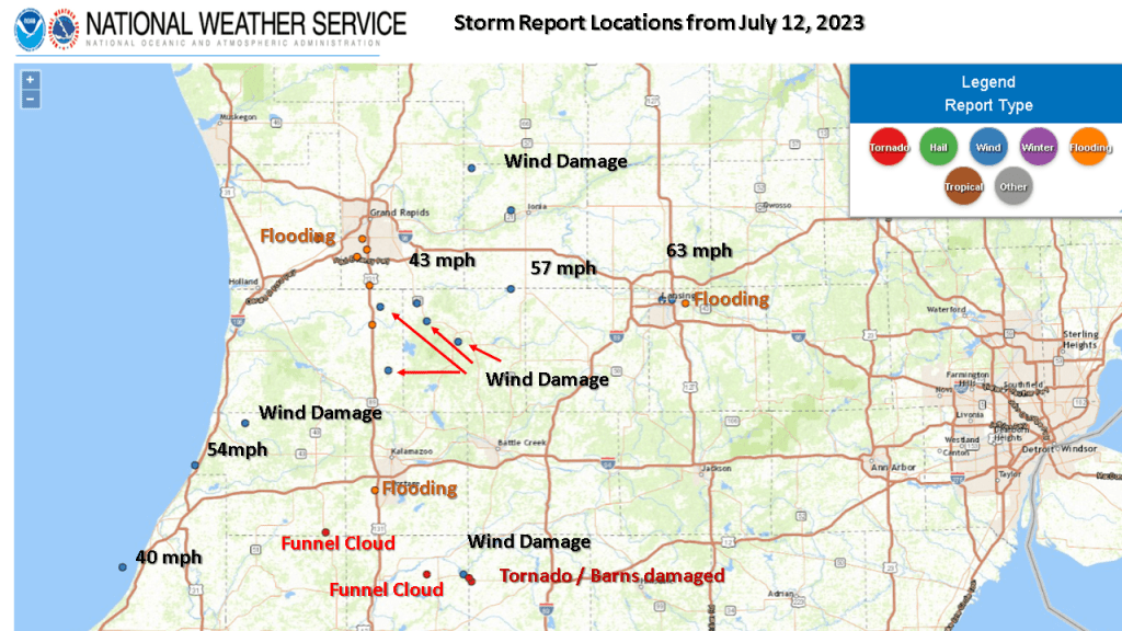
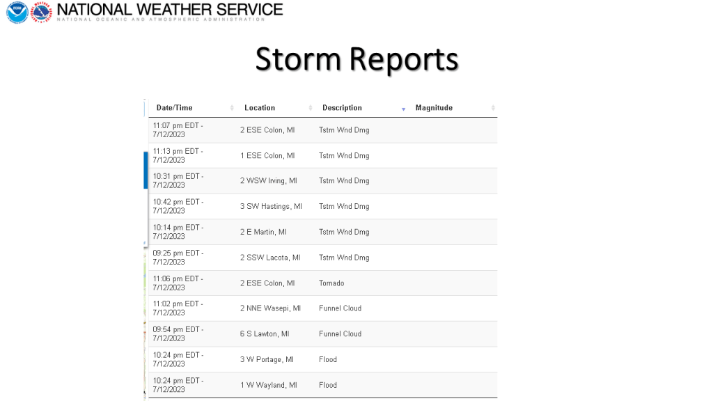
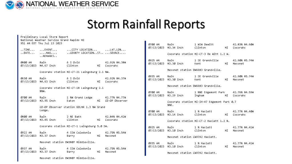
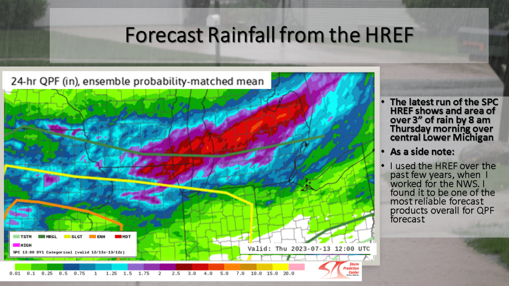
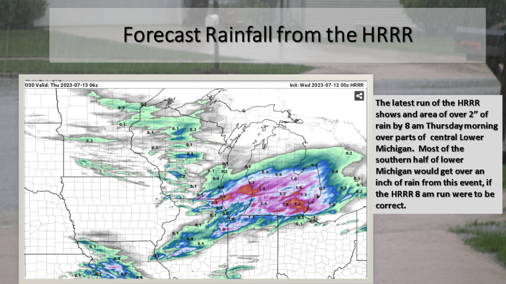
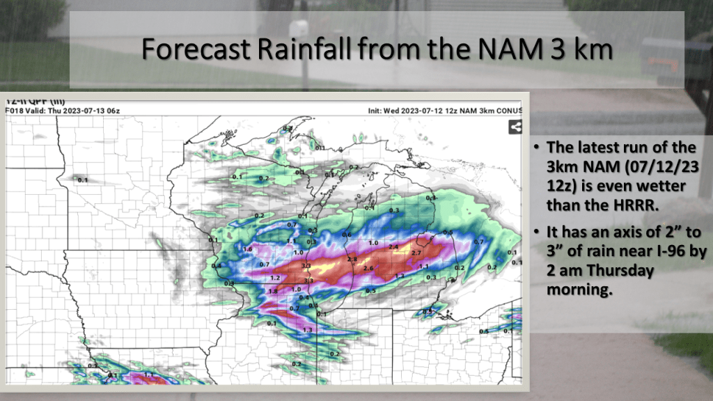
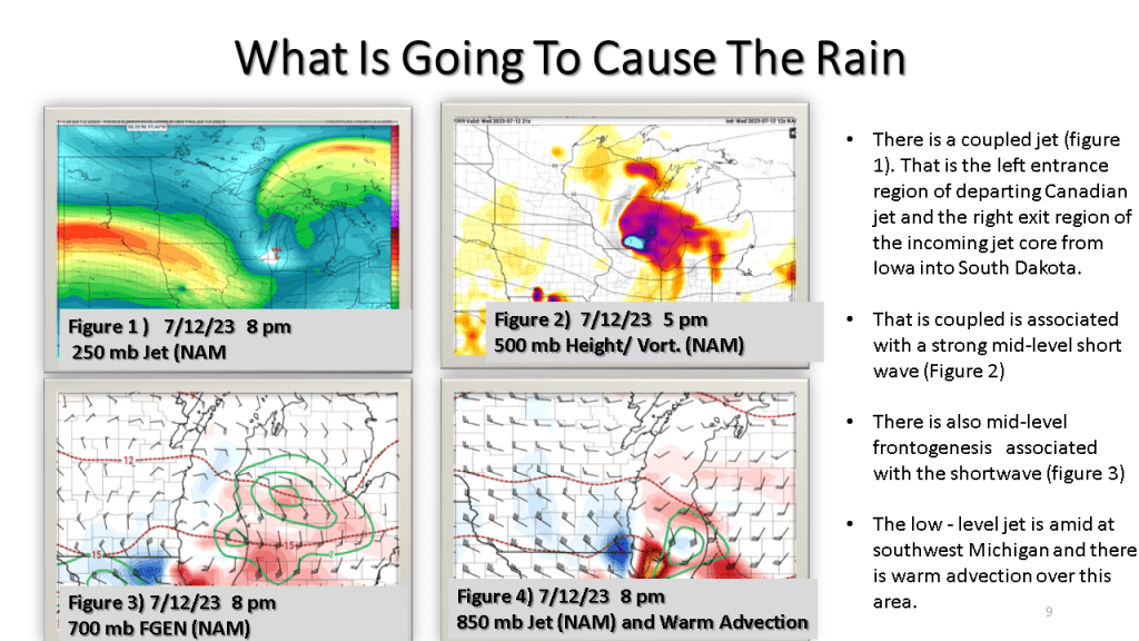
Yesterday We Expected Widespread Heavy Rainfall During the Late Afternoon and into Early This Morning. We also expected a slight chance of severe storms. As it turned out the rainfall forecast was very much on track as most of southern and central Lower Michigan had 2 to 4 inches of rain. There was a report of tornado near Colon Michigan at 11:06 pm. There were also several reports of wind damage, mostly south of I-96.

Heavy rain with localized flooding occurred over southern and central Lower Michigan on the evening of the 12th of July. There were also reports of damaging winds, a tornado near Colon and a few funnel cloud reports.

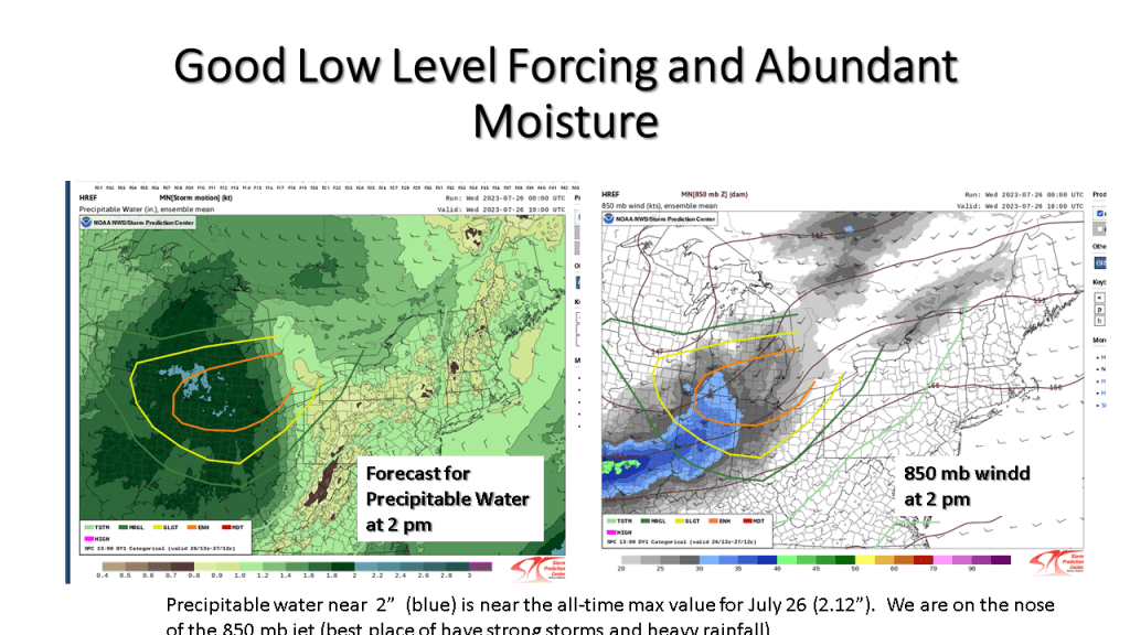
We are expecting heavy rain late this afternoon into early tonight across the southern half of Lower Michigan.

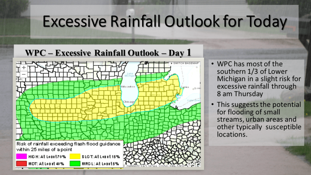
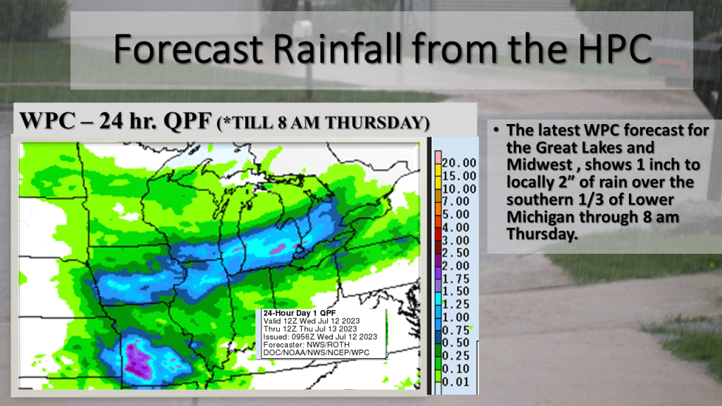
Heavy rain with a few thunderstorms is expected over the southern 1/3 of Lower Michigan from late afternoon until early Thursday morning. Rainfall amounts of 2″ to 4″ is expected over a large area, so that may cause some urban and small stream flooding.

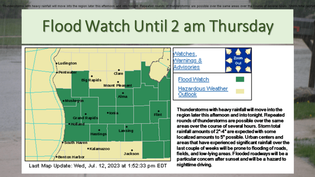
The heaviest rainfall is expected between 5 pm and 9 pm this evening. Rainfall of 2 inches to 4 inches is expected with local amounts over 5 inches possible. As a result, The National Weather Service has issued a Flood Watch for the southern 1/3 of Lower Michigan until 2 am Thursday. This amount of rain will have an impact on reducing the on-going drought if in fact we actually do that that much rain over a large area.