Warmer than normal temperatures are expected over most of the CONUS following the system for the third week of July.


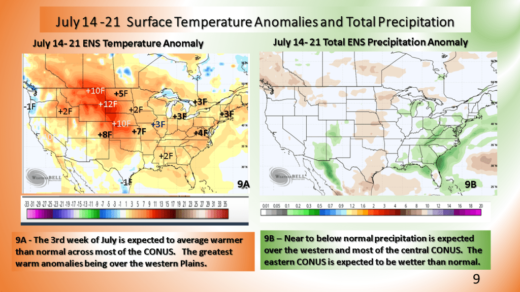
Warmer than normal temperatures are expected over most of the CONUS following the system for the third week of July.
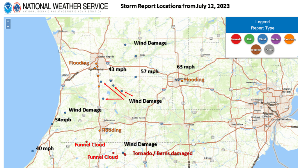
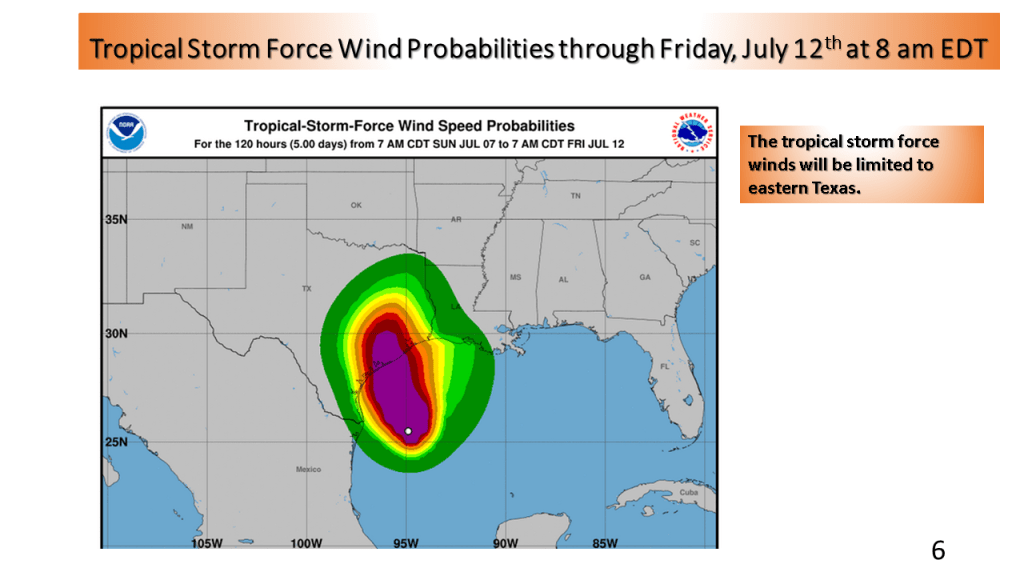
Winds to 76 mph, 1″ hail and rainfall to near 5″ within 12 hours

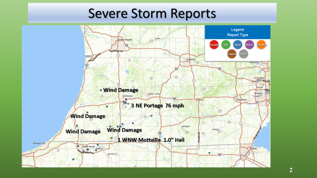


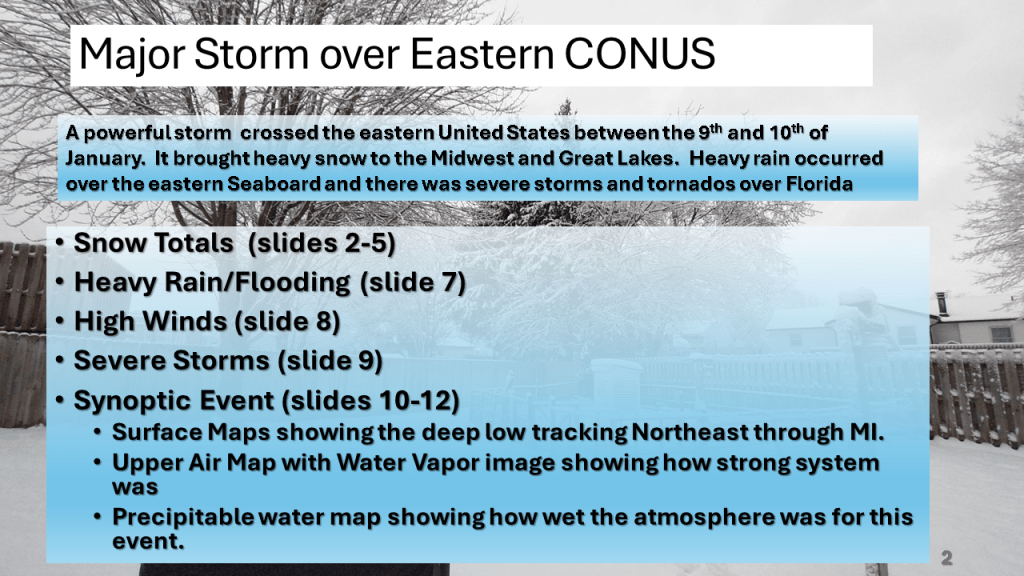
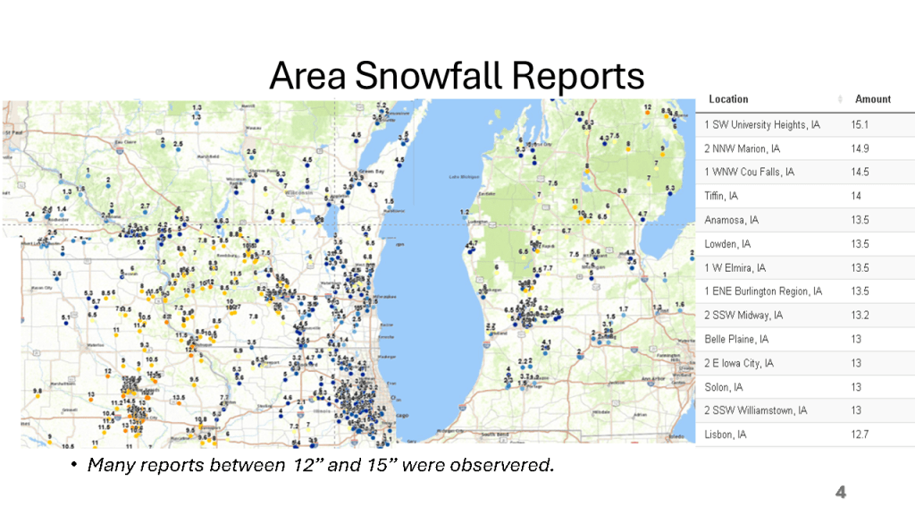
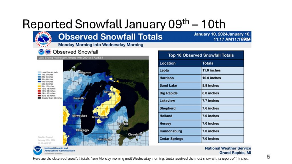
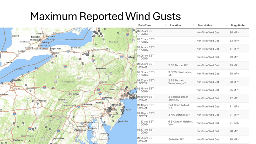
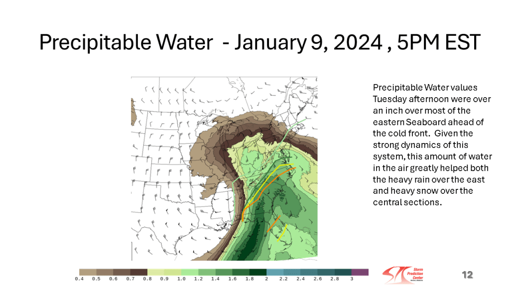
This storm brought heavy snow to the Midwest and parts of the Great Lakes, then there were damaging winds over the eastern Seaboard, as well as flooding. Severe storms and over a dozen tornadoes occurred over the Southeast sections.


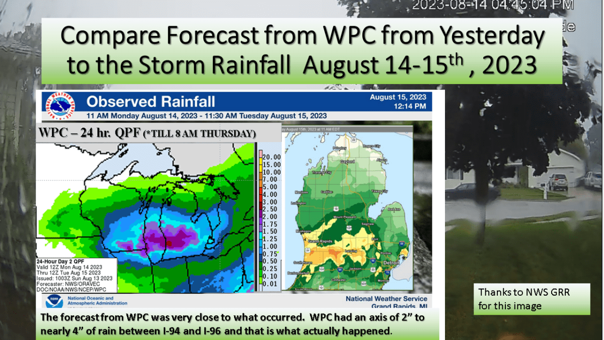
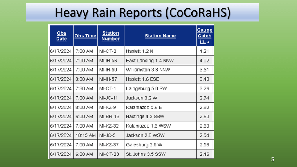
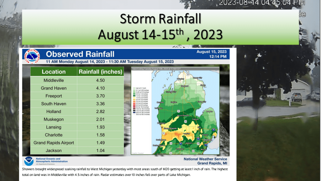
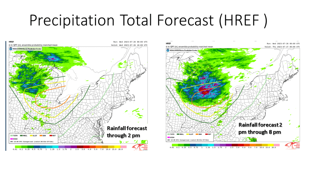
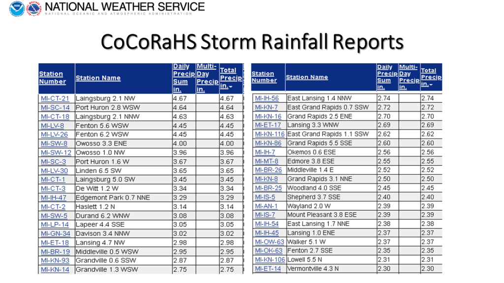
We forecast heavy rain between I-94 and I-96 and that is exactly what did happen. The heaviest rainfall report showed 4.50 inches in Middleville, most of that area had between 1″ and 3″ of rain from the event.


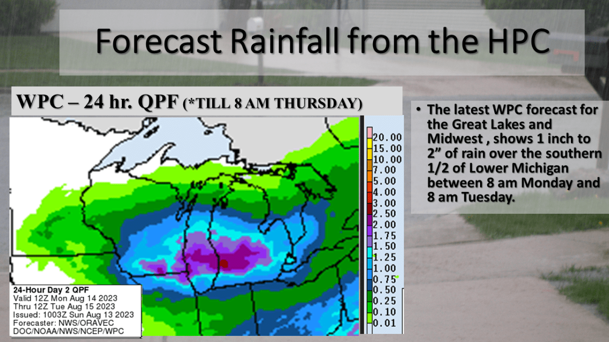
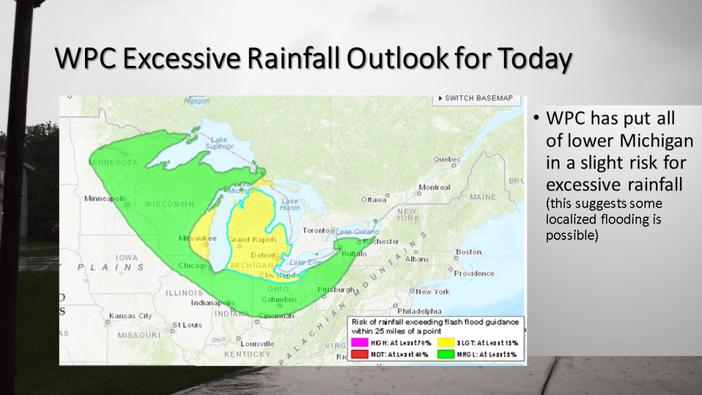
Heavy Rain is expected over most of the southern half of Lower Michigan between 2 pm Monday and 8 am Tuesday morning.
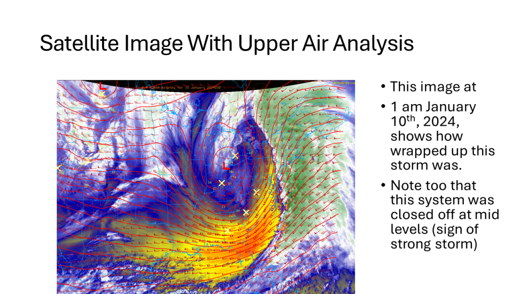
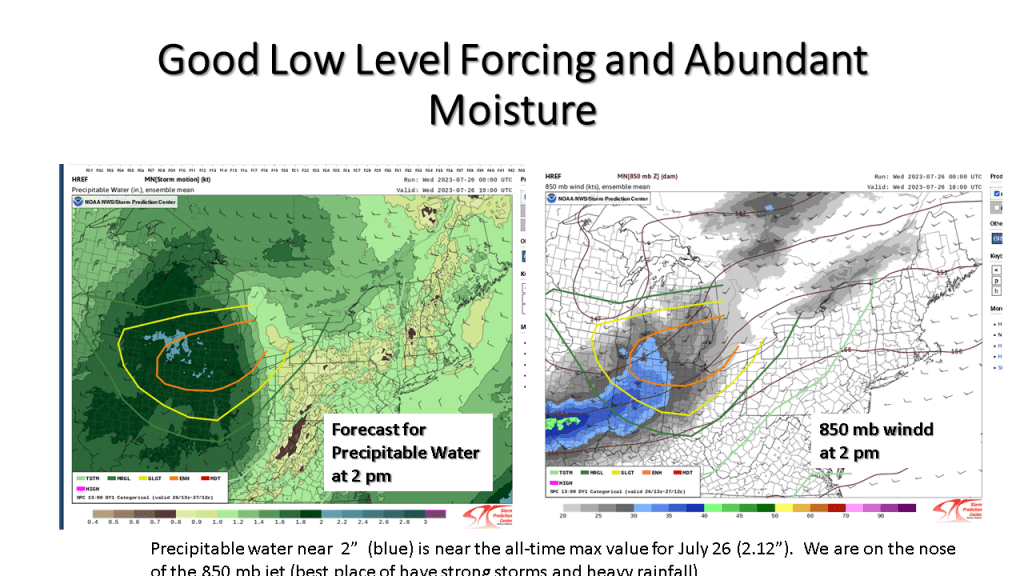
An unusually strong storm system for this time of year is expected to track east across Lower Michigan from Monday into Tuesday morning. This will be an occluded system, with the track of the surface low near I-94. It is typical for the heaviest precipitation to be within 100 miles of track of the surface low, but on the north it’s track. This system as a closed upper low with it and a coupled jet with it. The precipitable water reaches above 1.5 inches Monday afternoon over the southern 1/3 of Lower Michigan as this system tracks through the area. There is also good model continuity with this system so it gives me confidence that the heavy rainfall will happen. Just exactly were is questionable but I would have to believe between I-94 and Route 10, between Monday afternoon and Tuesday morning a large part of that area should see more than an inch of rainfall.


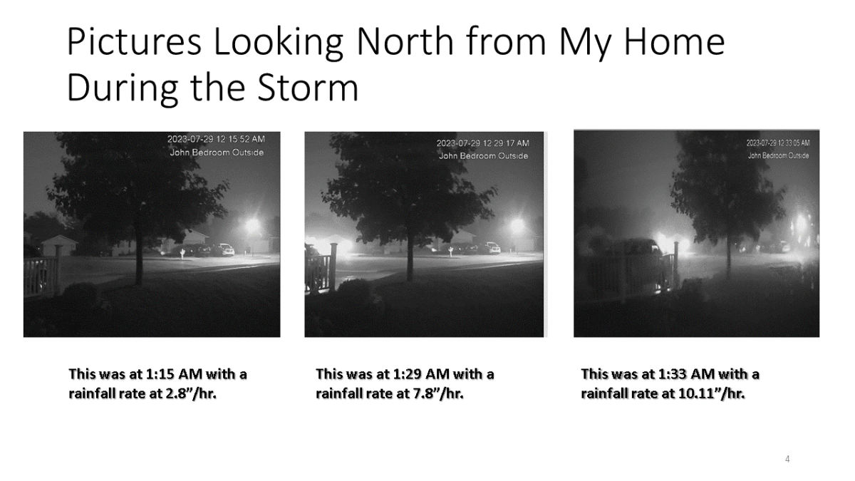
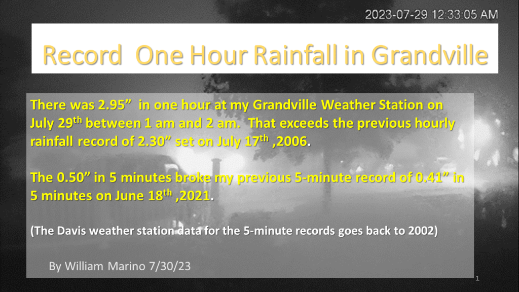
Exceptional rainfall occurred during the early morning hours at Grandville between 1 am and 2 am. This storm broke my all time 5 minute rainfall rate record and 1 hour rainfall rate record.
With Grandville Weather Data at my house having records back to the fall of 1995, the 2.95″ of rain that was recorded in both my 4″ rain gauge and my Davis Weather Station (nice that they agreed) , is my all time record rainfall in one hour. The previous record was 2.30″ during a thunderstorm during the evening of July 17 2oo6 between 9:45 pm and 10:45 pm. The 0.50″ in 5 minutes is also a new record for 5 minute rainfall, exceeding the 0.41″ on June 18th 2021.

The pictures above are from our home, looking north out of what is my son John’s bedroom window. The time posted on the pictures are EST, so you have have to add one hour to get the correct time for these images.
The Storm Prediction Center has put most of the southern 1/3 of Lower Michigan an enhanced risk for severe storms today (mostly late morning into mid afternoon). Locally heavy rainfall is expected too.

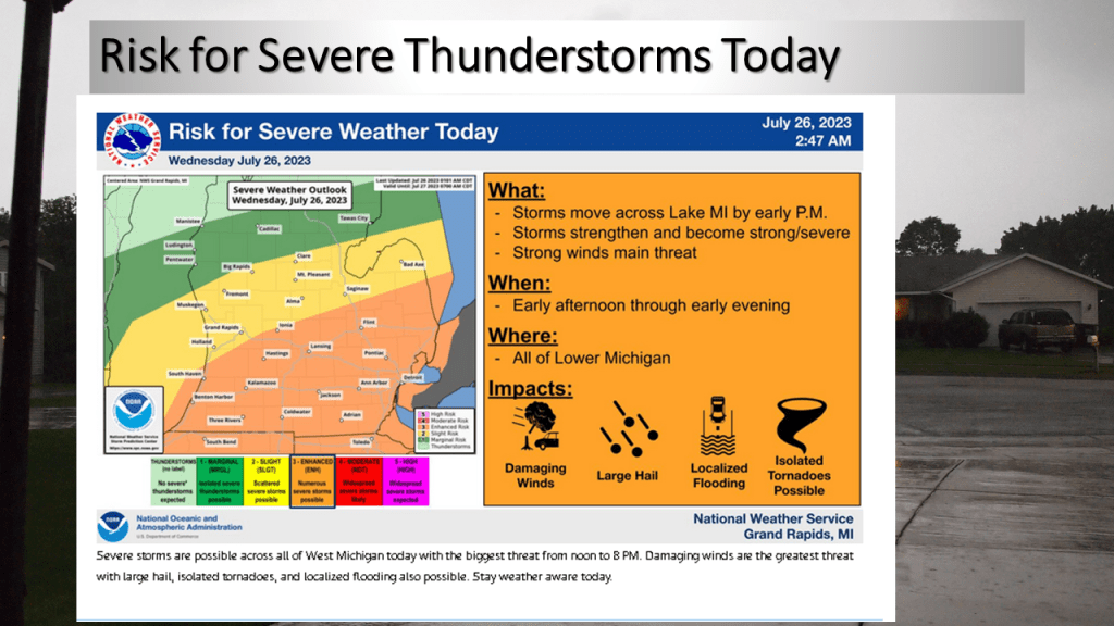
Most of the rainfall today will be from late morning into mid afternoon.
My experience in forecasting over the past 46 years tell me that for Southwest Michigan convection during the spring and summer months, warm fronts, stationary fronts and surface waves bring this area the most rainfall. Cold fronts bring us the least (typically). This event is warm front with a surface wave that develops into a surface low. This tells me most area should see meaningful rainfall today.


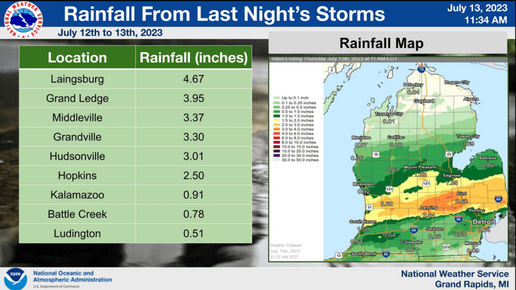
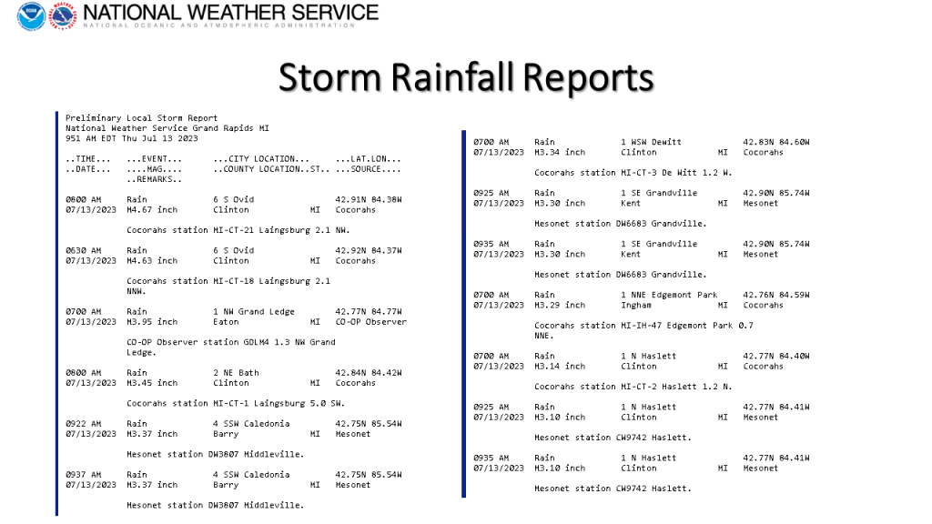
I added the Colon EF-1 Tornado to the storm summary plus the CoCoRaHS rainfall reports for the storm.


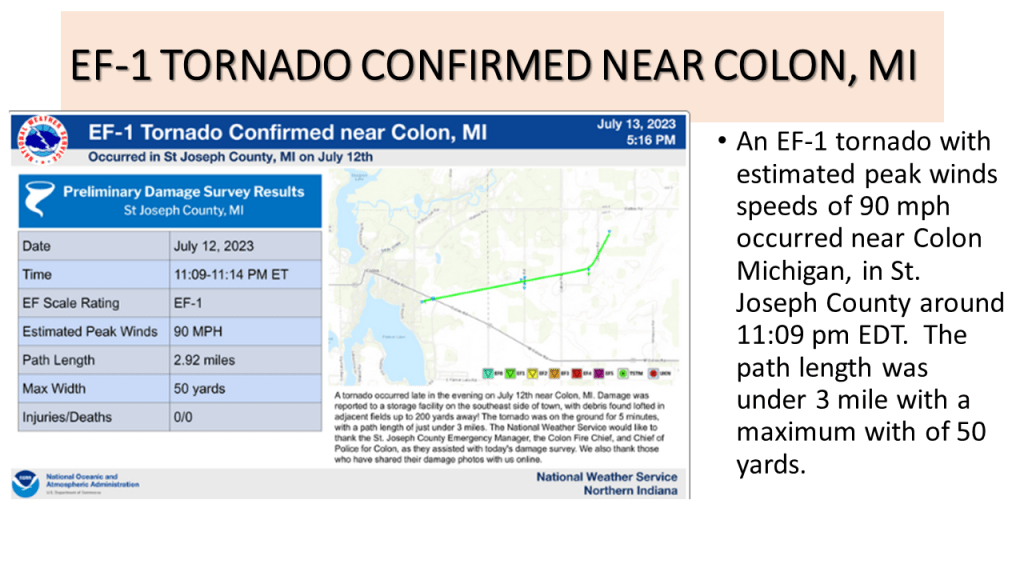

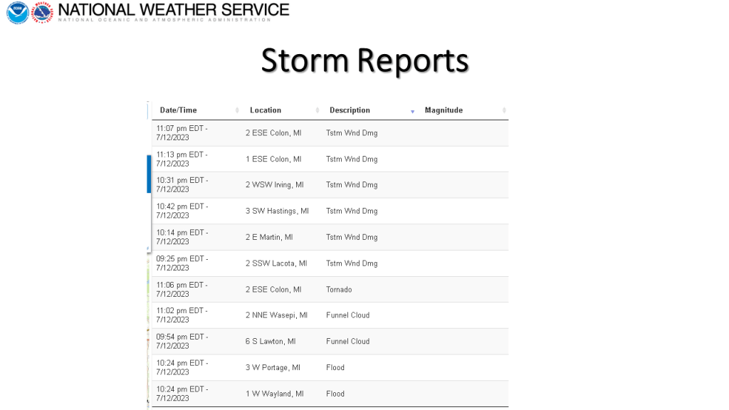


Heavy rain with localized flooding occurred over southern and central Lower Michigan on the evening of the 12th of July. There were also reports of damaging winds, a tornado near Colon and a few funnel cloud reports.