


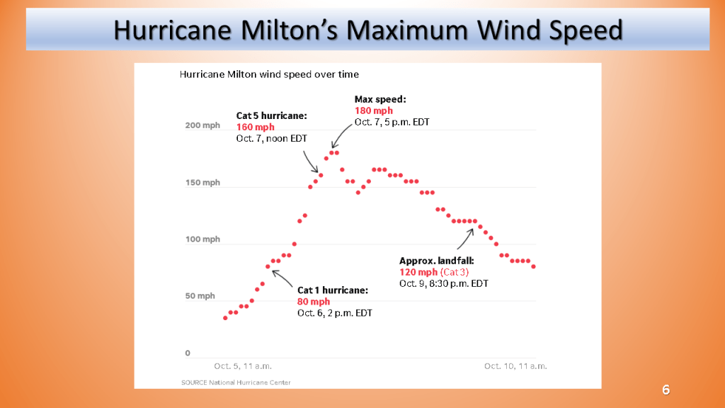
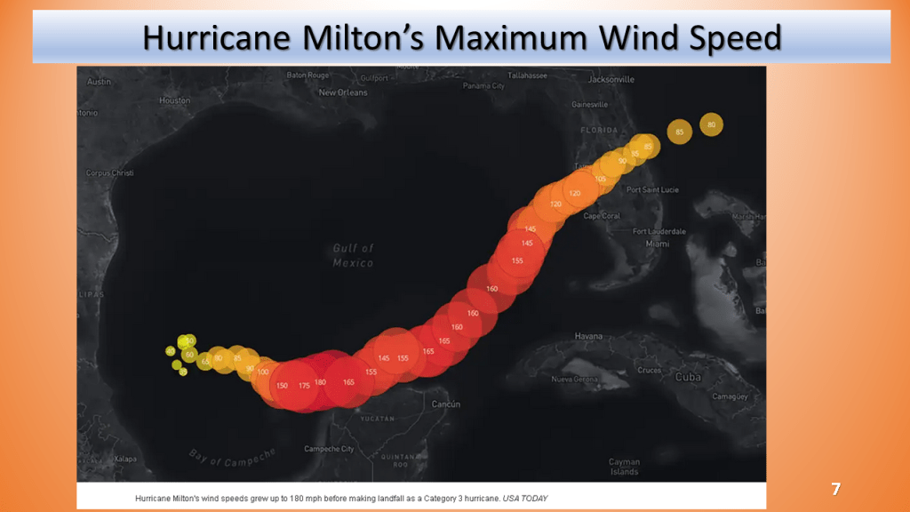
This is by no means a compressive summary, it’s what I could find using NWS data from various sources. I updated the max wind speed and added slides for the track and maximum wind speed with time (from NHC and USAtoday)

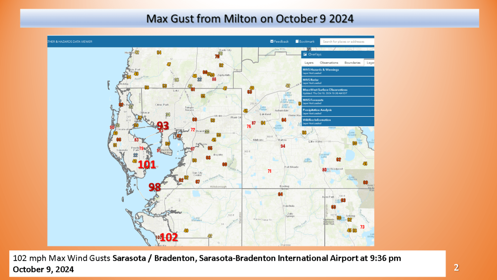
https://www.wfla.com/news/local-news/hurricane-milton-brings-100-mph-wind-gusts-to-tampa-bay/
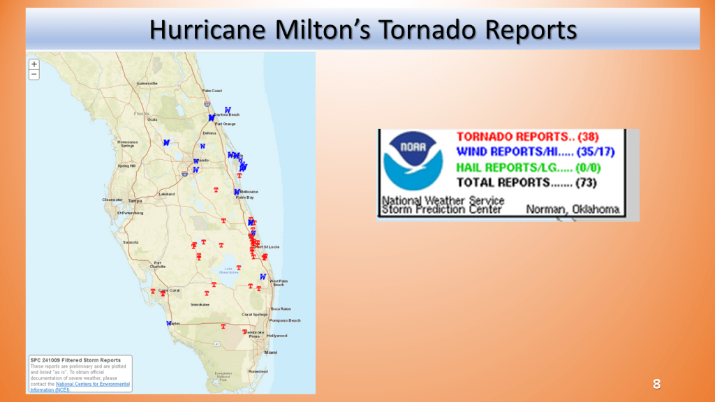
Here are a few links to see details on the tornadoes
Jacksonville
https://www.weather.gov/jax/TropicalEventSummary
Miami
https://www.weather.gov/media/mfl/TropicalEventSummary/PSHMFL_2024AL09_Helene_Summary.pdf
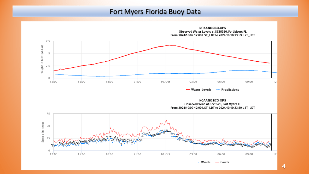
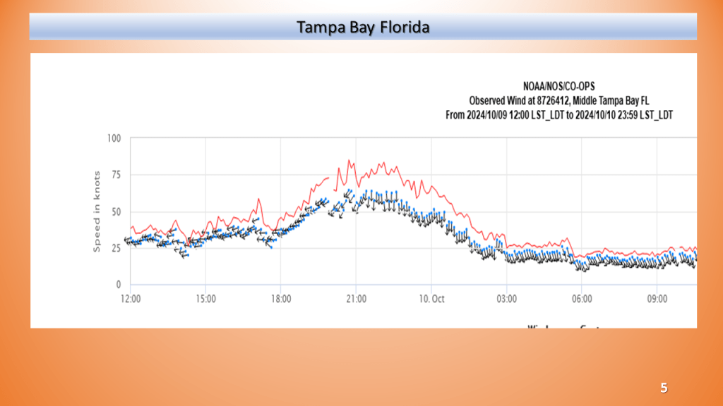
Tampa
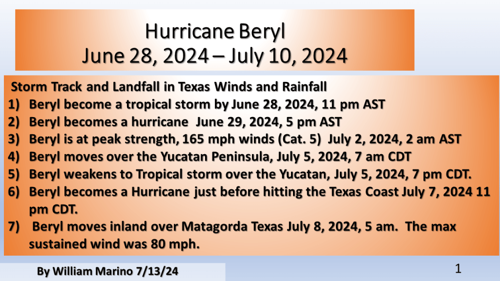
Beryl was the first Category 4 hurricane to form in the month of June. The previous record was Dennis when it became a Category 4 hurricane on July 8, 2005.


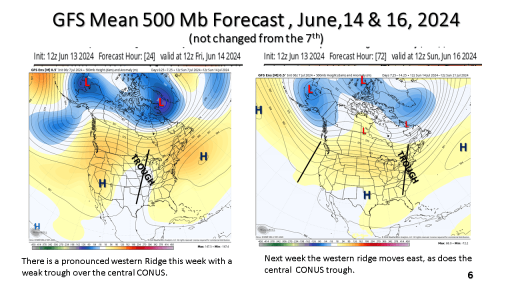


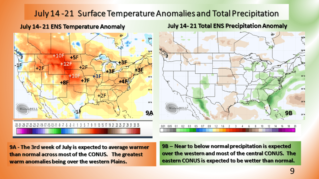
Warmer than normal temperatures are expected over most of the CONUS following the system for the third week of July.


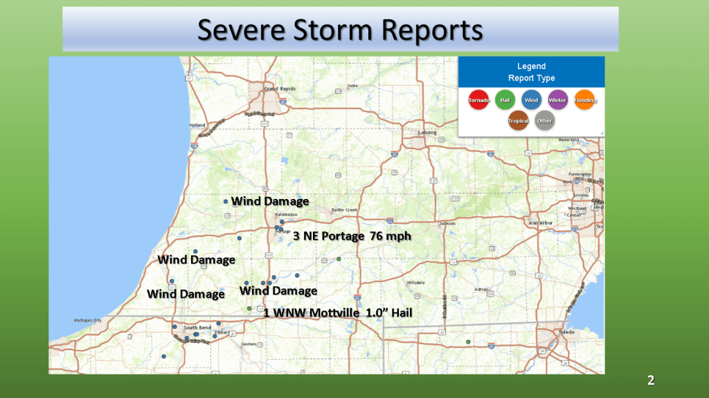
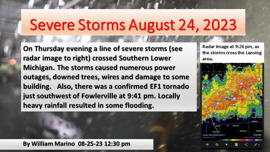
Winds to 76 mph, 1″ hail and rainfall to near 5″ within 12 hours


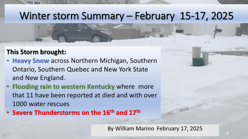
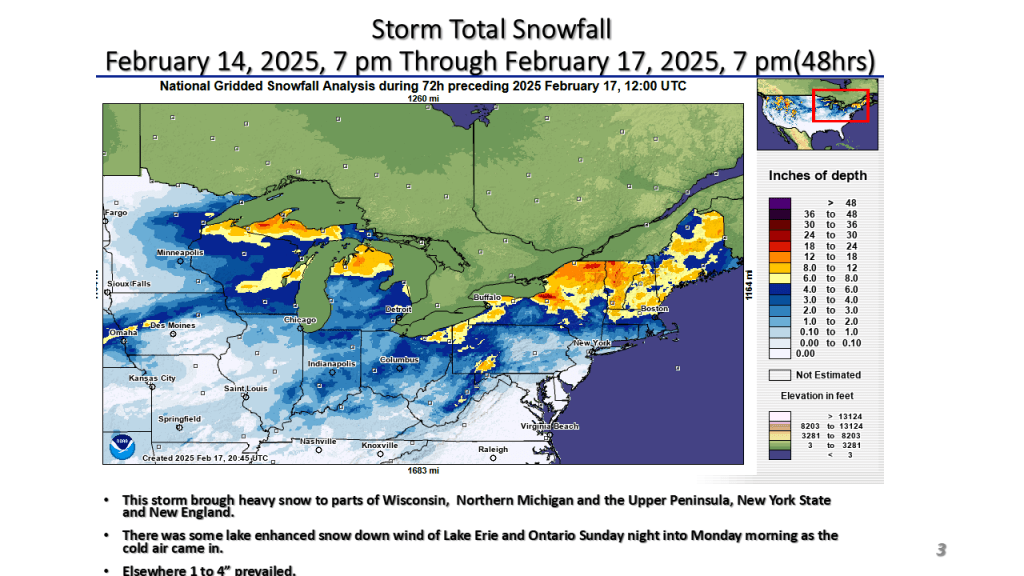
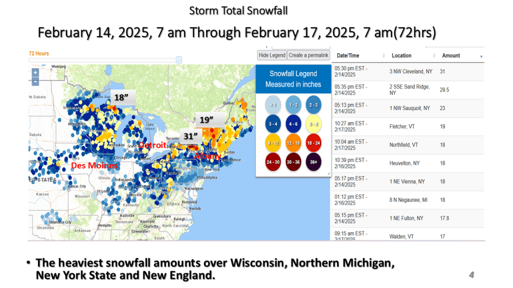
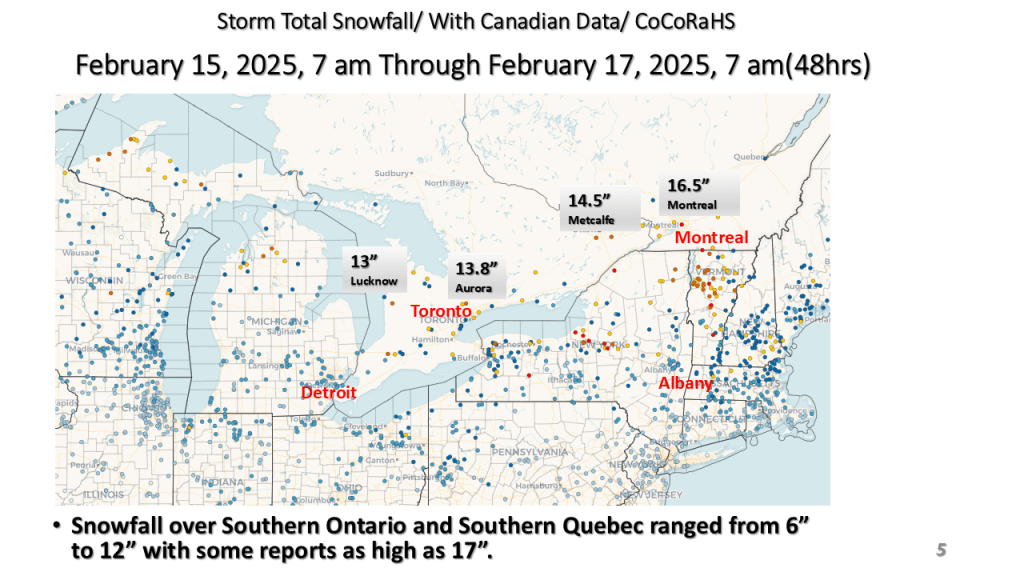
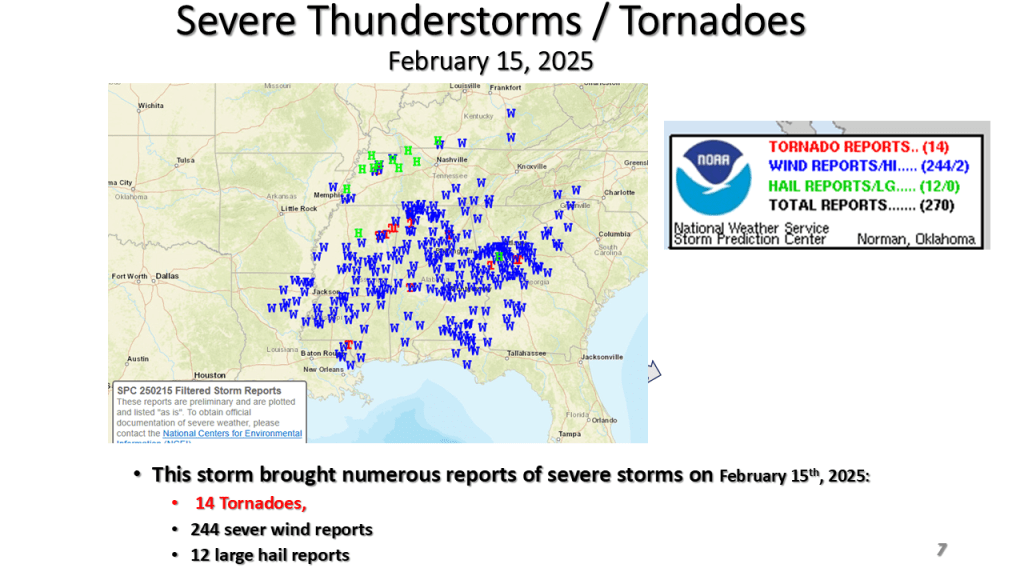
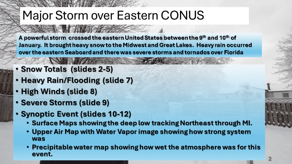
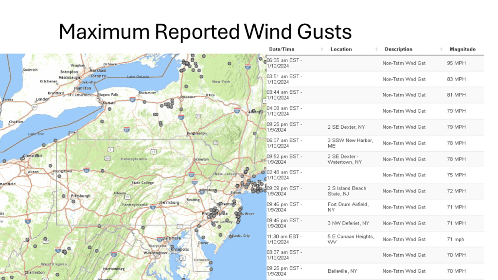
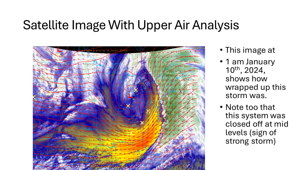
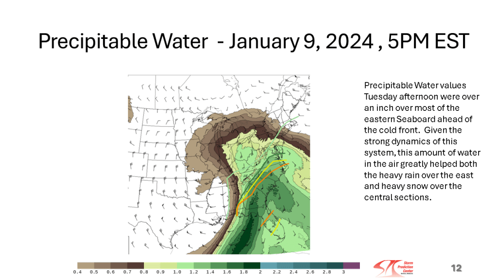
This storm brought heavy snow to the Midwest and parts of the Great Lakes, then there were damaging winds over the eastern Seaboard, as well as flooding. Severe storms and over a dozen tornadoes occurred over the Southeast sections.


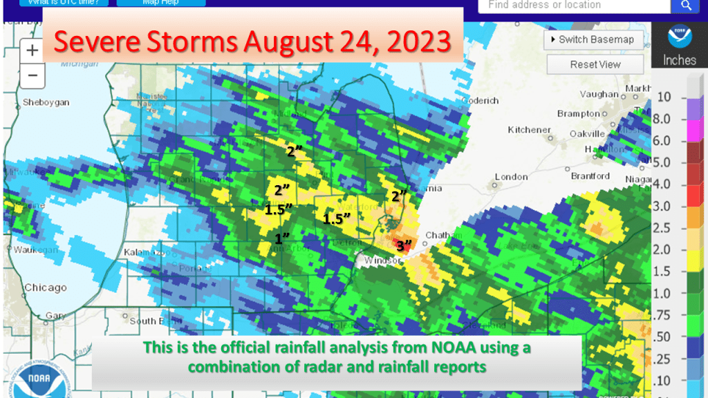
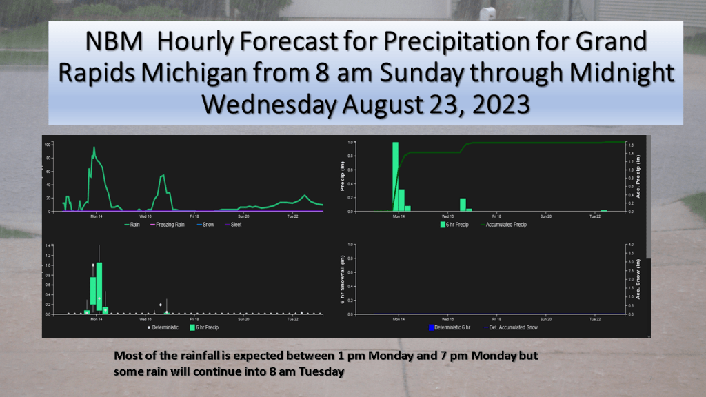
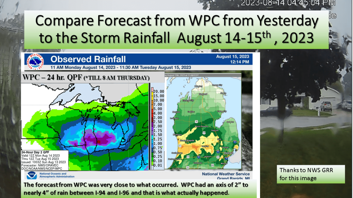
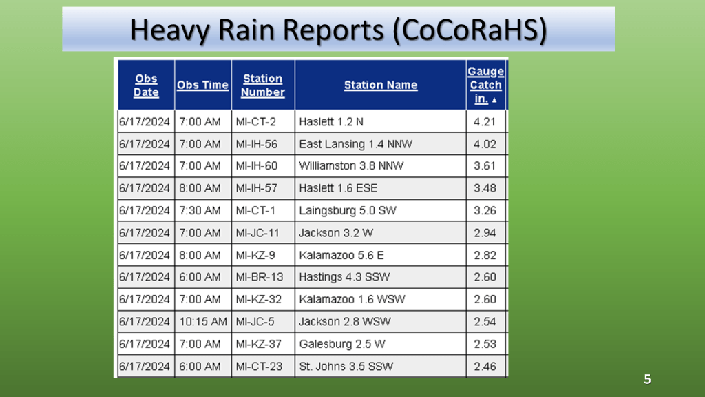
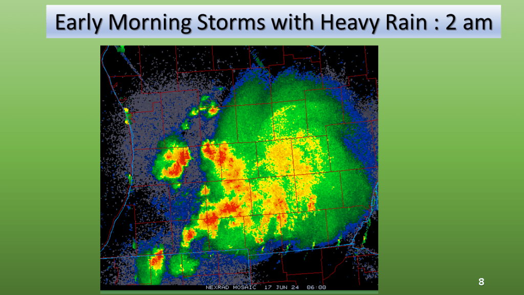
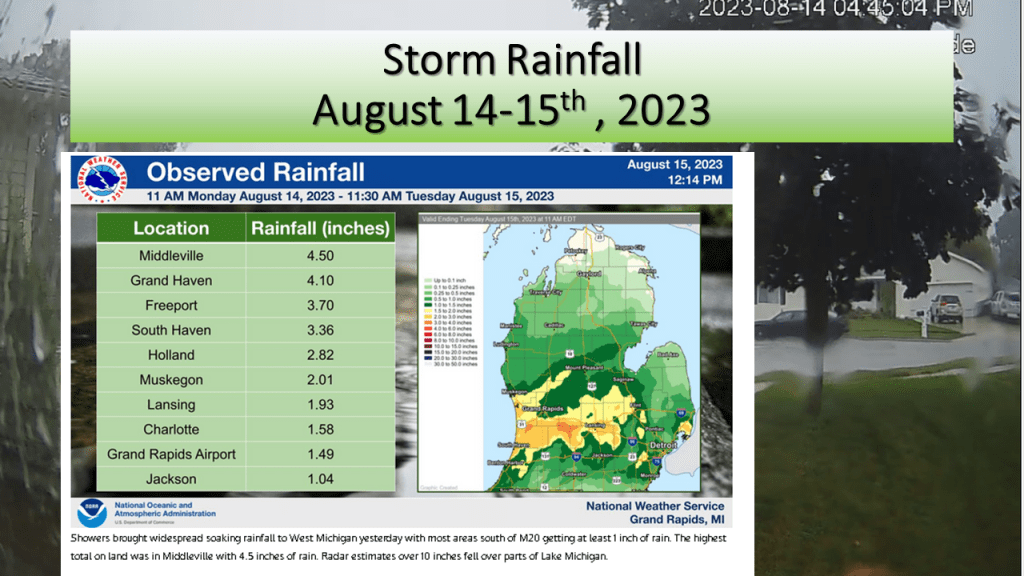
We forecast heavy rain between I-94 and I-96 and that is exactly what did happen. The heaviest rainfall report showed 4.50 inches in Middleville, most of that area had between 1″ and 3″ of rain from the event.


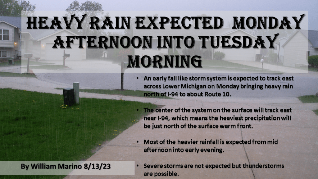
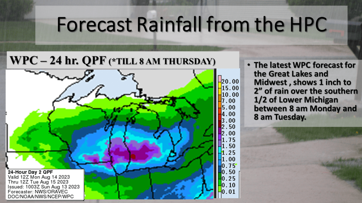
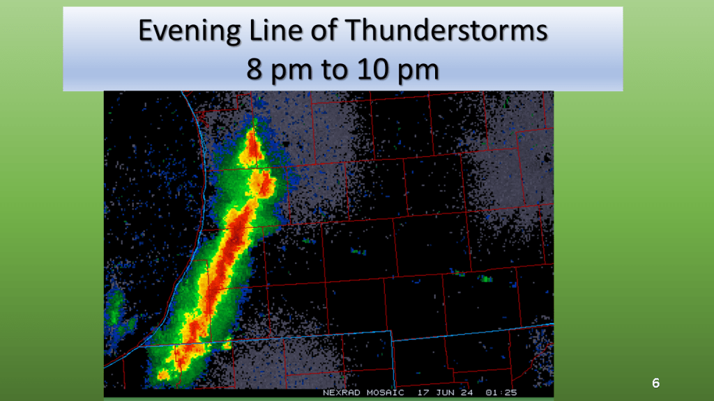
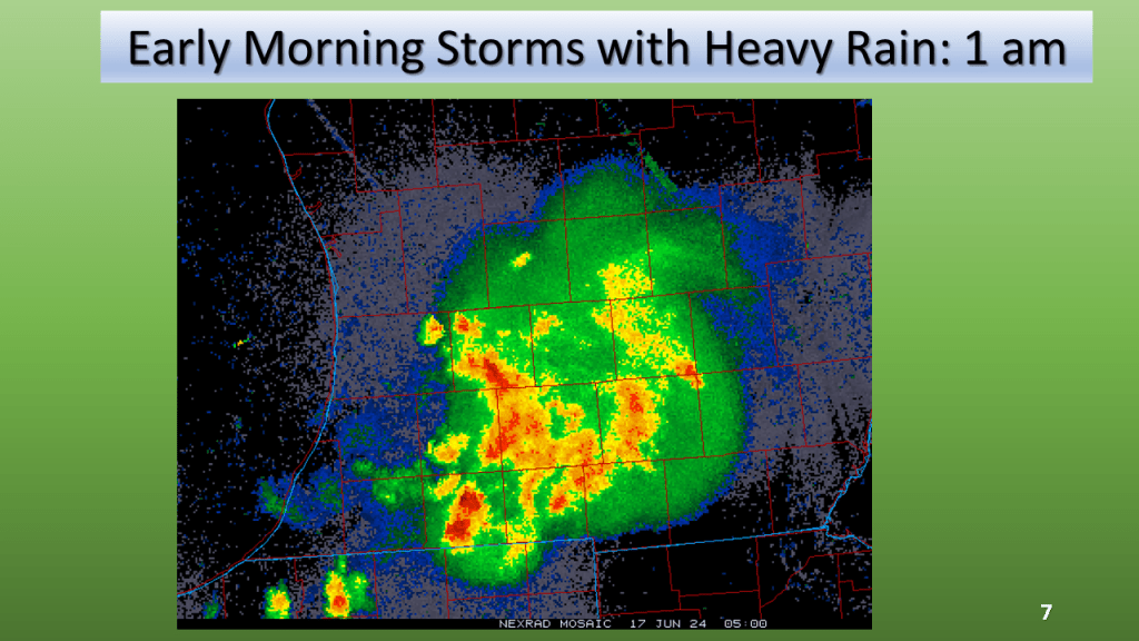
Heavy Rain is expected over most of the southern half of Lower Michigan between 2 pm Monday and 8 am Tuesday morning.
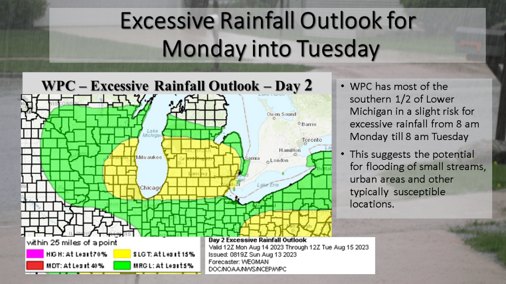
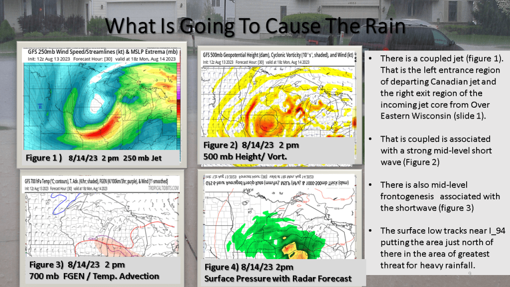
An unusually strong storm system for this time of year is expected to track east across Lower Michigan from Monday into Tuesday morning. This will be an occluded system, with the track of the surface low near I-94. It is typical for the heaviest precipitation to be within 100 miles of track of the surface low, but on the north it’s track. This system as a closed upper low with it and a coupled jet with it. The precipitable water reaches above 1.5 inches Monday afternoon over the southern 1/3 of Lower Michigan as this system tracks through the area. There is also good model continuity with this system so it gives me confidence that the heavy rainfall will happen. Just exactly were is questionable but I would have to believe between I-94 and Route 10, between Monday afternoon and Tuesday morning a large part of that area should see more than an inch of rainfall.