Here is my forecast for this coming week, plus a look at the current fall foliage report. The short story is warm and dry this week of the Great Lakes and northern New England. Wet along most of the East Coast and over the western CONUS. It will be cool and wet over the western CONUS.

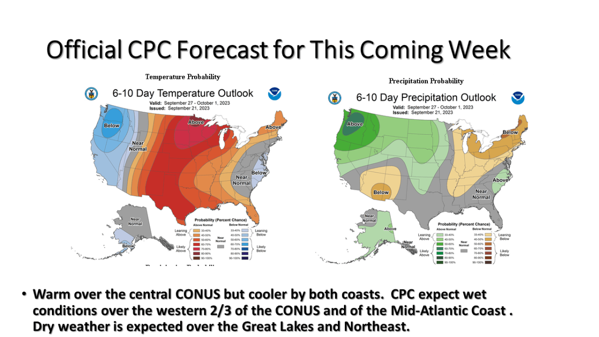
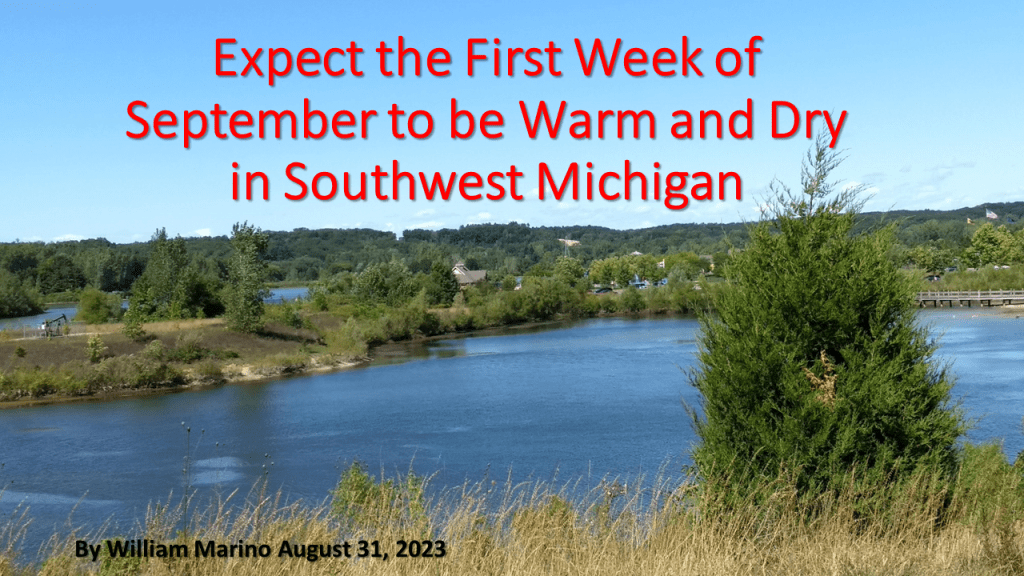
I am expecting warm and dry weather this week over Michigan but warm and wet over the east coat, and cool and wet over the west coast.

Fall Foliage Map

Here is my updated version of the summer of 2023 climate. I have added some details on Southwest Michigan including the severe weather events this summer. I have also added slides on the large scale pattern, that is our transition from La Nina this past winter to El Nino this summer. This lead to persistent blocking over North America, which is why there were persistent heat over the south and wet weather over the eastern 1/3 of the CONUS.

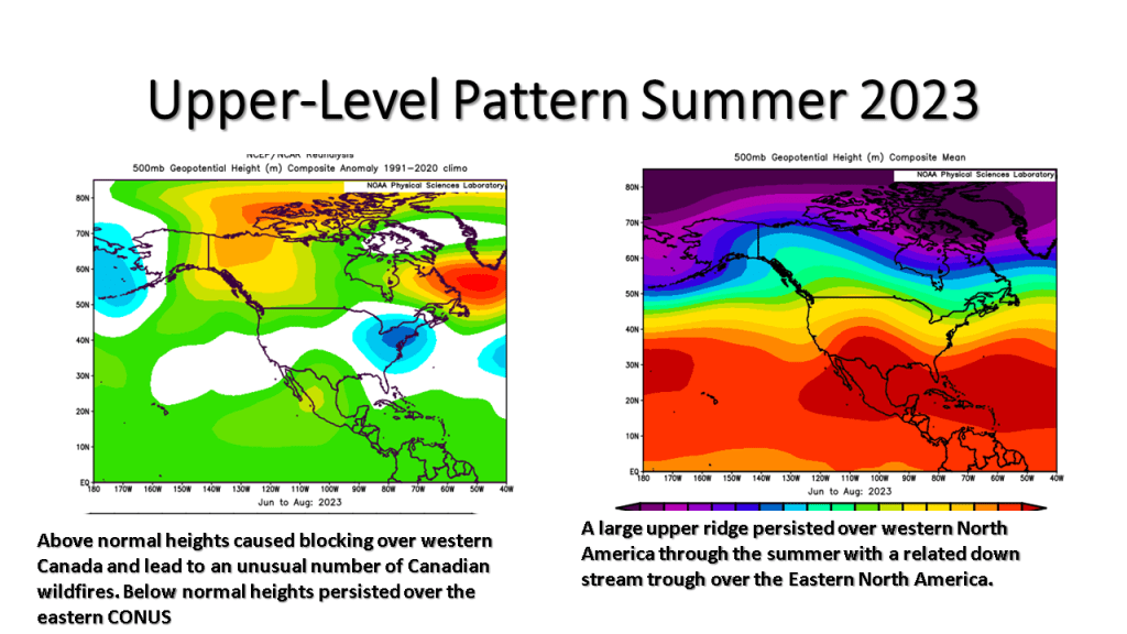
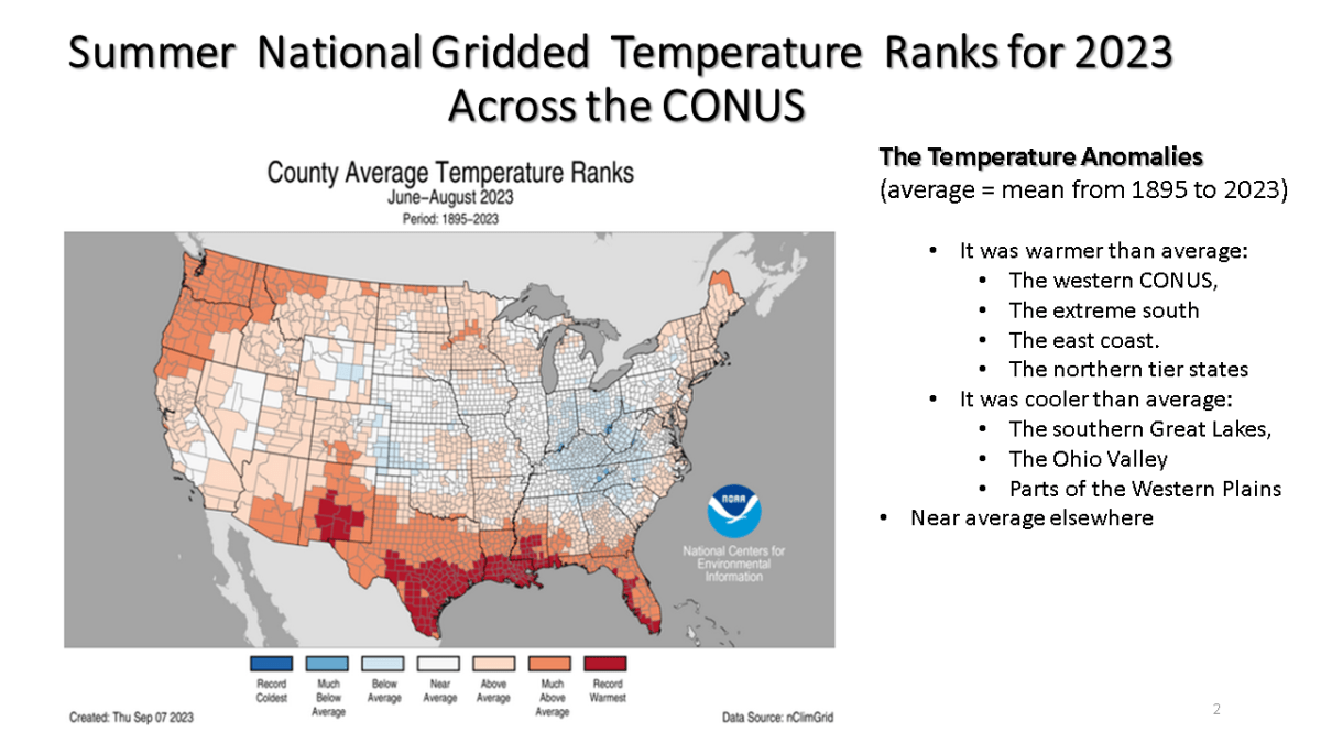
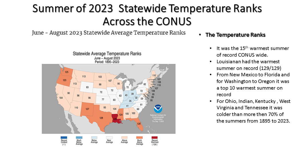
This was a summer that featured persistent weather patterns over most of North America and lead to one of the most active Canadian wildfire seasons on record. It also lead the the 15th warmest summer on record (back to 1895) over the CONUS.

GRR August 24th Event Link

DTX August 24th Event Link

DTX August 24th Event Flooding Link

DTX EVENT SUMMARYhttps://www.weather.gov/dtx/severeweather07202023
DTX EVENT SUMMARY

How did the Summer of 2023 turn out weather wise across the CONUS (continental United States)? How did the summer forecast I posted in March turn out (very good for the temperature, not so great for the precipitation)

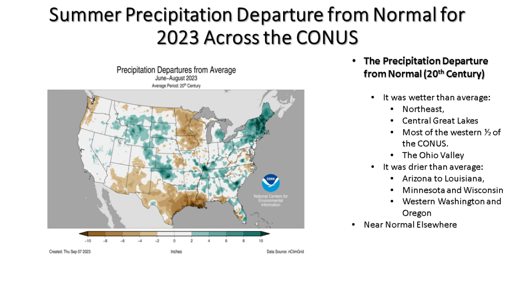
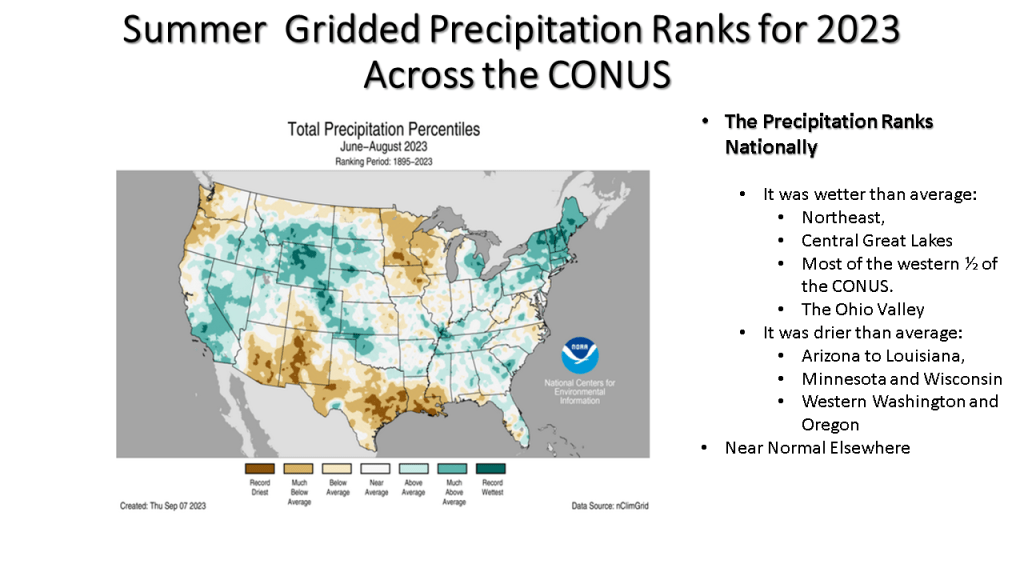
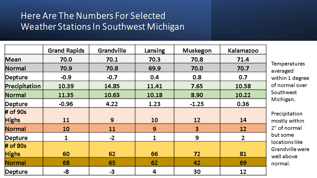
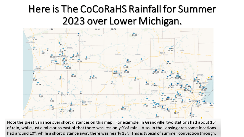
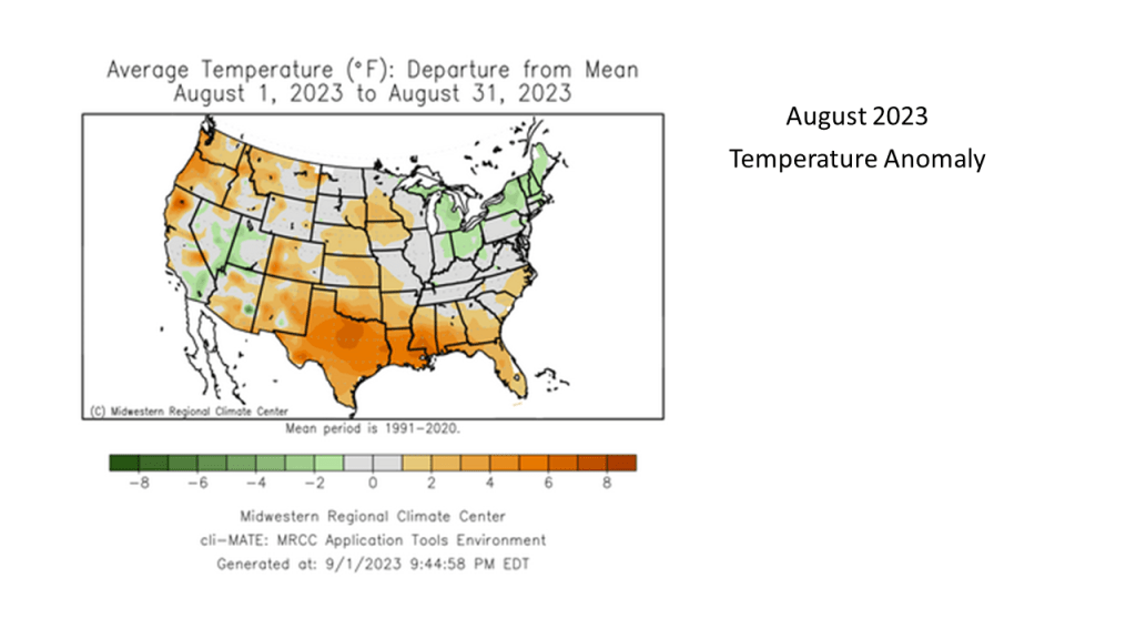
While it was the 15th warmest summer on record nationally, not all of the CONUS had a warm summer. You may want to find out how your area did relative to normal for this summer.

It appears cool weather will prevail over the eastern Continental United States (CONUS) for the next 3 weeks. It should be drier than normal over the Great Lakes but wetter than normal over the East Coast and Western Plains.

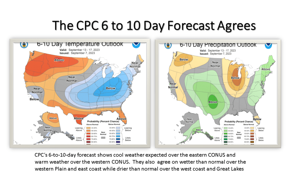
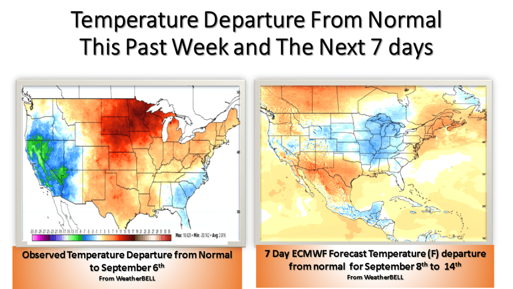
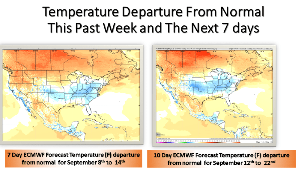
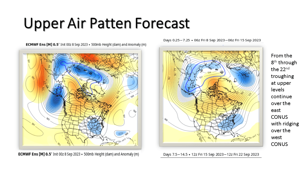
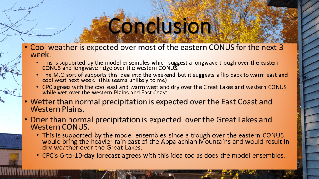
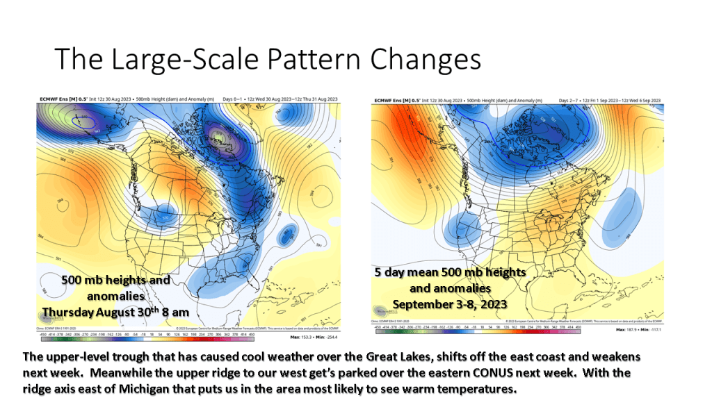
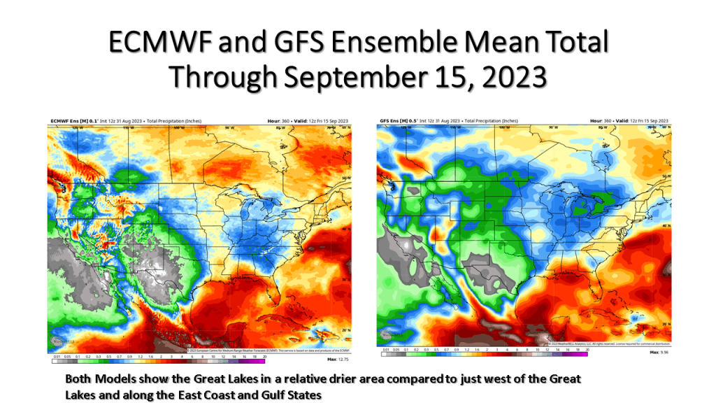
Expect the next 3 weeks to be cooler than normal over most of the eastern United States. It will be dry over the Great Lakes but very wet over the eastern seaboard.

This coming week could see our last days this year with highs on the 90s over the western Great Lakes. Little rainfall is expected until the middle of next week. Labor Day Weekend over all of Michigan and for that matter the Great Lakes.

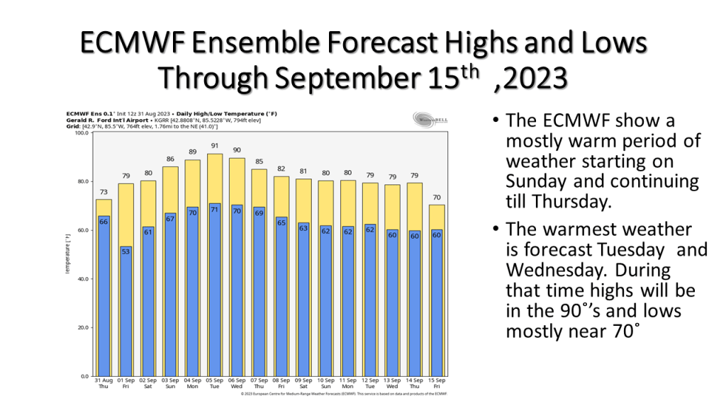
Warmer temperatures are expected from Labor Day into the middle of the week. A cold front coming through the area in late Wednesday/Thursday time frame may bring showers and slightly cooler weather .

Here is an updated report on the storms on August 24, 2023. As it turned out there were 1 EF-1 tornado in Southwest Michigan, and EF-2 tornado in South Central Michigan and 6 tornadoes, 1 EF-0 and 5 EF-1’s in the Detriot area. I updated some of my slides for the event.

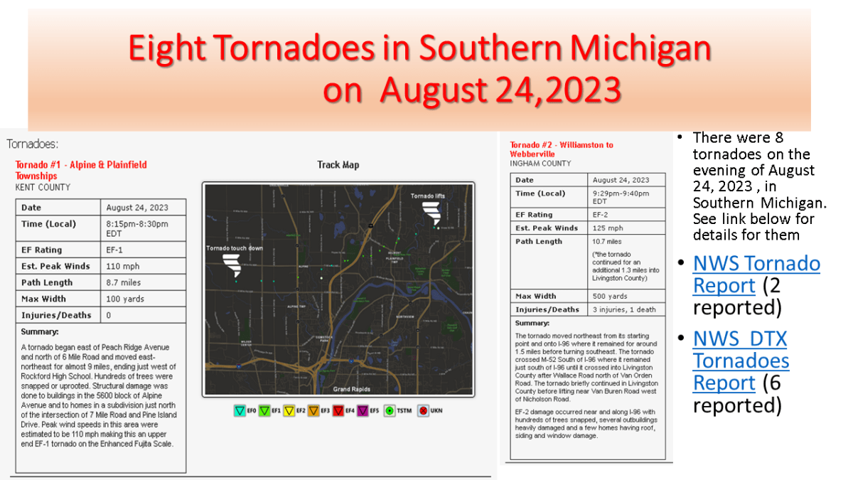
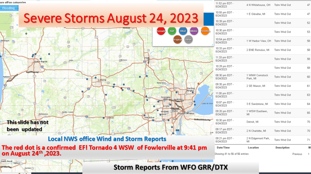
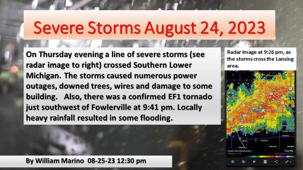
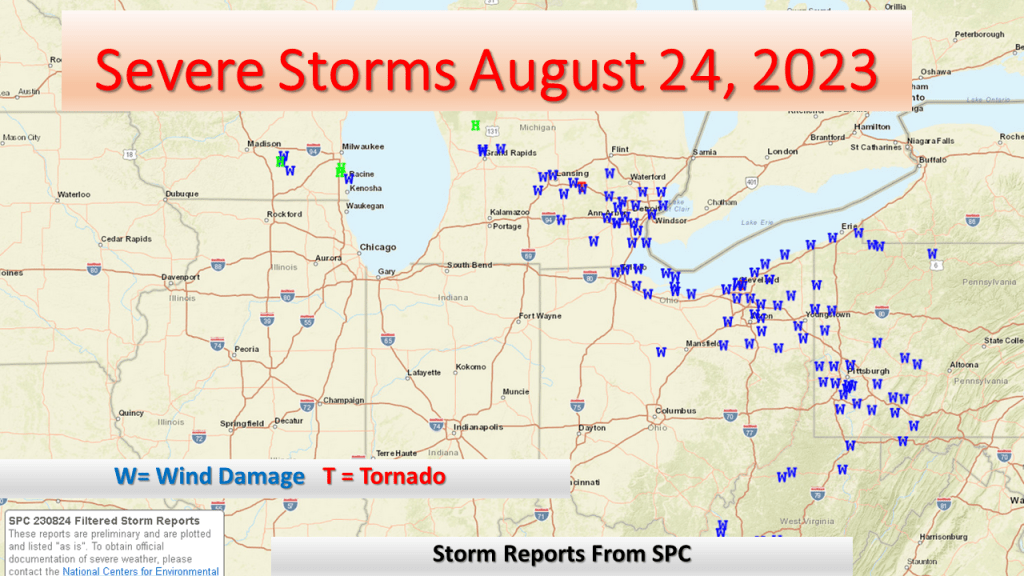
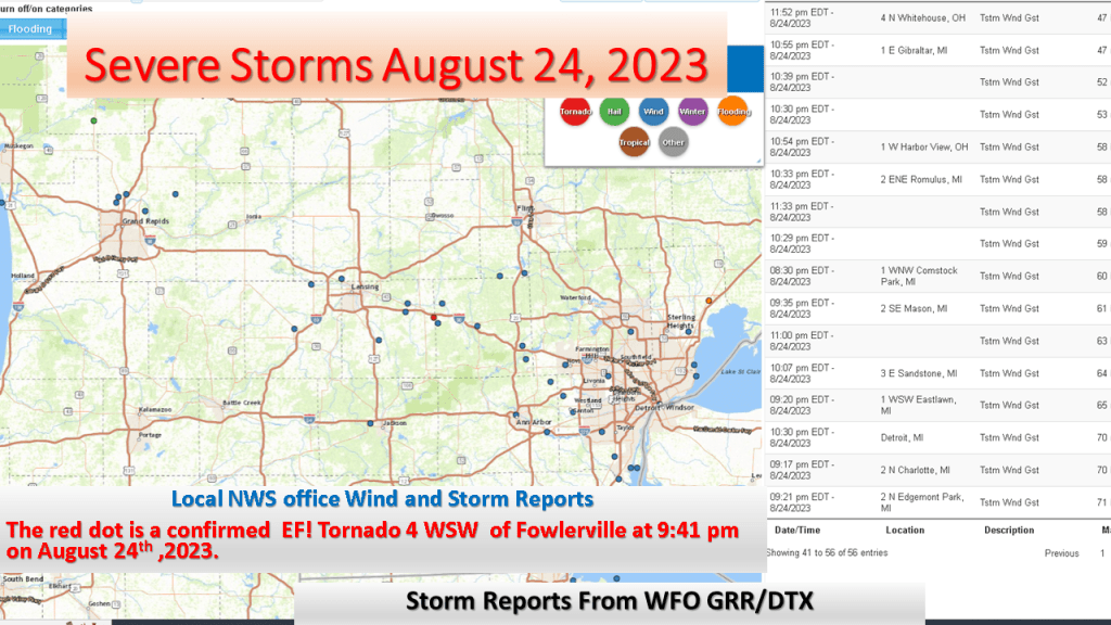
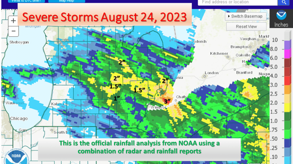
I updated my story about the severe storms since the NWS has now reported 8 tornadoes in Michigan on the 24th of August. The strongest was an EF-2 near Webbrvillle

Severe Storms, on Thursday night (8-24-23) cause power outages, flooding and an EF1 tornado over Lower Michigan. This shows some preliminary reports from the storm last night.

It was a HOT JULY over most of the CONTINENTAL UNITED STATES but that was not the case for the Upper Midwest and Great Lakes.

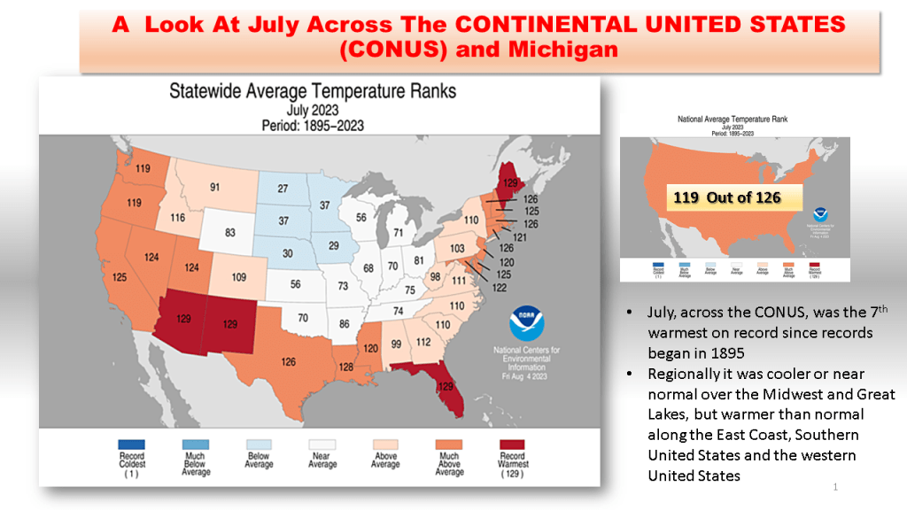
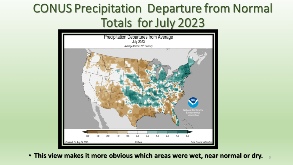
As promised I have posted the national images of July 2023. The short story is it was the 7th warmest and 45th wettest for the CONUS. In Michigan it was the 58th warmest and 5th wettest on record.

Heavy Rain was forecast for yesterday afternoon into mid morning today. The slides below show the what actually happened.

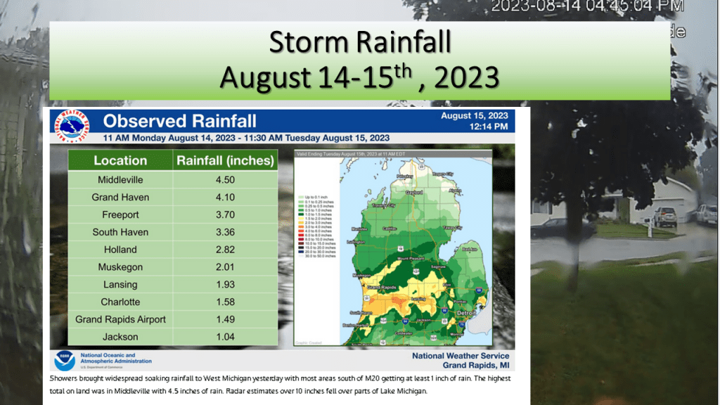
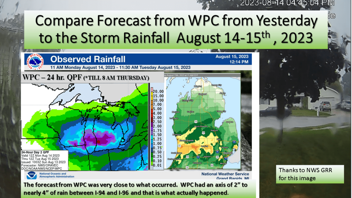
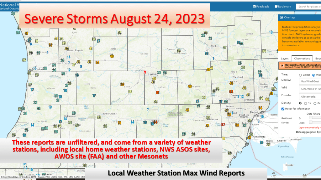
We forecast heavy rain between I-94 and I-96 and that is exactly what did happen. The heaviest rainfall report showed 4.50 inches in Middleville, most of that area had between 1″ and 3″ of rain from the event.