


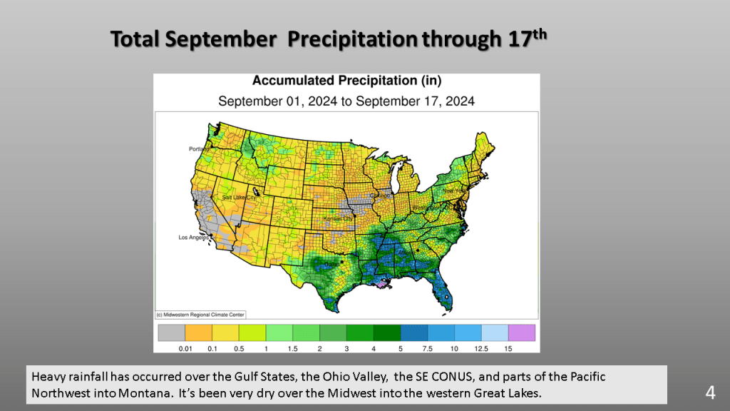
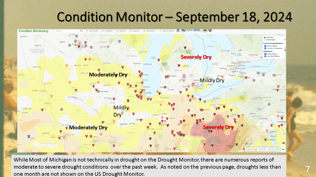
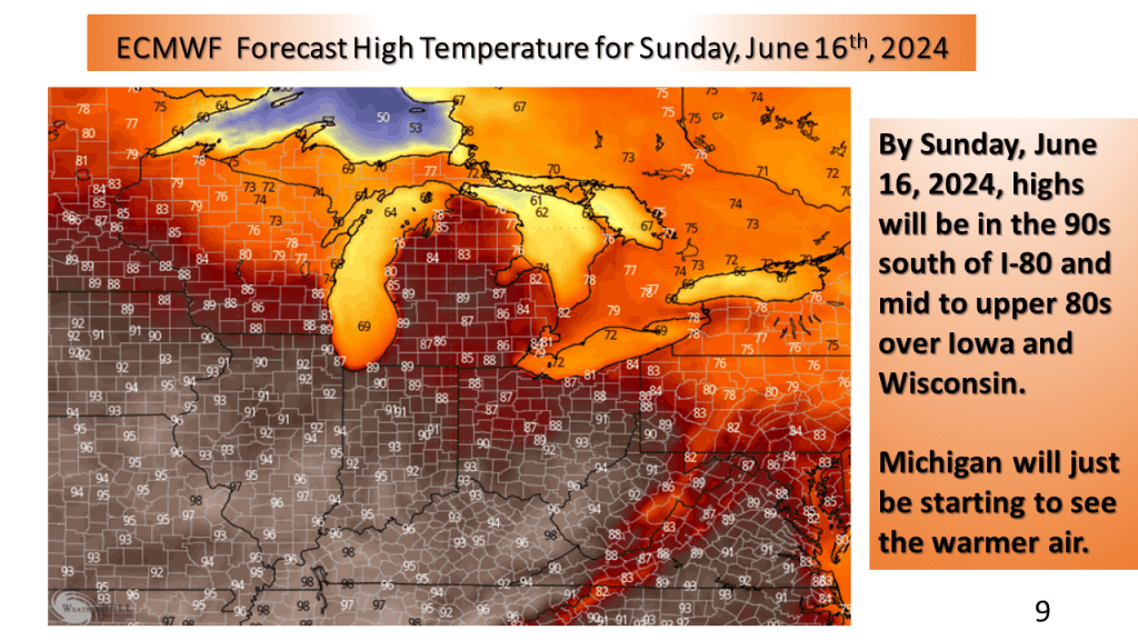
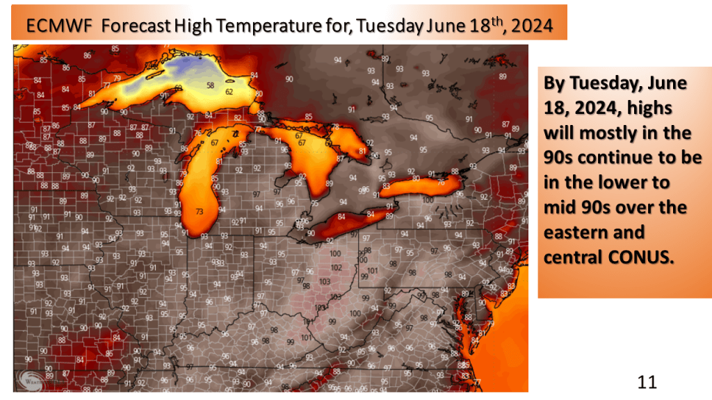
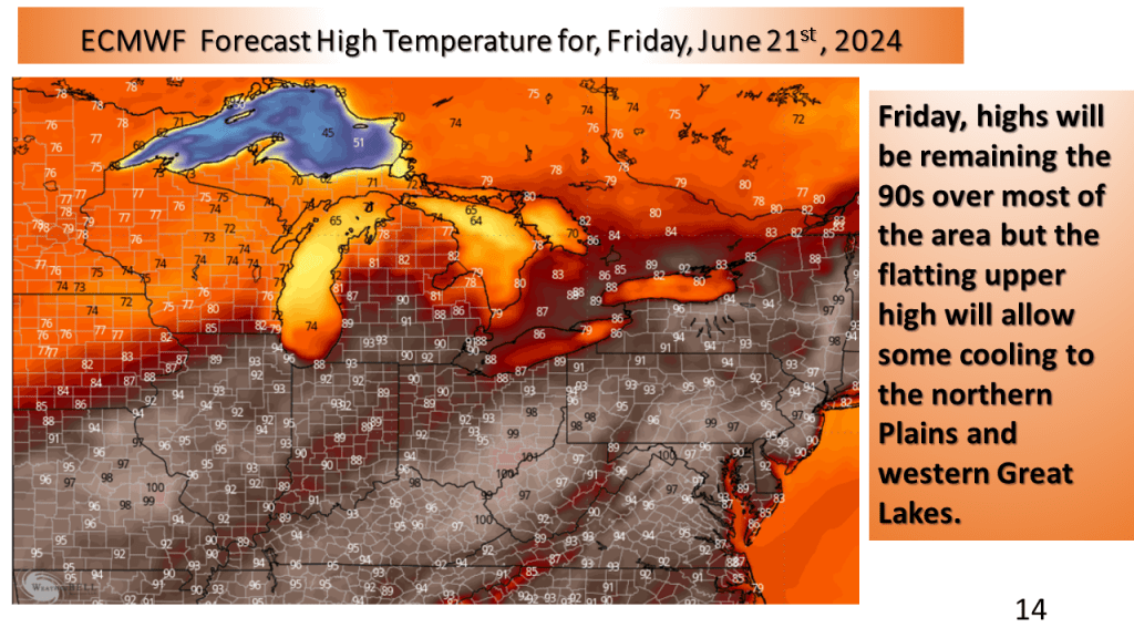
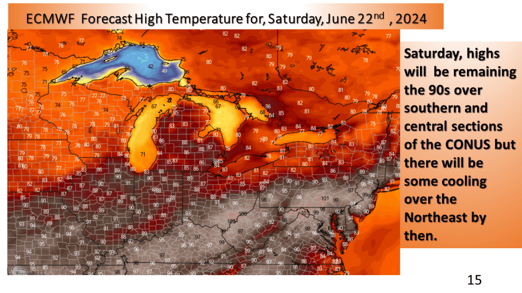
(over the Midwest and Great Lakes)


Seems another developing closed upper low my cool the eastern CONUS off by 19th of August (or the 3rd full week of August). This would likely be a wet period over the east.


Warmer than normal temperatures are expected over most of the CONUS following the system for the third week of July.


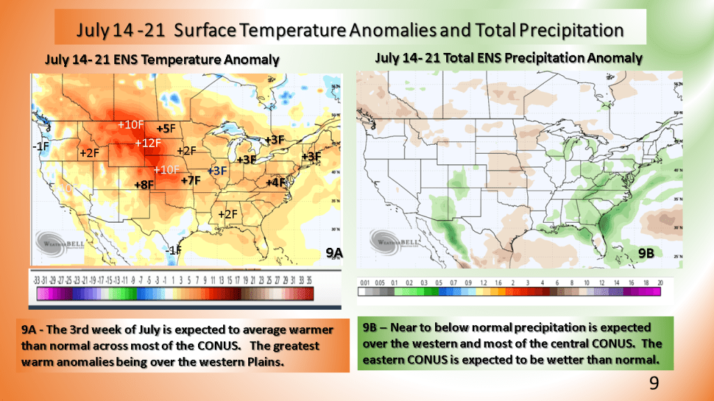


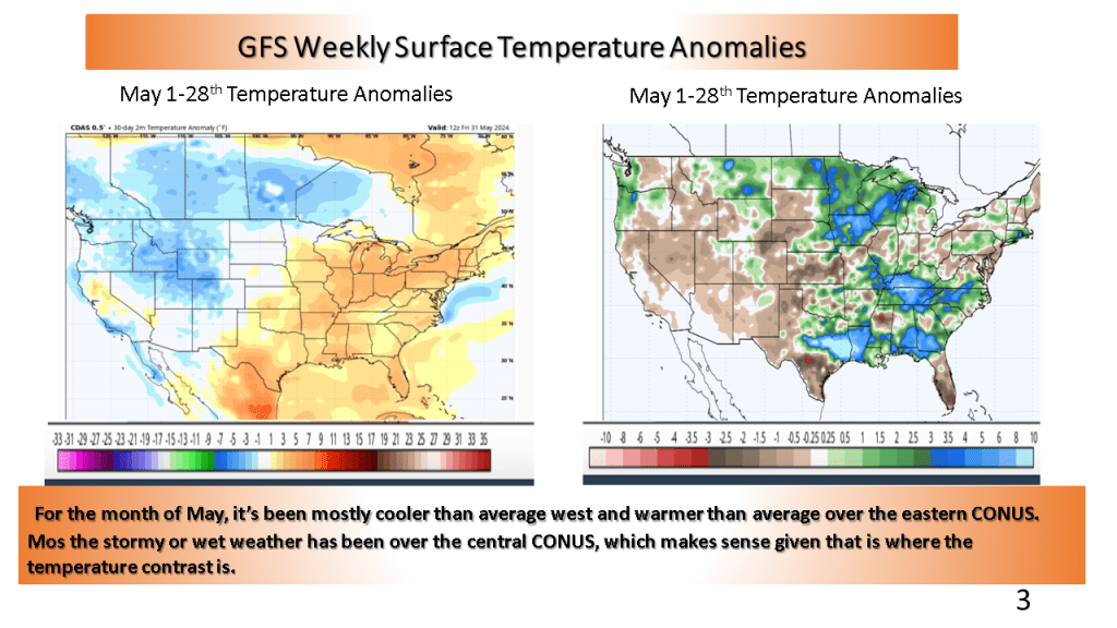
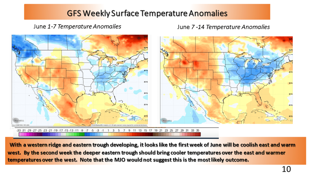
This would suggest cooler than normal over the eastern CONUS and warmer than normal over the western CONUS. The wet weather over the central CONUS may last into the first week of June but most of the rest of June is expected to feature near to below normal precipitation.