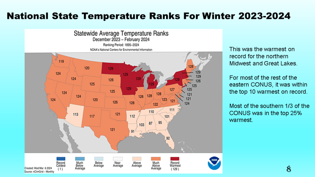
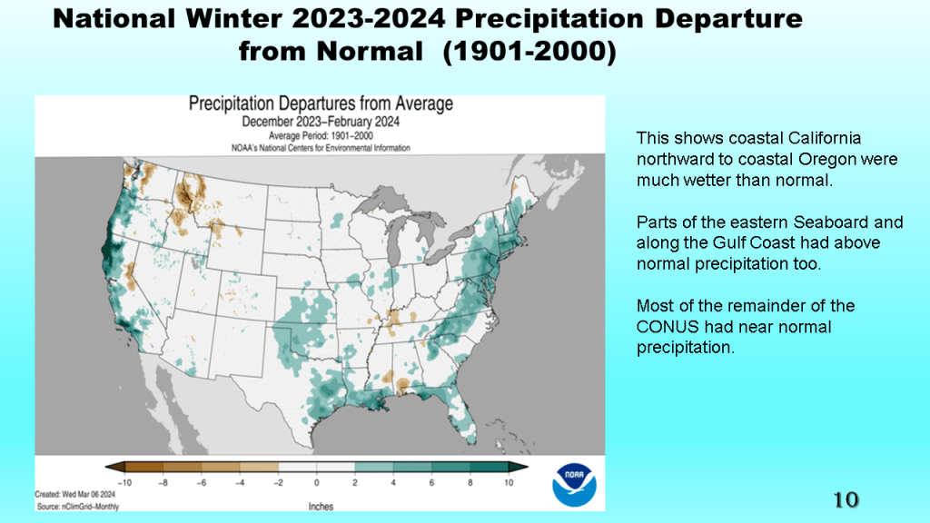
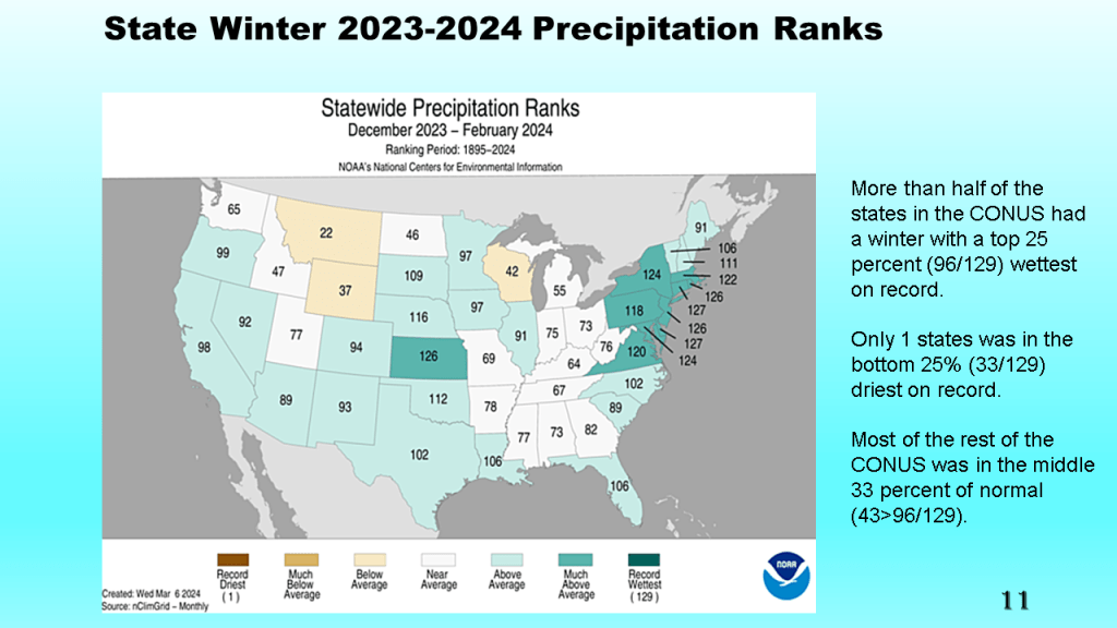
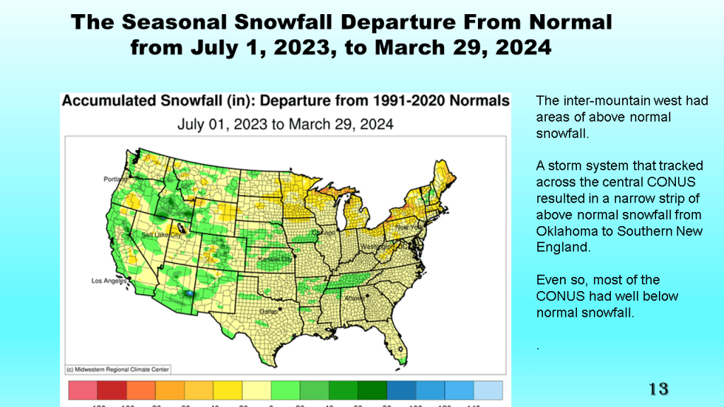
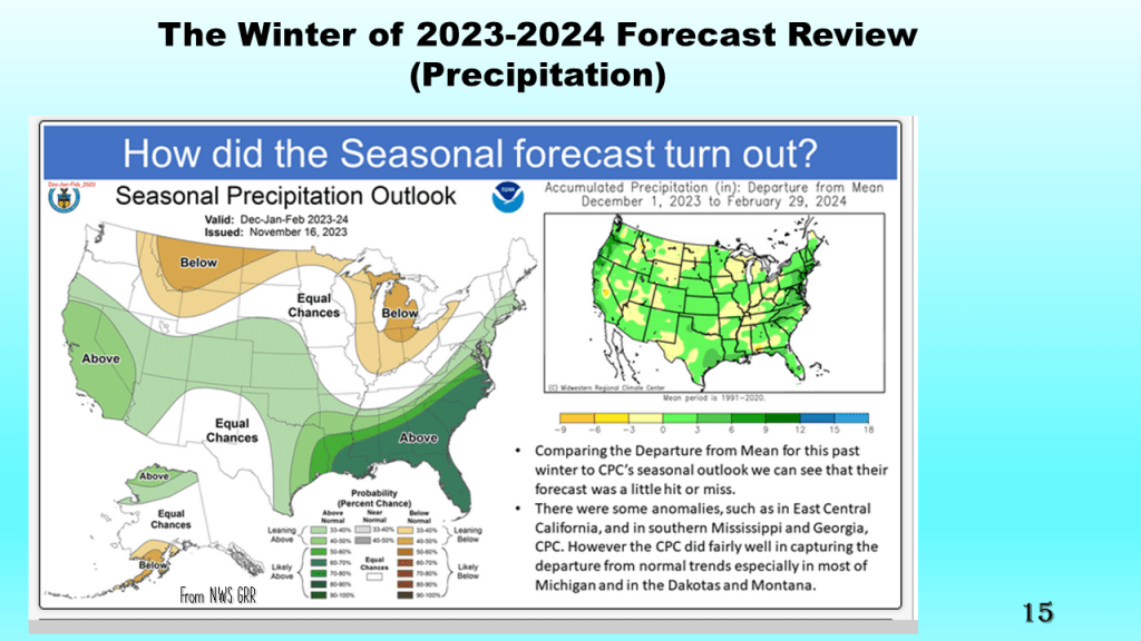
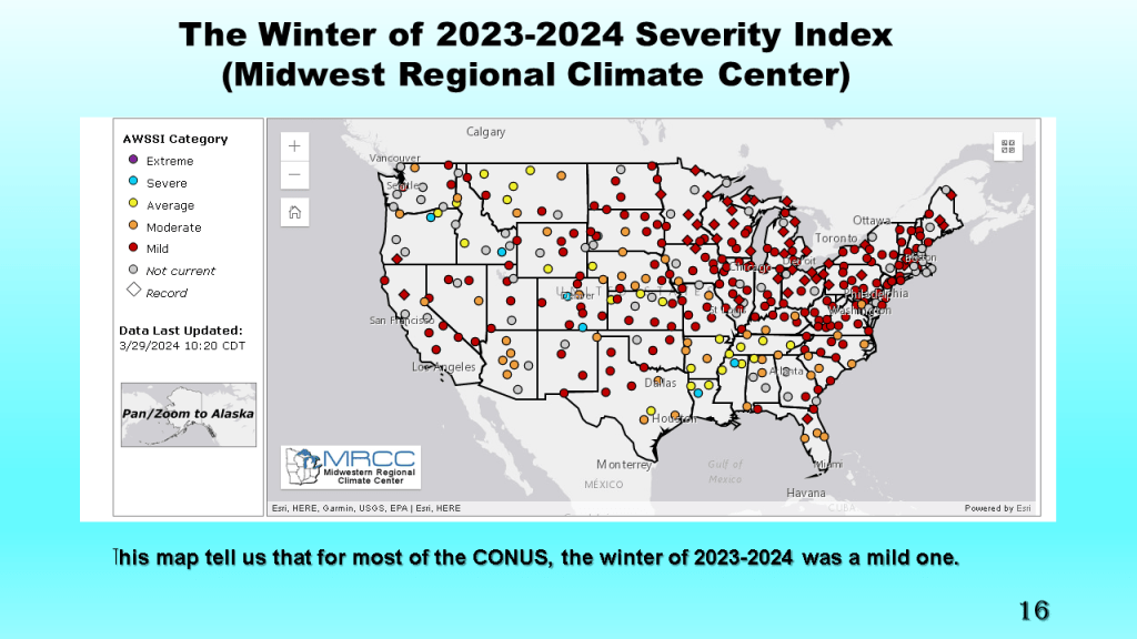
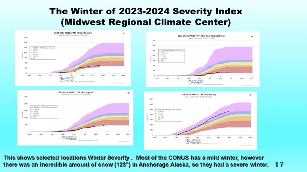
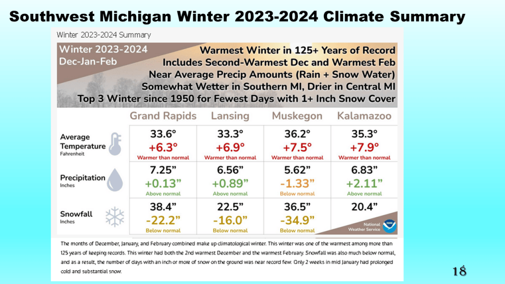
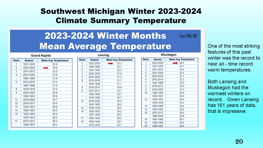
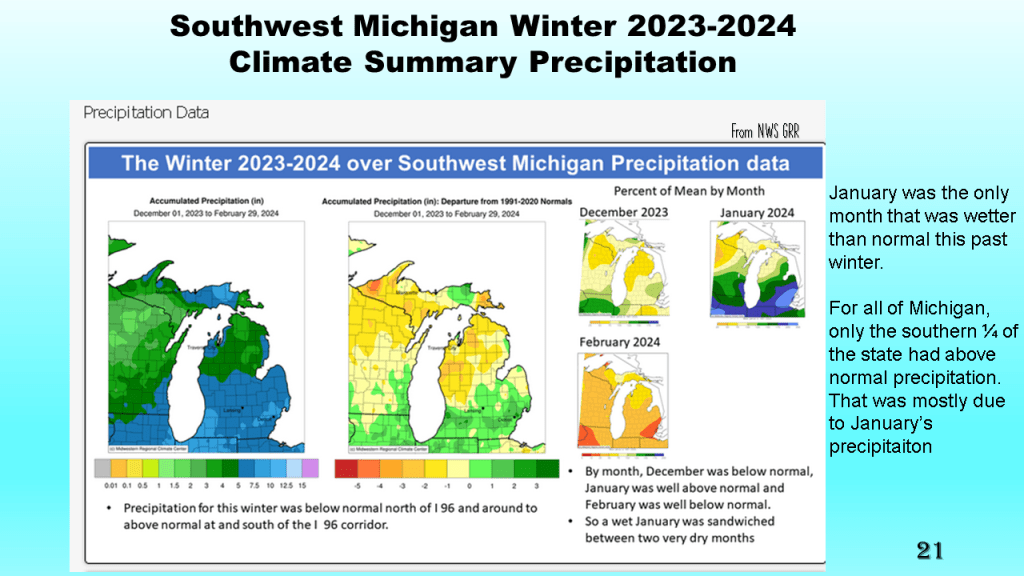
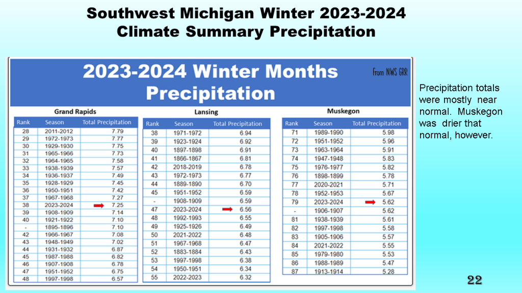
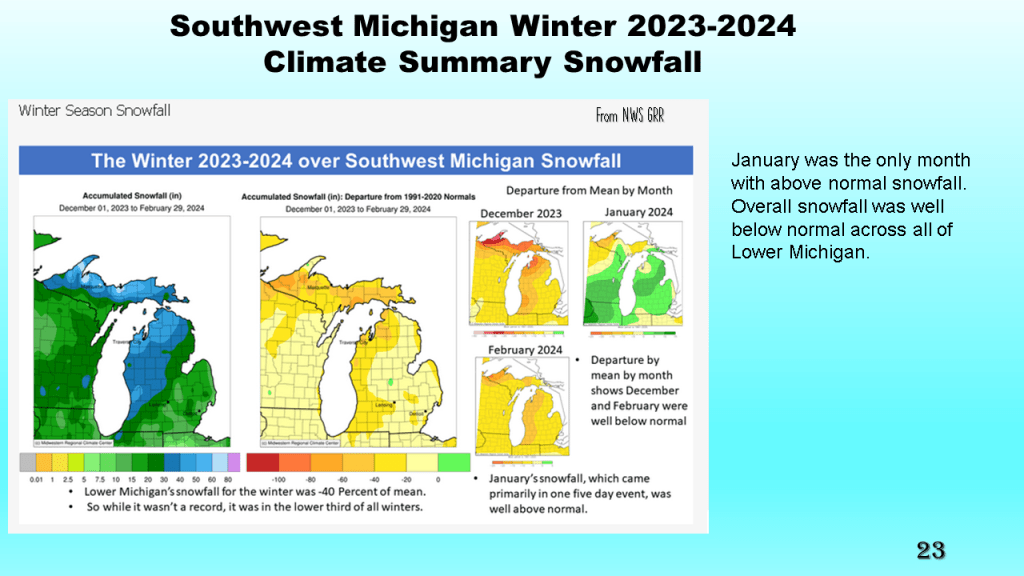
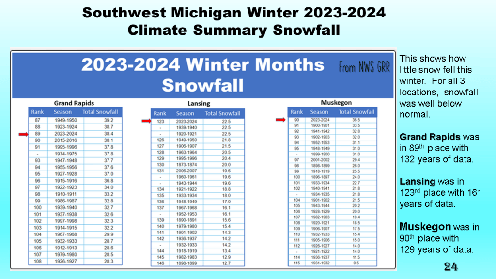
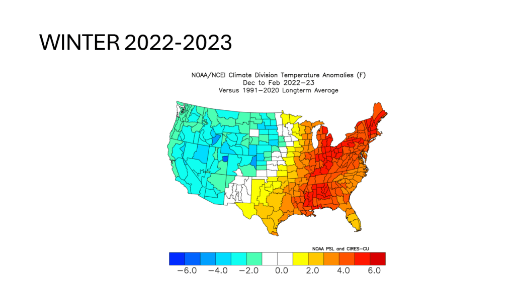
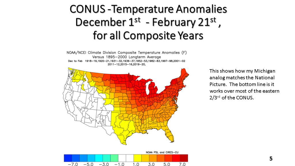
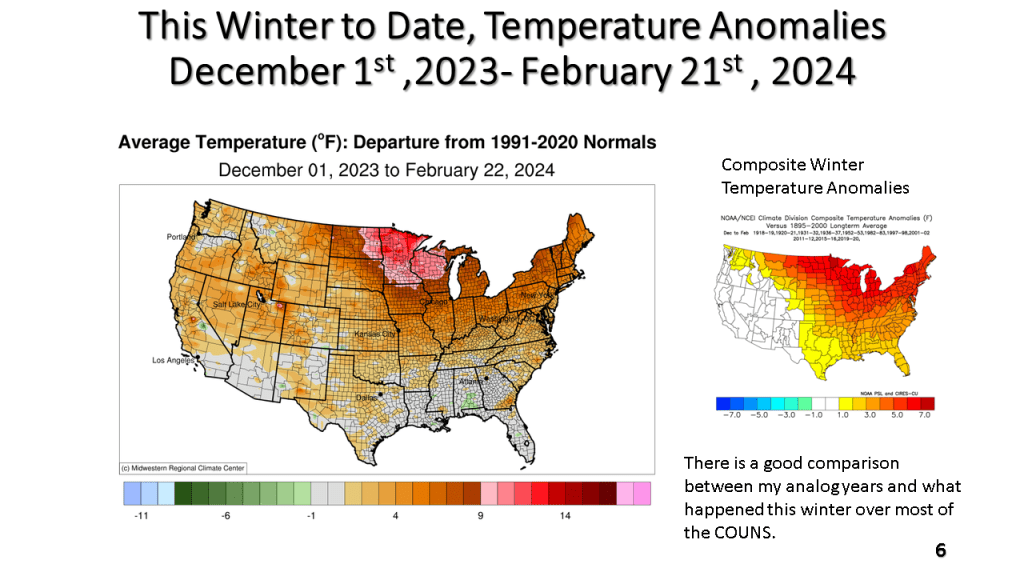
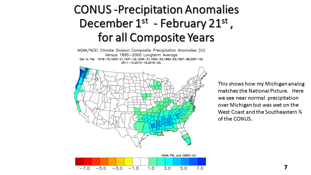
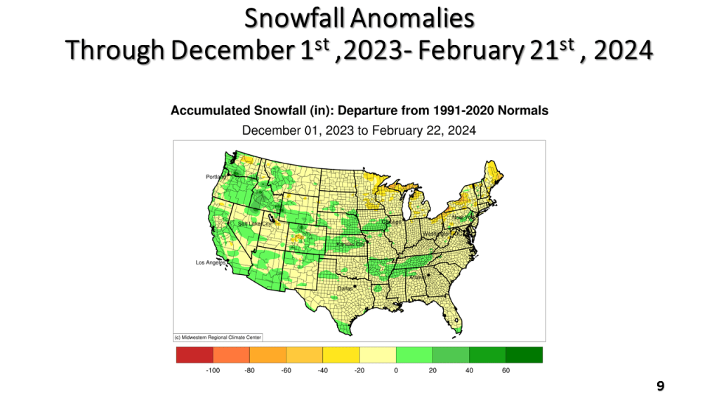
This was both nationally and locally one of the warmest winters on record, with records going back to 1895. Nationally and locally snowfall was below to well below normal. Precipitation was mostly near normal.


This was both nationally and locally one of the warmest winters on record, with records going back to 1895. Nationally and locally snowfall was below to well below normal. Precipitation was mostly near normal.
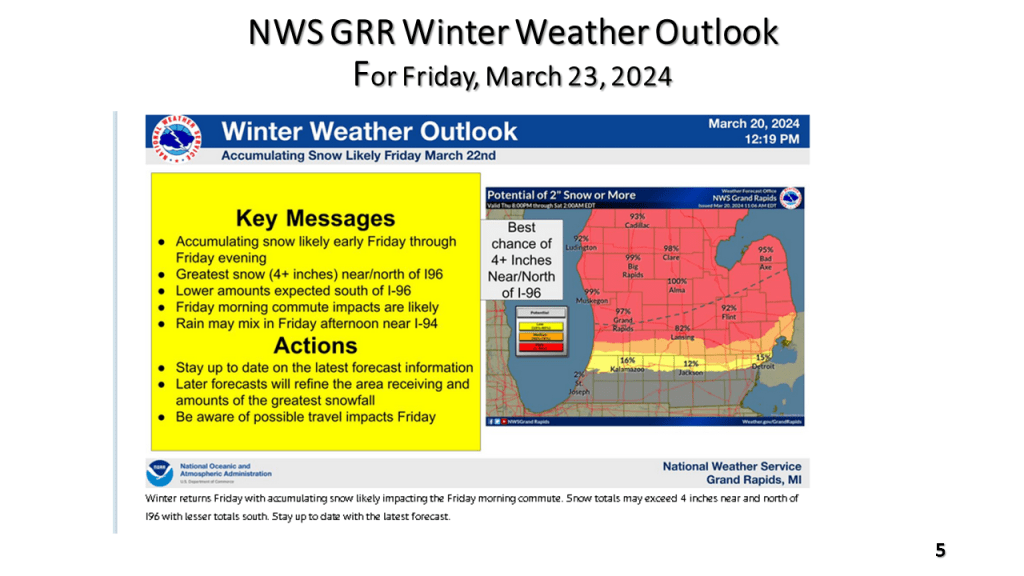
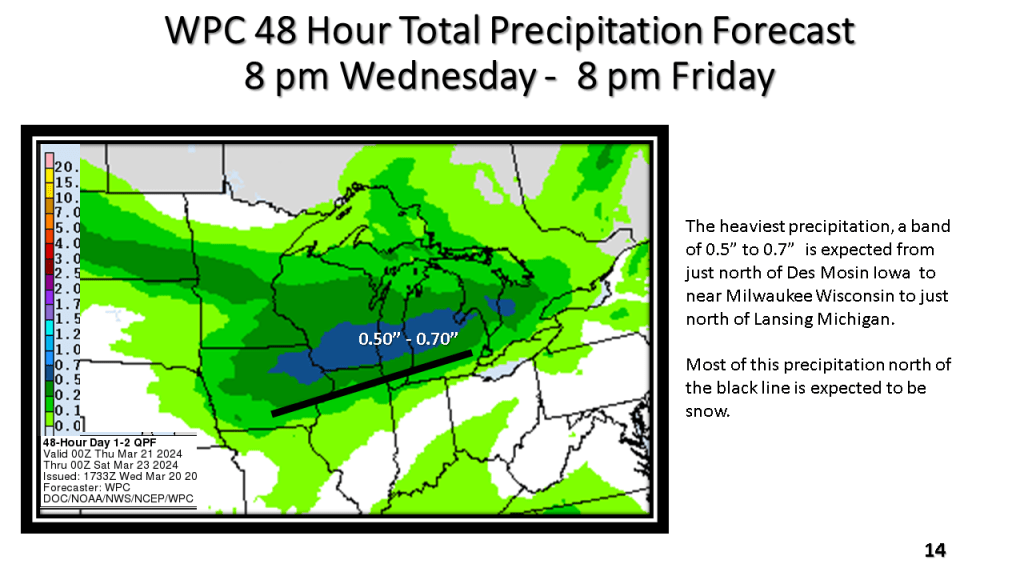
The National Weather Service offices across the western Great Lakes have all issued Winter Weather Advisories for this snowfall event that is expected to continue, even over Iowa into northern Illinois and Wisconsin into early Friday afternoon and over Lower Michigan into the early evening of Friday.
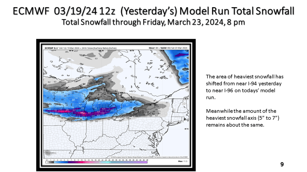
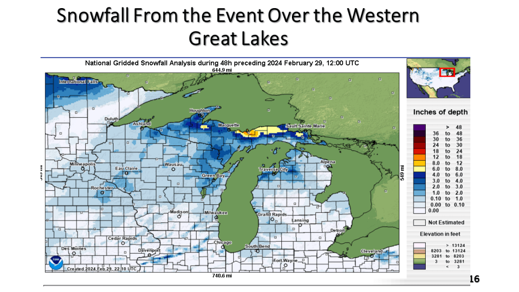
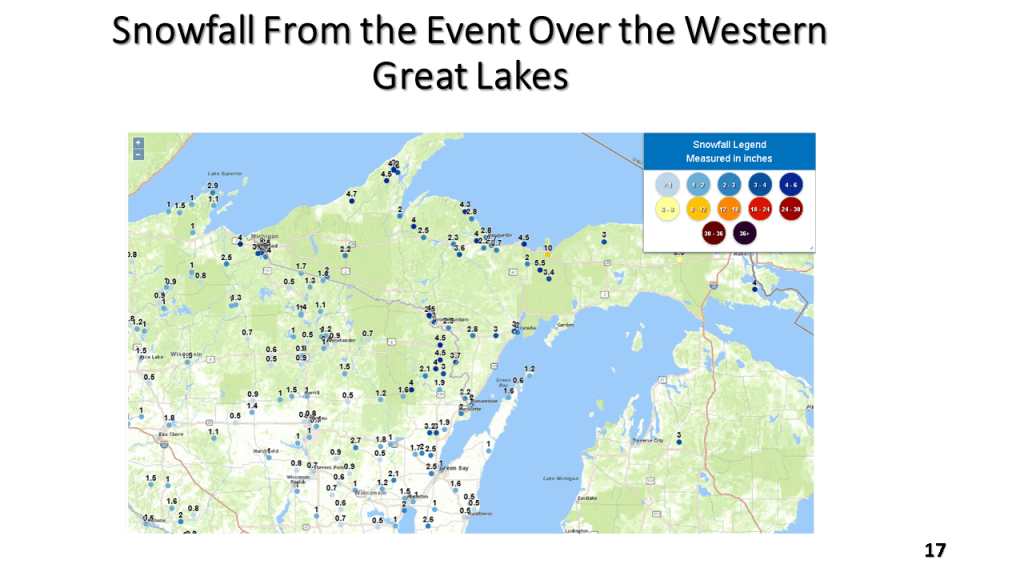
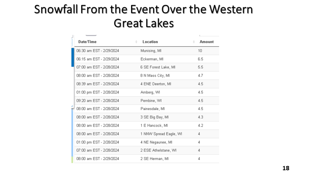
The following slides will show you the details of this event that is expected to bring up to 10″ of snow in about 12 hours to some locations in western Great Lakes. It will likely be the heaviest snowfall over most of the area since mid February.


A narrow band of snowfall greater than 6″ in 12 hours is expected about 100 miles north of the track of the surface low. That would be near or just north of I-96 in Michigan. Snowfall rates in the heaviest snow area will be high enough to accumulate during the daytime, even in late March.


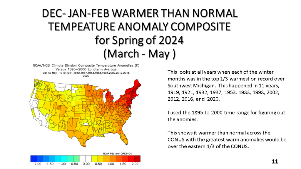
This is an update to what I did yesterday but with a lot more detail. I have added CONUS scale winter temperature anomalies for each of the past 10 years so you can see for yourself, in your area how the cold winter frequency has changed (there is a summary CONUS scale summary table for this now too). I have added correlation slides from CPC and Physical Science Laboratories to show there really the correlation I am suggesting is true.

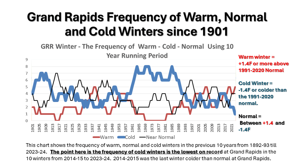
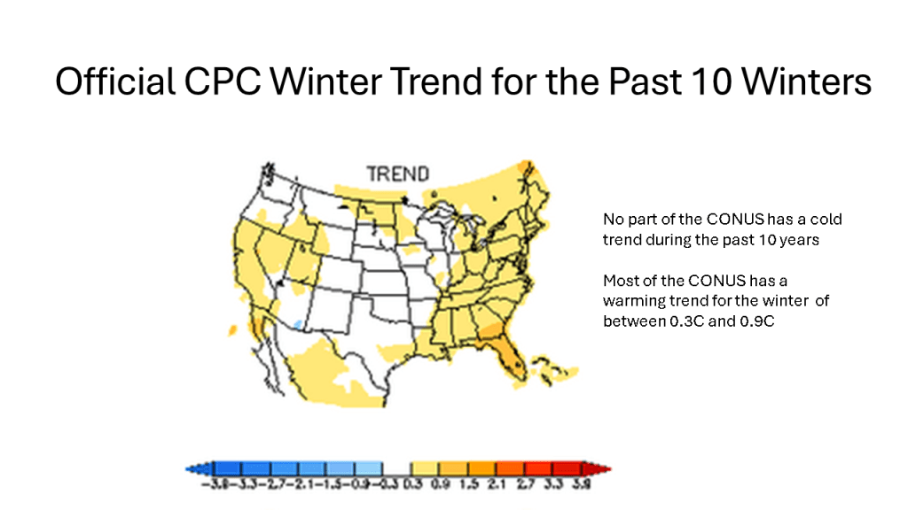


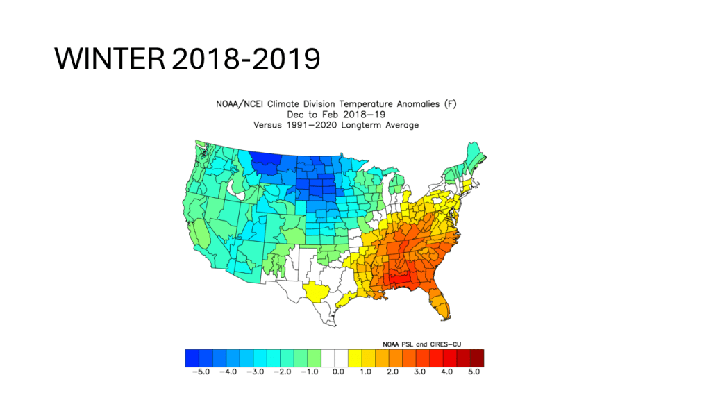
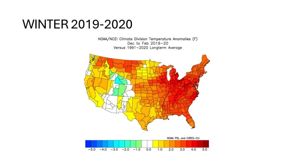
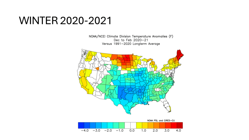
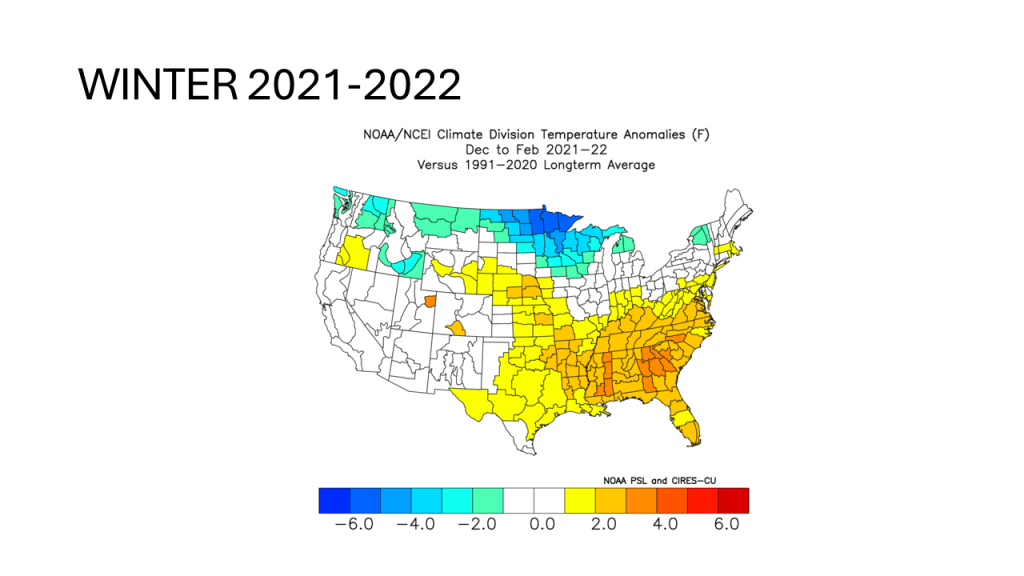

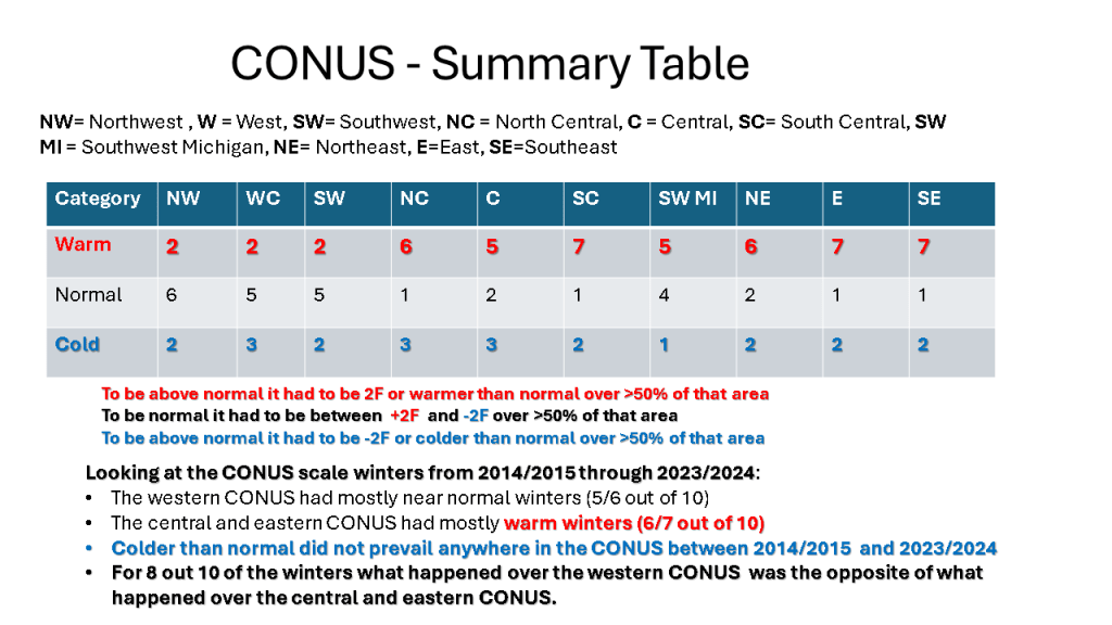
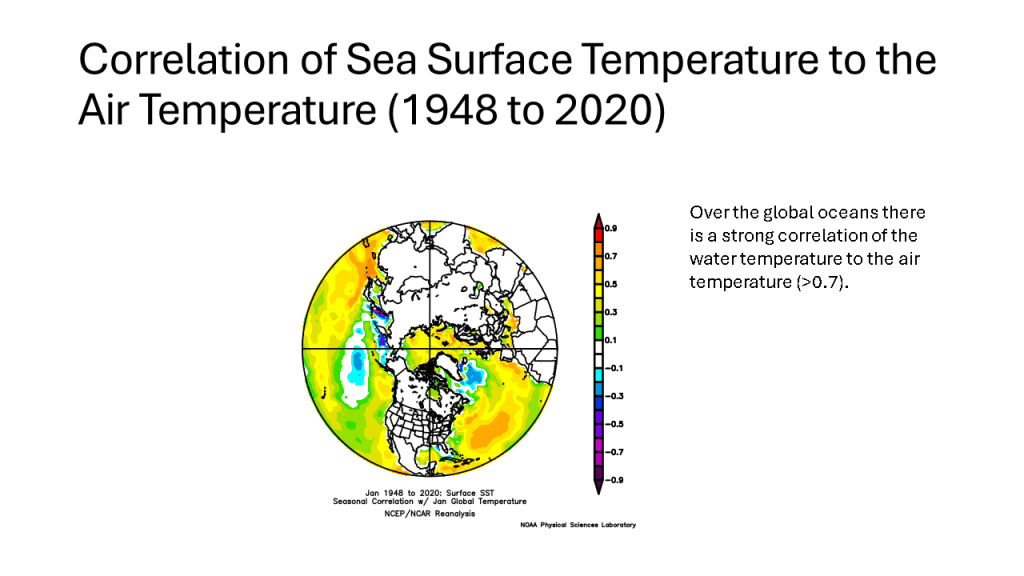

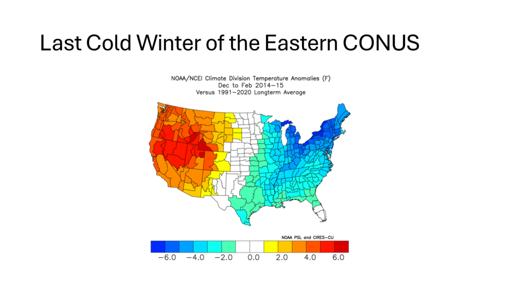
At least over Southwest Michigan and likely most of the northern CONUS, we have lacked cold winter (relative to 1991-2020 normal) since the winter of 2014/2015, which was the last cold winter. I would suggest warming oceans are at least part of the story.


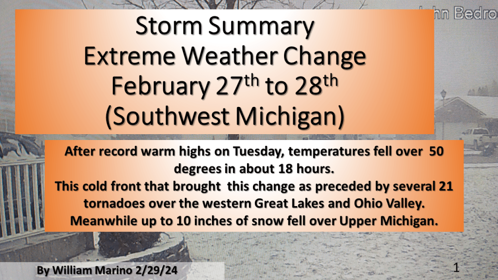
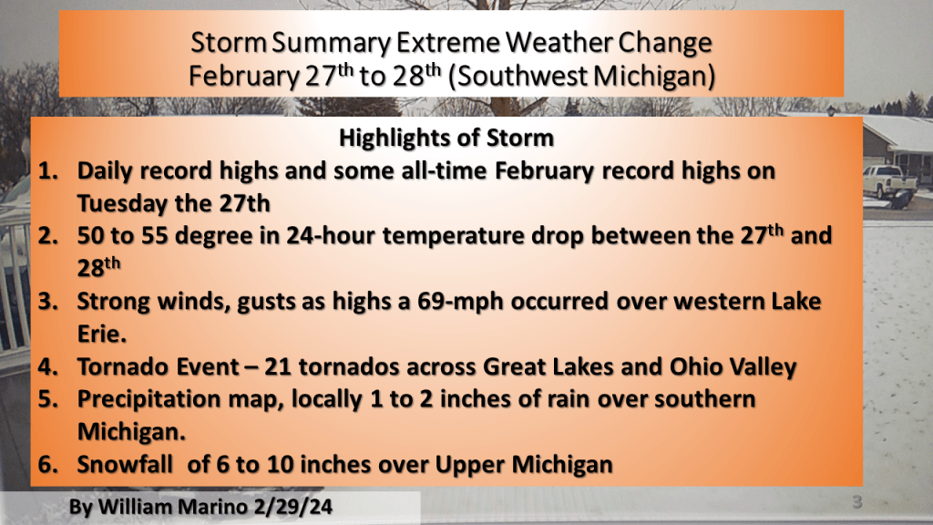
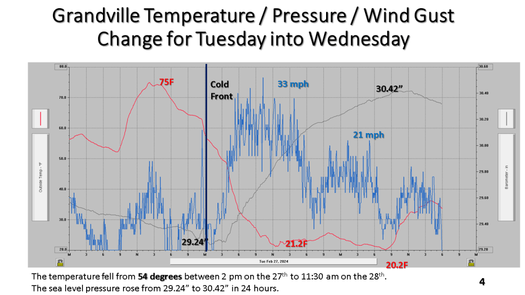
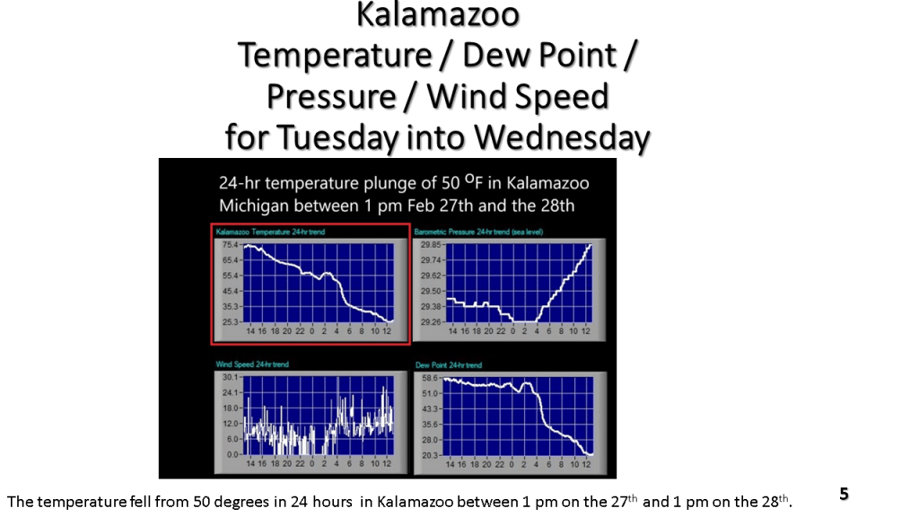
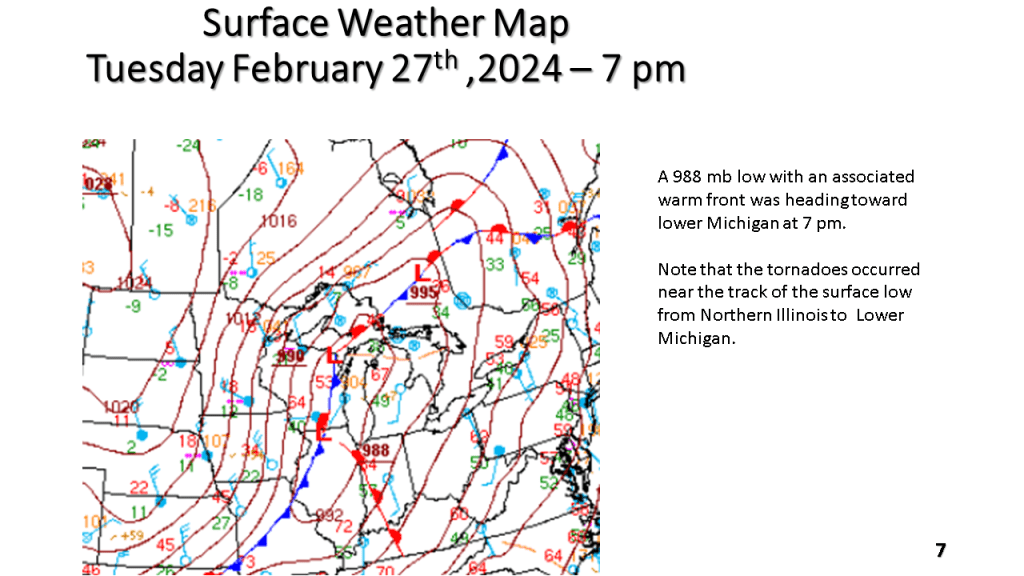
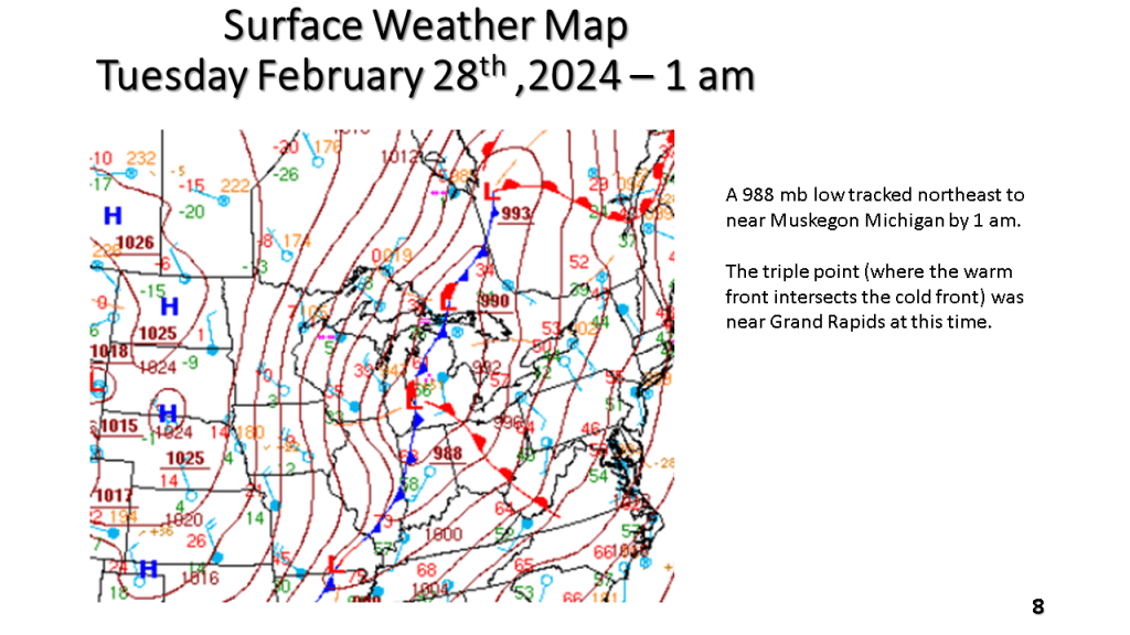
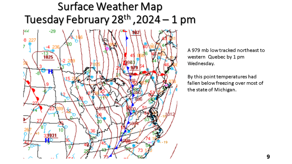
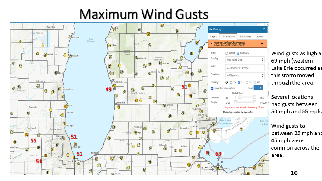
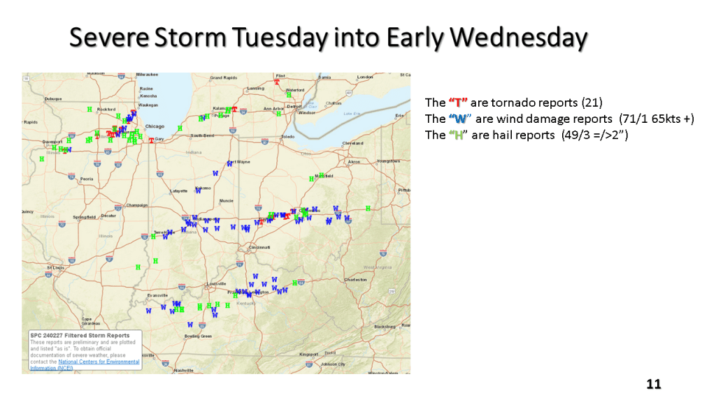
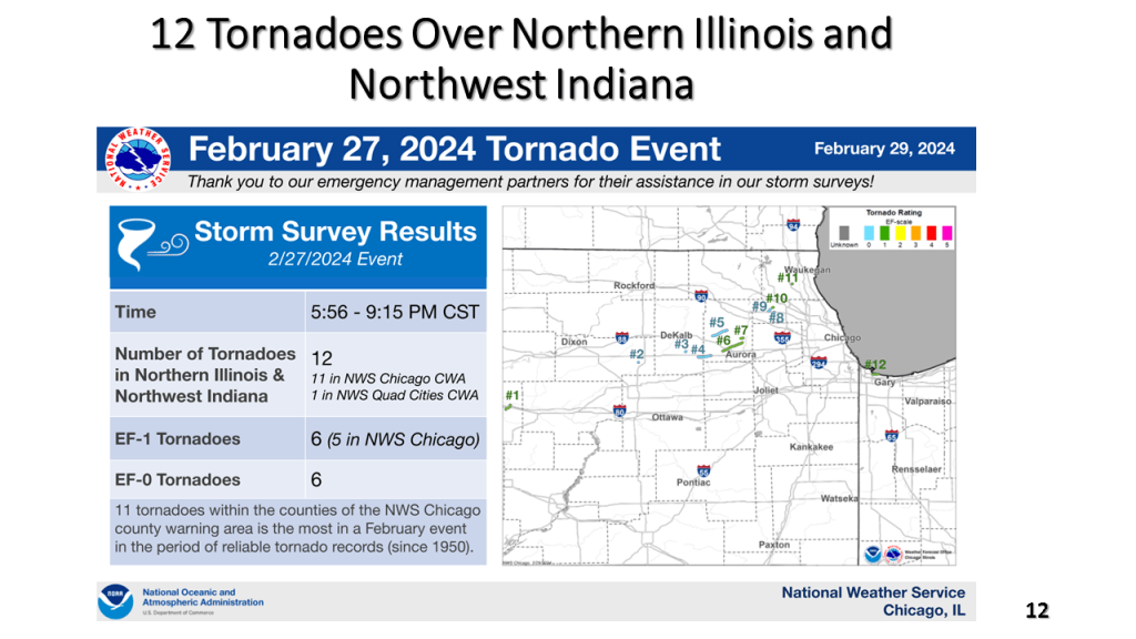
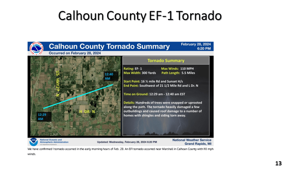
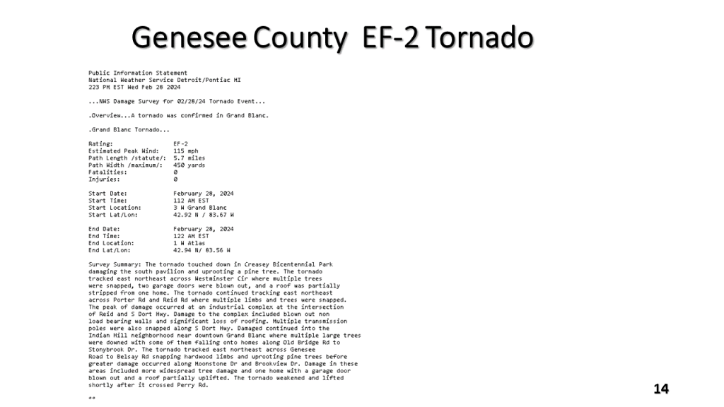
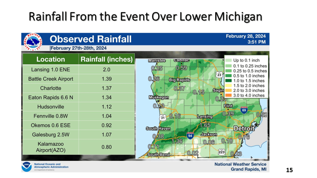
Record high temperatures ( many cases all time record highs for February) were quickly brought to an end by a strong late February cold front. There were 21 reported tornadoes, mostly EF-0 and EF-1 but there was an EF-2 near Grand Blanc in Geneses County just ahead of the cold front. Temperatures fell around 50 degrees between Tuesday afternoon and Wednesday afternoon over Lower Michigan. There was 6 to 10 inches of snow in upper Michigan and locally 1 to 2 inches of rain in parts of southern Lower Michigan. Winds gusted to 69 mph over western Lake Erie.

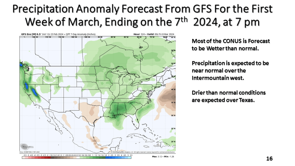
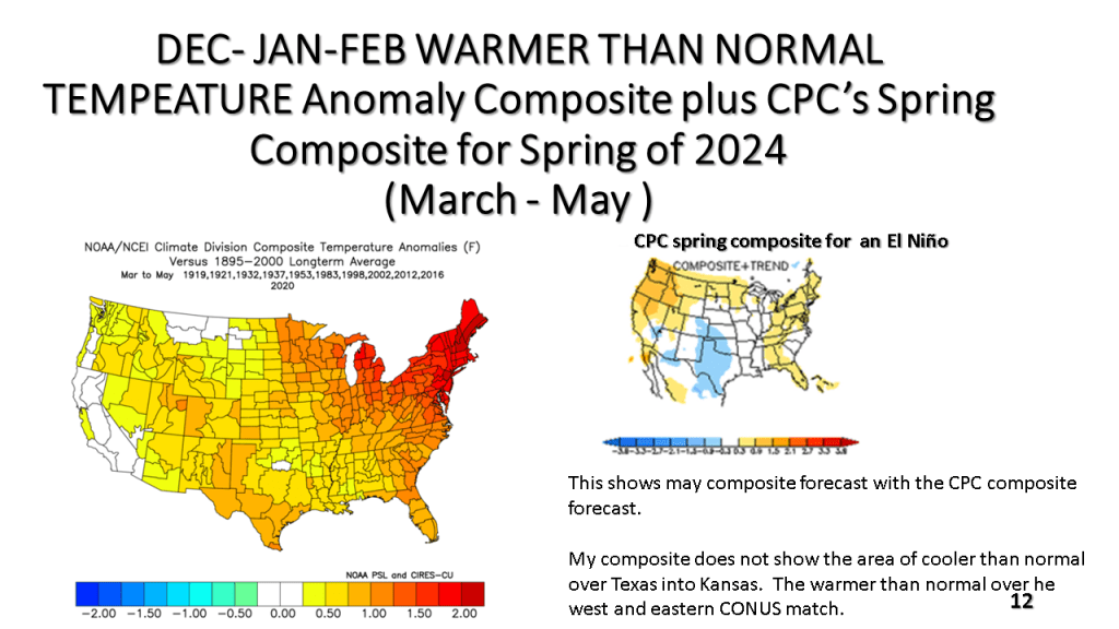
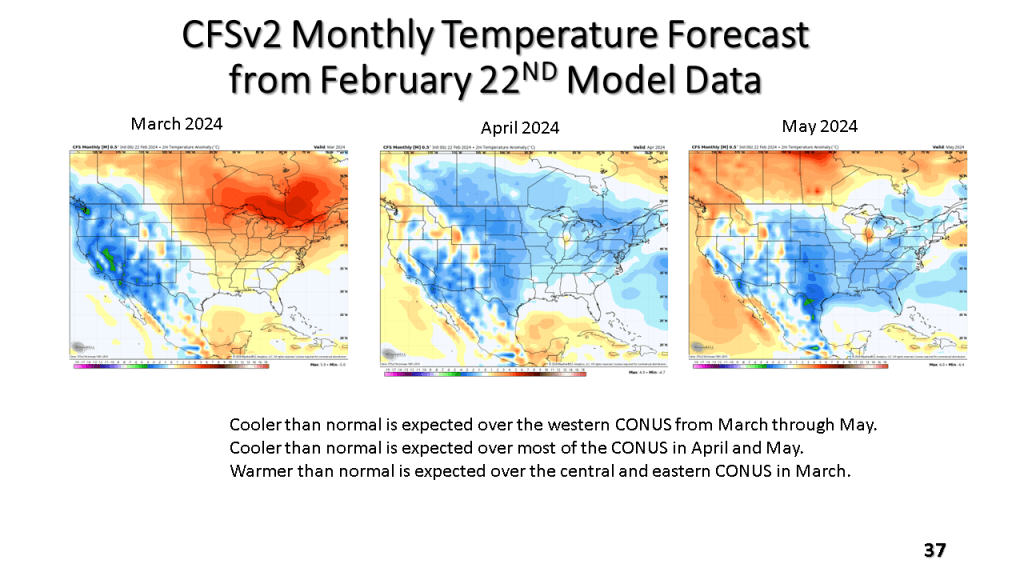
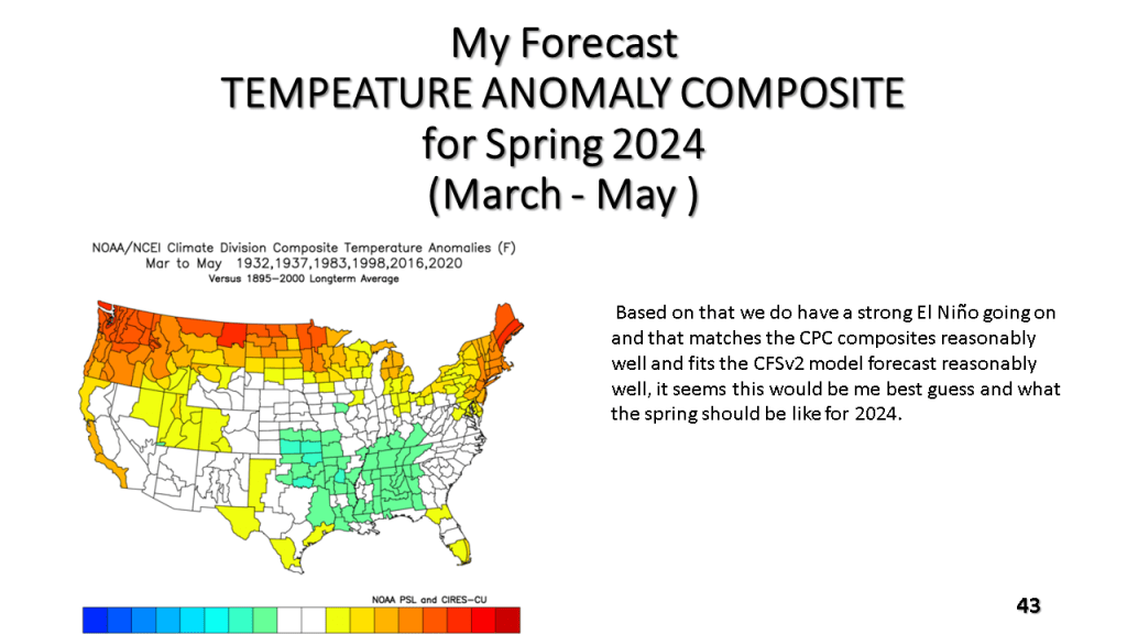
Largely this means warmer and wetter over the CONUS but cold and snowy over southern Canada.


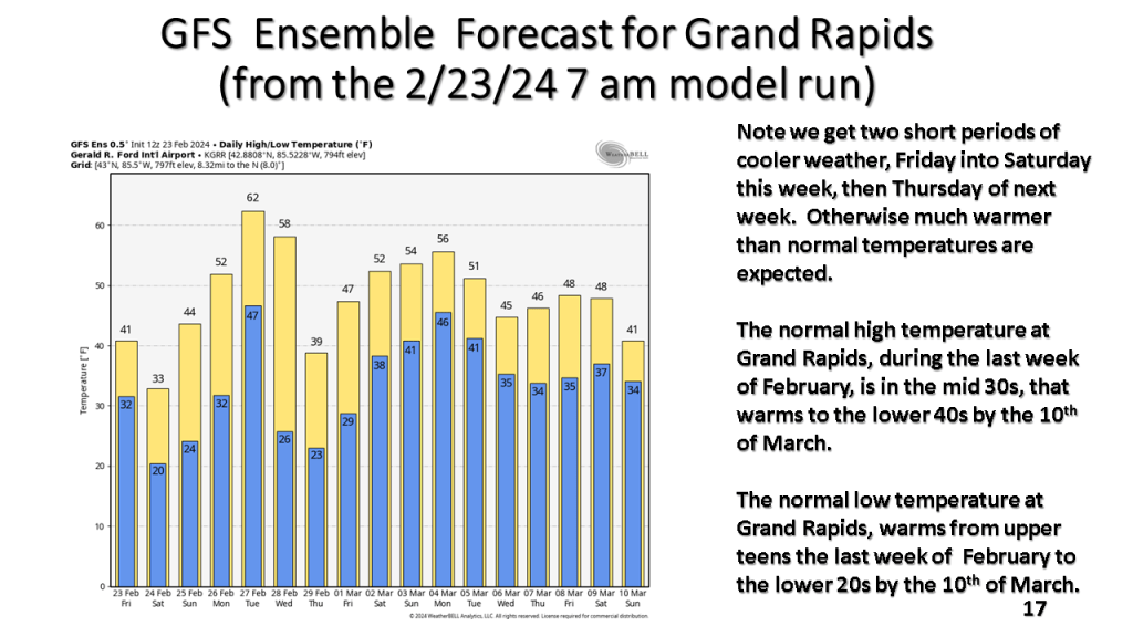


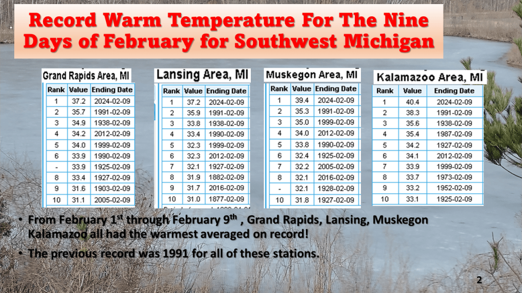
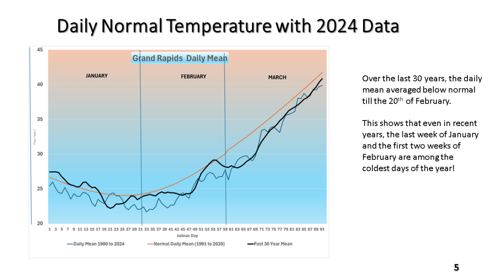
What makes this more striking is that over the past 30 years, the last week of January and the first two weeks of February are the coldest weeks of the entire year. The mean of 37.2 degrees in Grand Rapids would be normal for the 20th of March (using the 1991-2020 normal).