This past 15 days ( Jan. 23- Feb. 7) in Grand Rapids, Michigan were the warmest on record (34.8F) that exceeded the 34.7F for the 15 days ending on January 6th 2012.


This past 15 days ( Jan. 23- Feb. 7) in Grand Rapids, Michigan were the warmest on record (34.8F) that exceeded the 34.7F for the 15 days ending on January 6th 2012.


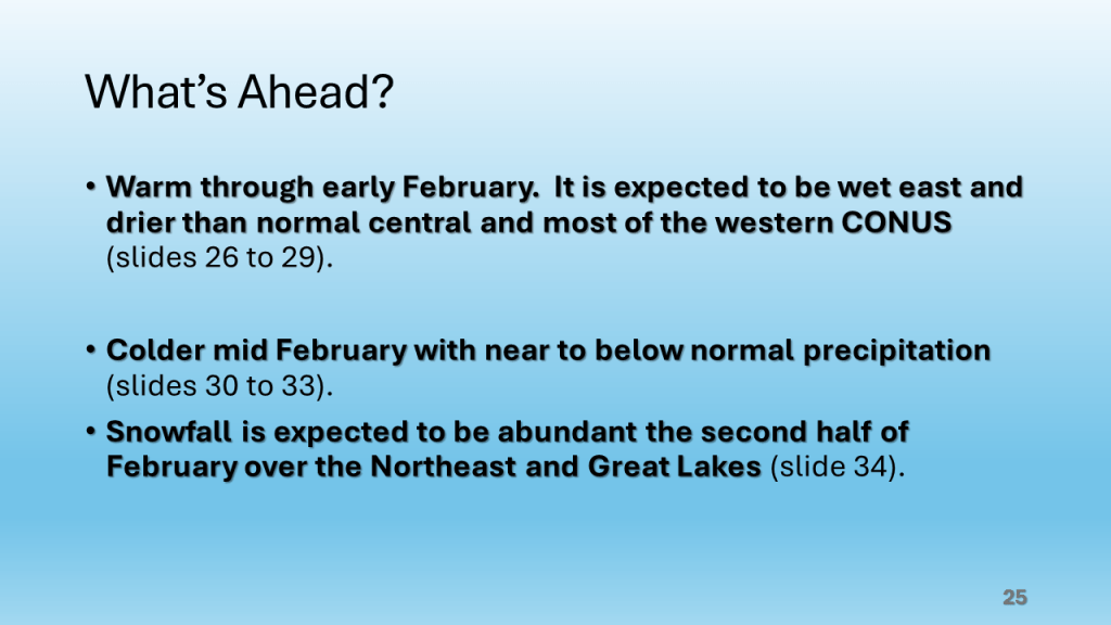
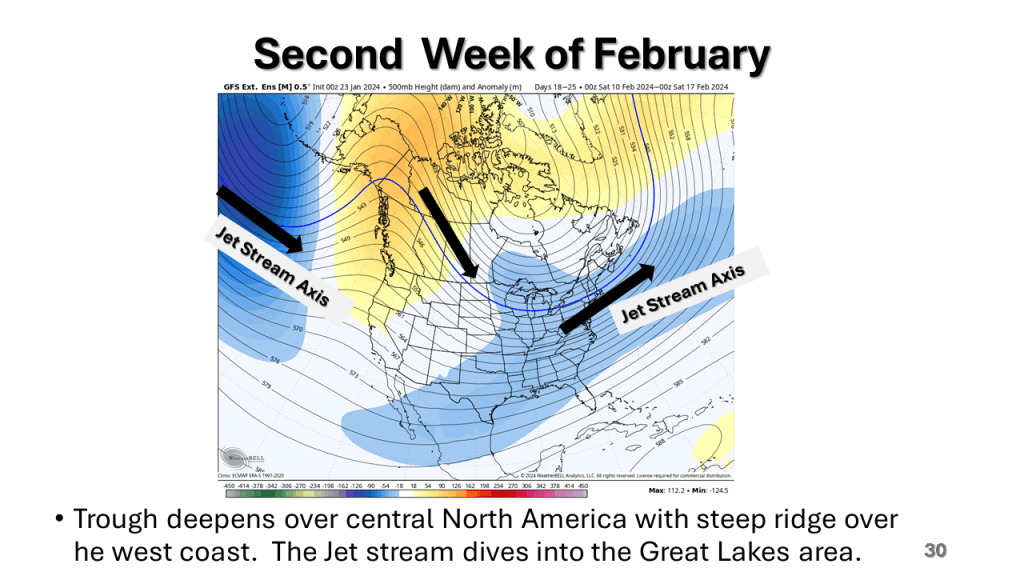
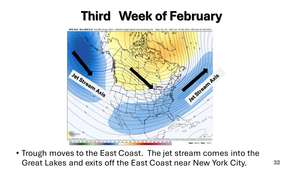
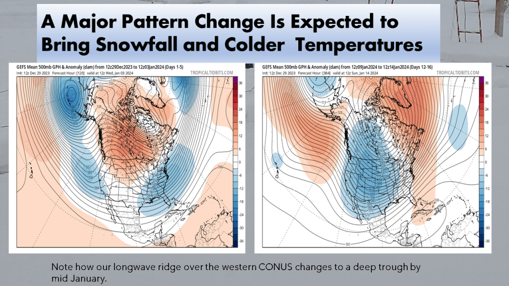
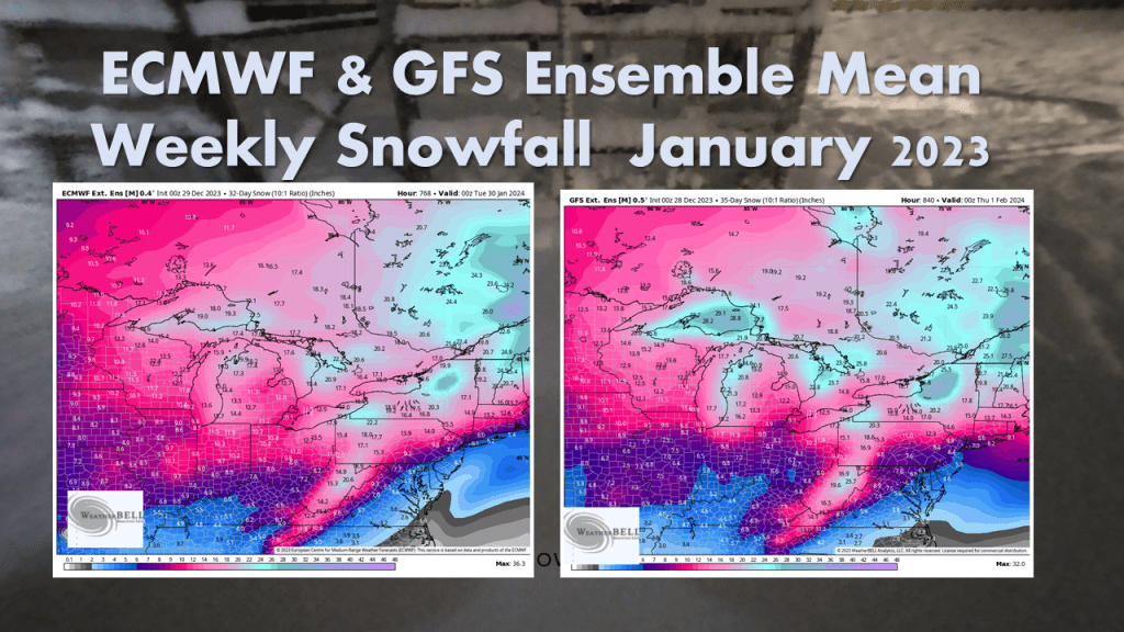
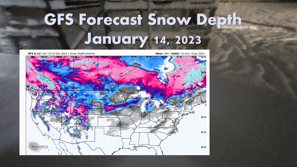
The bottom line is it will be very warm, relative to normal until around Valentine’s Day, the it will get cold across most of the central and eastern CONUS with a significant amount of snow over the Great Lakes and New England.
Does the cold and snowy weather come back?


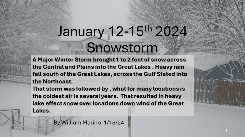
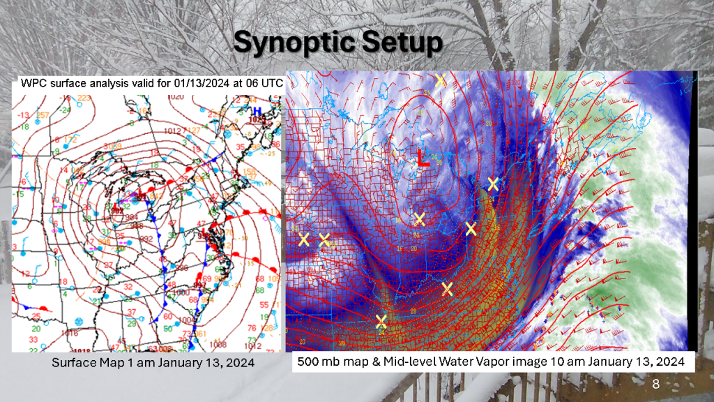
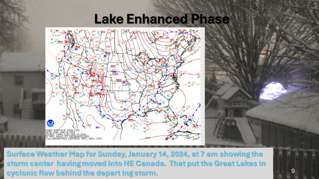
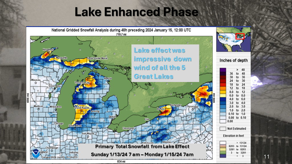
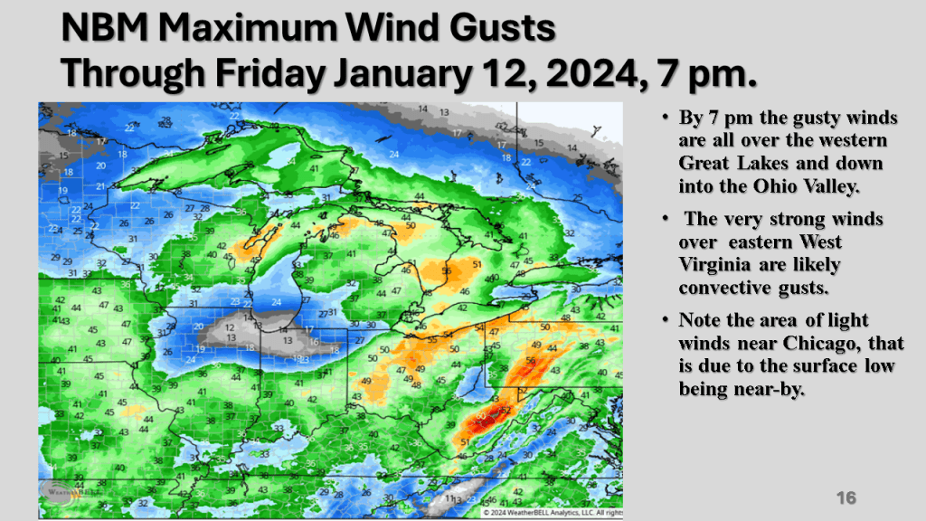
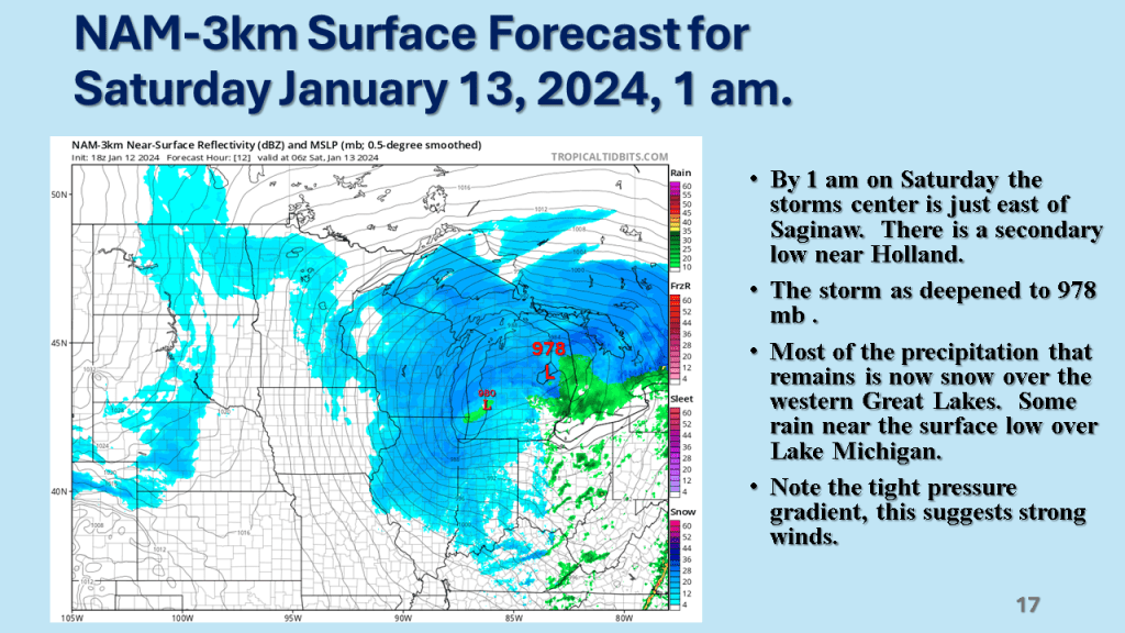
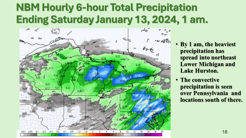
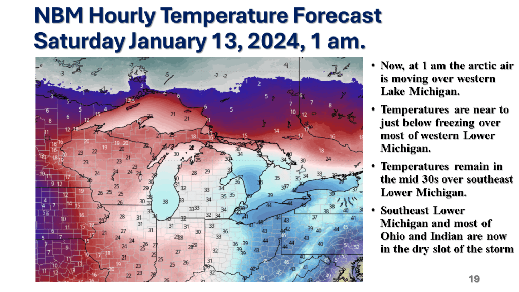
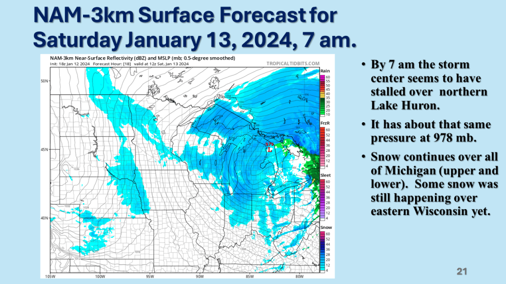
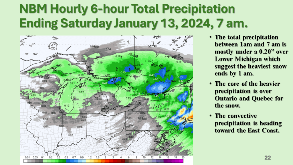
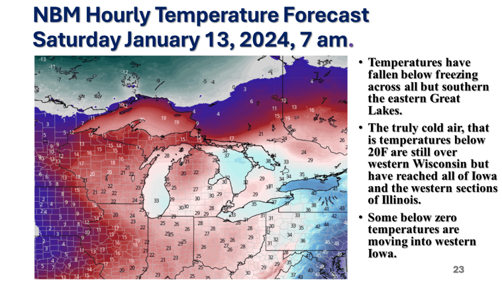
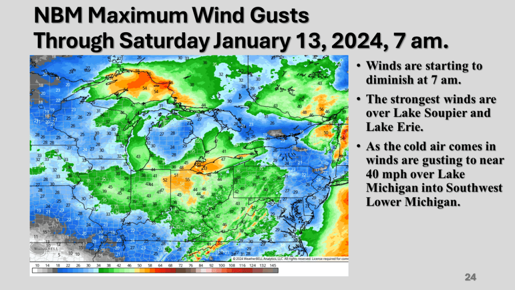
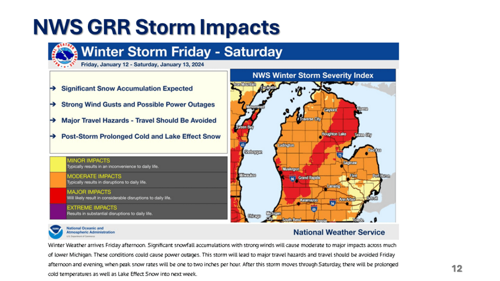
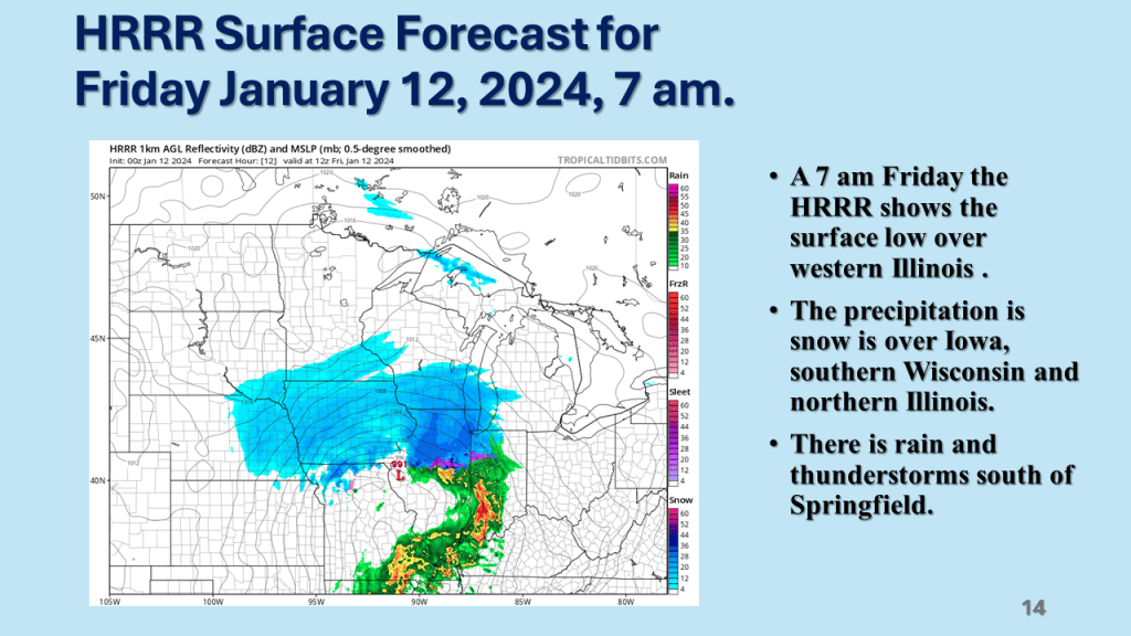
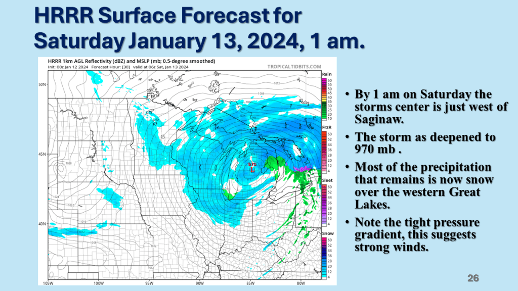
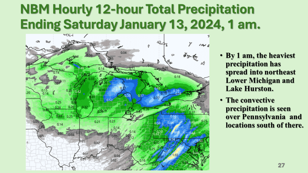
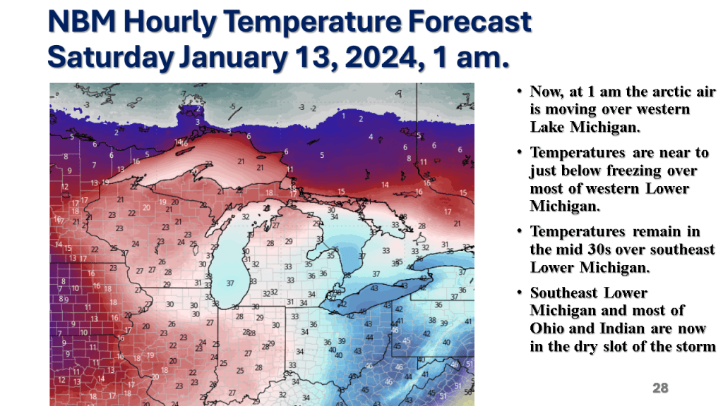
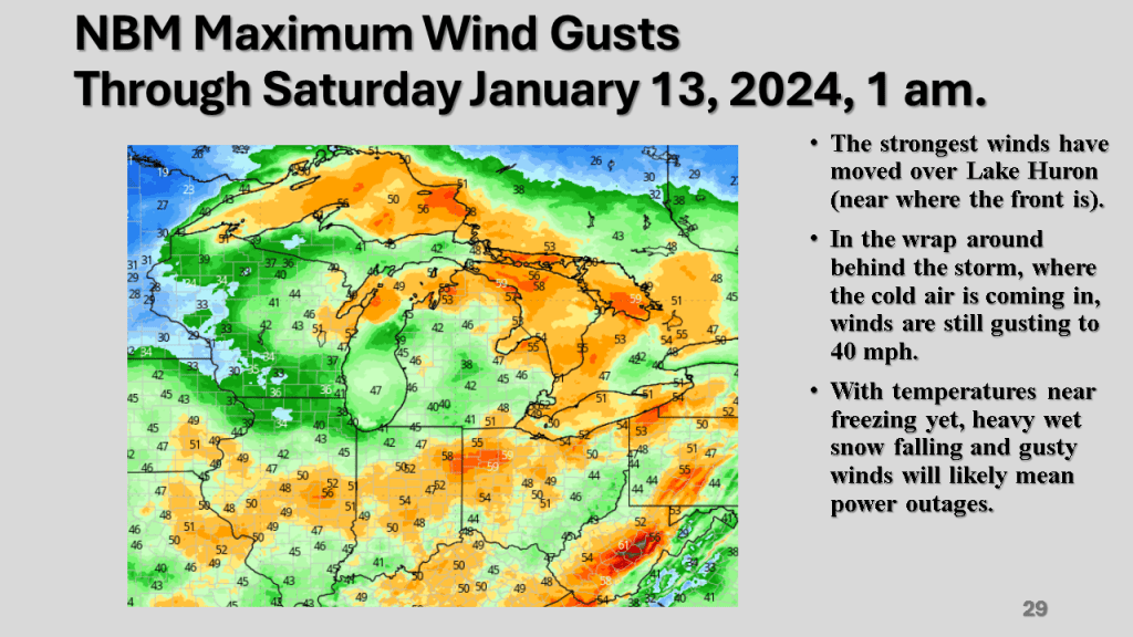
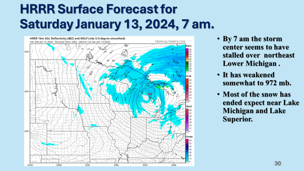
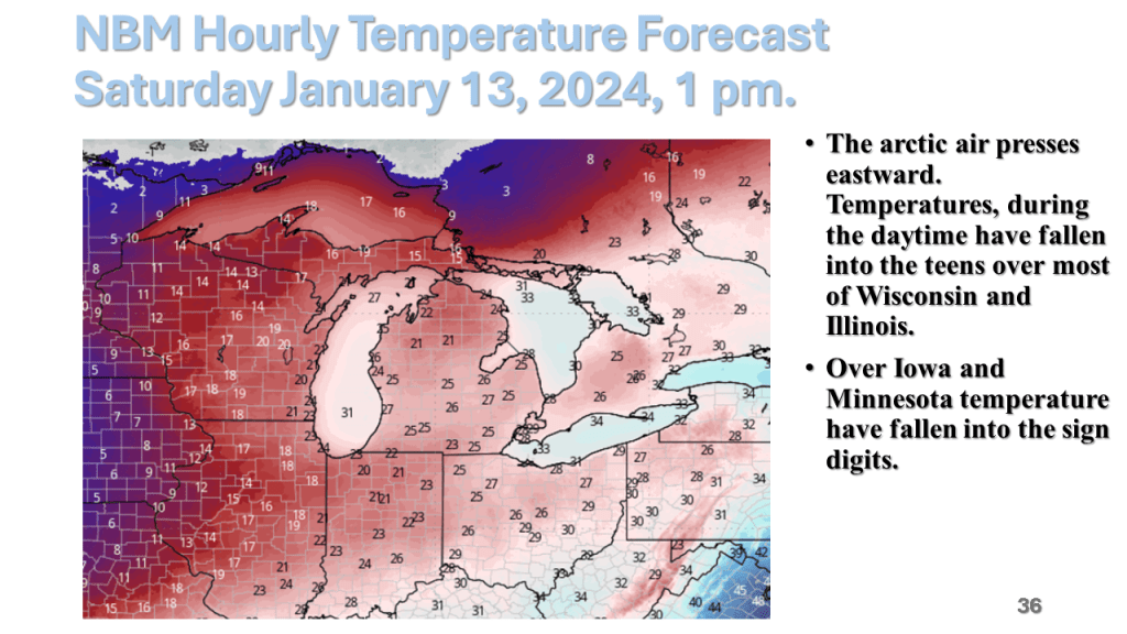
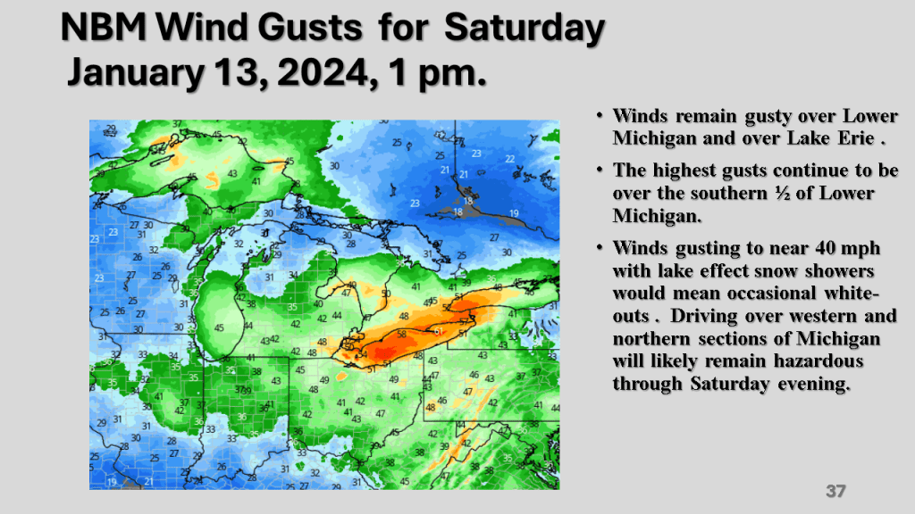
A rapidly deepening storm tracked Texas on Thursday afternoon to the northern Great Lakes by Saturday morning. The storm brought 1 to 2 feet of snow from Nebraska, across Iowa, Wisconsin then into Michigan. Strong winds accompanied the storm then the coldest air in several years followed the storm with dangerously cold wind chills over most of the Northern and Central Midwest. That cold air caused heavy lake effect snow in Michigan, near Buffalo New York and over the Tug Hill Plateau in the Adirondack Mountains, down wind of Lake Ontario.


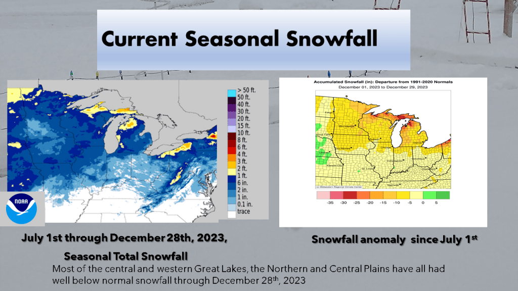


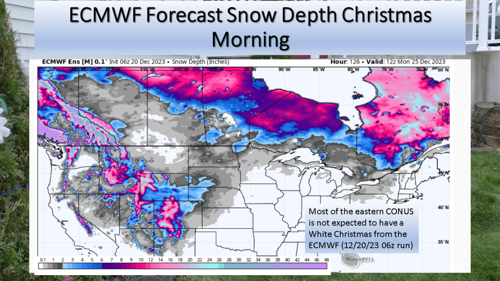
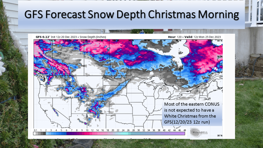
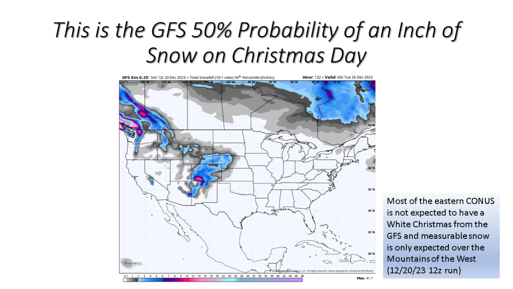
The short story is if you live in the central or eastern CONUS it is very unlikely you’ll have snow on the ground Christmas morning.
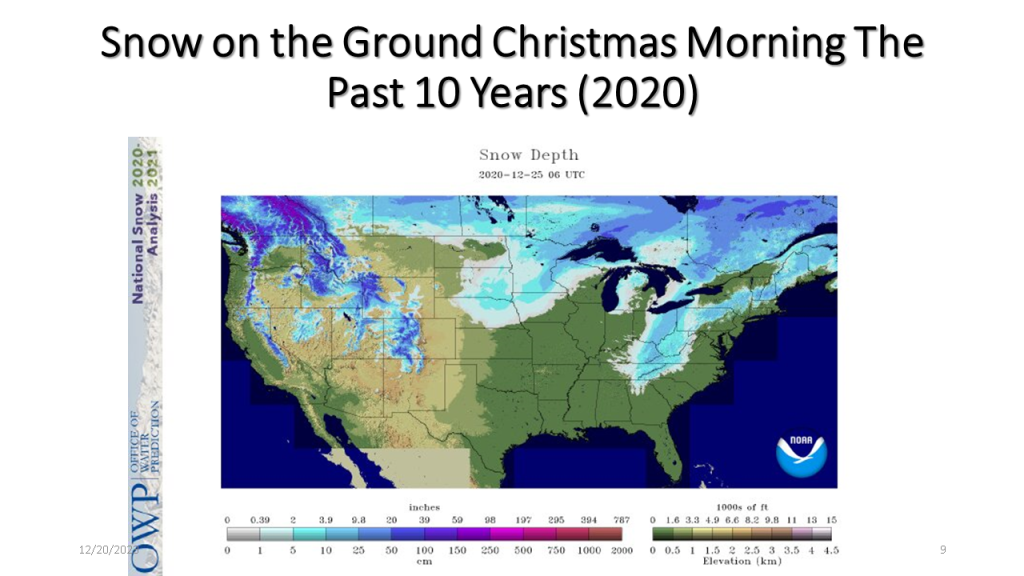
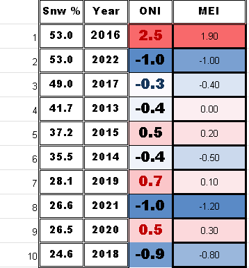
I have updated this to show the percent snow cover and ENSO state for each of the 10 years. At the end I have 2 tables that show the years with the ENSO index numbers and the snow cover for that Christmas. The bottom table sorts the percent snow cover from highest to lowest to see if there is a correlation between the ENSO state and the percent snow cover on Christmas day.


| Area Covered By Snow: | 53% |

| Area Covered By Snow: | 26.6% |
| Area Covered By Snow: | 26.5% |

| Area Covered By Snow: | 28.1% |

| Area Covered By Snow: | 24.6% |

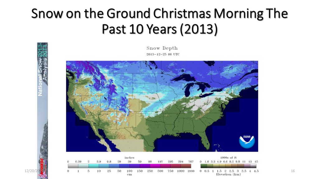
| Area Covered By Snow: | 49.0% |

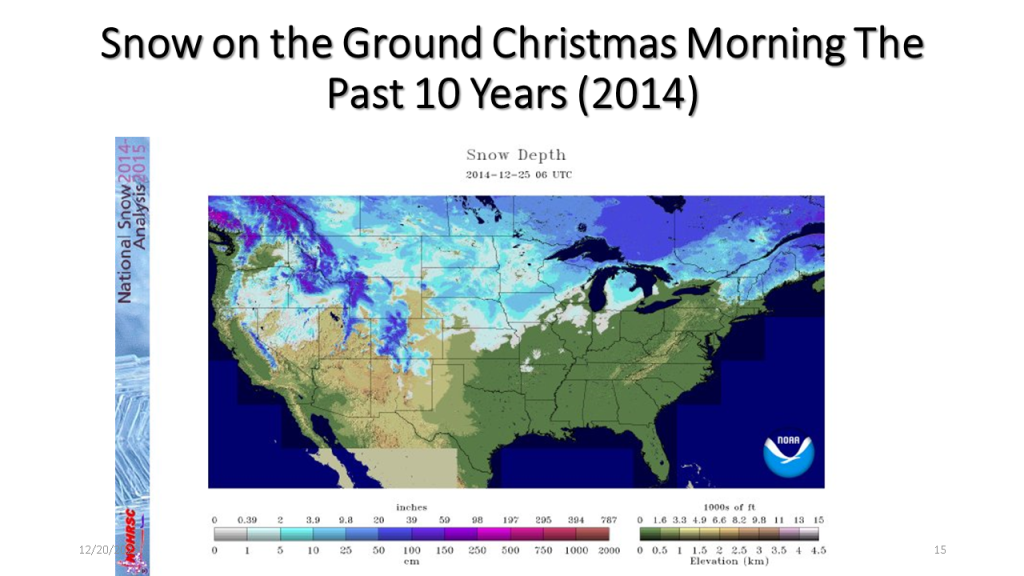
| Area Covered By Snow: | 44.1% |
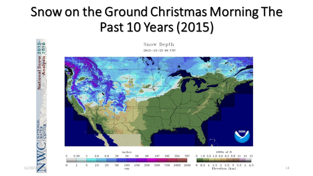
| Area Covered By Snow: | 37.2% |
| Area Covered By Snow: | 35.5% |
| Area Covered By Snow: | 41.7% |
Below is a table showing the percent snow cover on Christmas
Below is a table showing the percent snow cover on Christmas Day in chronological order.
Below is a table showing ENSO numbers and the percent snow cover on Christmas day for that year sorted from the highest percent snow cover to the lowest. There does not seem to be a significant correlation to the ENSO state and the percent snow cover on Christmas Day.
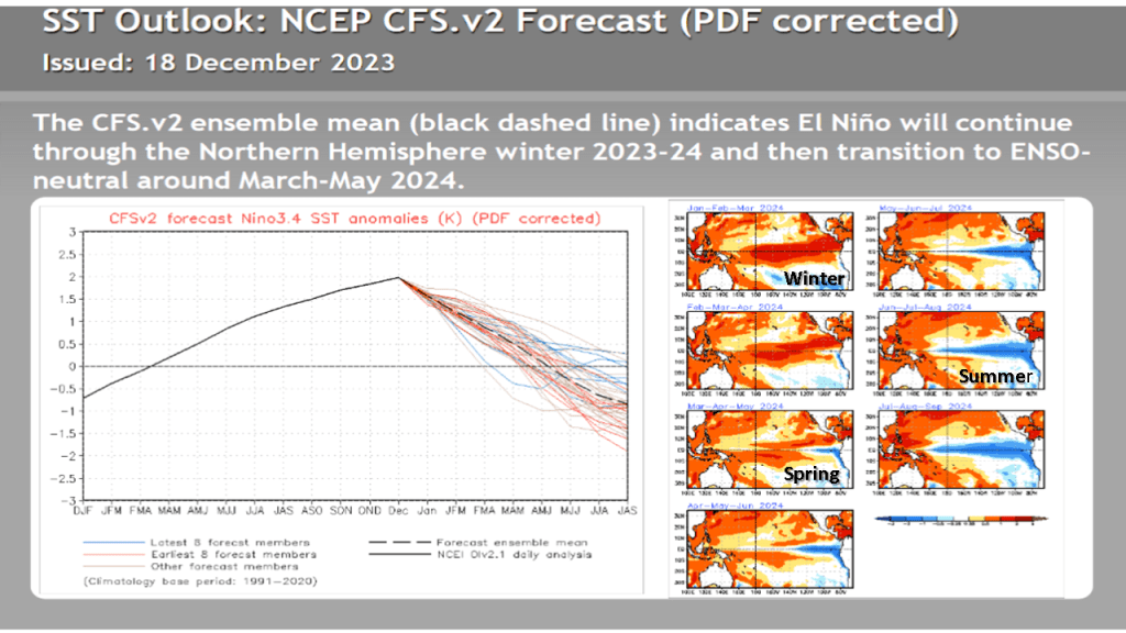
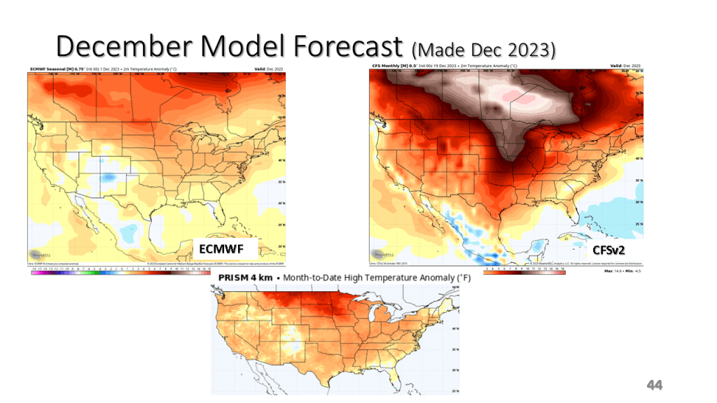
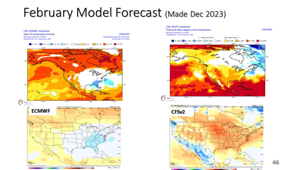
My actual forecast remains unchanged. I mostly updated the ENSO slides and added monthly model forecasts from the ECMWF and the CFSv2.


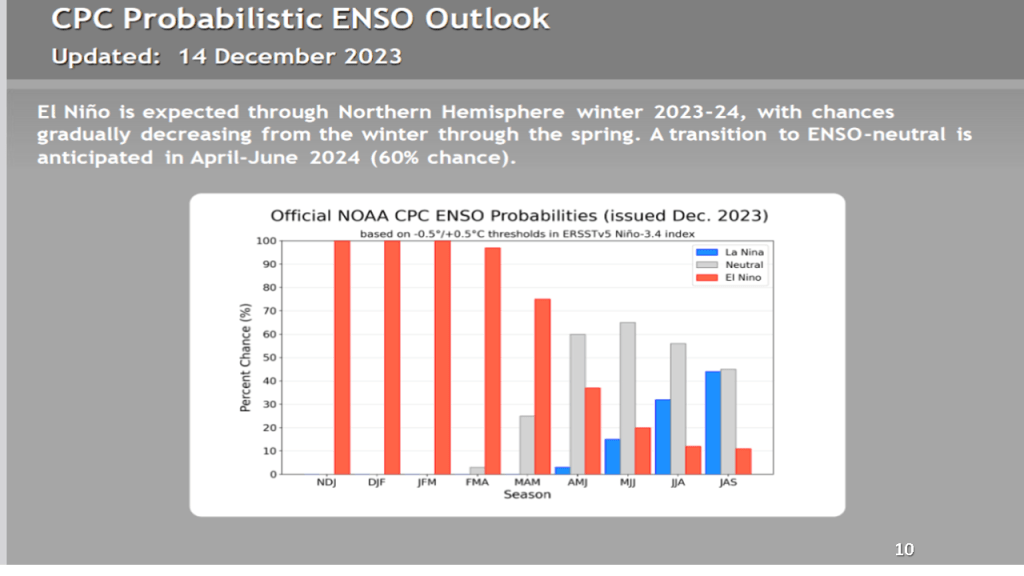

CPC’s forecast for this winter has not changed significantly in the past few months.


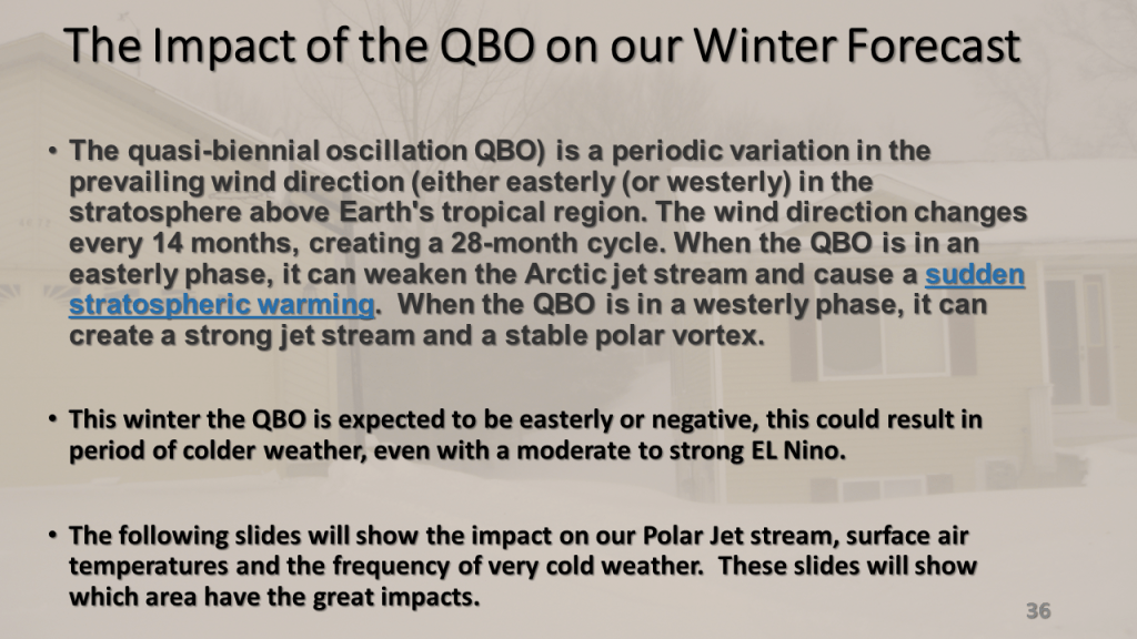
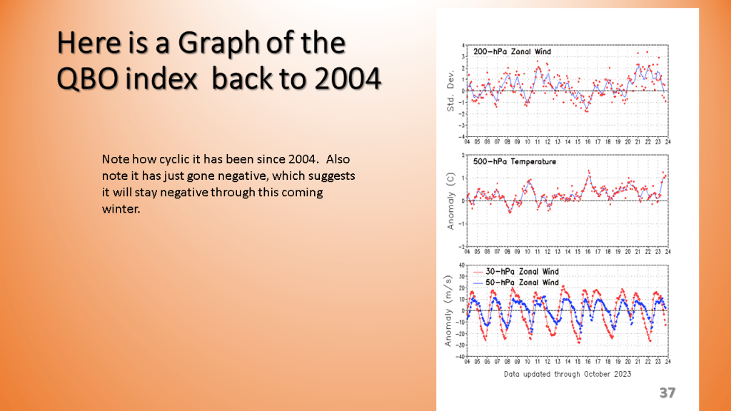
The QBO should allow for more arctic air to reach the CONUS once we get into January and February.
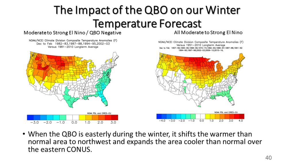


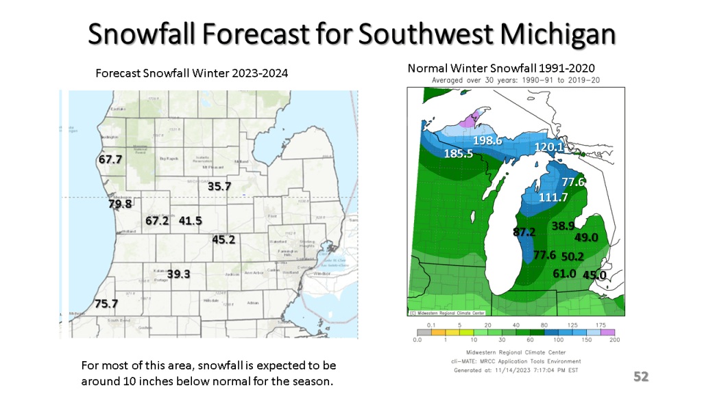
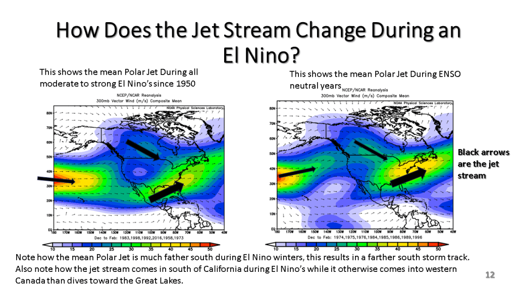
I am thinking snowfall will generally be below normal over Michigan, however sections of the East Coast, from North Carolina to Maine could have well above normal snowfall since El Nino’s favor Nor-Easters (Coastal Storms). When we get into a cooler pattern in January, I’d expect to see some heavy snow events along the east coast. See slide 48 for details.