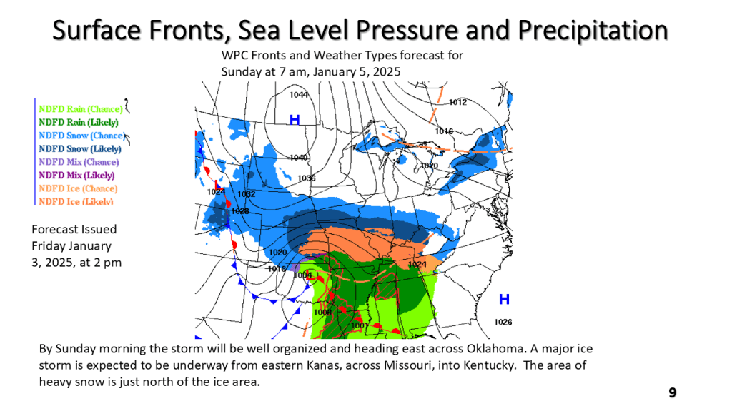
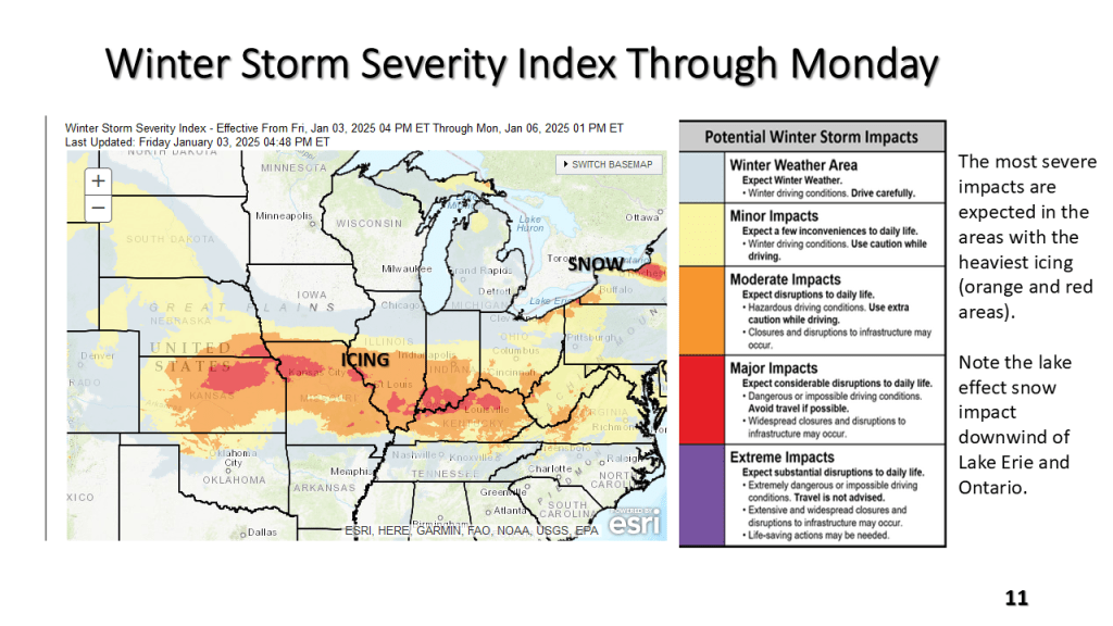
Between Friday, January 3, 2025 and Monday January 6,2025


Between Friday, January 3, 2025 and Monday January 6,2025


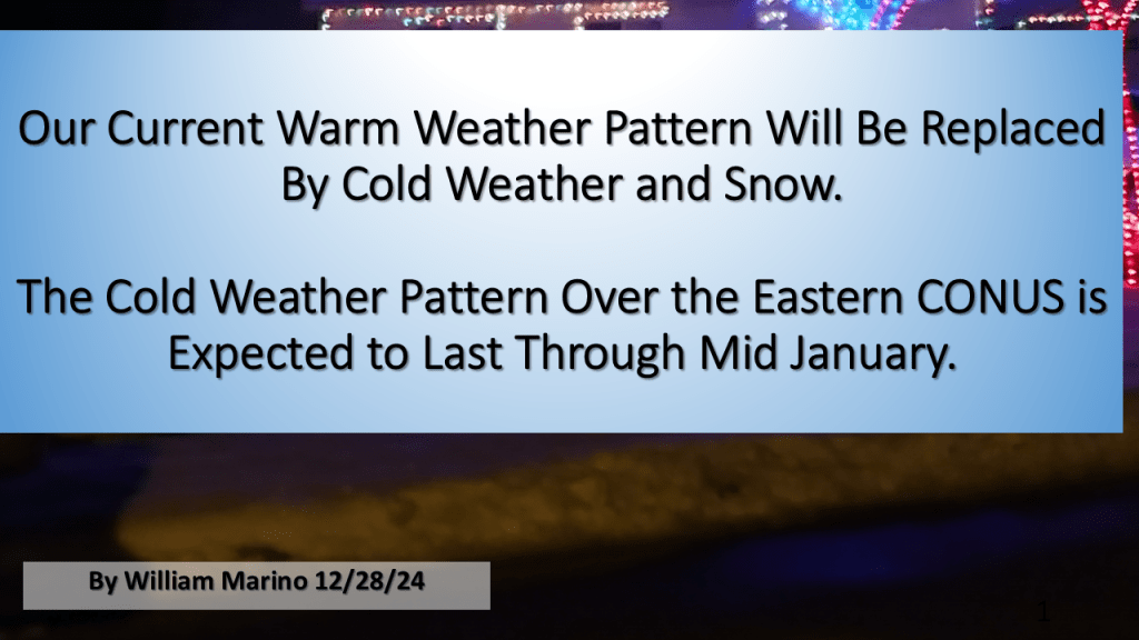
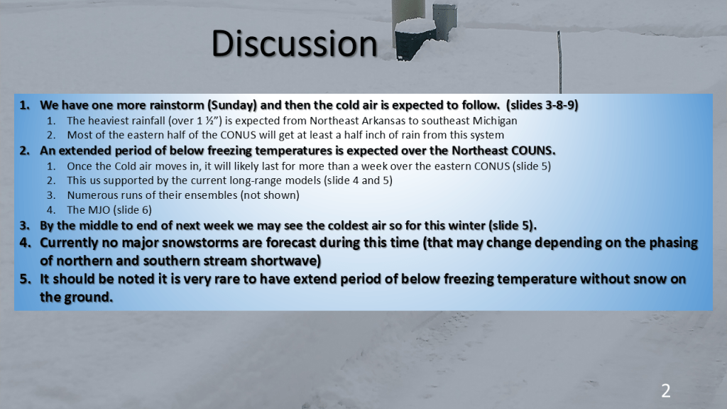
The current warmer than normal temperature pattern over the eastern CONUS will be replaced by below to well below normal temperatures by the middle of this coming week. That new pattern may last into the weekend of the 12th of January.


This is for Southwest Lower Michigan


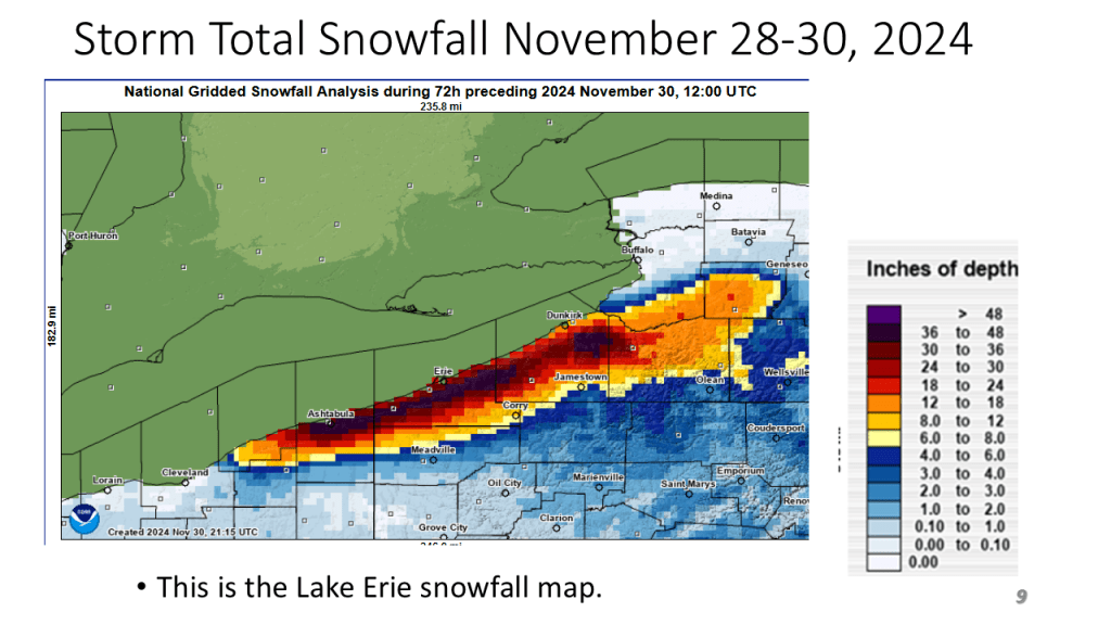
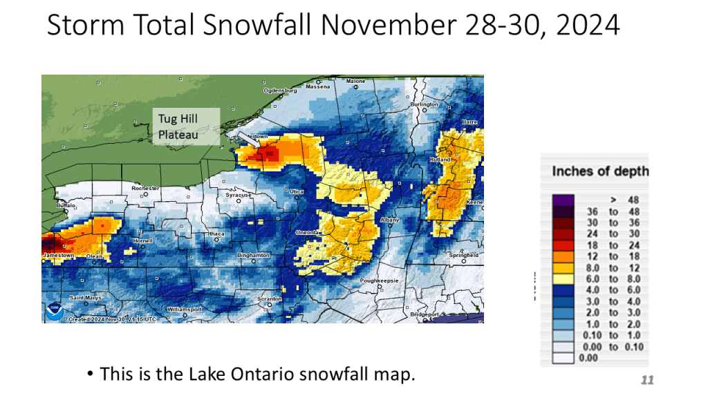
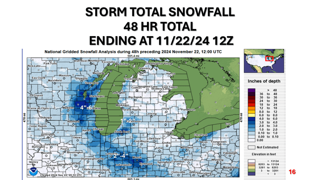
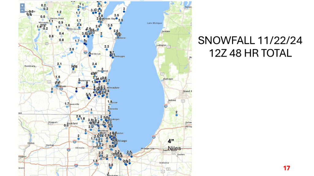
Heavy lake effect snow impacted all of the Great Lakes between Wednesday evening and this morning. Many areas had over 2 feet of snow.


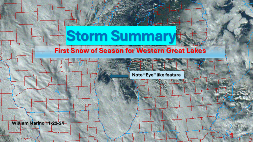
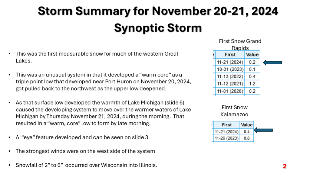
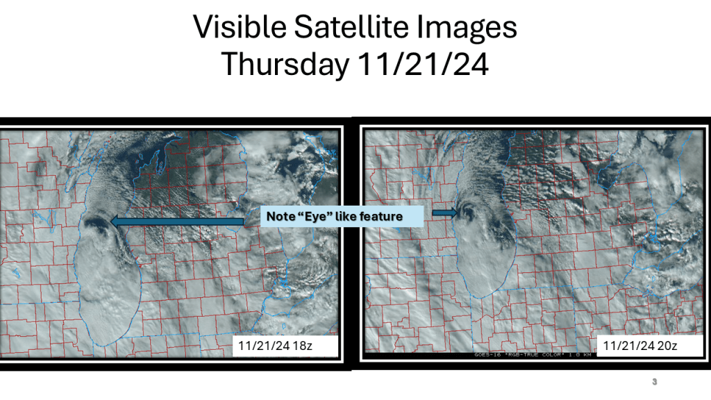
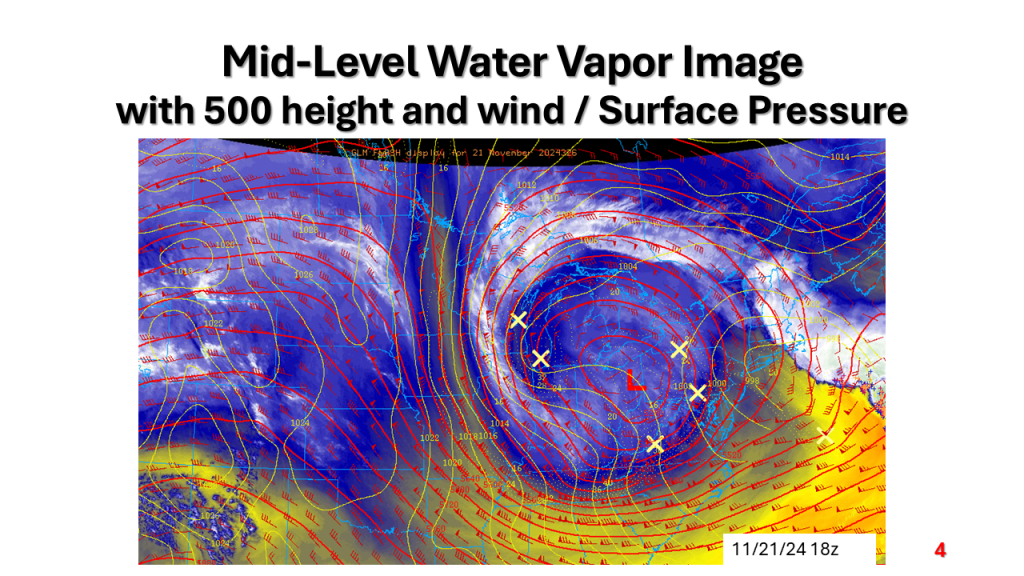
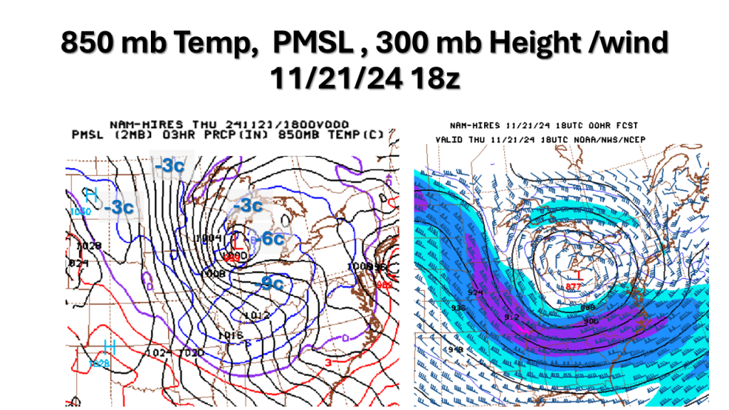
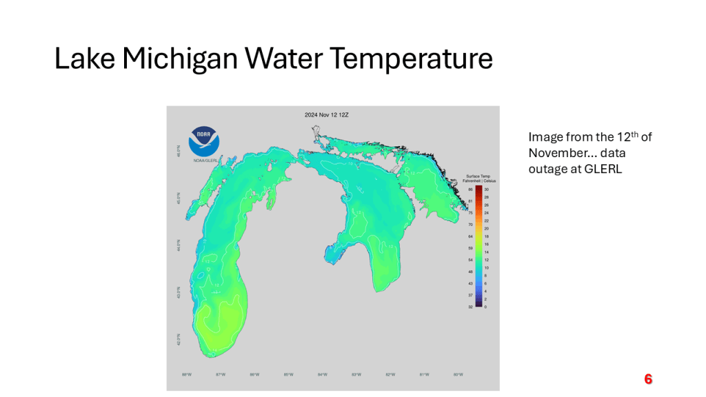
A strong November storm system brought the first snow of the season to parts of the western Great Lakes. Due to the warmth of Lake Michigan and that the surface low moved over Lake Michigan it developed an “Eye” like feature during the afternoon of Thursday, November 21, 2024.


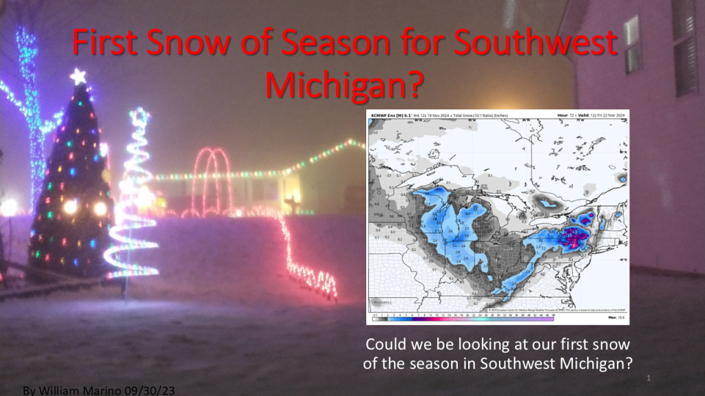
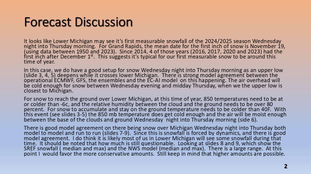
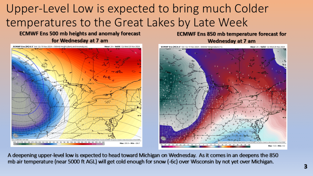
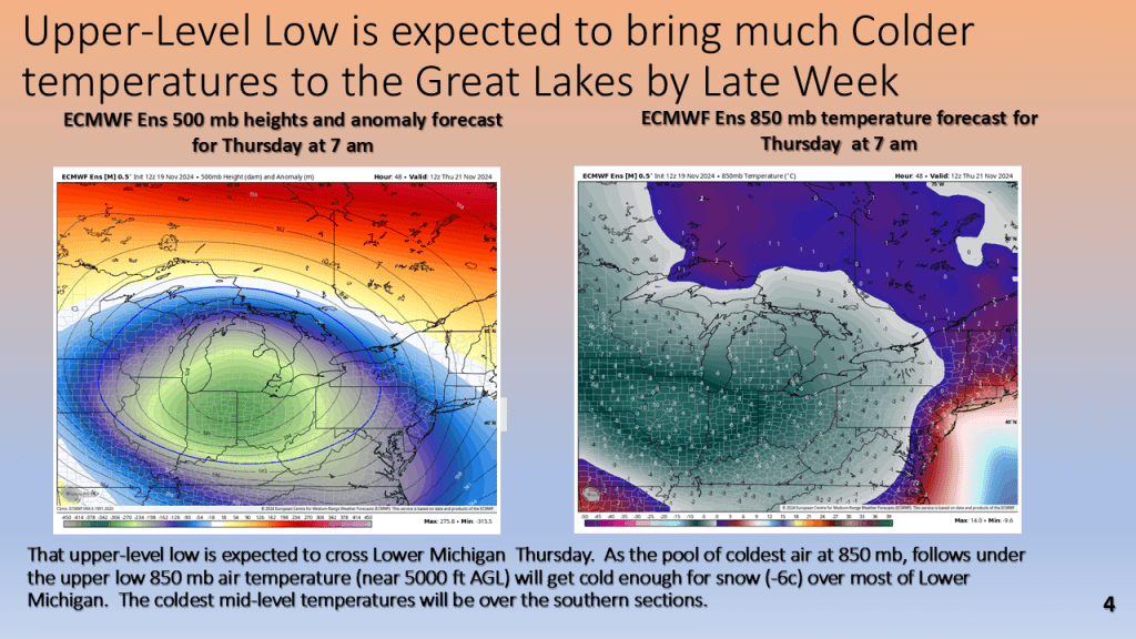
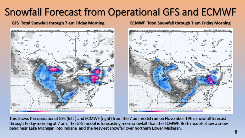
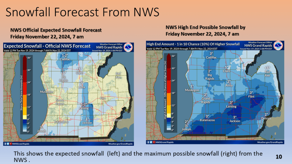
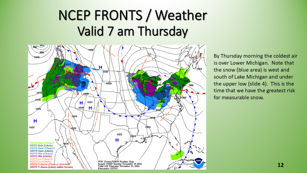
The first snowfall of the 2024/2025 season is likely for Most of Lower Michigan between Wednesday night and Thursday morning.