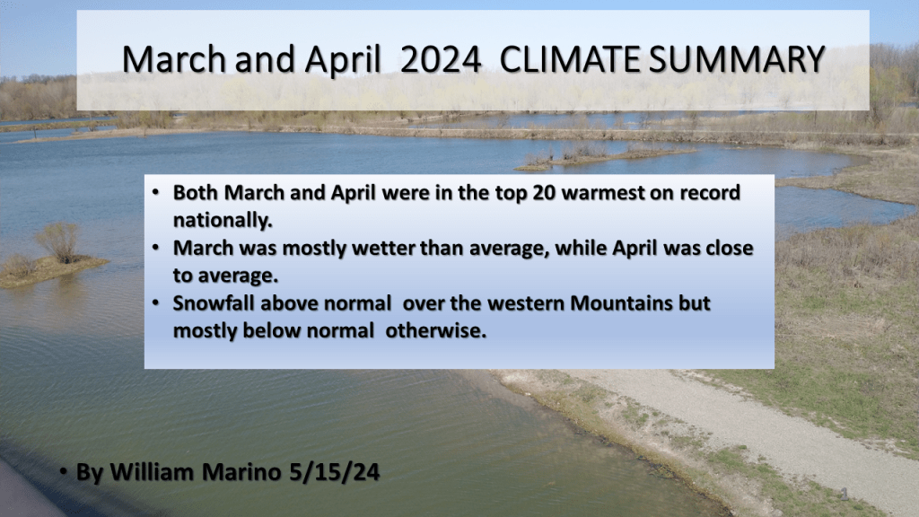
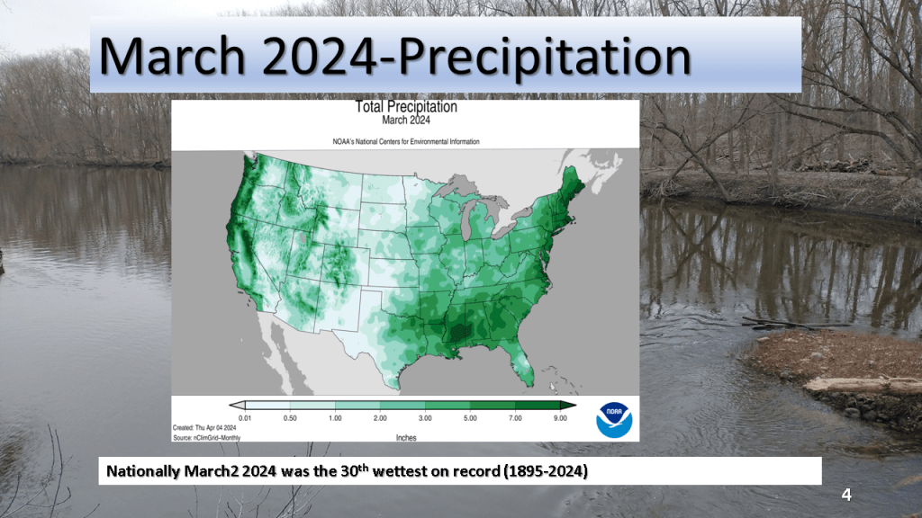
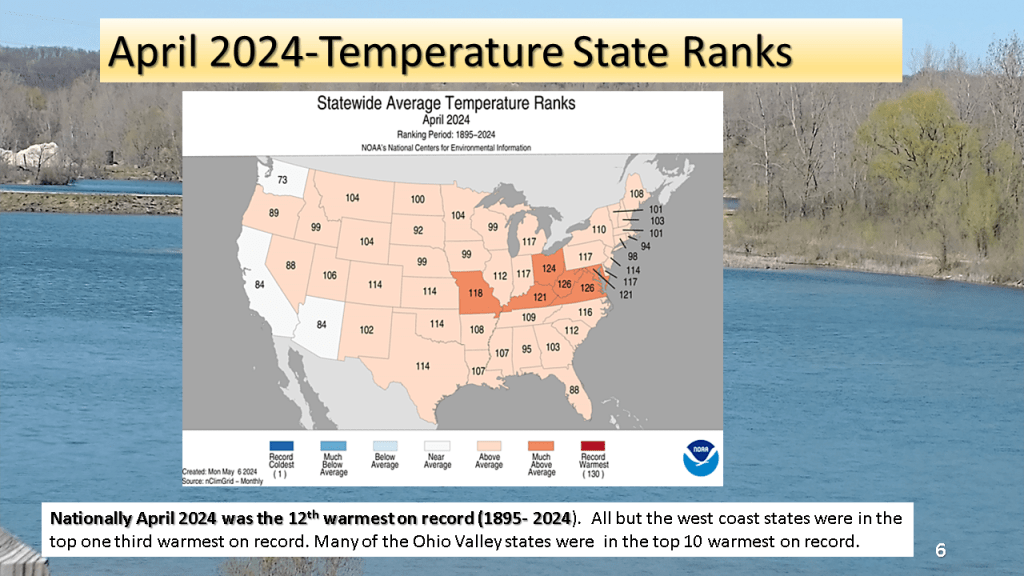
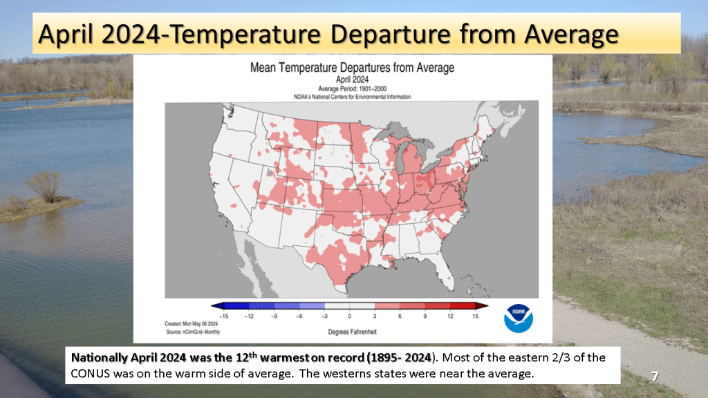
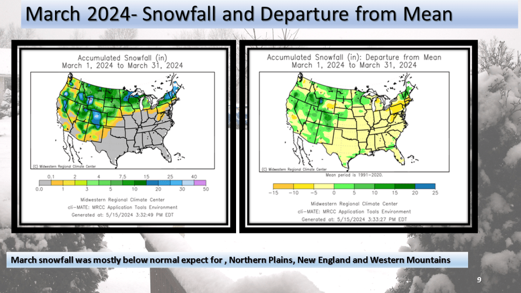
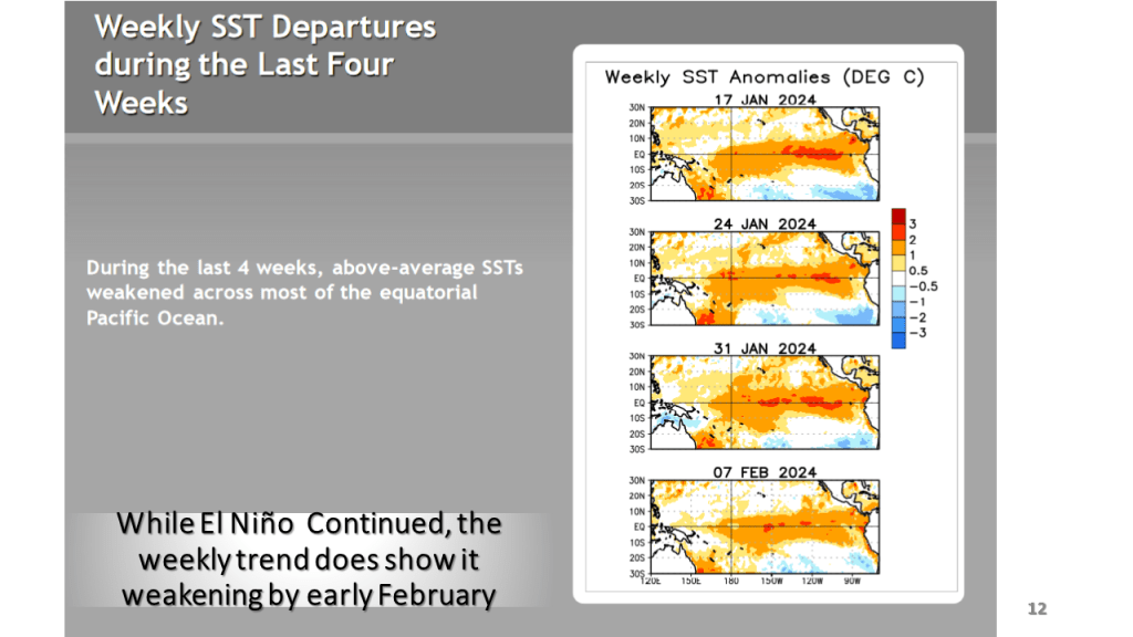
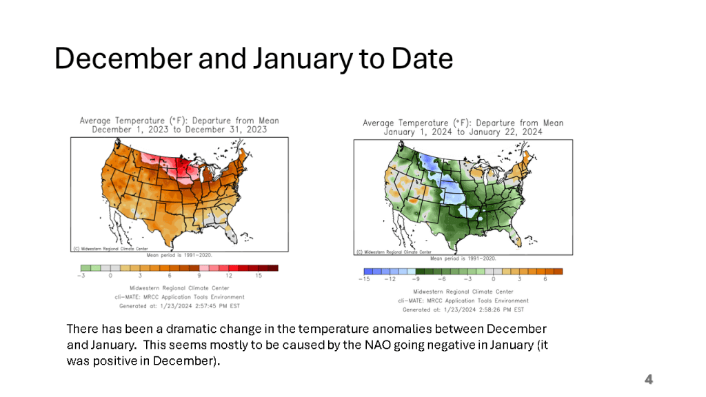
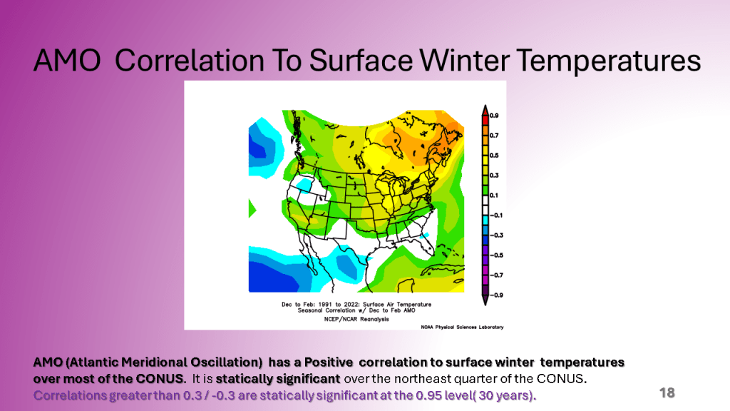
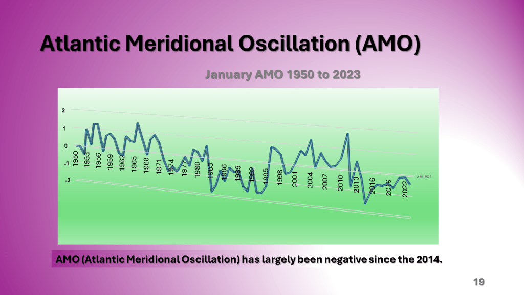
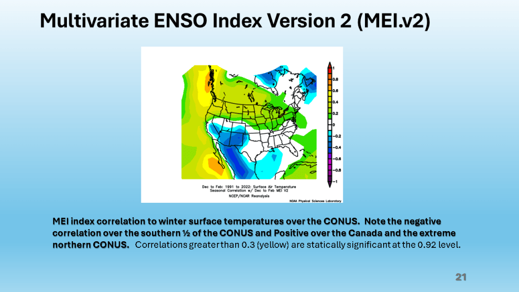
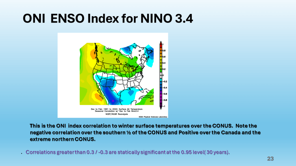
This past 15 days ( Jan. 23- Feb. 7) in Grand Rapids, Michigan were the warmest on record (34.8F) that exceeded the 34.7F for the 15 days ending on January 6th 2012.


This past 15 days ( Jan. 23- Feb. 7) in Grand Rapids, Michigan were the warmest on record (34.8F) that exceeded the 34.7F for the 15 days ending on January 6th 2012.


Does the cold and snowy weather come back?


Over Michigan, November and December featured well below normal snowfall. The first 2 1/2 weeks of January seem to be making up some of that deficit. Over the rest of the CONUS, seasonal snowfall mostly remains below normal.


This storm brought heavy snow to the Midwest and parts of the Great Lakes, then there were damaging winds over the eastern Seaboard, as well as flooding. Severe storms and over a dozen tornadoes occurred over the Southeast sections.


The short story is I am expecting a not so typical moderate to strong El Nino Winter this year. This is due to record warm sea surface temperatures in combination with an easterly wind over the tropical oceans, near 200 mb. This these two features acting together create an unusual amount of blocking in our Northern Hemisphere jet stream. This will mean periods of extremely cold weather and periods of unusually warm weather for a good part of the central and eastern United States lower 48 states. Even so, for Southwest Michigan and actually for all of Michigan I expect snowfall to be below normal but we will get a decent amount of snow nonetheless.


