This storm brought heavy snow to the Midwest and parts of the Great Lakes, then there were damaging winds over the eastern Seaboard, as well as flooding. Severe storms and over a dozen tornadoes occurred over the Southeast sections.


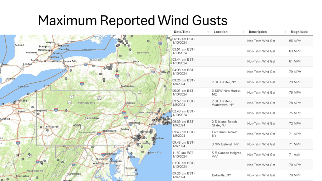


This storm brought heavy snow to the Midwest and parts of the Great Lakes, then there were damaging winds over the eastern Seaboard, as well as flooding. Severe storms and over a dozen tornadoes occurred over the Southeast sections.


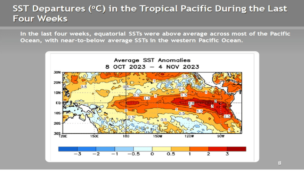
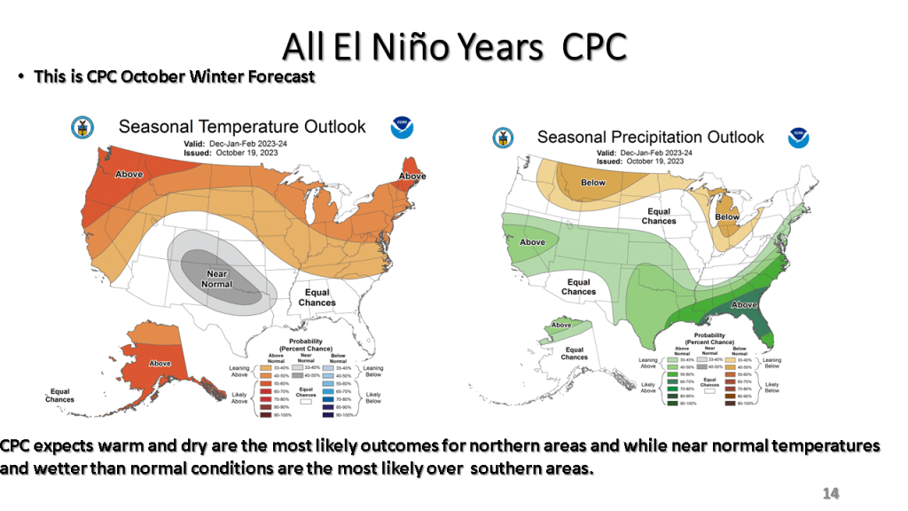
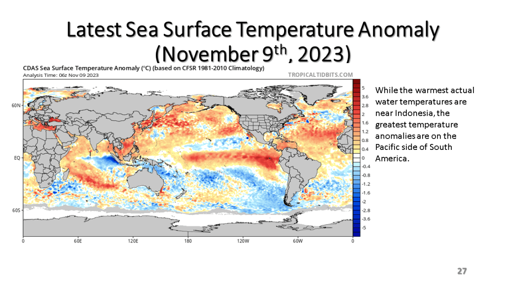
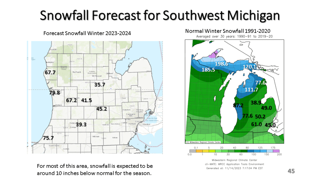
The short story is I am expecting a not so typical moderate to strong El Nino Winter this year. This is due to record warm sea surface temperatures in combination with an easterly wind over the tropical oceans, near 200 mb. This these two features acting together create an unusual amount of blocking in our Northern Hemisphere jet stream. This will mean periods of extremely cold weather and periods of unusually warm weather for a good part of the central and eastern United States lower 48 states. Even so, for Southwest Michigan and actually for all of Michigan I expect snowfall to be below normal but we will get a decent amount of snow nonetheless.


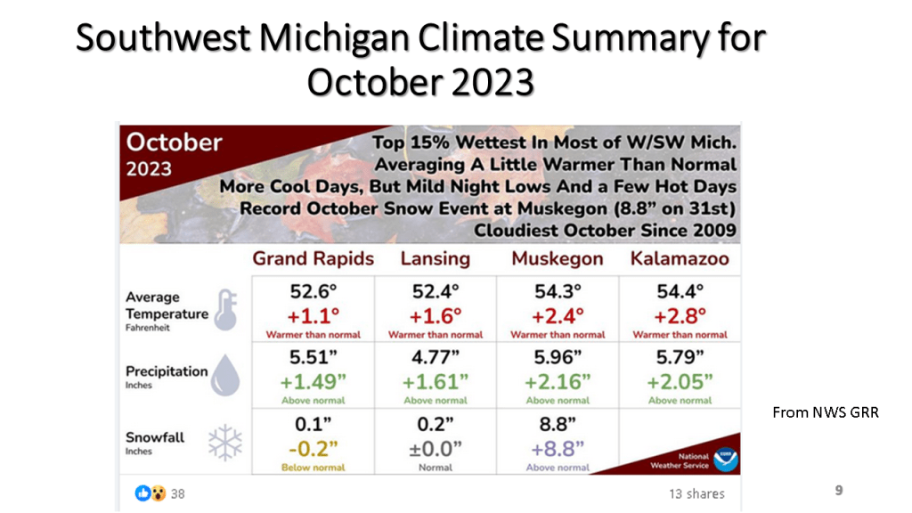
By waiting until the 8th, I can get the maps from NCEI (National Center for Environmental Information). I have added graphs from xmACIS for the daily temperature and precipitation plus I have the monthly climate summary from Grand Rapids and Gaylord.


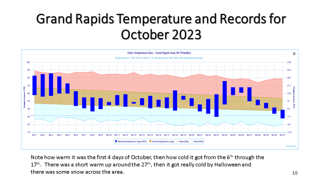


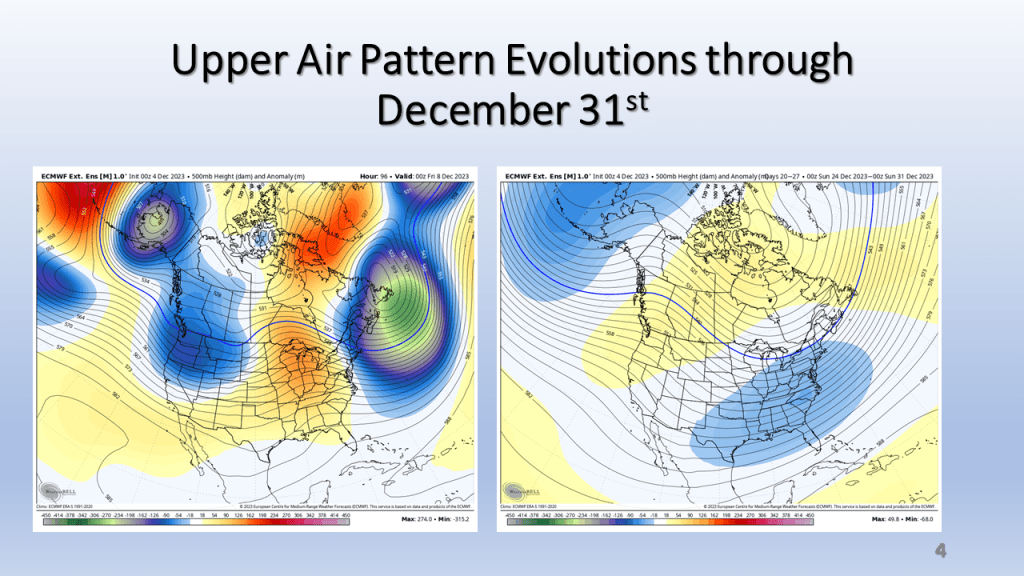
This shows our transition point from warmer to cooler weather.


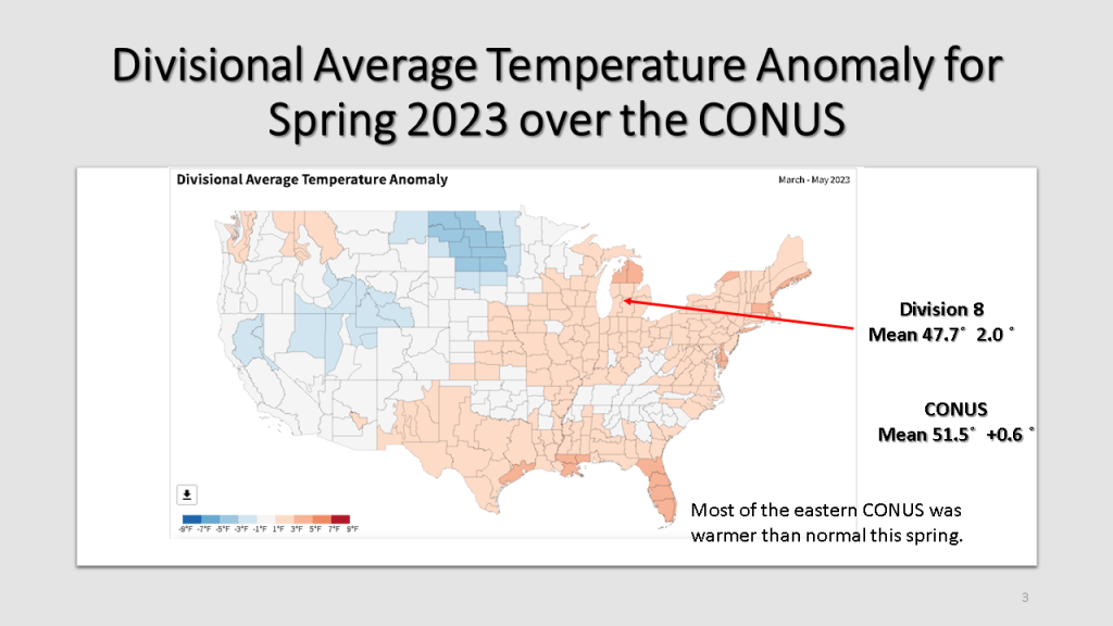
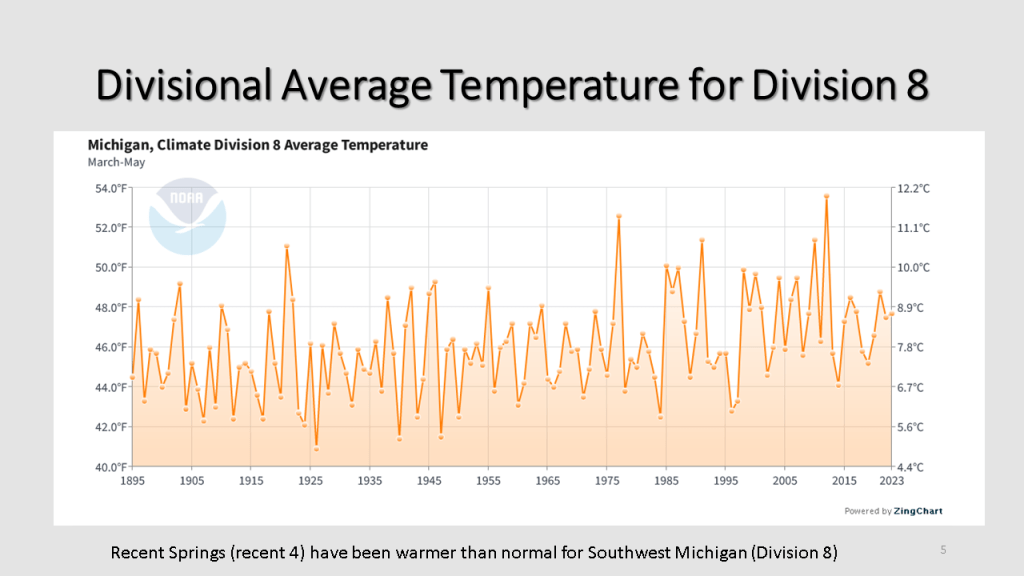
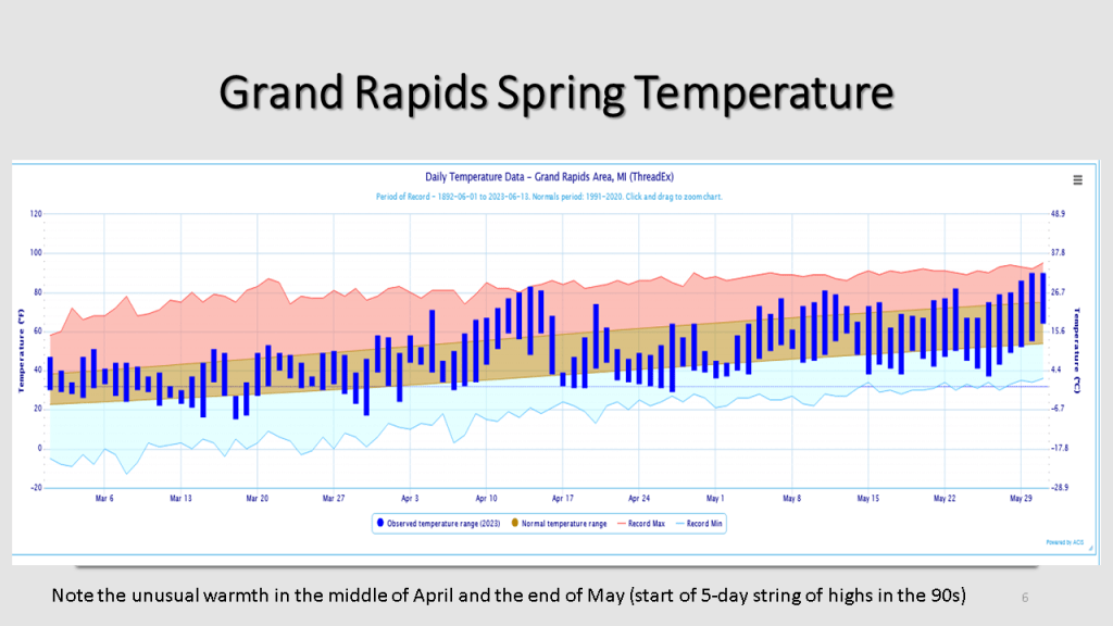
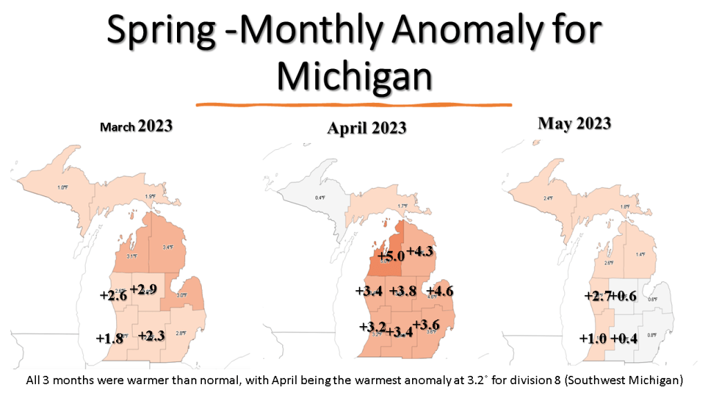
Spring started out in March, warmer than normal, snowy and wet but ended in May still warmer than normal but very dry over Lower Michigan.