


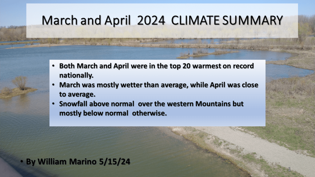
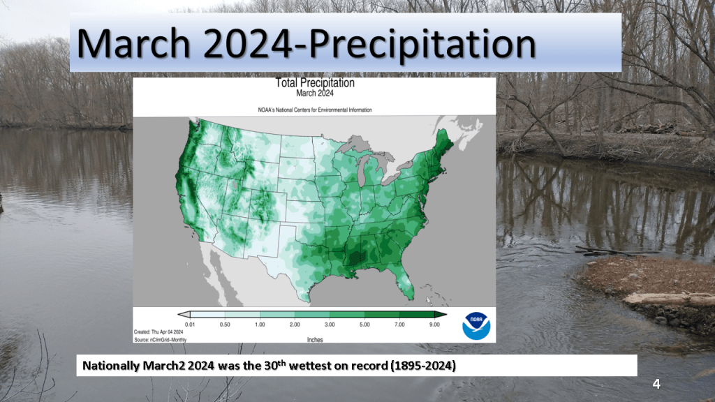
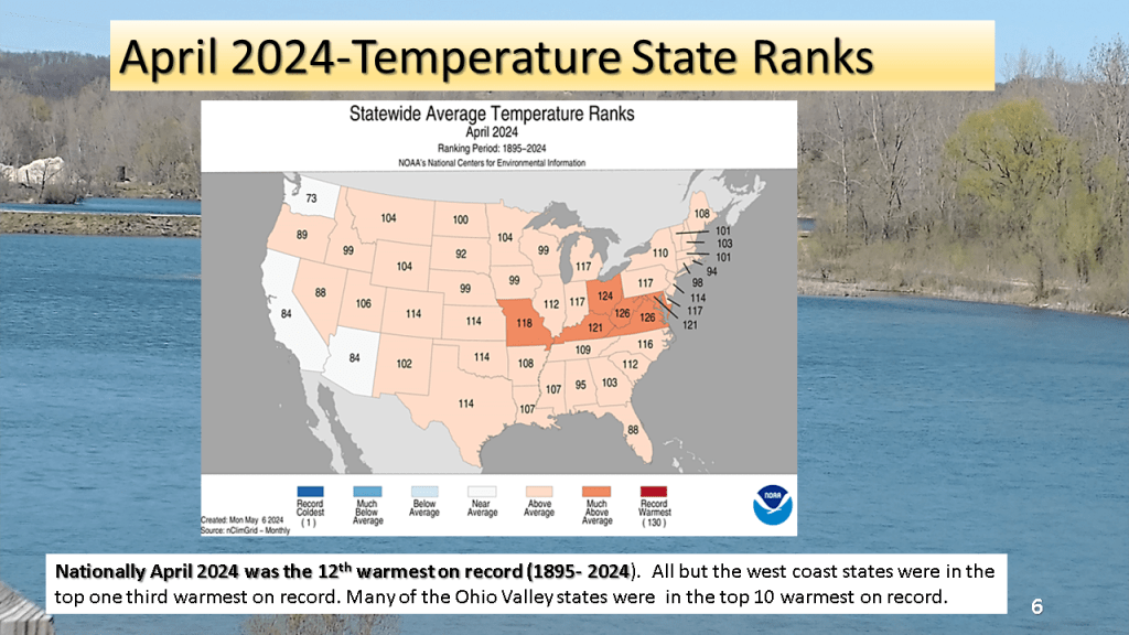
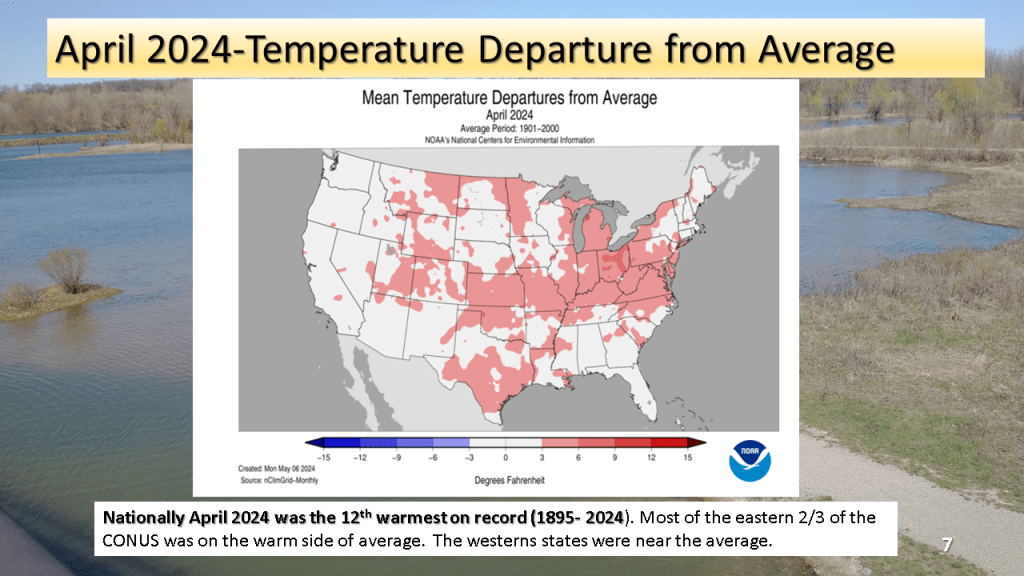
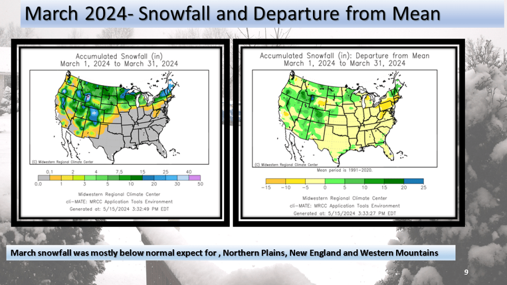
The national trend of top 20 warmest months on record continued for both March and April. March was overall wet compared to average while March was closer to normal. Snowfall was above normal over the western Mountains but below normal (mostly ) elsewhere.


This is a short version compared to my previous seasonal forecasts but I believe the shorter version will be easier to read. I may add details as the season progresses.


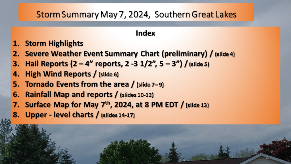
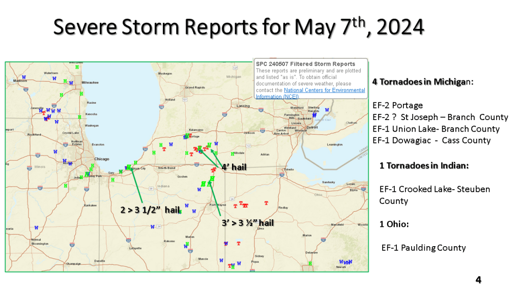
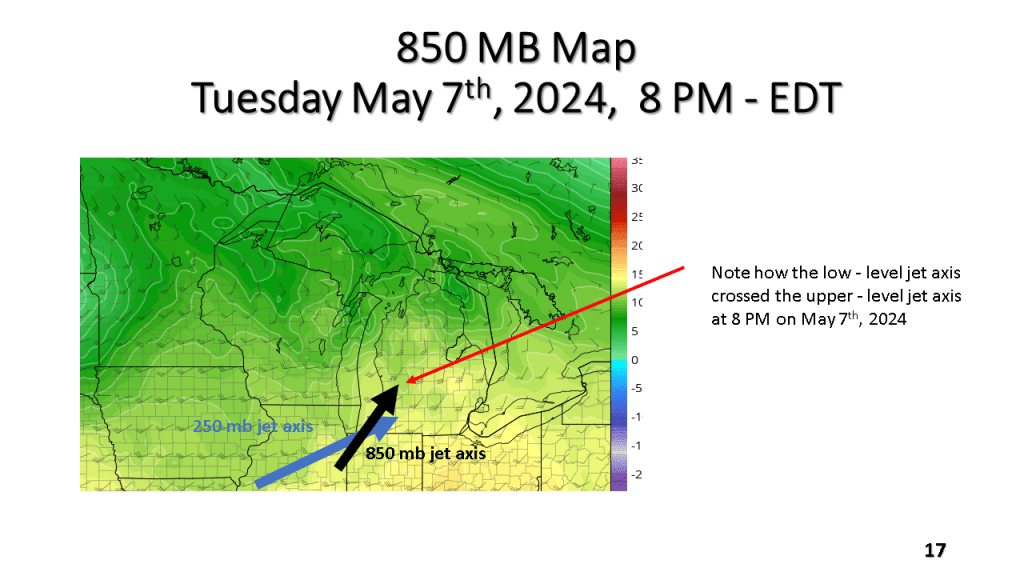
The Southern Great Lakes several tornadoes (2 EF-2), more than a dozen reports of hail larger than 2″, damaging winds, and locally heavy rainfall during the evening of Tuesday May 7th, 2024.


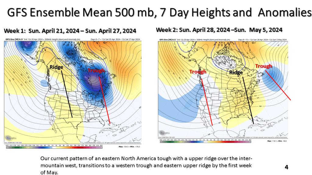
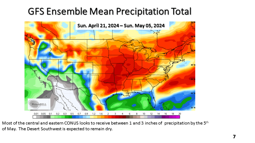
The current cool weather pattern has recently developed over the central and norther Plains. That cold air is expected to spread east over the next week. Frost and freezing temperatures are possible in northern and central sections over the next 7 days. Than, a warmer and wetter weather pattern is expected over most of the eastern and central CONUS.


(Severe reports were mostly large hail near Lansing)


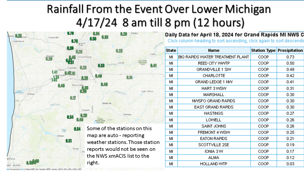


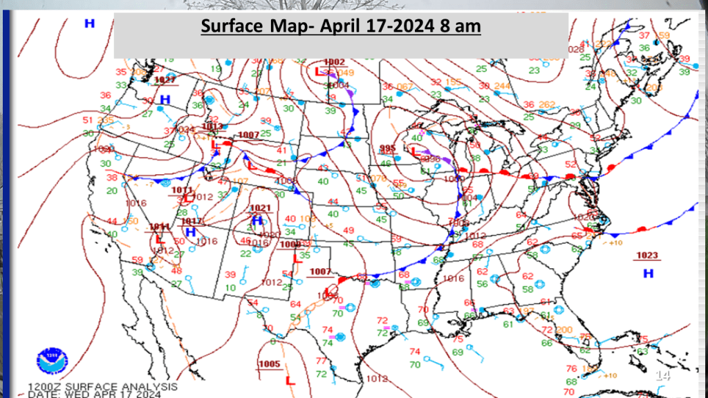
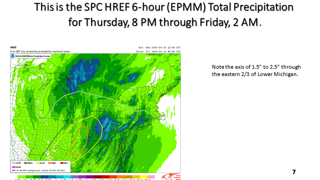
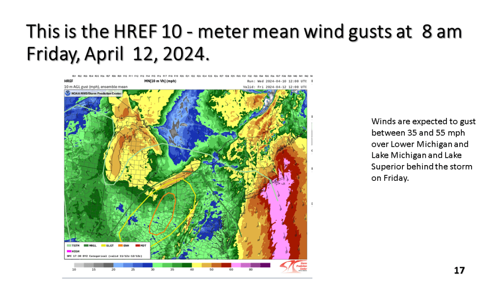
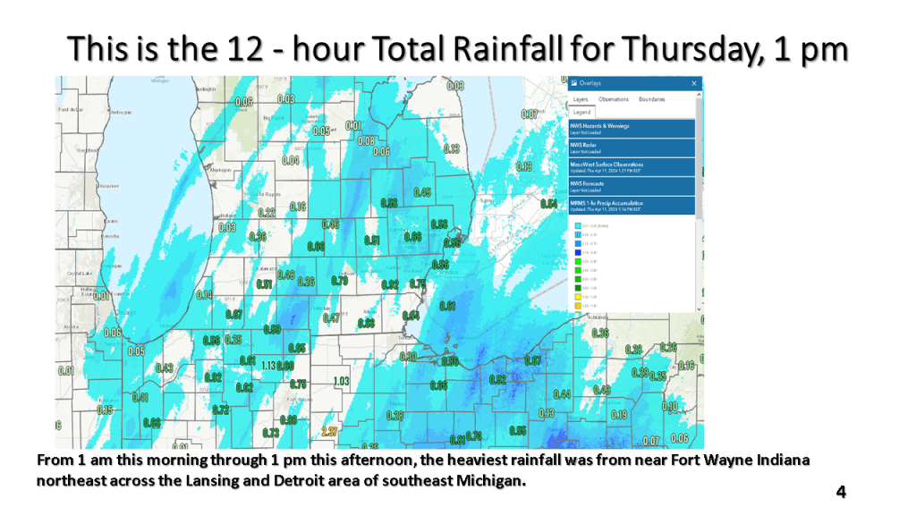
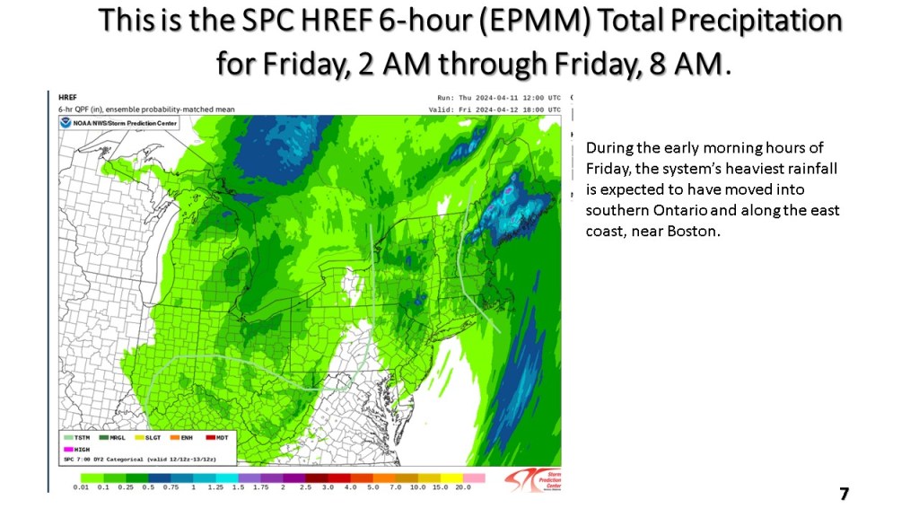
One to two inches of rain fell over a good part of Lower Michigan during this time. A rapidly deepening surface low tracked north across Lake Huron Friday, April 12, 2024 deepening below 980MB by late in the morning. This resulted in winds gusting to 40 to 60 mph across most of the area.


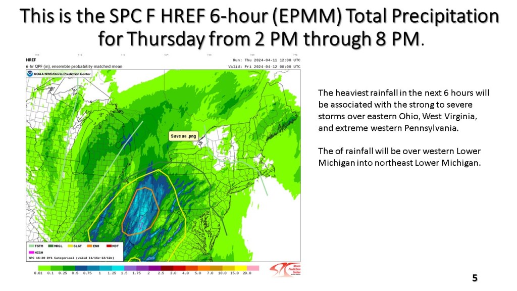


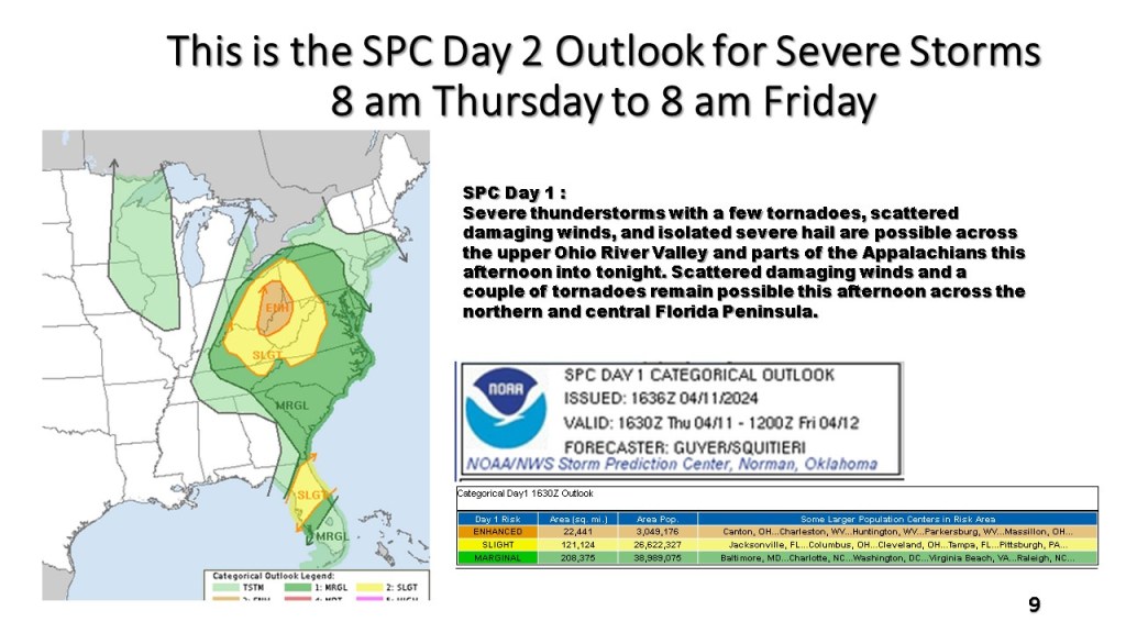


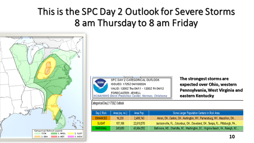
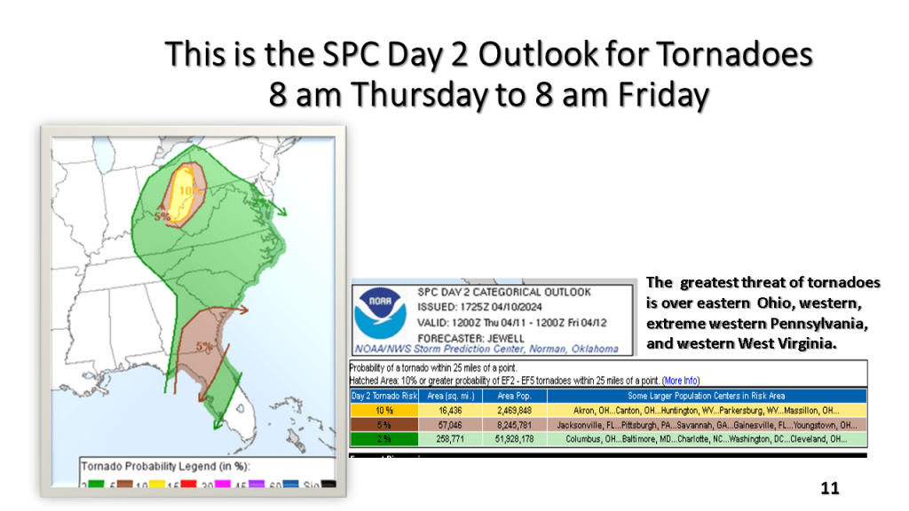
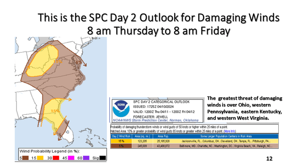
South of Michigan there is an enhanced risk for severe thunderstorms, including tornadoes over Ohio, western Pennsylvanian, West Virginia, and Kentucky.