Here is my final forecast update for the Eclipse on Monday afternoon.

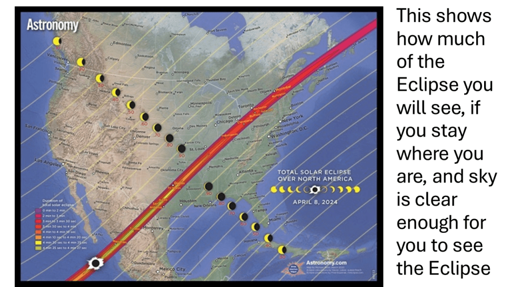
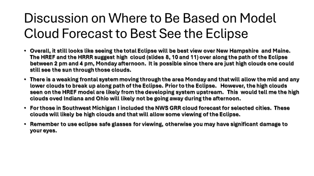
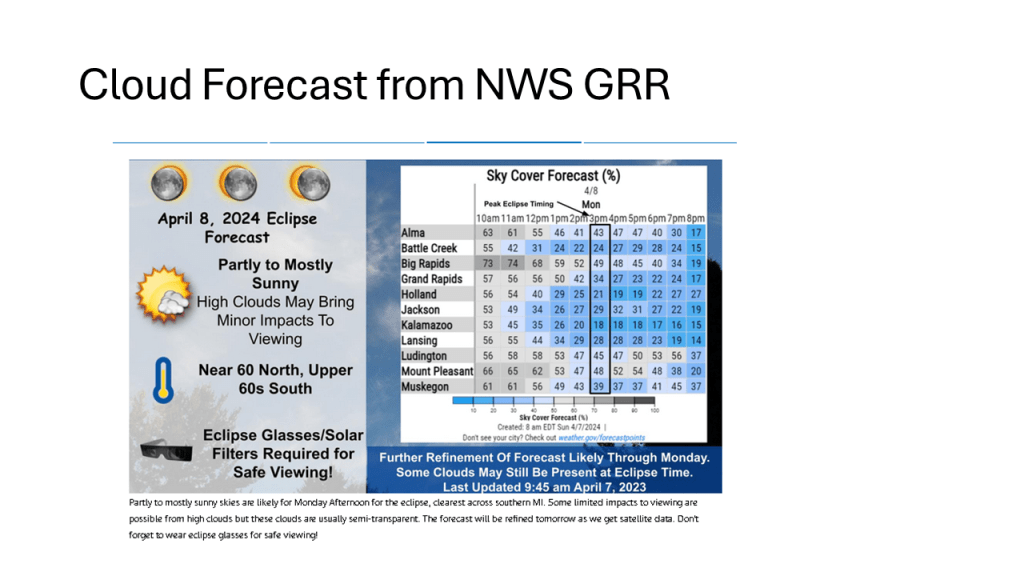
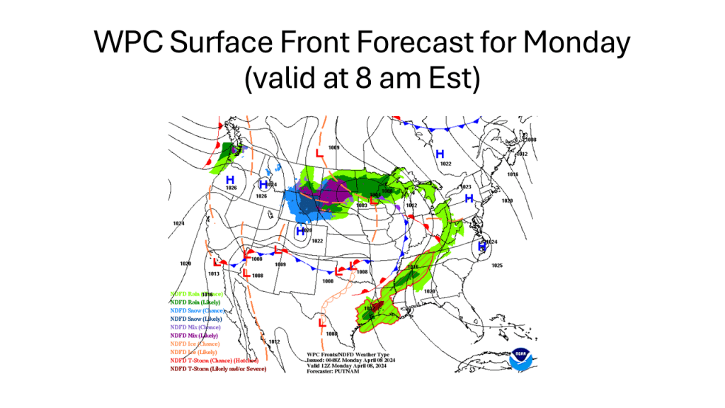
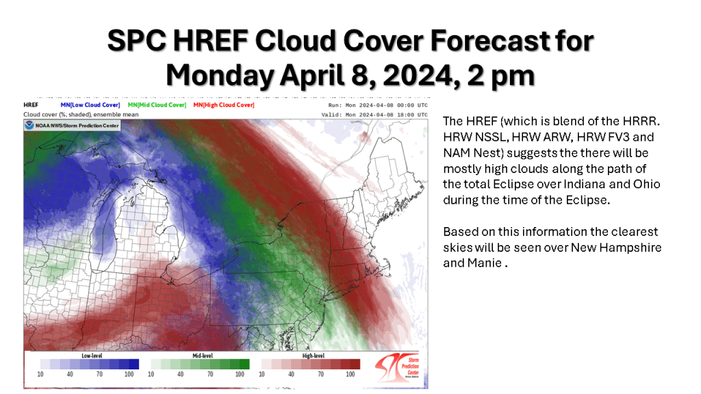
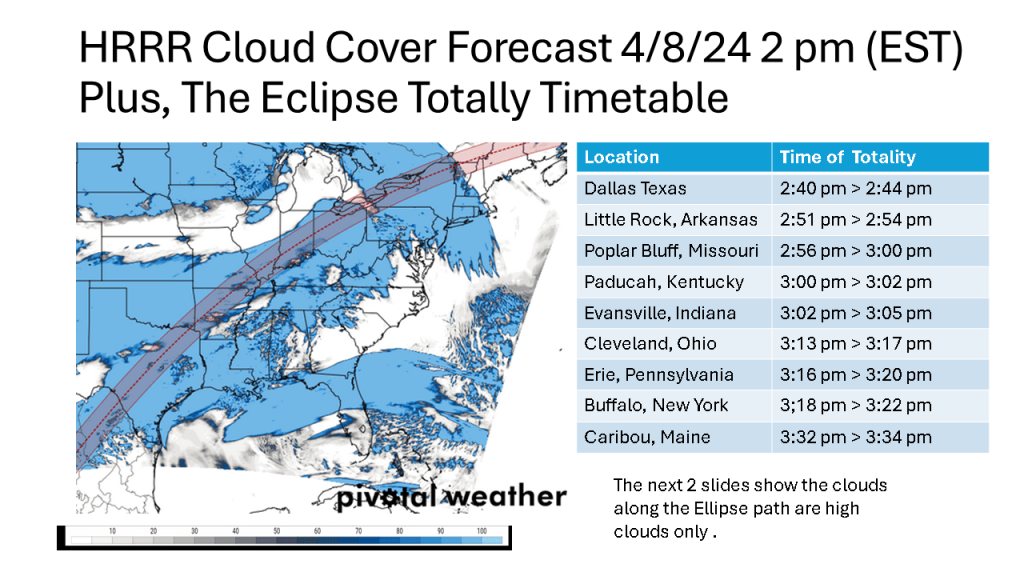
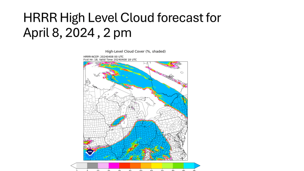
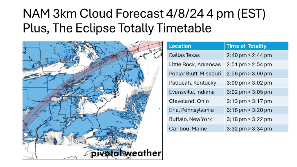
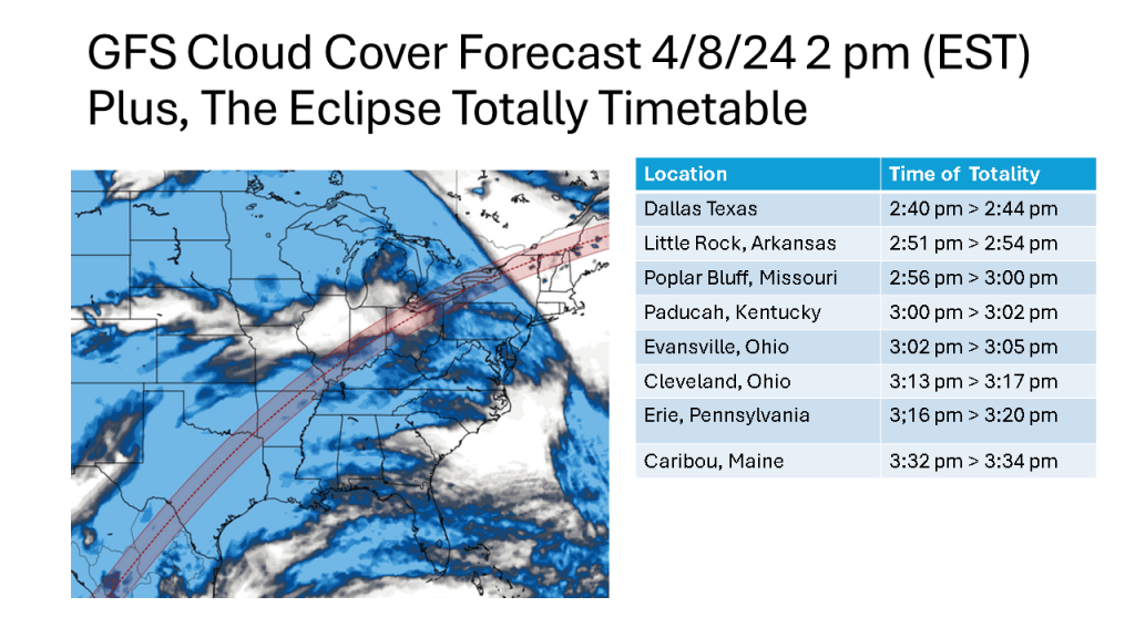
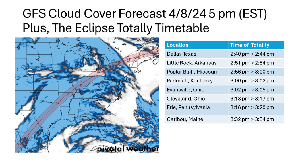
I waited for the evening HREF to come in so I could use the very latest model data for this forecast. Based on the HREF , NAM 12k m, NAM 3Km and the HRRR, it seems likely there will be high clouds over the Eclipse track from Indiana into Ohio. Being high clouds, more than likely you’d see some of the Eclipse. The best viewing still seems to be in over New Hampshire and Maine.

Where is the most likely location for you to go, based on the model cloud forecast so you can view the Total Solar Eclipse Monday?

I will update this forecast once the high resolution models get within 48 hours of the time of the Eclipse (2-3 pm Monday).

Note the times of Totality at various locations came from Astronomy as did slide #2.

Winter Weather Expected Over Most of Lower Michigan Friday!

The National Weather Service offices across the western Great Lakes have all issued Winter Weather Advisories for this snowfall event that is expected to continue, even over Iowa into northern Illinois and Wisconsin into early Friday afternoon and over Lower Michigan into the early evening of Friday.

The following slides will show you the details of this event that is expected to bring up to 10″ of snow in about 12 hours to some locations in western Great Lakes. It will likely be the heaviest snowfall over most of the area since mid February.

Snow Expected over Wisconsin and Michigan late Thursday into Friday.

A narrow band of snowfall greater than 6″ in 12 hours is expected about 100 miles north of the track of the surface low. That would be near or just north of I-96 in Michigan. Snowfall rates in the heaviest snow area will be high enough to accumulate during the daytime, even in late March.

What Happened to Our Cold Winters over the past 10 Winters?

This is an update to what I did yesterday but with a lot more detail. I have added CONUS scale winter temperature anomalies for each of the past 10 years so you can see for yourself, in your area how the cold winter frequency has changed (there is a summary CONUS scale summary table for this now too). I have added correlation slides from CPC and Physical Science Laboratories to show there really the correlation I am suggesting is true.

What Happened to Our Cold Winters of the Past?

At least over Southwest Michigan and likely most of the northern CONUS, we have lacked cold winter (relative to 1991-2020 normal) since the winter of 2014/2015, which was the last cold winter. I would suggest warming oceans are at least part of the story.