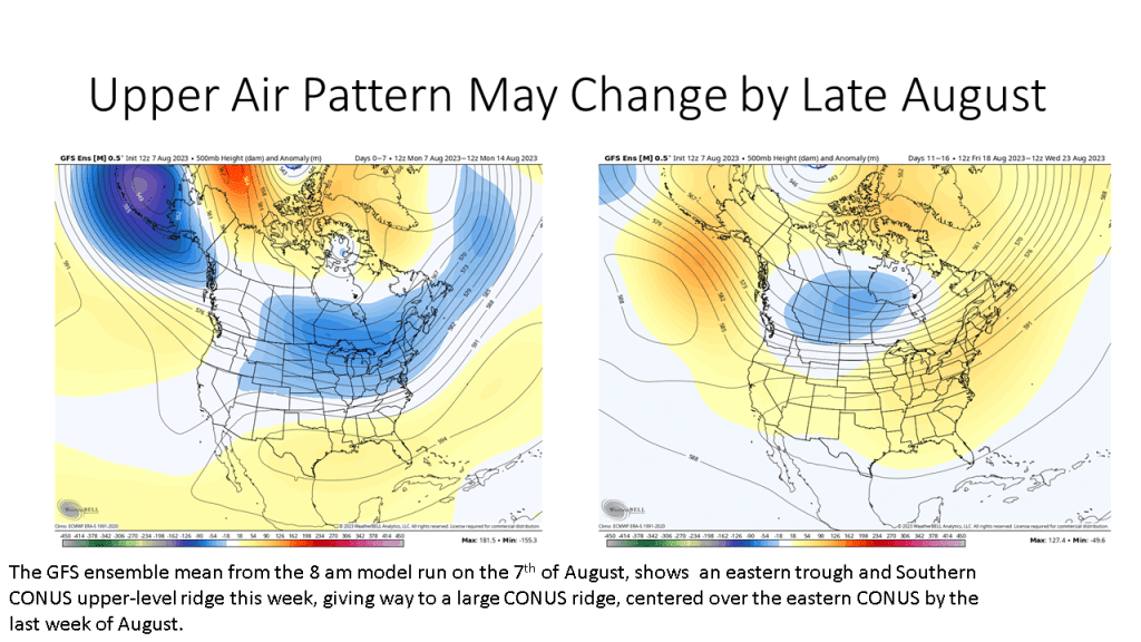
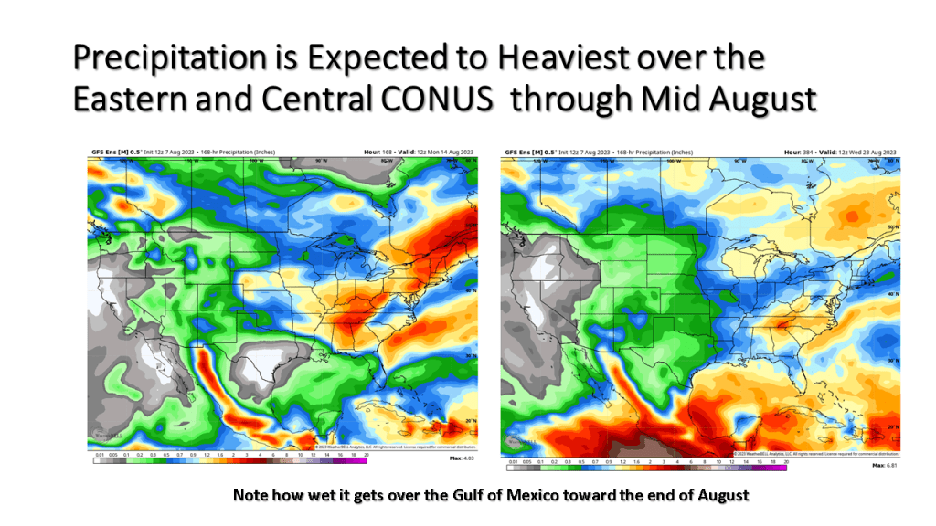
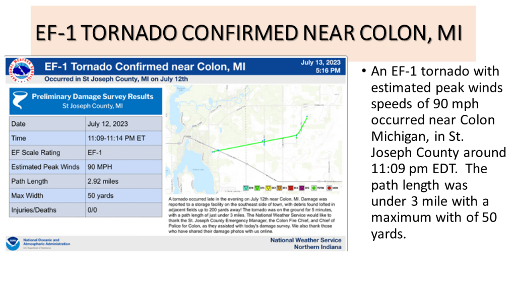
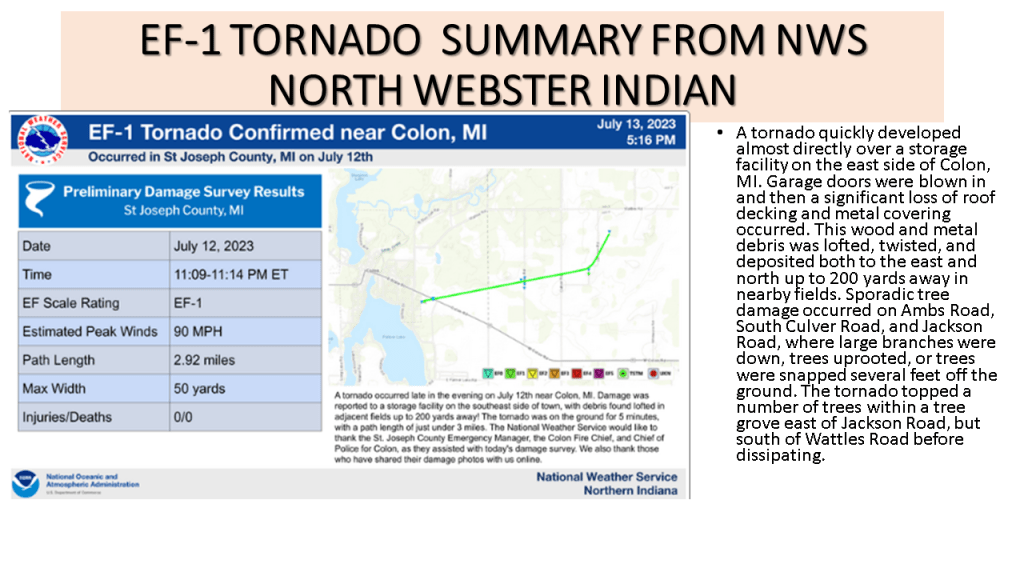
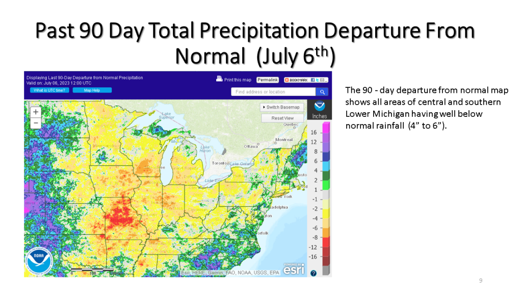
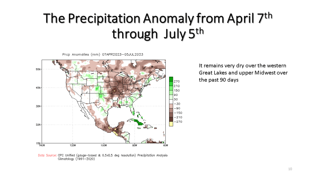
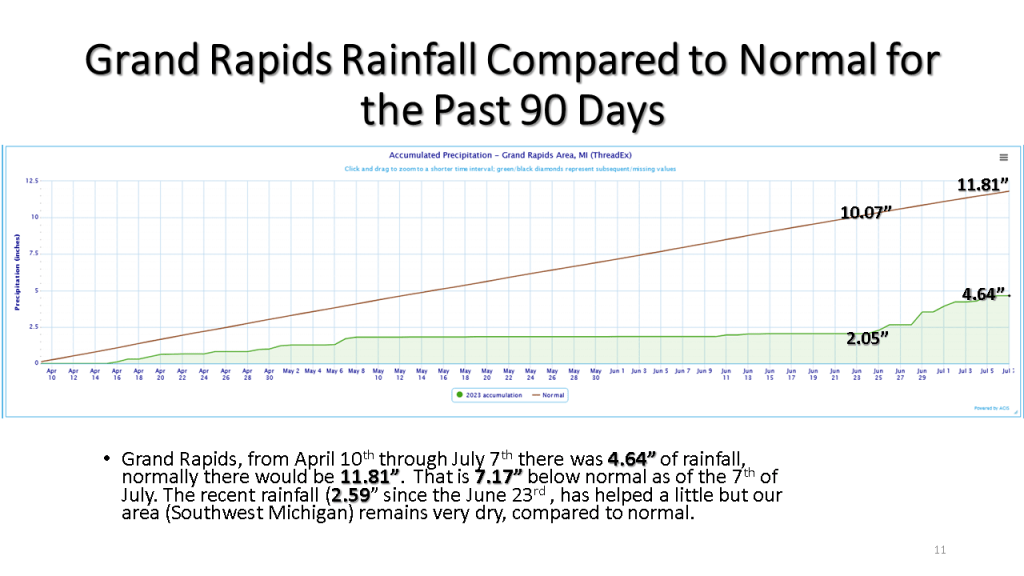
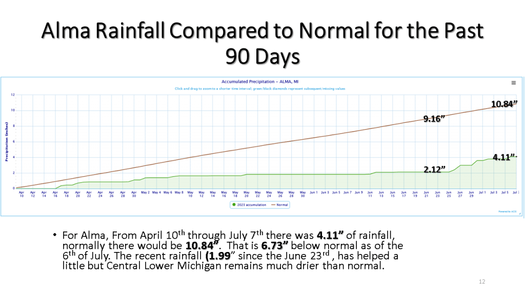


Heavy rain with localized flooding occurred over southern and central Lower Michigan on the evening of the 12th of July. There were also reports of damaging winds, a tornado near Colon and a few funnel cloud reports.


Heavy rain with a few thunderstorms is expected over the southern 1/3 of Lower Michigan from late afternoon until early Thursday morning. Rainfall amounts of 2″ to 4″ is expected over a large area, so that may cause some urban and small stream flooding.
The heaviest rainfall is expected between 5 pm and 9 pm this evening. Rainfall of 2 inches to 4 inches is expected with local amounts over 5 inches possible. As a result, The National Weather Service has issued a Flood Watch for the southern 1/3 of Lower Michigan until 2 am Thursday. This amount of rain will have an impact on reducing the on-going drought if in fact we actually do that that much rain over a large area.


Recent rainfall has helped our drought improve some, but with rainfall anomalies being between 4 and 7 inches over the past 3 months, that has not come close to ending our current drought.


Severe storms during the evening of June 29th 2023 brought down trees and wires. Locally heavy rain causes some roads to be closed for a while.


To end our current drought over southern Michigan we would need around 6 inches of rain by the end of July. This is near record totals for July at most of our climate sites. It would seem unlikely given our current weather pattern we would get that much widespread rainfall. So while we do expect more rain in the next month than the previous month, the expected rainfall will likely fall short of ending this drought.


Our current drought and it’s impacts continue across Michigan, this blog looks at what is happening now and then what we should expect going forward into mid July.


Spring started out in March, warmer than normal, snowy and wet but ended in May still warmer than normal but very dry over Lower Michigan.


It’s been unusually dry is Lower Michigan since early May, this is expected to change by Sunday.


May in Southwest Michigan was one of the top 10 driest on Record, the fist half of June is not expected to be all that much wetter.


Upper air pattern will support dry and warmer than normal conditions through most of next week.


