


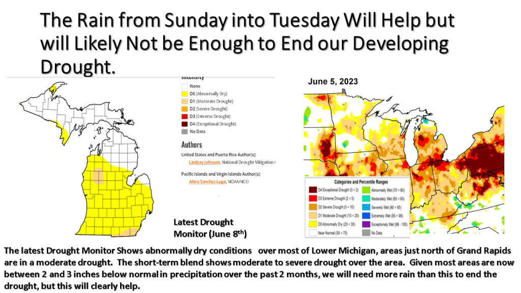
Our current drought and it’s impacts continue across Michigan, this blog looks at what is happening now and then what we should expect going forward into mid July.
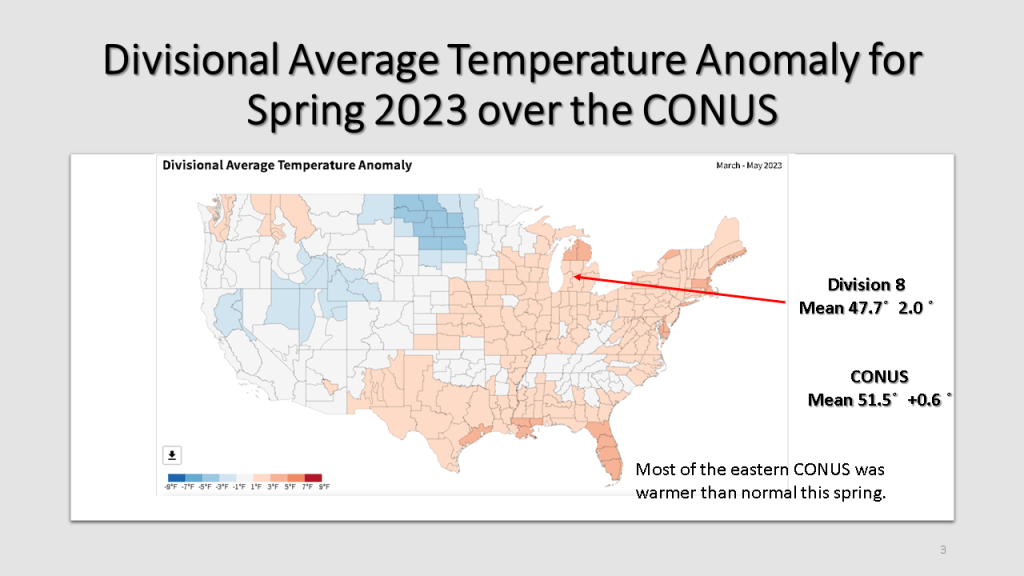
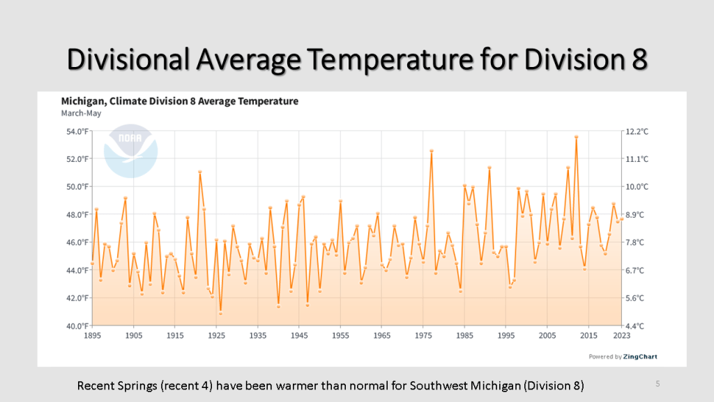
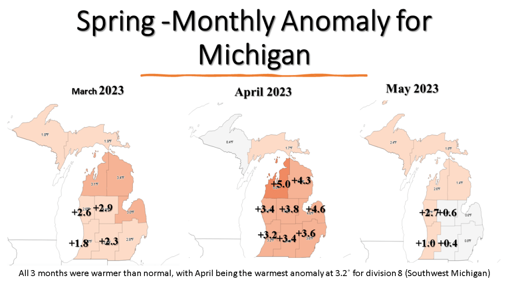
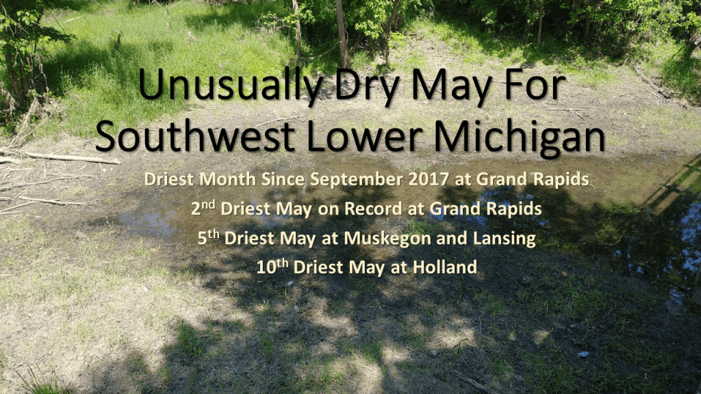
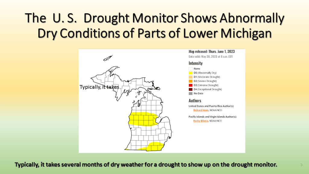
Spring started out in March, warmer than normal, snowy and wet but ended in May still warmer than normal but very dry over Lower Michigan.


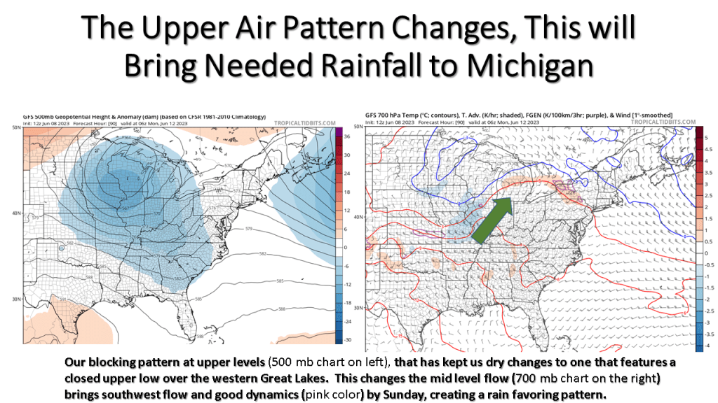
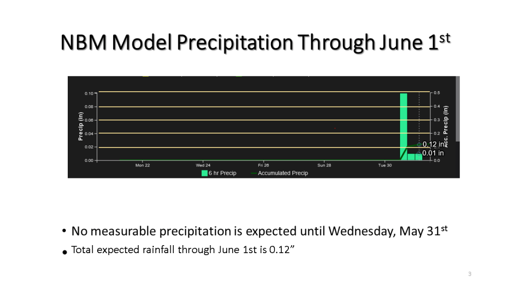
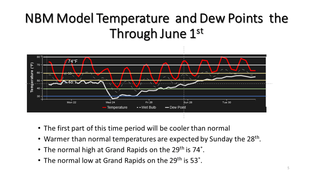
It’s been unusually dry is Lower Michigan since early May, this is expected to change by Sunday.
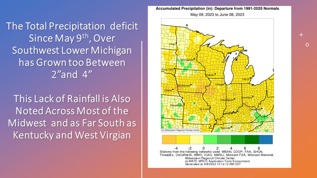


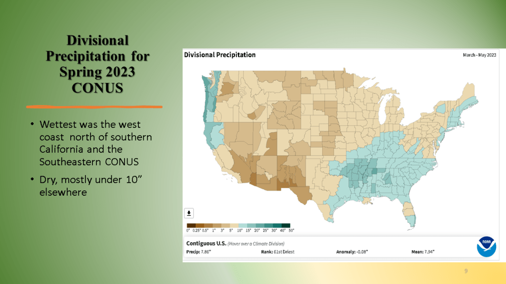
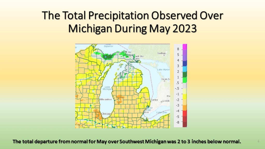
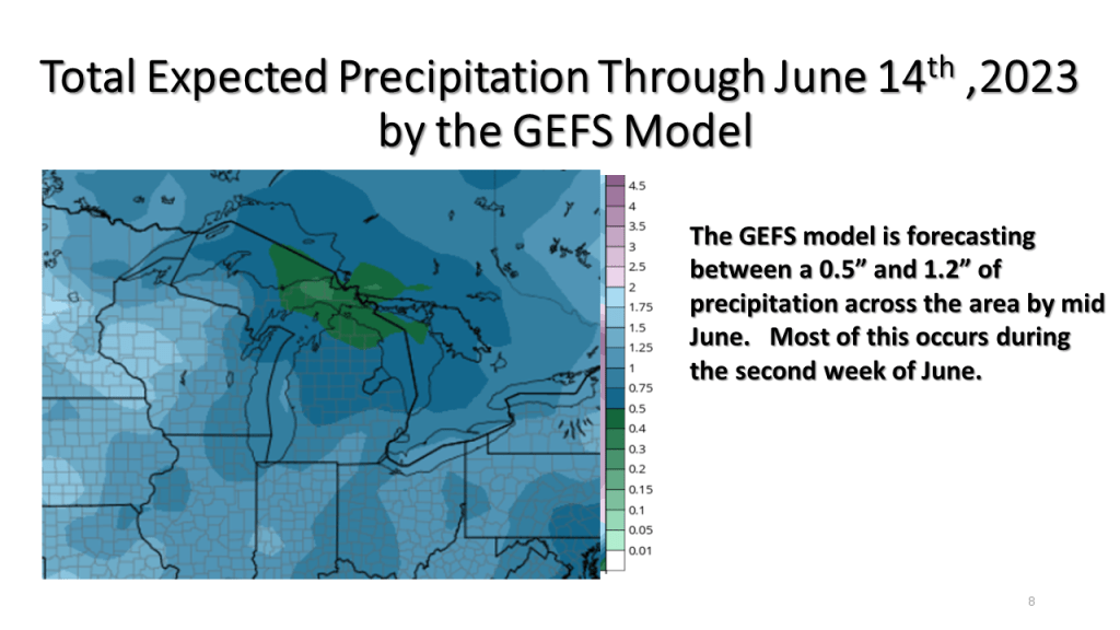
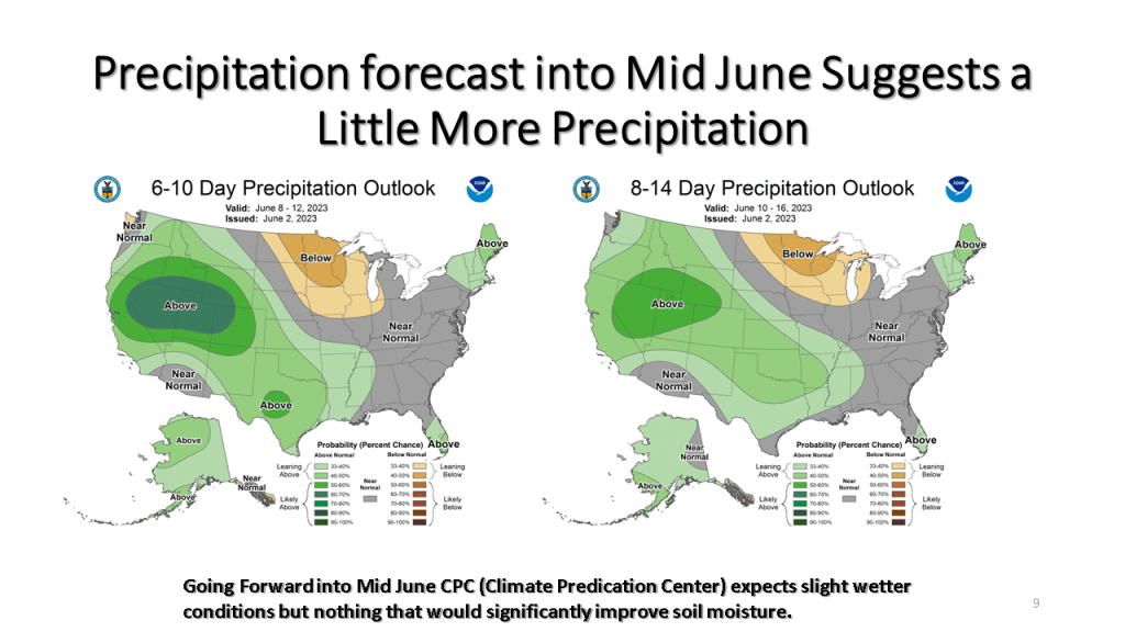
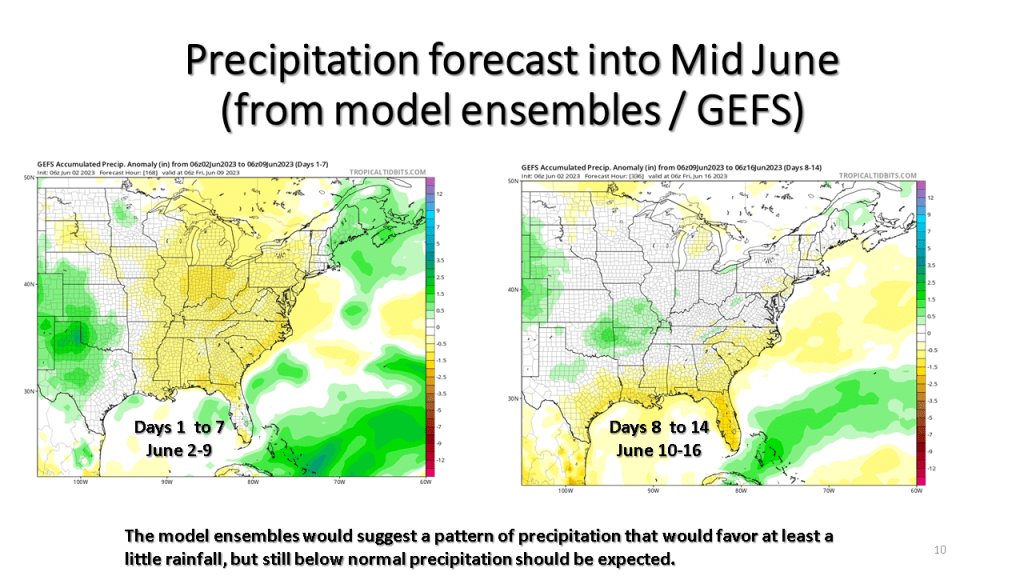
May in Southwest Michigan was one of the top 10 driest on Record, the fist half of June is not expected to be all that much wetter.


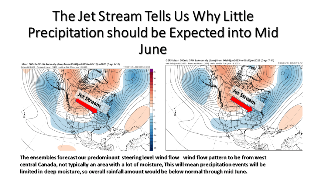

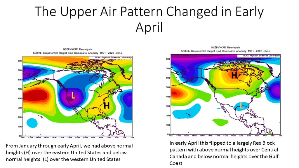
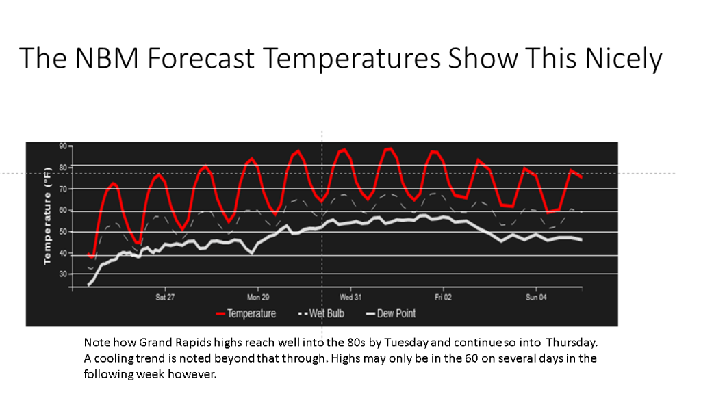
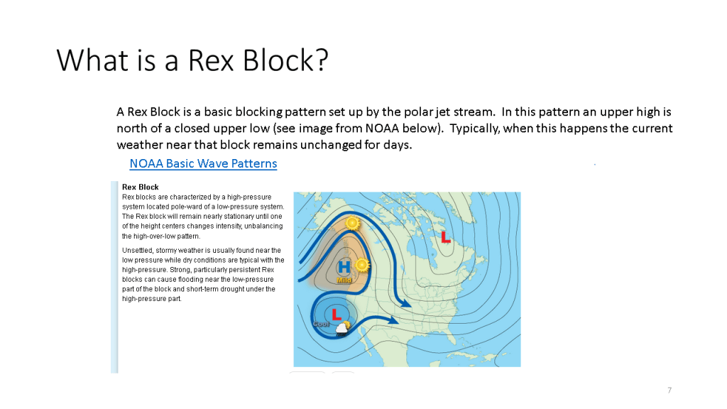
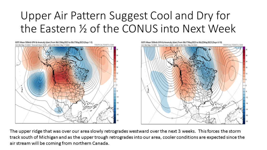
Upper air pattern will support dry and warmer than normal conditions through most of next week.


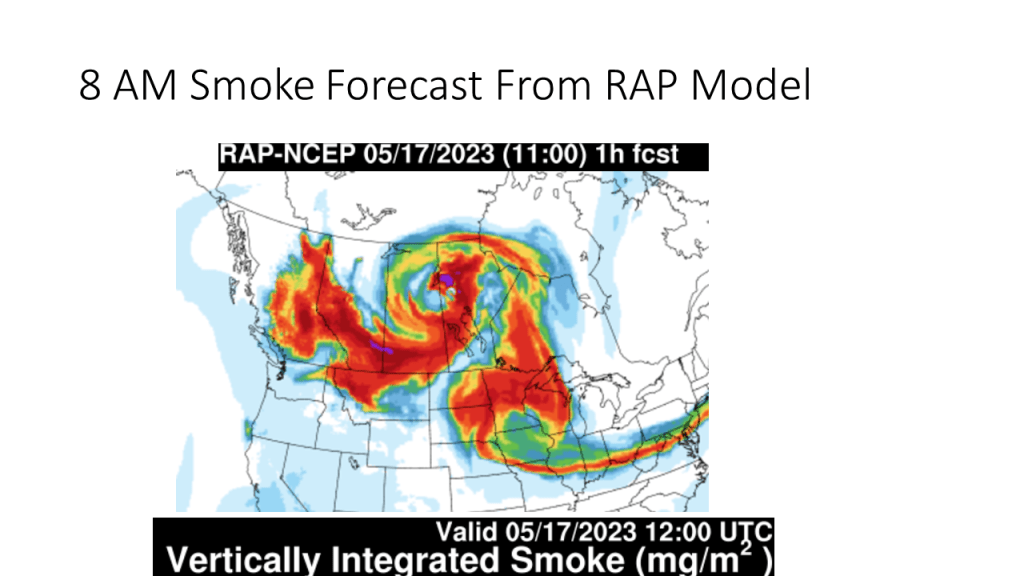
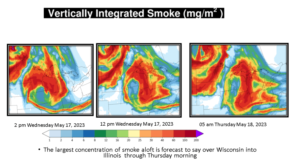
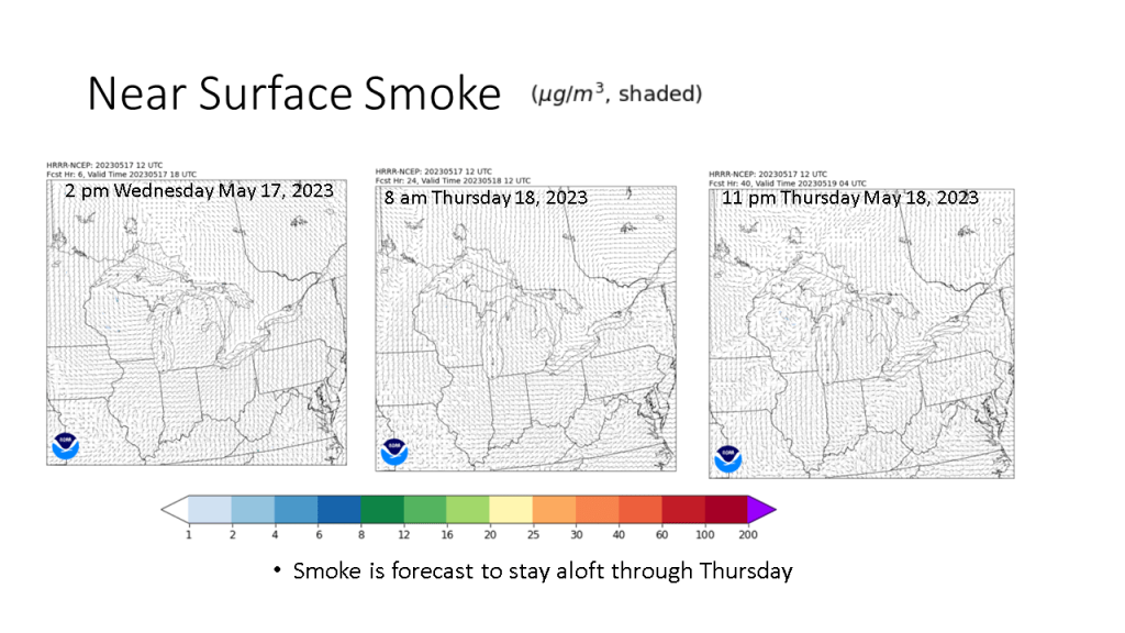
The smoke in the sky the past few days is coming from western and central Canada due to wildfires there.


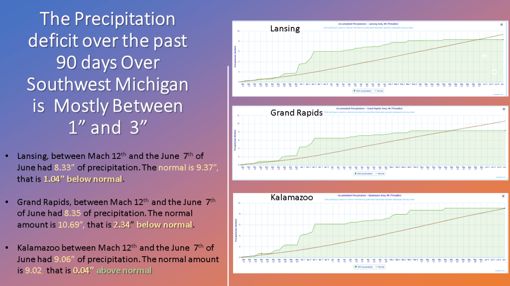
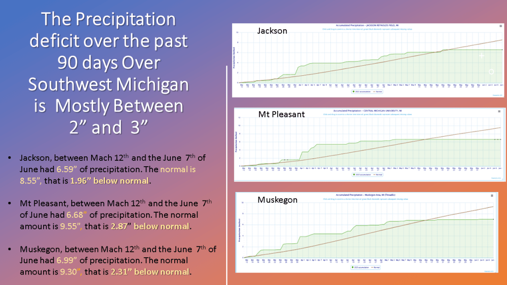
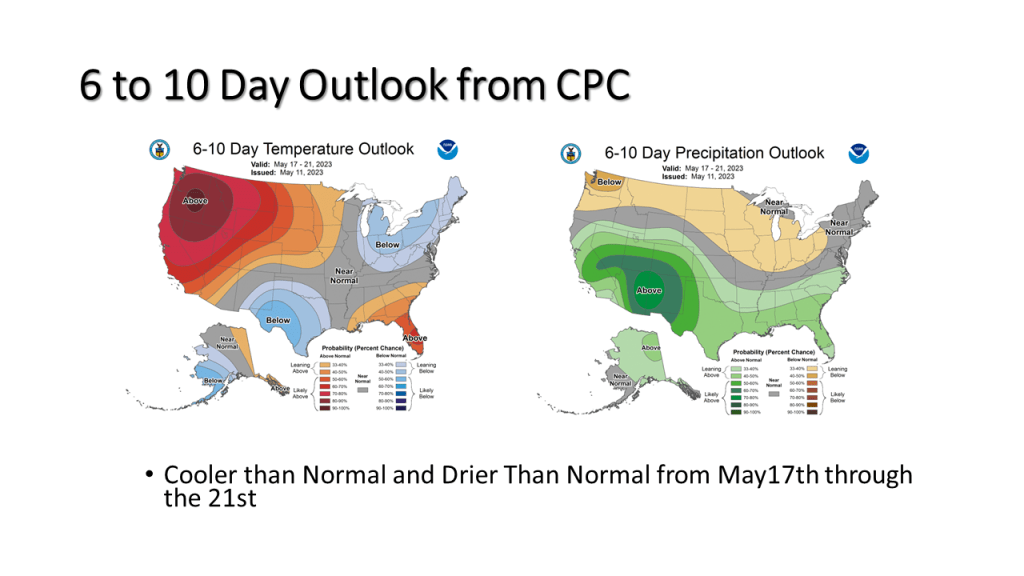
Over Southwest Michigan, May has largely been drier than normal and cooler than normal Overall the next two weeks will mostly be that way.


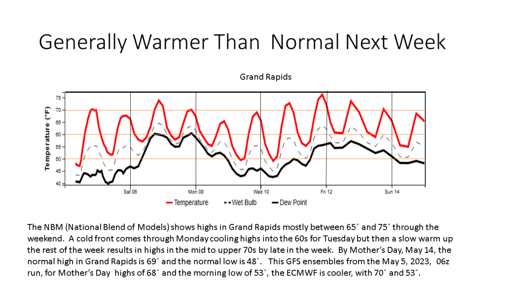
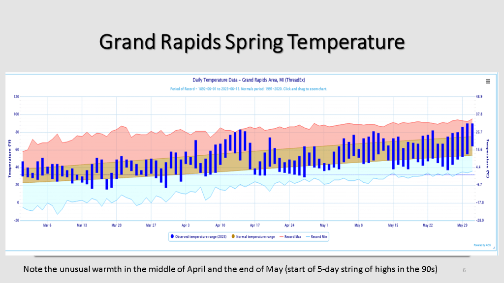
Warmer Temperatures are expected for the Great Lakes area through Mother’s Day