


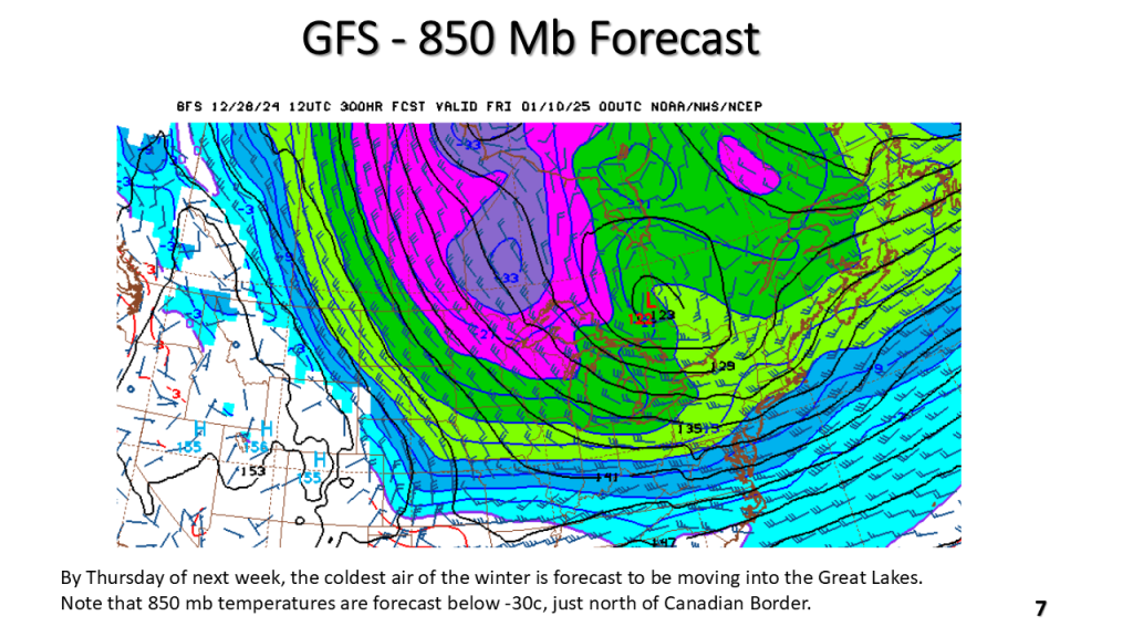
The current warmer than normal temperature pattern over the eastern CONUS will be replaced by below to well below normal temperatures by the middle of this coming week. That new pattern may last into the weekend of the 12th of January.


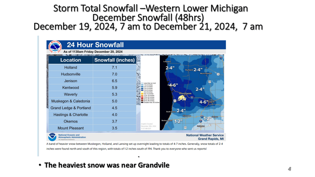
This is for Southwest Lower Michigan


This is the final version and contains information on recent warming trends