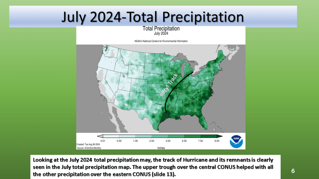
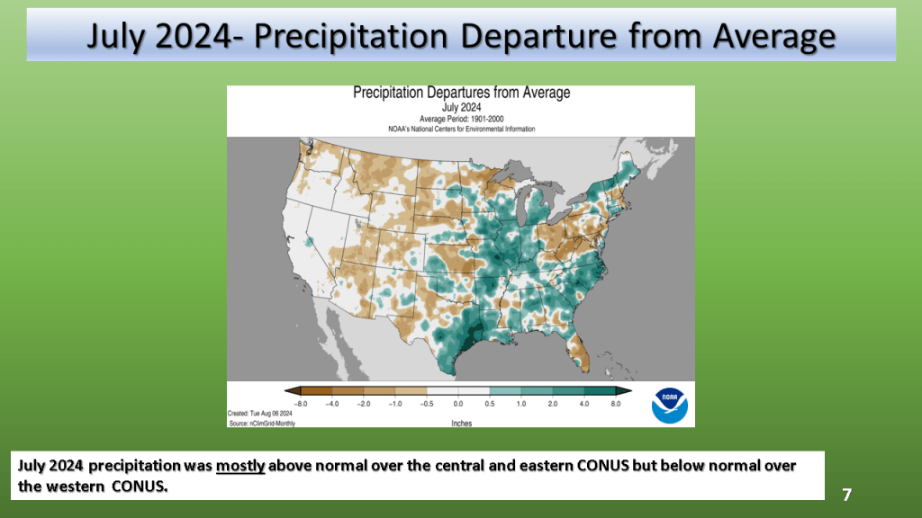
Most of the CONUS was warmer than normal and dry in September. The notable exception was over the Southeast CONUS where Hurricane Helene and it’s remnants caused devastating flooding in some areas.
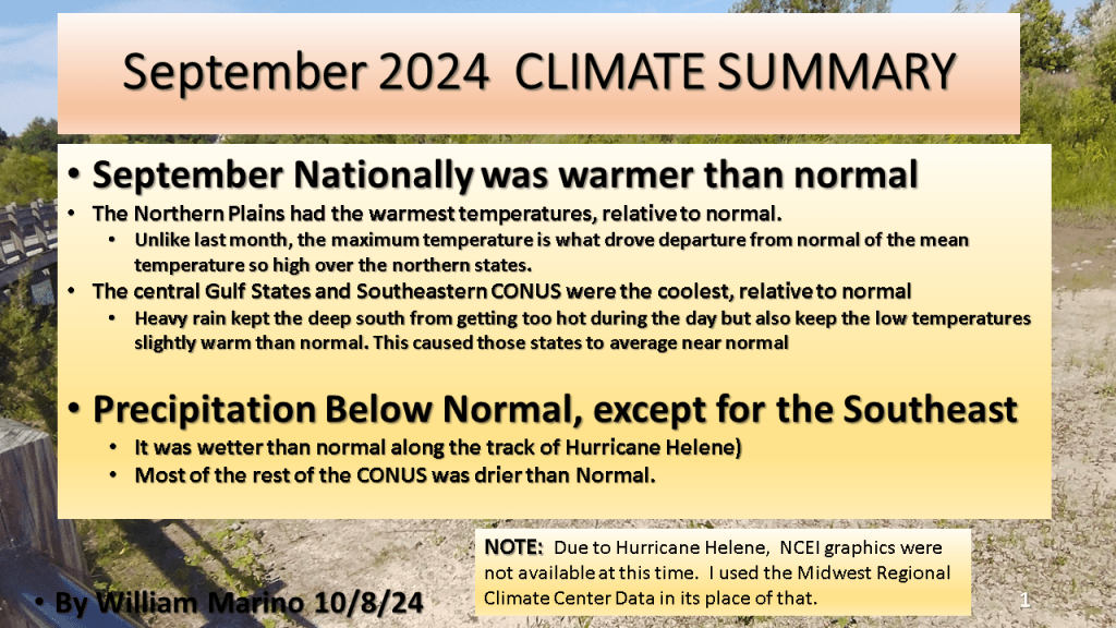


Most of the CONUS was warmer than normal and dry in September. The notable exception was over the Southeast CONUS where Hurricane Helene and it’s remnants caused devastating flooding in some areas.


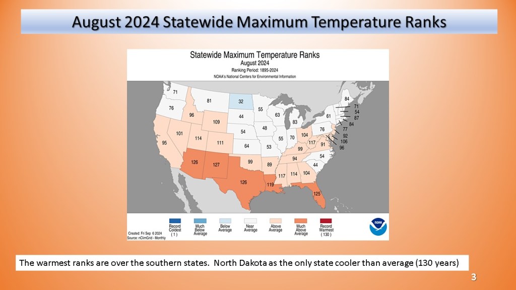
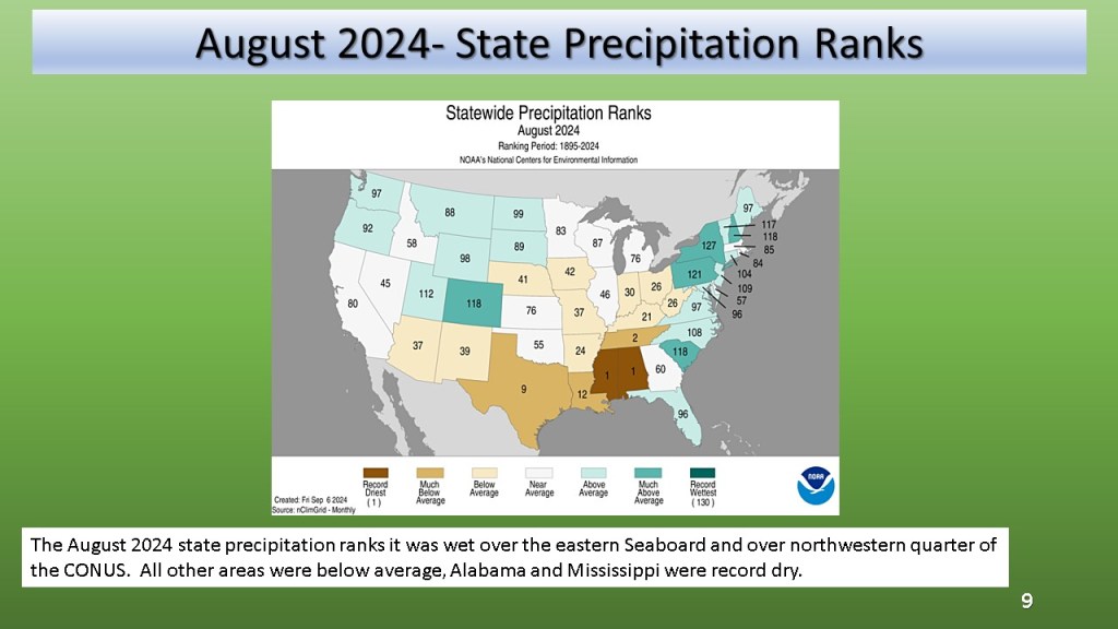
Record dry Alabama and Mississippi, most of the CONUS was warmer than average.


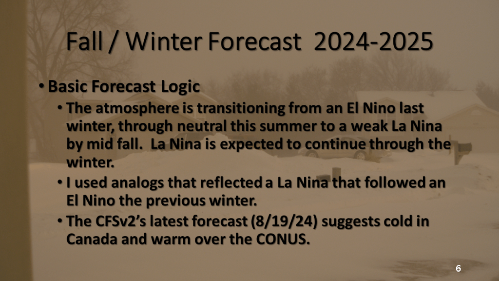
Nationally and Locally over Southwest Michigan
Updated with State Maximum and Minimum Temperature Ranks and details on Florida and Michigan heavy rainfall amounts


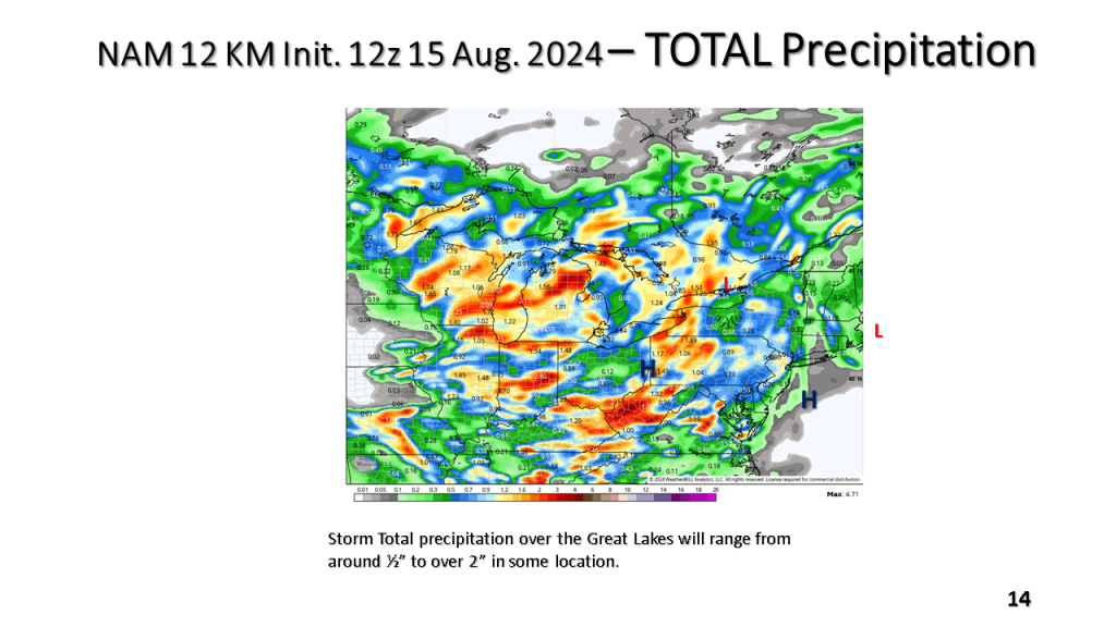
(over the Midwest and Great Lakes)


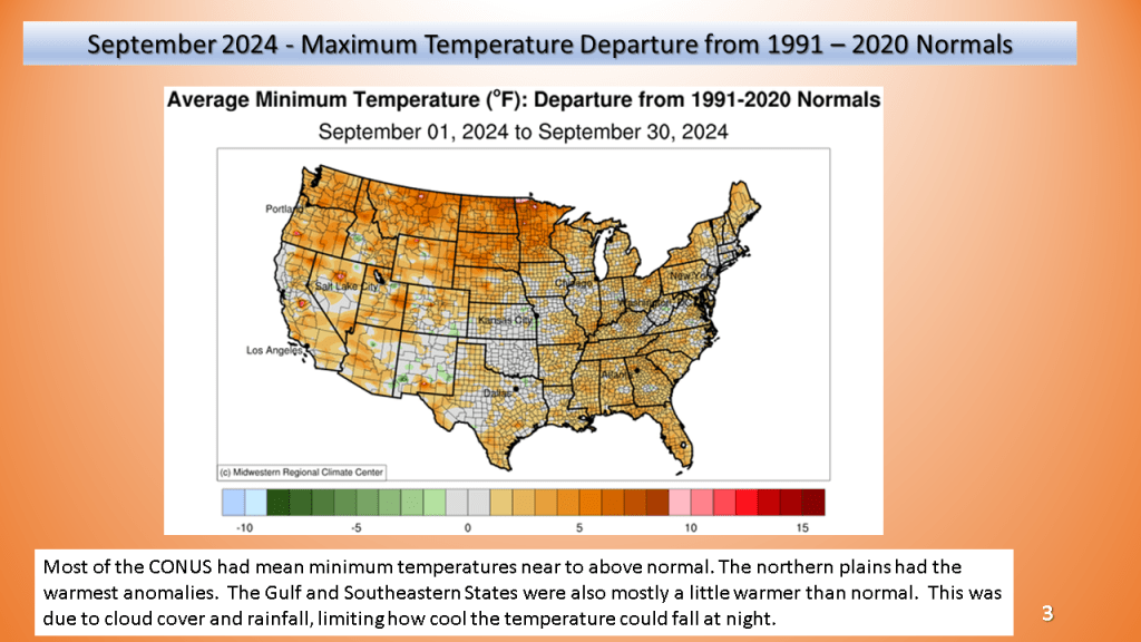
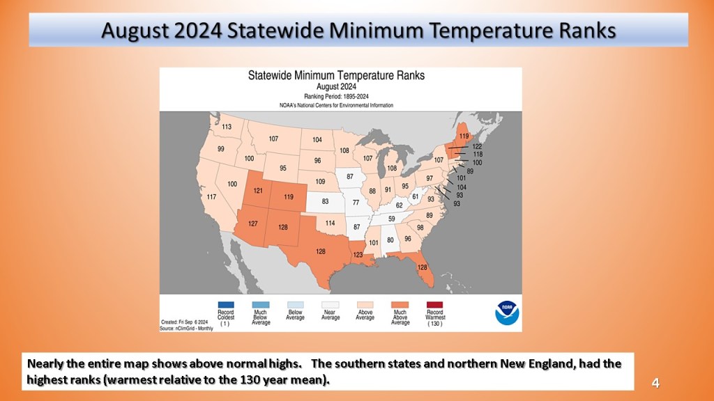
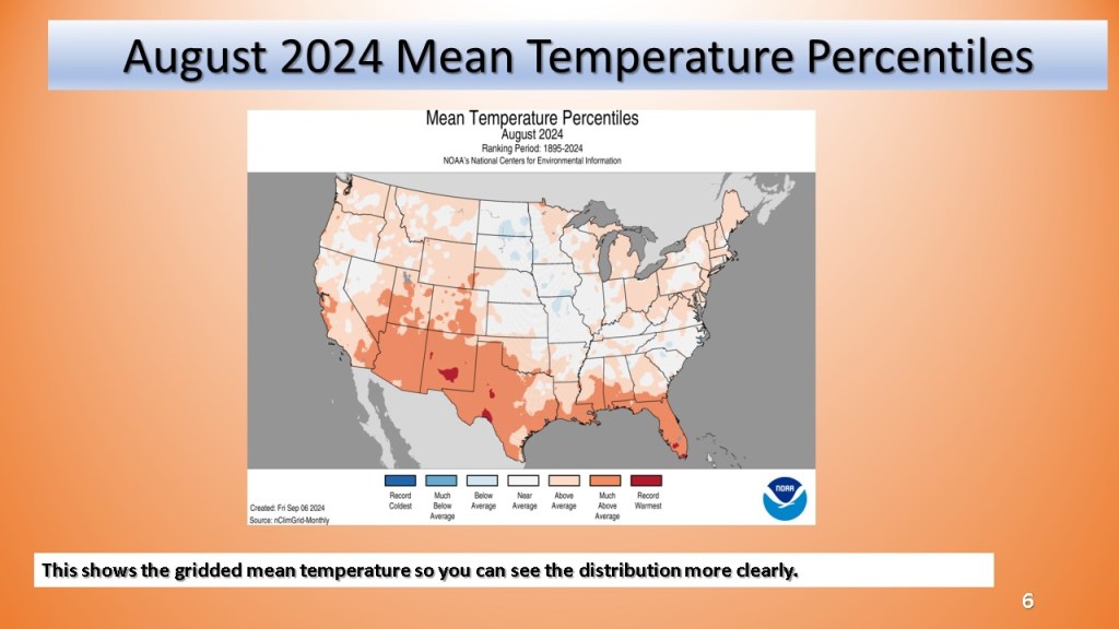
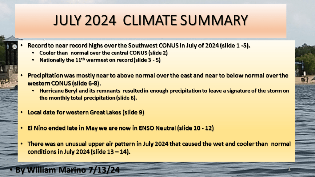
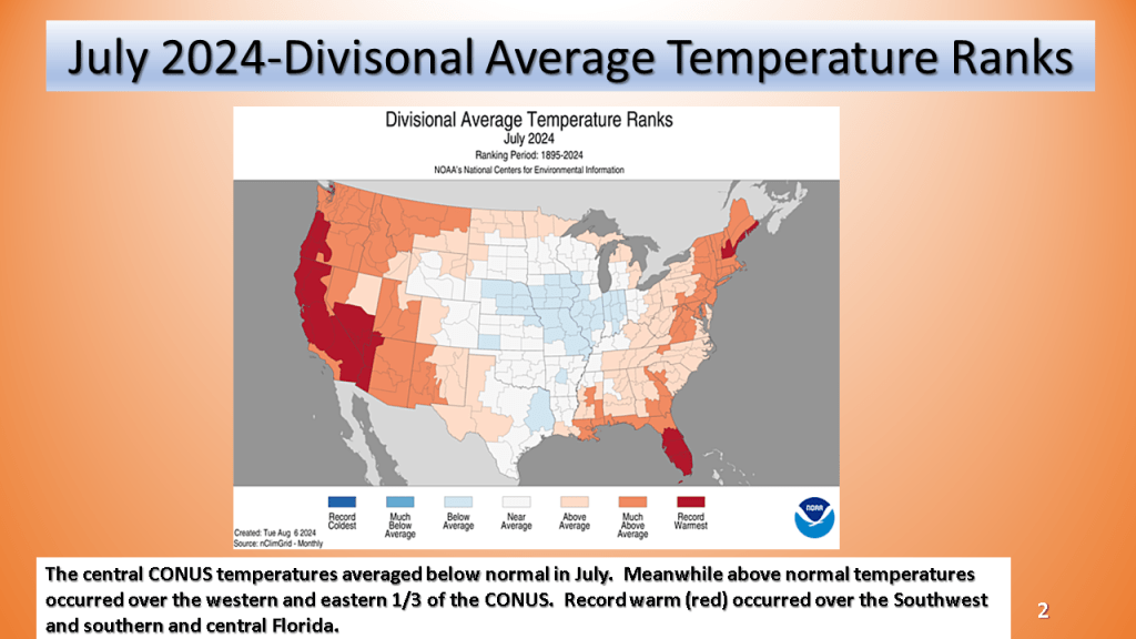
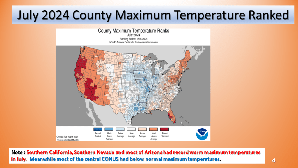
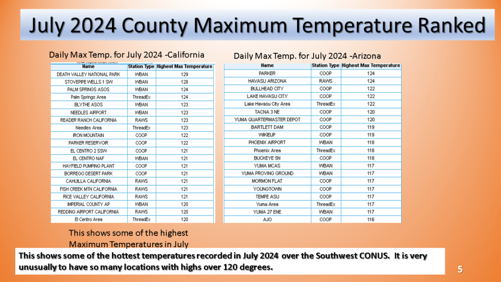
Record to near record heat over the Southwest CONUS and parts of Florida, while the Midwest and Great Lakes was cooler and wetter than normal. Grand Rapids Michigan had it’s coolest month, relative to normal since April 2022!


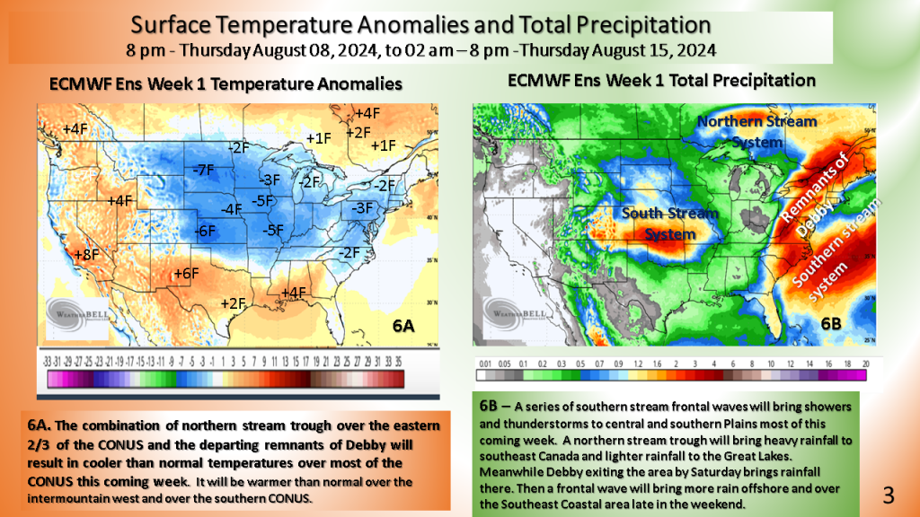
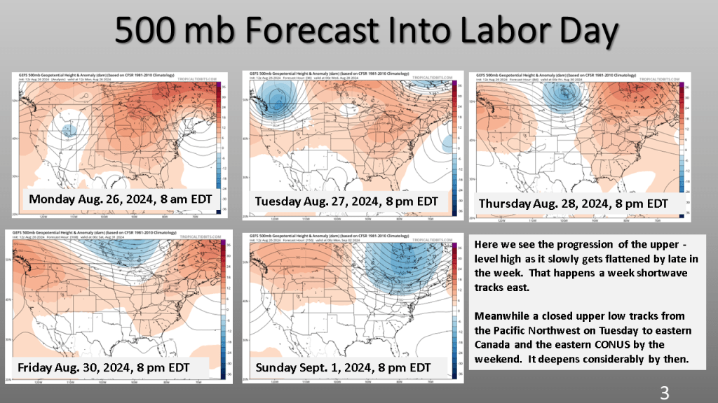
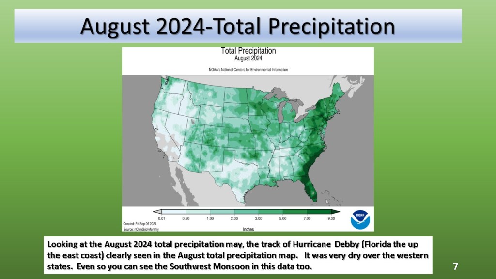
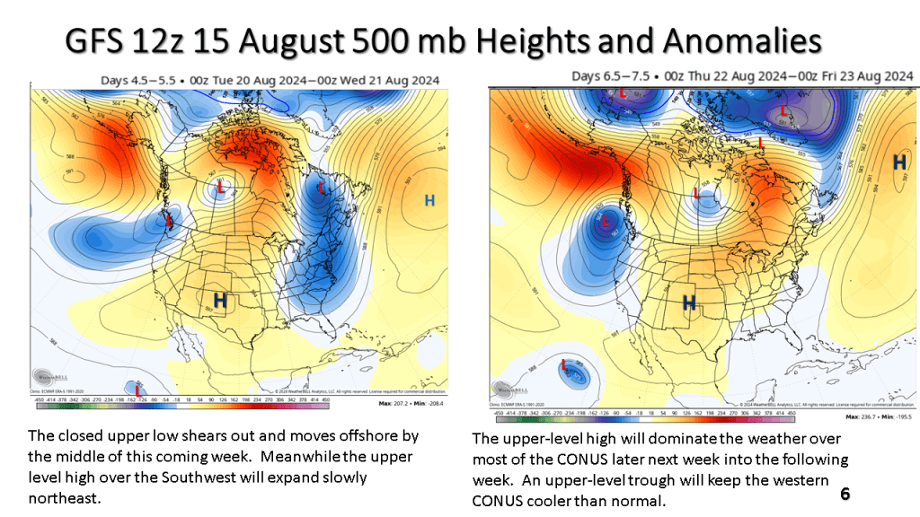
Seems another developing closed upper low my cool the eastern CONUS off by 19th of August (or the 3rd full week of August). This would likely be a wet period over the east.