


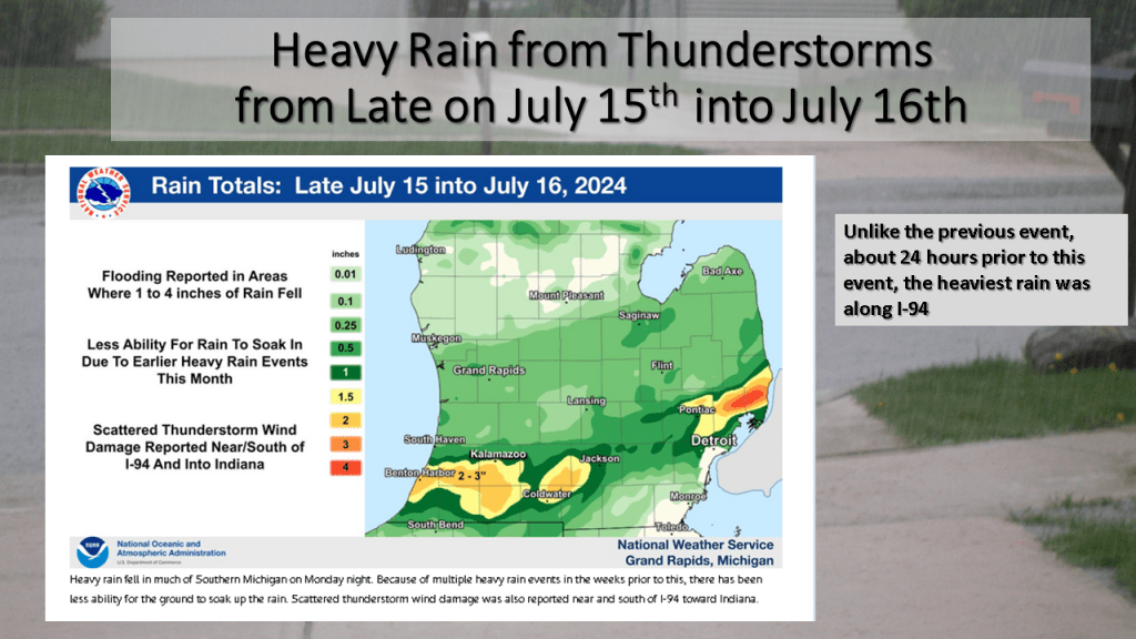
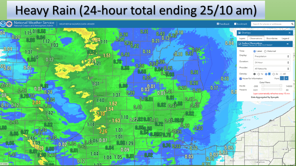
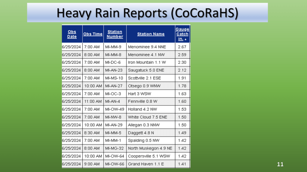
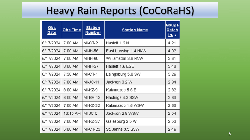
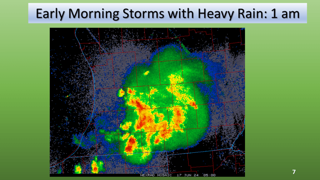
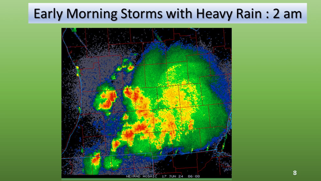
Thunderstorms with heavy rain two nights in a row brought 2″ to 3″ of rain over a good share of southern Half of Lower Michigan.


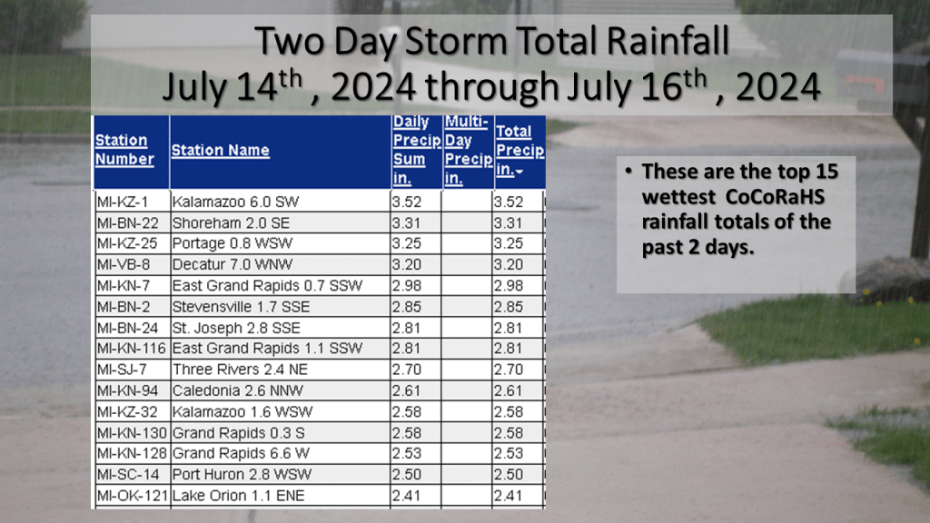
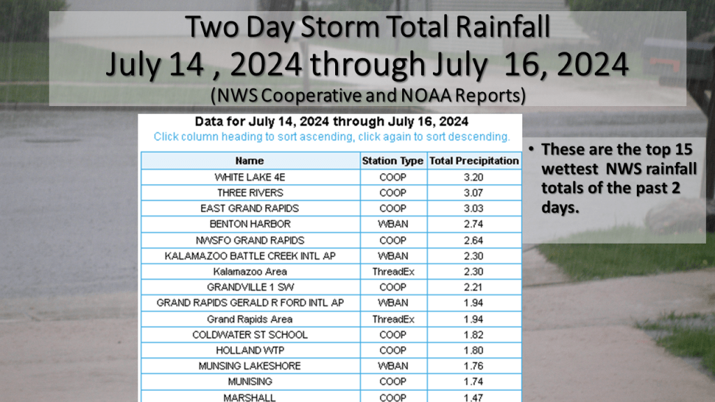
Kalamazoo’s CoCoRaHS report of 3.52″ was the greatest total from the reports I have seen.


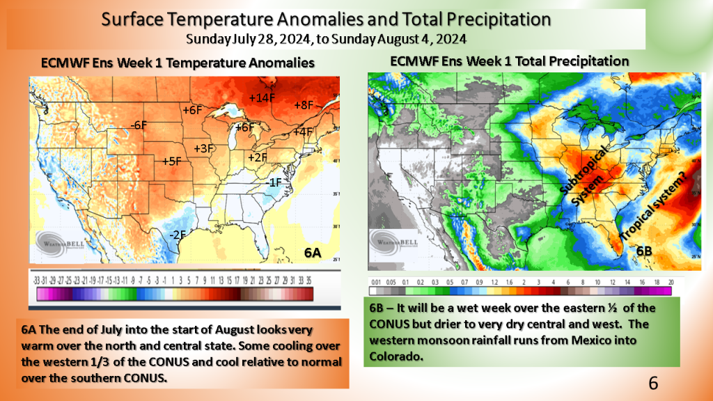
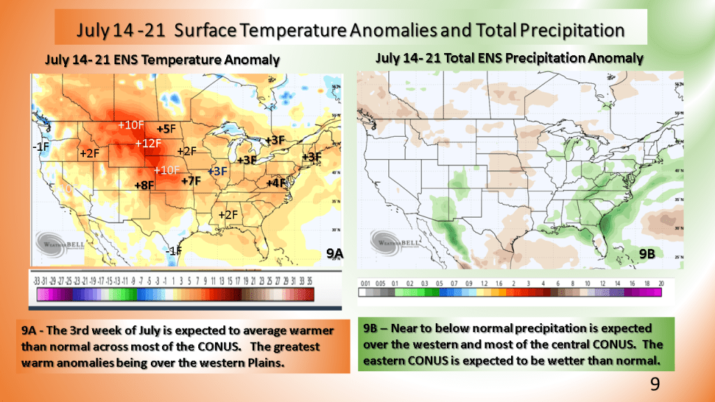
Warmer than normal temperatures are expected over most of the CONUS following the system for the third week of July.


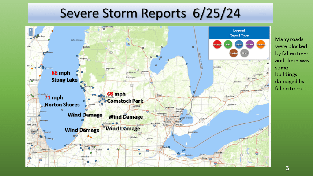
National Weather Service / Grand Rapids Storm Summary
This summary has radar loops, pictures of the damage and much more!
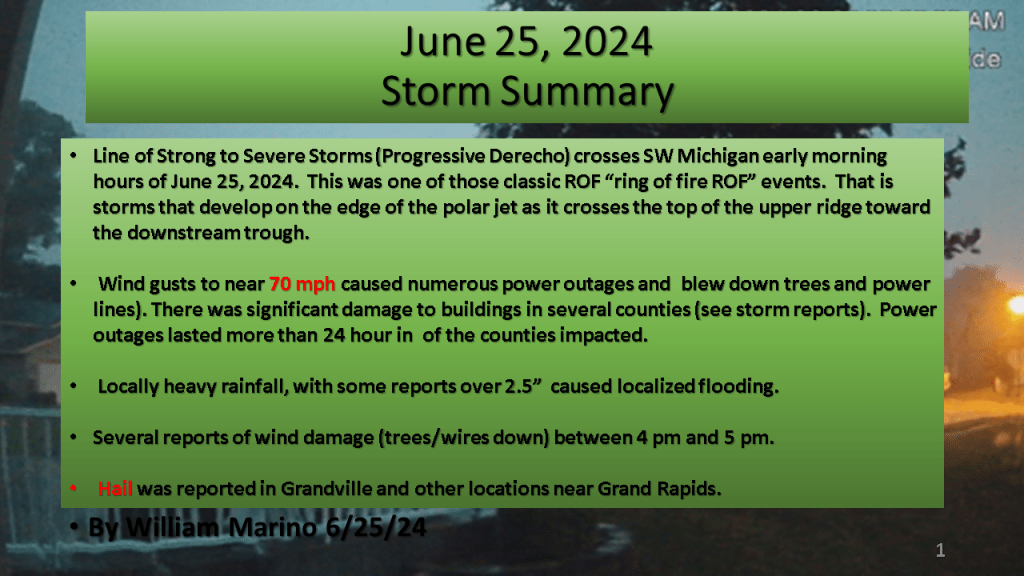


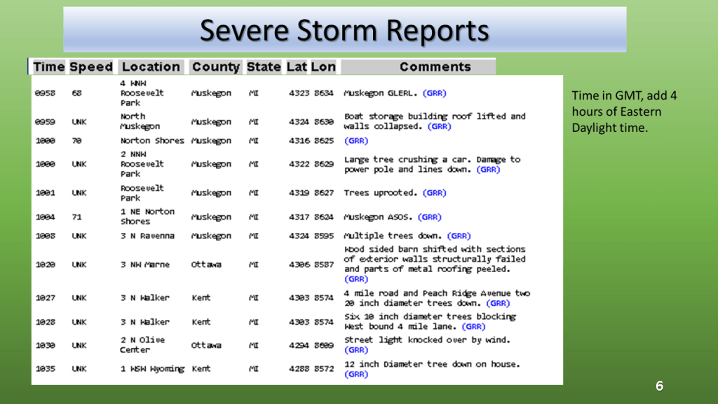


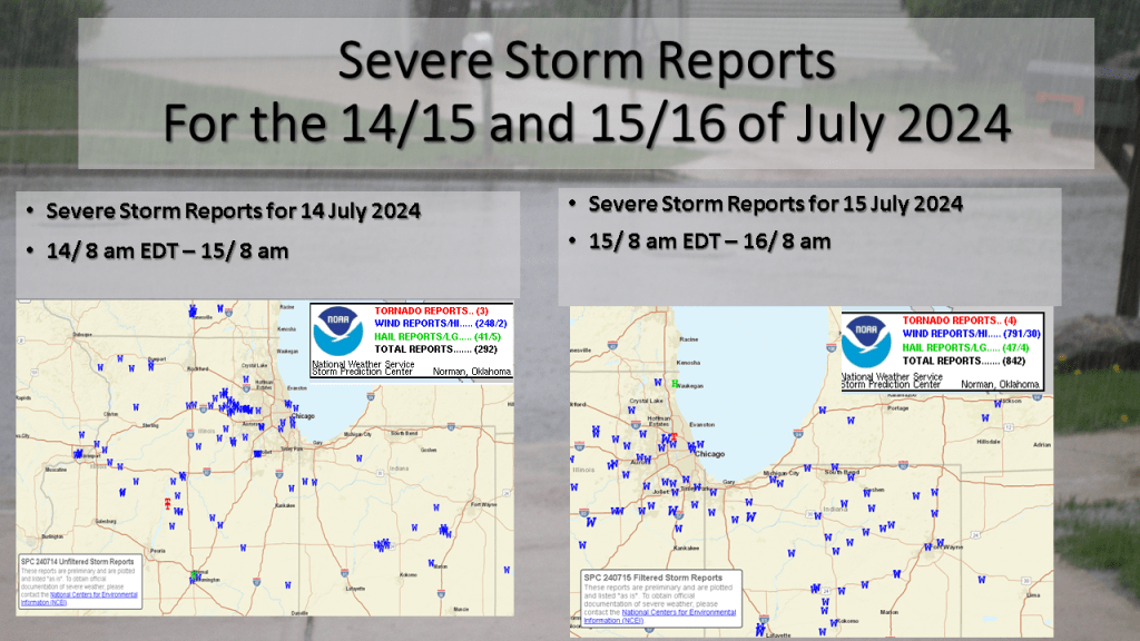
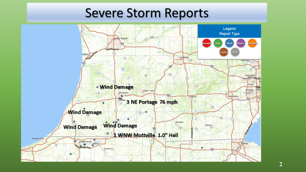
Winds to 76 mph, 1″ hail and rainfall to near 5″ within 12 hours


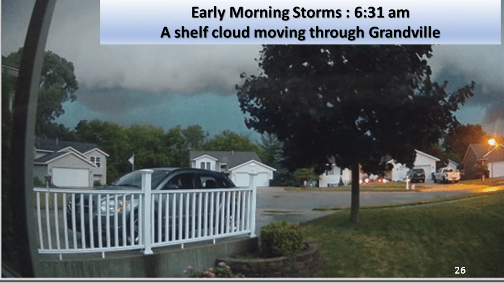
(with a brief look at Southwest Michigan on the last slide)


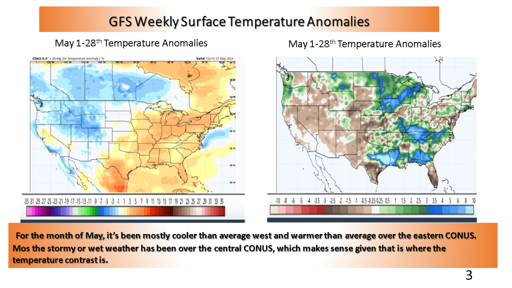
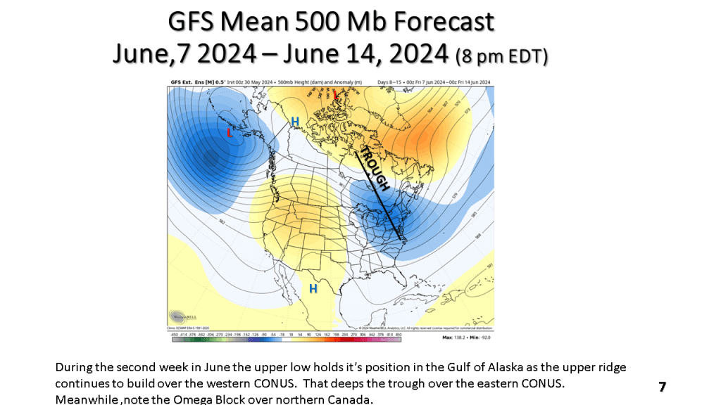
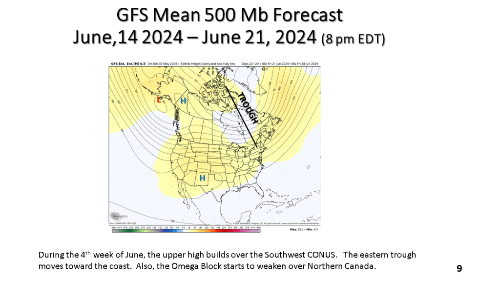
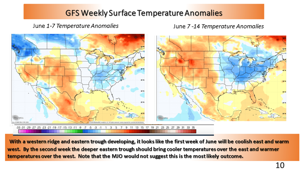
This would suggest cooler than normal over the eastern CONUS and warmer than normal over the western CONUS. The wet weather over the central CONUS may last into the first week of June but most of the rest of June is expected to feature near to below normal precipitation.