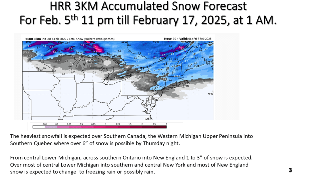
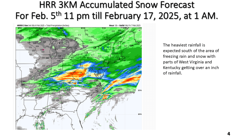
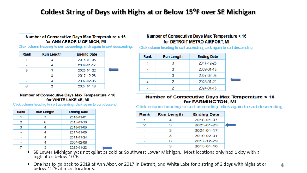
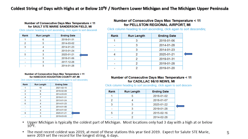
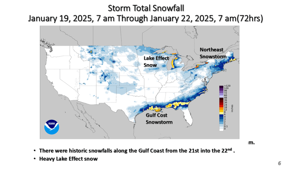
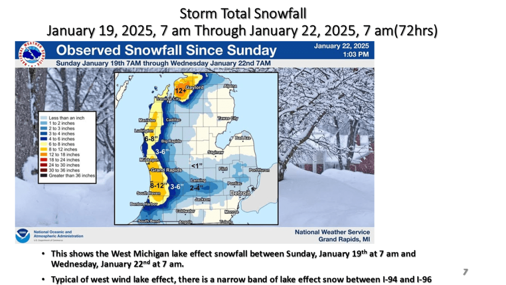
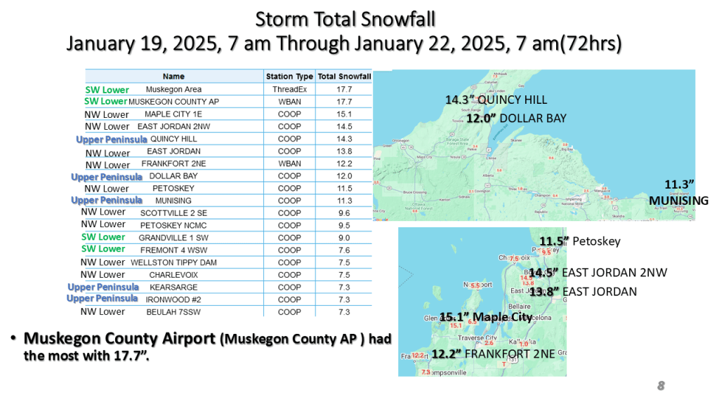
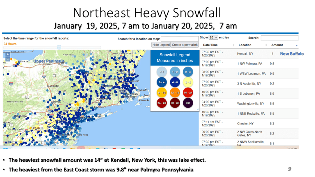
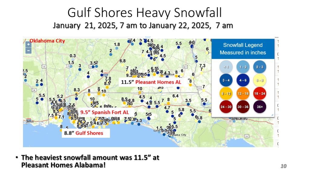
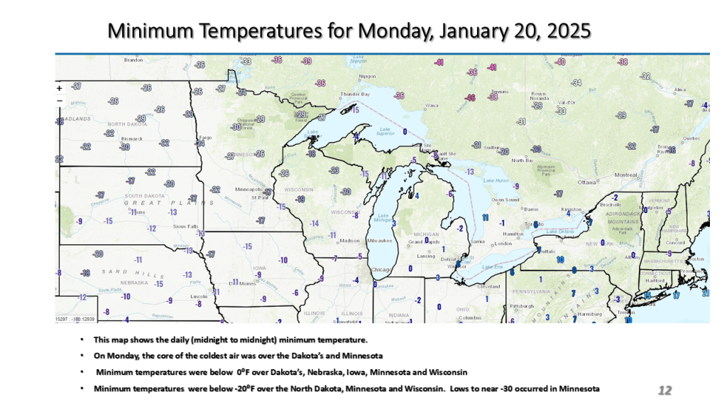
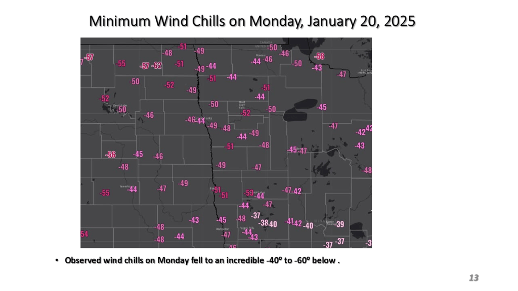
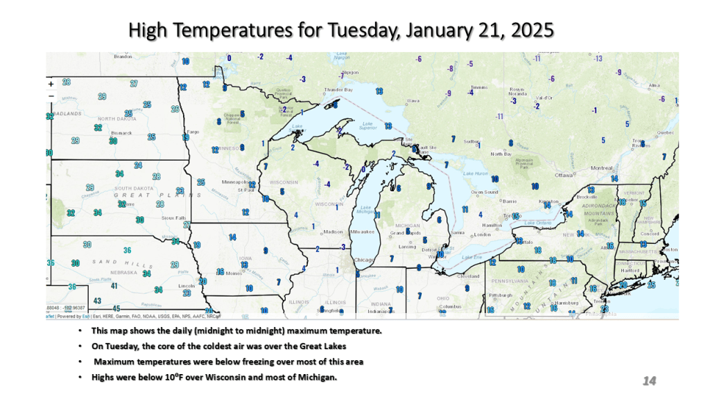
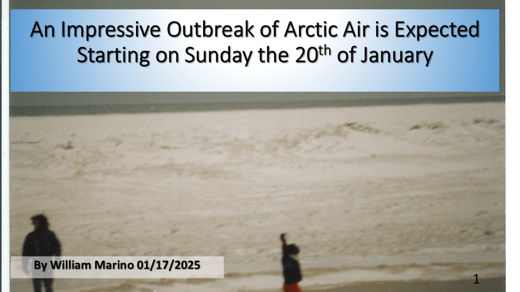
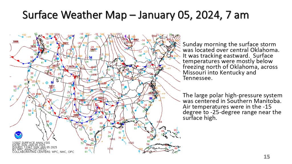
Arctic Outbreak was the coldest since 2019. It brought heavy snow to the Gulf Coast, along the East Coast and the Great Lakes.
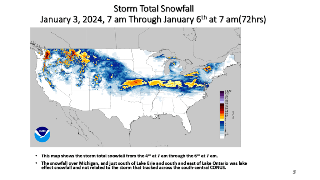
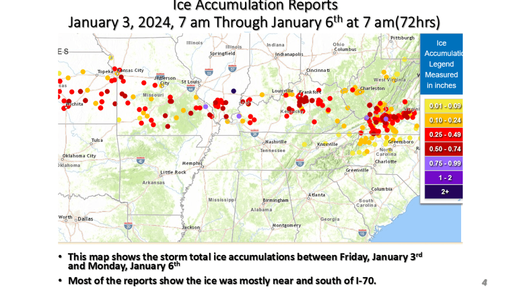
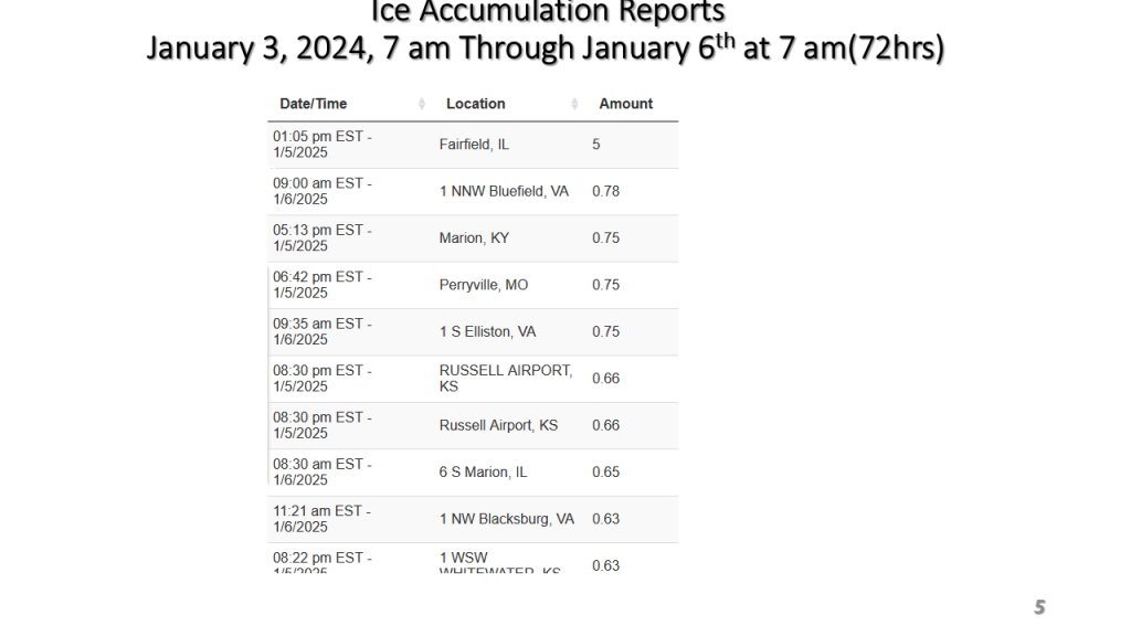
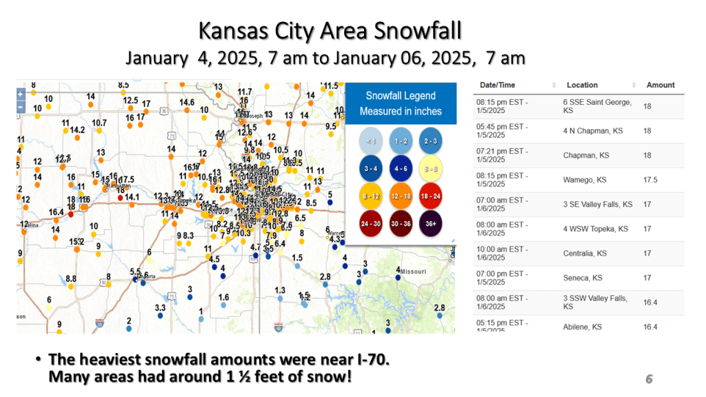
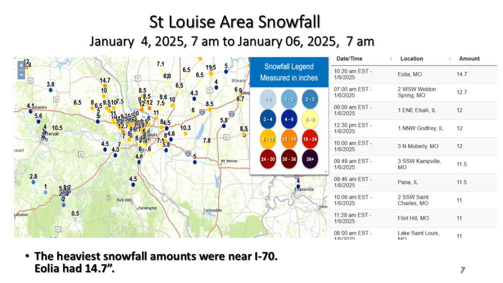
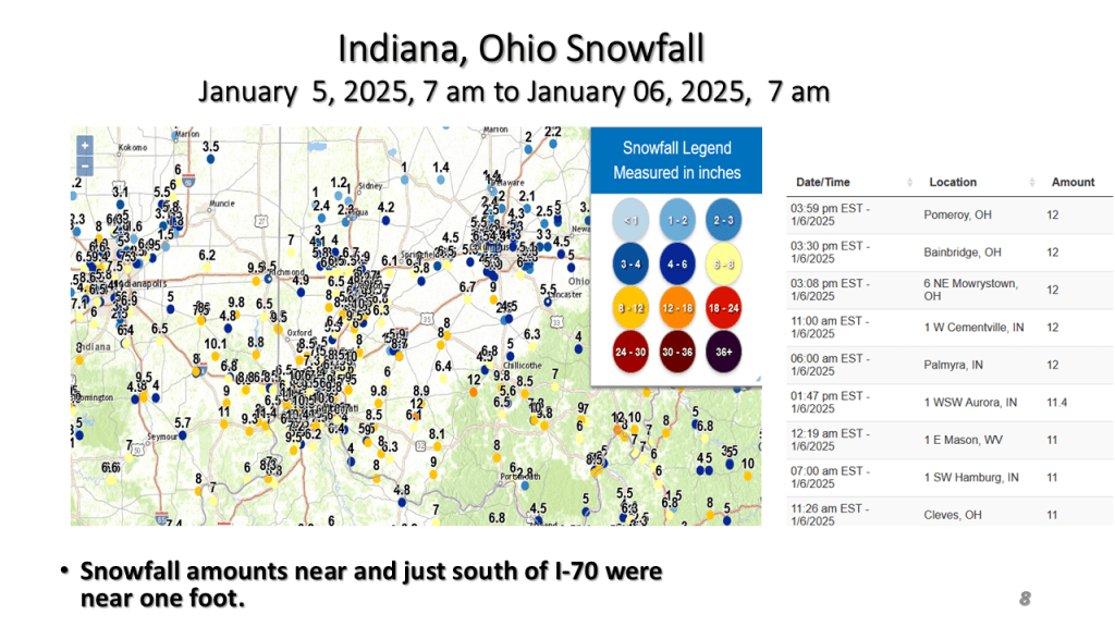
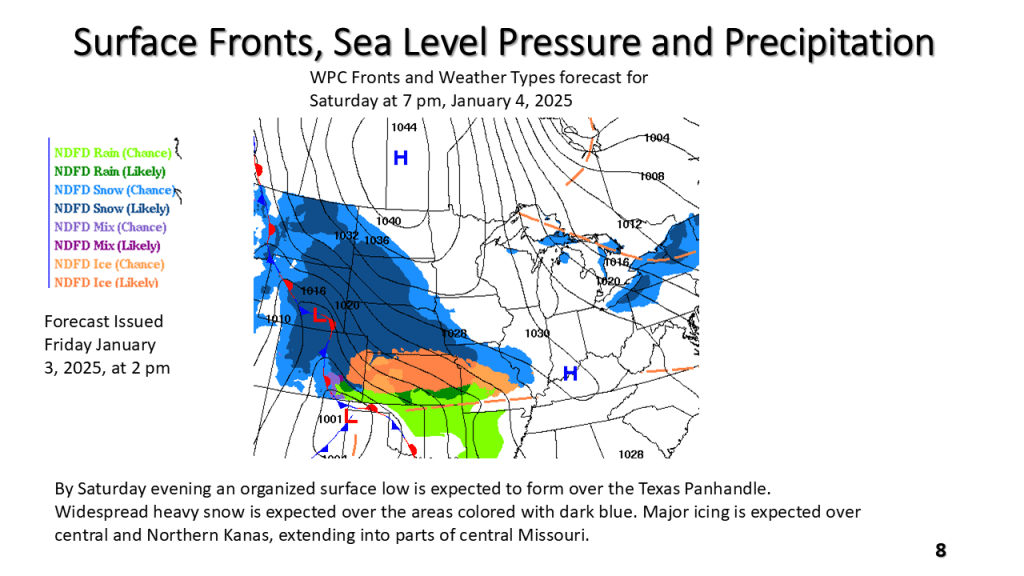
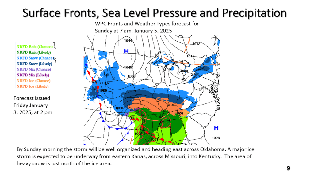
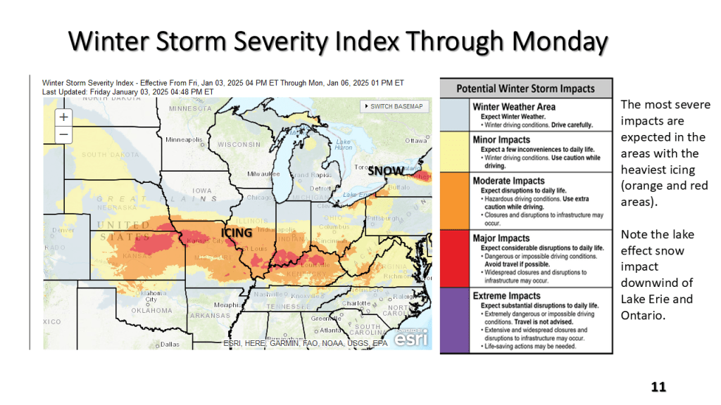
Major Winter Storm Impacts the Central United States Between Friday, January 3, 2025 and Monday January 6,2025