Heavy lake effect snow impacted all of the Great Lakes between Wednesday evening and this morning. Many areas had over 2 feet of snow.


Heavy lake effect snow impacted all of the Great Lakes between Wednesday evening and this morning. Many areas had over 2 feet of snow.
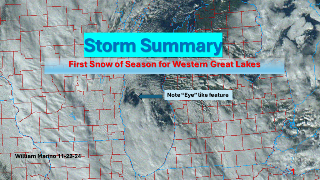
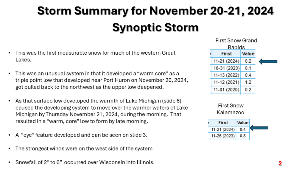
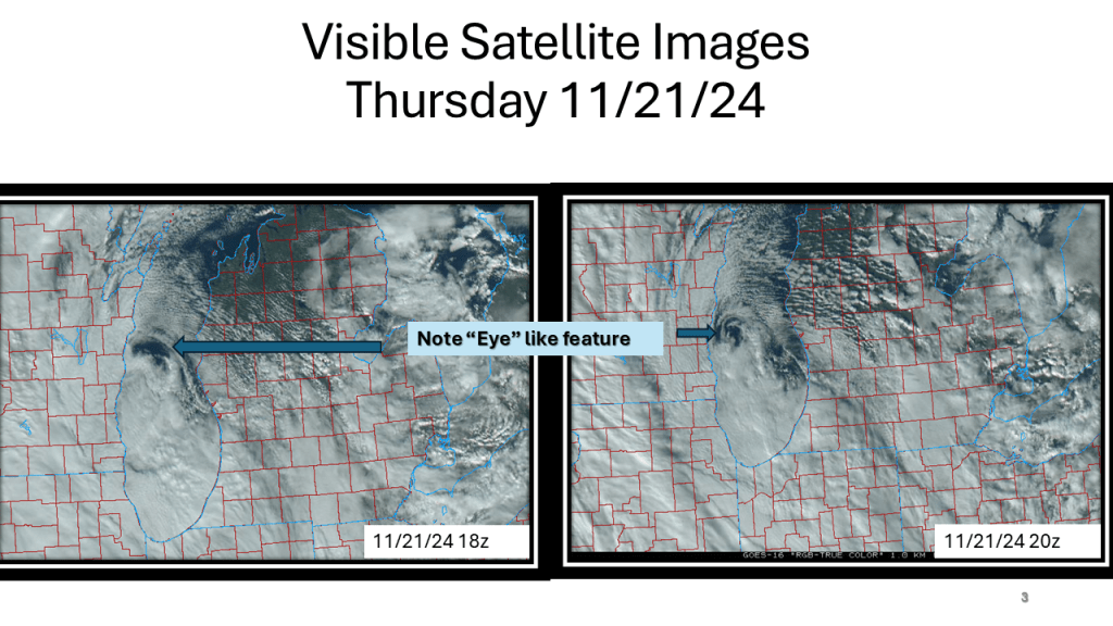
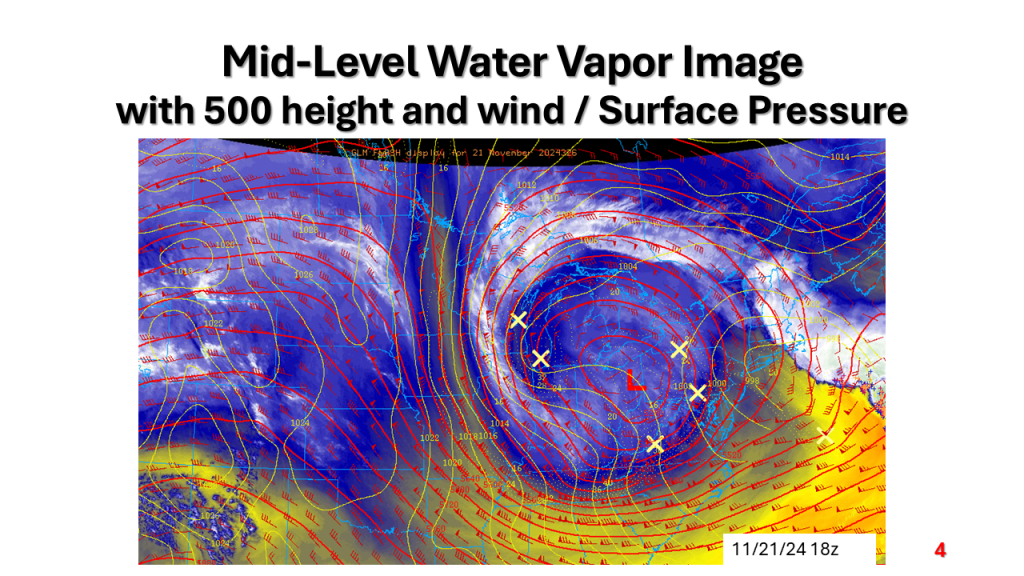
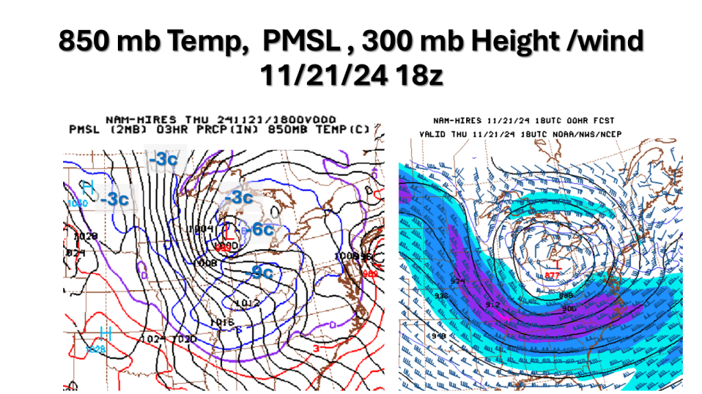
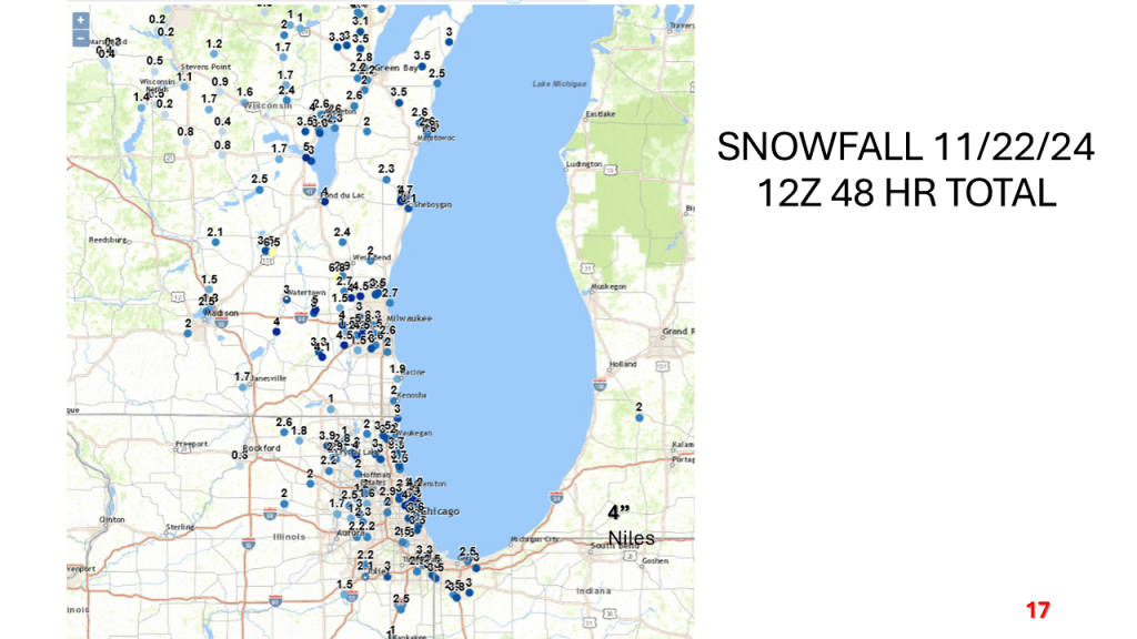
A strong November storm system brought the first snow of the season to parts of the western Great Lakes. Due to the warmth of Lake Michigan and that the surface low moved over Lake Michigan it developed an “Eye” like feature during the afternoon of Thursday, November 21, 2024.


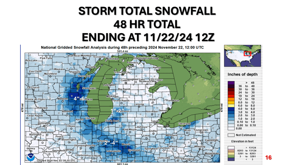


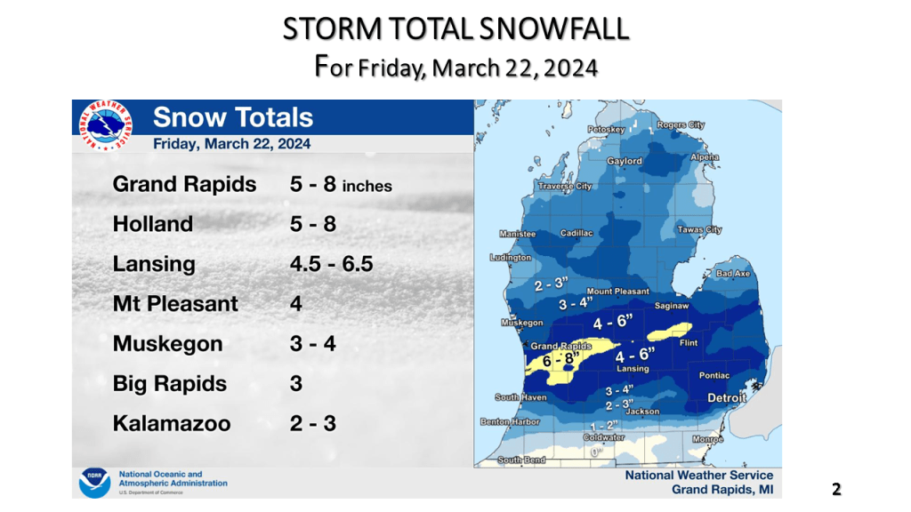
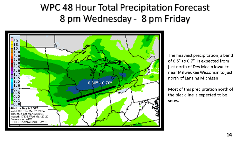
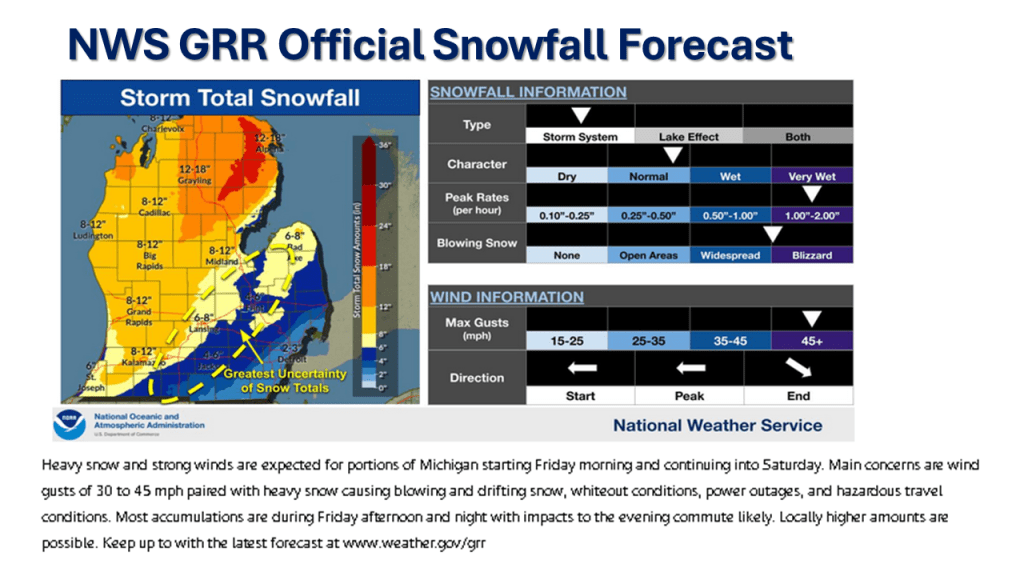
There was a narrow band of 5″ to 8″ of snow From Near Holland Michigan, across the Grand Rapids area, to just north of Flint. Most of the snow fell in about 12 hours.

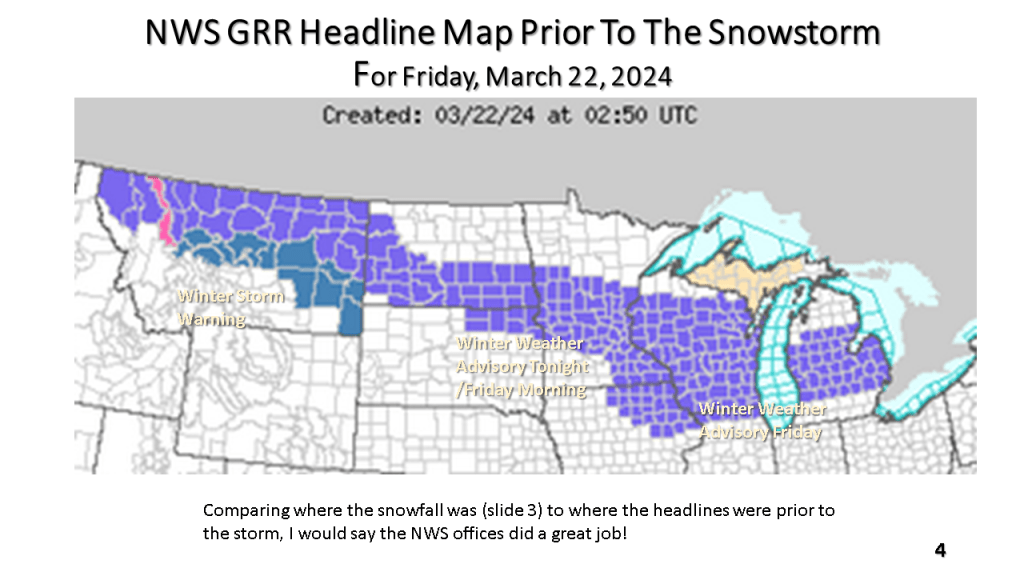

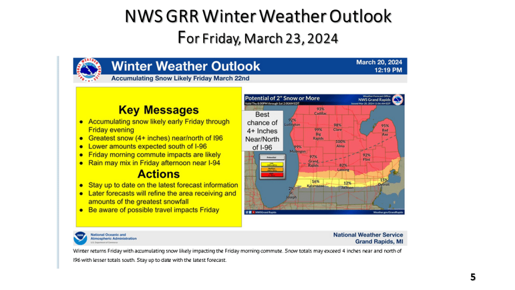
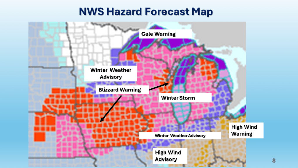
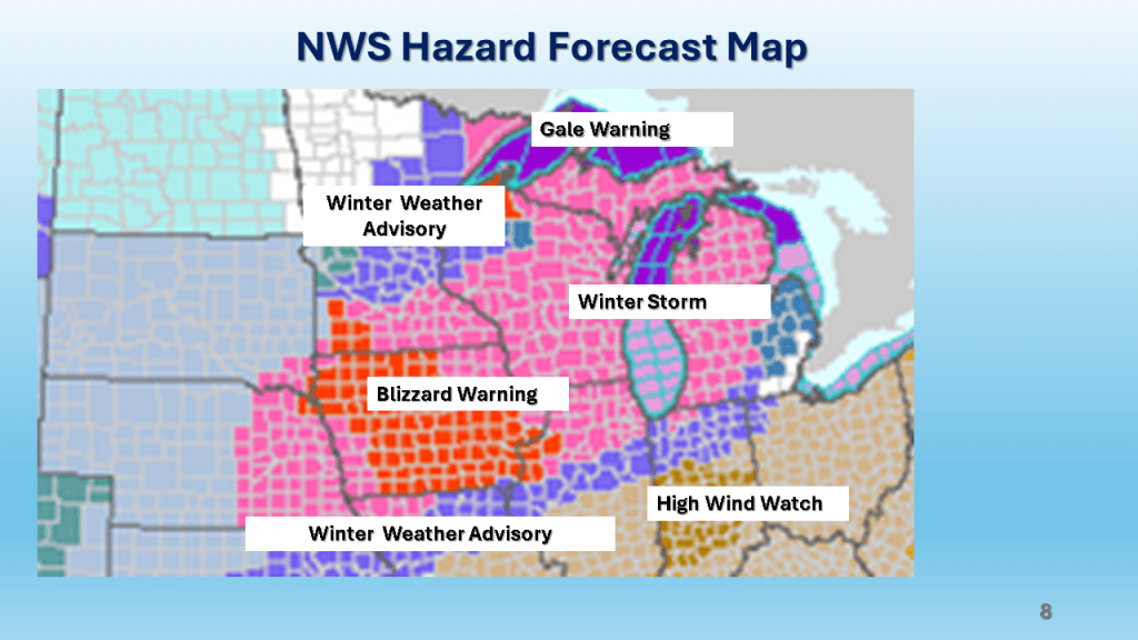
The National Weather Service offices across the western Great Lakes have all issued Winter Weather Advisories for this snowfall event that is expected to continue, even over Iowa into northern Illinois and Wisconsin into early Friday afternoon and over Lower Michigan into the early evening of Friday.
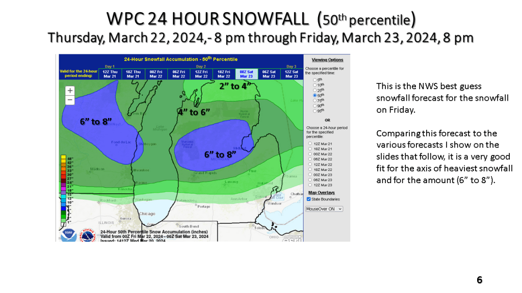
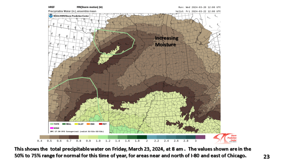
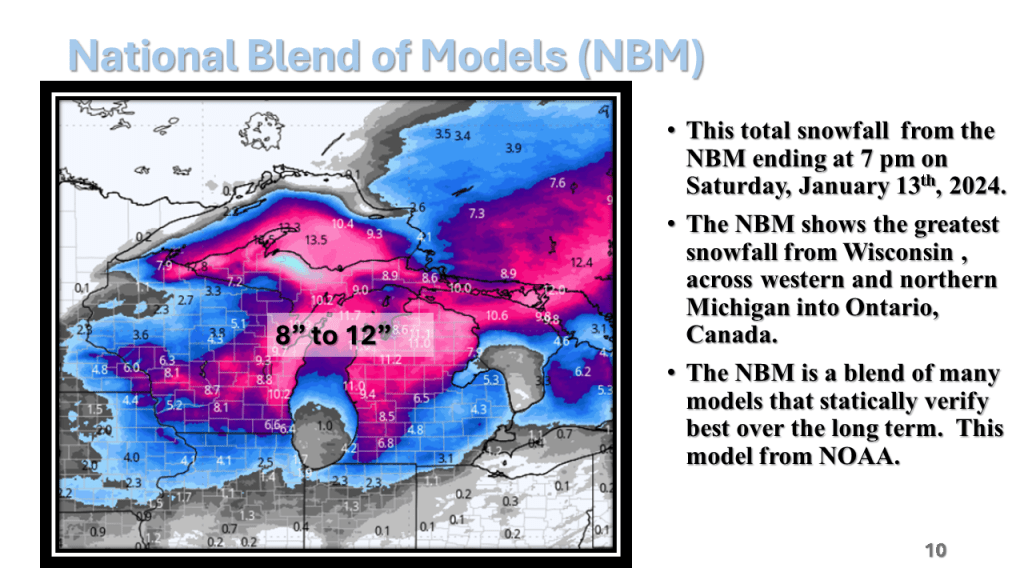
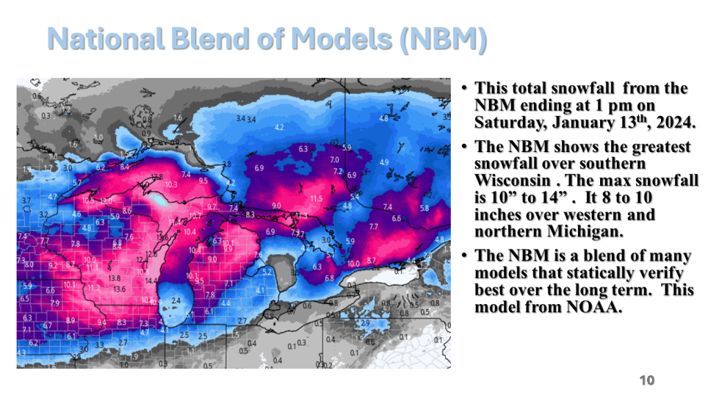
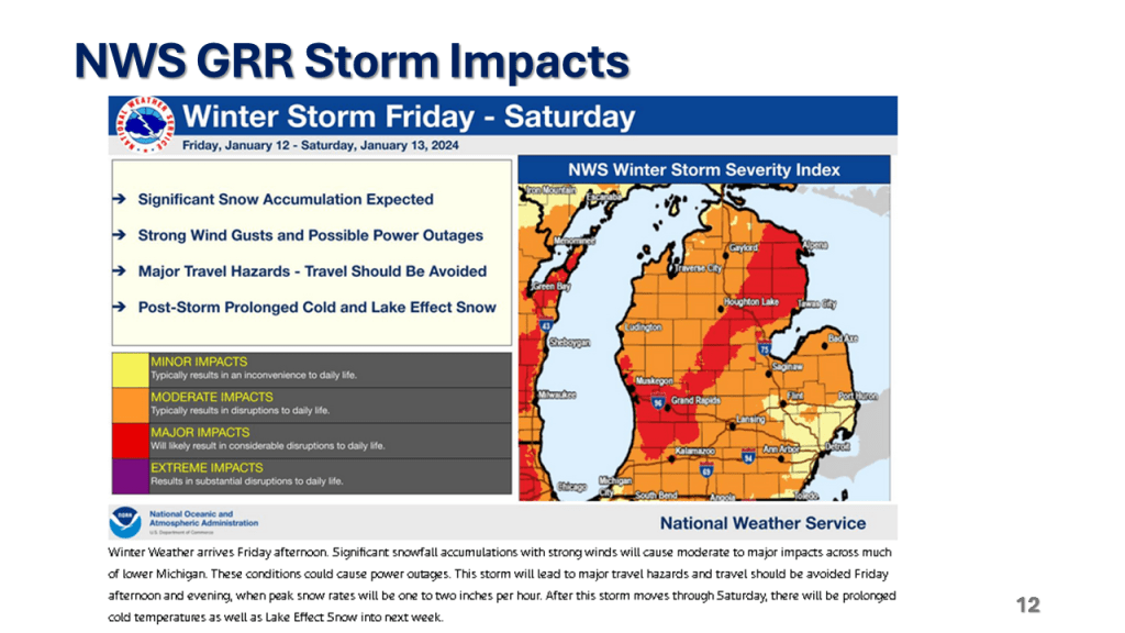
The following slides will show you the details of this event that is expected to bring up to 10″ of snow in about 12 hours to some locations in western Great Lakes. It will likely be the heaviest snowfall over most of the area since mid February.


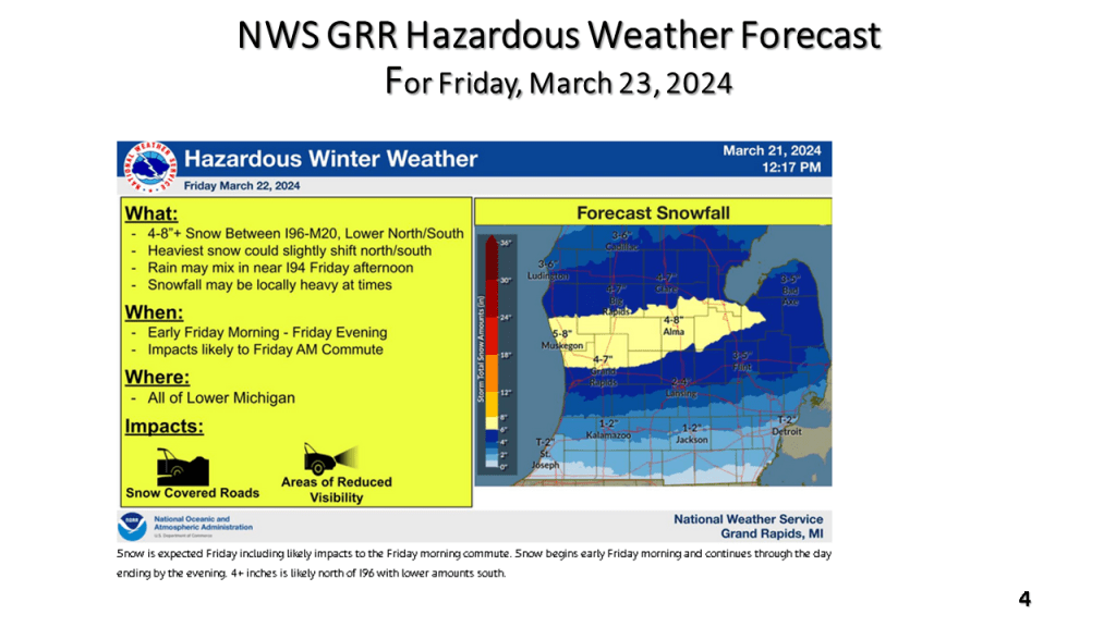
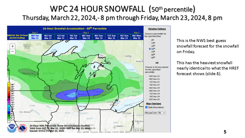

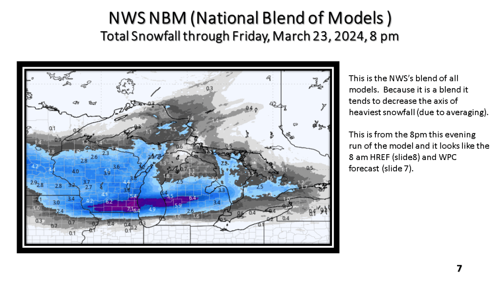
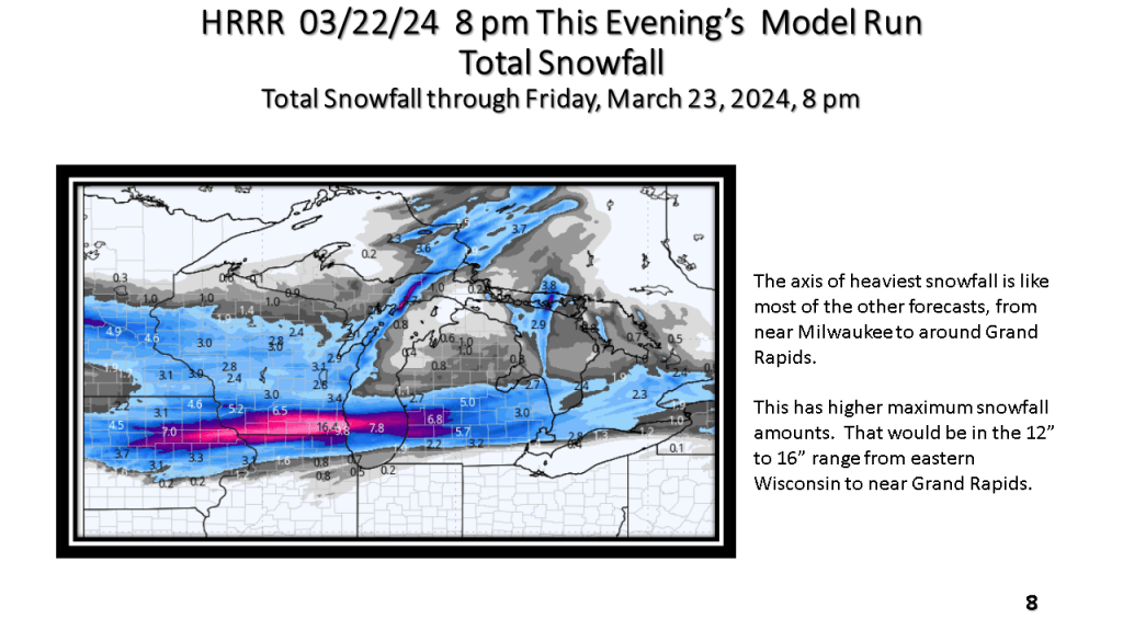


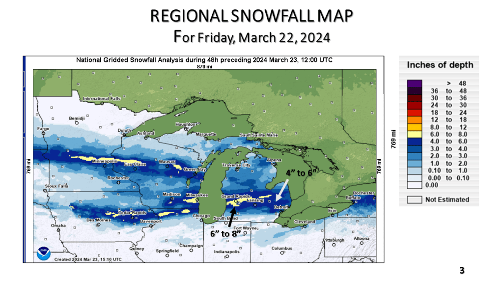
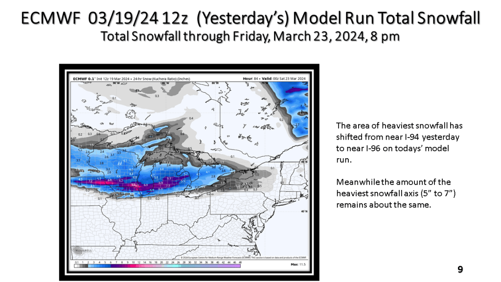
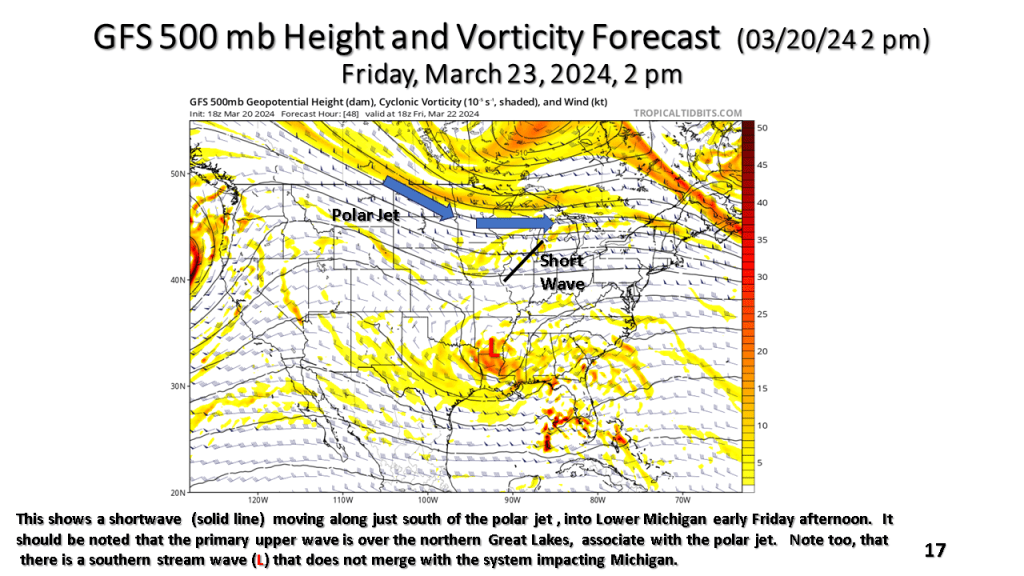
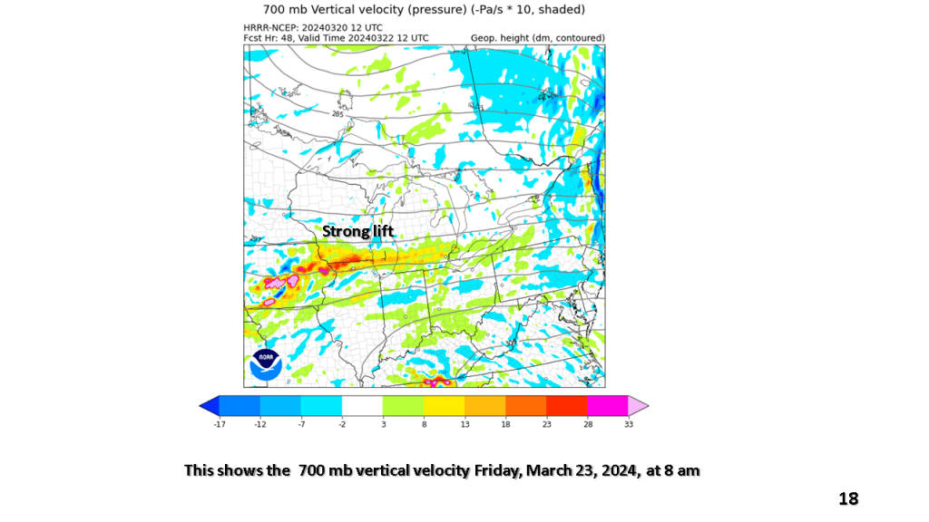
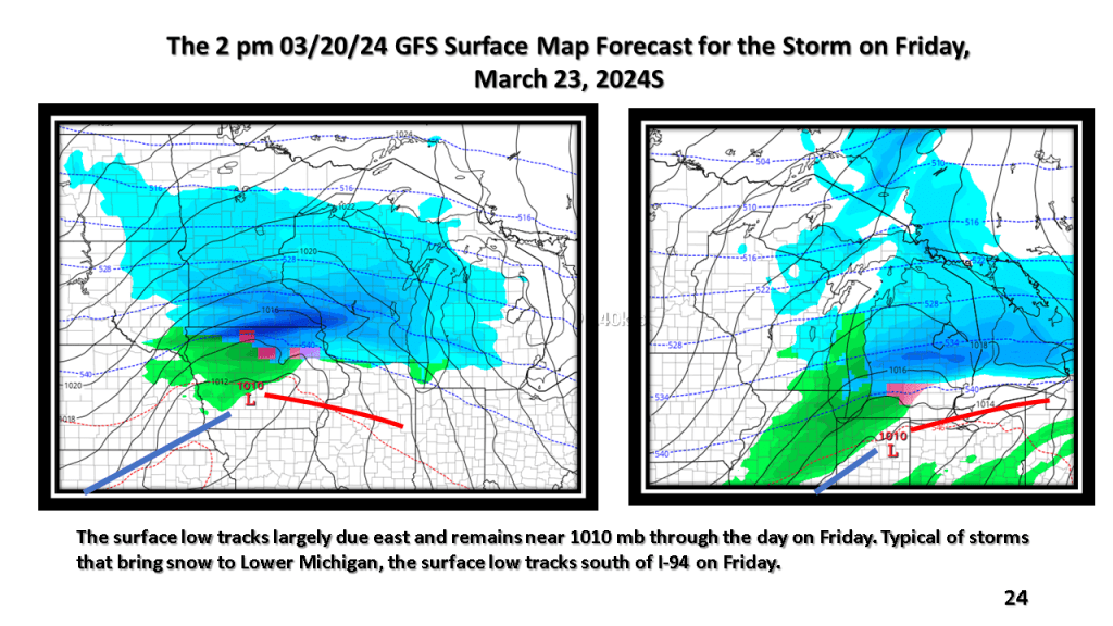
A narrow band of snowfall greater than 6″ in 12 hours is expected about 100 miles north of the track of the surface low. That would be near or just north of I-96 in Michigan. Snowfall rates in the heaviest snow area will be high enough to accumulate during the daytime, even in late March.


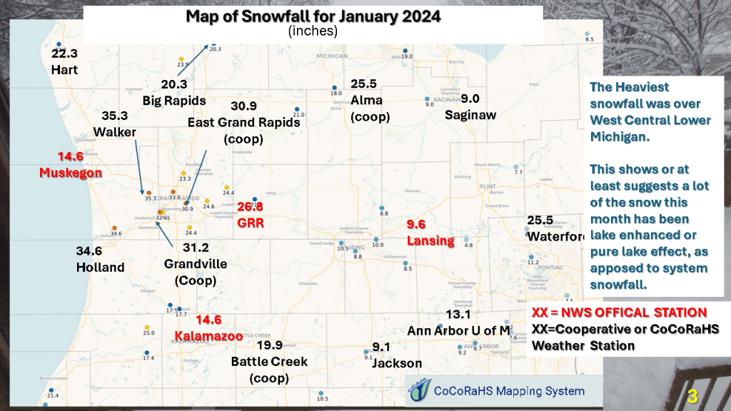
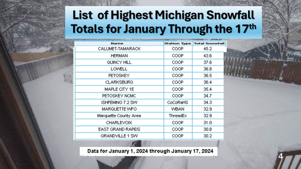
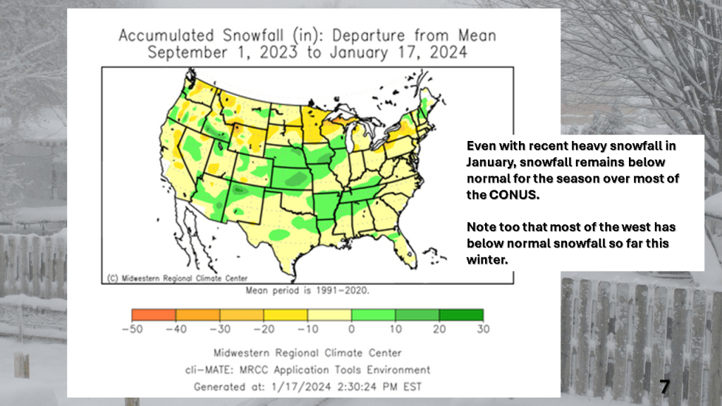
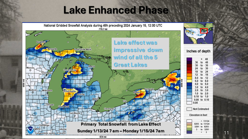
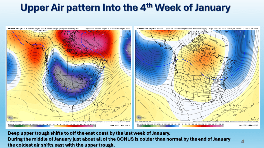
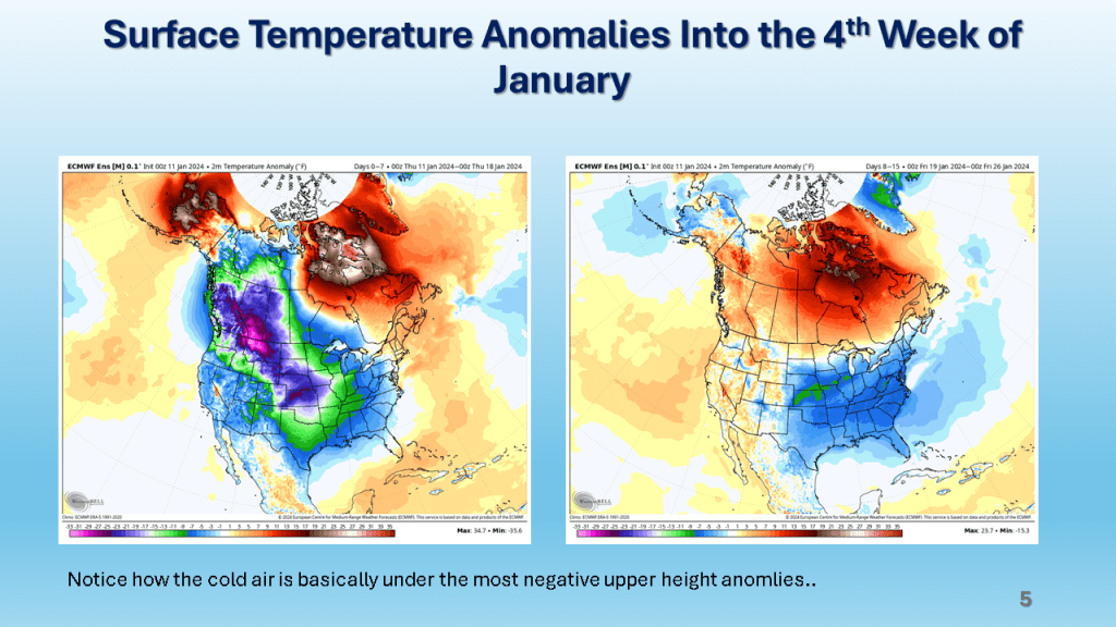
Over Michigan, November and December featured well below normal snowfall. The first 2 1/2 weeks of January seem to be making up some of that deficit. Over the rest of the CONUS, seasonal snowfall mostly remains below normal.


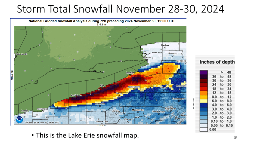
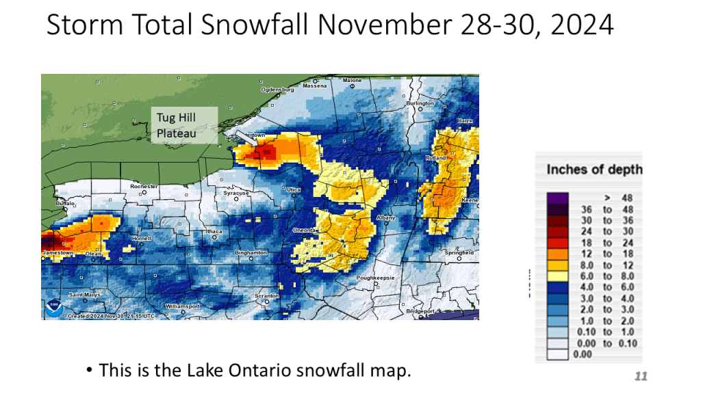
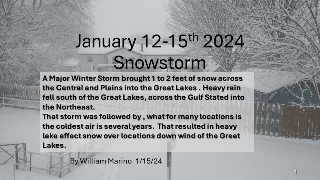
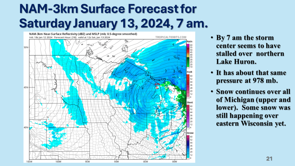
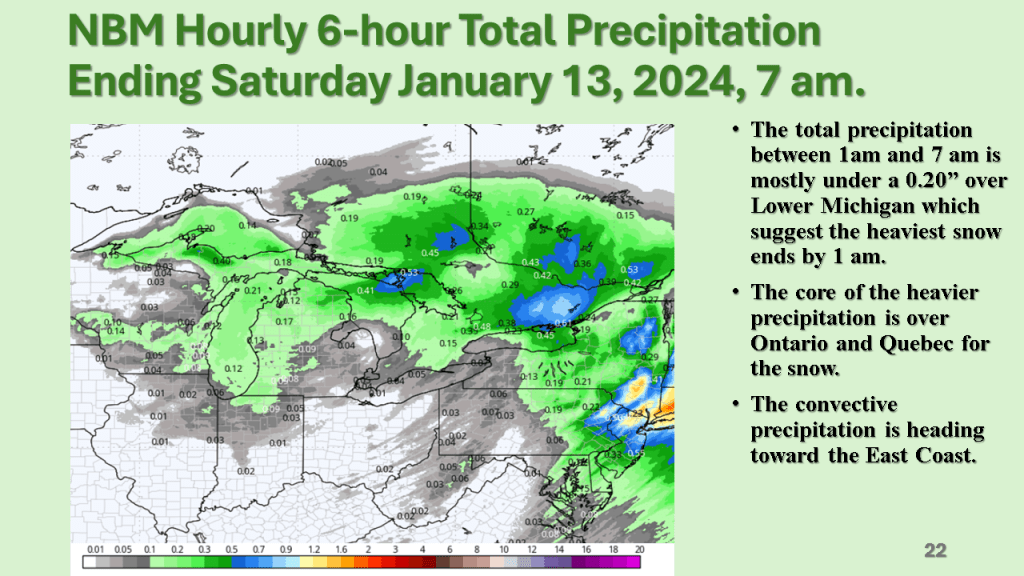
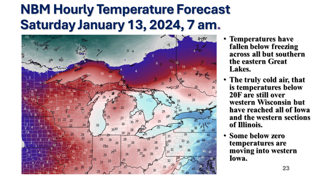
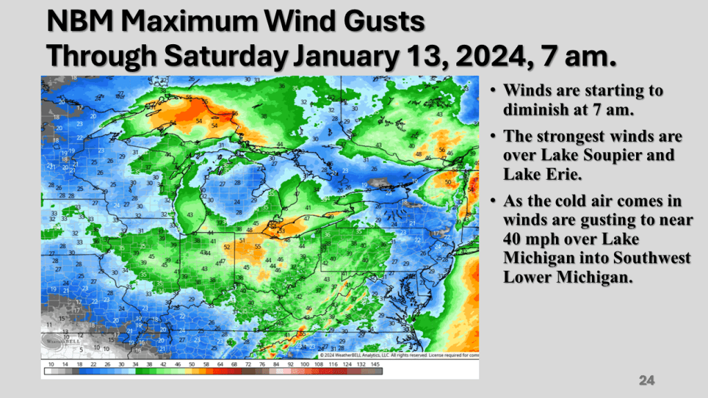
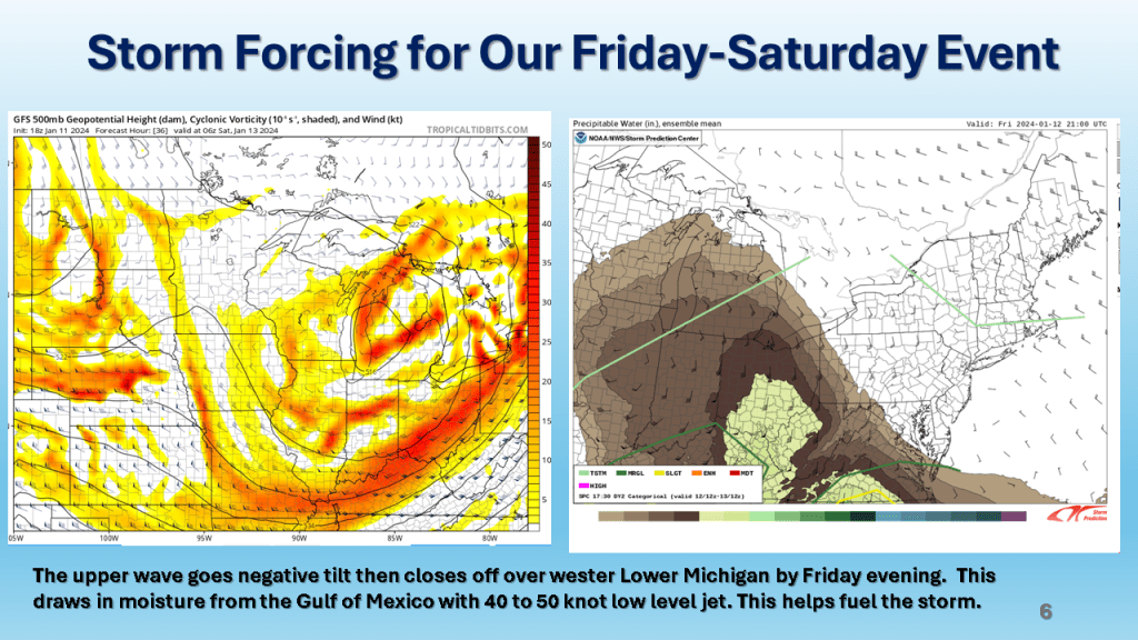
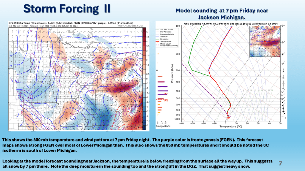
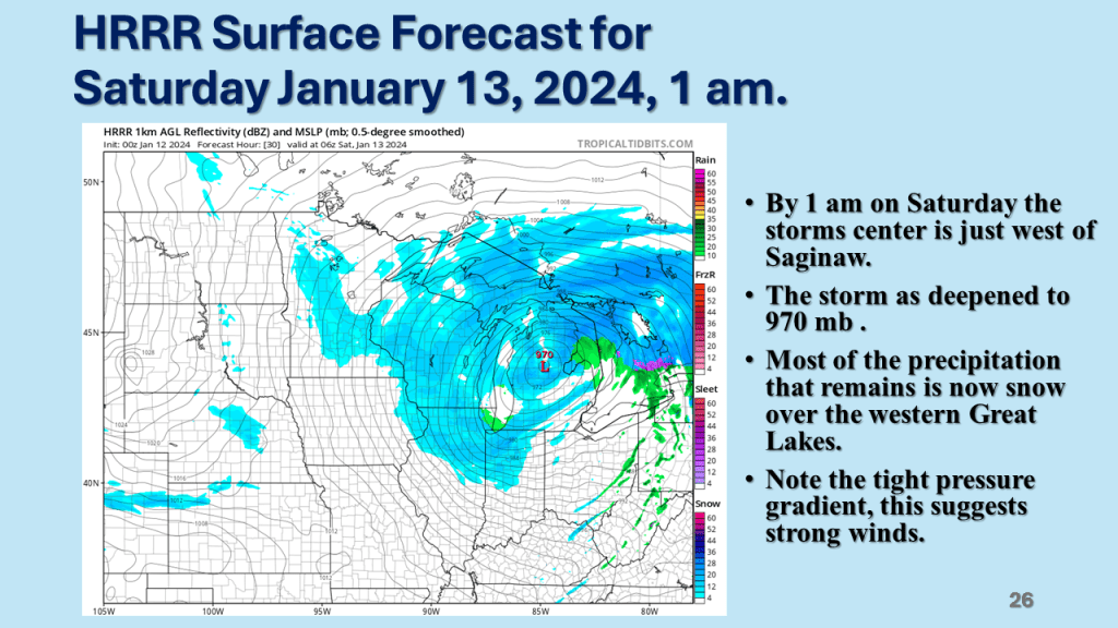
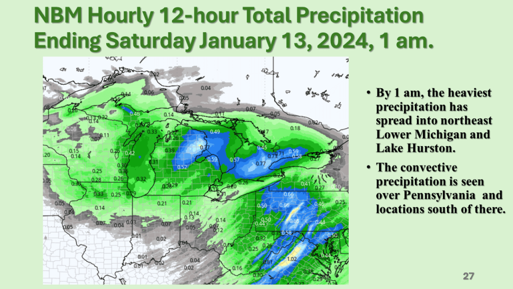
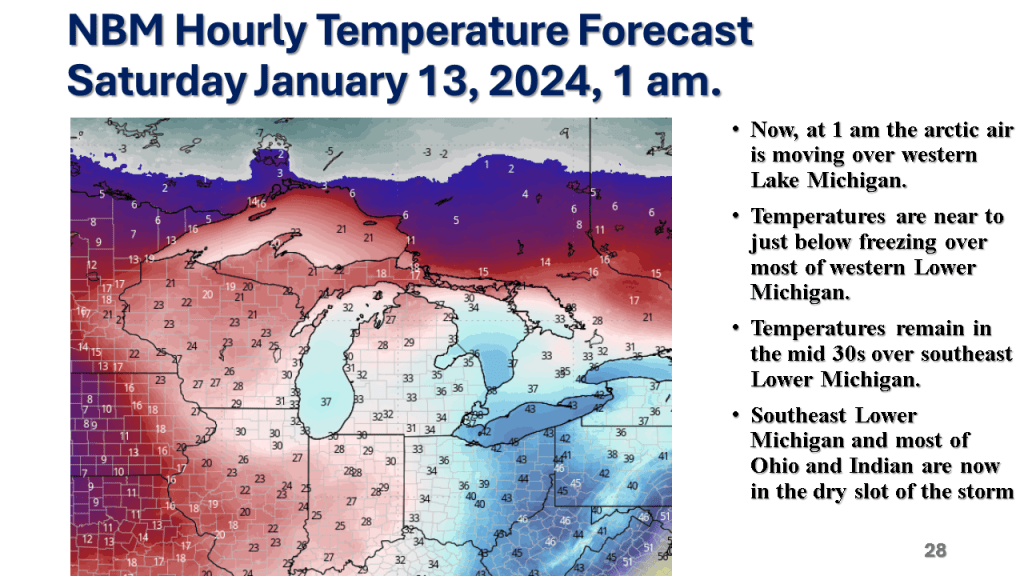
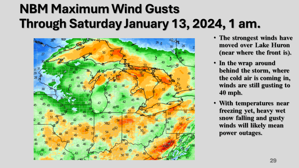
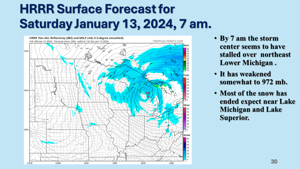
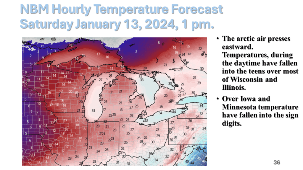
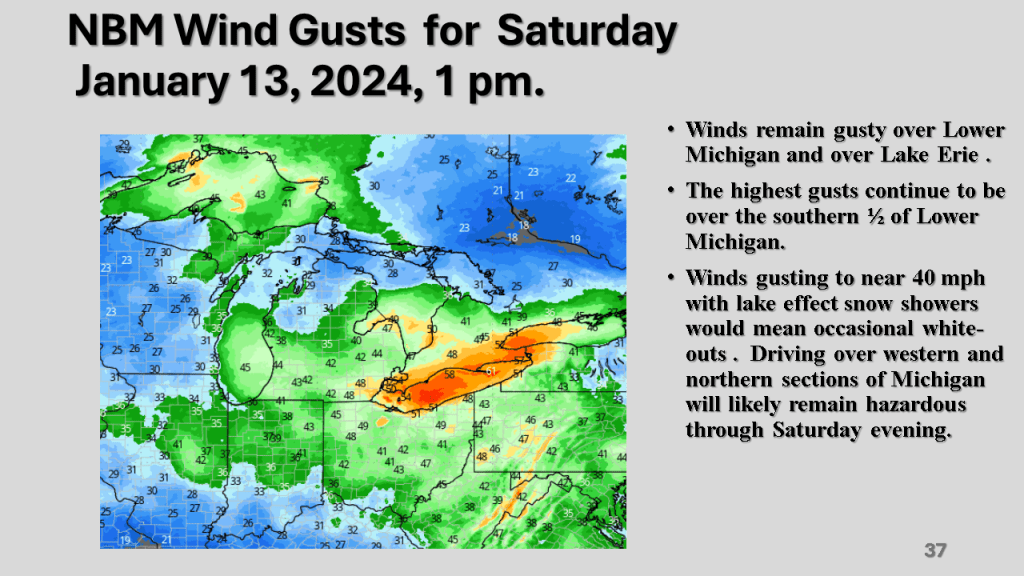
A rapidly deepening storm tracked Texas on Thursday afternoon to the northern Great Lakes by Saturday morning. The storm brought 1 to 2 feet of snow from Nebraska, across Iowa, Wisconsin then into Michigan. Strong winds accompanied the storm then the coldest air in several years followed the storm with dangerously cold wind chills over most of the Northern and Central Midwest. That cold air caused heavy lake effect snow in Michigan, near Buffalo New York and over the Tug Hill Plateau in the Adirondack Mountains, down wind of Lake Ontario.


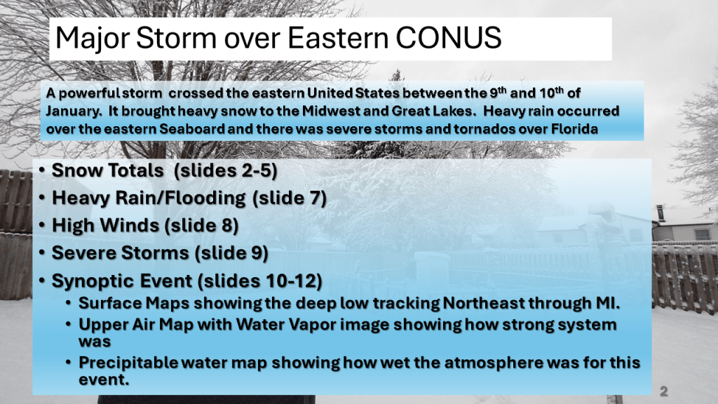
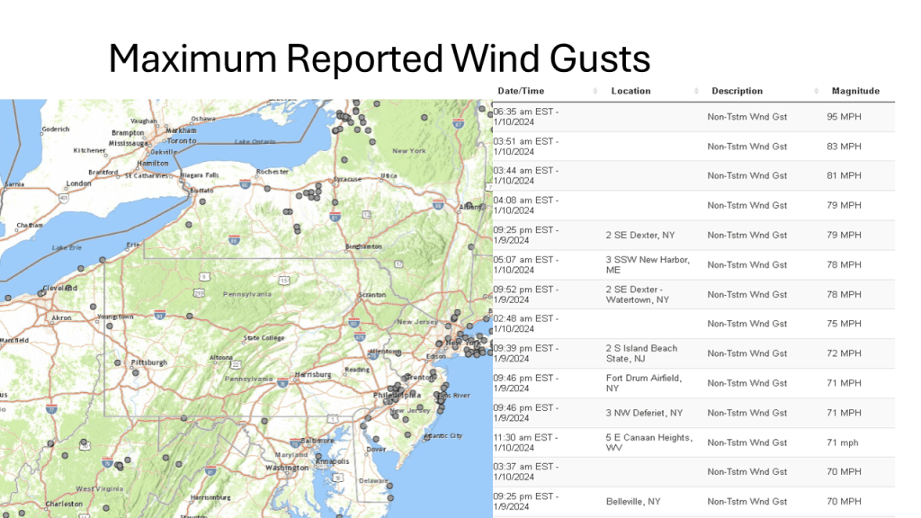
This storm brought heavy snow to the Midwest and parts of the Great Lakes, then there were damaging winds over the eastern Seaboard, as well as flooding. Severe storms and over a dozen tornadoes occurred over the Southeast sections.