


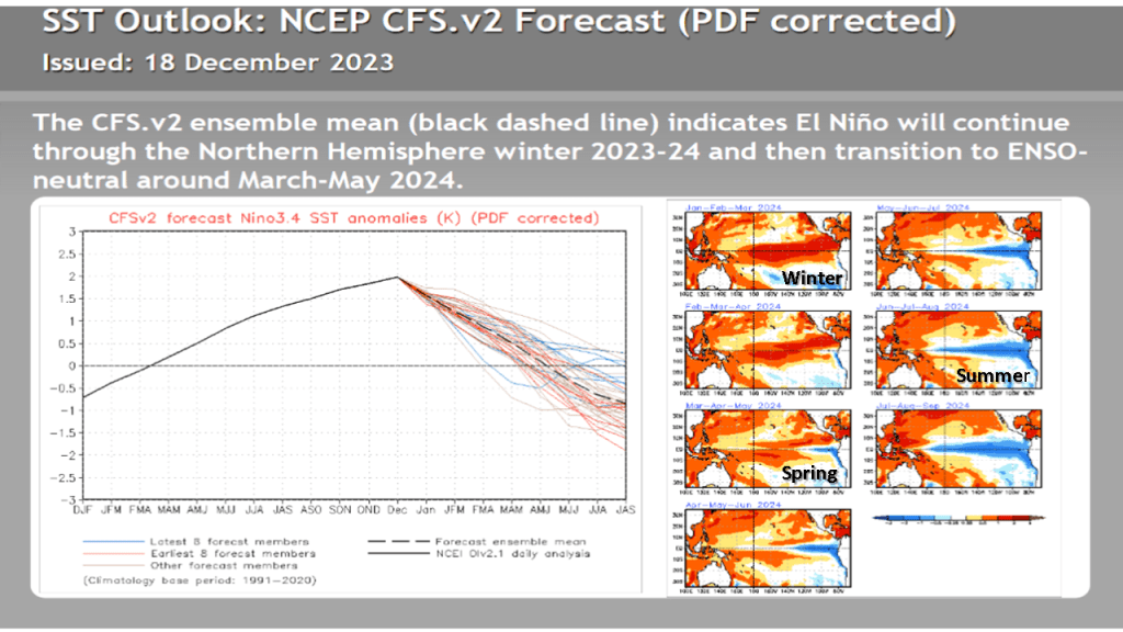
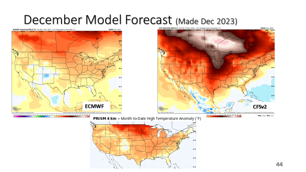
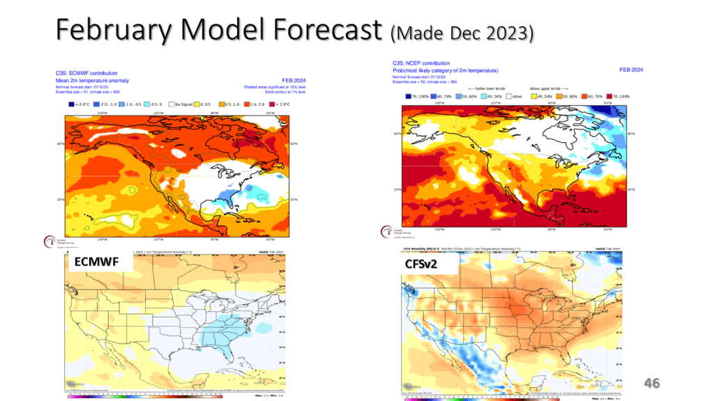
My actual forecast remains unchanged. I mostly updated the ENSO slides and added monthly model forecasts from the ECMWF and the CFSv2.
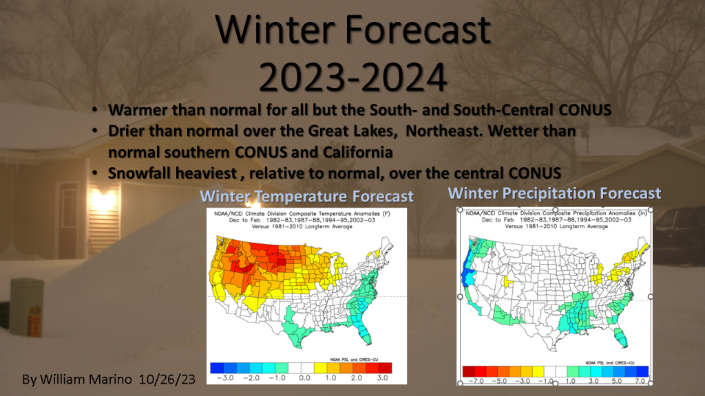


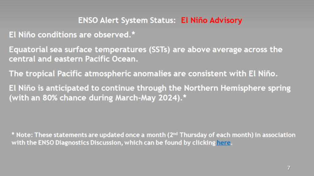


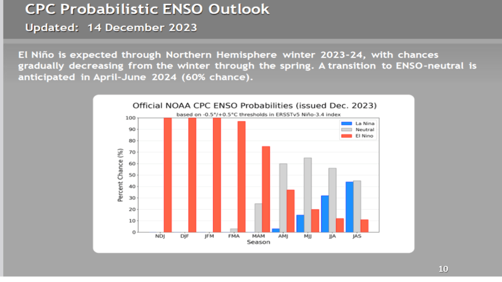

CPC’s forecast for this winter has not changed significantly in the past few months.


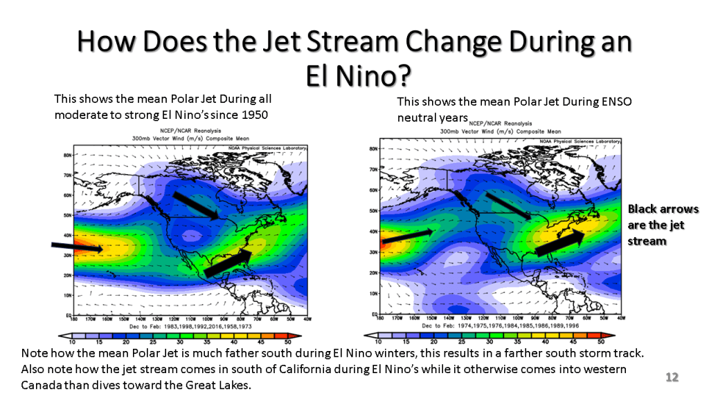
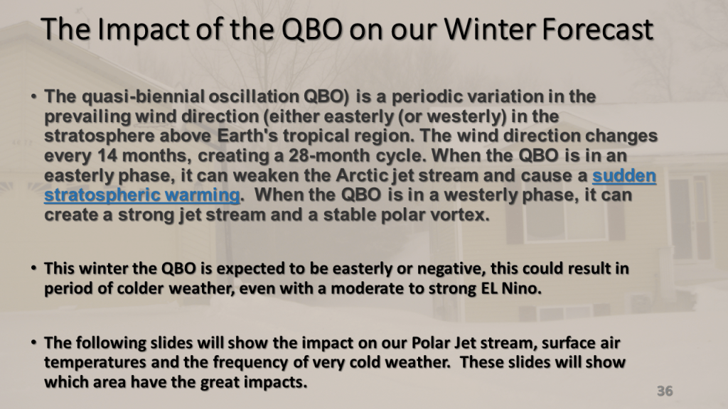
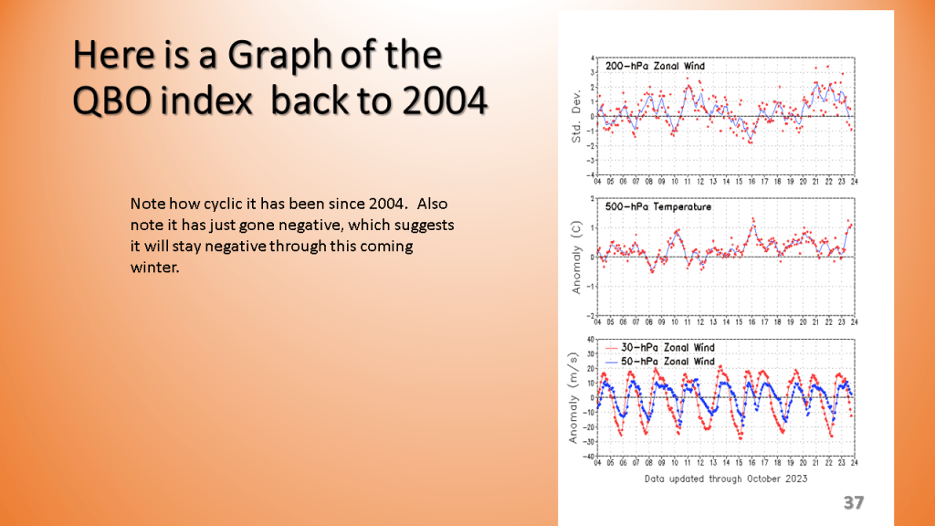
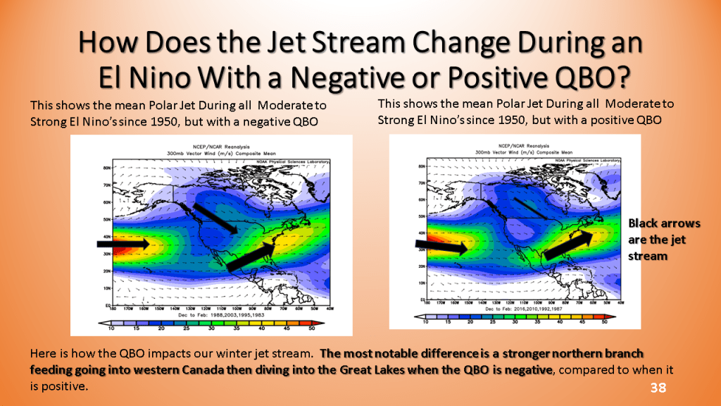
The QBO should allow for more arctic air to reach the CONUS once we get into January and February.


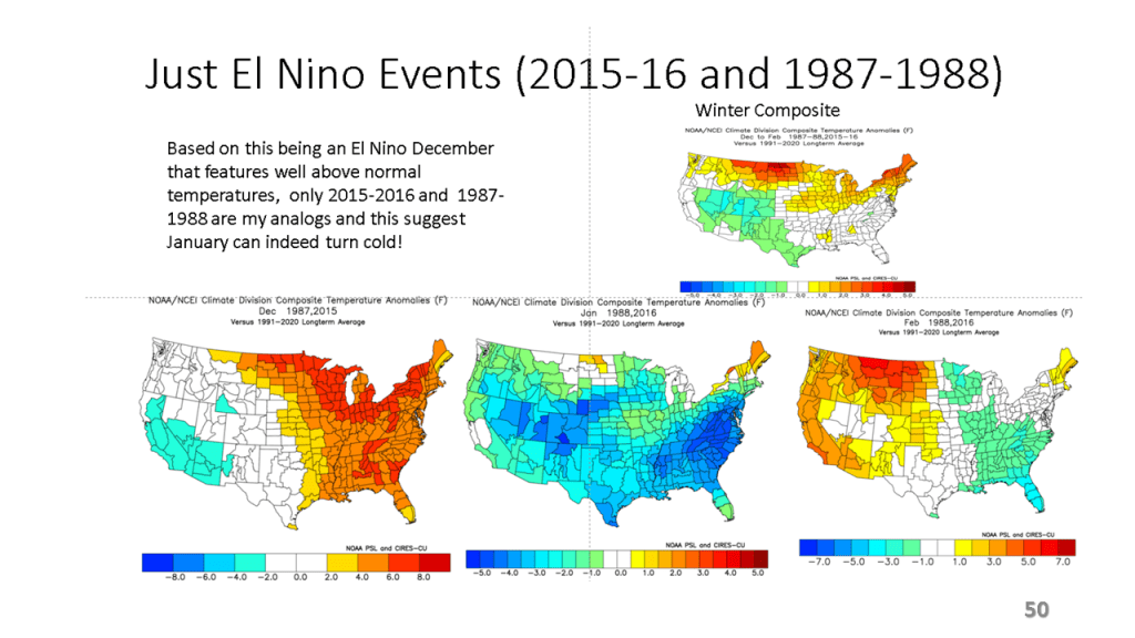
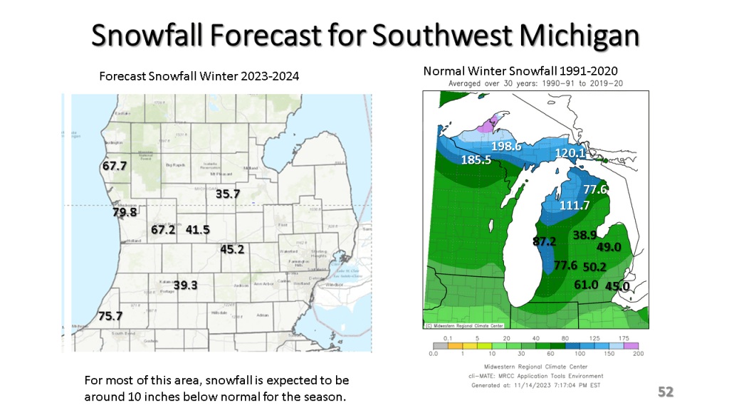
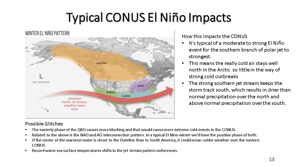
I am thinking snowfall will generally be below normal over Michigan, however sections of the East Coast, from North Carolina to Maine could have well above normal snowfall since El Nino’s favor Nor-Easters (Coastal Storms). When we get into a cooler pattern in January, I’d expect to see some heavy snow events along the east coast. See slide 48 for details.


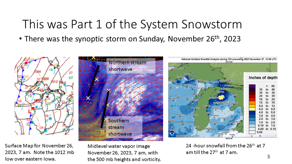
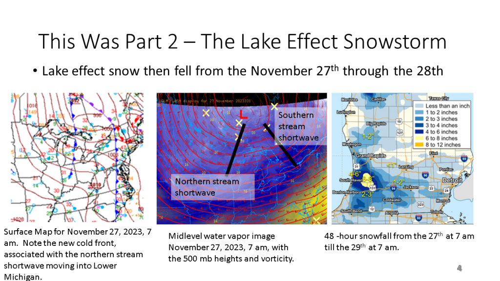
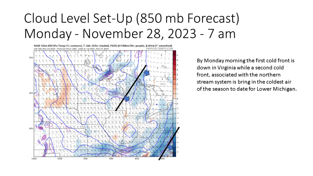
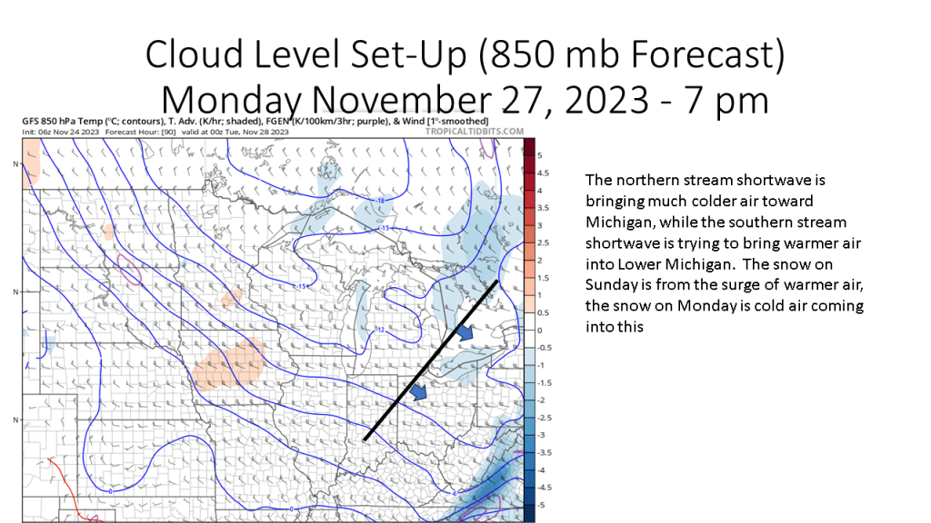
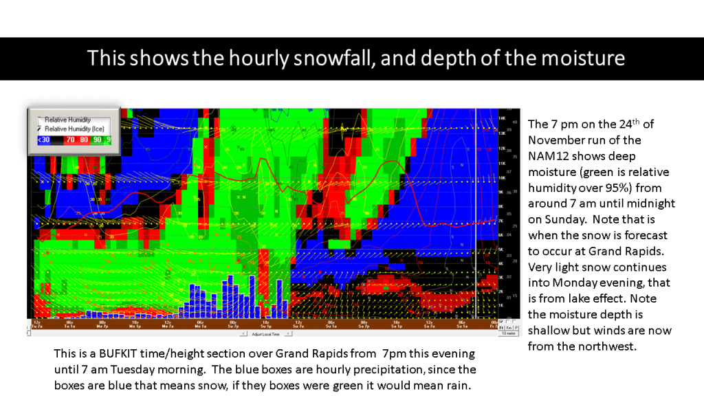
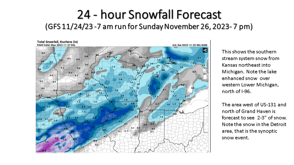
There was a southern stream shortwave that brought 1 to 3 inches of snow to the southern Great Lakes on Sunday. However most of the snow fell from lake effect as the coldest air of the season crossed the relatively warm water of the Great Lakes (mostly in the 40s) Monday into Tuesday. The heaviest snowfall was were the west to northwest wind was forced up-slope over northern Lower Michigan but even more so over the Tug Hill Plateau of western New York were over a 1 1/2 feet of snow fell.