


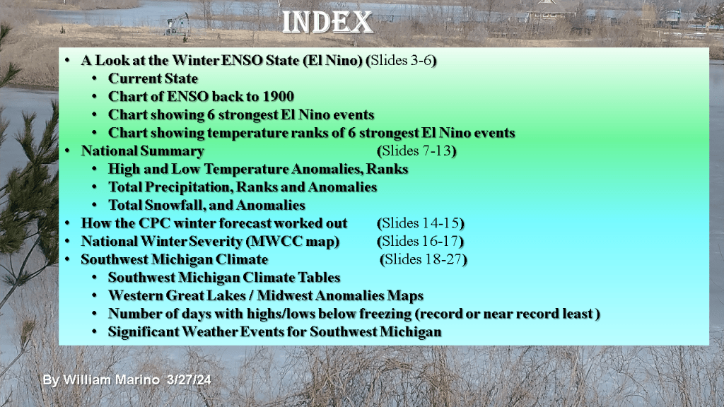
This is for Southwest Lower Michigan


This version of the winter forecast has the seasonal forecast as well as monthly forecasts from December through February.


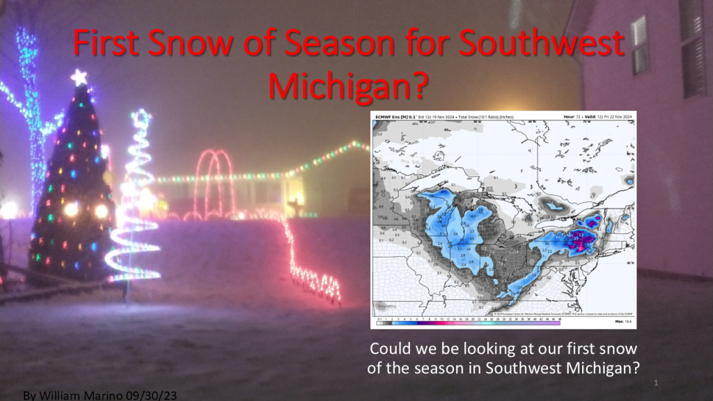
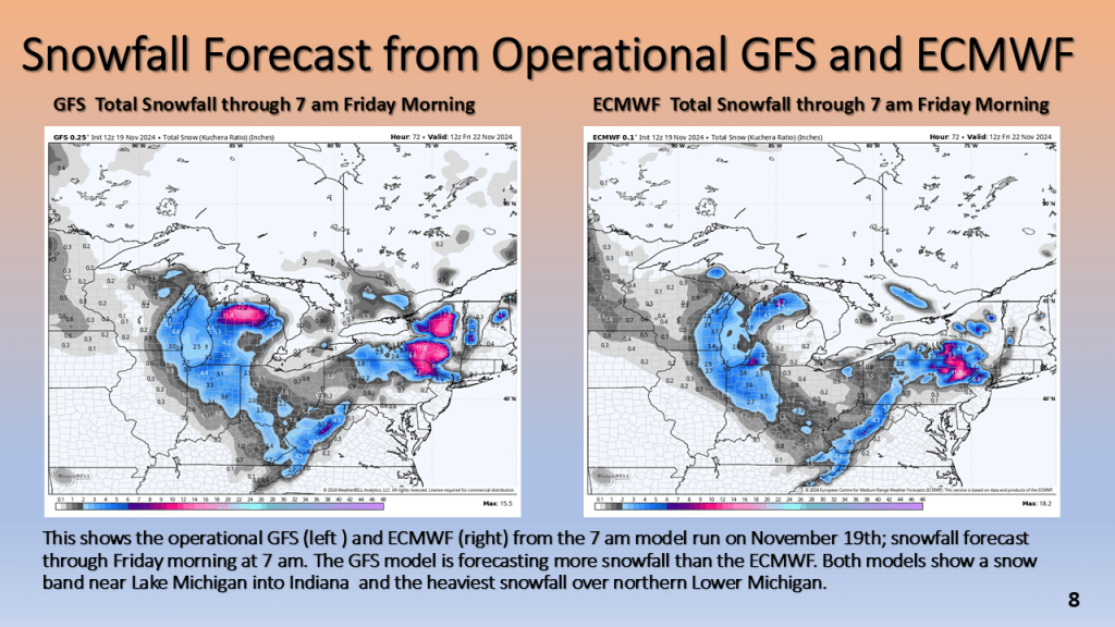
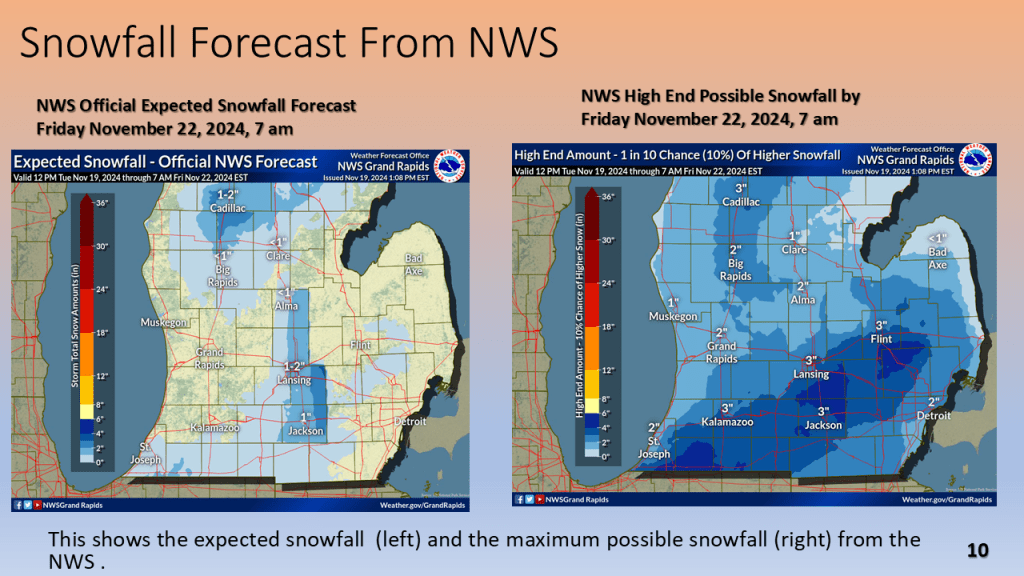
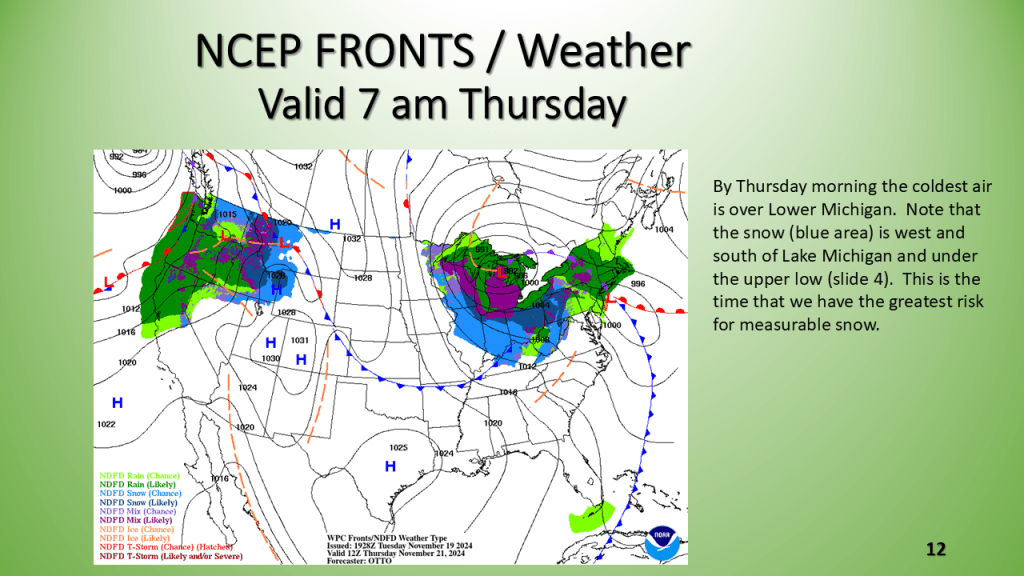
The first snowfall of the 2024/2025 season is likely for Most of Lower Michigan between Wednesday night and Thursday morning.


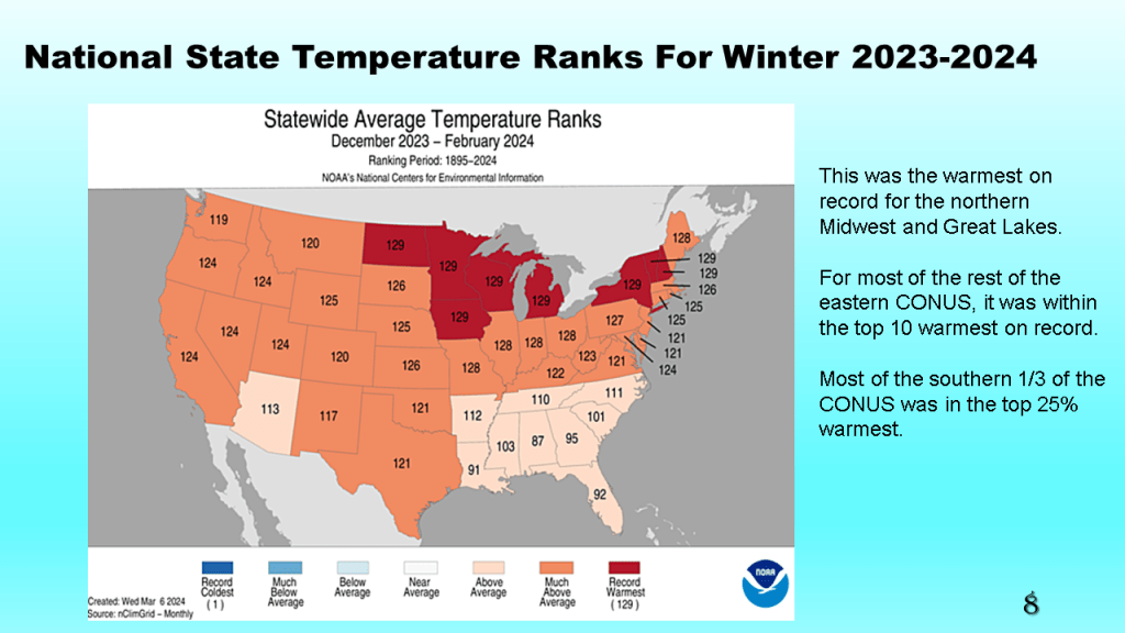
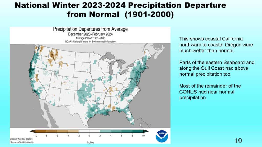
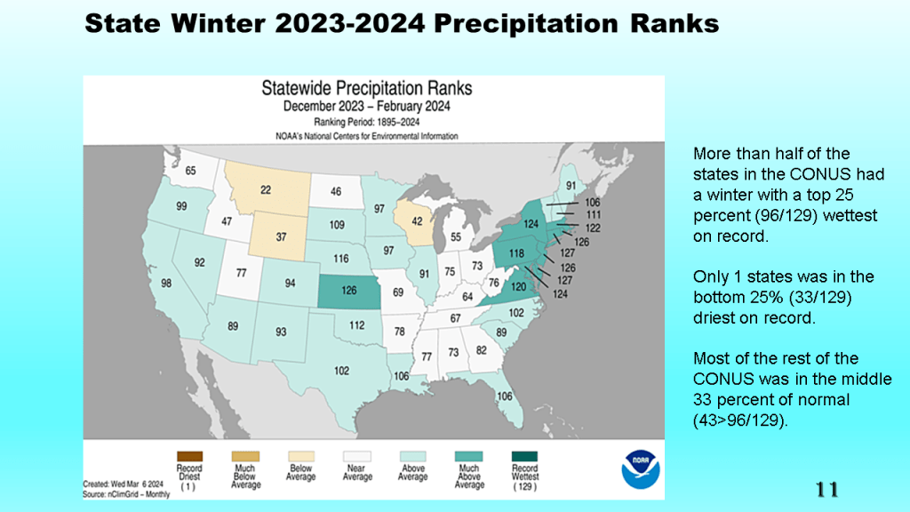
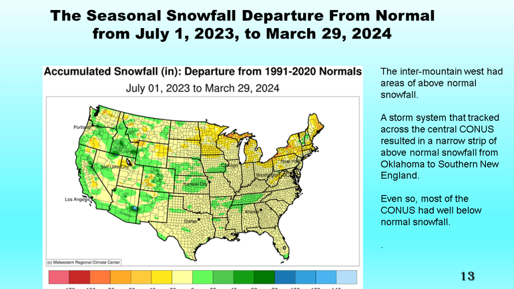
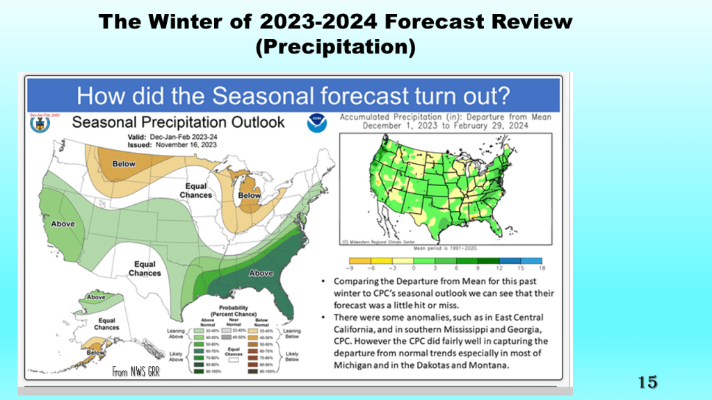
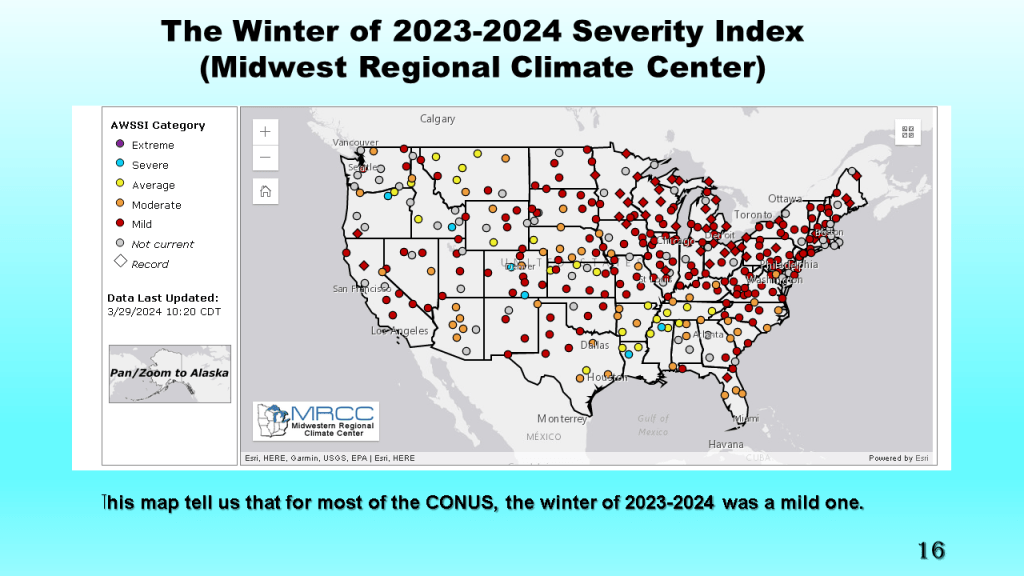
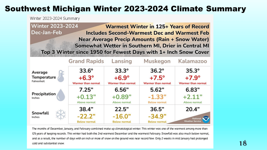
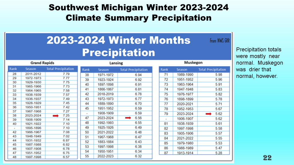
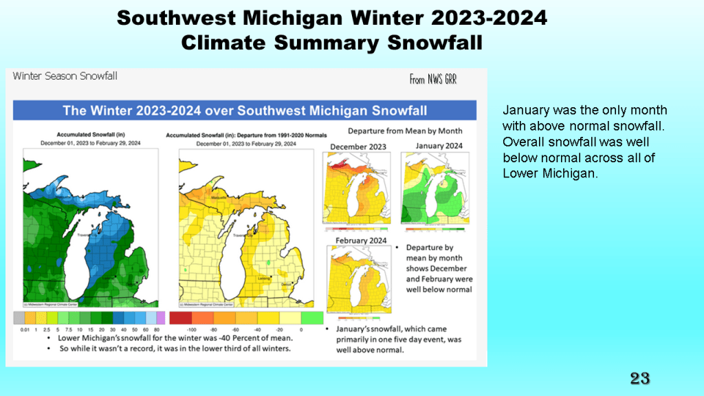
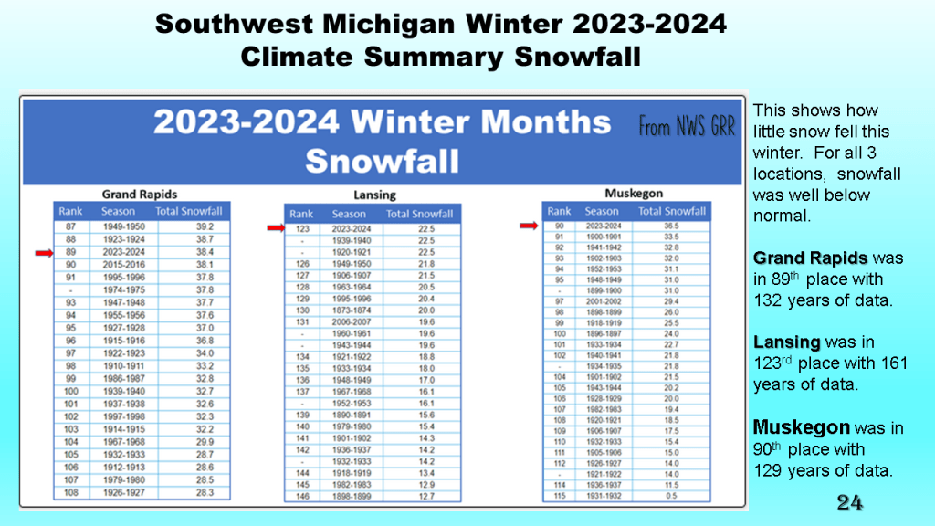
This was both nationally and locally one of the warmest winters on record, with records going back to 1895. Nationally and locally snowfall was below to well below normal. Precipitation was mostly near normal.


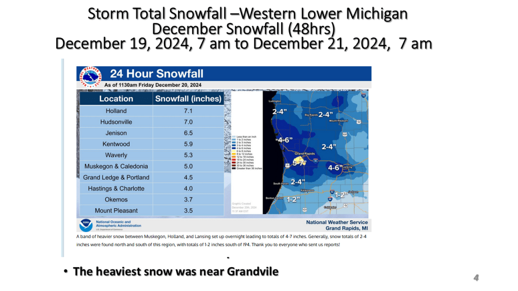
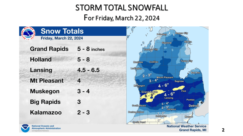
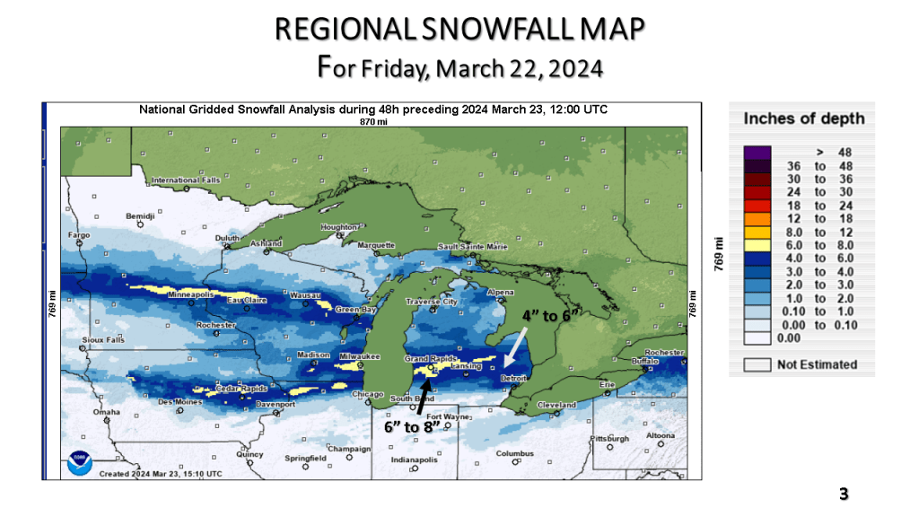
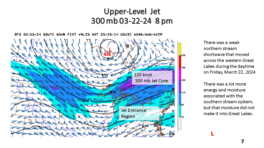
There was a narrow band of 5″ to 8″ of snow From Near Holland Michigan, across the Grand Rapids area, to just north of Flint. Most of the snow fell in about 12 hours.


This past 15 days ( Jan. 23- Feb. 7) in Grand Rapids, Michigan were the warmest on record (34.8F) that exceeded the 34.7F for the 15 days ending on January 6th 2012.


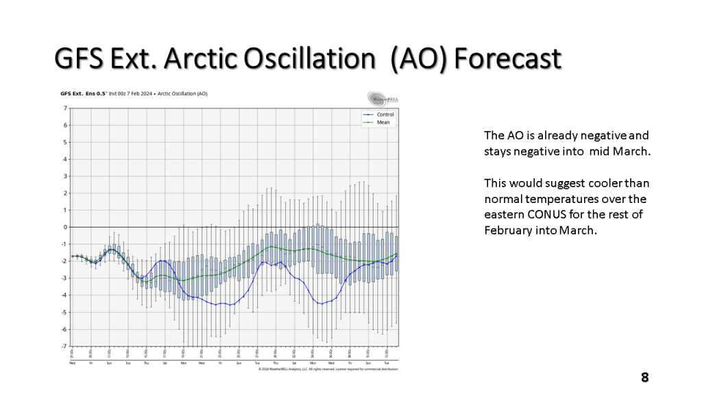
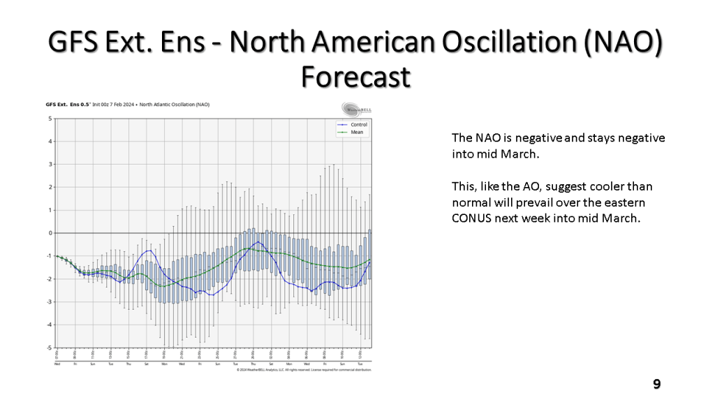


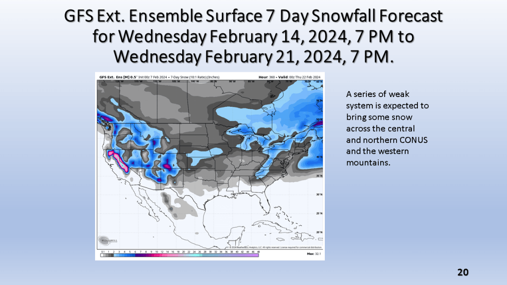


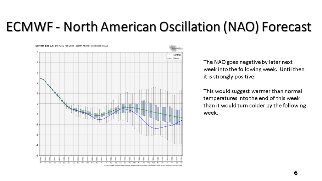
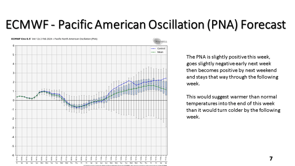


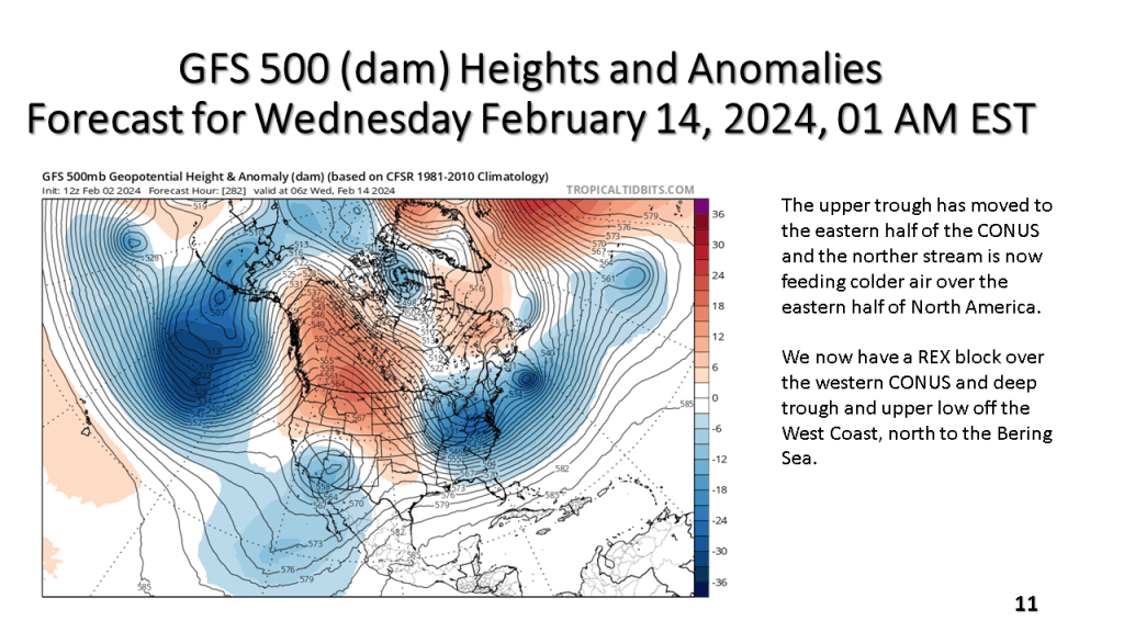


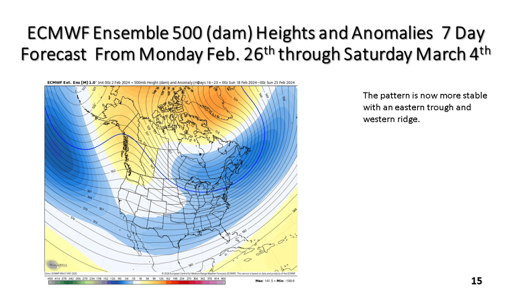
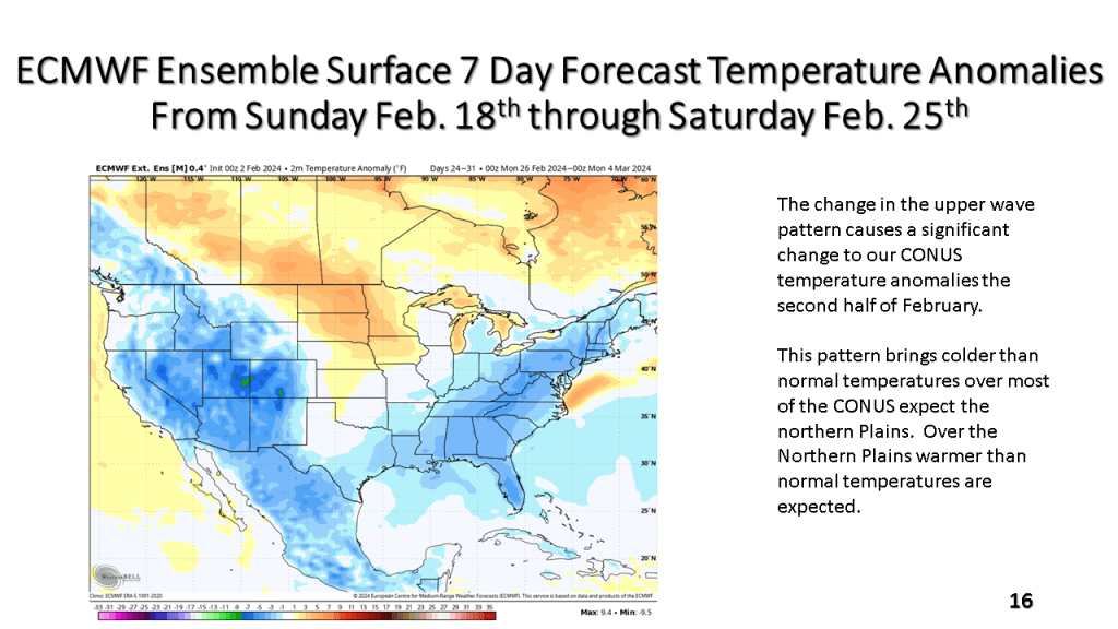


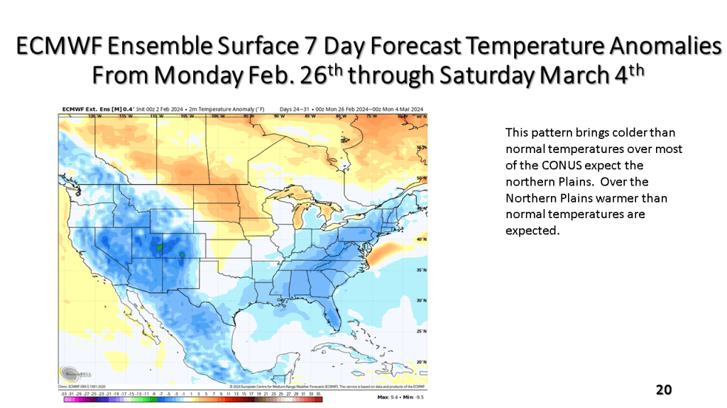
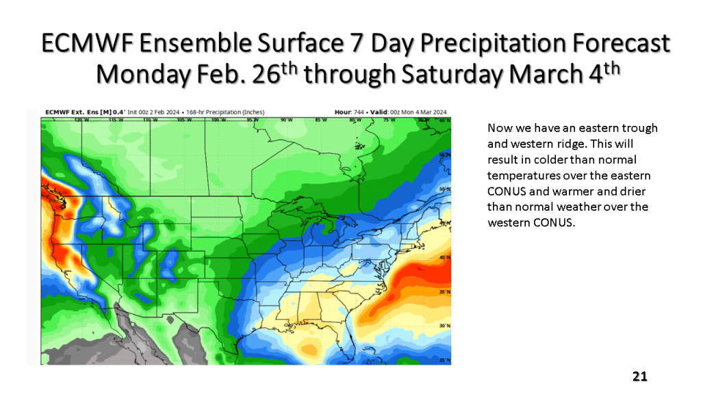


The bottom line is it will be very warm, relative to normal until around Valentine’s Day, the it will get cold across most of the central and eastern CONUS with a significant amount of snow over the Great Lakes and New England.
