FOR SOUTHWEST LOWER MICHIGAN
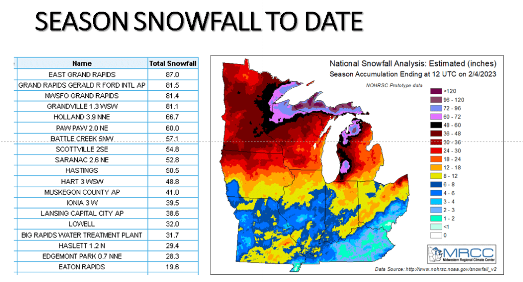
Note the heaviest snowfall this winter has been displaced inland toward US-131 compared to the typical heaviest snowfall near the lake shore (see map below). What is odd too, is my Grandville weather station has less total snowfall than the official site at Grand Rapids. I do not remember a year, since I moved here in 1995 where that was true like it is this winter.
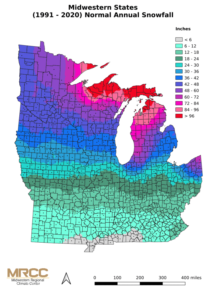
This is the normal seasonal snowfall across the area.
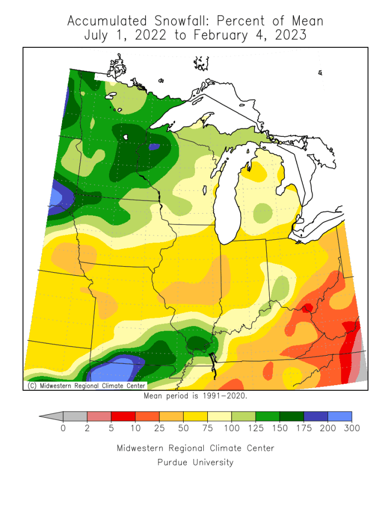
The percent of the mean shows this too, that is the heavier snowfall, relative to normal has been displaced inland for this winter season.

Interesting stuff Bill. Also of interest is the fact that with all of the snow we have received in the Grand Rapids, It has totally melted 3 times and it looks like what is on the ground now will melt again too.
LikeLike
This has been an odd winter in that way. I am thinking we will see a 4th version of this late February into early March.
LikeLike
More than likely it appears. Bastardi has been saying it will a very late spring for quite some time now. I hope that is wrong
LikeLike
Yes JB has been saying that actually. Of course I like snow so I would hope he’s correct
LikeLike