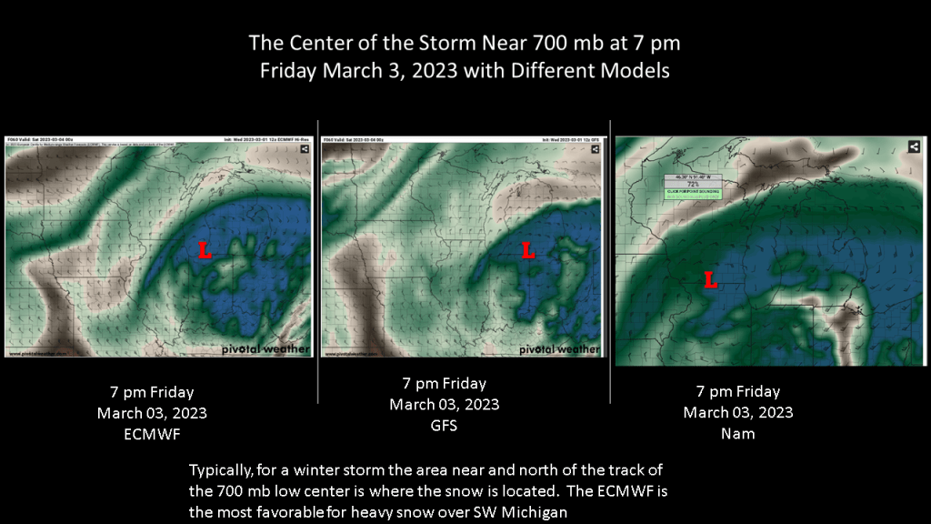
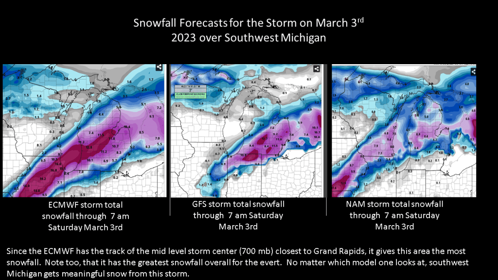
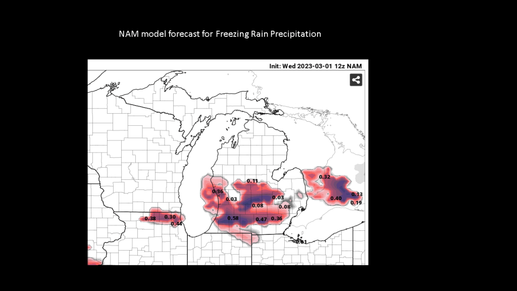
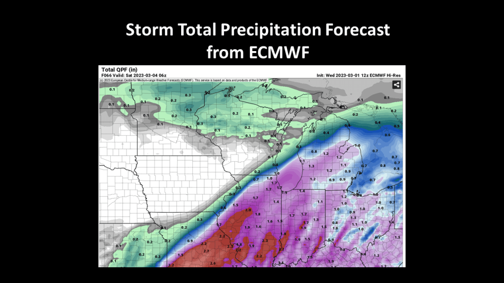
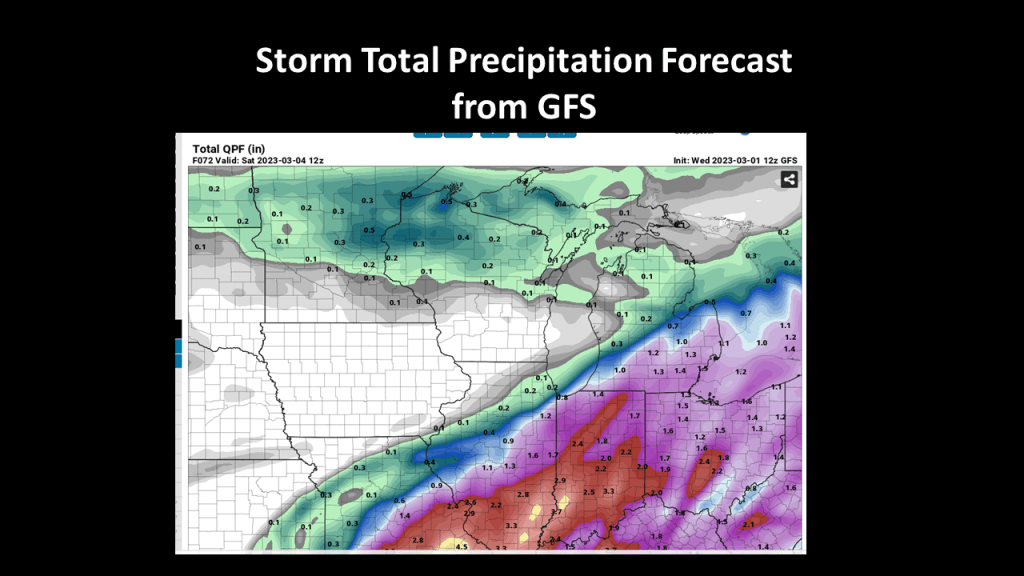
I have put together a few slides to show there is significant change our area could see an impactful winter weather event Friday into early Saturday. The storm has been consistently forecast to impact our area for several days now on the ECMWF, GFS, and the ensemble members of both of those models.
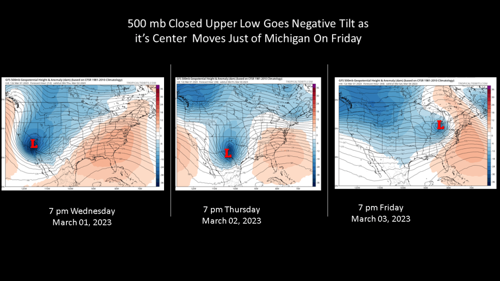
This is one of those storms with strong upper level forcing and a good feed of moisture from the Gulf of Mexico. Since the upper level part of the storm is closed off and upper wave goes negative tilt as the storm moves through our area, that significantly increases the risk of a major winter weather event on Friday.
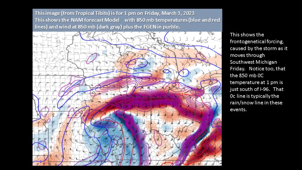
This storm will not only have an area of heavy snowfall but it will have strong winds to blow the snow around.
Below the a few slides to help make my point that this will be an impactful storm for most of Southwest Michigan.


Why do you think they didn’t issue a Winter Storm Watch this afternoon for Friday afternoon and Friday night?
LikeLike