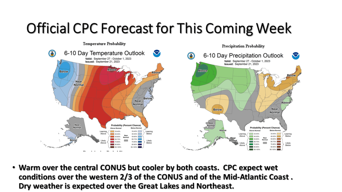


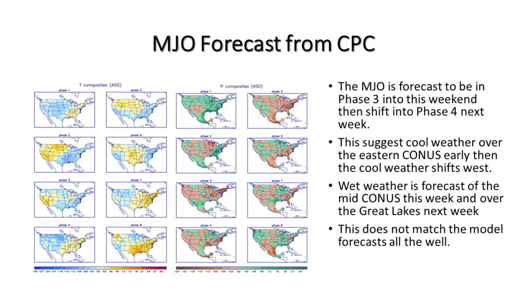
I am expecting warm and dry weather this week over Michigan but warm and wet over the east coat, and cool and wet over the west coast.
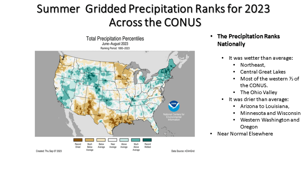
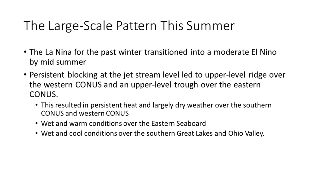
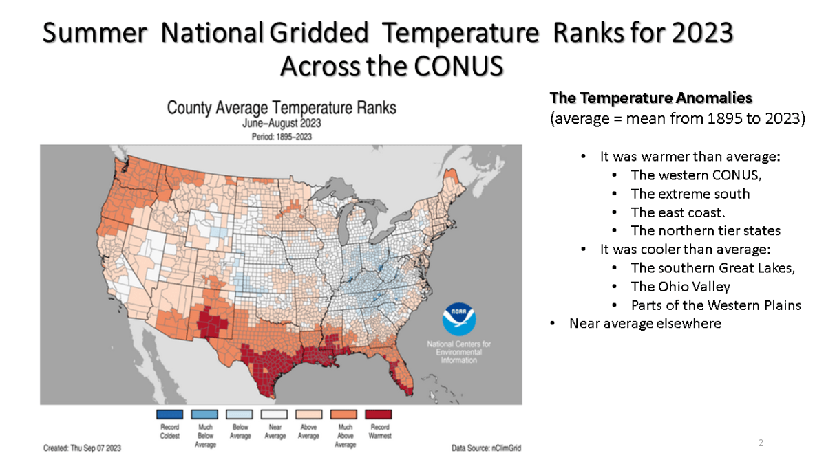
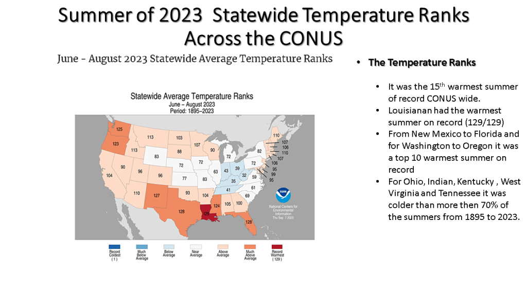
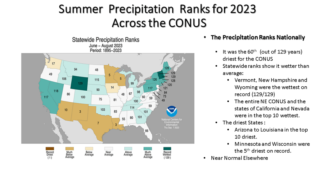
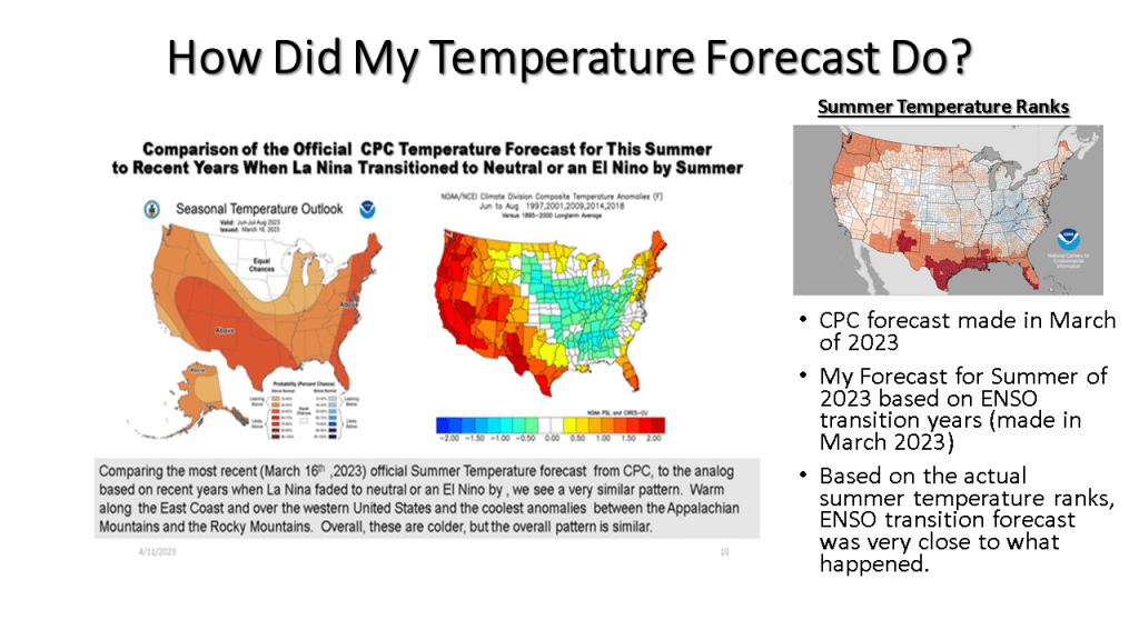
This was a summer that featured persistent weather patterns over most of North America and lead to one of the most active Canadian wildfire seasons on record. It also lead the the 15th warmest summer on record (back to 1895) over the CONUS.
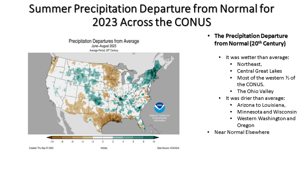
While it was the 15th warmest summer on record nationally, not all of the CONUS had a warm summer. You may want to find out how your area did relative to normal for this summer.


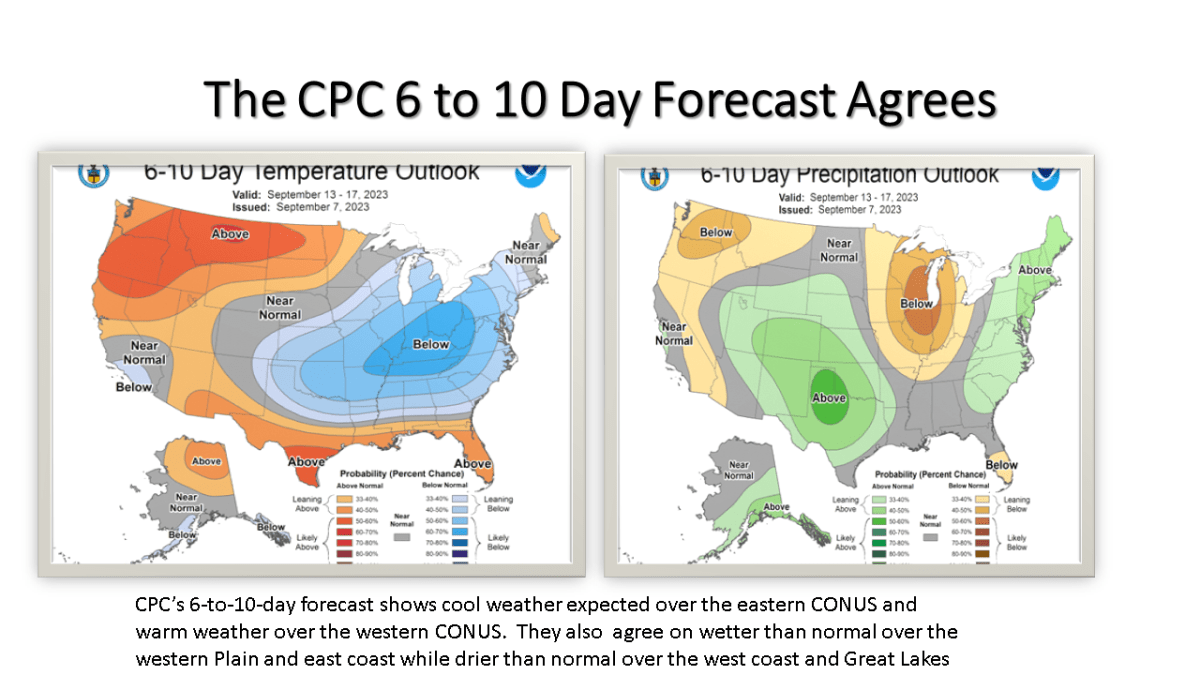
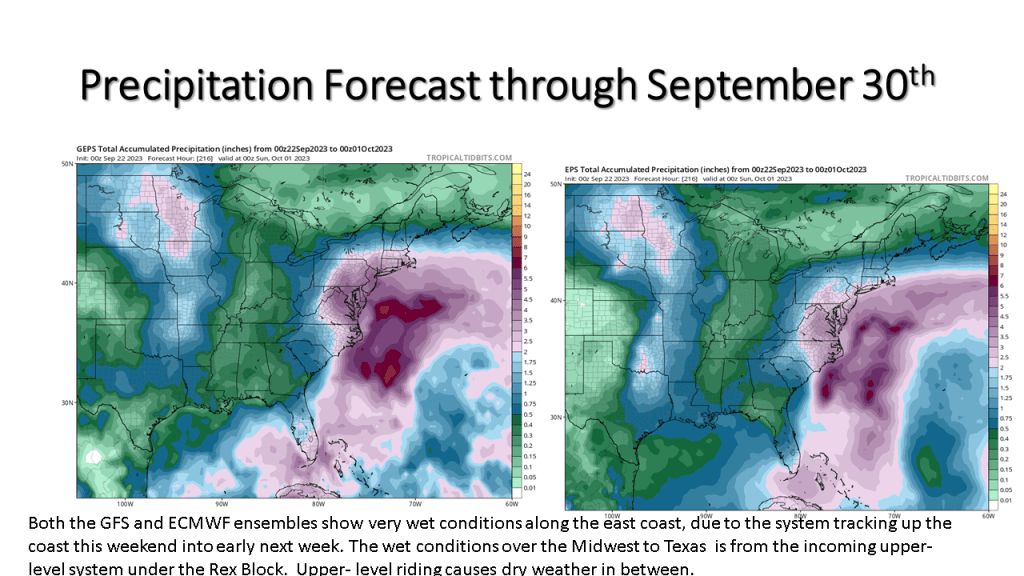
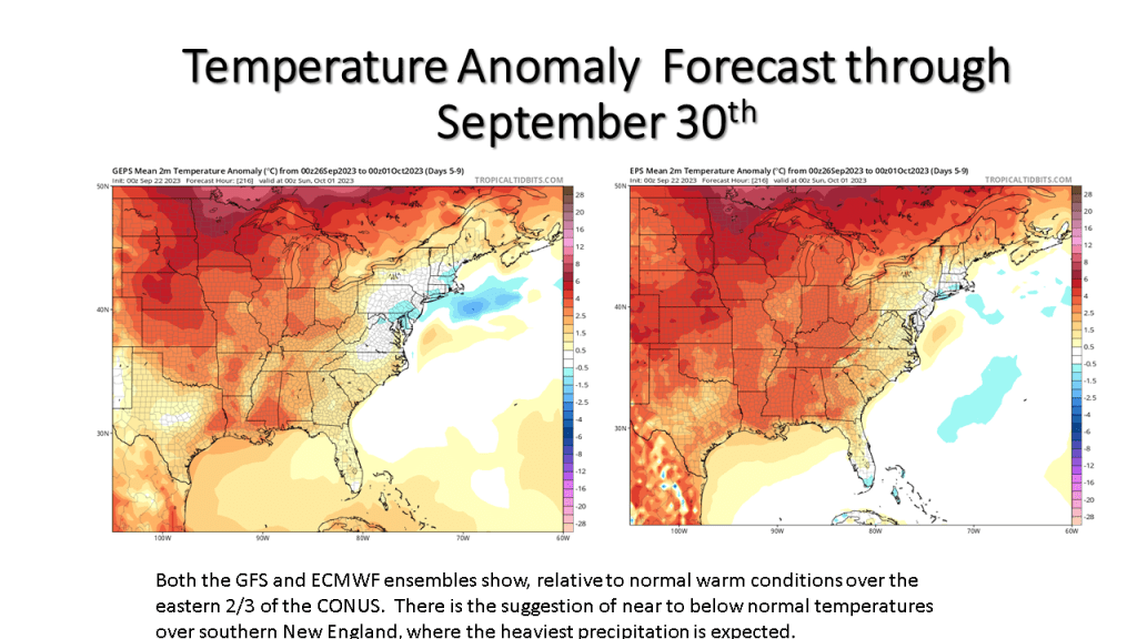
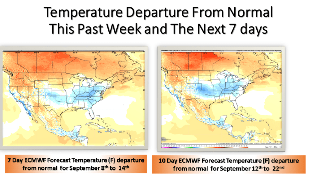
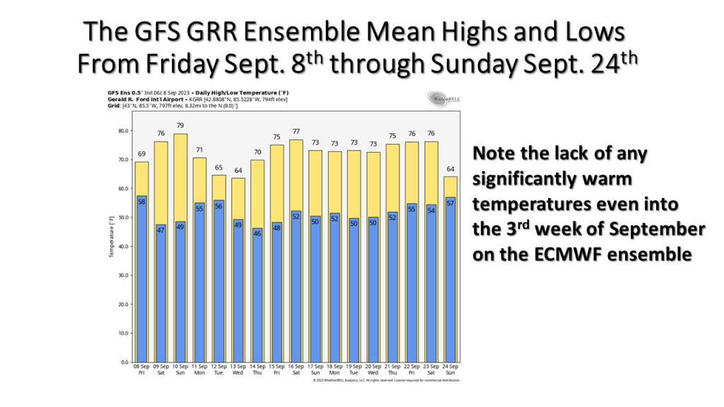
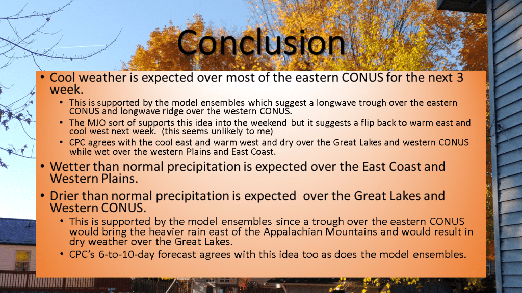
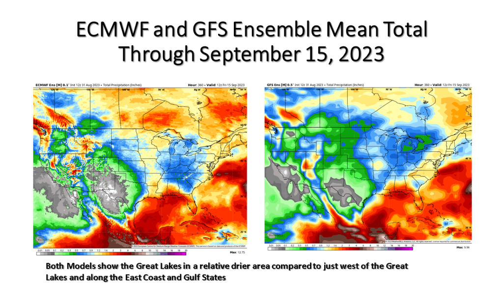
Expect the next 3 weeks to be cooler than normal over most of the eastern United States. It will be dry over the Great Lakes but very wet over the eastern seaboard.


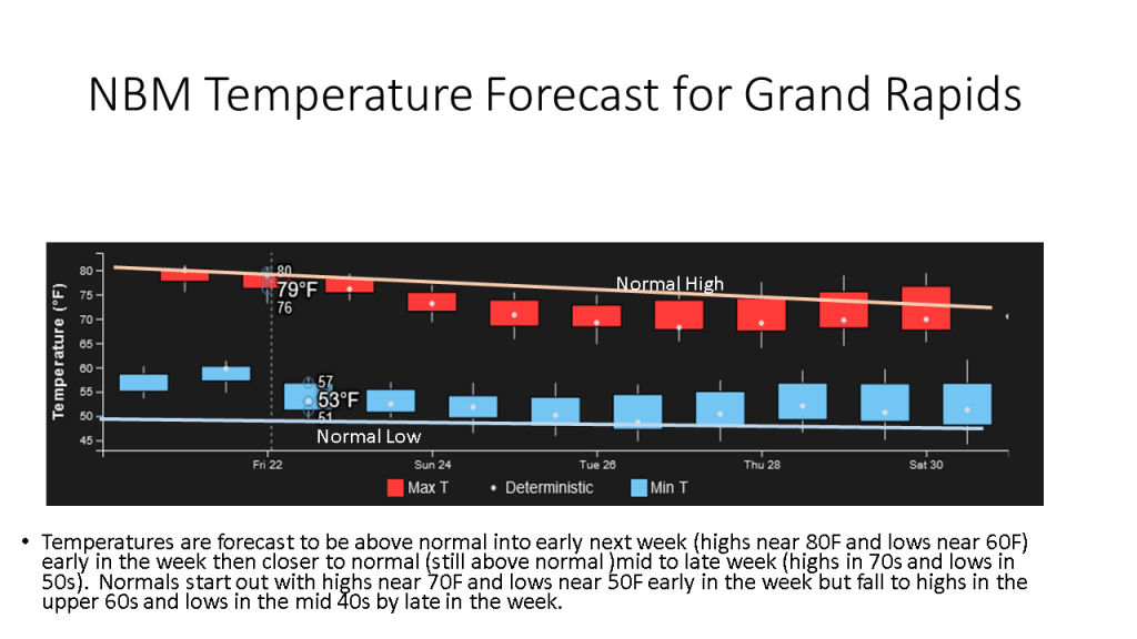
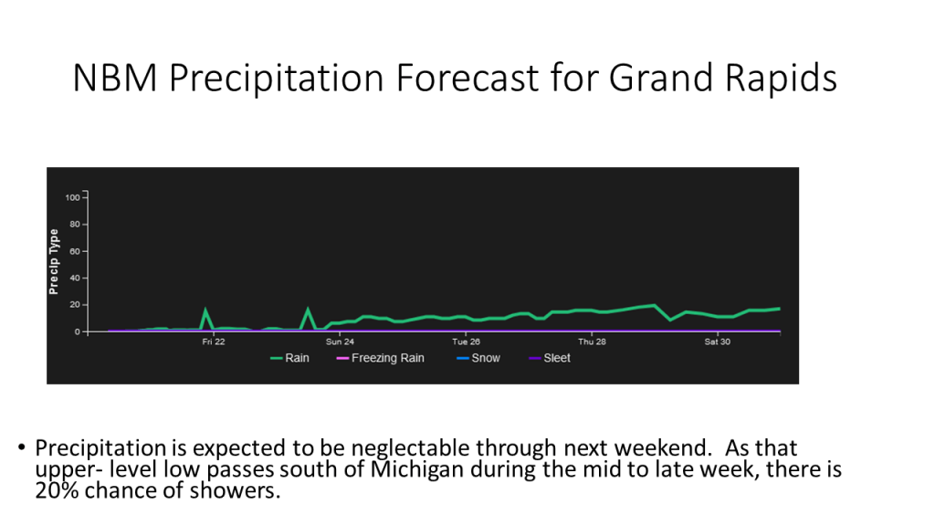
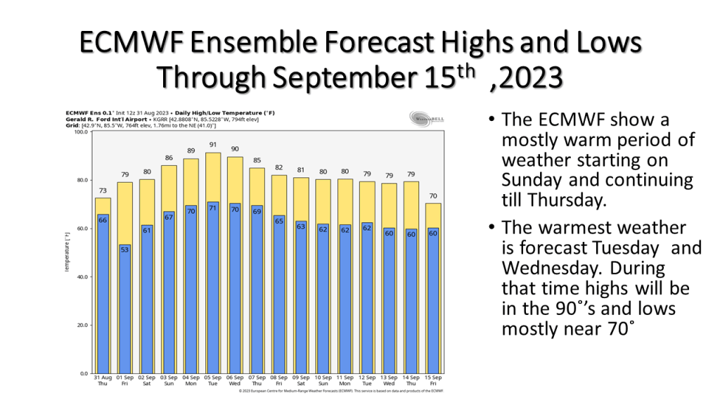
Warmer temperatures are expected from Labor Day into the middle of the week. A cold front coming through the area in late Wednesday/Thursday time frame may bring showers and slightly cooler weather .


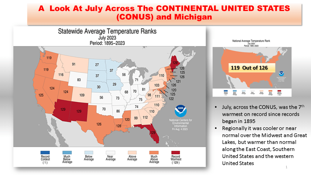
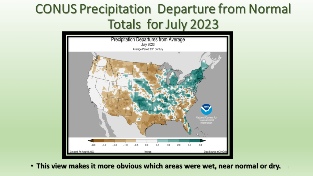
As promised I have posted the national images of July 2023. The short story is it was the 7th warmest and 45th wettest for the CONUS. In Michigan it was the 58th warmest and 5th wettest on record.


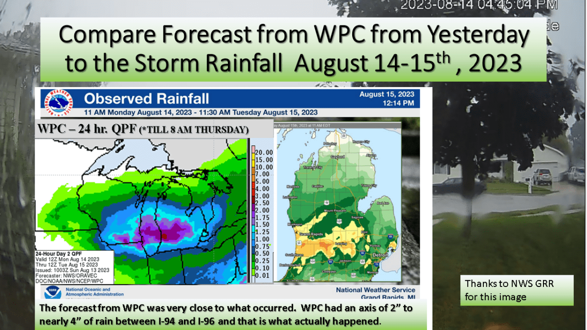
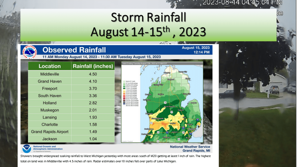
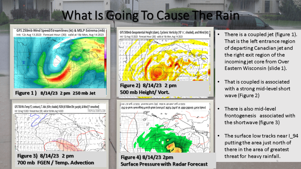
We forecast heavy rain between I-94 and I-96 and that is exactly what did happen. The heaviest rainfall report showed 4.50 inches in Middleville, most of that area had between 1″ and 3″ of rain from the event.


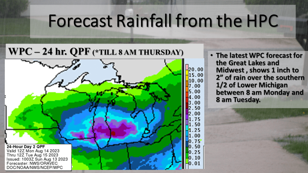
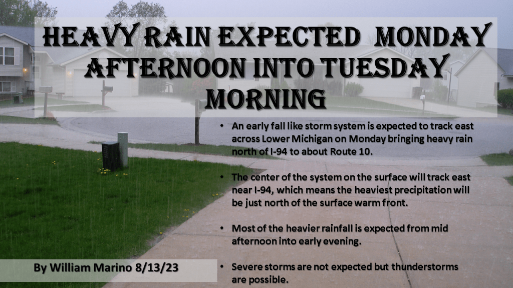
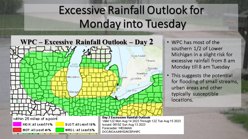
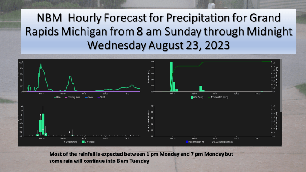
Heavy Rain is expected over most of the southern half of Lower Michigan between 2 pm Monday and 8 am Tuesday morning.
An unusually strong storm system for this time of year is expected to track east across Lower Michigan from Monday into Tuesday morning. This will be an occluded system, with the track of the surface low near I-94. It is typical for the heaviest precipitation to be within 100 miles of track of the surface low, but on the north it’s track. This system as a closed upper low with it and a coupled jet with it. The precipitable water reaches above 1.5 inches Monday afternoon over the southern 1/3 of Lower Michigan as this system tracks through the area. There is also good model continuity with this system so it gives me confidence that the heavy rainfall will happen. Just exactly were is questionable but I would have to believe between I-94 and Route 10, between Monday afternoon and Tuesday morning a large part of that area should see more than an inch of rainfall.


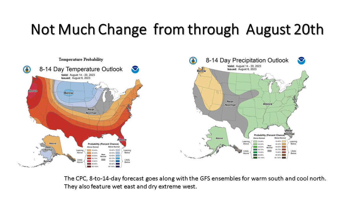
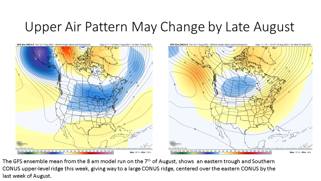
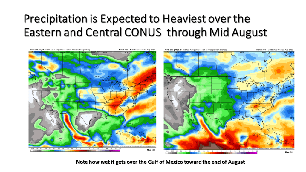
Cooler than normal temperatures are expected to prevail over a large part of the northern CONUS into mid August.
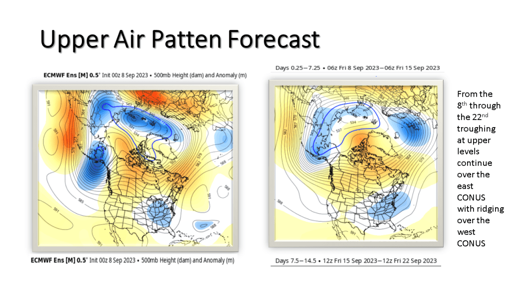
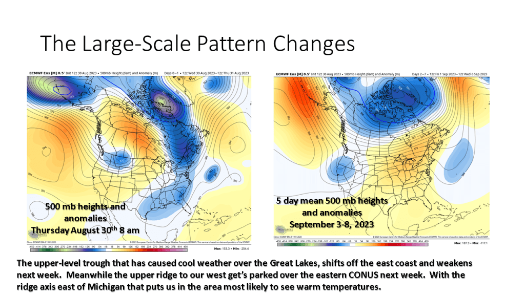
We continue to see an overall eastern North American trough and western upper level ridge prevailing through the 3rd week of August. It does however look like a case of discontinuous retrogression by the later part of August as the models show a large upper ridge developing late in the month over most of the Continental United States (CONUS).


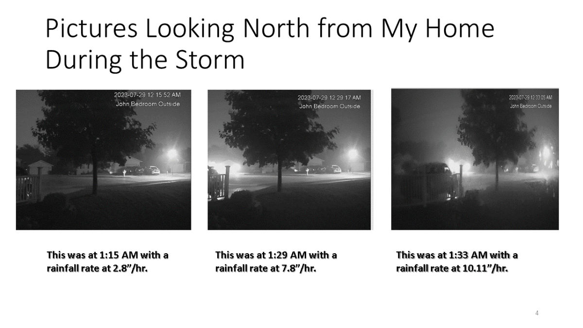
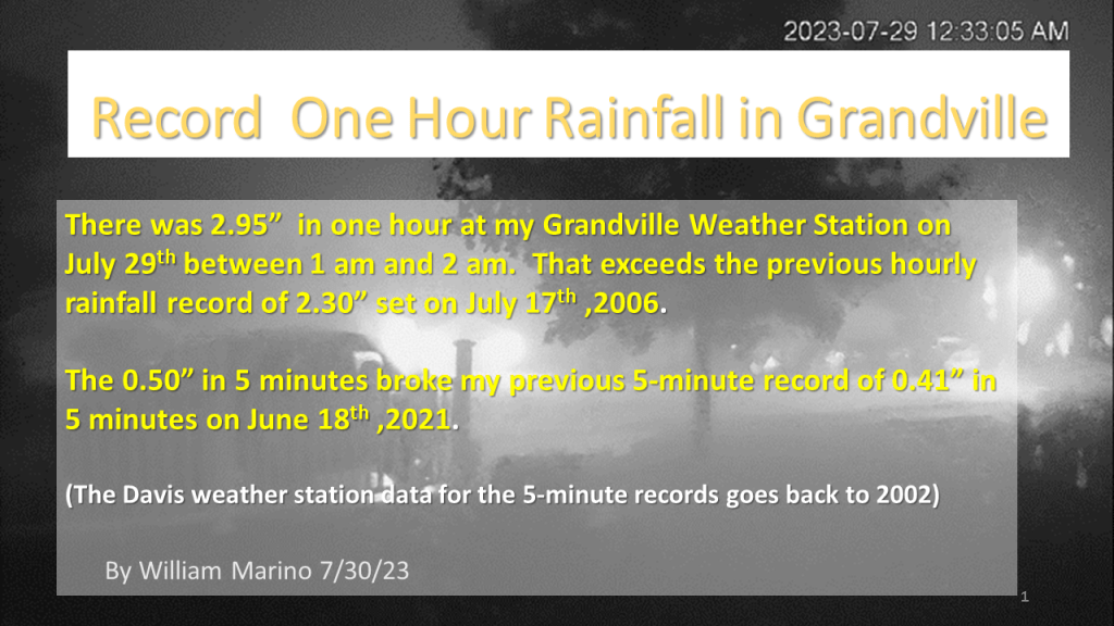
Exceptional rainfall occurred during the early morning hours at Grandville between 1 am and 2 am. This storm broke my all time 5 minute rainfall rate record and 1 hour rainfall rate record.
With Grandville Weather Data at my house having records back to the fall of 1995, the 2.95″ of rain that was recorded in both my 4″ rain gauge and my Davis Weather Station (nice that they agreed) , is my all time record rainfall in one hour. The previous record was 2.30″ during a thunderstorm during the evening of July 17 2oo6 between 9:45 pm and 10:45 pm. The 0.50″ in 5 minutes is also a new record for 5 minute rainfall, exceeding the 0.41″ on June 18th 2021.
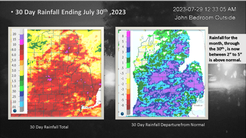

The pictures above are from our home, looking north out of what is my son John’s bedroom window. The time posted on the pictures are EST, so you have have to add one hour to get the correct time for these images.