Does the cold and snowy weather come back?


Does the cold and snowy weather come back?
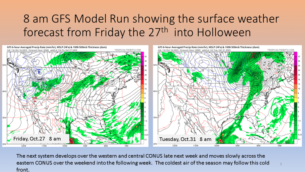
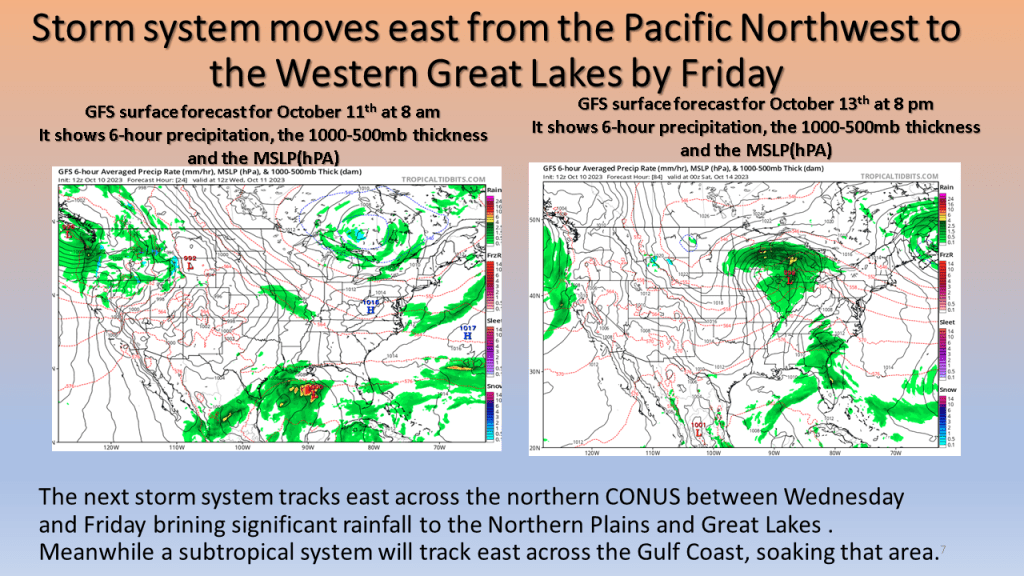
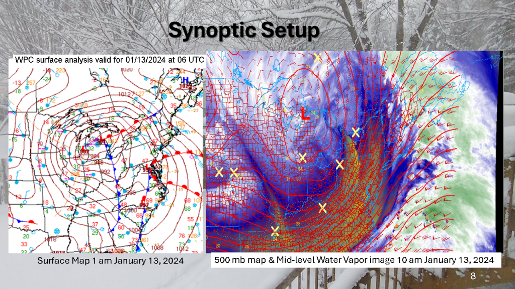
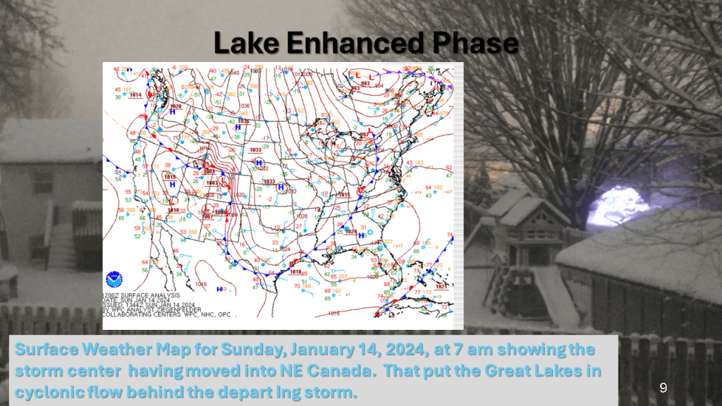
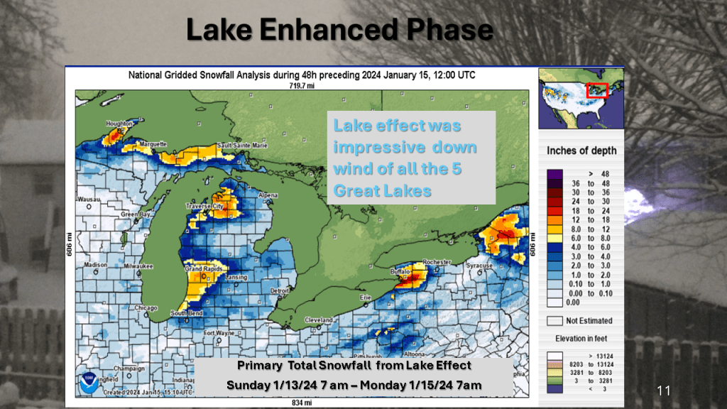
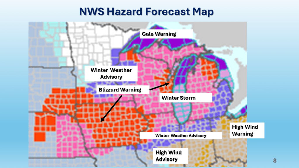
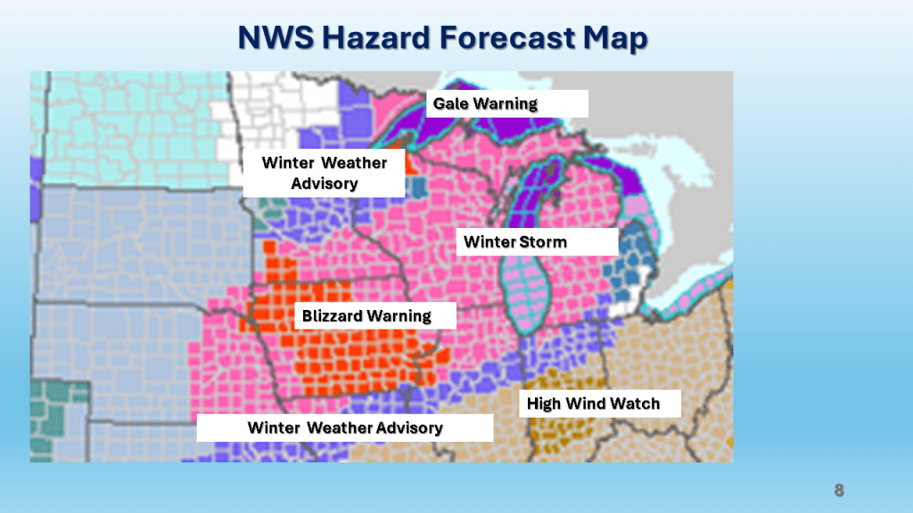
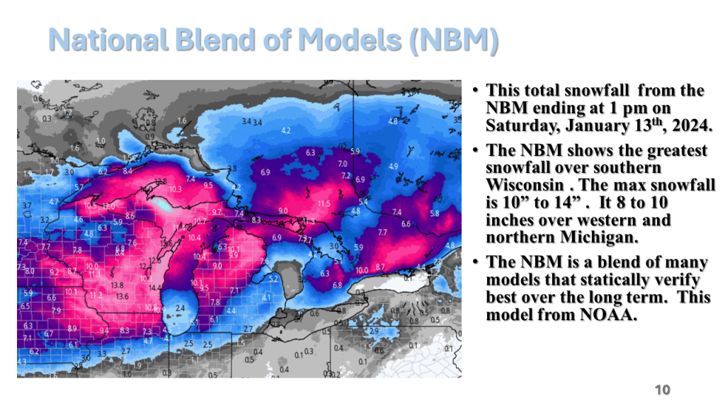
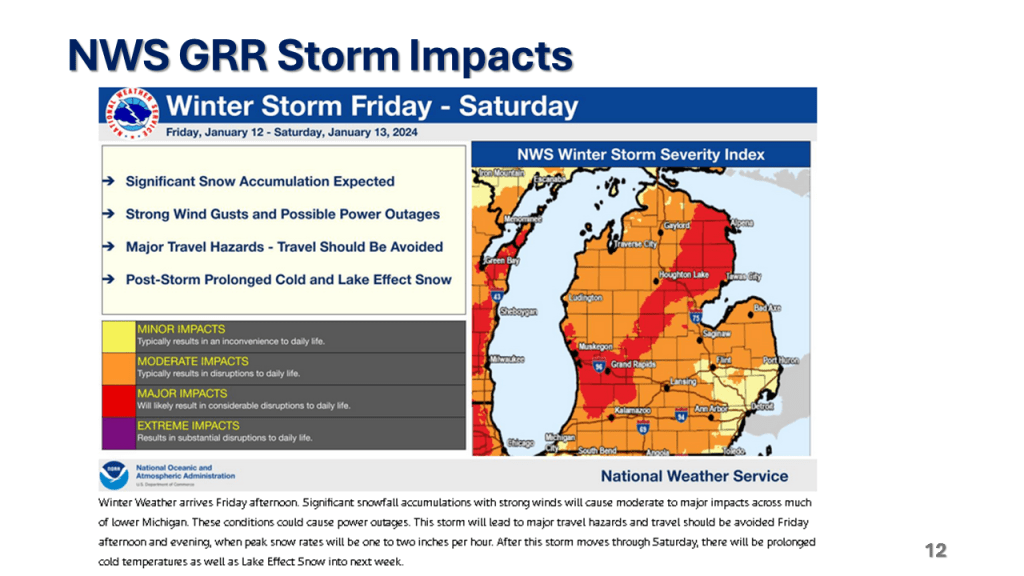
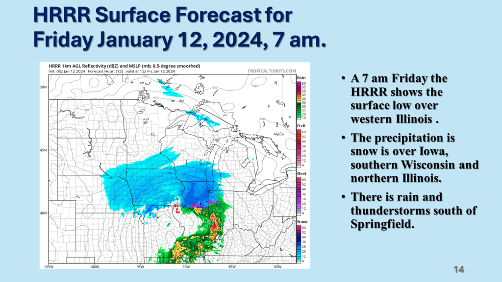
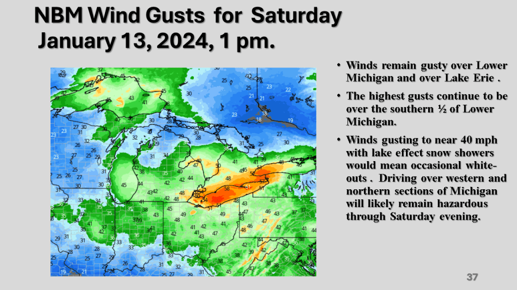
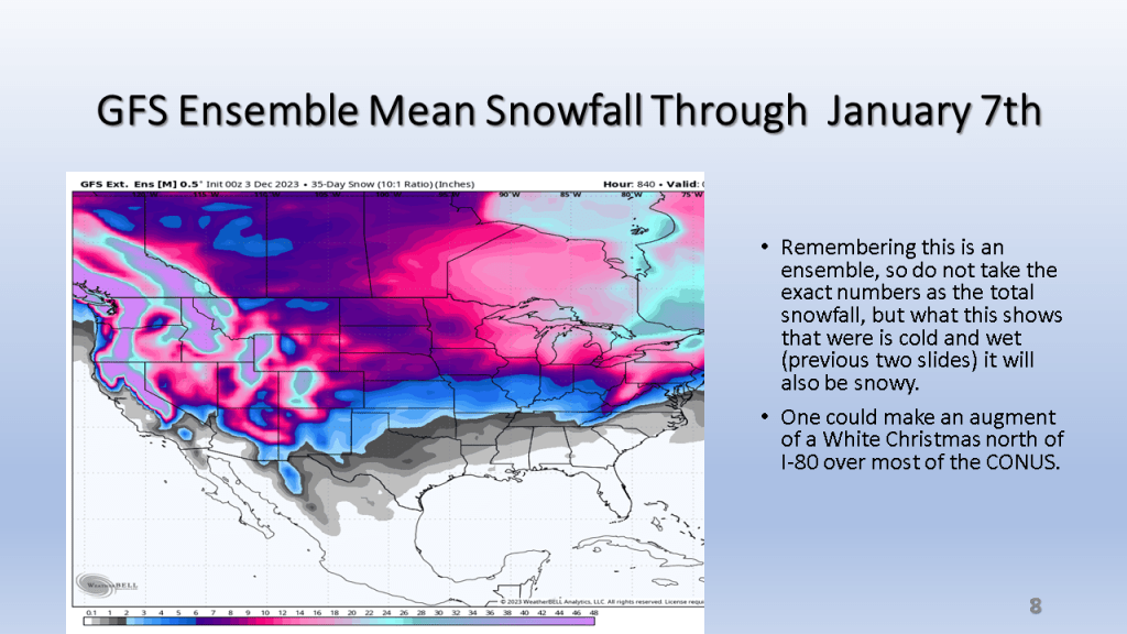
A rapidly deepening storm tracked Texas on Thursday afternoon to the northern Great Lakes by Saturday morning. The storm brought 1 to 2 feet of snow from Nebraska, across Iowa, Wisconsin then into Michigan. Strong winds accompanied the storm then the coldest air in several years followed the storm with dangerously cold wind chills over most of the Northern and Central Midwest. That cold air caused heavy lake effect snow in Michigan, near Buffalo New York and over the Tug Hill Plateau in the Adirondack Mountains, down wind of Lake Ontario.


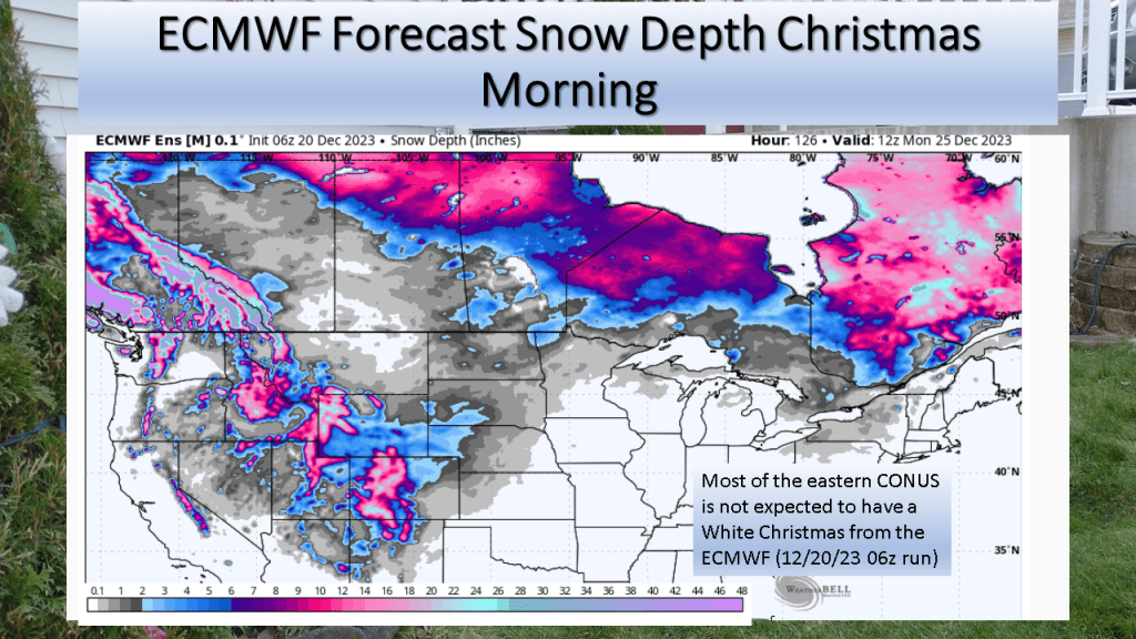
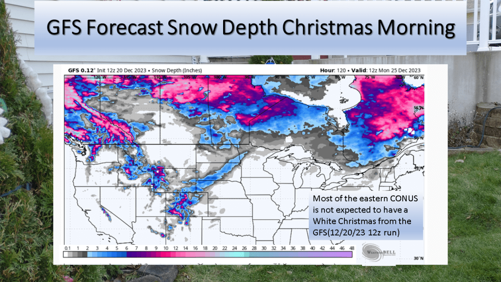
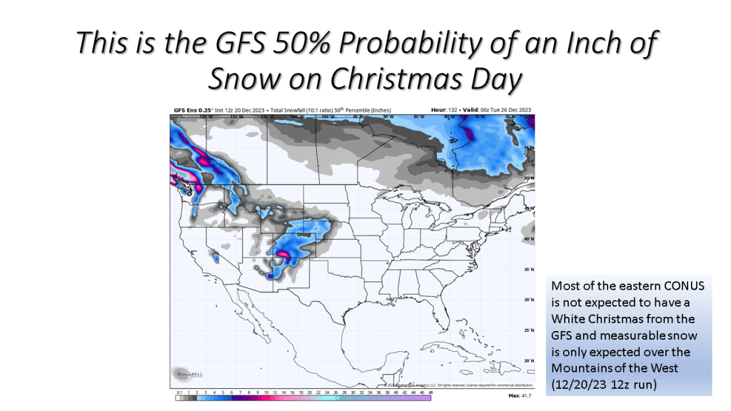
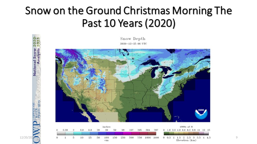
The short story is if you live in the central or eastern CONUS it is very unlikely you’ll have snow on the ground Christmas morning.
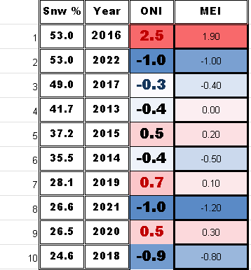
I have updated this to show the percent snow cover and ENSO state for each of the 10 years. At the end I have 2 tables that show the years with the ENSO index numbers and the snow cover for that Christmas. The bottom table sorts the percent snow cover from highest to lowest to see if there is a correlation between the ENSO state and the percent snow cover on Christmas day.


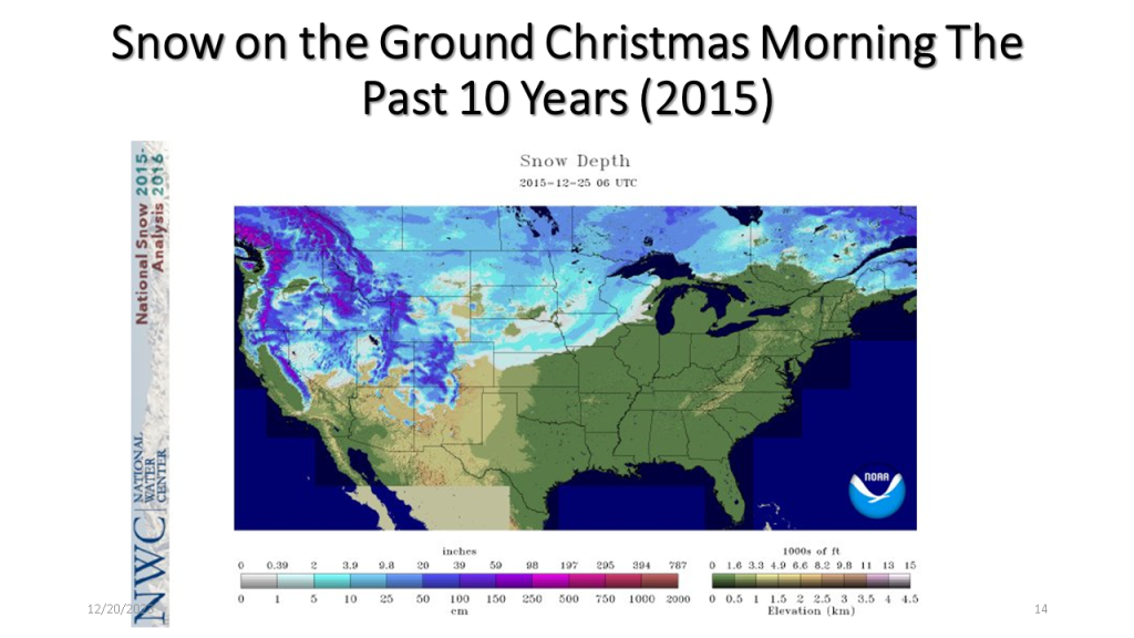
| Area Covered By Snow: | 53% |

| Area Covered By Snow: | 26.6% |
| Area Covered By Snow: | 26.5% |

| Area Covered By Snow: | 28.1% |

| Area Covered By Snow: | 24.6% |

| Area Covered By Snow: | 49.0% |

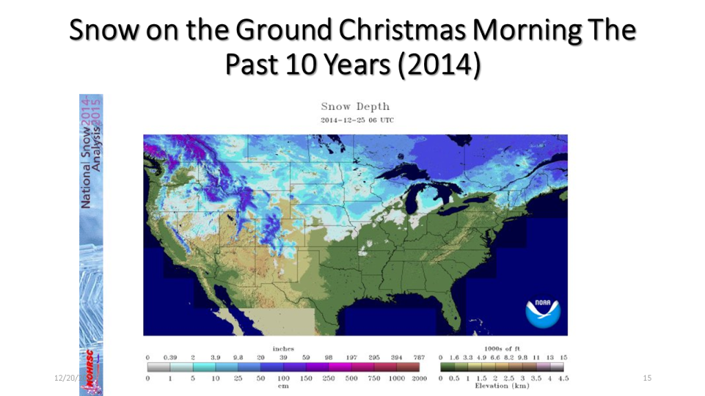
| Area Covered By Snow: | 44.1% |
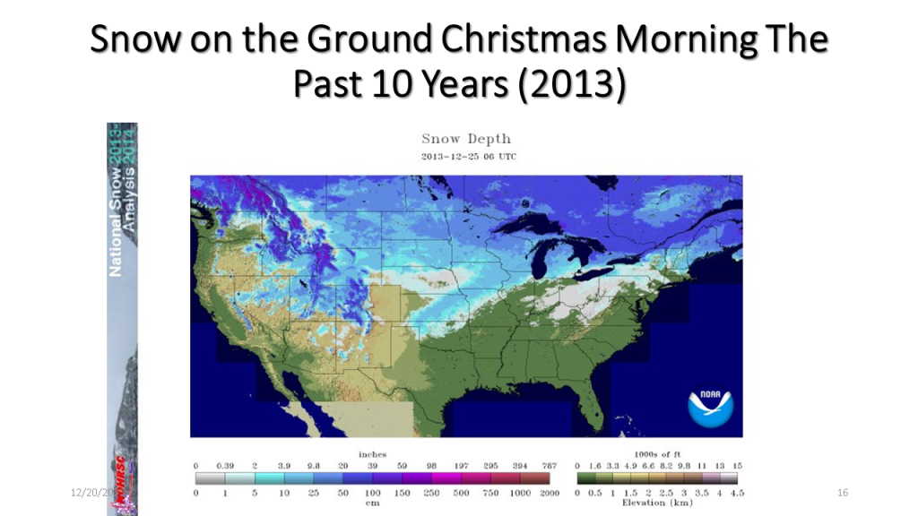
| Area Covered By Snow: | 37.2% |
| Area Covered By Snow: | 35.5% |
| Area Covered By Snow: | 41.7% |
Below is a table showing the percent snow cover on Christmas
Below is a table showing the percent snow cover on Christmas Day in chronological order.
Below is a table showing ENSO numbers and the percent snow cover on Christmas day for that year sorted from the highest percent snow cover to the lowest. There does not seem to be a significant correlation to the ENSO state and the percent snow cover on Christmas Day.


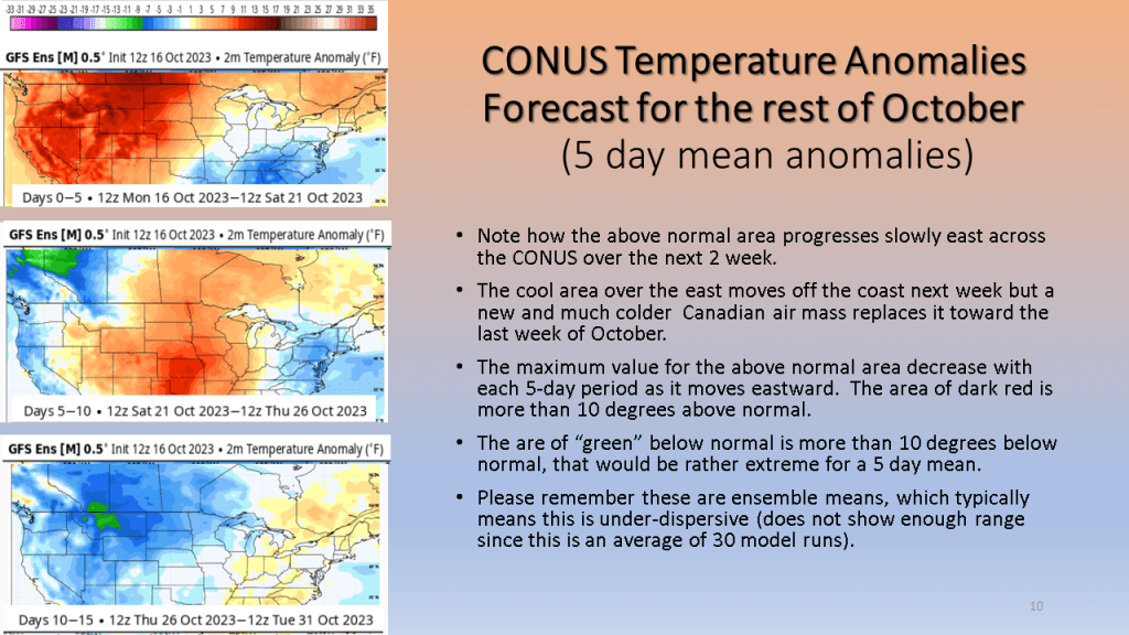
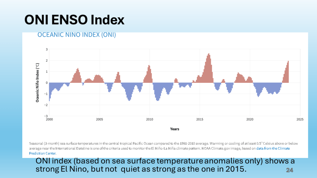
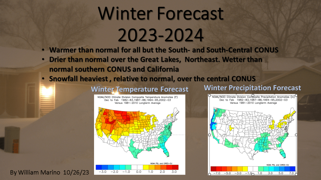
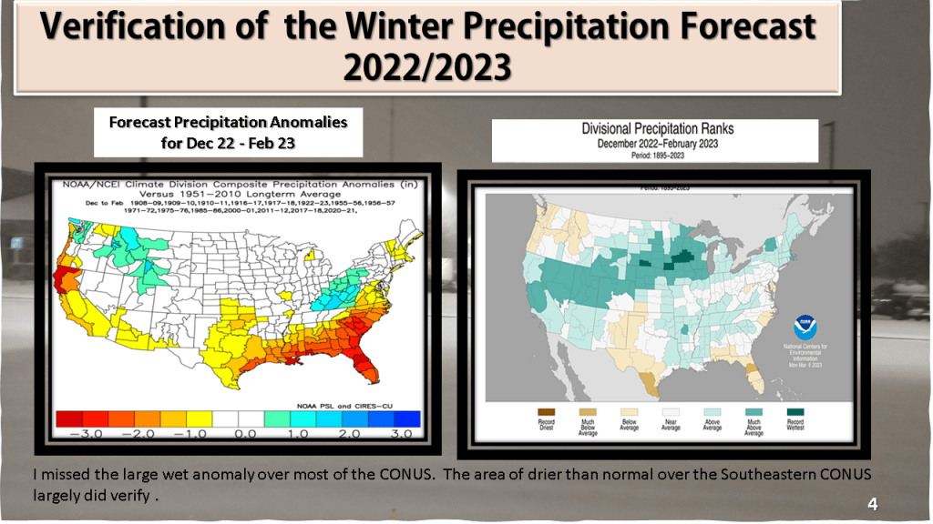
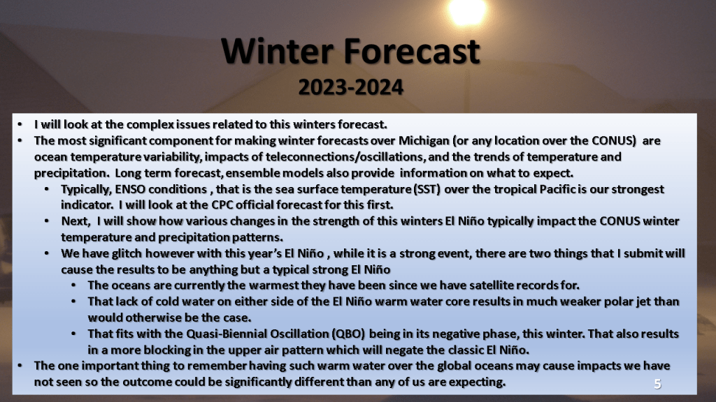
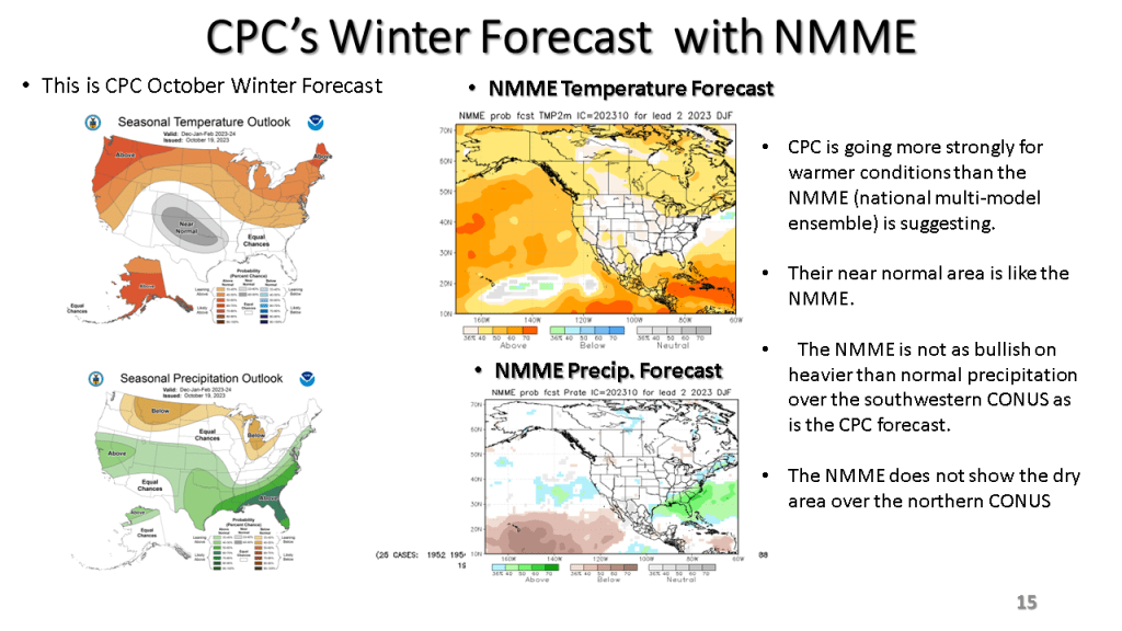
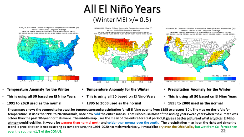
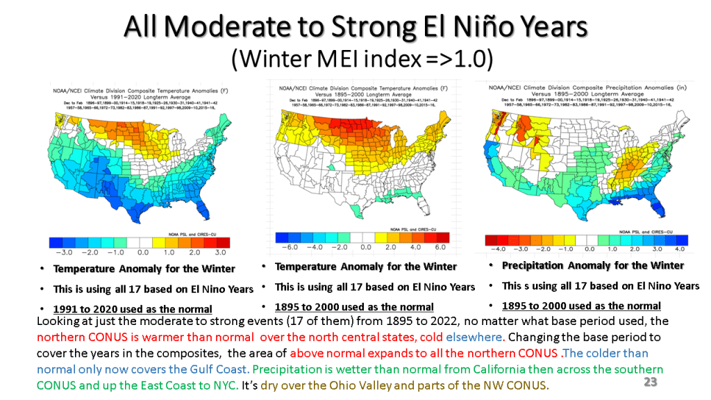
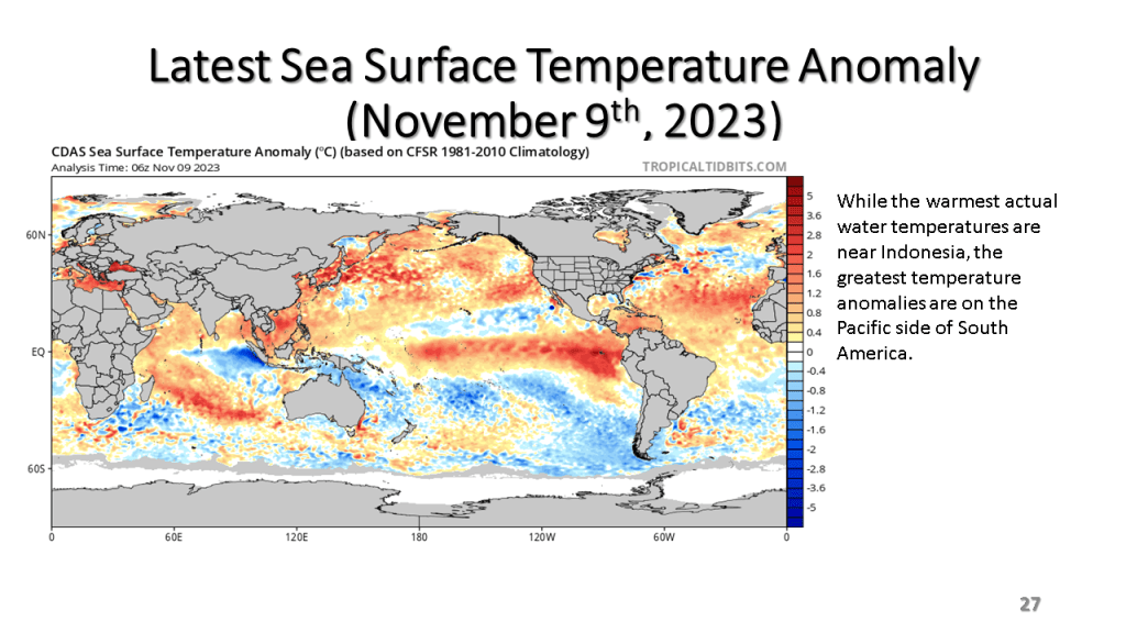
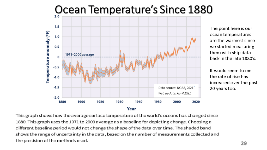
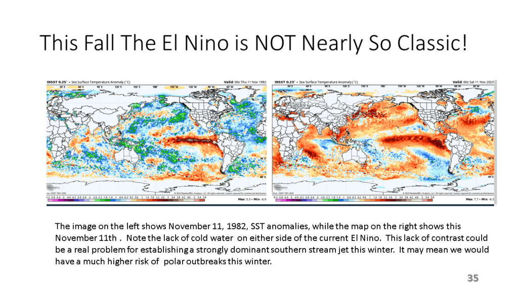
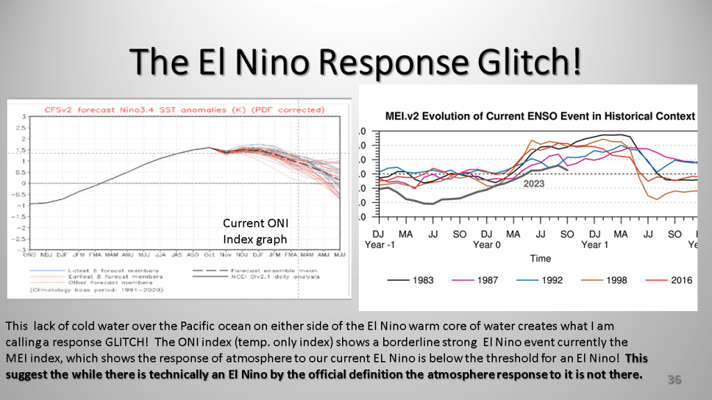
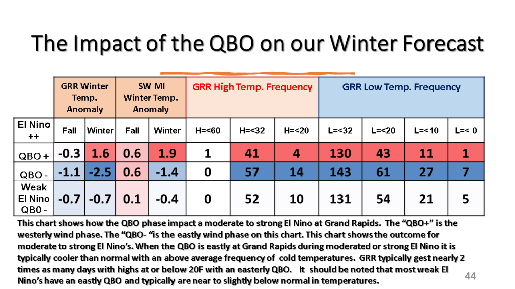
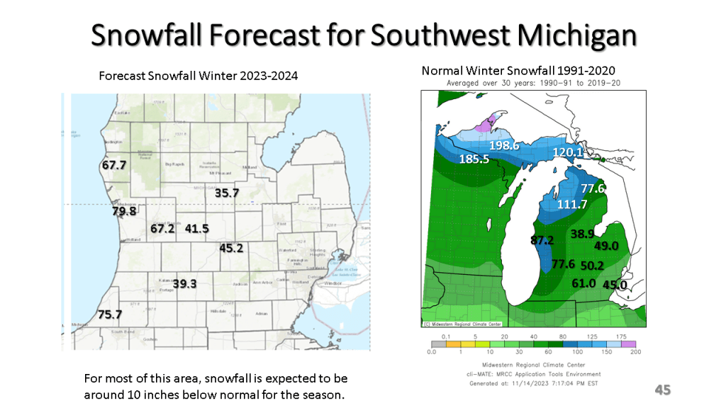
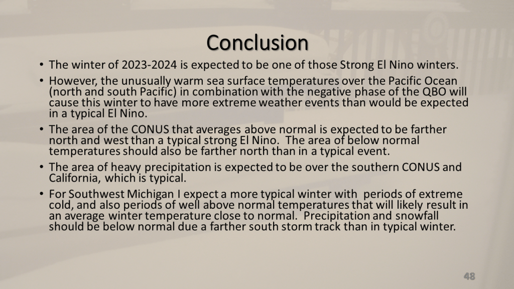
The short story is I am expecting a not so typical moderate to strong El Nino Winter this year. This is due to record warm sea surface temperatures in combination with an easterly wind over the tropical oceans, near 200 mb. This these two features acting together create an unusual amount of blocking in our Northern Hemisphere jet stream. This will mean periods of extremely cold weather and periods of unusually warm weather for a good part of the central and eastern United States lower 48 states. Even so, for Southwest Michigan and actually for all of Michigan I expect snowfall to be below normal but we will get a decent amount of snow nonetheless.


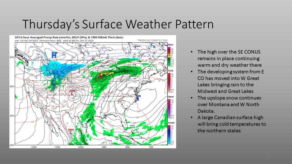
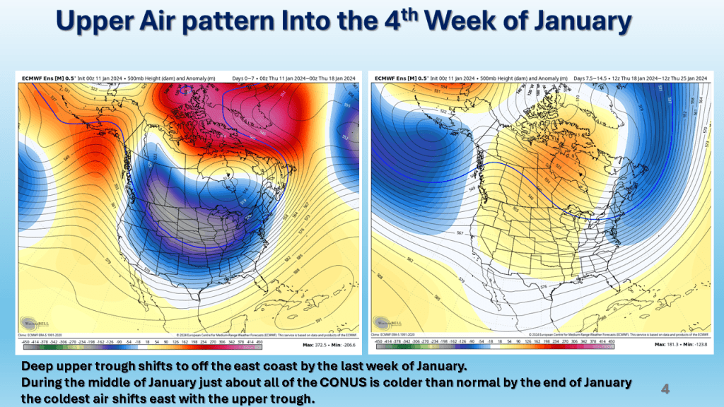
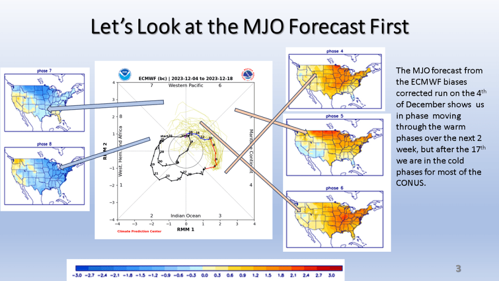
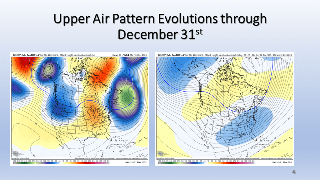
This shows our transition point from warmer to cooler weather.