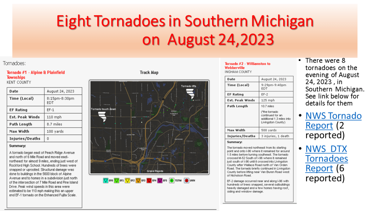
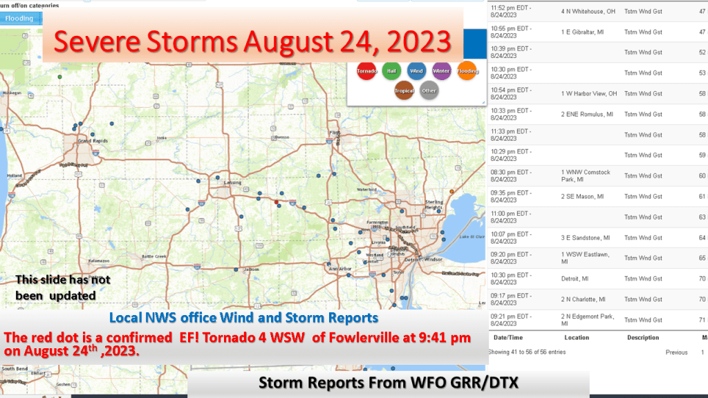
I updated my story about the severe storms since the NWS has now reported 8 tornadoes in Michigan on the 24th of August. The strongest was an EF-2 near Webbrvillle


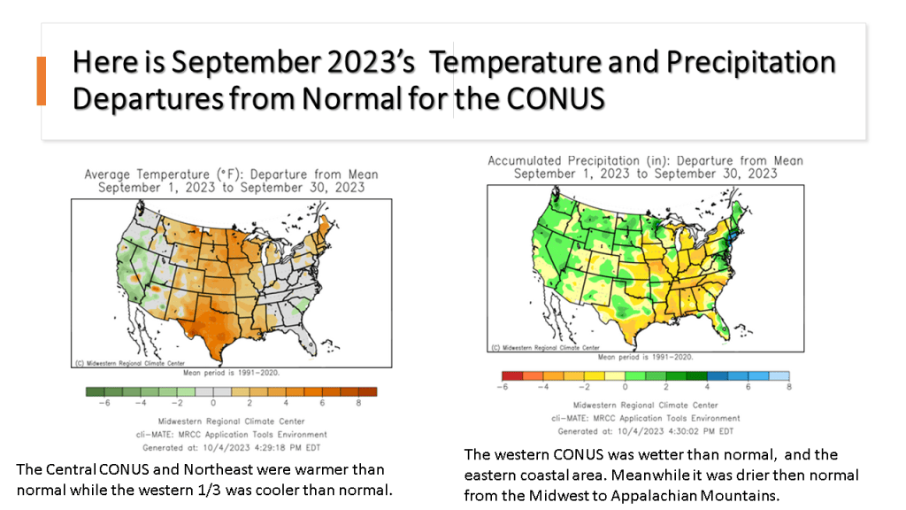
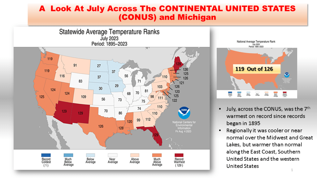
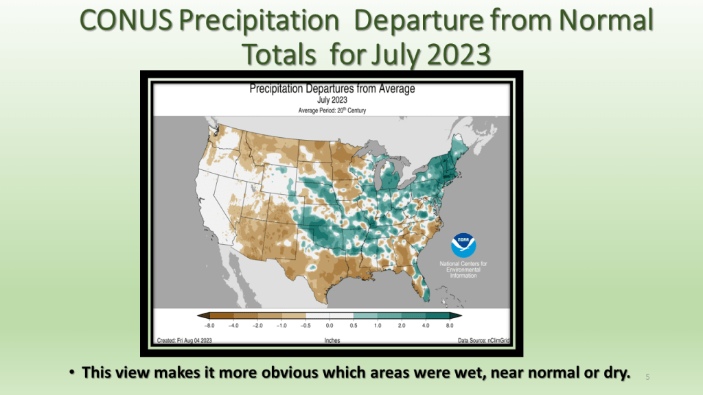
As promised I have posted the national images of July 2023. The short story is it was the 7th warmest and 45th wettest for the CONUS. In Michigan it was the 58th warmest and 5th wettest on record.


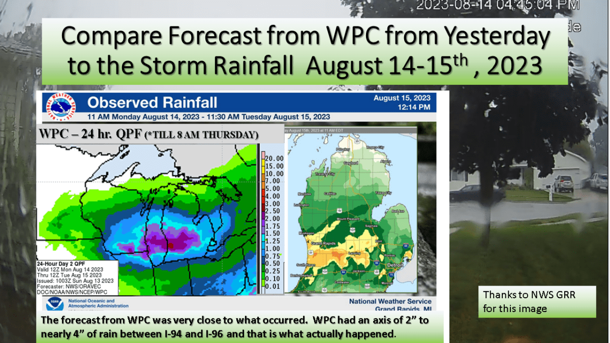
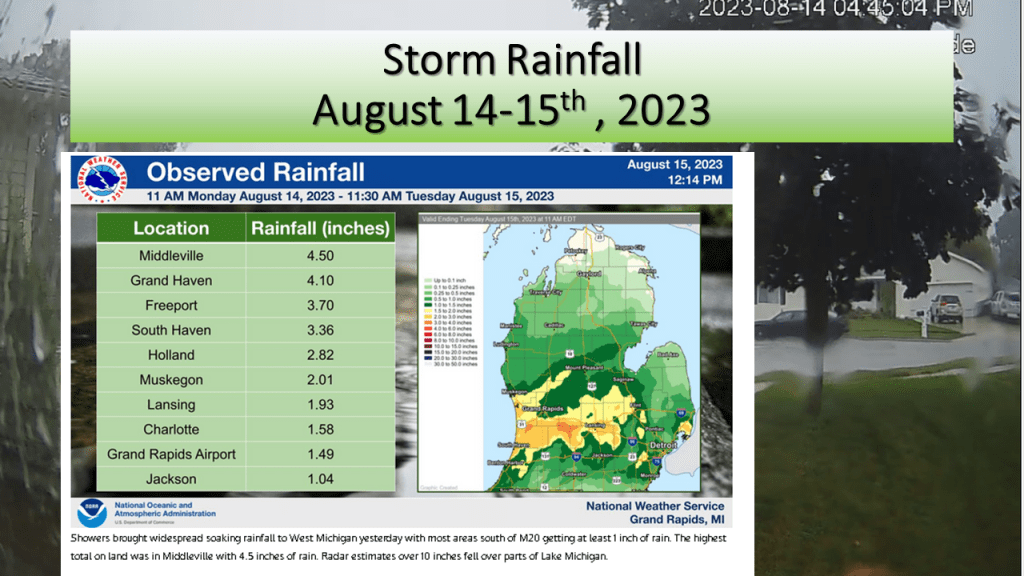
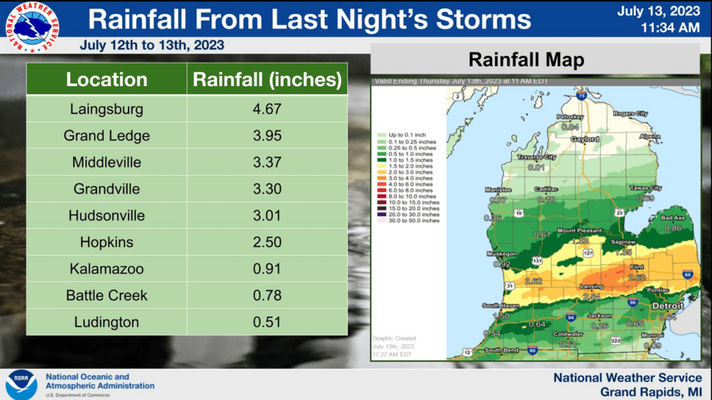
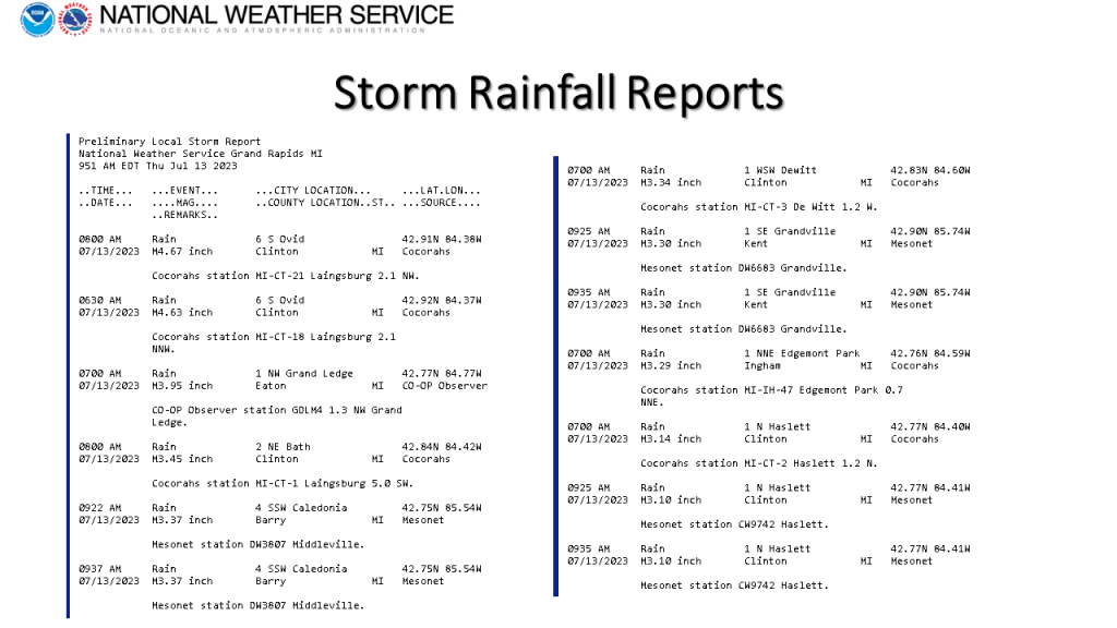
We forecast heavy rain between I-94 and I-96 and that is exactly what did happen. The heaviest rainfall report showed 4.50 inches in Middleville, most of that area had between 1″ and 3″ of rain from the event.


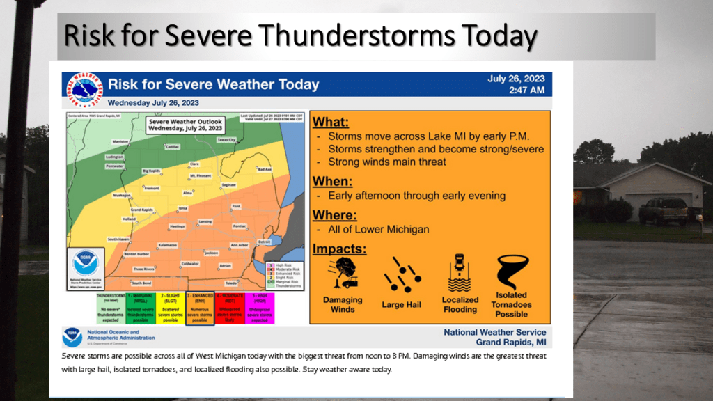
The Storm Prediction Center has put most of the southern 1/3 of Lower Michigan an enhanced risk for severe storms today (mostly late morning into mid afternoon). Locally heavy rainfall is expected too.

Most of the rainfall today will be from late morning into mid afternoon.
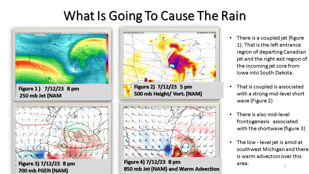
My experience in forecasting over the past 46 years tell me that for Southwest Michigan convection during the spring and summer months, warm fronts, stationary fronts and surface waves bring this area the most rainfall. Cold fronts bring us the least (typically). This event is warm front with a surface wave that develops into a surface low. This tells me most area should see meaningful rainfall today.


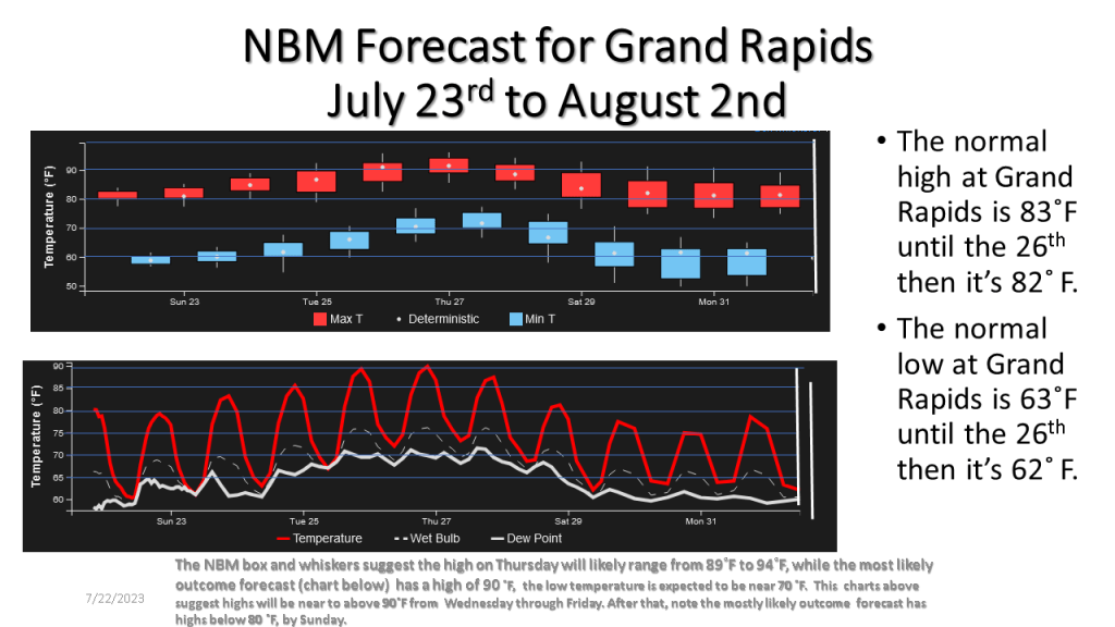
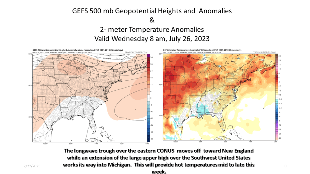
It’s been cool for the 2nd and 3rd week of July, however a dramatic change to hot weather is expected from Wednesday through Saturday.


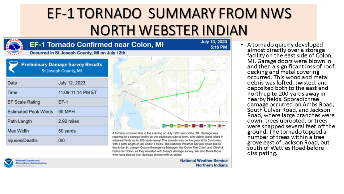
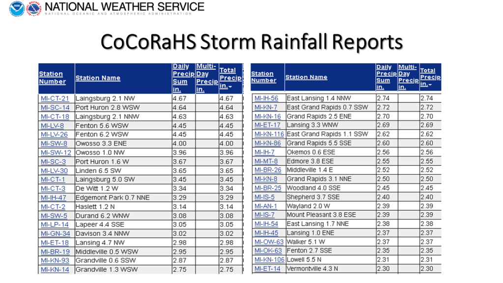
I added the Colon EF-1 Tornado to the storm summary plus the CoCoRaHS rainfall reports for the storm.


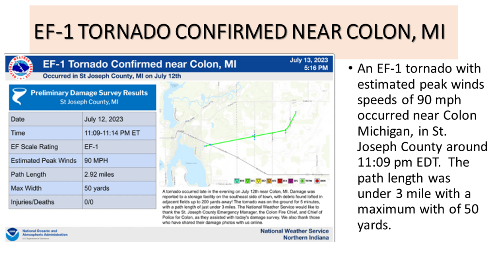
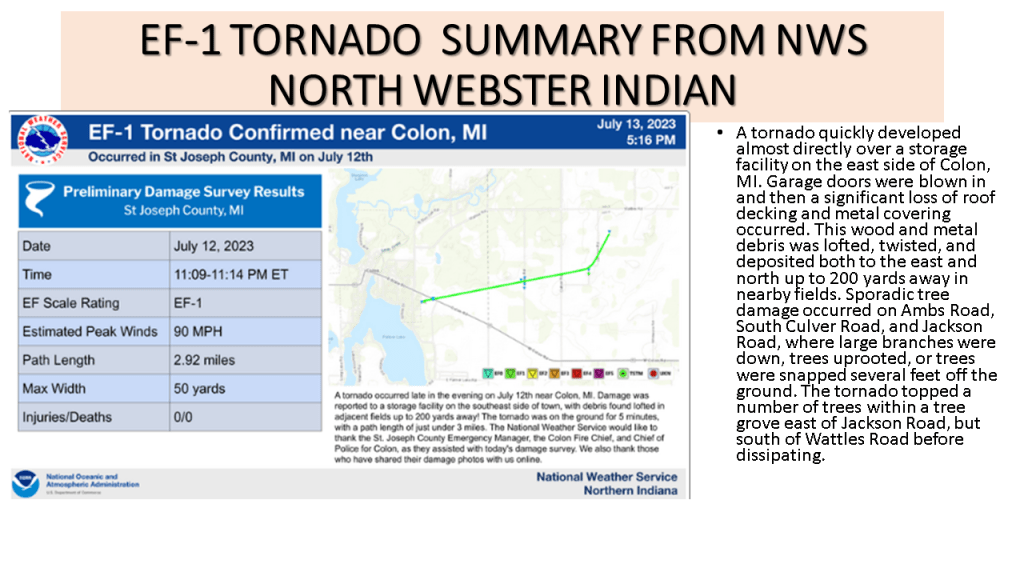
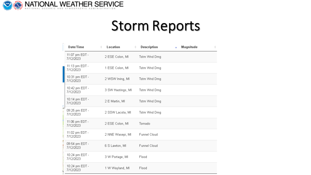


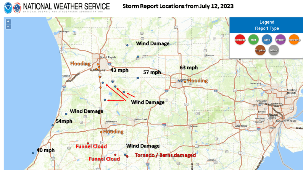
Heavy rain with localized flooding occurred over southern and central Lower Michigan on the evening of the 12th of July. There were also reports of damaging winds, a tornado near Colon and a few funnel cloud reports.


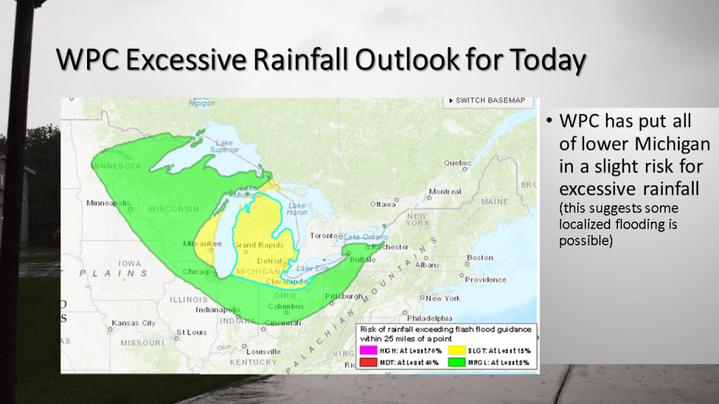
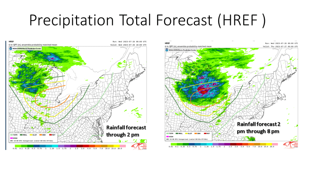
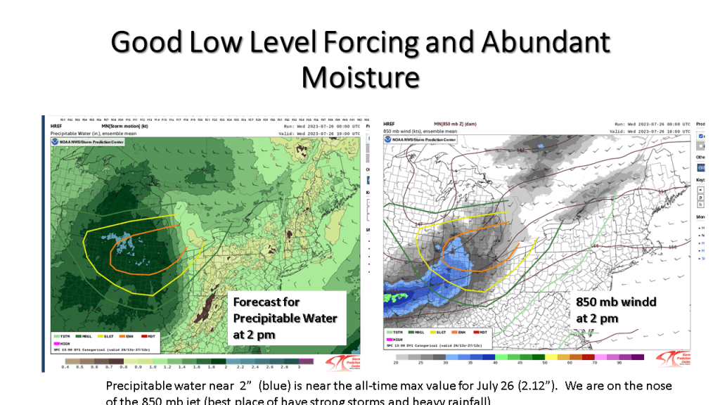
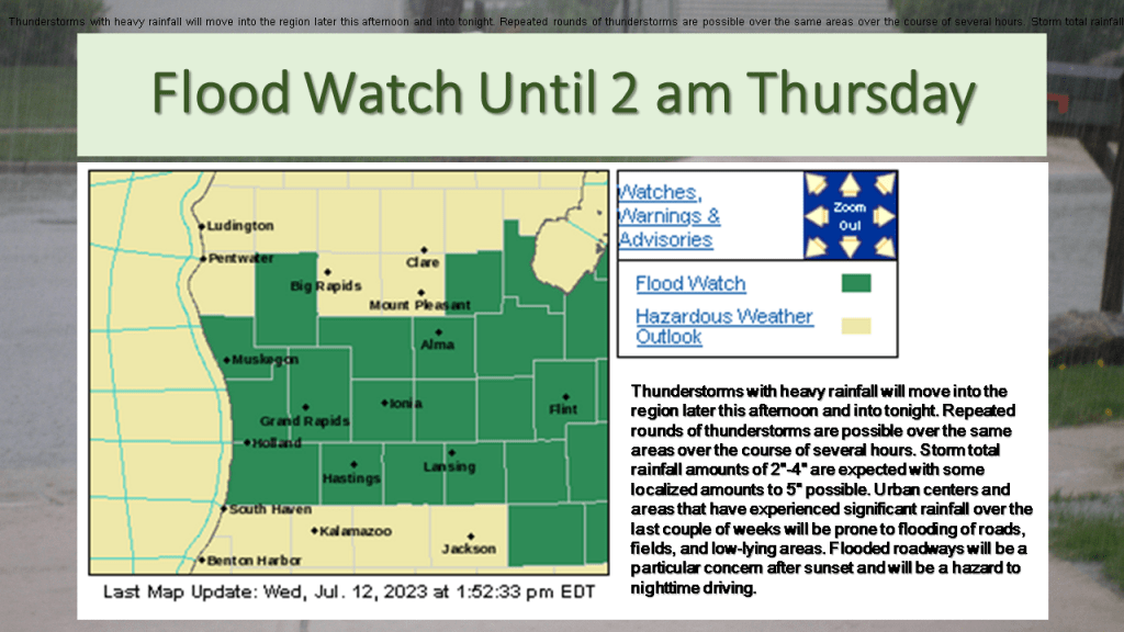
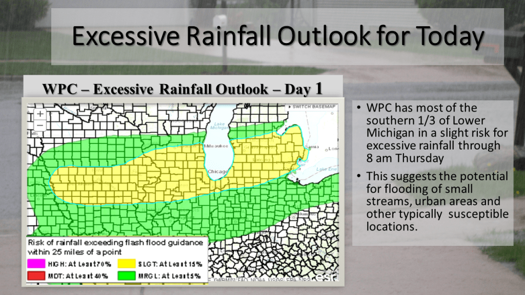
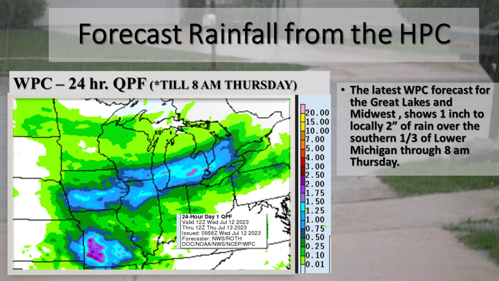
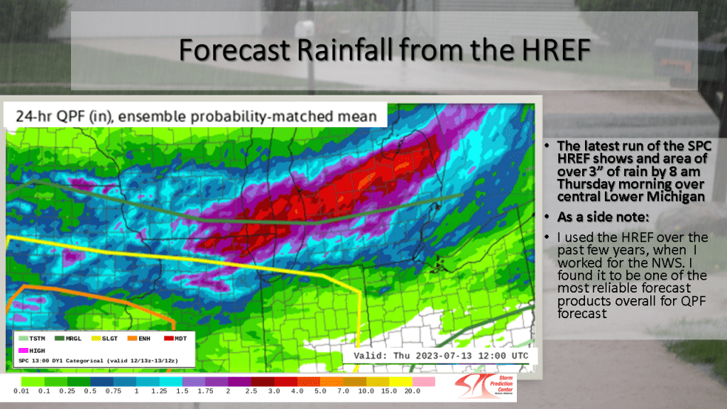
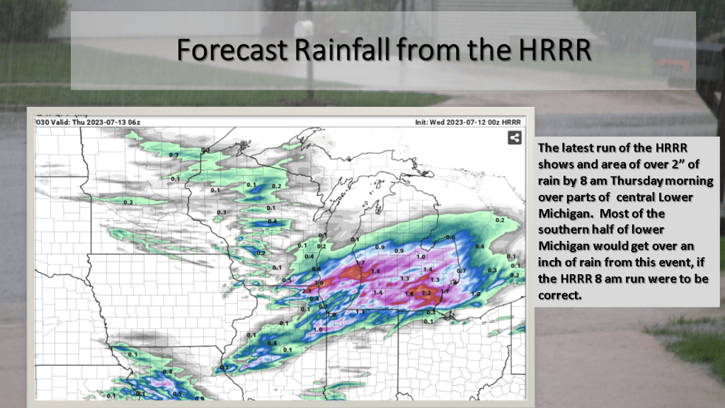
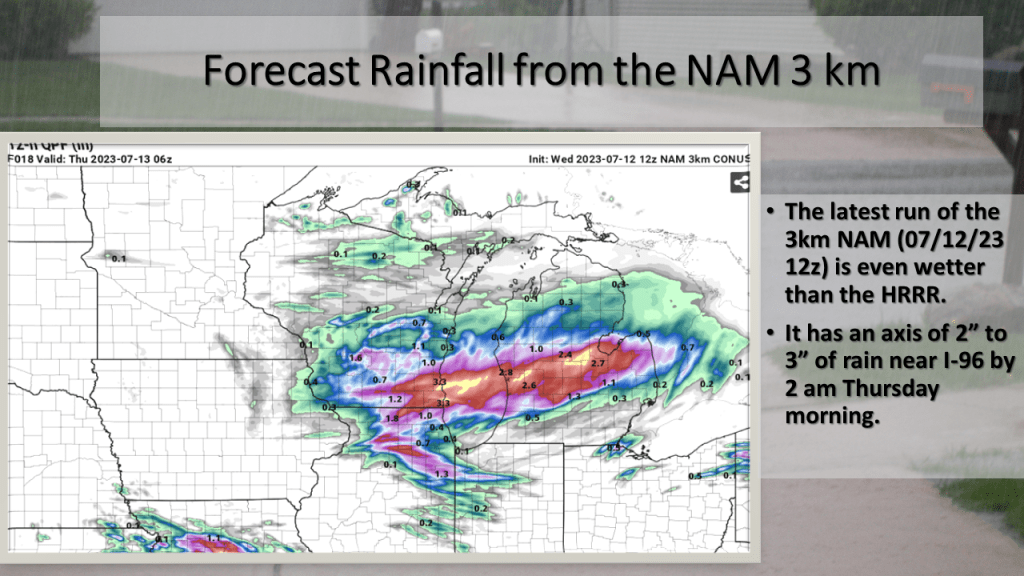
Heavy rain with a few thunderstorms is expected over the southern 1/3 of Lower Michigan from late afternoon until early Thursday morning. Rainfall amounts of 2″ to 4″ is expected over a large area, so that may cause some urban and small stream flooding.
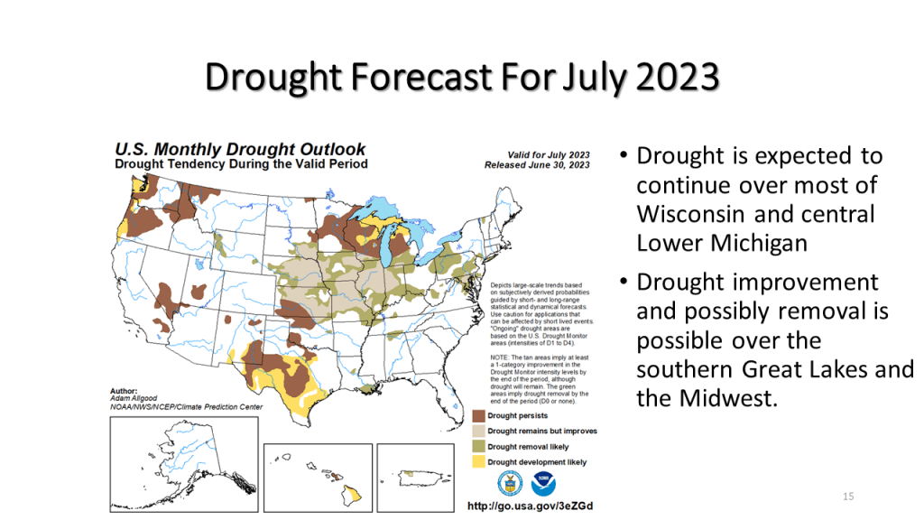
The heaviest rainfall is expected between 5 pm and 9 pm this evening. Rainfall of 2 inches to 4 inches is expected with local amounts over 5 inches possible. As a result, The National Weather Service has issued a Flood Watch for the southern 1/3 of Lower Michigan until 2 am Thursday. This amount of rain will have an impact on reducing the on-going drought if in fact we actually do that that much rain over a large area.


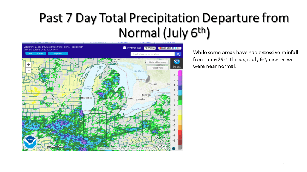
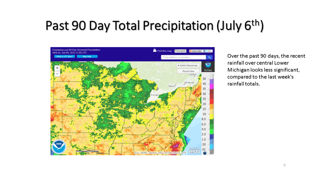
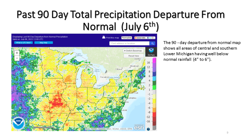
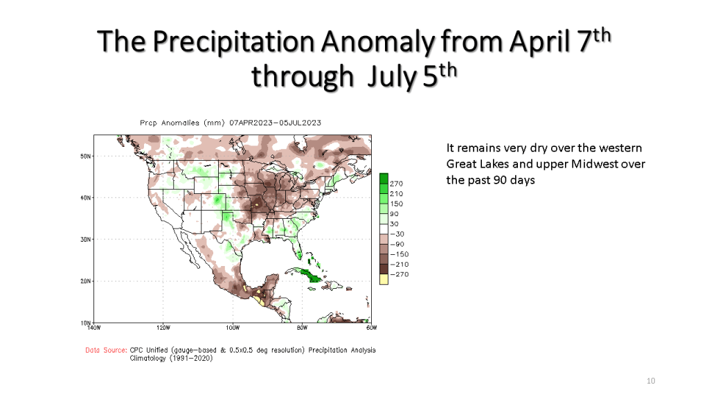
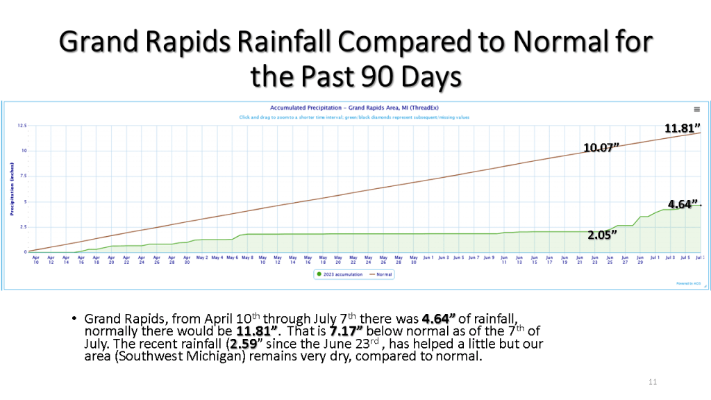
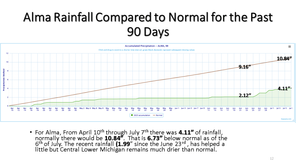
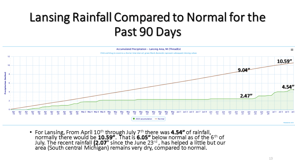
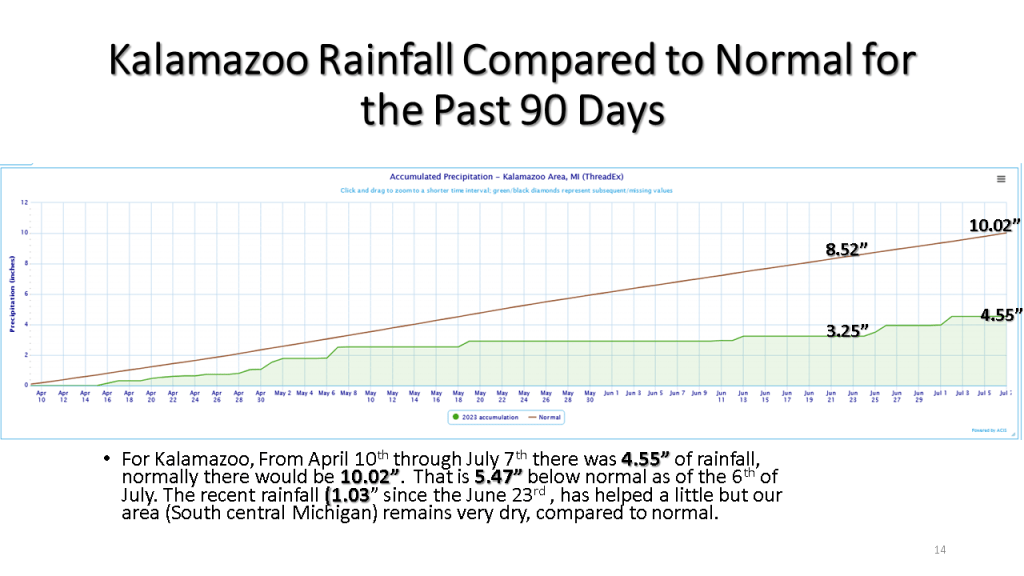
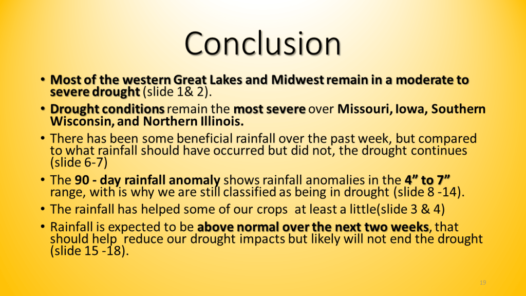
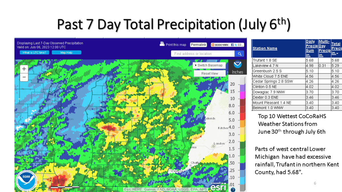
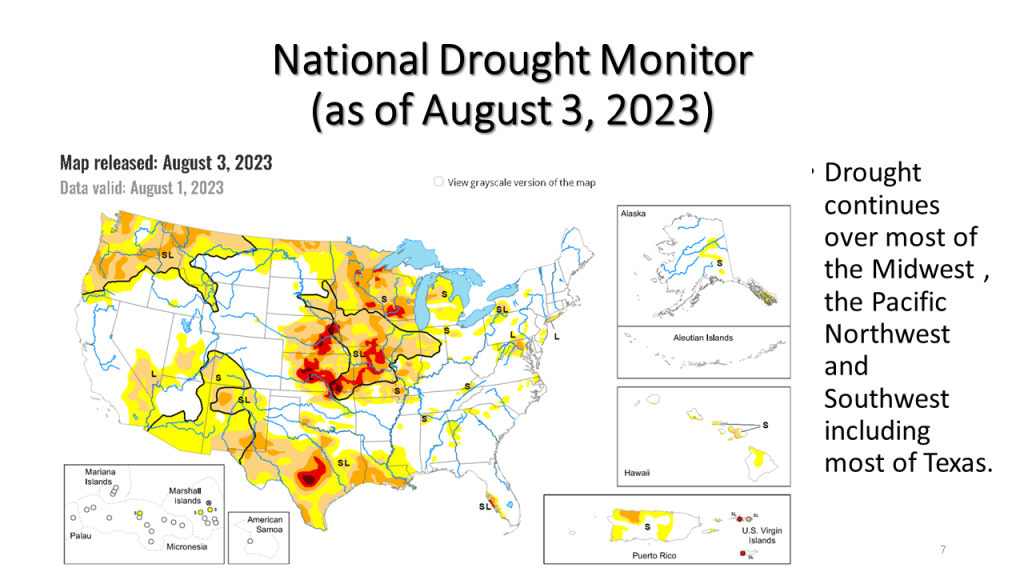
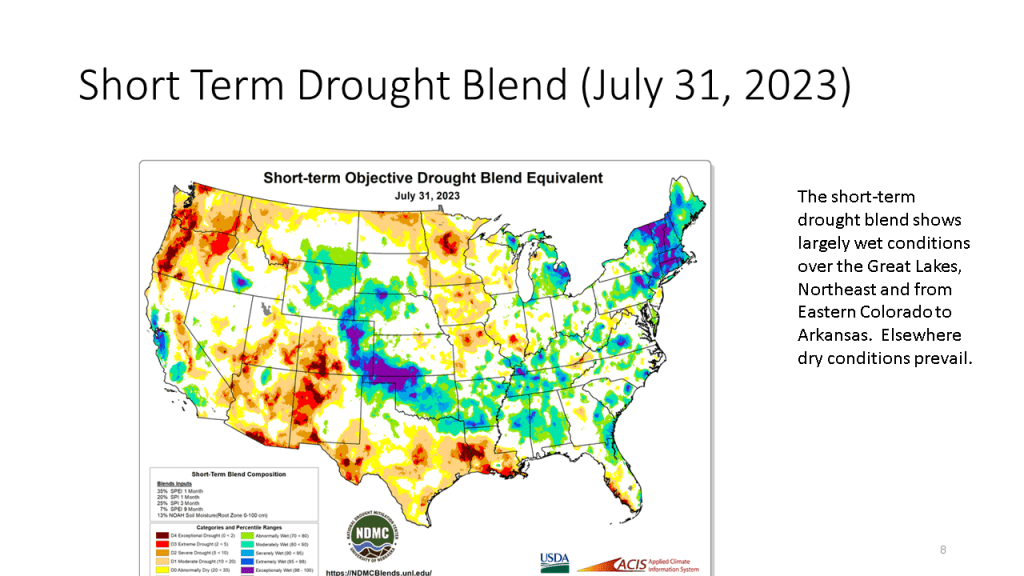
Recent rainfall has helped our drought improve some, but with rainfall anomalies being between 4 and 7 inches over the past 3 months, that has not come close to ending our current drought.