


National Weather Service / Grand Rapids Storm Summary
This summary has radar loops, pictures of the damage and much more!


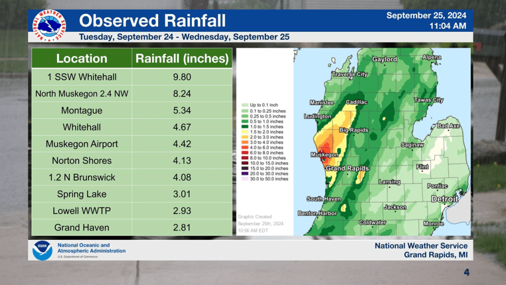
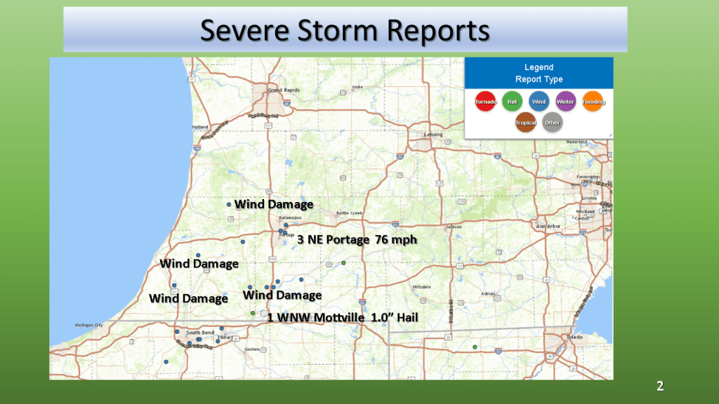
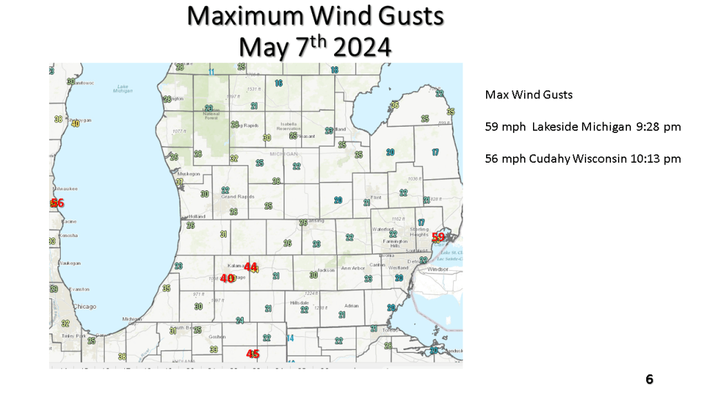
Winds to 76 mph, 1″ hail and rainfall to near 5″ within 12 hours


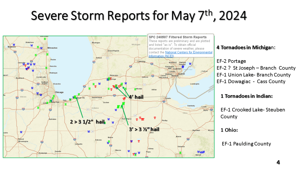
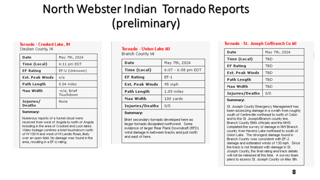
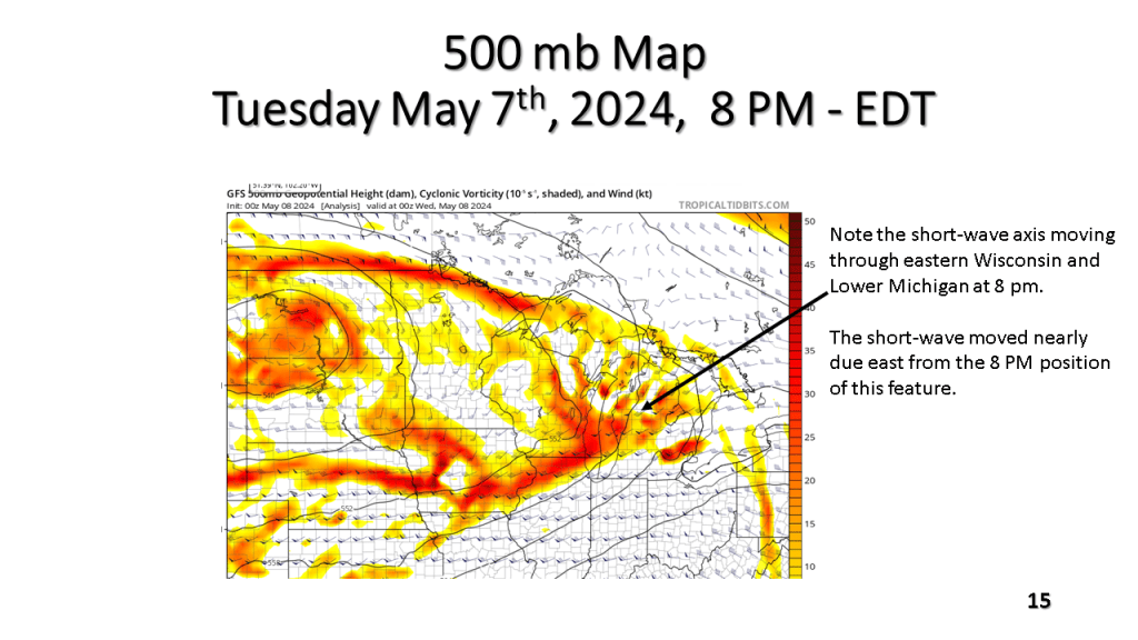
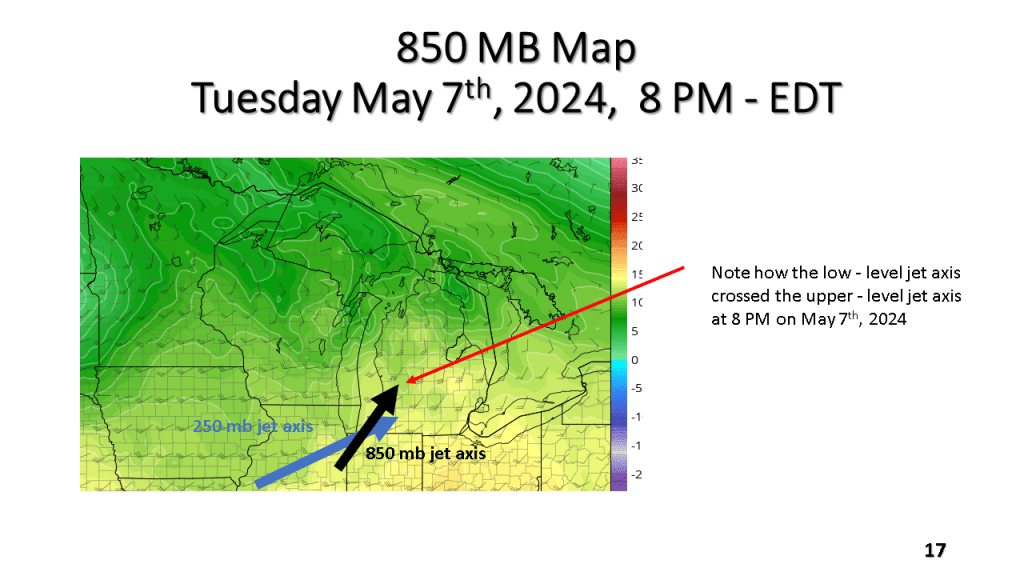
The Southern Great Lakes several tornadoes (2 EF-2), more than a dozen reports of hail larger than 2″, damaging winds, and locally heavy rainfall during the evening of Tuesday May 7th, 2024.


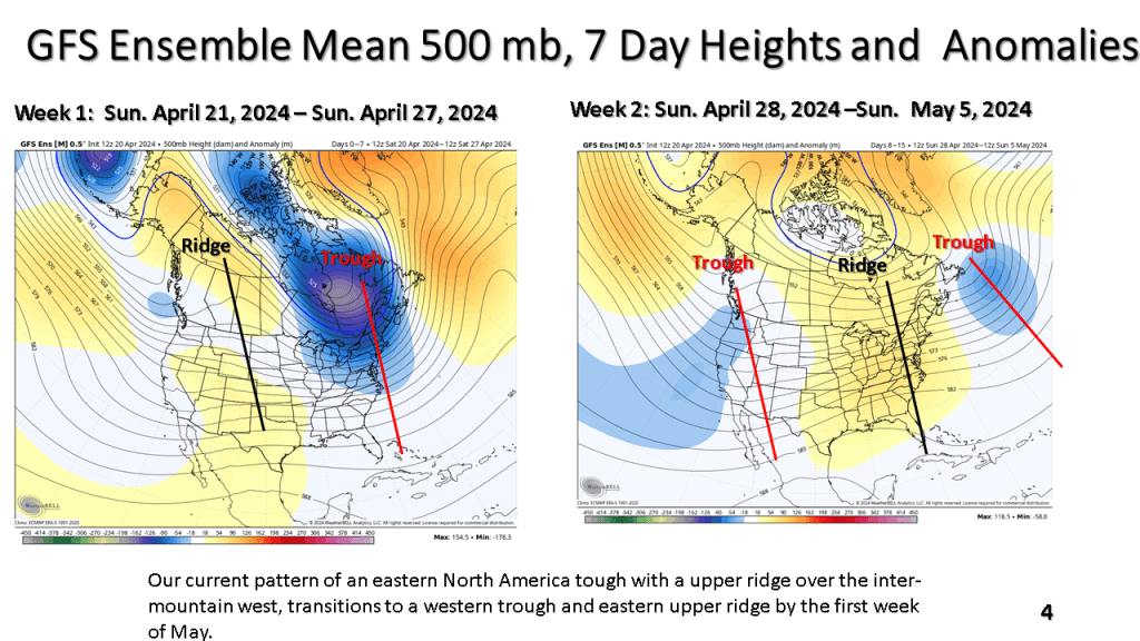
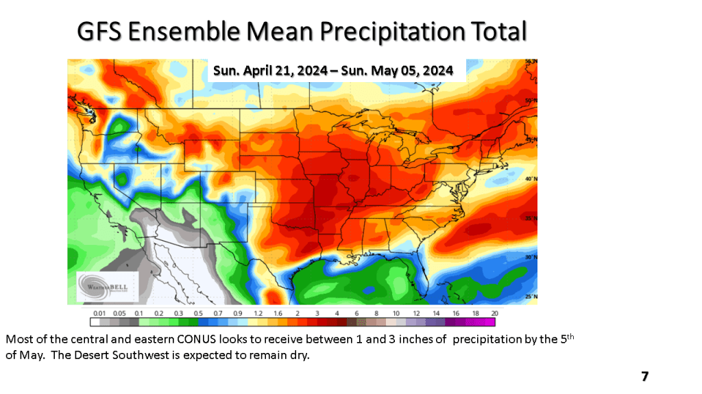
The current cool weather pattern has recently developed over the central and norther Plains. That cold air is expected to spread east over the next week. Frost and freezing temperatures are possible in northern and central sections over the next 7 days. Than, a warmer and wetter weather pattern is expected over most of the eastern and central CONUS.


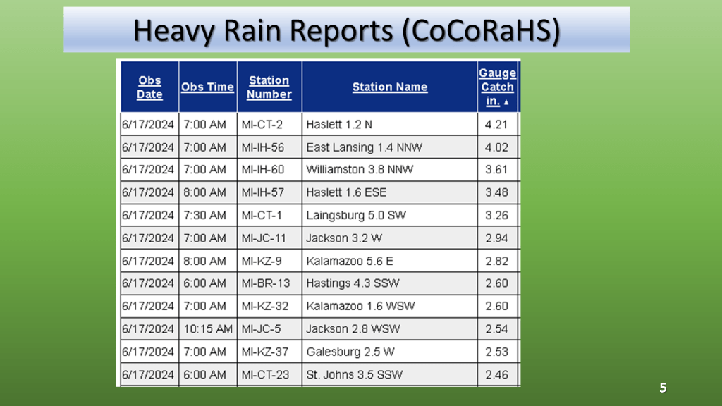
(Severe reports were mostly large hail near Lansing)


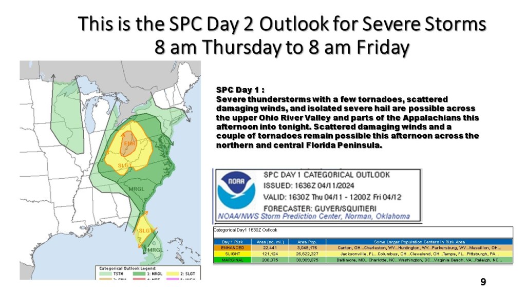


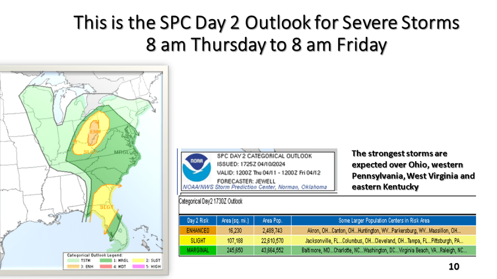
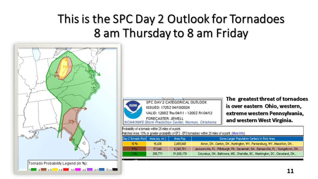
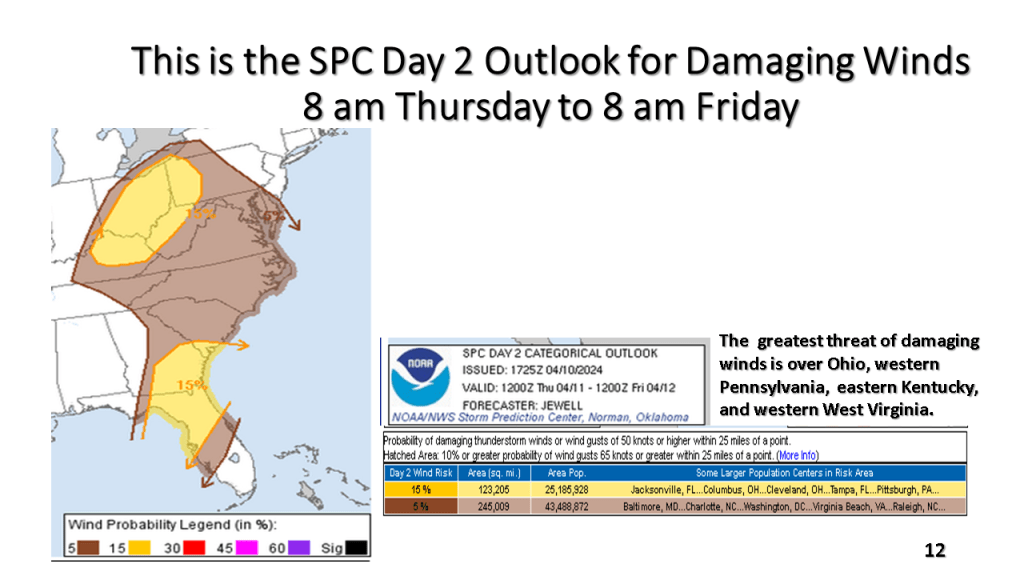
South of Michigan there is an enhanced risk for severe thunderstorms, including tornadoes over Ohio, western Pennsylvanian, West Virginia, and Kentucky.